
- 12201 Sunrise Valley Drive
- Reston, VA 20192, USA
- 703-648-5953
- 1-888-ASK-USGS
- Employee Directory
- Web Chat
The Energy and Minerals Mission Area conducts research and assessments that focus on the location, quantity, and quality of mineral and energy resources, including the economic and environmental effects of resource extraction and use.
View Science Strategy
USGS now has the new standard for natural gas.

A new USGS report summarizes the primary sources of potash in the United States. Potash is an essential nutrient that, along with phosphorus and nitrogen, is used as fertilizer for growing crops.
Lurking below the twin concepts of connectivity and disconnectivity are their first, and in some ways, richer cousins: continuity and discontinuity. In this paper we explore how continuity and discontinuity represent fundamental and complementary perspectives in fluvial geomorphology, and how these perspectives inform and underlie our conceptions...
Newly synthesized data indicate that the geochemistry of igneous rocks associated with epithermal mineral deposits varies extensively and continuously from subalkaline basaltic to rhyolitic compositions. Trace element and isotopic data for these rocks are consistent with subduction-related magmatism and suggest that the primary source magmas were...

This report draws on previous syntheses and basic research studies of sedimentary exhalative (sedex) deposits to arrive at the defining criteria, both descriptive and genetic, for sedex-type deposits. Studies of the tectonic, sedimentary, and fluid evolution of modern and ancient sedimentary basins have also been used to select defining criteria...

Although there are ways of developing causal relationships between stressors and aquatic community responses without experimentation; some argue that experimental manipulation under controlled conditions is both critical and necessary to establish causation. Single species toxicity tests are the gold standard for developing toxicant biological response relationships however these tests are...

In this study we will conduct a series of mesocosm studies to examine the toxicity of cobalt, copper, nickle, and zinc to natural communities of invertebrates. ...

The use of uranium is an alternative energy source to petroleum products and some of the United States’ highest quality ore is located on the Colorado Plateau. However, some regions where suitable mining efforts are conducted include areas that are near important environmental resources such as National Parks that provide viewscapes and habitat for wildlife....

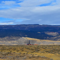
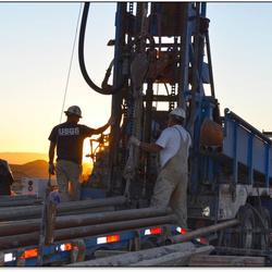
Oil and gas undiscovered resource assessments for conventional and unconventional accumulations, reserve growth evaluations, and energy economic analyses for the U.S. and world.
We operate a low–enriched uranium–fueled, pool–type reactor, the Geological Survey TRIGA® Reactor, to support science by providing information on geologic, plant, and animal specimens to advance methods and techniques unique to nuclear reactors. Samples from around the world are submitted to the USGS for analysis using the reactor facility.
U.S. coal resource and reserve assessments, U.S. and world coal quality, and coalbed gas.
The U.S. National Ice Core Laboratory is a facility for storing, curating, and studying ice cores recovered from the polar regions of the world. It provides scientists with the capability to conduct examinations and measurements on ice cores, and it preserves the integrity of these ice cores in a repository for current and future investigations.
Research and evaluations of gas hydrates, geothermal, uranium, oil shale, and wind energy impacts on animals.
The laboratory capabilities include imaging, ex-ray analysis, x-ray mapping, image processing, and optical microscopy.
Studies of environmental aspects of energy such as water from oil and gas production, geologic carbon sequestration, and mercury and selenium in the environment.
Seismic data acquisition, processing, interpretation, and archiving; energy geochemistry laboratory; and geochemistry research.

Information on domestic and international supplies and uses of mineral commodities is essential to the U.S. economy and to national security. Statistics and information on domestic and international minerals production, consumption, and materials flow is collected based on surveys of the domestic mineral industry and foreign governments.

USGS has recently undertaken a project to develop a methodology for assessing wind energy impacts on wildlife at a national scale. The USGS data set provides industrial-scale onshore wind turbine locations in the United States through July 22, 2013.

Periodical publications that provide statistical data on production, distribution, stocks, and consumption of significant mineral commodities. Information on minerals-related issues, including minerals conservation, sustainability, availability, materials flow, and the economic health of the U.S. minerals industry is also available.

Interactive maps and downloadable data for regional and global geology, geochemistry, geophysics, and mineral resources. Includes web services providing data for users of Geographic Information System software (GIS). Links to portals for minerals information, geochemical data, and geophysical data.

Conceptual models describing the essential characteristics of groups of similar mineral deposits.

View and download map-based energy data, search energy GIS data collections, browse the coal photomicrograph atlas and coal quality database, perform an advanced publications search, explore seismic reflection profiling data in Alaska, look at and print world geology maps, peruse the energy multimedia library, and more.

Digital geologic maps of the U.S. States with consistent lithology, age, GIS database structure, and format.

Mine plants and operations for commodities monitored by the National Minerals Information Center of the USGS. Operations included are those considered active in 2003 and surveyed by the USGS.

Maps of facilities for both international and domestic locations.
Newly synthesized data indicate that the geochemistry of igneous rocks associated with epithermal mineral deposits varies extensively and continuously from subalkaline basaltic to rhyolitic compositions. Trace element and isotopic data for these rocks are consistent with subduction-related magmatism and suggest that the primary source magmas were...
du Bray, Edward A.Lurking below the twin concepts of connectivity and disconnectivity are their first, and in some ways, richer cousins: continuity and discontinuity. In this paper we explore how continuity and discontinuity represent fundamental and complementary perspectives in fluvial geomorphology, and how these perspectives inform and underlie our conceptions...
Grant, Gordon E.; O'Connor, James E.; Safran, ElizabethThe Bonneville Flood was one of the largest floods on Earth. First discovered by G.K. Gilbert in the 1870s during his inspection of the outlet at Red Rock Pass, it was rediscovered in the 1950s by Harold Malde and coworkers, leading to mapping and assessment of spectacular flood features along Marsh Creek, Portneuf River, and Snake River for over...
O'connor, James
This report summarizes the primary sources of potash in the United States. Potash is an essential nutrient that, along with phosphorus and nitrogen, is used as fertilizer for growing crops. Plants require sufficient potash to activate enzymes, which in turn catalyze chemical reactions important for water uptake and photosynthesis. When potassium...
Yager, Douglas B.
The upper Santa Cruz Basin is an important groundwater basin containing the regional aquifer for the city of Nogales, Arizona. This report provides data and interpretations of data aimed at better understanding the bedrock morphology and structure of the upper Santa Cruz Basin study area which encompasses the Rio Rico and Nogales 1:24,000-scale U...
Bultman, Mark W.; Page, William R.This report draws on previous syntheses and basic research studies of sedimentary exhalative (sedex) deposits to arrive at the defining criteria, both descriptive and genetic, for sedex-type deposits. Studies of the tectonic, sedimentary, and fluid evolution of modern and ancient sedimentary basins have also been used to select defining criteria...
Emsbo, Poul; Seal, Robert R.; Breit, George N.; Diehl, Sharon F.; Shah, Anjana K.
Late Cenozoic faulting and large-magnitude extension in the Great Basin of the western USA has created locally deep windows into the upper crust, permitting direct study of volcanic and plutonic rocks within individual calderas. The Caetano caldera in north–central Nevada, formed during the mid-Tertiary ignimbrite flare-up, offers one of the best...
Watts, Kathryn E.; John, David A.; Colgan, Joseph P.; Henry, Christopher D.; Bindeman, Ilya N.; Schmitt, Axel K.To evaluate the risks of metal mixture effects to natural stream communities under ecologically relevant conditions, the authors conducted 30-d tests with benthic macroinvertebrates exposed to cadmium (Cd) and zinc (Zn) in experimental streams. The simultaneous exposures were with Cd and Zn singly and with Cd+Zn mixtures at environmentally...
Mebane, Christopher A.; Schmidt, Travis S.; Balistrieri, Laurie S.
SummaryThe U.S. Department of the Interior has proposed to withdraw approximately 10 million acres of Federal lands from mineral entry (subject to valid existing rights) from 12 million acres of lands defined as Sagebrush Focal Areas (SFAs) in Idaho, Montana, Nevada, Oregon, Utah, and Wyoming (for further discussion on the lands involved see...
Lund, Karen; Zürcher, Lukas; Hofstra, Albert H.; Van Gosen, Bradley S.; Benson, Mary Ellen; Box, Stephen E.; Anderson, Eric D.; Bleiwas, Donald I.; DeAngelo, Jacob; Drake, Ronald M.; Fernette, Gregory L.; Giles, Stuart A.; Glen, Jonathan M. G.; Haacke, Jon E.; Horton, John D.; John, David A.; Robinson,, Gilpin R.; Rockwell, Barnaby W.; San Juan, Carma A.; Shaffer, Brian N.; Smith, Steven M.; Williams, Colin F.
SummaryThe U.S. Department of the Interior has proposed to withdraw approximately 10 million acres of Federal lands from mineral entry (subject to valid existing rights) from 12 million acres of lands defined as Sagebrush Focal Areas (SFAs) in Idaho, Montana, Nevada, Oregon, Utah, and Wyoming (for further discussion on the lands involved see...
Mauk, Jeffrey L.; Zientek, Michael L.; Hearn, B. Carter; Parks, Heather L.; Jenkins, M. Christopher; Anderson, Eric D.; Benson, Mary Ellen; Bleiwas, Donald I.; DeAngelo, Jacob; Denning, Paul D.; Dicken, Connie L.; Drake, Ronald M.; Fernette, Gregory L.; Folger, Helen W.; Giles, Stuart A.; Glen, Jonathan M. G.; Granitto, Matthew; Haacke, Jon E.; Horton, John D.; Kelley, Karen D.; Ober, Joyce A.; Rockwell, Barnaby W.; San Juan, Carma A.; Sangine, Elizabeth S.; Schweitzer, Peter N.; Shaffer, Brian N.; Smith, Steven M.; Williams, Colin F.; Yager, Douglas B.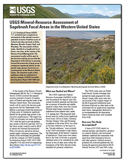
U.S. Geological Survey (USGS) scientists have completed an assessment of the mineral-resource potential of nearly 10 million acres of Federal and adjacent lands in Idaho, Montana, Nevada, Oregon, Utah, and Wyoming. The assessment of these lands, identified as Sagebrush Focal Areas, was done at the request of the Bureau of Land Management.
Frank, David G.; Frost, Thomas P.; Day, Warren C.
SummaryThe U.S. Department of the Interior has proposed to withdraw approximately 10 million acres of Federal lands from mineral entry (subject to valid existing rights) from 12 million acres of lands defined as Sagebrush Focal Areas (SFAs) in Idaho, Montana, Nevada, Oregon, Utah, and Wyoming (for further discussion on the lands involved see...
Vikre, Peter G.; Benson, Mary Ellen; Bleiwas, Donald I.; Colgan, Joseph P.; Cossette, Pamela M.; DeAngelo, Jacob; Dicken, Connie L.; Drake, Ronald M.; du Bray, Edward A.; Fernette, Gregory L.; Glen, Jonathan M.G.; Haacke, Jon E.; Hall, Susan M.; Hofstra, Albert H.; John, David A.; Ludington, Stephen; Mihalasky, Mark J.; Rytuba, James J.; Shaffer, Brian N.; Stillings, Lisa L.; Wallis, John C.; Williams, Colin F.; Yager, Douglas B.; Zürcher, Lukas


")
USGS now has the new standard for natural gas.
A new USGS report summarizes the primary sources of potash in the United States. Potash is an essential nutrient that, along with phosphorus and nitrogen, is used as fertilizer for growing crops.

This is the largest estimate of continuous oil that USGS has ever assessed in the United States.

New study investigates groundwater from the air

Environmental Ratios of Cadmium and Zinc are less Toxic to Aquatic Insects than Expected

At the request of the Bureau of Land Management, USGS has released an assessment of mineral resources in six Western states.

We're live-streaming this seminar at 1:00pm ET on our Facebook page: https://www.facebook.com/USGeologicalSurvey/ Check it out!

This research is the result of a partnership between the Government of India, the Government of Japan, and U.S. scientists.

“Whatcha gonna do when they come for you”-thinks this week’s EarthWord...

We're putting our assessments on the map...literally!

The USGS released a publication highlighting the nonfuel minerals industry of Iran.

Phone: 703-648-6401

Phone: 703-648-5953

