
- 12201 Sunrise Valley Drive
- Reston, VA 20192, USA
- 703-648-5953
- 1-888-ASK-USGS
- Employee Directory
- Web Chat
Ecosystems provides unbiased science, tools, and decision support to our Nation’s natural resource managers, with particular focus on the science needs of the Department of Interior bureaus to conserve species, lands, and priority ecosystems; fulfill treaty obligations; provide water for irrigation and human consumption; and manage mineral and energy resources.

Do you eat fruits and vegetables? What about nuts? If so, you can thank an insect pollinator, usually a honey bee. Honey bee populations are declining but USGS scientists are becoming honey bee helpers.
Find out more
USGS scientists have launched a new program using California's hotter drought as a forecaster for forest vulnerability worldwide.
Learn More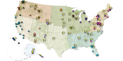
Find out where Ecosystems Science Centers, Field Stations, and Cooperative Research Units are located.
Browse by Location
A new study published in PLOS ONE demonstrates that current conservation planning efforts for waterbird habitat in the Central Valley can likely compensate for habitat loss through the middle of the century.

The U.S. Geological Survey and the Bureau of Land Management today released a collaborative report with new information and tools to support effective management of millions of acres of BLM public lands. The report underscores the value of a landscape approach to management, and shows that the BLM manages some of the largest areas of intact public lands in the west.

Hundreds of articles have been written about the largest volcanic eruption in recorded history, at Indonesia’s Mt. Tambora just over 200 years ago. But for a small group of New England-based researchers, one more Tambora story needed to be told, one related to its catastrophic effects in the Gulf of Maine that may carry lessons for intertwined human-natural systems facing climate change today.
Stand-replacing wildfires are a keystone disturbance in the boreal forest, and they are becoming more common as the climate warms. Paleo-fire archives from the wildland–urban interface can quantify the prehistoric fire regime and assess how both human land-use and climate change impact ecosystem dynamics. Here, we use a combination of a...
The North American Model of Wildlife Conservation represents the key principles that in combination resulted in a distinct form of wildlife conservation in the United States and Canada. How and to what extent captive cervid facilities comport with or conflict with these principles has implications for wildlife conservation. Greatest threats appear...
Ecological associations between epibionts (organisms that live on the surface of another living organism) and vertebrates have been documented in both marine and terrestrial environments, and may be opportunistic, commensal, or symbiotic (Lewin et al. 1981, Holmes 1985, Allen et al. 1993, Bledsoe et al. 2006, Pfaller et al. 2008, Suutari et al...

This dataset includes aerial imagery of the Little Missouri River in the North Unit of Theodore Roosevelt National Park, ND from 1939 to 2005, as well as shape files delineating the channel in each image. These data were analyzed in:
Miller, J.R., and J.M. Friedman. 2009. Influence of flow variability on flood-plain formation and destruction, Little Missouri River, North Dakota....

Drought is killing riparian trees along many rivers in the western United States. The cause can be increasing temperature or decreasing precipitation, flow or water-table elevation. At multiple locations we are relating water availability to physiological measurements of tree survival and water stress, such as ring width, carbon stable isotope ratio and branch hydraulic conductivity....

The Challenge: Ancient Egyptians mummified animals for a variety of reasons, not the least of which was as votive offerings to certain deities. Among the six species of shrews that have been identified as mummies, one is now extinct, one is no longer occurs in Egypt, and the remaining four have more restricted distributions in the country. One of the latter species also exhibits...

The Challenge: The postcranial skeletons of mammals exhibit tremendous variation in form that partly relates to phylogeny (who a particular species is related to) and partly to locomotory function (how that species moves through its environment). Understanding the contributions of these two factors is important because phylogenetic characters assist in working out evolutionary...

California's State Reptile, the desert tortoise (Gopherus agassizii), lives in the Mojave Desert and the western part of the Sonoran Desert. An elusive creature, this reptile can live up to 80 years and dines on grasses, cacti and wildflowers in its harsh environment. It was listed by the state and federal governments as a threatened species in 1990. Four years later, the U...

The Challenge: Achieving conservation objectives in protected natural areas requires the ability to sustain visitation while avoiding or minimizing adverse environmental impacts. Trails are an essential infrastructure component that limits resource impacts by concentrating use on hardened treads designed and maintained to sustain traffic. This is particularly challenging...

The Challenge: The Potomac River Gorge, managed by the National Park Service in Virginia and Maryland, is a highly accessible protected natural area bordered by the intensively developed Washington metro region. The Gorge is biologically rich, with more than 400 occurrences of over 200 rare species. Potomac Gorge receives exceptionally heavy visitation, with nearly two...

The Challenge: The proliferation and degradation of visitor-created “informal” trails in protected areas can be a vexing management issue for land managers. Formal trail systems never provide access to all locations required by visitors seeking to engage in a variety of appropriate recreational activities. Traveling off-trail may be necessary to engage in...

The Challange: In eastern North America there is a viral disease called Eastern Equine Encephalitis, or EEE. This virus is transmitted among native bird species by the mosquito, Culiseta melanura, but does not cause disease in these passerine species. However, the virus is capable of causing severe disease or death in horses, some game bird species, humans and whooping...

The Challange: Whooping cranes have been successfully introduced using costume rearing techniques in either a direct autumn release or in an ultralight led migration from Wisconsin to Florida. In Florida, we have also released parent-reared whooping cranes. Not much is known about the learning that takes place in this K-selected species over the almost one year that...

The Challenge: Many critical wildlife surveys, such as the North American Breeding Bird Survey (BBS), are analyzed using complex hierarchical models. These models are generally multi-scale and contain random effects; the standard approaches to model selection and assessment of model fit are often inappropriate and no simple way exists to compare alternative models....

The Challenge: Over the last half of the 20th century, the breeding range of American black duck (Anas rubripes) has contracted from central Canada and the Northeastern United States toward eastern Canada. This reduction in size of the breeding range has been reflected in a steady decline of black ducks counted during winter surveys, both the midwinter Waterfowl Survey...
 Screenshot")
The Dam Removal Information Portal is a Web site that serves information about the scientific studies associated with dam-removal projects. It is a visualization tool, including a map and interactive charts, of a dam-removal literature review designed and developed by a working group at the USGS John Wesley Powell Center for Analysis and Synthesis (Bellmore and others, 2015).

These data support the following publication (available online early): Jonathan J. Felis, Michelle L. Kissling, Robb S. A. Kaler, Leah A. Kenney, and Matthew J. Lawonn (2016) Identifying Kittlitz's Murrelet Nesting Habitat in North America at the Landscape Scale. Journal of Fish and Wildlife Management In-Press. doi: http://dx.doi.org/10.3996/112015-JFWM-116.

The survey was conducted in summer 2002 to assess the presence of terrapins in the Maryland portion of the Chesapeake Bay. Results are spatial locations of evidence related to nesting.

USGS scientists have been involved for a number of years in the development and use of Structural Equation Modeling (SEM). This methodology represents an approach to statistical modeling that focuses on the study of complex cause-effect hypotheses about the mechanisms operating in systems.

This video describes a statistical software package called "Evidence of Absence" that can be used to provide evidence of compliance with incidental take permits. It will be useful to wildlife managers and wind energy operators to estimate, with reasonable certainty, that a certain number of birds or bats have been killed at wind energy facilities, even when no carcasses are found.
South Florida Information Access (SOFIA) was established to provide coherent information access in support of research, decision-making, and resource management for the South Florida ecosystem restoration effort.

The interactive sea-level rise visualization tool results from a collaborative effort between NOAA's Coastal Services Center, USGS WARC, and USGS Mississippi Water Science Center. The tool illustrates the scale of potential flooding, but not the exact location, and does not account for erosion, subsidence, sediment accretion, or future construction.

WARC's Advanced Applications Team develops and maintains databases and applications to help the Alabama Department of Transportation and the U.S. Fish and Wildlife Service ensure new road construction and existing road maintenance at waterway crossings don't adversely affect threatened and endangered species dependent on those waterways.

This showcases the data and analytical products from studies related to habitat change, storm surge and ecological modeling, migratory bird impacts, and other studies conducted at WARC and funded by the Disaster Relief Appropriations Act of 2013. WARC's Advanced Applications Team also supports the efforts of scientists conducting research in Hurricane Sandy-impacted areas.

CRMS is the largest of all Coastal Wetlands Planning, Protection and Restoration Act (CWPRRA) funded projects and has established a network of ~400 biological monitoring stations across coastal Louisiana spanning all coastal habitat types and generating tremendous volumes of data.

MsCIP was developed in 2009 by the U.S. Army Corps of Engineers, Mobile District, in conjunction with other Federal and State agencies, to help reduce future storm damage along the Mississippi Gulf coast. In 2014, in cooperation with the USACE Mobile District, WARC's Advanced Applications Team began development on the MsCIP Data Viewer, an interactive web-mapping environment.
CWPPRA is the oldest and largest coastal restoration effort operating across coastal Louisiana and has constructed 105 restoration projects since its establishment over 20 years ago. WARC's Advanced Applications Team has proudly worked with the CWPPRA Task Force over the years to ensure timely and accurate project-specific information is publicly available.
 Summer - north")
Sooty Shearwater (Puffinus griseus) Density map (birds/sq km) Summer - north as part of the Pacific Continental Shelf Environmental Assessment (PaCSEA) project.
Project contacts: Josh Adams josh_adams@usgs.gov, John Takekawa john_takekawa@usgs.gov, Jonathan Felis jfelis@usgs.gov
Partner partners: National Oceanic and Atmospheric Administration and U.S. Bureau of Ocean Energy Management

The Clinch-Powell River Basins Spanning Virginia and Tennessee

Multiple search functions: State, major drainage area (HUC2), drainage area (HUC6), drainage area (HUC8), Zebra Mussel Collections, and fact sheets.
")
Extinct Taxa in States/Provinces of North America (2012)
")
Extinct Taxa in Ecoregions of North America (2012)
")
Numbered Ecoregions of North America (2008)

The U.S. Geological Survey (USGS) conducts Asian carp research focused on early detection, risk assessment, and development of control tools and strategies. The goals are to prevent the establishment of invasive Asian carp in the Great Lakes and to reduce their impacts in the Ohio River and Mississippi River Basins and elsewhere. Managers can use...
Kolar, Cynthia S.; Morrison, Sandra S.
Recent growth and development of renewable energy and unconventional oil and gas extraction are rapidly diversifying the energy supply of the United States. Yet, as our Nation works to advance energy security and conserve wildlife, some conflicts have surfaced. To address these challenges, the U.S. Geological Survey (USGS) is conducting innovative...

The renewable energy sector is rapidly expanding and diversifying the power supply of the country. Yet, as our Nation works to advance renewable energy and to conserve wildlife, some conflicts arise. To address these challenges, the U.S. Geological Survey (USGS) is conducting innovative research and developing workable solutions to reduce impacts...
Khalil, MonaHuman reliance on insect pollination services continues to increase even as pollinator populations exhibit global declines. Increased commodity crop prices and federal subsidies for biofuel crops, such as corn and soybeans, have contributed to rapid land-use change in the US Northern Great Plains (NGP), changes that may jeopardize habitat for...
Otto, Clint R.; Roth, Cali; Carlson, Benjamin; Smart, Matthew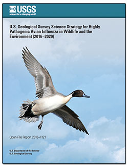
IntroductionThrough the Science Strategy for Highly Pathogenic Avian Influenza (HPAI) in Wildlife and the Environment, the USGS will assess avian influenza (AI) dynamics in an ecological context to inform decisions made by resource managers and policymakers from the local to national level. Through collection of unbiased scientific information on...
Harris, M. Camille; Pearce, John M.; Prosser, Diann J.; White, C. LeAnn; Miles, A. Keith; Sleeman, Jonathan M.; Brand, Christopher J.; Cronin, James P.; De La Cruz, Susan; Densmore, Christine L.; Doyle, Thomas W.; Dusek, Robert J.; Fleskes, Joseph P.; Flint, Paul L.; Guala, Gerald F.; Hall, Jeffrey S.; Hubbard, Laura E.; Hunt, Randall J.; Ip, Hon S.; Katz, Rachel A.; Laurent, Kevin W.; Miller, Mark P.; Munn, Mark D.; Ramey, Andy M.; Richards, Kevin D.; Russell, Robin E.; Stokdyk, Joel P.; Takekawa, John Y.; Walsh, Daniel P.Solar power towers produce electrical energy from sunlight at an industrial scale. Little is known about the effects of this technology on flying animals and few methods exist for automatically detecting or observing wildlife at solar towers and other tall anthropogenic structures. Smoking objects are sometimes observed co-occurring with reflected...
Diehl, Robert H.; Valdez, Ernest W.; Preston, Todd M.; Wellik, Mike J.; Cryan, Paul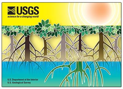
Mangrove ecosystems protect vulnerable coastlines from storm effects, recycle nutrients, stabilize shorelines, improve water quality, and provide habitat for commercial and recreational fish species as well as for threatened and endangered wildlife. U.S. Geological Survey scientists conduct research on mangrove ecosystems to provide reliable...
Ball, Lianne C.
Mobilized seafloor sediment can impact benthic reef communities through burial, scour, and turbidity. These processes are ubiquitous in coastal oceans and, through their influence on the survival, fitness, and interactions of species, can alter the structure and function of benthic communities. In northern Monterey Bay, California, USA, as much as...
Jared D. Figurski, Jan Freiwald, Steve I. Lonhart, and Curt D. StorlazziThis study is an investigation into the roles of wildfire and changing agricultural practices in controlling the inter-decadal scale trends of suspended sediment production from semi-arid mountainous rivers. In the test case, a decreasing trend in suspended sediment concentrations was found in the lower Salinas River, California between 1967 and...
A.B. Gray, G.B. Pasternack, E.B. Watson, M.A. Goñi, J.A. Hatten, J.A. WarrickPredicting changes in species distributions under a changing climate is becoming widespread with the use of species distribution models (SDMs). The resulting predictions of future potential habitat can be cast in light of planned land use changes, such as urban expansion and energy development to identify areas with potential conflict. However,...
Inman, Richard D.; Esque, Todd; Nussear, Kenneth E.; Leitner, Philip; Matocq, Marjorie D.; Weisberg, Peter J.; Dilts, Thomas E.
IntroductionSolar power represents an important and rapidly expanding component of the renewable energy portfolio of the United States (Lovich and Ennen, 2011; Hernandez and others, 2014). Understanding the impacts of renewable energy development on wildlife is a priority for the U.S. Fish and Wildlife Service (FWS) in compliance with Department...
Huso, Manuela; Dietsch, Thomas; Nicolai, Chris
Wetlands Postcard Research conducted by scientists at the U.S. Geological Survey provides reliable scientific information for the management of wetlands ranging from small freshwater alpine lakes in the Western United States to coastal wetlands of the Great Lakes and salt marshes along the Southeastern coast. Learn more about USGS wetlands...
Ball, Lianne C.
A suite of software tools and models developed by Colorado State University and the USGS Colorado Cooperative Fish And Wildlife Research Unit.
Tools for automated acoustic monitoring of nature.

Software from the American Fisheries Society

FW599: An introduction to data management and R for Fisheries and Wildlife applications--- a lighthearted look
The InVEST tool allows researchers to evaluate relationships between land management actions and wild bee populations.


A new study published in PLOS ONE demonstrates that current conservation planning efforts for waterbird habitat in the Central Valley can likely compensate for habitat loss through the middle of the century.
The U.S. Geological Survey and the Bureau of Land Management today released a collaborative report with new information and tools to support effective management of millions of acres of BLM public lands. The report underscores the value of a landscape approach to management, and shows that the BLM manages some of the largest areas of intact public lands in the west.
Hundreds of articles have been written about the largest volcanic eruption in recorded history, at Indonesia’s Mt. Tambora just over 200 years ago. But for a small group of New England-based researchers, one more Tambora story needed to be told, one related to its catastrophic effects in the Gulf of Maine that may carry lessons for intertwined human-natural systems facing climate change today.
")

"It’s a grand slam for all involved,” said Dawn Childs, USGS Cooperative Fish and Wildlife Research Units. “Recent high school graduates with special needs get real-world experience while helping USGS scientists on projects ranging from grizzly bears and energy to historic documents and bird migration. And a school system gets to successfully train students to enter the workforce."

Caribou, North America’s wild reindeer, have lives apart from their famous role on Christmas Eve. Reindeer and caribou are large, cold-adapted, herding herbivores related to deer, elk and moose.
To learn more about how these arctic antler-bearers spend the other 364 days of the year, we talked to USGS caribou expert Dr. Layne Adams, who has studied these animals for more than 30 years.

Upper Midwest and Great Lakes Landscape Conservation Cooperative Launches Coastal Wetland Decision Support Tools

Perhaps some of you have already experienced a sweet smooch or two under the holiday mistletoe, enjoying this fairly old kissing ritual for people. While figuring prominently in ancient lore, mistletoe is important in other vital ways: it provides essential food, cover and nesting sites for an amazing number of critters. In fact, some animals couldn’t even survive without mistletoe.


True or false? People are the leading cause of wildfires in the United States.

A group of turkeys is referred to as either a rafter or a gang. So this Thanksgiving, when celebrating with your own gang, remember the turkey as more than just the main course, but, as Benjamin Franklin said so many years ago, as a noble fowl of American tradition.
")
West Glacier, Mont. – Two rare alpine insects – native to the northern Rocky Mountains and dependent on cold waters of glacier and snowmelt-fed alpine streams – are imperiled due to climate warming induced glacier and snow loss according to a study by the U.S. Geological Survey and its partners.

Phone: 304 724-4400

Phone: 352-378-8181
Fax: 352-378-4956

Phone: 301 497-5000

Phone: 337-266-8500
Fax: 337-266-8513
Phone: 928-556-7094
Fax: 928-556-7092

Phone: (916) 278-9485
Fax: (916) 278-9475

Phone: 970-226-9100
Fax: 970-226-9230
Phone: 541-750-1030
Fax: 541-750-1069

Phone: (206) 526-6282
Fax: (206) 526-6654

Phone: (808) 985-6420
Fax: (808) 967-8568

Phone: 573-875-5399
Phone: 734-994-3331
Phone: 608-270-2400
Phone: 701-253-5500
Fax: 701-253 5553
")
Phone: 614-430-7700
Fax: 614-430-7777
")
Phone: 517-887-8903
Fax: 517-887-8937


