The NOAA vessel Pisces set sail from a busy Davisville, Rhode Island pier on Tuesday (Oct. 18) morning at 1030, flanked by a fleet of imported vehicles newly unloaded from two huge car carrying vessels docked nearby.

Two huge car carriers unload a fleet of imported cars onto the pier they share with the Pisces in Davisville, Rhode Island. Photo by Jerry Prezioso, NEFSC/NOAA Fisheries
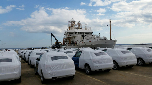
NOAA vessel Pisces, docked in Davisville, RI, flanked by freshly unloaded cars. Photo by Jerry Prezioso, NEFSC/NOAA Fisheries
Our first task of the day was to undertake a calibration of the EK60 acoustic system on board, which was carried out by Mike Jech and his team while we anchored in the lower part of Narragansett Bay. The process took six hours and involved moving a tungsten carbide sphere under the hull and measuring the acoustic returns from the system.

Joe Godlewski and Jennifer Johnson monitoring acoustic returns from EK60 calibration aboard the Pisces. Photo by Jerry Prezioso, NEFSC/NOAA Fisheries
The sphere got hung up at one point but the team was able to free it and get it back to continue the process, until it was finally completed at 1830 hours. By 1900 the team members, Mike Jech, Joe Godlewski and Jennifer Johnson, and all their gear were ferried ashore in a rigid hull inflatable launch to the Newport Naval Station located across the bay from our anchorage.

Joe Godlewski prepares the calibration team gear to leave the Pisces. Photo by Jerry Prezioso, NEFSC/NOAA Fisheries

Mike Jech and his calibration team departing the Pisces via the ship’s launch. Photo by Jerry Prezioso, NEFSC/NOAA Fisheries
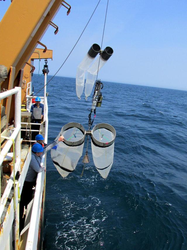
After the return of the launch we proceeded out of the bay to start the southern leg of our survey. Our mission is to continue the core monitoring program of gathering data on hydrographic and biological parameters of continental shelf waters, by means of electronic sensors, plankton tows and water casts. Unlike previous missions we have a very small scientific staff on this trip, with just two people on each 12 hour watch, but all our routine sampling will be carried out, including plankton sampling, dissolved inorganic carbon (DIC) sampling to track ocean acidity, and chlorophyll and nutrient measurements.
We also have an Imaging FlowCytoBot unit from Woods Hole Oceanographic Institution on board to photograph dinoflagellates, diatoms and marine protozoa that are picked up by the scientific seawater system of the vessel. The only difference from past surveys is that we have no outside researchers joining us. Even the Canadian Wildlife Service, which normally sends an observer to monitor seabirds and marine mammals, was unable to place someone on-board until the northern leg of this survey.
For now we are heading south, and at the moment of this writing, are approaching the outer edge of the continental shelf about 90 miles southeast from the mouth of Narragansett Bay. Weather for the next couple of days is looking good, so we’re expecting to make good progress, having already completed four plankton tow stations, and one water sampling station.
Jerry Prezioso
Chief Scientist
PC1609 Ecosystem Monitoring Survey


 Photos of spinner dolphin and false killer whales by Richard Holt under MMPS permit number 17355-01.
 Brown Booby that used the Bigelow as a resting spot. Photo by Michael Force