

The Cyclone Global Navigation Satellite System (CYGNSS) launched into orbit at 8:37 AM EST, December 15, 2016, aboard an Orbital ATK air-launched Pegasus XL launch vehicle. The rocket was dropped and launched from Orbital’s Stargazer L-1011 aircraft, which took off from Cape Canaveral Air Force Station in Florida, over the Atlantic Ocean, off the coast of central Florida. CYGNSS is NASA’s first satellite mission to measure ocean surface winds in the inner core of tropical cyclones, including regions beneath the eyewall and the intense inner rain-bands that could not previously be measured from space. These measurements will help scientists to obtain a better understanding of what causes variations in tropical cyclone intensity, thereby improving our ability to forecast tropical cyclones such as Hurricane Katrina. To learn more about CYGNSS, read "Eight Microsatellites, One Misson: CYGNSS" in the November-December issue of The Earth Observer.
Read More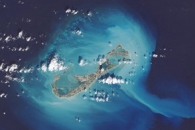


Recent Imagery
You will be directed to the NASA Visible Earth webpage when you select Images by Mission below, or click on the images at right that are randomly generated to represent four out of all possible topics.
Announcements and Highlights


NASA's Earth Observing System Project Science Office
NASA’s Earth Observing System (EOS) is a coordinated series of polar-orbiting and low inclination satellites for long-term global observations of the land surface, biosphere, solid Earth, atmosphere, and oceans. As a major component of the Earth Science Division of NASA’s Science Mission Directorate, EOS enables an improved understanding of the Earth as an integrated system. The EOS Project Science Office (EOSPSO) is committed to bringing program information and resources to the Earth science research community and the general public alike.
Download ChartEarth Science Mission Profiles
This website has been designed to cover not just the original Earth Observing System (EOS) missions, but also all of NASA’s Earth-observing satellite missions (many of them joint with other nations and/or agencies), along with other elements of NASA’s Earth Science program. The EOSPSO is funded through the Earth Science Division of NASA’s Science Mission Directorate.
NASA Earth Science Division Operating Missions

Added: December 19, 2016
-

-

-

-
Aquarius (NASA/Argentina )
-
Launch: Jun 10 2011
- Altitude:
- 657km
- Inclination:
- 98.00°
- Local Node:
- 6:00 a.m.

-

-

-

-

-

-

-

-

-

-

-

-

-

-

-

-

-

-

-

-

-

-

-

-

-

-

-

-

-

-

-

-

-

-

-

-

-

-

-

-
Aqua (Joint with Japan and Brazil)
-
Launch: May 4 2002
- Altitude:
- 705km
- Inclination:
- 98.20°
- Local Node:
- 1:30 p.m.

-
Aura (Joint with Netherlands, Finland, and the U.K.)
-
Launch: Jul 15 2004
- Altitude:
- 705km
- Inclination:
- 98.20°
- Local Node:
- 1:45 p.m.

-

-

-
CloudSat (Joint with Canada)
-
Launch: Apr 28 2006
- Altitude:
- 705km
- Inclination:
- 98.20°
- Local Node:
- 1:30 p.m.

-

-

-

-

-

-

-

-

-
Jason-3 (Joint with NOAA, CNES, and EUMETSAT)
-
Launch: Jan 17 2016
- Altitude:
- 1,336km
- Inclination:
- 66.00°

-
Landsat 7 (Joint with USGS)
-
Launch: Apr 15 1999
- Altitude:
- 705km
- Inclination:
- 98.20°
- Local Node:
- 10:05 a.m.

-

-

-

-
OSTM/Jason-2 (Joint with NOAA, CNES, and EUMETSAT)
-
Launch: Jan 20 2008
- Altitude:
- 1,336km
- Inclination:
- 66.00°

-

-

-

-

-

-

-

-

-

-

-

-

-

-

-

-

-

-

-

-

-

-

-

-

-

-

-

-

-

-

-

-

-

-

-

-

-

-
