Reports, Information and References generated by the North Carolina Coastal Program.
Maps of Historic Atlantic Coast Shad Migration
Current Fish Passage Restoration Efforts
 |
Reports, Information and References generated by the North Carolina Coastal Program.Maps of Historic Atlantic Coast Shad Migration Current Fish Passage Restoration Efforts Habitat Restoration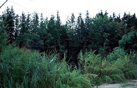
Atlantic White Cedar Stand Back Bay Currituck Sound Data ReportsPartners: Audubon, Duke University, North Carolina Coastal Federation, North Carolina Coastal Land Trust, North Carolina Department of Natural Resources, North Carolina State University, North Carolina Wildlife Resources Commission, University of North Carolina, Progress Energy, Restoration Systems, U.S. Army Corps of Engineers, U.S. Environmental Protection Agency, U.S. Marine Corps, and Weyerhaeuser. Coastal Barrier Resources ActCongress passed the Coastal Barrier Resources Act (CBRA) in 1982 to address problems caused by coastal barrier development. CBRA restricted Federal expenditures and financial assistance, including Federal flood insurance, in the Coastal Barrier Resource System, a defined list of undeveloped coastal barriers mapped along the Atlantic and Gulf of Mexico coasts. An additional responsibility addressed under the program involves making geographic determinations for the Federal Emergency Management Agency’s (FEMA) National Flood Insurance Program regarding whether coastal parcels of private property are within units of the National Coastal Barrier Resource System, as delineated on maps produced by the U.S. Fish and Wildlife Service. Program ContactContact: Mike Wicker, Coastal Program Coordinator, Raleigh Field Office. |