The Colville National Forest is located in northeastern Washington state.
Where is this Forest?


Welcome to the Colville National Forest!

ALTERNATIVE DESCRIPTION FOR ACCESSIBILITYALTERNATIVE DESCRIPTION FOR ACCESSIBILITYALTERNATIVE DESCRIPTION FOR ACCESSIBILITYALTERNATIVE DESCRIPTION FOR ACCESSIBILITYALTERNATIVE DESCRIPTION FOR ACCESSIBILITYALTERNATIVE DESCRIPTION FOR ACCESSIBILITYALTERNATIVE DESCRIPTION FOR ACCESSIBILITYALTERNATIVE DESCRIPTION FOR ACCESSIBILITYALTERNATIVE DESCRIPTION FOR ACCESSIBILITYALTERNATIVE DESCRIPTION FOR ACCESSIBILITYALTERNATIVE DESCRIPTION FOR ACCESSIBILITYALTERNATIVE DESCRIPTION FOR ACCESSIBILITYALTERNATIVE DESCRIPTION FOR ACCESSIBILITYALTERNATIVE DESCRIPTION FOR ACCESSIBILITYALTERNATIVE DESCRIPTION FOR ACCESSIBILITYALTERNATIVE DESCRIPTION FOR ACCESSIBILITYALTERNATIVE DESCRIPTION FOR ACCESSIBILITYALTERNATIVE DESCRIPTION FOR ACCESSIBILITYALTERNATIVE DESCRIPTION FOR ACCESSIBILITYALTERNATIVE DESCRIPTION FOR ACCESSIBILITYALTERNATIVE DESCRIPTION FOR ACCESSIBILITYALTERNATIVE DESCRIPTION FOR ACCESSIBILITYALTERNATIVE DESCRIPTION FOR ACCESSIBILITY


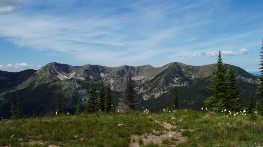
The Colville National Forest disproves the widely held notion that Washington state lies flat east of the Cascade Mountains. Today's 1.1 million acre forest was first shaped over 10,000 years ago by Ice Age glaciers that carved three major valleys of today's Columbia, San Poil-Curlew, and Pend Oreille River flowing north into Canada before entering the Columbia River. These million acres in the northeast corner roll like the high seas. Three waves of mountains run from north to south, separated by troughs of valleys. These ranges -- the Okanogan, Kettle River, and Selkirk -- are considered foothills of the Rocky Mountains. Read full article.

Top Things People Want to Know

G E T   A C T I V E . . . B E   P R E P A R E D . . .
Go Camping! Link to camping information on the forest. Got a Map? Link to available maps for the forest.
Go Hiking! Link to hiking opportunities on the forest. Need a Recreation Pass? Link to information on various passes available for standard amenity fee sit

Stay Connected

Blog icon Email icon Facebook icon Flickr icon Twitter icon YouTube icon

Recent News


Features

Colville and Okanogan-Wenatchee Forest Plan Revision

The Colville and the Okanogan-Wenatchee National Forests are working in a cooperative effort to revise their Forest Plans.  The two national forests released Proposed Actions on June 30, 2011,  which was followed by a 90-day comment period that closed on September 28, 2011. 

The Forests are now analyzing those public comments to identify main issues and public concerns related to the proposed actions.  The public concerns will be used to identify a range of alternatives, and refine the scope of the analysis—which will be documented in a draft environmental impact statement (DEIS).  Please visit the Forest Plan Revision Project page to learn more about the next steps in the process..... (Forest Plan Revision Page)


Travel Management

Find Motor Vehicle Use Maps, motor vehicle management project information, and more.  2013 Motor Vehicle Use Maps are now available.

Spotlights

The Colville National Forest was awarded $968,000 in restoration funding

 The Colville National Forest was awarded $968,000 in restoration funding for the Northeast Washington Forest Vision 2020 project…

CNF and NE Washington Forestry Coalition Announce Forest Restoration Projects

Joint Colville National Forest and Northeast Washington Forestry Coalition News Release on 2012 NEW Vision Project Selection


Bridge on Upper Barnaby Creek is Open for Use

The temporary closure has been lifted and normal use may resume on the bridge. For more information, please contact the Three Rivers Ranger District at (509) 738-7700.

Forest Plan Revision: Potential Wilderness Recommendations

For information on potential areas recommended for Wilderness designation scroll towards the bottom of the page and look under "Colville Collaboration Information Materials."


View More Spotlights