|
|
|
|
 |
| view map |
 |
|
|
|
|
|
|
Grand Canyon National Park
Hermit Road
|
|
|
|
|
|
 |
Jump to photos from the Hermit Road Overlooks
Hermit Road is a scenic route along the west end of Grand Canyon Village on the South Rim which follows the rim for 7 miles (11 km) out to Hermits Rest. This extremely popular route is accessed by free park shuttle bus, foot, bicycle, or commercial bus tour most of the year, with private vehicles allowed only during winter months of December, January and February.
Along the rim are nine designated viewpoints where the free Hermits Rest Route shuttle bus stops. The Rim Trail also follows the rim of the canyon for 7.8 miles (12.6 km) along Hermit Road and offers the opportunity for short or long walks between viewpoints on both paved and dirt trails. In addition to the Rim Trail, three miles of paved greenway trail provide additional views for cyclists and hikers.

|
| NPS Map |
| Between March 1st and November 30, Hermit Road buses provide transportation between the Village Route Transfer Station and Hermits Rest (7 miles/ 11 km) with stops at 9 canyon overlooks. On the Return Trip, buses stop only at Hermits Rest, Pima, Mojave, and Powell Points. The Hermit Road (Red Route) is a 75 minute round-trip ride (without getting off the bus). |
|

|
| Shuttle bus stops on Hermit Road. Service from March 1 - November 30 each year. |
| Between March 1st and November 30th, free shuttle buses provide transportation between the Village Route Transfer Station and Hermits Rest (7 miles/ 11 km) with stops at nine canyon overlooks. On the return trip, buses stop only at Hermits Rest, Pima, Mohave, and Powell Points. |
|
Touring the Scenic Hermit Road - Audiocast, (January 30, 2009)
Duration 4:56 - By Park Ranger Brian Gatlin -
(19kb PDF File) Hermit Road Podcast
Download link (3.95MB MP3 File) cut and paste this link into your media player:
http://www.nps.gov/grca/photosmultimedia/upload/20090130hermit.mp3
Photos From the Hermit Road Overlooks

Boarding Hermit Road Shuttle
Hermits Rest Transfer
0.7 miles, 1.1 km west from here to Trailview Overlook on paved trail
The Hermits Rest Route (Red) shuttle begins here.
The Rim Trail also begins here. From the transfer station, the trail climbs a hill to Trailview Overlook. The hill was created by the Bright Angel Fault, and is one of the steepest sections of the Rim Trail. But the views along the way are worth the climb!

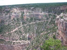
NPS/Marge Ullmann View of top section of Bright Angel Trail and Historic District from Trailview Overlook.
Trailview Overlook
0.7 miles, 1.1 km west from here to Maricopa Point on paved trail
0.7 miles, 1.1 km east from here to Hermits Rest Transfer on a paved trail
This viewpoint offers good views of the Bright Angel Trail switchbacking through the canyon below, as well as the Historic District of the village, including the prominent El Tovar Hotel. Several sets of stairs access two main viewing areas.

NPS/Marge Ullmann View to the east from Maricopa Point.
Maricopa Point
0.5 miles, 0.8 km west from here to Powell Point on paved and then dirt trail
0.7 miles, 1.1 km east from here to Trailview Overlook on a paved trail
In addition to stunning vistas, Maricopa Point looks out over the former Orphan Lode Mine, claimed in 1891 by miner Dan Hogan. Originally mining copper, Hogan switched to uranium ore in the 1950s. Mining operations ended in 1967. Grand Canyon National Park acquired the property in 1987 but only began major environmental restoration in 2008.

NPS/Marge Ullmann Powell Memorial
Powell Point
0.3 miles, 0.5 km west from here to Hopi Point on dirt trail
0.5 miles, 0.8 km east from here to Maricopa Point on dirt and then paved trail
The Powell Memorial at this viewpoint commemorates the 1869 and 1871-72 exploratory trips down the Colorado River by Major John Wesley Powell and expedition crews. Stunning vistas can also be enjoyed from Powell Point.

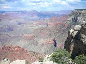
NPS/Marge Ullmann View looking across at the North Rim from an upper tier of Hopi Point.
Hopi Point
0.8 miles, 1.3 km west from here to Mohave Point on dirt trail
0.3 miles, 0.5 km east from here to Powell Point on dirt trail
Hopi Point is one of the most popular viewpoints for watching the sunset and sunrise because of its wide vistas. The Colorado River comes into view to the west. Restrooms are available here.

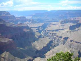
NPS/Marge Ullmann View to the west of Mohave Point.
Mohave Point
1.1 miles, 1.8 km west from here to The Abyss on dirt trail
0.8 miles, 1.3 km east from here to Hopi Point on dirt trail
Another spectacular point for watching sunset and sunrise, Mohave Point also offers views of the Colorado River deep in the canyon below.

NPS/Marge Ullmann Looking down into Monument Creek drainage from The Abyss.
The Abyss
0.9 miles, 1.4 km west from here to Monument Creek Vista on dirt trail
1.1 miles, 1.8 km east from here to Mohave Point on dirt trail
This viewpoint provides an almost vertical view down into the canyon, looking down into the Monument Creek drainage area where backpackers often camp next to Monument Creek or on a small beach along the Colorado River at Granite Rapids.

NPS/Marge Ullmann Looking down into Monument Creek drainage from Monument Creek Vista.
Monument Creek Vista
1.7 miles, 2.7 km west from here to Pima Point on paved trail
0.9 miles, 1.4 km east from here to The Abyss on dirt trail
From this viewpoint the Greenway Trail begins, accommodating hikers, bicyclists, and visitors using wheelchairs. The trail meets Accessibility Guidelines for Outdoor Developed Areas. Much of the trail follows the 1912 alignment of Hermit Road. There are six overlooks, including Pima Point, in addition to multiple resting areas along the trail.

NPS/Marge Ullmann View of Colorado River to the west from Pima Point.
Pima Point
1.1 miles, 1.8 km west from here to Hermits Rest on paved trail
1.7 miles, 2.7 km east from here to Monument Creek Vista on paved trail
Pima Point is one of the best places on the rim to see and sometimes hear the river. The splash and grind of Granite Rapids below can be heard echoing up the canyon walls on quiet days. The Greenway Trail continues from here to Hermits Rest, allowing bicyclists and visitors using wheelchairs to share the path with pedestrians.

NPS/Marge Ullmann Hermits Rest
Hermits Rest
Rim Trail ends to the west
1.1 miles, 1.8 km east from here to Pima Point on paved trail
Mary Colter, one of Grand Canyon's most famous architects, built Hermits Rest in 1914 to look like an old miner's cabin, complete with a giant fireplace and front porch. Today Hermits Rest has a gift shop and small snack bar. Restrooms are available here. The Hermit Trail, winding steeply down into the canyon, begins about 0.5 miles, 0.8 km west of Hermits Rest.

NPS/Marge Ullmann Metal cages protect young plants from browsing animals.
In November 2008 a major rehabilitation project was completed along Hermit Road that included widening the road to increase visitor safety, widening and improving the rim trail and constructing a new multi-use Greenway Trail, while maintaining the historic rural character of the roadway and protecting the park’s natural and cultural resources.
To learn more about the 2008 Hermit Road Rehabilitation Project go to The Scenic and Historic Hermit Road.
The project also included one of the largest vegetation restoration and rehabilitation efforts ever undertaken at Grand Canyon National Park. Restoration crews planted 20,000 plants and spread 200 pounds of native grass and shrub seed. The vegetation work stabilized road shoulders, maintained the genetic integrity of plant species along Hermit Road, replanted impacted areas, and continues today with invasive species management and routine maintenance.
To learn more about the revegetation project go to Canyon Sketches Vol 06 - October 2008 Hermit Road Native Plant Restoration.
|

|
 |
|
You are exiting the National Park Service website
Thank you for visiting our site.
You will now be redirected to:
We hope your visit was informative and enjoyable.
|


