About the ESDS Program
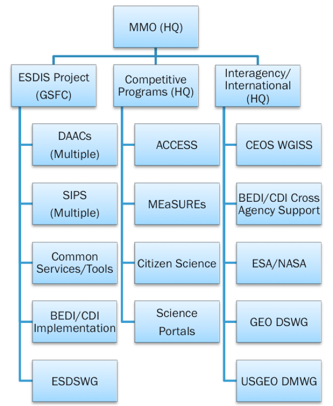
The Earth Science Data Systems (ESDS) Program, governed by and through NASA HQ, is comprised of three major facets, each one containing various, ongoing projects and activities.
- #1: Earth Observing System Data and Information System (EOSDIS), managed by the ESDIS Project. EOSDIS is a key core capability in the ESDS Program as it provides end-to-end capabilities for managing NASA’s Earth science data from various sources--satellites, aircraft, field measurements, and various other programs.
- #2: Competitive Programs, including Advancing Collaborative Connections for Earth Science Systems (ACCESS), Making Earth System Data Records for Use in Research Environments (MEaSUREs), and the newly established and recently launched Citizen Science for Earth Systems Program (CSESP).
- #3: International and Interagency Coordination and Development with various agencies and organizations, including the Climate Data Initiative (CDI) and the Big Earth Data Initiative (BEDI).
ESDS is responsible for:
- Actively managing NASA’s Earth science data as a national asset
- Developing unique data system capabilities optimized to support rigorous science investigations
- Processing instrument data to create Earth System Data Records (ESDRs)
- Upholding NASA’s policy of free, full, and open sharing of all data, tools, and ancillary information for all users
- Engaging members of the Earth science community in the evolution of data systems
For more about NASA's ESDS Program, select any of the following links:
Last Updated: Nov 22, 2016 at 12:40 PM EST
