- Data and Products
- Weather & Climate
- CRONOS Database
- Climate Thresholds
- Holiday Climatology
- Winter Storm Database
- Ask a Meteorologist Database
- Climate Division Data
- Climate Normals
- CRONOS API
- CRONOS Review
- Daily Normals Temperature Tool
- Data Request Form
- Environmental Modeling
- Evapotranspiration
- Heat Index Climatology
- Hurricanes Database
- NCDC Storm Events Database
- Open Water Evaporation
- Precipitation Estimates
- Storm Reports Portal
- Sunrise / Sunset Times
- Weather Extremes
- Wind Rose
- Water Resources
- Agriculture
- Forestry
- NC ECONet
- Data Request Form
- All Products
- Weather & Climate
- Aspects of NC Climate
- Educational Outreach
- About Our Office
State Climate Office of North Carolina
Email: sco@climate.ncsu.edu
Phone: 919-515-3056
Phone: 919-515-3056
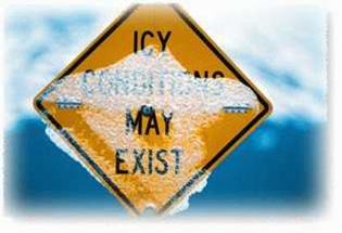
Winter Weather - Winter Weather Climatology
| Introduction | Precipitation Types | Atmospheric Patterns | Impacts | Winter Storm Database |
A Winter Weather Climatology for the Southeastern United States
Christopher Fuhrmann and Charles E. Konrad, II
Department of Geography
The University of North Carolina at Chapel Hill
- Introduction
- Background
- Data and Methods
- Winter Weather Climatologies
- Annual Winter Storm Frequencies
- Annual Precipitation Distrubution
- Diurnal Precipitation Distribution
- Monthly Precipitation Distribution
- Precipitation Type Transitions
- Mean Recurrence Intervals and Annual Probabilities
- The December 4-5, 2002 Southeast Severe Ice Storm: A Climatological Comparison
 This
study provides a wealth of information on all winter weather events observed at 18 first-order weather
stations in the southeastern United States over a 55-year period, 1948-2003. Winter weather events are defined by the occurrence of
measurable snow, sleet, freezing rain, and/or cold rain. Each link on the contents page allows one to access a variety of resources
and analyses, including a review of precipitation types and their formation, a comprehensive climatology of the spatial and temporal
distributions of winter precipitation and winter weather events, the distribution and frequency of precipitation-type transitions, and
recurrence intervals and probabilities for events of varying types and intensities. A case study and climatological analysis of the
December 2002 ice storm, one of the most severe and costly winter storms to affect the Southeast, is also provided. An upcoming feature
of this project is the addition of a winter weather events database for each recording station used in the climatology. These databases
will be available for download and may be useful research tools, as they provide a number of statistical parameters for each event,
including a new winter storm magnitude typing.
This
study provides a wealth of information on all winter weather events observed at 18 first-order weather
stations in the southeastern United States over a 55-year period, 1948-2003. Winter weather events are defined by the occurrence of
measurable snow, sleet, freezing rain, and/or cold rain. Each link on the contents page allows one to access a variety of resources
and analyses, including a review of precipitation types and their formation, a comprehensive climatology of the spatial and temporal
distributions of winter precipitation and winter weather events, the distribution and frequency of precipitation-type transitions, and
recurrence intervals and probabilities for events of varying types and intensities. A case study and climatological analysis of the
December 2002 ice storm, one of the most severe and costly winter storms to affect the Southeast, is also provided. An upcoming feature
of this project is the addition of a winter weather events database for each recording station used in the climatology. These databases
will be available for download and may be useful research tools, as they provide a number of statistical parameters for each event,
including a new winter storm magnitude typing.
Winter weather (i.e. snow, sleet, freezing rain) occurs with the greatest frequency in the northern latitudes
(e.g. New England and the Midwest) and higher altitudes (e.g. the Rocky Mountains ). However, such weather regularly affects the
southeastern United States as far south as Georgia during each cold season. In fact, the impacts of winter weather in the Southeast
have been recorded as early as the first week of October and as late as mid-April. What separates our response to winter weather in
this region, particularly in the Piedmont and Coastal Plain, from that of our more northern and western neighbors, is the lack of a
sufficient utility infrastructure to effectively handle these events. The result is temporary economic and social disruptions, realities
that strike even at the mere threat or forecast of winter weather.
Each type of winter precipitation brings with it unique hazards. For instance, falling snow can significantly reduce visibility and create
dangerous driving conditions, as well as paralyze entire communities if enough snow accumulates. Sleet (or ice pellets), can worsen the
driving hazard by creating a dangerously slick surface, although sleet is less likely to adhere to trees and power lines. Perhaps the most
destructive form of precipitation is freezing rain (or ice loading). Freezing rain accumulation on trees and power lines can cause them to
snap, resulting in power outages and damage to homes, automobiles, and ecosystems. The fact that each frozen precipitation type occurs with
some regularity throughout the Southeast is due mainly to the topography of the region as well as its geography. Continental polar air masses
from Canada typically supply the cold air necessary for snow, while cold, dry air from New England entering the region can become entrained
against the east slopes of the Appalachian Mountains, forming a dome (or wedge) of near-surface cold air. The moisture necessary for precipitation
is brought in from the nearby Gulf of Mexico, where the thermal contrast between the cold land surface and the relatively warmer gulf waters
provides a favorable environment for storm development and intensification. In these situations, if a cold dome is already in place east of
the mountains, the warm frontal boundary and moisture associated with the developing storm may migrate northward over the cold dome, setting
the stage for a mixed precipitation (freezing/frozen) event. In addition to identifying the atmospheric processes that produce winter weather
in the Southeast, having knowledge of the spatial and temporal distributions of winter precipitation and the varying winter weather scenarios
that transpire across the region is crucial in forecasting and planning for these events.
Climatology: While most studies of frozen precipitation in the Southeast involve either individual storms or small
groups of events, this study strives to identify climatological characteristics from a database of all frozen precipitation events across the
Southeast for a 55 year period, beginning in 1948 and ending with the last winter event of the 2002-2003 season. This database includes over
70 weather variables for each event, extracted from 18 first order weather stations across the study area. In particular, recurrence intervals
have been constructed for events of various intensities and precipitation types, along with a spatial analysis of various types and frequencies
of precipitation-type transitions across the region.
Due to the lengths of the time series for each station and the amount of parameters included in the database, five data sources were needed.
Hourly observations from all first-order weather stations were extracted from CD-ROM's produced by EarthInfo for the time period 1948 to 1997.
Hourly Precipitation Data (HPD) was extracted from the National Climatic Data Center (NCDC) CD to hourly precipitation amounts. Data for the
period starting in 1998 and ending in 2000, including precipitation, was extracted from NCDC Integrated Surface Hourly Weather Observations
(ISHWO) CD-ROM's. Data for the remaining time period, 2001 to present, was extracted from Automated Surface Observing System (ASOS) sensors,
which are maintained at airports by the National Weather Service. Daily snowfall totals (used to calculate snowfall recurrence intervals) were
extracted from an online database of Cooperative Observer Network Stations (COOP) archived by NCDC.
Although most of the data is good, certain caveats prevent the construction of a complete, hourly time series due mostly to location changes and
the time of construction of weather sensors. Four of the 18 stations - Athens (GA), Augusta (GA), Greer (SC), and Beckley (WV) - have time series
beginning after 1948. This reduced the sample size of winter events, however, it does not have a significant impact on the climatology. Additionally,
weather reports for the period 1966 to 1971, with the exception of precipitation totals, were only made every three hours. These reports were
extrapolated to the intervening two hours (e.g. 1200 LST and 1400 LST reports are assumed to be the same as the 1300 LST report).
A FORTRAN program was developed to identify winter weather events in each time series file. A second program was written to link events across
stations and identify climatological characteristics. Events at a given station were defined by the occurrence of measurable (0.01") precipitation
and one or more observations of frozen precipitation. An event was terminated if there was more than a six-hour lapse in these conditions. A
corollary to this was that events could have lapses in the requisite conditions of up to six hours.
A fourth form of winter precipitation was added to the database. Defined as "Cold Rain", these events were identified by the occurrence of rainfall
and a temperature of 35° F or less. Such events provided an added perspective to understanding the processes involved in winter weather, as these
events were very close to producing frozen precipitation.
To complete the database, various climatological characteristics were identified for each station and plotted on maps. These characteristics
included annual frequencies and return intervals for different types of winter weather events. Special attention was given to the particulars
of each event, including the types and frequencies of various phase transitions (e.g. rain to snow, snow to sleet etc.).
- Annual Winter Storm Frequencies
- Annual Precipitation Distrubution
- Diurnal Precipitation Distribution
- Monthly Precipitation Distribution
- Precipitation Type Transitions
- Mean Recurrence Intervals and Annual Probabilities
The December 4-5, 2002 Southeast Severe Ice Storm: A Climatological Comparison