

Tweets
- Tweets
- Tweets & replies
- Media
@NOAASatellites is blocked
Are you sure you want to view these Tweets? Viewing Tweets won't unblock @NOAASatellites.
-
Happy
#FullDiskFriday!!! Join us as we take a moment to appreciate our amazing Earth with this image from GOES East! http://goo.gl/zL7BMG pic.twitter.com/vkX2KwsWzw
-
Not all the consequences of space weather are negative. Without it, we wouldn't have Aurorae!!! Learn more at http://goo.gl/CauhNd pic.twitter.com/fFPL1xlN2C

-
Study: the same conditions that favor the formation of Atlantic hurricanes may also protect the US coast. Read more: https://nyti.ms/2k5wyH8 pic.twitter.com/292Ics3Tbp
-
As seen in this GOES infrared imagery, rain & snow will continue in the West and storms are likely in the southeast: http://goo.gl/nVm0QI pic.twitter.com/ft6562Gfm7
-
While parts of the West get rain & snow, the atmosphere around HI looks dry in this GOES West water vapor imagery: http://goo.gl/h9KpYY pic.twitter.com/TiOMEHEOjl
-
As part of SARSAT, NOAA satellites helped rescue 307 people in 2016 — the highest number since 2007! Learn more at http://goo.gl/Xdiuqe pic.twitter.com/5fgDSd0xXK

-
As seen in this GOES infrared imagery, storms are likely in areas of the West, south central, & southeast today: http://goo.gl/nVm0QI pic.twitter.com/s1PoDsqQkz
-
A snow-covered landscape surronds the St. Lawrence River & Gulf of St. Lawrence in this Suomi NPP image from 1/17: http://goo.gl/WsgVTa pic.twitter.com/B56a6EltZL

-
This GOES water vapor imagery shows areas of moisture over the western, south central, and northeastern US today: http://goo.gl/nVm0QI pic.twitter.com/ikwqlpMbG6
-
According to NOAA, 2016 is officially the warmest year on record, edging out previous record holder, 2015, by .07°F: http://goo.gl/CdohLP pic.twitter.com/K6qjIRYTFo
-
A system of low pressure system churns off the coast of WA in this GOES West GeoColor imagery from 1/18. See more @ http://goo.gl/J0SQU4 pic.twitter.com/RHXf98439O
-
1 year ago, Jason-3 rocketed into orbit! This super satellite monitors 95% of Earth’s ice-free oceans every 10 days! http://goo.gl/4j1p62 pic.twitter.com/v90luAgxzz
-
Watch a system of low pressure roll across the central US in this 72-hour GOES water vapor imagery. See more @ http://goo.gl/4iZDFj pic.twitter.com/7ni03VNaya
-
1 year ago today, NOAA launched Jason-3! Learn more about this satellite & its mission to measure sea-surface height http://goo.gl/5EC0CQ pic.twitter.com/cGx0jnxH4P
-
Happy
#FullDiskFriday! It's Friday the 13th, so thought it appropriate to share this full-disk image from GOES-13! http://goo.gl/zL7BMG pic.twitter.com/wuSMlLwEjF
-
Thanks to
@atmolife for including us and other NOAA accounts in its list of Top Meteorology Twitter Accounts to Follow in 2017!#wxtwitterpic.twitter.com/9NiSu3poMr
-
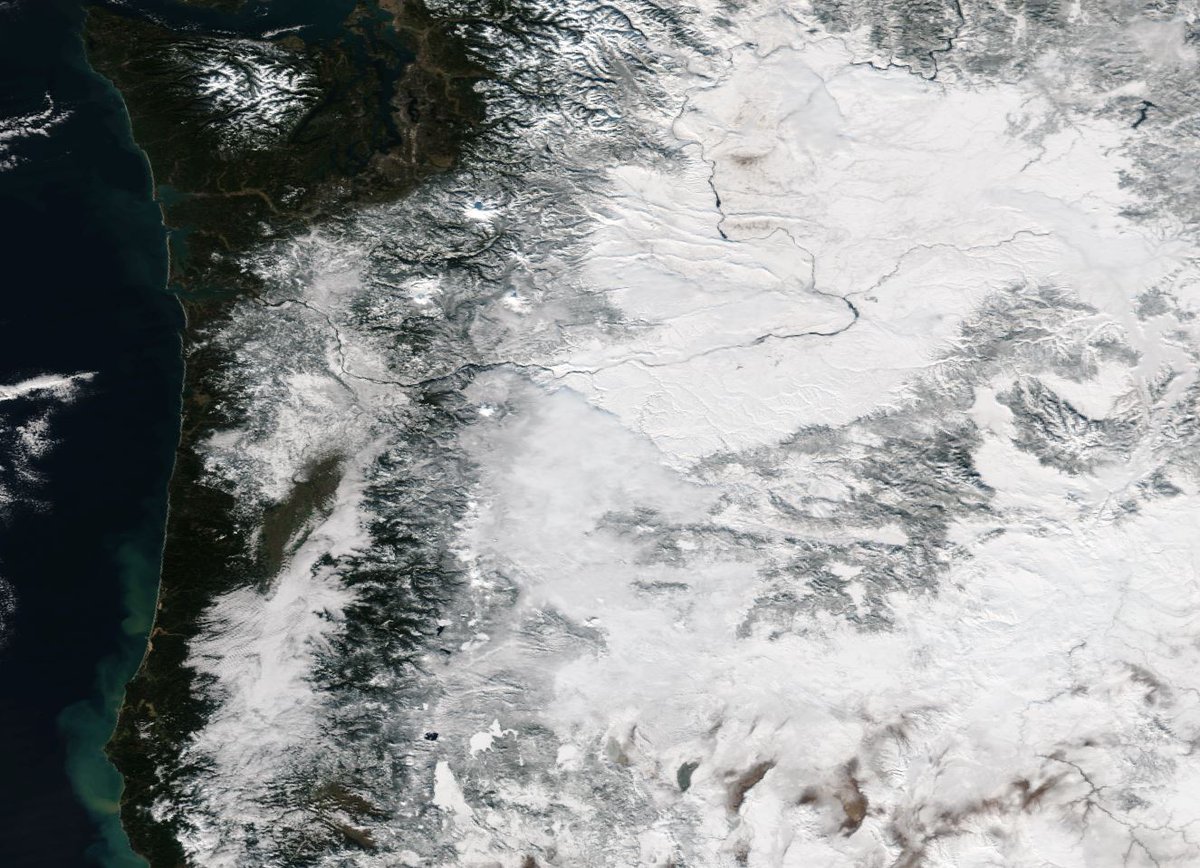
Snow covers the PNW in the true-color image captured by Suomi NPP on 1/12. Get a closer look at http://goo.gl/53lUzL pic.twitter.com/44Qr9utXJv
-
As seen in this video from GOES-13's solar x-ray imager, NOAA's satellites monitor space weather too! Learn more at http://goo.gl/8vso4u pic.twitter.com/rMyjUTzSu3
-
This GOES infrared imagery shows the system expected to bring ice storms and freezing rain to the central US today http://goo.gl/ibDfaM pic.twitter.com/DQHss9Fgzw
-
These maps from the US Drought Monitor show just how much drought conditions in CA have improved. Learn more at http://goo.gl/Hs8iXu pic.twitter.com/tcrskurIjV

 NOAA Satellites
Loading seems to be taking a while.
Twitter may be over capacity or experiencing a momentary hiccup. Try again or visit Twitter Status for more information.