

How to find your way through this section:
- By topic: Click on a topic on the grid below to find maps, data and links to information about that category. Some links may appear in more than one topic, such as soil moisture, vegetation and agriculture.
- By interactivity: The “Tools” page links to interactive sites where you can customize information to meet your needs. The tools allow you to customize information by designating locations; date ranges; comparisons among events and conditions; and more. Many of these applications will create charts or maps specific to the situation you design. Interactive tools also appear under specific topics.
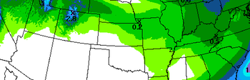
The majority of the links show the continental U.S. For North American and Global data, go to the North American Drought Portal or the Global Drought Portal.


The science of past droughts; reconstructions of drought from the past 1200 years; more.


This is the official software repository for National Integrated Drought Information System (NIDIS).
