

Announcing the Sub-Seasonal Climate Forecast Rodeo!
The Bureau of Reclamation is launching a forecasting prize competition toward improved sub-seasonal forecasting. Competitors submit forecasts of temperature and precipitation for one year, competing in real-time against other teams, as well as official forecasts from NOAA. For more information, see https://www.usbr.gov/research/challenges/forecastrodeo.html.

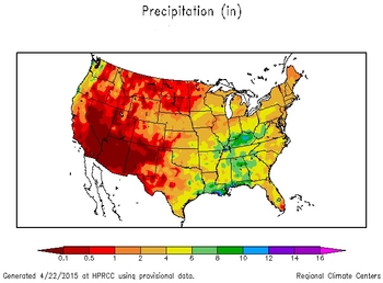
Current and archived precip analysis at different timescales. (Click for actual conditions)
Tool generates precipitation temperature maps for different locations and timescales. (Click for actual conditions)

Select forecast maps for total precipitation over different timescales. (Click for actual conditions)

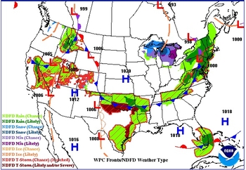
Wide selection of maps includes forecasts for temperature and precipitation for next 12 hours to 6 days. (Click for more resources)


Weekly, one-, three- and 12-month maps depicting precip totals, maximum and minimum temperatures, and departures from normal. (Click for more resources)

Probabilities of above- or below-normal temperature and precipitation. (Click for more resources)
Interactive tool for users to select and compare layers of climate data, including temperature and precipitation, at national to local scales.