

NIDIS and its partners support efforts to develop a national soil moisture monitoring network. For more information, see the 2013 report, “Developing a Coordinated National Soil Moisture Network.”

Climate Reference Network (CRN) and Soil Climate Analysis Network (SCAN) are a collection of climate monitoring stations which track, among other things, soil moisture and temperature at a series of depths.
![Sample of [paragraphs_item:field-grid-block-link:title]](https://webarchive.library.unt.edu/web/20170119004035im_/https://www.drought.gov/drought/sites/drought.gov.drought/files/styles/grid_thumbail/public/externals/06a1e1efb274486d203ca1650e6f4f90.gif?itok=5ZnkQP_6)

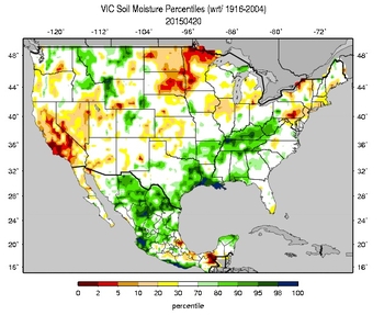
Current percentiles for soil moisture, snow-water equivalents (SWE) and other variables with respect to the climatological period. (Click for actual conditions)

Interactive U.S. map of snow conditions, precipitation, streamflow and reservoir storage. (Click for actual conditions)
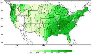
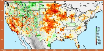
Maps show most recent daily, monthly and 12-month calculated soil moisture, anomalies and percentiles. (Click for actual conditions)
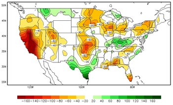
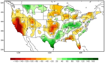
Anomalies and percentiles of soil moisture for different timescales. (Click for actual conditions)
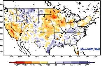
Multiple maps show soil moisture totals, anomalies, change and more. (Click for actual conditions)
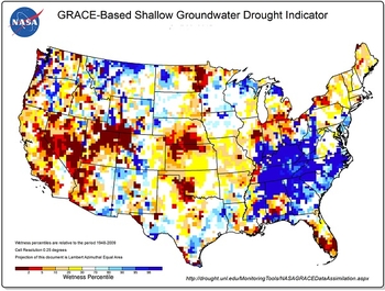
Water storage observations derived from satellite data, integrated with other observations. (Click for actual conditions)
Outlooks for the next two weeks, month, and season. (Click for actual conditions)

Visualize soil moisture, drought and climate information through interactive mapping of information from NIDIS partners.