GOES Surface and Insolation Products
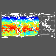
The GOES Surface and Insolation Products (GSIP) processing system is a near real-time operational system for generating products related to Earth radiation budget and associated products. Data from the Imager instruments of GOES, MTSAT and MSG are the primary inputs. Output parameters include (among others) radiative fluxes for the shortwave, longwave, and visible portions of the electromagnetic spectrum; surface temperature; and cloud properties. Radiative fluxes are calculated for downward and upward directions at the Earth surface and the top-of-atmosphere. The primary output products are the insolation (shortwave downward surface radiative flux) and photosynthetically available radiation or PAR (visible downward surface radiative flux), which are used in predictive models of coral reef health (coral bleaching prediction) and hydrological models (e.g., solar influence on evapotranspiration).
Daily Insolation and Photosynthetically Active Radiation (PAR) images are shown below. Click on a small image to display a larger view.
Current Daily Insolation

|
Current Daily PAR

|
Previous Daily Insolation

|
Previous Daily PAR

|
Version 3 of the GSIP system (GSIP-v3) is an enhancement to the GSIP Full Disk system (GSIP-fd). Rather than the Full Disk and Northern Hemisphere Extended domains, the GSIP-v3 extends coverage to West Pacific, East Indian, and West Atlantic Oceans. In addition, spatial resolution is increased in this version to 4 km. Also produced are Daily-average blended shortwave downward surface radiative flux (insolation) and visible downward surface radiative flux (PAR). Finally, this version utilizes improved algorithms for improving navigation.
GSIP-v3 products are processed for the GOES-East, GOES-West, MTSAT, and MSG Imagers. Processing occurs on an hourly basis for the GOES Northern Hemisphere Extended domain, MTSAT and MSG Full Disk domains; and on a 3-hourly basis for the GOES Full Disk domain.

