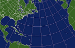
| Atlantic Ocean | Atlantic imagery is available from both polar and geostationary satellites. GOES-East and MSG (Meteosat) provide infrared, visible, shortwave infrared and water vapor images and loops. Infrared imagery is provided with several enhancements including AVN, Dvorak, JSL, RGB, Funktop, and Rainbow. Geostationary imagery is added every 30 minutes for GOES-East and every six hours for MSG. Floater imagery is available at a resolution as low as 1KM. Standard sectors are 4KM to 8KM. Polar microwave imagery at 8Km resolution is saved as composites and updated every 3 to 12 hours based on the number of satellites. (DMSP 12 hours and AMSU 3 hours). New imagery is posted every 3 hours if available. Atlantic Ocean Sectors (Includes SST Overlays) |
|
|
||
| GOES East, MSG | Resolution: 1-8 Km | Frequency: 30 minutes - 6 hours |
| DMSP, AMSU | Resolution: 8 Km | Frequency: 3 - 12 hours |
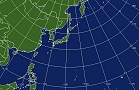
| Pacific Ocean | Pacific imagery is available from both polar and geostationary satellites. GOES-West and MTSAT provide infrared, visible, shortwave infrared and water vapor images and loops. Infrared imagery is provided with several enhancements including AVN, Dvorak, JSL, RGB, Funktop, and Rainbow. Geostationary imagery is added every 30 minutes for GOES-West and every hour for MTSAT. Floater imagery is available at a resolution as low as 1KM. Standard sectors are 4KM to 8KM. Polar microwave imagery at 8Km resolution is saved as composites and updated every 3 to 12 hours based on the number of satellites. (DMSP 12 hours and AMSU 3 hours). New imagery is posted every 3 hours if available. Pacific Ocean Sectors (Includes SST Overlays) |
|
|
||
| GOES West, MTSAT | Resolution: 1-8 Km | Frequency: 30 - 60 minutes |
| DMSP, AMSU | Resolution: 8 Km | Frequency: 3 - 12 hours |
| Polar Stereographic Atlantic | Atlantic imagery is available from both polar and geostationary satellites. GOES-East and MSG (Meteosat) provide infrared, visible, shortwave infrared and water vapor images and loops. Infrared imagery is provided with several enhancements including AVN, Dvorak, JSL, RGB, Funktop, and Rainbow. Geostationary imagery is added every 30 minutes for GOES-East and every six hours for MSG. Standard sectors are 10KM to 16KM resolution. Polar microwave imagery at 8KM resolution is saved as composites and updated every 3 to 12 hours based on the number of satellites. (DMSP 12 hours and AMSU 3 hours). New imagery is posted every 3 hours if available. Polar Sterographic Sectors |
|
|
||
| GOES EAST, MSG | Resolution: 10-16 Km | Frequency: 30 minutes - 6 hours |
| DMSP, AMSU | Resolution: 8 Km | Frequency: 3 - 12 hours |
| Polar Stereographic Pacific | Pacific imagery is available from both polar and geostationary satellites. GOES-West and MTSAT provide infrared, visible, shortwave infrared and water vapor images and loops. Infrared imagery is provided with several enhancements including AVN, Dvorak, JSL, RGB, Funktop, and Rainbow. Geostationary imagery is added every 30 minutes for GOES-West and every hour for MTSAT. Standard sectors are 16KM resolution. Polar microwave imagery at 8KM resolution is saved as composites and updated every 3 to 12 hours based on the number of satellites. (DMSP 12 hours and AMSU 3 hours). New imagery is posted every 3 hours if available. Polar Sterographic Sectors |
|
|
||
| GOES West, MTSAT | Resolution: 16 Km | Frequency: 30 - 60 minutes |
| DMSP, AMSU | Resolution: 8 Km | Frequency: 3 - 12 hours |