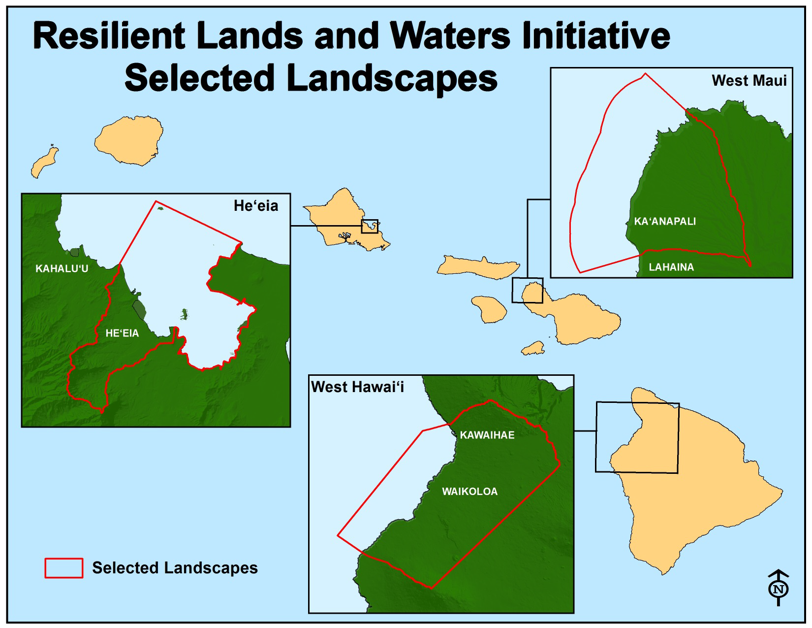
Ridge-to-reef efforts to build resilience in the most vulnerable areas
The three locations chosen for this initiative have active management in place with participation from several federal, state, and local government agencies, as well as community and non-profit organizations. Each location is already designated a priority location by the State of Hawai’i and NOAA.
He‘eia is a NOAA Sentinel Site and the state nominated the area to be added to NOAA’s National Estuarine Research Reserve System. Conservation efforts in He’eia include:
- stream and wetland restoration
- invasive species eradication
- fishpond restoration
West Maui is a State of Hawai’i and U.S. Coral Reef Task Force priority area with a watershed restoration initiative led by a large, multi-stakeholder group of federal, state, and local non-profit organizations.
The State of Hawai’i and the U.S. Coral Reef Task Force have also designated South Kohala, within West Hawai’i, as a priority area, which is a NOAA-designated Sentinel Site location and Habitat Blueprint Focus Area. Priorities in West Hawai’i include:
- reef resilience
- erosion and wildfire control
- dry forest restoration
West Maui and West Hawai’i are also within National Marine Sanctuary boundaries.
While each location has slightly different partners and focus, they all incorporate robust community engagement and partnerships to address resilience options. We’re combining existing tools and services with new science to understand climate vulnerability. In He’eia, organizations are using the NOAA Sea Level Viewer, reef resilience studies, and various techniques to remove invasive species. In West Maui we are working to identify reef stressors, high erosion locations, and post-fire rehabilitation plans. West Hawai’i is conducting similar reef-resilience studies and erosion assessments while working to better prevent wildfire impacts.
Selection as one of the Resilient Lands and Waters helped bring together partners to address specific climate change-related issues in areas of high vulnerability. The improved coordination and maps are helping to prioritize which climate change impacts are the most widespread and of greatest concern.
- A story map was created to house and visualize all the information gathered and created for organizations to utilize and build upon in future actions for the three sites that comprise the landscape.
- An interactive map and database
 were created to illustrate resilience activities in the RLW locations.
For additional information please contact: Jeff Burgett (USFWS) 808 687-6149 or Lani Watson (NOAA) at 808-725-5007