
- 12201 Sunrise Valley Drive
- Reston, VA 20192, USA
- 703-648-5953
- 1-888-ASK-USGS
- Employee Directory
- Web Chat
Information about water is fundamental to the national and local economic well-being, protection of life and property, and effective management of the Nation’s water resources. The USGS works with partners to monitor, assess, and conduct targeted research on the wide range of water resources and conditions, including streamflow, groundwater, water quality, and water use and availability.
Visit Website
Explore current streamflow conditions for the United States.
Get DataExplore our science by the topical areas that drive the research and projects conducted by our Programs.
Learn More!
USGS uses state-of-the-art science techniques to estimate phosphorus and suspended-sediment loads to Upper Klamath Lake in the Klamath Basin.

Uranium levels in Pigeon Spring, just north of the Grand Canyon, are likely due to a natural source of uranium and not related to the nearby former Pigeon Mine, according to a recent study by the U.S. Geological Survey.

A regional assessment of untreated groundwater in the Basin and Range basin-fill aquifers, which include parts of Nevada, California, Arizona, Utah and adjacent states, is now available from the U.S. Geological Survey.
Four pairs of fresh and partly-weathered granitoids, obtained from well-characterized watersheds—Merced River, CA, USA; Panola, GA, USA; Loch Vale, CO, USA, and Rio Icacos, Puerto Rico—were reacted in columns under ambient laboratory conditions for 13.8 yrs, the longest running experimental weathering study to date. Low total column mass losses (...

Tidal freshwater wetlands are one of the most vulnerable ecosystems to climate change and rising sea levels. However salinification within these systems is poorly understood, therefore, productivity (litterfall, woody biomass, and fine roots) were investigated on three forested tidal wetlands [(1) freshwater, (2) moderately saline, and (3) heavily...
Temporal changes in methyl tert-butyl ether (MtBE) concentrations in groundwater were evaluated in the northeastern United States, an area of the nation with widespread low-level detections of MtBE based on a national survey of wells selected to represent ambient conditions. MtBE use in the U.S. peaked in 1999 and was largely discontinued by 2007...
Water is one of seven science mission areas of the U.S. Geological Survey (USGS). Water's mission is to collect and disseminate reliable, impartial, and timely information that is needed to understand the Nation's water resources.
Read Science Plan
Endocrine disrupting chemicals (EDC) threaten the reproductive success and long-term survival of sensitive aquatic populations in the U.S. National Park Service (NPS). Understanding the ecological impacts of contaminants of emerging concern (CEC), in general, and EDC, in specific, has been identified as a NPS management priority.
The project employs a standardized EDC risk...

The water cycle describes how Earth's water is not only always changing forms, between liquid (rain), solid (ice), and gas (vapor), but also moving on, above, and in the Earth. This process is always happening everywhere.
Our USGS Water Science School has an in-depth...

Several Research areas are listed and their contacts regarding Glacial Aquifer System Groundwater Availability Study are available here.
<- Back to main Glacial Aquifer System Groundwater...

Federal policymakers and land managers are accountable to the public for how they invest public funds and for the outcomes of the policy and management decisions they make. Through a variety of economic analyses and custom modeling, SEA economists evaluate how investments and management decisions affect individuals, local communities, and society as a whole....

The Glacial Aquifer System Groundwater Availability Study began in 2012 and will be completed in 2016. The glacial aquifer system groundwater availability study is one of the USGS efforts in response to the Department of Interior WaterSMART initiative. This study is designed to provide information and analysis to stakeholders and decisionmakers for characterizing groundwater availability...

Groundwater resources in northwestern Louisiana may be needed for development of natural gas production from the Haynesville Shale. Use of groundwater for hydro-fracturing of the shale may lower water levels and alter groundwater flow directions in the Carrizo-Wilcox aquifer and other local aquifers. Regional maps of aquifers in northwestern Louisiana are unavailable. The LaWSC, in cooperation...

Since 1950 when the U.S. Geological Survey (USGS) first conducted water-use compilations, important changes in water use have occurred in Alabama. The early part of the history (1950 to 1980) showed a steady increase in water use. During this time, the expectation was that, as the population increased, so would water use. Contrary to this expectation, reported water withdrawals declined...
 Basin Study")
Welcome....the Lower Tennessee River Basin in Tennessee, Alabama, Georgia, Kentucky, and Mississippi is one of the 59 study units that are part of the U.S. Geological Survey's National Water-Quality Assessment (NAWQA) Program.The long-term goals of this program are to describe the status and trends in the quality of a large, representative part of the Nation's...

The USGS in Michigan-in cooperation with local, State, Tribal, and Federal partners-operates 155 streamgages recording stage and streamflow, and 13 lake-level gages. There are about 7,400 streamgages nationwide; many of these gages provide real-time data in 15-minute increments, which typically are transmitted to the World Wide Web every 1 to 2 hours using satellite, telephone, or cellular...

Data on low-flow characteristics are used by water-resources managers for a variety of purposes, including water-supply planning, making decisions about wastewater-discharge and water withdrawal permits, and evaluating in-stream flow requirements. The Michigan low-flow network currently consists of seven sites where streamflow is typically measured only during low-flow periods. In addition to...

The USGS operates a network of real-time water-quality monitoring stations that measure up to five physical parameters. The parameters are temperature, specific conductance, pH, dissolved oxygen, and turbidity. One to four of those parameters are measured at 26 sites, while all five parameters are measured at 13 sites. These data are used for decision making about hydroelectric power...

Historically, small streams with drainage areas less than 100 square miles have not been adequately represented in regional peak- (high) flow analysis. In Michigan, USGS operates 24 traditional crest-stage gages, where stage and streamflow is only measured during high flows, and 6 continuous-record crest-stage gages, where cooperators can continually monitor stage and USGS maintains a high-...
The USGS investigates the occurrence, quantity, quality, distribution, and movement of surface and underground waters and disseminates the data to the public, State and local governments, public and private utilities, and other Federal agencies involved with managing our water resources. Explore our water resources data!

Are you looking for data for today, in the past, or what might happen in the future? Discover USGS Water Data resources here!
Water-use data are collected by area type (state, county, watershed, or aquifer) and source (rivers or groundwater), and category (such as public supply or irrigation). Water-use data has been reported every five years since 1950. The USGS works with local, State, and Federal agencies as well as other organizations to collect and report withdrawals.
At the National Water Census Data Portal you will find national estimates of water budget components for local watersheds, water withdrawal data for counties, tools to calculate statistics of daily streamflow records, modeled daily streamflow at ungaged stations, and access to records of aquatic biology observations.

Spatial/GIS data sets for Alabama are available numerous spatial data clearinghouses. Spatial/GIS data sets for USGS studies that include Alabama or include parts of Alabama are also available from USGS.
Downloadable GIS Datasets, OGB GIS Datasets, Digital Raster Graphics (DRG), 1:24000 DRG, 1:100000 DRG, 1:250000 DRG, Hazards GIS Data, Hazards Data Water GIS Data, HUC 11 Watersheds
Downloadable spatial data files for exploration and analysis.
")
Endocrine disrupting chemicals (EDC) threaten the reproductive success and long-term survival of sensitive aquatic populations in the U.S. National Park Service (NPS). The project employs a standardized EDC risk assessment framework to link new and ongoing research efforts in individual Parks and in Park Monitoring Networks, in order to provide a service-wide assessment of EDC risk in the NPS.
River and Coastal Forecast Information
Lower Mississippi River Forecast Center, Slidell, Louisiana—(NWS)

Network wells depicted on the Climate Response Network location map
Note: Color shading in the table below indicates multiple wells that plot as a single point on the state location map above.
Note: BLS = Water Level in Feet Below Land Surface, RVD = Water Level referenced to a vertical datum

Alabama Counties depicted on the state location map with active wells

The Mobile River Basin in Alabama, Georgia, Mississippi, and Tennessee is one of the 59 study units that are part of the U.S. Geological Survey's National Water-Quality Assessment (NAWQA) Program.

Available online are estimated Secchi-disk transparency (eSDT) and corresponding estimated trophic state index (eTSI) values for Michigan inland lakes. To view available eSDT for Michigan inland lakes greater than 20 acres without interference from clouds, cloud shadows, dense vegetation or shoreline, go to the Michigan Lake Water Clarity Interactive Map Viewer.

Real-time displays of current floating conditions at various sites along the Arkansas Buffalo River.

As part of their mission to protect public health and aquatic ecosystems, Alabama state agencies need accurate and representative streamflow statistics to establish realistic and applicable criteria for both water quality and water quantity (fig. 1).

The Arkansas Groundwater - Quality Network is a web map interface that provides rapid access to the U.S. Geological Survey's (USGS) NWIS and the U.S. Environmental Protection Agency's (EPA) STORET databases of ambient groundwater information. The interface enables users to perform simple graphical analysis and download selected water-quality data.

Beta version 4 is now available for most states on a trial basis, and version 3 remains available. Beta version 4 provides a single user interface (at http://streamstatsags.cr.usgs.gov/streamstats/) for all states that are implemented, rather than separate applications for each state, as in versions 2 and 3, and the user interface is more user friendly than previous versions.

StreamStats is a Web-based tool that provides streamflow statistics, drainage-basin characteristics, and other information for USGS streamgaging stations and for user-selected ungaged sites on streams. When users select the location of a streamgaging station, StreamStats provides previously published information from a database. When users select a site on an ungaged stream,
Explore new publications and highlighted collections.
Temporal changes in methyl tert-butyl ether (MtBE) concentrations in groundwater were evaluated in the northeastern United States, an area of the nation with widespread low-level detections of MtBE based on a national survey of wells selected to represent ambient conditions. MtBE use in the U.S. peaked in 1999 and was largely discontinued by 2007...
Lindsey, Bruce; Ayotte, Joseph; Jurgens, Bryant; Desimone, LeslieAs part of the ZERT program, sediments from two wells at the ZERT site, located in Bozeman, Montana, USA were reacted with a solution having the composition of local groundwater. A total of 50 water samples were collected from 7 containers placed for 15 days in a glove box with one atmosphere of CO2 to investigate detailed changes in the...
Kharaka, Yousif K.; Thordsen, James J.; Abedini, Atosa A.; Beers, Sarah; Thomas, BurtFour pairs of fresh and partly-weathered granitoids, obtained from well-characterized watersheds—Merced River, CA, USA; Panola, GA, USA; Loch Vale, CO, USA, and Rio Icacos, Puerto Rico—were reacted in columns under ambient laboratory conditions for 13.8 yrs, the longest running experimental weathering study to date. Low total column mass losses (...
White, Arthur F.; Schulz, Marjorie S.; Lawrence, Corey R.; Vivit, Davison V.; Stonestrom, David A.Combining water-quality data from multiple sources can help counterbalance diminishing resources for stream monitoring in the United States and lead to important regional and national insights that would not otherwise be possible. Individual monitoring organizations understand their own data very well, but issues can arise when their data are...
Sprague, Lori A.; Oelsner, Gretchen P.; Argue, Denise M.Tidal freshwater wetlands are one of the most vulnerable ecosystems to climate change and rising sea levels. However salinification within these systems is poorly understood, therefore, productivity (litterfall, woody biomass, and fine roots) were investigated on three forested tidal wetlands [(1) freshwater, (2) moderately saline, and (3) heavily...
Pierfelice, Kathryn N.; Graeme Lockaby, B.; Krauss, Ken W.; Conner, William H.; Noe, Gregory; Ricker, Matthew C.
Groundwater provides nearly 50 percent of the Nation’s drinking water. To help protect this vital resource, the U.S. Geological Survey (USGS) National Water-Quality Assessment (NAWQA) Project assesses groundwater quality in aquifers that are important sources of drinking water. The Basin and Range basin-fill aquifers constitute one of the...
Musgrove, MaryLynn; Belitz, Kenneth
Groundwater provides nearly 50 percent of the Nation’s drinking water. To help protect this vital resource, the U.S. Geological Survey (USGS) National Water-Quality Assessment (NAWQA) Project assesses groundwater quality in aquifers that are important sources of drinking water. The Northern Atlantic Coastal Plain aquifer system constitutes one of...
Lindsey, Bruce; Belitz, Kenneth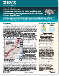
Groundwater provides nearly 50 percent of the Nation’s drinking water. To help protect this vital resource, the U.S. Geological Survey (USGS) National Water-Quality Assessment (NAWQA) Project assesses groundwater quality in aquifers that are important sources of drinking water.
Barlow, Jeannie; Lindsey, Bruce; Belitz, Kenneth
Groundwater provides nearly 50 percent of the Nation’s drinking water. To help protect this vital resource, the U.S. Geological Survey (USGS) National Water-Quality Assessment (NAWQA) Project assesses groundwater quality in aquifers that are important sources of drinking water.
Barlow, Jeannie R.B.; Belitz, KennethWe simulate the 1950–2010 water balance for the conterminous U.S. (CONUS) with a monthly water balance model (MWBM) using the 800 m Parameter-elevation Regression on Independent Slopes Model (PRISM) data set as model input. We employed observed snow and streamflow data sets to guide modification of the snow and potential evapotranspiration...
Hostetler, Steven W.; Alder, Jay R.Despite elevated summer insolation forcing during the early Holocene, global ice sheets retained nearly half of their volume from the Last Glacial Maximum, as indicated by deglacial records of global mean sea level (GMSL). Partitioning the GMSL rise among potential sources requires accurate dating of ice-sheet extent to estimate ice-sheet volume...
Ullman, David J.; Carlson, Anders E.; Hostetler, Steven W.; Clark, Peter U.; Cuzzone, Joshua; Milne, Glenn A.; Winsor, Kelsey; Caffee, Marc A.Software and related material (data and documentation) are made available by the USGS to be used in the public interest and the advancement of science.

In 1977, the Congress of the United States recognized the need for uniform, current, and reliable information on water use and directed the U.S. Geological Survey (USGS) to establish a National Water-Use Information Program (NWUIP) to complement the Survey's data on the availability and quality of the Nations water resources.

Software and related material (data and documentation) are made available by the U.S. Geological Survey (USGS) to be used in the public interest and the advancement of science.

STRMDEPL08—An Extended Version of STRMDEPL with Additional Analytical Solutions to Calculate Streamflow Depletion by Nearby Pumping Well
The USGS produces many types of multimedia products. Use the links below to browse our offerings of photograph galleries, podcasts and sound files, videos, aerial photos, and posters related to water. The USGS Newsroom has a Web page that highlights the main collection of multimedia products.


USGS uses state-of-the-art science techniques to estimate phosphorus and suspended-sediment loads to Upper Klamath Lake in the Klamath Basin.
Uranium levels in Pigeon Spring, just north of the Grand Canyon, are likely due to a natural source of uranium and not related to the nearby former Pigeon Mine, according to a recent study by the U.S. Geological Survey.
A regional assessment of untreated groundwater in the Basin and Range basin-fill aquifers, which include parts of Nevada, California, Arizona, Utah and adjacent states, is now available from the U.S. Geological Survey.
A regional assessment of untreated groundwater in the Coastal Lowlands aquifer system in the southeastern United States is now available from the U.S. Geological Survey.
A regional assessment of untreated groundwater in the Northern Atlantic Coastal Plain aquifer system in the eastern United States is now available from the U.S. Geological Survey.
The U.S. Geological Survey is near the midpoint of a complex undertaking to survey the quality of the nation’s largest drinking-water resource. From 2012 – 2023, the USGS is assessing groundwater throughout the country through extensive sampling. The latest results from five regional aquifers have become available today.
A regional assessment of untreated groundwater in the Southeastern Coastal Plain aquifer system is now available from the U.S. Geological Survey.
A regional assessment of untreated groundwater in the combined Valley and Ridge and Piedmont and Blue Ridge aquifers in the eastern United States is now available from the U.S. Geological Survey.

U.S. Geological Survey scientist Dr. Robert Baskin is being awarded with a 2016 Governor’s Medal for Science and Technology. Gov. Gary R. Herbert will present awards to 11 individuals and one company at the 30th anniversary awards dinner tonight.

Water users around the country can now view the past and simulated future of hydrologic processes.

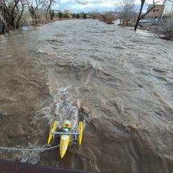
You are invited to join USGS scientists and field technician crews as they collect discharge measurements in rainfall-affected areas.

Helpful new information for anyone designing structures over or near water, managing water distribution, or interested in the flow of local streams.

saterrac@usgs.gov
Phone: (631) 736-0783
Fax: (631) 736-4283

Phone: 608-828-9901
Fax: 608-821-3817
Phone: (512) 927-3500
Fax: (512) 927-3590

Phone: (605) 394-3200
Fax: (605) 355-4523

information@usgs.gov
Phone: 443-498-5500
Fax: 442-498-5510
Phone: (405) 810-4400
Fax: (405) 843-7712
Phone: (225) 298-5481
Fax: (225) 298-5490

Phone: (502) 493-1900
Fax: (502) 493-1909

Phone: (916) 278-3000
Fax: (916) 278-3070
Phone: (303) 236-6900
Fax: (303) 236-4912

Phone: (787) 749-7400

Phone: 520-670-6671
Fax: 520-670-5592

Phone: (785) 842-9909
Fax: (785) 832-3500

Phone: (907) 786-7000
Fax: (907) 786-7020

Phone: (606) 549-2406
Fax: (606) 549-5400

Phone: 860-291-6740
Fax: 860-291-6799
Phone: 217-328-8747
Fax: 217-328-9770

Phone: (919) 571-4000
Fax: (919) 571-4041
Phone: 443-498-5552
Fax: 443-498-5510

Phone: Phone: (208) 387-1300
Fax: (208) 387-1372
Phone: (701) 250-7400
Fax: (701) 250-7429

Phone: (678) 924-6700
Fax: (678) 924-6710
Phone: (402) 328-4100
Fax: (402) 437-5139
Phone: (317) 290-3333
Fax: (317) 290-3313

Phone: (813) 498-5000
Fax: (813) 498-5002

GS-W-TNnsh Webmaster@usgs.gov
Phone: (615) 837-4700
Fax: (615) 837-4799
Phone: 319-337-4191
Fax: (319) 358-3606

Phone: (804) 261-2600
Fax: (804) 261-2657
Phone: (717) 730-6900
Fax: (717) 730-6997
Phone: (502) 493-1900
Fax: (502) 493-1909

Phone: (304) 347-5130
Fax: (304) 347-5133
Phone: (609) 771-3900
Fax: (609) 771-3915

Phone: 517-887-8903
Fax: 517-887-8937
Phone: (508) 490-5000
Fax: (508) 490-5068

Phone: (603) 226-7800
Fax: (603) 226-7894
Phone: 573-308-3667
Fax: (573) 308-3645
Phone: (207) 622-8201
Fax: (207) 622-8204
Phone: (253) 552-1600
Fax: (253) 552-1581
Phone: (763) 783-3100
Fax: (763) 783-3103

Phone: (406) 457-5900
Fax: (406) 457-5990

Phone: (775) 887-7600
Fax: (775) 887-7629

Phone: (334) 395-4140
Fax: (334) 395-4168
Phone: (307) 778-2931
Fax: (307) 778-2764
Phone: (503) 251-3200
Fax: (503) 251-3470

Phone: (601) 933-2900
Fax: (601) 933-2901

Phone: 207 622-8201
Phone: (505) 830-7900
Fax: (505) 830-7998

Phone: 614-430-7700
Fax: 614-430-7777

Phone: 808-690-9600
Fax: 808-690-9599
Phone: (801) 908-5000
Fax: (801) 908-5001
Phone: (501) 228-3600
Fax: (501) 228-3601
Phone: (316) 773-3225
Phone: (785) 623-2848

Phone: (479) 442-4888
Phone: 906-786-0714
Fax: 906-786-5461
Phone: 989-348-8291
Fax: 989-348-6866
Phone: (318) 251-9630

Phone: (315) 265-4410 / (518) 285-5602
Fax: (315) 265-2166
Phone: 808-877-6135
