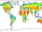
| Blended TPW | Operational Products Overview Algorithm Product Animation North Pacific | Australia | Indian Ocean | South Pacific | East Asia Super National | South Indian Ocean | Europe
North Pacific | Australia | Indian Ocean | South Pacific | East Asia Super National | South Indian Ocean | Europe
North Pacific | Australia | Indian Ocean | South Pacific | East Asia Super National | South Indian Ocean McIDAS AWIPS: Puerto Rico | Alaska | Hawaii | Super National GPS Data: GPS Plot | GPS NCEP |
|
|
|
||
| Microwave Integrated Retrieval System (MIRS) | Operational Products Cloud Liquid Water Ice Water Path Land Surface Emissivities Land Surface Temperature Liquid Water Path Moisture Profiles Rain Rate Rain Water Path Snow Cover Sea Ice Concentration Surface Type Classification Snow Water Equivalent Temperature Profiles Total Precipitable Water Operational Products by Satellite: POES Products Metop Products SSMIS Products |
|
|
|
||
| Microwave Surface and Precipitation Products System (MSPPS) | Operational Products Cloud Liquid Water Ice Water Path Land Surface Emissivities Land Surface Temperature Rain Rate Snow Cover Snow Fall Rate Sea Ice Snow Water Equivalent Total Precipitable Water Operational Products by Satellite: NOAA 15 Products NOAA 18 Products Metop-A Products NOAA 19 Products Metop-B Products |
|
|
|
||
| NOAA Operational GCOM-W1 AMSR-2 Products System (NOGAPS) | The NOAA Operational GCOM-W1 AMSR-2 Products System (NOGAPS) is developed to process GCOM data and generate NOAA unique operational products for users. It ingests GCOM-W1 AMSR-2 RDRs and generates L1B products with software provided by JAXA and generates L2 products using the GCOM-W1 AMSR2 Algorithm Software Package (GAASP) provided by NESDIS STAR. Both L1 and L2 products are distributed to users through the ESPC NDE system, while L1 products are only made available to restricted users approved by JAXA. The NOAA unique L2 products include: calibrated microwave brightness temperatures, rainfall rate, sea surface temperature, sea surface wind speed, total precipitable water, cloud liquid water, soil moisture, surface type, snow cover, snow depth, snow water equivalent, and sea ice. The GCOM-W1 data and products are expected to be utilized by NOAA users for improving numerical weather prediction, precipitation and tropical cyclone location, intensity analysis, and monitoring. Product Link |
| Ocean Color | Okeanos Operational Products Chlorophyll Concentration | Remote Sensing Reflectance Water Attenuation Coefficient Chlorophyll Concentration | Remote Sensing Reflectance Chlorophyll Concentration | Remote Sensing Reflectance Magnitude | Direction Chlorophyll Concentration | Remote Sensing Reflectance 8-Day Composite | Composite Calcite Concentration Other Operational Products |
|
|
|
||
| Tropical Cyclone Formation Probability Product | Geostationary satellite data and National Centers for Environmental Prediction (NCEP) global analyses are used as input to an algorithm developed by the Cooperative Institute for Research in the Atmosphere (CIRA) to estimate the probability of tropical cyclone formation within the next 24 hours in 5 by 5 degree latitude/longitude areas. Product Link |
|
 |
||
| GOES, MTSAT-1R | Resolution: 5x5 Degrees | Frequency: 6 Hours |
| Soil Moisture Operational Products System (SMOPS) | The Soil Moisture Operational Products System (SMOPS) combines soil moisture retrievals from multi-satellites/sensors to provide a global soil moisture map with more spatial and temporal coverage.
Product Link |
|
|
||
| Mapped Resolution: 0.25 x 0.25 degree grids |
Frequency: Every 6 hours | |
| Blended Rain Rate (bRR) | The blended rain rate (RR) product is produced hourly by blending together recent rain rate retrievals from passive microwave instruments on six polar-orbiting satellites, including POES NOAA-18, NOAA-19 and MetOp-A, and also DMSP F16, F17 and F18. The blended RR eliminates the bias between those data sets and provides a unified, meteorologically significant rain rate field for satellite analysts and weather forecasters. Product Link |
|
|
||
| Multiple Platforms | Resolution: 16 Km at Equator (Mercator) | Frequency: 12 hrs |
| Hydro-Estimator Rainfall | The Hydro-Estimator (HE) algorithm uses infrared (IR) brightness temperatures to identify regions of rainfall and retrieve rainfall rate, while using National Centers for Environmental Prediction (NCEP) Global Forecast System (GFS) model fields to account for the effects of moisture availability, evaporation, orographic modulation, and thermodynamic profile effects. Recently the HE has been extended to the entire globe equator-ward of 60 degrees to meet user community's need for support of global flash flood guidance efforts. The operational global HE products available include instantaneous rain rates and 1-hour, 3-hour, 6-hour, 24-hour and multi-day precipitation accumulations. Product Link |
|
|
||
| GOES | Resolution: 4 Km | Frequency: 15 min.; 1 hr. on AWIPS |