Lynn Kurth: The Ocean and Humans are Inextricably Interconnected, July 1, 2016

NOAA Teacher at Sea

Lynn M. Kurth

Aboard NOAA Ship Rainier

June 20-July 1, 2016

Mission: Hydrographic Survey

Geographical area of cruise:  Latitude:  58˚03.973 N   Longitude:  153˚34.292 W

Date:  July 4, 2016

Weather Data from the Bridge
Sky:  Cloudy
Visibility: 10+ Nautical Miles
Wind Direction: 010
Wind Speed: 10 Knots
Sea Wave Height: 0-1 ft. (no swell)
Sea Water Temperature: 11.1° C (51.9° F)
Dry Temperature: 12° C (53.6° F)
Barometric (Air) Pressure: 1013.3 mb


Science and Technology Log

Throughout my experience as a Teacher at Sea, it has been evident that the ocean and humans are inextricably interconnected.  This was apparent from my very first evening in Homer when I came across an eagle poised next to its colossal nest assembled in the middle of three rusty pier pilings.  An illustration of nature conforming to our presence on the water and what we deem to be acceptable for our environment.


eagle

Eagle with nest located in deep water port of Homer, AK

But, humankind must sometimes accept and conform to nature.   The fishermen of Uganik Bay have built their fishing camps above the tidal line and strung out their nets where the fish traditionally run.  Most of the men and women who live here have chosen to do so because this is where the fish are found.  One such gentlemen is Toby Sullivan, a commercial fisherman, who in 1975 headed to Alaska from Connecticut to work on the Alaskan pipeline.  Instead, he found himself fishing vs. working on the pipeline and to this day is still gill-netting salmon to make a living.  Toby’s fishing camp, East Point, located on the south shore of the Uganik Bay, has had a net on the site for the past 80 years.  And, unfortunately, we drifted into that site when a strong current took us by surprise while we were gathering water quality data over the side of the small sonar vessel.  When this happened, Toby and his crew worked swiftly and diligently to secure their fishing gear while NOAA divers were summoned from the Rainier to safely help our vessel leave the area.


enhancedtoby

Toby Sullivan and crew work to install an additional line on their fishing set

A few evenings later, Mr. Sullivan and his crew came on board the Rainier as dinner guests and a rich discussion of hydrographic work and fishing gear followed.  He explained in detail how he sets his fishing gear and offered the idea that a radio channel be utilized between NOAA’s small vessels that are working around fishing gear and the local fisherman, in order to facilitate better communication.


discuss

Toby Sullivan and XO (executive officer) Jay Lomincky

As I watched the exchange of ideas between Commanding Officer E.J. Van Den Ameele and Mr. Sullivan it appeared that both men recognized that both parties were interested in Uganik Bay because the ocean and humans are inextricably interconnected.  The Rainier’s primary mission in Uganik Bay is to gather the necessary data to create accurate and detailed charts for navigational use by the local fisherman and other mariners.  As a commercial fisherman, Mr. Sullivan’s primary interest is to keep his gear and crew safe while continuing to make a living from the harvest of local fish.

toby

Toby Sullivan shares information about how he sets his fishing gear

Today the Rainier continues on with its mission of hydrographic work at sea using the multibeam sonar which is located on the hull of the Rainier.  The swath that multibeam sonar on the Rainier covers is similar to the swath of the multibeam sonar on the smaller boats; the coverage area depends on the depth of the water.  For example, at our current water depth of 226 meters, the swath of each pass that the multibeam sonar makes an image of  is 915 meters wide.  This evening, upon the completion of the work with the Rainier’s multibeam sonar we will depart the area and be underway for Kodiak, AK.


All Aboard!

Michael Bloom serves as as survey technician aboard the Rainier and kindly took some time with me to discuss his background and work aboard the Rainier.

DSCN0300

Survey Technician Michael Bloom completes the collection of a bottom sample in Uganik Bay

Tell us a little about yourself:

I grew up in a military family, so I was actually born in England and have lived in Florida, Nebraska, Montana, Oregon and Washington.  I went to college at Oregon State University located in Corvallis, OR and majored in earth systems with a focus on marine science.

How did you discover NOAA?:  

Ever since I was a little kid instead of having posters of bands etc… I had posters of maps.  NOAA Corps participated in career fairs at my university.  I stopped at their booth my sophomore year and again my junior and senior year to learn more about their program.  After learning more about NOAA I also focused on the marine aspect of earth science because I knew I wanted to work with them.  Initially I didn’t know about the civilian side of NOAA, so I applied for the NOAA Corps two times and wasn’t accepted into the program, although I was an alternate candidate once.  At some point, when speaking with an officer he told me to apply for a civilian position with NOAA.  So, I applied and was accepted.

I’m happy to be on the civilian side because I get to work on the science side of the operations all of the time and I get to keep my beard!


DSCN0393 (2)

Survey Technician Michael Bloom monitors the settings of the Rainier’s multi beam sonar

What are your primary responsibilities when working on the ship?:

I am survey tech and my primary duties include data acquisition and data processing.  We can work to become the Hydrographer in Charge on the surveys after enough time working in the field and, if after the Field Operations Officer observes us, he feels confident that we are ready. Eventually I’d like to work for NOAA as a physical scientist, a job that would have me going out to sea several times a year but one that is primarily land based.

What do you love about your work with NOAA?:

I get paid to travel!  I go to places that people pay thousands of dollars to visit and I actually get paid thousands of dollars to go there.  I enjoy that I can see the real world application of the work that I do.  Scientists are using our data and ultimately we could be saving lives by creating such accurate charts.


Personal Log

NOAA’s website for the Rainier states that the Rainier is one of the most productive and advanced hydrographic ships in the world.  After spending two weeks working on board the Rainier, I couldn’t agree more.  However, I don’t believe that it is only the cutting-edge technology that makes the Rainier one of the best hydrographic ships in the fleet.  But rather a group of outstanding people at the helm of each of the different technical aspects of hydrography.  Hydrographic surveying has many steps before the end product, a chart, is released.  The people I met on board who are part of that process are teaching each other the subtle nuances of Rainier’s hydrographic mission in order to become even better at what they do.  I am grateful for the time that the crew and Officers have graciously given me while I have been on board.  I felt very welcome from the moment a NOAA Corps member picked me up at the airport throughout my stay on the Rainier as I continued to pepper everybody with questions.  Thank you Rainier!  I am confident that when I return to my classroom your efforts to help me better understand your work of hydrographic surveying will pay off.   You have given me the gift of new knowledge that, when shared with my students has the potential to ignite in them the same excitement and passion for science that so many of you possess.

DSCN0398 (2)

Teacher at Sea Kurth on the middle deck of the ship

Barney Peterson: Spreads Like A Ripple, July 1, 2016

NOAA Teacher at Sea

Barney Peterson

(Soon to be) Aboard NOAA Ship Oregon II

August 13-28, 2016

Mission: Shark/Red Snapper Longline Survey

Geographic Area of Cruise: Gulf of Mexico

Date: July 1, 2016

Spreads Like a Ripple

“Yep, sounds exciting, but you teach about Pacific Salmon, so how useful is learning about Hammerhead Sharks in the Gulf of Mexico really going to be?” my friend asked.

Her reaction was not unusual. I am a 4th grade teacher with 26 years of experience in the Everett Public Schools in Washington State. I have put some serious thought into using my Teacher At Sea experiences to open eyes and minds to the world around us. I think the possibilities are endless.

My first Teacher at Sea assignment was summer 2006 aboard NOAA ship, RAINIER, on a hydrographic survey mission in the Shumagin Islands, Gulf of Alaska. From this I developed lessons on making contour maps using sticks and a sounding box. I grew my understanding of how weather systems that develop in the Gulf of Alaska influence our weather in Puget Sound. I used that knowledge to help students understand relationships between geography, weather and climate. I learned about birds, mammals and fish in the ocean food chain and inserted that learning into helping students understand the life cycle of the salmon we raise in our classroom.

In 2008 I had the opportunity to share a Teacher in the Air experience with fellow TASA Dana Tomlinson from San Diego, California. We flew with a winter storm research crew from Portland, Oregon; traveling 1800 miles out over the Pacific Ocean and back tracking developing weather systems. We created lessons that helped students understand the importance of using accurate global positioning information to follow low pressure systems as they moved across the ocean toward the west coast of North America. We put together a unit to help them understand how air pressure, relative humidity, and wind speed and direction are measured and how that data is used to understand and predict weather patterns. My students still use those lessons as we participate in the GLOBE program, sending data in every day of the school year.

That was then, and this is now:

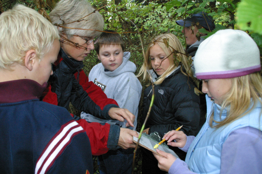
Field studies of salmon habitat with 4th grade students

Field studies of salmon habitat with 4th grade students

At school, I have students use globes and inflatable Earth Balls to track from the Arctic Ocean through every other ocean and back to the Arctic without taking their pointer-fingers off ocean surface. Then they start to get it… the connections: there is really just one big ocean! We learn about the water cycle and I challenge them to explain “where the water comes from.” We learn about food webs and energy flow. Our salmon studies teach them about producers, consumers and decomposers. They get the idea of cycles and systems and how all parts must work together. They learn to consider what happens when one step of a cycle fails or one part of a system is missing. We learn about organisms labeled “indicator species” that help scientists track changes in the health of ecosystems.

True, all of this is presented with a focus on where we live in the Pacific Northwest. But…that is just one place on the edge of our one ocean. Time comes to broaden the view. There are many life cycles depending upon the continual efficient functioning of Earth’s systems. Since there is just one ocean, nothing really happens in isolation. The same kinds of events that disrupt life cycles in one place will certainly disrupt them in another.

In August I will be aboard the NOAA ship, OREGON II, in the Gulf of Mexico. Our mission is to investigate and gather data about Scalloped Hammerhead Sharks and Red Snapper. They share an ecosystem and participate in the same food web. They are subject to consequences of the same environmental changes and catastrophes that happen in other parts of our ocean.

Drop a pebble into the water anywhere and ripples spread until they reach the outermost boundaries. We all share one ocean. Where does the ripple stop?

Lynn Kurth: The Earth has One Big Ocean, June 22, 2016

NOAA Teacher at Sea

Lynn M. Kurth

Aboard NOAA Ship Rainier

June 20-July 1, 2016

Mission: Hydrographic Survey

Geographical area of cruise:  Latitude: N 57˚50 Longitude: W 153˚20  (North Coast of Kodiak Island)

Date:  June 23, 2016

Weather Data from the Bridge:
Sky: Clear
Visibility: 10 Nautical Miles
Wind Direction: 268
Wind Speed: 14 Knots
Sea Wave Height: 2-3 ft. on average
Sea Water Temperature: 12.2° C (54° F)
Dry Temperature: 16° C (60.8° F)
Barometric (Air) Pressure: 1023 mb


Science and Technology Log

I’m continually searching for ways to connect what I am learning to what is relevant to my students back home in the Midwest.  So, as we left Homer, AK for our survey mission in Kodiak Island’s Uganik Bay, I was already thinking of how I could relate our upcoming survey work to my students’ academic needs and personal interests.  As soon as the Rainier moved away from Homer and more of the ocean came into view, I stood in awe of how much of our planet is covered with water.  It’s fascinating to think of our world as having one big ocean with many basins, such as the North Pacific, South Pacific, North Atlantic, South Atlantic, Indian, Southern and Arctic.  The study of ocean and its basins is one of the most relevant topics that I can teach when considering the following:

  • the ocean covers approximately 70% of our planet’s surface
  • the ocean is connected to all of our major watersheds
  • the ocean plays a significant part in our planet’s water cycle
  • the ocean has a large impact on our weather and climate
  • the majority of my students have not had any firsthand experience with the ocean


IMG_1675

Earth’s One Big Ocean as seen from outside of Homer, AK


Each of the ocean basins is composed of the sea floor and all of its geological features which vary in size and shape.  The Rainier will be mapping the features of the sea floor of the Uganik Bay in order to produce detailed charts for use by mariners.  The last survey of Uganik Bay was completed in 1908 when surveyors simply deployed a lead weight on a string over the edge of a boat in order to measure the depth of the water.  However, one of the problems with the charts made using the lead line method, is that the lead line was only deployed approximately every 100 meters or more which left large gaps in the data.  Although not in the Uganik Bay, in the 1930s NOAA began using single beam sonar to measure the distance from a ship’s hull to the sea floor which made surveying faster but still left large gaps in the data. Fast forward from approximately 100 years ago when lead lines were being used for surveying to today and you will find the scientists on the Rainier using something called a multibeam sonar system.  A multibeam sonar system sends out sound waves in a fan shape from the bottom of the ship’s hull.  The amount of time it takes for the sound waves to bounce off the seabed and return to a receiver is used to determine water depth.  The multibeam sonar will allow our team on the Rainier to map 100% of the ocean’s floor in the survey area that we have been assigned.

nNTC_Hydro

Evolution of Survey Techniques (Illustration Credit: NOAA)


DSCN0006

NOAA Ship Rainier June 22, 2016 in Uganik Bay off of Kodiak Island


 All Aboard!

IMG_1814

NOAA Corps Junior Officer Shelley Devereaux

The folks I am working with are some of the most knowledgeable and fascinating people that I have met so far on this voyage and Shelley Devereaux from Virginia is one of those people.  Shelley serves as a junior officer in the NOAA  (National Oceanic and Atmospheric Administration) Corps and has been working aboard the Rainier for the past year.  The NOAA Commissioned Officer Corps is one of the seven uniformed services of the United States and trains officers to operate ships, fly aircraft, help with research, conduct dive operations, and serve in other staff positions throughout NOAA.

Here is what Shelley shared with me when I interviewed her one afternoon.

Tell us a little about yourself:  I’m originally from the rural mountains of Appalachia and moved to Washington DC after college.  I lived in DC for about seven years before I joined the NOAA Corps and while in DC I really enjoyed cycling, hiking, cooking, baking and beer brewing.

How did you discover NOAA Corps and what do you love most about your job in the NOAA Corps?

I went to Washington DC after I received my undergraduate degree in math and worked a lot of different jobs in a lot of different fields.  In time, I decided to change careers and went to graduate school for GIS (Geographic Information Systems) because I like the data management side of the degree and the versatility that the degree could offer me.  I was working as a GIS analyst when my Uncle met an officer in the NOAA Corps who talked with my Uncle about the NOAA Corps.  After that, my Uncle told me about NOAA Corps and the more I found out about NOAA Corps the more I liked it.  Especially the hydro side!  In the NOAA Corps each of your assignments really develops on your skill base and you get to be involved in a very hands on way.  Just this morning I was out on a skiff literally looking to determine what level a rock was in the water.  And, later in my career I can serve an operations officer.  So I loved the fact that I could join the NOAA Corps, be out on ship collecting data while getting my hands dirty (or at least wet!), and then progress on to other interesting things.  I love getting to be part of all the aspects of ship life and being a surveyor.   It’s a wonderful feeling knowing that what we do here has a tangible effect on the community and the public because we are making the water safer for the people who use it.

DSCN0011

NOAA Corps Junior Officer Shelley Devereaux manages her sheets during near shore work in Uganik Bay

What are your primary responsibilities when working on the ship?  

I am an ensign junior officer on a survey ship.  Survey ships operate differently than other ships in the NOAA fleet with half of my responsibilities falling on the junior officer side of ship operations which includes driving the ship when we are underway, working towards my officer of the deck certification, working as a medical officer, damage control officer and helping with emergency drills.  The other half of what I get to do is the survey side.  Right now I am in charge of a small section called a sheets and I am in charge of processing the data from the sheets in a descriptive report about the area surveyed.  So, about half science and half ship operations is what I do and that’s a really good mix for me.  As a junior officer we are very fortunate that we have the opportunity to and are expected to learn the entire science of hydrography.

IMG_1819

Junior Officer Shelley Devereaux checks the ship’s radar

What kind of education do you need to have this job and what advice do you have for young people interested in a career like yours?

You need a college degree with a lot of credits in science and/or math.  Knowing the science that is happening on the ship is important to help your understanding of the operations on the ship which helps you be a better ship operator. Realize that there are a lot of opportunities in the world that are not always obvious and you need to be aggressive in pursuing them.


Personal Log

You didn’t think I’d leave out the picture of Teacher at Sea in her “gumby suit” did you?  The immersion suit would be worn if we had to abandon ship and wait to be rescued.

IMG_1760

Teacher at Sea (TAS) Kurth Hi Mom!

 Happy Solstice!  Quirky but fun:  For the past six years I have celebrated the solstice by taking a “hand picture” with the folks I am with on the solstice.  I was thrilled to be aboard the Rainier for 2016’s summer solstice and include some of the folks that I’m with on the ship in my biannual solstice picture.

IMG_0989

Winter Solstice 2015 with Sisu (family pet) and my husband James

IMG_1820

All Hands on Deck! Summer Solstice 2016


Did You Know?

Glass floats or Japanese fishing floats are a popular collectors’ item.  The floats were used on Japanese fishing nets and have traveled hundreds and possibly thousands of miles via ocean currents to reach the Alaskan shoreline. The floats come in many colors and sizes and if you’re not lucky enough to find one while beach combing, authentic floats and/or reproductions can be found in gift shops along the Alaskan coast.

floats(2)

Japanese Fishing Floats


Spencer Cody: Farewell Fairweather, June 18, 2016

Spencer Cody

Onboard the NOAA Ship Fairweather

May 29 – June 18, 2016

Mission:  Hydrographic Survey

Geographical Area of the Cruise:  along the coast of Alaska

Date: June 18, 2016

Weather Data from the Bridge: 

Observational Data:

Latitude: 55˚ 20.643′ N

Longitude: 131˚ 37.505′ W

Air Temp: 20˚C (68˚F)

Water Temp: 13˚C (55˚F)

Ocean Depth: 30 m (100 ft.)

Relative Humidity: 65%

Wind Speed: 9 kts (11 mph)

Barometer: 1,022 hPa (1,022 mbar)

Science and Technology Log:.

111_0798 (2)

In order to check whether the tide gauge is working or not, a tidal observation needs to take place.  Over the course of several hours, the tide is measured as it rises or falls on graduated staffs and is recorded and compared to our tidal gauge data.  Credit Brian Glunz for the photo.

While horizontal control base stations are used to improve the accuracy of the positions of all points on a surface by providing a fixed known location to compare to GPS coordinates, constantly changing tides present another challenge in of its own.  With tides in the survey area ranging 3 to 6 meters (10 to 20 ft.), depths can vary widely for various shallow-water hazards depending on the strength of the tide.  Consequently, accurate tide data must be recorded during the survey and in close proximity of the survey site since tides vary widely depending on topography, weather systems, and other factors.  This is where tide stations come into play and are necessary to accurately gauge the vertical level of water throughout the survey area.

111_0930 (2)

Surveying equipment is used to check benchmarks near the tide station in the upper left for any movement.  Hydrographic Assistant Survey Technician Hannah Marshburn is recording data from the leveling process with Ensign Matthew Sharr sighting a staff held in place by Ensign Mason Carroll and Hydrographic Senior Survey Technician Clint Marcus.

Before a survey is started in an area, a tide station can be set up within the survey area to measure local tides. The tide stations use solar cells to generate electricity to power a small compressor on land that sends air through a hose that is attached to the ocean bottom in a near-shore environment.  The tide gauge can measure how much pressure is needed to generate a bubble out the end of the hose, the greater the pressure, the deeper the water.  These pressure gradients correlate to a certain depth of water while the depth of the water is tied to a nearby benchmark of surveyed elevation.  This information is then transmitted out to tide reporting sites online.  For additional data on tide patterns, the information on tide levels can be downloaded from the gauge in refining survey data.  In order to ensure that a tide gauge is working correctly, manual tide observations are periodically made at the same location. Additionally, the benchmarks near the tide gauge go through a process called “leveling.” This is survey work that compares all of the secondary benchmarks in the area to the primary benchmark.  If none of the benchmarks have moved relative to each other, it is safer to assume that the benchmarks still represent the elevation that they were originally surveyed.  Once the survey in the area is completed, the tidal gauge is packed up to be used at another location.  Since the portion of the tidal gauge that releases the pressurized bubble is under the entire tidal water column, a dive team is required to remove the remaining equipment.  The entire tidal gauge site is returned to how it looked before the station was set up.  Only the survey benchmarks remain for future use.

Personal Log:

107_0553 (2).JPG

From left to right Ensign Tyler Fifield charts our course while Able Seaman Godfrey Gittens has the helm with Ensign Lander Van Hoef controlling the power to propulsion.  Bridge usually has at least one officer and one deck member on watch at all times.  Ensign Fifield has been in NOAA and on the Fairweather for two years and has a background in marine safety and environmental protection.  AB Gittens spent 4 years in the Navy, 20 years on commercial and military marine contracted vessels, and has now worked for NOAA for a couple of months.  Ensign Van Hoef has a background in mathematics and has been on the Fairweather for six months.

Dear Mr. Cody,

On our cruise ship there are officers that wear uniforms who run the ship.  They also look out for the safety of everyone onboard.  They are very nice and know a lot about how to keep the ship running and get the cruise ship to each stop on our vacation.  They work with each department on the ship to make sure everything runs properly and people stay safe.  It has been a great trip to Alaska, and now we are at our last stop.  Goodbye Alaska!  (Dillion is one of my science students who went on an Alaska cruise with his family in May and has been corresponding with me about his experiences as I blog about my experiences on the Fairweather.)

Dear Dillion,

The Fairweather also has officers, the NOAA Corps, to help run the ship and carry out NOAA’s mission by utilizing NOAA’s fleet of ships and aircraft and by staffing key land-based positions throughout the organization.  The NOAA Corps ensures that trained personnel are always available to carry out NOAA’s missions using cutting-edge science and technology.  This gives NOAA the flexibility it needs to complete many types of varied research since officers are trained to fulfill many types of missions.  This gives NOAA the ability to respond quickly to scientific and technological needs and helps retain a continuity of operations and protocol throughout the vast fleet and area of operations.  In order to be considered for acceptance into the NOAA Corp, applicants must have at least a four year degree in a field of study relating to NOAA’s scientific and technological interests.  Once accepted into the program, they go through five months of training at the United States Coast Guard Academy where they develop an understanding of NOAA’s mission, maritime and nautical skills, and general ship and boat operation skills.  After successful completion of the training, NOAA officers are placed on a ship in the fleet for three years of sea duty to begin their new career.

109_0606 (2)

Chief Electronics Technician Sean Donovan performs his daily check of communications systems on the bridge.  CET Donovan served as a naval service ground electronic technician for 11 years in the Navy and has been in NOAA for 8 months.

On the Fairweather NOAA Corp officers help run and manage the ship and launch boats.  They navigate the ship and stand watch on the bridge.  They work with the other departments to ensure that the mission is accomplished and everyone remains safe during the mission.  On a hydrographic survey ship such as the Fairweather, Corps officers commonly have the position of sheet manager for hydrographic survey regions as collateral duties allowing them the opportunity to plan the logistics of hydrographic survey areas and learn how to use software associated with hydrographic data collection and analysis. Additionally, officers will be assigned to other scientific missions as they arise since the Fairweather will participate in a variety of scientific projects throughout the year.

109_0599 (2)

Able Seaman Carl Coonce controls the hydraulic system that is picking up a launch boat from a survey mission.  AB Coonce has been in NOAA for 12 years.  He was also on the NOAA ships Albatross and Bigalow.  He has been on the Fairweather for five years.  He started out in NOAA as a second cook and then a chief steward, but he wanted to learn more about ships; so, he made the move to the deck department commenting, “When you go out on deck, all differences are set aside.  We lookout for each other.”

A hydrographic ship such as the Fairweather requires many departments to work together  including the NOAA Corps officers to accomplish the mission.  There is the deck department and engineering department and the steward department as I have discussed their role in previous posts.  However, there are also electronic technicians that assist the survey in all of its technological aspects including the ship’s servers, electronics, radar, and communication systems.  Since technology plays a critical role in the collection and analysis of data, a hydrographic ship depends on these systems to carry out its scientific research.

109_0601 (2)

Acting Chief Hydrographic Survey Technician John Doroba prepares a boat launch for another portion of the hydrographic survey.  ACHST Doroba is the lead survey technician for this leg.  He has a background in geography, physical science, and information systems with a decade of work experience in and out of NOAA relating to surveying and related technology.

The survey department does the bulk of the collection and analysis of hydrographic data.  Depending on experience and education background, someone in survey may start out as a junior survey technician or assistant survey technician and advance up to a survey technician, senior survey technician, and possibly a chief survey technician.  With each step more years of experience is required because a greater amount of responsibility comes with each position concerning that survey.  Survey technicians generally need to have a background in the physical sciences or in computer science.  Technology and physical science go hand-in-hand in hydrographic survey work by applying and analyzing scientific data through the lens of advanced technology and software.  One needs to be capable in both areas in order to be proficient in the survey department.

104_0414 (2)

Hydrographic Assistant Survey Technician Steve Eykelhoff collects hydrographic data during a launch.  HAST Eykelhoff has a background in geology and hydrology.  He has worked on many mapping projects including mapping the Erie Canal and the Hudson River.

It really comes down to people working together as a team to get something done.  In the case of the Fairweather, all of this talent and dedication has been brought together in a team of NOAA Corps, engineers, deck, survey, technicians, and stewards to carry out a remarkable array of scientific work safely and efficiently.  This team is always ready for that next big mission because they work together and help each other.  Yes, Dillion, my time here on the Fairweather is also drawing to a close.  I have enjoyed the three weeks onboard and have learned a lot from a very friendly and informative and driven crew.  I thank all of those who were willing to show me what their job in NOAA is like and the underlying concepts that are important to their careers.  I learned a great deal concerning NOAA careers and the science that is carried out onboard a NOAA hydrographic ship.  Thank you!

Did You Know?

The NOAA Commissioned Officer Corps is one of seven uniformed services of the United States consisting of more than 300 officers that operate NOAA’s fleet of 16 ships and 9 aircraft.

Can You Guess What This Is?111_0918 (2)

A. a ship  B. a hydrographic survey  C. a NOAA vessel  D. a final farewell to an amazing ship and crew

You should already know the answer if you have been following this blog!

(The answer to the question in the last post was C. an azimuth circle.  The Fairweather has an azimuth circle onboard.  While it is not typically used for navigation, it is yet another technology that remains as a holdover from earlier seafaring times and as a potential navigation tool available when all modern equipment has failed.  The azimuth circle can be used to measure the position of a celestial body for navigation purposes or to get a bearing on an object visible from the ship.)

Spencer Cody: Killing the Dots, June 13, 2016

NOAA Teacher at Sea

Spencer Cody

Onboard the NOAA Ship Fairweather

May 29 – June 17, 2016

Mission:  Hydrographic Survey

Geographical Area of the Cruise:  along the coast of Alaska

Date: June 13, 2016

Weather Data from the Bridge: 

Observational Data:

Latitude: 55˚ 10.643′ N
Longitude: 132˚ 54.305′ W
Air Temp: 19˚C (66˚F)
Water Temp: 14˚C (58˚F)
Ocean Depth: 33 m (109 ft.)
Relative Humidity: 50%
Wind Speed: 6 kts (7 mph)
Barometer: 1,014 hPa (1,014 mbar)

Science and Technology Log:

104_0366 (2)

“Killing dots” or manually flagging data points that are likely not accurately modeling hydrographic data is only the beginning of a very lengthy process of refining hydrographic data for new high-quality nautical charts.  Credit Hannah Marshburn for the photo.

In the last post, I talked about how we collect the hydrographic data.  The process of hydrographic data collection can be a challenge in of itself with all of the issues that can come up during the process.  But, what happens to this data once it is brought back to the Fairweather?  In many ways this is where the bulk of the work begins in hydrography.  As each boat files back to the ship, the data they bring back is downloaded onto our servers here on the ship to begin processing.  Just the process of downloading and transferring the information can be time consuming since some data files can be gigabytes worth of data.  This is why the Fairweather has servers with terabytes worth of storage to have the capacity to store and process large data files.  Once the data is downloaded, it is manually cleaned up.  A survey technician looks at small slices of hydrographic data and tries to determine what is the actual surface of the bottom and what is noise from the multibeam echosounder.  Leaving too many false data points in the slice of hydrographic data may cause the computer software to adjust the surface topography to reach up or below to something that in reality does not exist. The first phase of this is focused on just cleaning the data enough to prevent the hydrographic software from recognizing false topographies.  Even though the data that does not likely represent accurate hydrographic points are flagged and temporarily eliminated from the topographic calculation, the flagged data points are retained throughout the process to allow for one to go back and see what was flagged versus what was retained. It is important to retain this flagged data through this process in case data that was thought to be noise from the echosounder really did represent a surface feature on the bottom.

104_0365 (2)

Hydrographic Assistant Survey Technician Sam Candio is using a three dimensional viewer to clean the hydrographic data collected from that day’s launches.

Once this process is complete, the day’s section is added to a master file and map of the target survey area.  This needs to happen on a nightly basis since survey launches may need to be dispatched to an area that was missed or one in which the data is not sufficient to produce quality hydrographic images.  Each launch steadily fills in the patchwork of survey data; so, accounting for data, quality, and location are vitally important.  Losing track of data or poor quality data may require another launch to cover the same area.  After the survey area is filled in, refinement of the new map takes place.  This is where the crude cleanup transitions into a fine-tuned and detailed analysis of the data to yield smooth and accurate contours for the area mapped.  Data analysis and processing are the parts of hydrographic work that go unnoticed.  Since this work involves many hours using cutting-edge technology and software, it can be easy to underappreciate the amount of work survey technicians go through to progress the data through all of these steps to get to a quality product.

Personal Log:

20160513_113539 (2)

Dillion and family in Hoonah, Alaska.

Dear Mr. Cody,

Today we docked in Hoonah, Alaska.  We had a whale show right under our balcony!  They are incredible to watch.  There is so much to see for wildlife in Alaska. (Dillion is one of my science students who went on an Alaska cruise with his family in May and will be corresponding with me about his experiences as I blog about my experiences on the Fairweather.)

Dear Dillion,

104_0408 (2)

A friendly humpback is keeping our survey launch company as we map our assigned polygon.

I know what you mean about the wildlife.  I am seeing wildlife all over the place too.  On our transit to our survey site from Juneau, I saw numerous marine mammals: hump back whales, dolphins, and killer whales.  On our last survey launch, we had two humpbacks stay within site of the boat the entire morning.  They are remarkable creatures.  Whenever we locate a marine mammal, we fill out a marine mammal reporting form allowing various interests to use these reports to estimate the population size and range of these animals.  The waters off the Alaskan coast are full of marine life for a reason.  It is a major upwelling area where nutrients from the ocean bottom are being forced up into the photic zone where organisms such as phytoplankton can use both the nutrients and sunlight to grow.  This provides a large amount of feed for organisms all the way up the food chain.  This area is also known for its kelp forests.  Yes, if you were on the sea bottom in these areas dominated by kelp, it would look like a forest!  Kelp are a very long- and fast-growing brown algae that provide food and habitat for many other marine organisms.

104_0437 (2)

Kelp forests form on relatively shallow rocky points and ledges allowing for the holdfasts to form and latch onto the bottom giving the resulting algae growth the opportunity to toward the surface to collect large amounts of sunlight for photosynthesis.

Did You Know?

The RESON 7125sv multibeam echosounders found onboard the survey launches use a 200 kHz or 400 kHz sound frequency.  This means the sound waves used fully cycle 200,000 or 400,000 times per second.  Some humans can hear sounds with pitches as high as 19 kHz while some bat and dolphin species can hear between 100 and 150 kHz.  No animal is known to have the capability to audibly hear any of the sound waves produced by the multibeam onboard our survey boats.  Animals that use echolocation tend to have much higher hearing ranges since they are using the same premise behind acoustic mapping in hydrography but to detect food and habitat.

Can You Guess What This Is?

104_0410 (2)

A. a marker buoy  B. a water purification system  C. an electric bilge pump  D. a CTD sensor

The answer will be provided in the next post!

(The answer to the question in the last post was A. a search and rescue transponder.  If a launch boat were to become disabled with no means of communication or if the boat needs to be abandoned, activating a search and rescue transponder may be the only available option left for help to find someone missing.  When the string is pulled and the cap is twisted, a signal for help is sent out in the form of 12 intense radar screen blips greatly increasing the odds for search and rescue to find someone in a timely manner.  The radar blips become arcs as a radar gets closer to the transponder until the radar source gets within a nautical mile in which the arcs become full circles showing rescue crews that the transponder is nearby.)

Spencer Cody: Filling in the Asterisk, June 10, 2016

NOAA Teahcer at Sea

Spencer Cody

Onboard the NOAA Ship Fairweather

May 29 – June 17, 2016

Mission:  Hydrographic Survey

Geographical Area of the Cruise:  along the coast of Alaska

Date: June 10, 2016

Weather Data from the Bridge: 

Observational Data:

Latitude: 55˚ 10.643′ N

Longitude: 132˚ 54.305′ W

Air Temp: 19˚C (66˚F)

Water Temp: 12˚C (54˚F)

Ocean Depth: 33 m (109 ft.)

Relative Humidity: 60%

Wind Speed: 4 kts (5 mph)

Barometer: 1,014 hPa (1,014 mbar)

Science and Technology Log:

102_0137

Goodbye Juneau, we are off to our survey site just west of Prince of Wales Island in the southernmost part of Southeast Alaska.

On Sunday with everyone who needed to be here for the next leg of the hydrographic survey onboard, we set off for the survey site.  Transiting through Alaskan fjords and associated mountains is a real treat to say the least.  The abundance of wildlife and picturesque views of glaciers, mountains, and forests lend one easily susceptible to camera fatigue.  Every vista resembles a painting or photograph of significance.  The views are stunning and the wildlife breathtaking.  After a day’s worth of transiting, we arrived in our survey area just west of Prince of Wales Island on the southern tip of Southeast Alaska and its Alexander Archipelago.  The chain of islands that makes up the Alexander Archipelago represent the upper reaches of the submerged coastal range of mountains along the Pacific.  A mere 20,000 years ago, the sea level was roughly 120 meters (400 ft.) lower than what it is today as our planet was in the grips of the last major ice age.  To put that into perspective, the Fairweather is currently anchored in a calm bay with about 30 meters (100 ft.) of water.  During the recent ice age, this entire ship would be beached hanging precariously next to ledges dropping 100 meters (300 ft.) to the ocean below.  The mountains and steep island banks continue down to the sea floor providing for wildly changing topography below sea level.  This type of environment is perfectly geared toward Fairweather’s capabilities.

While mapping survey areas that include shallow near-shore water, the Fairweather anchors in a calm bay maximizing ideal conditions for launching and retrieving boats whenever possible.  Survey launches are dispatched out to their assigned polygons with the survey area while a skiff boat carries out near-shore marking of rocks and obstructions.  Each of the four survey launches have a RESON 7125sv multibeam echosounder to collect data for mapping.  Survey launches are sent out for much of the day and return with hydrographic data concerning their assigned area.  All of the data is compiled into one file after extensive processing and quality control.

Personal Log:

20160512_154154 (2)

Dillion enjoying Sitka, Alaska.  Credit Suzi Vail for the photo.

Dear Mr. Cody,

We arrived in Sitka, Alaska, with bald eagles flying overhead.  The islands with the tall mountains are amazing.  Some even have snow on them still.  They have a lot of trees and wildlife.  The mountains are all over the island and come right down to the ocean with a very tall dormant volcano across the sound from Sitka.  (Dillion is one of my science students who went on an Alaska cruise with his family in May and will be corresponding with me about his experiences as I blog about my experiences on the Fairweather.)

102_0213 (2)

Assisting Ensign Joseph Brinkley in lowering a Conductivity, Temperature, and Depth (CTD) sensor.  The CTD records temperature, salinity, and density.  All of these factors affect the speed of sound and must be factored into our data collection.  Credit Todd Walsh for the photo.

Dear Dillion,

We are not that far to the southeast of you in our survey area.  That is part of the challenge of mapping this area and ensuring that nautical maps are accurate and up to date.  Those tall mountains that you see so close to your ship really do continue down into the ocean in many places.  I was able to go out on one of our survey launches to see how hydrographic data is collected using the Fairweather’s fleet of survey launch boats.  It started with a mission and safety briefing before the launches were turned loose.  Our operations officer went over the assigned polygon mapping areas with us.  We were then reminded of some of the hazards that a small boat needs to be cognizant of such as the log debris in the water and the potential of grounding a boat on rocks.  Both our commanding officer and executive officer repeatedly stressed to us the importance of being careful and alert and always defaulting to safety versus more data collection.  Once the briefing was over, our boats were launched one at a time to our assigned survey polygons.  We were to map the area just north of the McFarland Islands.  Parts of the this area had known hazards hidden just below sea level.  Complicating matters was the fact that many of these hazards marked on existing maps were instances in which someone hit a rock but did not know the exact location or a rock was potentially spotted at low tide.  It was our job to carefully map the area without damaging the boat or putting any of the passengers in harm’s way.

102_0185 (2)

Keeping the boat on course as we collect a swath of hydrographic data in deep water devoid of rocks, kelp, or logs.  Credit Todd Walsh for the photo.

Mapping an assigned area can be anywhere between the two extremes of incredibly uneventful to nimbly avoiding obstacles while filling in the map.  Since the multibeam echosounder requires sound waves to travel farther through a deeper column of water, the swath covered by the beam is wider and takes longer to collect.  In such stretches of water, the boat is crawling forward to get the desired amount of pings from the bottom needed to produce quality hydrographic data.  When the boat is in shallow water, the reverse is true.  The beam is very narrow, and the boat is able to move at a relatively fast pace.  This makes mapping shallow regions challenging.  The person navigating the boat must work with a narrower beam at faster speeds while avoiding the very hazards we were sent to map.  Additionally, in this area kelp forests are very common.  The long brown algae forms a tangled mass that can easily bind up a boat propeller.  Add massive floating logs from all the timber on these islands, and now you have a situation in which a trained driver needs to have all their wits about them.

102_0253 (2)

Narrowing the data collection to a range of depths in which the entire swath can be recorded minimizes the cleanup of false data points while not losing any of the pertinent hydrographic data.  Credit Amber Batts for the photo.

While the person navigating the boat tries to orderly fill in the polygon with a swath of hydrographic data, a person must be stationed at a work station inside the cabin modifying the data stream from the beam to help keep out noise from the data making the survey data as clean as possible.  Sloppy data can result in more time in cleanup during the night processing of data once the boats return to the Fairweather.  In addition, to control what is recorded, the station also determines when the multibeam echosounder is on or off.  It takes some practice to try to keep multiple tasks on multiple screens functioning within an acceptable range.  The topography in the map area also adds to the challenge since drop offs are commonplace.  There were many times were the difference from one end of the beam to the other end was 100 meters or more (300 feet or more).  It was like trying to survey the cliff and bottom of the canyon including the wall of the canyon in one swipe.  Sometimes the ridges are so steep underwater that shadows are produced in the data were the sound waves were blocked by the ridge and our relative angle to it preventing a complete swath.  This requires us to move over the ridge on the other side to map the gap.

102_0200 (2)

Slowly but surely, we are painting over the existing map with a detailed color-coating of contours of depth.

There is something inherently exciting about being the first to see topography in such detail.  Much of this area was last surveyed by lead line and other less advanced means of surveying than our current capabilities.  In many respects they were accurate, but as we filled in our data over the existing maps, one could not help but to feel like an explorer or as much as one can feel like an explorer in this modern age.  We were witnessing in our little assigned piece of the ocean something never seen before: land beneath the water in striking detail.  The rocks and navigational hazards no longer resembled mysteriously vague asterisks on a navigation map to be simply avoided.  We were replacing the fear of the unknown with the known by using science to peer into those asterisks on the map and paint them in a vivid array of well-defined contours later to be refined and made ready for the rest of the world to utilize and appreciate through upgraded navigation charts.  Once our assigned polygon was filled to the best of our abilities, we moved on to the next and so on until it was time to head back to the Fairweather completing another successful day of data collection.

Did You Know?

Kelp is a long brown algae that forms underwater forests that serve as an important habitat for many marine organisms.  Kelp is one of the fastest growing organisms on the planet.  Some species can grow a half a meter (1.5 ft.) per day reaching lengths of 80 m (260 ft.) long.

Can You Guess What This Is?

152_3283 (2)A. search and rescue transponder  B. an emergency flashlight  C. a marker buoy  D. a flare gun

The answer will be provided in the next post!

(The answer to the question in the last post was B. an oil filter.  Getting an oil filter change for the Fairweather is a little different than for your car though the premise is similar.  The four long filters used for each of the two diesel engines onboard are many times larger to accommodate the oil volume and are more durable to handle circulating oil 24 hours a day.)

Spencer Cody: No Survey, No Problem, June 8, 2016

Spencer Cody

Onboard the NOAA Ship Fairweather

May 29 – June 17, 2016

Mission:  Hydrographic Survey

Geographical Area of the Cruise:  along the coast of Alaska

Date: June 8, 2016

Weather Data from the Bridge: 

Observational Data:

Latitude: 55˚ 10.643′ N

Longitude: 132˚ 54.305′ W

Air Temp: 17˚C (63˚F)

Water Temp: 11˚C (52˚F)

Ocean Depth: 33 m (109 ft.)

Relative Humidity: 52%

Wind Speed: 10 kts (12 mph)

Barometer: 1,014 hPa (1,014 mbar)

Science and Technology Log:

155_3353 (2)

Refrigeration, boiler, and compressed air are just three of the many systems that are monitored and maintained from engineering.

With much of the survey team either on leave or not yet here for the next leg of the hydrographic survey, it can be easy to be lulled into the sense that not much is going on onboard the Fairweather while she is in port, but nothing could be further from the truth.  Actually, having the ship docked is an important time for departments to prepare for the next mission or carry out repairs and maintenance that would be more difficult to perform or would cause delays during an active survey mission.  On that note while the Fairweather was docked was a perfect time to see the largely unseen and unappreciated: engineering.  Engineering is loud and potentially hazardous even when the engines are not running, much less, when we are underway.  One of the key purposes of engineering is to monitor systems on the ship to make sure many of the comforts and conveniences that we take for granted seemingly just happen.  Sensors constantly monitor temperature, pressure, and other pertinent information alerting the crew when a component drifts outside of its normal range or is not functioning properly.  Catching an issue before it progresses into something that needs to be repaired is a constant goal.  Monitoring in engineering includes a wide array of systems that are vital to ship operations, not just propulsion.  Sanitation, heating, refrigeration, ventilation, fuel, and electric power are also monitored and regulated from engineering.  Just imagine spending the day without any of these systems while the loss of all of them would send us reeling to earlier seafaring days when humanity was entirely at the mercy of nature’s whim.

155_3424 (2)

Tommy Meissner, an oiler in the engineering department, is giving me a tour and overview of engineering.  The day after this photo was taken, he took and passed his junior engineer certification exam.  Congratulations Tommy!

Two diesel generators can produce enough power to power a small town.  Water systems pressurize and regulate water temperatures for use throughout the ship while filtration systems clean used water before it is released according to environmental regulations.  Meanwhile, enough salt water can be converted to freshwater to meet the needs of the ship and crew.  The method of freshwater production ingeniously uses scientific principles from gas laws to our advantage by boiling off freshwater from salt water under reduced air pressures increasing freshwater production while minimizing energy consumption.  Steam is generated to heat the water system and provide heat for radiators throughout the ship, and of course the two large diesel engines that are used to provide propulsion for the ship are also located in engineering.

150_2981 (2)

Chief Engineer Bill Ness using the ship’s crane to unload a crate of materials and equipment onto the pier.

How does one get to work in engineering onboard a ship like the Fairweather?  There are several different positions in the ship’s engineering department.  An oiler is largely responsible for maintenance, repair, and fabrication and must pass a qualifying test for this designation focusing on boilers, diesel technology, electrical, and some refrigeration.  Once the qualifying test is passed, the Coast Guard issues a Merchant Mariner credential.  Only then can one apply for that position.  Junior engineers must pass a test demonstrating that they have the working knowledge of the systems involved with engineering especially in areas of auxiliary systems and repair.  Junior engineers generally need less supervision for various operations than oilers and have a greater scope in responsibility that may also include small boat systems and repair.  The scale of responsibility does not stop there, but continues through Third, Second, and First Engineers.  Each involving a qualifying test and having more requirements involving education and experience.  Finally, the Chief Engineer heads the department.  This too requires a qualifying test and certain experience requirements.  There are two different ways in which one can progress through these different levels of responsibility.  They can attain the formal education or they can document the job-related experience.  Usually both play a role in where someone is ultimately positioned determining their role onboard the ship as part of an engineering team.

Personal Log:

100_0019 (2)

Deck crew Terry Ostermyer (lower, right) with Jason Gosine (middle) and I (left) degreasing cables for the hydraulic boat launching system.  It really needs a before and after photo to be appreciated.  Credit Randy Scott for the photo.

Dear Mr. Cody,

The crew is very friendly.  They take care of everything that we need on our trip to Alaska.  They also take care of the ship.  They must have to do a lot of work to keep such a large ship going and take care of this many people on vacation at sea.  (Dillion is one of my science students who went on an Alaska cruise with his family in May and will be corresponding with me about his experiences as I blog about my experiences on the Fairweather.)

Dear Dillion,

The Fairweather also has a crew that takes care of the ship and its very own fleet of boats.  While in port, I worked with our deck department to get a very small sense of what they do on a day-to-day basis to keep the ship running.  The pitfall of having a lot of equipment and having the capability of doing many multifaceted missions is that all of this equipment needs to be maintained, cleaned, repaired, and operated.  This includes maintaining both the ship’s exterior and interior, deployment and retrieval of boats, buoys, arrays, and various other sampling and sensory systems.  When not assisting with carrying out a component of a mission such as launching a boat, the deck crew is often performing some sort of maintenance, standing watch, mooring and anchoring the ship, unloading and loading supplies, and stowing materials.  Depending on years of experience and whether they have a Merchant Mariner’s certification or not will determine the level of responsibility.  On a survey ship, the deck department specializes in boat launches and maintenance; so, the levels of responsibility reflect that central area of concern.  Beginning experience starts with general vessel assistant and ordinary seaman progressing through able seaman with Merchant Mariner’s certification and seaman surveyor or deck utility man to boatswain group leader to chief boatswain.  The chief boatswain is in charge of training and supervision regarding all of the areas pertinent to the deck department.  This is a stark contrast compared to the deck department on the Pisces that specialized in techniques associated with fish surveys.

100_0033 (2)

Cannot paint because of a rain delay?  No problem.  There is always something else to do like heads and halls.  Deck crewmember Denek Salich is in the background.  Credit Randy Scott for the photo.

When I was with the Fairweather’s deck crew, they were working on taking an old coating of grease off cables and applying a new coating back on.  The cables are used to raise and lower the 28’ long hydrographic survey launches.  This will be a system that will be in use throughout the next leg; so, now is a great time to clean and replace that grease!  After using rags and degreasing agents to strip the old grease off, a new coating was added to the cables.  The crew is always conscientious about using chemicals that are friendly to the environment and proper containment strategies to prevent runoff from the deck directly into the ocean.  Deck crew need to be very flexible with the weather.  Since the weather was not cooperating for painting, we moved indoors and did “heads and halls,” sweeping and mopping hallways and stairs and cleaning bathrooms.  The Fairweather resembles an ant colony in its construction; so, heads and halls can be a lot of work even for a whole team of people, but as I am reminded by one of our deck crew, “Teamwork will make the dream work.”  It is, indeed, teamwork that makes Fairweather’s missions, not only possible, but successful.

Did You Know?

The boiler system produces steam that provides a heat source for the water system and the heating system.

Can You Guess What This Is?

155_3411 (2)A. an ocean desalinization unit  B. an oil filter  C. a fuel tank  D. a sewage treatment unit

The answer will be provided in the next post!

(The answer to the question in the last post was C. an incinerator.  You may not think of it as being a major problem, but one person can produce a lot of trash over the course of a week or weeks.  Imagine this same problem times 50!  Since the Fairweather must utilize its storage and equipment spaces efficiently, burnable wastes must be incinerated; otherwise, we would be stacking the trash to the ceiling in every available space.)