Wes Struble: Science Research in the Bahamas? Sign me up! February 27, 2012

NOAA Teacher at Sea
Wes Struble
Aboard NOAA Ship Ronald H. Brown
February 15 – March 5, 2012

Mission: Western Boundary Time Series
Geographical Area: Sub-Tropical Atlantic, off the Coast of the Bahamas
Date: February 27, 2012

Weather Data from the Bridge

Position: 26 degrees 31 minutes North Latitude & 76 degrees 48 minutes West Longitude / 9 miles east of the Bahamas
Windspeed: 8 knots
Wind Direction: East by Southeast
Air Temperature: 24.8 deg C / 76.5 deg F
Water Temperature: 24.2 deg C / 75.5 deg F
Atm Pressure: 1025 mb
Water Depth: 3830 meters / 12,770 feet
Cloud Cover: Approximately 60%
Cloud Type: Some altostratus and cumulostratus

Science/Technology Log:

The temperature has become quite warm and it has been a delight to walk around the deck in the sunshine in a t-shirt and shorts (the current weather back home is between 10 and 20 deg F and snowing). As you can see from the photo below the weather continues to be clear with some fair weather cumulus clouds and a light breeze.

A view of the wide western Atlantic off the Ron Brown's bow from the weather deck several days after leaving the port of Charleston, SC

The Ron Brown's wake trailing off into the west as we head toward our first CTD station

NOAA research scientist, Dr. Molly Baringer, Chief Scientist during the cruise, catches up on some computer work and reading in the shade of the bridge on the "lifeguard chair" on the "steel beach" (the weather deck) of the NOAA research vessel Ronald H Brown

A drifter buoy arrives prepackaged and ready for deployment

Removing the plastic packaging and recording the coordinates and serial number of the drifter buoy before deployment

A drifter buoy ready for deployment by Dr. Aurelie Duchez

Dr. Aurelie Duchez tosses the drifter over the stern of the Ron Brown. This cruise is a continuation of a long period of study (over 30 years) of the Gulf Stream and the Western Boundary currents in and around the region of Florida and the Bahamas. This region is of particular interest because of the impact these currents have on the weather and climate patterns of the northeastern North America and Northern Europe. The Gulf Stream current helps transport large amounts of heat energy derived from the equatorial Atlantic to the northern latitudes of America and Europe. An image of the Gulf Stream current from space - NASA photo. The Gulf Stream is the orange colored current that passes on the east coast of Florida and flows north along the eastern seaboard of the US

This phenomenon helps to moderate the climates of those areas by producing milder temperatures than would normally occur at these latitudes. Changes in the characteristics of these currents could potentially have a profound affect on the climates of these regions and it would be of particular interest to understand in detail the nature and interaction of these mobile bodies of water. To study these currents a combination of techniques have been employed. We should all be familiar with the concept of induction – the process of producing a current in a conductor by moving it through an electromagnetic field. This was one of the more important discoveries of Michael Faraday and is one for which we should be very grateful since most of our modern world depends upon the application of this scientific discovery.

Michael Faraday - the great British Scientist

As an example think of what modern life would be like without electric motors or generators. Well, it just so happens there exist old communications cables on the seafloor under these very currents between south Florida and the Bahamas. These cables are affected by a combination of the earth’s magnetic field and the motion of the seawater (a solution composed primarily of dissolved ions, charged particles, of Na+ and Cl). This combination of charges, motion, and the earth’s magnetic field causes a weak electrical current to be induced in the cable – a current which researchers have been able to measure.

A schematic showings the induction of an electric current in the underwater cable by motion of the sea water current (NOAA Image)

The electric current in the cable can be related mathematically to the strength of the ocean currents flowing over them. In addition to the data produced by the cable, the NOAA scientists are also deploying moored buoys below the surface that measure the characteristics of the seawater (temperature, density, etc) and use an Acoustic Doppler array to measure the relative motion of the current.

ADCP (Acoustic Doppler Current Profiler) and two other types of buoys - image from Grand Valley State University

An ADCP (Acoustic Doppler Current Profiler) buoy - Image from SAIC

A buoy deployment operation on the Ron Brown. Notice the large orange spherical ADCP buoys in the right foreground on the deck of the ship

These two data acquisition systems (in addition to the drifter buoys and CTD sampling) provide the data used to analyze the dynamics of the currents. As more data is collected and analyzed the nature and impact of these currents is slowly unraveled. Consider visiting the following website for a more detailed explanation:

http://www.aoml.noaa.gov/phod/wbts/index.php

Kathy Schroeder, May 10, 2010

NOAA Teacher at Sea
Kathy Schroeder
Aboard NOAA Ship Oscar Dyson
May 5 – May 18, 2010

Mission: Fisheries Surveys
Geographical Area: Eastern Bering Sea
Date: May 10, 2010

5/10 Drifter Buoy

My hard hat

My hard hat

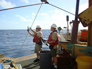
Deploying a drifter buoy

Deploying a drifter buoy

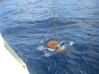
Last night I couldn’t sleep. I still saw my glow-in-the-dark alarm clock at 1:15am. I guess I was looking forward to waking up in the middle of the night to deploy the drifter buoy. It was 5am and it was time to go. It was still dark and I put on my float coat, gloves and hardhat. We went to the stern of the ship where it was lightly snowing and set up the drifter. I was able to write on the side of the drifter! 🙂 Key Biscayne Community School is now being represented in the Bering Sea! Of course I drew a Green Sea Turtle for Jonah on the top!A drifter buoy floats on the surface and is tracked by satellite. Some drifters make observations of currents, sea surface temperature, atmospheric pressure, winds and salinity. The ball floats on the surface of the water. It is attached to a wire that is 40 meters long and attached to a holey sock drogue, which looks like a tunnel Jonah would play in. They usually are active for 3-12 months. This particular drifter will just be tracked only by location because we are placing it close to large amounts of larvae pollock to determine where they are headed. Usually they are headed closer to shore. Once I return home I will be able to track it for our science class. We hope to deploy two more on this trip. The water got much rougher tonight. Using two hands to hold on while going up and down the stairs. Headed towards the Pribilof Islands tomorrow.
Richard Jones & Art Bangert, January 18, 2010

NOAA Teacher at Sea
Richard Jones
Onboard NOAA Ship KAIMIMOANA
January 4 – 22, 2010

Mission: Oceanographic Survey
Geographical Area: Hawaiian Islands
Date: January 18, 2010

Science Log

Painting in the morning, painting in the afternoon.We had a time change this morning, we set our clocks back (retarded) them one hour so we are now four hours earlier than Montana or 11 hours earlier than GMT (Greenwich Mean Time) or Zulu. This means that we are almost half way around the world from the Prime Meridian that runs through Greenwich England.

Ensigns onboard

Ensigns onboard

You might notice that it looks like Rick is in a fog, well he is. The difference between the inside of the ship and the outside of the ship in regards to temperature and humidity is huge. The ship is generally around 21 degrees c or close to 70 degrees F with low humidity and outside has been close to 31 degrees c or about 87 degrees F with high humidity. When you bring something like a camera outside from the cooler interior of the ship the moisture in the humid outside air condenses on the camera and instant fog.
More buoy maintenance

More buoy maintenance

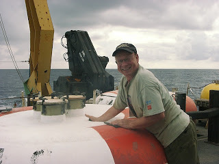
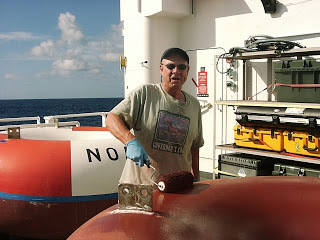
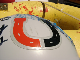
We painted the international yellow on the top half of the four tolroids and now all the buoys will be the new color scheme, no more orange and white top half’s anymore.
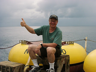
Hitch hiking onboard

TAS Rick hitch hiking onboard

You may have noticed that the sky is gray and the sea is fairly calm. We are in the Doldrums, an area of low pressure and often very little wind. This area is also known as the “Horse Latitudes”. Do you know why?
Small cups

Small cups

While we were waiting for the paint to dry we watched Alen refresh the sonic releases that connect the anchor to the nylon anchor line. Each of these releases costs about $12,000 and it is essential to use them over and over so replacing the battery, the rubber “O” rings and filling them with argon is a must after they are recovered with the anchor line Nilspin and nylon, pretty much ever thing that can be re-used is reused in order to minimize the cost of the project. Because we are able to use the acoustical releases only the iron anchor and some chain are left on the bottom of the ocean where they rust away eventually. It is hard to see but just before the releases are approved for re-deployment Argon is put into the body of the refreshed unit to provide and inert environment for the electronics. By removing the air, the risk of oxidation to the components is reduced.

Cleaning up the lab

Cleaning up the lab

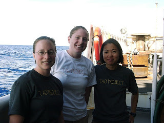
After lunch the paint was dry enough that we taped in prep for painting the black waterline and we put the TAO on the donuts.Now these are ready for deployment on the next two legs of the cruise. We also had some time today to interview some of the crew on the KA. Today we chatted with three of the four young Ensign’s who are stationed on this ship. We asked them a variety of questions about life in NOAA and the types of degrees that they have and their interests. We discovered that one of the Ensign Rose (white shirt) is from Wyoming and that Rick went to school with one of her uncles and that she is distantly related to his wife through a cousin. Weird how small the world really is.

DSC02155
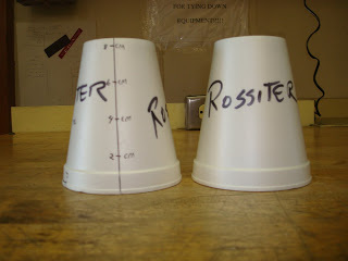
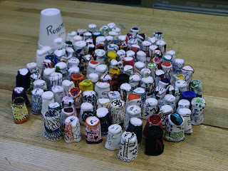
Two days ago, on 1/16/10, we conducted the last deep CTD at about 3,000 meters (about 2 miles). Rick had about 130 cups to send down and Art ran an experiment with control for Rossiter School in Helena. Just to review, this operation sends down a large, round instrument with tubes that collect water samples at different depths up to 3,000 meters. The intent of this procedure is to measure the salinity, Temperature and Pressure at different depths of the Ocean. As the depth of the ocean increases, so does the pressure of the water. An experiment that we can do to see the strength of the pressure is to attach a bag of Styrofoam cups to the CTD instrument. As the instrument sinks, what do you think would happen to the Styrofoam cups? Look at the picture of the cups before being sunk into the ocean depths and after. How would you describe the pressure of the ocean waters at 3,000 meters?
The batch of cups, back from the depths

The batch of cups, back from the depths

Richard Jones & Art Bangert, January 17, 2010

NOAA Teacher at Sea
Richard Jones
Onboard NOAA Ship KAIMIMOANA
January 4 – 22, 2010

Mission: Oceanographic Survey
Geographical Area: Hawaiian Islands
Date: January 17, 2010

Science Log

Today was not all that physically demanding which is good since it was 30.5 degrees Celsius by 9:30 AM ship time.My students should be able to figure out the temperature in temperature units they are more familiar with.While it was still fairly cool this morning Art and Rick helped Alen paint the anti fouling paint on the bottom of each of the three tolroids that needed it. Once the deck crew flipped them back to top side up, Alen discovered that one of the buoys had been hit and was cracked and so he needed to do some grinding and patching before painting the yellow. So we are going to finish the paint job early tomorrow after the patch has time to cure.

TAS Art painting

TAS Art painting

Land Ho! Later in the day we sighted land for the first time since we lost sight on Hawaii on the 6th. We came upon Tautua Island, which is part of the Cook Islands. If you take a look on Google Earth around 9 degrees: 13 minutes South and 157 degrees: 58 minutes West you can see the

island and the village on the island. We weren’t very close, so we couldn’t actually see the village, but it was nice to see land after 10 days of the vast expanse of the Pacific in every direction to the horizon.

Rick painting the buoy

Rick painting the buoy

Tautua

Tautua

Richard Jones & Art Bangert, January 15, 2010

NOAA Teacher at Sea
Richard Jones
Onboard NOAA Ship KAIMIMOANA
January 4 – 22, 2010

Mission: Oceanographic Survey
Geographical Area: Hawaiian Islands
Date: January 15, 2010

Science Log

We have our last buoy of the 155 West line in the water and the anchor is set. Today began with a ride for Rick over the old buoy where he was responsible for removing an old loop of rope in order to put on the shackle and line that the tow line would be attached to.

Readying to retrieve the buoy

Readying to retrieve the buoy

You would think that cutting a three-eights nylon line would be pretty easy, and you would be right if that line wasn’t attached to a rocking, slime covered buoy floating in the middle of an ocean that is over 5000 meters deep.
Teamwork is essential

Teamwork is essential

It would also have helped if my knock-off Leatherman had a sharper blade.Anyway, Al and I went out the buoy on the RHIB and got a pretty good spray here and there as you can see from the water drops on some of the images.
Reeling it back in

Reeling it back in

Once we were on the buoy Al removed the ‘Bird” and handed to the support crew in the RHIB.If it weren’t for these men and women we (the scientists) would not be able to collect the data.This is science on the front lines and it takes a dedicated and well-trained crew to make the endeavor of science one that produces meaningful, valid, and important data.

Barnacles and all!

Barnacles and all!

Once the ‘Bird’ is off the buoy and the towline is attached it is time to go back to the KA to pick-up the towline so that the buoy can be recovered and the next phase of the process can begin, deployment of the new buoy that will replace this one.

Zodiak returning to the ship

Zodiak returning to the ship

During the recovery Art and Rick often work as a team spooling the nylon because it takes two people to re-spool the line in a way to prevent tangles, one person to provide the turning and another to be the ‘fair lead’.
The fair lead actually has the harder job because they have to keep constant eye on the line as it spools.With seven spools of nylon all over 500 meters and the 700 meters of Nilspin recovery is a team effort by everyone.
KA from RHIB_1
Like the recovery, the deployment is a team effort and many hands make the work easier for everyone.But at this point of the cruise Art and Rick can pretty much handle the nylon line individually, but work as a team to move the empty spools and reload the spool lift with full spools. Deployment of this buoy ended just about 4:30 PM with the anchor splashing and some deck clean up then it was out of the sun and into the air-conditioned comfort of the ship for some clean clothes and good food.
Deployment is also a team effort

Deployment is also a team effort

Richard Jones & Art Bangert, January 14, 2010

NOAA Teacher at Sea
Richard Jones
Onboard NOAA Ship KAIMIMOANA
January 4 – 22, 2010

Making fish lures

Making fish lures

Mission: Oceanographic Survey
Geographical Area: Hawaiian Islands
Date: January 14, 2010

Science Log

After the buoy deployment yesterday, I spent the afternoon, contributing to our blog, setting up my online courses for this semester and building fishing lures. Yes, building fishing lures. I mean we are in the middle of the Pacific Ocean – why not fish? This type of fishing is very different from what we typically think of when fishing in the rivers and lakes of Montana. Most of the fish are big and require heavy tackle. I had the opportunity to help Jonathan and Doc (Helen) build a lure using multicolored rubber skits tied onto a large metal head.

These lures are then attached to a nylon line that is about 200 feet long and attached to the rear of the boat.
Fishing off the back of the boat

Fishing off the back of the boat

Catch of the day

Catch of the day

The prized fish is the yellow fin tuna (Ahi) that the crew likes to make Sashimi and Poke (Sushi). Other fish caught include Whaoo (Ono) and Mahi Mahi (Dorado). The Chief Stewart even deep fat fried the Ono to produce delicious, firm chunks of fish to supplement on of our dinner meals and tonight we had Ono baked in chili sauce that Rick said was…Ono, which is Hawaiian for ‘good’. After lunch today I launched the Rossiter/MSU Atlantic Oceanographic Meteorological Laboratory (AOML) drifting buoy. These buoys collect surface sea surface temperature and air temperature data and send this information to the Argos satellite system. The data is downloaded and used by agencies such as the National Weather Service to produce models that are used to predict weather patterns. The satellites also track the AOML buoy’s drifting path. These buoys will collect this data for approximately the next three years. You can track the Rossiter/MSU drifting buoy as soon as the information from the deployment is registered with the proper agency.

Rick had a fairly relaxed day today, preparing the
next batch of cups for the 3000 meter CTD cast at 8S: 155W and doing odd jobs on the buoy deck getting ready for our recovery-deploytomorrow at 5S: 155W and future deployments scheduled later in the cruise.

With the drifter buoy

With the drifter buoy

Cups ready for the depths

Cups ready for the depths

Continuing south

Continuing south

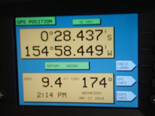
As you can see by the GPS, at 4:54 Hawaiian Standard time (7:54 Mountain Standard Time) we continue to move south toward our next buoy recovery and deployment at 5 latitude South and 155 West longitude.
Stay Tuned for More!

Richard Jones & Art Bangert, January 13, 2010

NOAA Teacher at Sea
Richard Jones
Onboard NOAA Ship KAIMIMOANA
January 4 – 22, 2010

At the controls

At the controls

Mission: Oceanographic Survey
Geographical Area: Hawaiian Islands
Date: January 13, 2010

Science Log

Bronc Buoy Day! By 8 this morning ship time we were running out the Nielspin and slapping on the fairings from the recovery yesterday.Some of these were pretty clean, but the majority of them, the ones that the teachers got to help with were pretty slimy and even had barnacles stuck to them. The fairings are added to help the reduce shake on the wire that can be produced by currents close to the equator.

We put these airfoil shaped fairings on the first 250 meters, after that it was smooth sailing.Because the Bronc-Bobcat buoy at 0: 155W is a TAO-CO2 buoy it needed a little extra weight on the anchor, 6200 pounds of steel. Once the anchor was off the fantail and sinking we noticed that there was a ship close to the location of the buoy. The science crew commented that this must be a new record for fishermen finding one of the buoys. It seems that fishermen love the TAO buoys since they attract fish.One of the scientists said, “A buoy for these guys is like having your own private fishing hole”. It will be interesting to see if this ship leaves, or just steams away and waits for us to be clear of the area and then comes back.

Broncs buoy deployed!

Broncs buoy deployed!

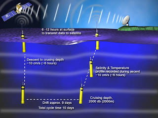
Around 12:15 today, actually Rick and Art were just finishing up lunch when the call came from Survey, “Teacher’s at Sea report to the CTD deck”. The first order of business was to lower an Argo buoy over the side of the ship and then to release the buoy using a quick release. According the home page for Argo, Argo is a global array of 3,000 (3199 on Jan 13) free-drifting profiling floats that measure the temperature and salinity of the upper 2000 m of the ocean.

These buoys are unique because the sink to between 1000 and 2000 meters and then on regular intervals, generally 10 days the Argo returns to the surface to transmit and the data it has collected. This allows, for the first time, continuous monitoring of the temperature, salinity, and velocity of the upper ocean, with all data being relayed and made publicly available within hours after collection. Once the Argo was on its own a call was made to the bridge for the crew to help with the deployment of the Bronc Buoy. This AOML drifter’s data will be available in a few days from the Adopt-A-Drifter website. It will be interesting to follow the Bronc Buoy and see where it goes over the next several years.

Our afternoon will be spent sailing south, in the Southern Hemisphere for the first time this trip and devoted to teardown of the old 0: 155W buoy and set-up of our next buoy.

After the deployment of the new CObuoy we crossed the equator and entered the southern hemisphere. Our new position put us in the southern hemisphere and we officially went from the winter to the summer season. Currently (at 6:15 pm MST) we are approximately 28.5 miles (at 6:19 MST) miles south of the equator.
Minding the lines

Minding the lines

Reeling it in

Reeling it in

Those of you in Montana today experienced temperatures ranging from 30 to 40 degrees while the temperatures around the equator (regardless of north – winter or south- summer) are staying at about 84 degrees Fahrenheit. Quite a warm temperature when considering the area north of the equator is technically in the Winter season. Regardless, of your position just north or south of the equator, the deck work required to recover and deploy TAO buoys is demanding. An air temperature of 84 degrees seems mild but is really very hot when working on a deck that is painted dark gray. Everyone has to be careful to make sure they drink enough water to stay hydrated. This operation is certainly a team effort. Everyone works together to make sure the job gets done by checking to make sure those participating in deployments or recoveries are safe. This means checking for life jackets, hardhats, application of sunscreen, the need for water etc. Higher education could take a lesson from the way that this crew collaborates and works together!

The anchor sinks to the depths

The anchor sinks to the depths

Decorative spirit

Decorative spirit

The team

The team

How the buoy gathers and sends data

How the buoy gathers and sends data

Crossed the equator!

Crossed the equator!