Julia Harvey: The Nearest Land is 3 Miles Down, June 28, 2016

NOAA Teacher at Sea

Julia Harvey

Aboard NOAA Ship Hi’ialakai

June 25 – July 3, 2016


Mission: WHOI Hawaii Ocean Timeseries Station (WHOTS)

Geographical Area of Cruise: Pacific Ocean, north of Hawaii

Date: June 28th, 2016


Weather Data from the Bridge
(June 28th at 2pm)

Wind Speed: 12 knots

Temperature: 26.2 C

Humidity: 81%

Barometric Pressure: 1016.3 mb


Science and Technology Log

The Aloha Station is about 100 miles north of Oahu, Hawaii and was selected because of its closeness to port but distance from land influences (temperature, precipitation etc).  The goal is to select a site that represents the north Pacific, where data can be collected on the interactions between the ocean and the atmosphere. Woods Hole Oceanographic Institution Hawaii Ocean Time Series (WHOTS) has used this site for research since 2004.  You can find real time surface and meteorological data and archived data at the WHOTS website.

We are stationed in the vicinity of mooring 12 and 13 in the Aloha Station to begin intercomparison testing.  CTD (conductivity/temperature/depth) casts are conducted on a regular schedule. This data will help align the data from mooring 12 to mooring 13. If CTDs don’t match up between the two moorings then efforts will be made to determine why.

Mooring 13 is being inspected to make sure sensors are working. Photographs have been taken to determine measurement height of the instruments and where the water line is.

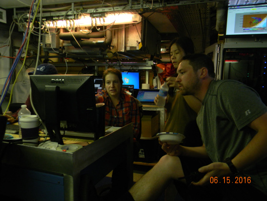
When I was aboard the Oscar Dyson, there were multiple studies going on besides the Walleye Pollock survey. The same is true on the Hi’ialakai. The focus is on the mooring deployment and recovery but there are a professor and graduate student from North Carolina State University who are investigating aerosol fluxes.

Professor Nicholas Meskhidze earned his first Physics degree from Tbilisi State University (Georgia).  He completed his PhD at Georgia Institute of Technology (USA).  He is now an Associate Professor at NC State University Department of Marine Earth and Atmospheric Sciences.

Meskhidze’s study on this cruise is looking at sea spray aerosol abundance in marine boundary layer and quantifying their flux values. Sea spray is formed from breaking waves. Sea spray analysis begins by collecting the aerosol. Using electrical current, particles of a given size (for example 100 nanometer (nm)) are selected for. This size represents the typical size of environmental climatically important particles (70-124 nm). The next step is to remove all other particles typically found in the marine boundary layer, such as ammonium sulfate, black carbon, mineral dust and any organics. The remaining particles are sea salt.

Sea spray analysis

Dr. Nicholas Meskhidze with the sea spray analysis equipment

Meskhidze is looking at the fluxes of the salt aerosols.  Sea salt aerosols are interesting.  If a salt aerosol is placed in 80% humidity, it doubles in size.  But then placed in 90% humidity, it quadruples in size. Due to their unique properties, sea salt aerosols can have considerable effect on atmospheric turbidity and cloud properties.

Aerosols are key components of our climate but little is known about them. Climate models are used to predict future climatic change, but how can one do this without understanding a key component (aerosols)?

little is known

Source: IPCC Fourth Assessment Report, Summary for Policy Makers


Personal Log

The galley (ship’s kitchen) is a happening place three times a day.  The stewards are responsible for feeding 30-40 people.

Chief Steward Gary Allen is permanently assigned to the Hi’ialakai. He has worked for NOAA for 42 years and he has stories to tell. He grew up in Tallahassee, Florida and his early work was at his father’s BBQ stand. He attended Southern University on a football scholarship and majored in food nutrition. After an injury, he finished school at Florida A & M. He worked for a few years in the hotel food industry, working his way up to executive chef. Eventually he was offered the sous chef job at Brennan’s in New Orleans. He turned it down to go to sea.

Chief Steward Allen Gary

Chief Steward Allen Gary

In 1971, he sailed for the first time with NOAA. The chief steward was a very good mentor and Gary decided to make cooking at sea his career. He took a little hiatus but was back with NOAA in 1975, where he would spend 18 years aboard the Discoverer and would become chief steward in 1984. He would sail on several other ships before finding his way to the Hi’ialakai in 2004.

In the 42 years at sea, Gary has seen many changes. Early in his career, he would only be able to call home from ports perhaps every 30 days. Now communication allows us to stay in contact more. He is married to his wife of 43 years and they raised 3 daughters in Seattle.

I asked him what he enjoys the most about being at sea. He has loved seeing new places that others don’t get to see. He has been everywhere, the arctic to Antarctica. He enjoys the serenity of being at sea. He loves cooking for all the great people he meets.

I met Ava Speights aboard the Oscar Dyson in 2013 when she was the chief steward and I was participating in the walleye pollock survey as a Teacher at Sea. She has been with NOAA for 10 years.

Ava Speights (on the right) and me

Ava Speights (on the right) and me

She and a friend decided to become seamen. Ava began working in a shipyard painting ships. In 2007, she became a GVA (general vessel assistant) and was asked to sail to the Bahamas for 2 weeks as the cook. This shifted her career pathway and through NOAA cooking classes and on the job training, she has worked her way up to chief steward.

She is not assigned to a specific ship. She augments, meaning she travels between ships as needed. She works 6 months of the year, which allows her to spend time with her 2 daughters, 1 son, 2 stepdaughters and 4 grandchildren. Her husband is an engineer with NOAA. Her niece is an AB (able bodied seaman) on deck. Her son is a chief cook for Seafarer’s.  And her daughter who just graduated high school will be attending Seafarer’s International Union to become a baker.  Sailing must run in her family.

She loves to cook and understands that food comforts people. She likes providing that comfort.  She has also enjoyed traveling the world from Africa to Belgium.

2nd Cook Nick Anderson

2nd Cook Nick Anderson

Nick is 2nd cook and this is his first cruise with NOAA. He attended cooking school in California and cooked for the Coast Guard for 6 years where he had on the job training. In 2014, he studied at the Culinary Institute of America and from there arrived on the Hi’ialakai. He also is an augmenter, so he travels from ship to ship as Ava does.


Did You Know?

The Hi’ialakai positioned mooring 13 in an area with a 6 mile radius known as the Aloha Station. Check out all of the research that takes place here at Station Aloha. There is a cabled observatory 4800 meters below the ocean surface. A hydrophone picks up on sounds and produces a seismograph. Check the results for the night the anchor was dropped.

Seismograph

Seismograph during Mooring Deployment

Click here to hear whales who pass through this area in February.

Pacific Sunset

Pacific Sunset

Lynn Kurth: Time and Tide Wait For No Man, June 28, 2016


NOAA Teacher at Sea

Lynn M. Kurth

Aboard NOAA Ship Rainier

June 20-July 1, 2016

Mission: Hydrographic Survey

Geographical area of cruise:  Latitude:  57˚57.486 N   Longitude:  152˚55.539 W  (Whale Pass)

Date:  June 28, 2016

Weather Data from the Bridge
Sky:  Overcast
Visibility: 15 Nautical Miles
Wind Direction: 164
Wind Speed: 8 Knots
Sea Wave Height: 1 ft. (no swell)
Sea Water Temperature: 8.3° C (46.94° F)
Dry Temperature: 12.° C (53.6° F)
Barometric (Air) Pressure: 1019.6 mb


Science and Technology Log

The ocean supports many ecosystems which contain a diversity of living things ranging in size from tiny microbes to whales as long as 95 feet.  Despite the fact that I am working on a hydrographic ship, when out on a skiff or while in port, I have had the opportunity to view some of these ecosystems and a number of the species found in them.

While the Rainier was in port in Homer, I spent some time at the Kachemak Bay National Estuarine Research Reserve which, like other estuaries, is among the most productive ecosystems in the world.  An estuary, with accompanying wetlands, is where the freshwater from a river meets and mixes with the salt water of the sea.  However, there are some estuaries that are made entirely from freshwater.  These estuaries are special places along the Great Lakes where freshwater from a river, with very different chemical and physical characteristics compared to the water from the lake, mixes with the lake water.

Because estuaries, like the Kachemak Bay Estuary, are extremely fragile ecosystems with so many plants and animals that rely on them, in 1972 Congress created the National Estuarine Research Reserve System which protects more than one million estuarine acres.

ESTRE

Kachemak Bay National Estuarine Research Reserve

All estuaries, including the freshwater estuaries found on the Great Lakes, are affected by the changing tides.  Tides play an important part in the health of an estuary because they mix the water and are therefore are one of several factors that influence the properties (temperature, salinity, turbidity) of the water

Prior to my experience in Alaska, I had never realized what a vital role tides play in the life of living things, in a oceanic region.  Just as tides play an important role in the health and function of estuaries, they play a major role in the plants and animals I have seen and the hydrographic work being completed by the Rainier.  For example, the tides determine when and where the skiffs and multi beam launch boats will be deployed.  Between mean low tide and high tide the water depth can vary by as much as 12 feet and therefore low tide is the perfect time to send the skiffs out in to document the features (rocks, reefs, foul areas) of a specific area.

DSCN0069 (2)

Rock feature in Uganik Bay (actually “the foot” mentioned in previous blog) Notice tidal line, anything below the top of that line would be underwater at high tide!

In addition to being the perfect time to take note of near shore features, low tide also provides the perfect opportunity to see some amazing sea life!  I have seen a variety of species while working aboard the Rainier, including eagles, deer, starfish, dolphins, whales, seals, cormorants, sea gulls, sea otters and puffins.  Unfortunately, it has been difficult to capture quality photos of many of these species, but I have included some of my better photos of marine life in the area and information that the scientists aboard the Rainier have shared with me:

Tufted Puffins:  Tufted Puffins are some of the most common sea birds in Alaska.  They have wings that propel them under water and a large bill which sheds its outer layer in late summer.

puff2

Double Crested Cormorants:  Dark colored birds that dive for and eat fish, crabs, shrimp, aquatic plants, and other marine life.  The birds nest in colonies and can be found in many inland areas in the United States.  The cormorants range extends throughout the Great Lakes and they are frequently considered to be a nuisance because they gorge themselves on fish, possibly decimating local fish populations.

cormor

Cormorant colony with gulls

Pisaster Starfish:  The tidal areas are some of the favorite areas starfish like to inhabit because they have an abundance of clams, which the starfish love to feed on.  To do so, the starfish uses powerful little suction cups to pull open the clam’s shell.

Kurthstar1

Teacher at Sea Kurth with a starfish that was found during a shore lunch break while working on a skiff.

tidestarfish

Starfish found in tidal zone

Glaucous-winged Gull:  The gulls are found along the coasts of Alaska and Washington State.  The average lifespan of Glaucous-winged Gull is approximately 15 years.

birdstheword285

Glaucous-winged Gull watching the multi beam sonar boat

The hydrographic work in Uganik Bay continues even though there are moments to view the wildlife in the area.  I was part of the crew on board a boat equipped with multi beam sonar which returned to scan the “foot feature” meticulously mapped by the skiff.  During this process, the multi beam sonar is driven back and forth around the feature as close as the boat can safely get.  The multi beam does extend out to the sides of the boat which enables the sonar to produce an image to the left and right of the boat.  The sonar beam can reach out four times the depth of the water that the boat is working in.  For example, if we are working in six feet of water the multi beam will reach out a total of 24 feet across. Think of the sonar as if it was a beam coming from a flashlight, if you shine the light on the floor and hold the flashlight close to the floor, the beam will be small and intense.  On the other hand, if you hold the flashlight further from the floor the beam of light will cover a wider area but will not be as intense. The sonar’s coverage is similar, part of why working close to the shore is long and tedious work: in shallow water the multi beam does not cover a very wide area.

foot3

“The foot” feature (as discussed in previous blog) being scanned by multi beam sonar


thefoot

Image of “the foot” after processing in lab. The rocks are the black areas that were not scanned by the multi beam sonar.


All Aboard!

I met Angelica on one of the first days aboard the Rainier and later spent some time with her, asking questions as she worked .  Angelica is very friendly, cheerful and a pleasure to talk with!  She graciously sat down with me for an interview when we were off shore of Kodiak, AK before returning to Uganik Bay.

IMG_1835

Assistant Survey Technician Angelica Patyten works on processing data from the multi beam sonar

Tell us a little about yourself:

I’m Angelica Patyten originally from Sacramento, CA and happy to be a part of NOAA’s scientific mission!  I have always been very interested in marine science, especially marine biology, oceanography and somewhat interested in fisheries.  Ever since I was a little kid I’ve always been interested in whales and dolphins.  My cousin said that when I was really young I was always drawing whales on paper and I’d always be going to the library to check out books on marine life.  I remember one of the defining moments was when I was in grade school, we took a trip to see the dolphins and orca whales and I thought they were amazing creatures.

As far as hobbies, I love anything that has to do with water sports, like diving and kayaking.  I also want to learn how to surf or try paddle boarding as well.

How did you discover NOAA?:

I just kind of “stumbled upon” NOAA right after I had graduated from college and knew that I wanted to work in marine science.  I was googling different agencies and saw that NOAA allows you to volunteer on some of their vessels.  So, I ended up volunteering for two weeks aboard the NOAA ship Rueben Lasker and absolutely loved it.  When I returned home, I applied online for employment with NOAA and it was about six months before I heard from back from them.  It was at that point that they asked me if I wanted to work for them on one of their research vessels.  It really was all good timing!

What are your primary responsibilities when working on the ship? 

My responsibilities right now include the processing of the data that comes in from the multi beam sonar.  I basically take the data and use a computer program to apply different settings to produce the best image that I can with the sonar data that I’m given.

What do you love about your work with NOAA?

I love the scenery here in Alaska and the people I work with are awesome!  We become like a family because we spend a lot of time together.  Honestly, working aboard the Rainier is a perfect fit for me because I love to travel, the scenery is amazing and the people I work with are great!


Personal Log:

Geoffrey Chaucer wrote, “time and tide wait for no man.”  Chaucer’s words are so fitting for my time aboard the Rainier which is going so quickly and continues to revolve around the tides.

Julia Harvey: More to a Mooring than meets the Eye, June 26, 2016

NOAA Teacher at Sea

Julia Harvey

Aboard NOAA Ship Hi’ialakai

June 25 – July 3, 2016


Mission: WHOI Hawaii Ocean Timeseries Station (WHOTS)

Geographical Area of Cruise: Pacific Ocean, north of Hawaii

Date: June 26th, 2016

Weather Data from the Bridge

Wind Speed: 15 knots

Wind Direction: 100 degrees (slightly east southeast)

Temperature: 24.5 degrees C

Barometric Pressure: 1014.7 mb

Science and Technology Log

One of the primary objectives of this WHOTS project is to deploy WHOTS-13 mooring. This will be accomplished on our second day at sea.

Site of Mooring-13 courtesy of WHOTS Project Instructions

Site of Mooring-13
(courtesy of WHOTS Project Instructions)

The mooring site was chosen because it is far enough away from Hawaii so that it is not influenced by the landmasses. Mooring 13 will be located near mooring 12 in the North Pacific Ocean where the Northeast Trade Winds blow. Data collected from the moorings will be used to better understand the interactions between the atmosphere and the ocean. Instruments on the buoy record atmospheric conditions and instruments attached to the mooring line record oceanic conditions.

A look at interactions between the atmosphere and the ocean.

A look at interactions between the atmosphere and the ocean. [R. Weller, WHOI]


There is a lot more going on than just plopping a mooring in the sea. Chief Scientist Al Plueddemann from Woods Hole Oceanographic Institution and his team began in-port prep work on June 16th. This included loading, positioning and securing the scientific equipment on the ship.  A meteorological system needed to be installed on the Hi’ialakai to collect data critical to the mission.  And then there was the assembly of the buoy which had been shipped to Hawaii in pieces.  Once assembled, the sensors on the buoy were tested.

Meteorological Station on the Bow

Meteorological Station

As we left Oahu, we stopped to perform a CTD (conductivity/temperature/depth) cast. This allowed for the testing of the equipment and once water samples were collected, the calibration of the conductivity sensors occurred.

Sunday, June 26th, was the day of deployment. Beginning very early in the morning, equipment was arranged on deck to make deployment efficient as possible. And the science team mentally prepared for the day’s task.

Predeployment

The deck before deployment began. The buoy is the blue item on the left.

Promptly at 7:30 am, deployment began. The first stage was to deploy the top 47 meters of the mooring with sensing instruments called microcats attached at 5 meter intervals. A microcats has a memory card and will collect temperature, conductivity and pressure data about every three minutes until the mooring is removed next year.

Sensing instruments for the morring

Microcats for recording oceanic conditions

readied microcats

Microcats readied for deployment. They are lined up on the deck based on their deployment depth.

This portion of the mooring is then attached to the surface buoy, which is lifted by a crane and lowered overboard. More of the mooring with instruments is lowered over the stern.

The remainder of the mooring is composed of wire, nylon, 68 glass balls and an anchor.  At one point, the mooring wire became damaged. To solve this problem, marine technicians and crew removed the damaged portions and replaced the section with wire from a new spool. This process delayed the completion of mooring deployment but it showed how problems can be solved even when far out at sea.

After dinner, the nylon section of the rope was deployed. Amazingly, this section is more than 2000 meters long and will be hand deployed followed by a section of 1500 m colmega line. It was dark by the time this portion was in the water. 68 glass floats were then attached and moved into the water. These floats will help in the recovery of the mooring next year. The attachment to the anchor was readied.

glass floats for recovery

These glass floats will help when the mooring is recovered next year.

The anchor weighs 9300 pounds on deck and will sit at a depth of 4756 meters. That is nearly 3 miles below the ocean surface. The crane is used to lift the anchor overboard. The anchor will drop at 1.6 m/s and may take about 50 minutes to reach the bottom.  As the anchor sinks, the wire, nylon and the rest of the mooring will be pulled down. Once it reaches the bottom, the mooring will be roughly vertical from the buoy to the anchor.


Mooring Structure

Mooring Structure

Personal Log

I sailed aboard NOAA ship Oscar Dyson in 2013 so I already had a general idea of what life aboard a ship would be. Both ships have workout areas, laundry facilities, lounges, and of course messes where we all eat. But on the Hi’ialakai, I am less likely to get lost because of the layout. A door that goes up is near a door that goes down.

On our first day aboard, we held two safety drills. The first was the abandon ship drill. As soon as we heard 6 short and 1 long whistles, we grabbed our life jacket, survival suit and a hat. We reported to our muster stations. I am assigned to lifeboat #1 and I report the starboard side of 0-3 deck ( 2 levels up from my room). Once I arrived, a NOAA officer began taking role and told us to don the survival suit. This being my first time putting the suit on, I was excited. But that didn’t last long. Getting the legs on after taking off shoes was easy as was putting one arm in. After that, it was challenging. It was about 84 F outside. The suit is made of neoprene. And my hands were the shapes of mittens so imagine trying to zip it up. I finally was successful and suffered a bit to get a few photos. This was followed by a lesson for how to release the lifeboats. There are enough lifeboats on each side of the ship, to hold 150% of the capacity on board.

Survival Suit & Julia

Abandon Ship drill with Survival Suit

Safety is an important aspect of living aboard a NOAA ship. It is critical to practice drills just like we do at school. So when something does happen, everyone knows what to do. A long whistle signals a fire. All of the scientists report to the Dry Lab for a head count and to wait for further instruction.

I am reminded of how small our world really is.  At dinner Saturday, I discovered one of the new NOAA officers was from Cottage Grove, Oregon. Cottage Grove is just a short drive south of Eugene. She had a friend of mine as her calculus teacher.  Then a research associate asked me if I knew a kid, who had graduated from South Eugene High School and swam in Virginia. I did. He had not only been in my class but also swam with my oldest son on a number of relay teams growing up. Small world indeed.


Did You Know?

The Hi’ialakai was once a Navy surveillance ship (USNS Vindicator) during the Cold War. NOAA acquired it in 2001 and converted it to support oceanic research.


Lynn Kurth: Goodbye “Toes”, June 26, 2016

NOAA Teacher at Sea

Lynn M. Kurth

Aboard NOAA Ship Rainier

June 20-July 1, 2016

Mission: Hydrographic Survey

Geographical area of cruise:  Latitude: N 57˚23  Longitude: W 153˚20  (North Coast of Kodiak Island)

Date:  June 26, 2016

Weather Data from the Bridge:
Sky: Fog
Visibility: 1 Nautical Mile
Wind Direction: 085
Wind Speed: 12 Knots
Sea Wave Height: –
Sea Water Temperature: 12.2° C (54° F)
Dry Temperature: 12.6° C (54.7° F)
Barometric (Air) Pressure: 1008.6 mb


Science and Technology Log

As I was looking up at the stars over the ship one evening, I was thinking about the study of space and the 1980’s Teacher in Space program.  It’s difficult to believe that as of this past January it has been thirty years since the Space Shuttle Challenger disaster, which took the life of educator Christa McAuliffe and six other astronauts.  Christa had been selected to become the first teacher in space, which offers such opportunity to learn and grow.  I admire Christa McAuliffe because of this and the fact that she recognized that the study of space offers the opportunity for discovery, innovation and investigation.

kurthblog2

Kurth at Sea (Uganik Bay, Alaska)

I love being a Teacher at Sea because the ocean is similar to space in that it is largely unexplored and offers the chance to discover, innovate and investigate.   In fact, less than 5% of earth’s ocean has been explored even though new technologies have expanded our ability to explore.  Scientists like those I am working with on the Rainier use a variety of this new technology such as satellites, complex computer programs, and multi beam sonar to explore and carry out their hydrographic work.  Over the past week, I have been fortunate to work with these scientists in Uganik Bay and gain a better understanding of how they use these technologies in their work.

DSCN0035 (2)

Out on the skiff with Chief Jim Jacobson and crew

Before the surveying work using the multi beam sonar system can begin, a small crew is sent off the Rainier in a skiff, a shallow flat-bottomed open boat, to complete near shore work.  During this work, the crew on the skiff meticulously examines the features of the coastline while comparing what they see to any available charts and other sources of information about the area.  The depth of Uganik Bay was last surveyed and charted in 1908 but the area does have some additional charting of shoreline features documented throughout the years via aerial photography and information shared by local mariners.  The skiff used for the near shore work is equipped with a GPS (global positioning system) unit and a computer program which continually maps where it travels.  The skiff moves slowly along the shoreline while circling rocks and other features (reefs, islands, kelp beds, fishing gear) in order to accurately determine their size and location.  The scientists record all of their findings on a sheet illustrating the area they are working in and enter the revisions into a computer program when they return to the Rainier.   These revisions frequently include adding features not previously documented, modifying information on existing features or suggesting possible features to be eliminated when they are not found and verified.

DSCN0112

Chief Jim Jacobson enters updated information from near shore work documented while on the skiff.

For example, one of the days while I was working with a crew on a skiff, part of our work involved verifying whether or not a series of rocks existed where they had been previously charted.  Oddly enough, when looking at the chart the formation of rocks looked like a giant left footprint.  This particular feature on the chart, was flagged for us to investigate and verify because each of the rocks that made up “the little toes” seemed to be too equally spaced to be natural features.  When we examined the area we found that there was only one rock, “the big toe”, at the top of the formation vs. a total of five.  The suggested updates to this feature were supported with the documentation of photographs and measurements.  In other words, the scientists suggested that the final revisions completed by NOAA staff in Seattle would include the “amputation” of the four “little toes” from the charts.

footblog1

Sheet used on skiff to document suggested revisions. Notice the “foot” feature?


All Aboard!

I have really enjoyed chatting with the people on board the Rainier because they have interesting stories to share and are happy to share them. Erin Earley, member of the engine utility crew, was one of those people who graciously gave me some of her time for an interview.

DSCN0198

Erin Earley (right) discusses ship operations with Ensign Bethany McAcy (left)

Tell us a little about yourself:

I’m Erin Earley from Sacramento, California and was a social worker prior to working for NOAA (National Oceanic Atmospheric Administration).  I enjoy water color painting, creating multi-medium sculptures, and anything to do with designing gardens.  And I love dogs, Shelties in particular.

How did you discover NOAA and what do you love the most about your job with NOAA?:

As a social worker I had a couple of young adults in the child protection system who wanted to find a different career.  When looking at career options for them I came across a maritime program for youth in Sacramento that seemed to meet their needs.  So, I went to a parent night to learn more about the program and when I heard about the rate of pay and opportunity to travel I asked if they were considering an option for adults to join the program. They said that they were and I registered for the program and began with the AB (able bodied seaman) program for deck work but after watching the Deadliest Catch I decided that wasn’t for me.  So, I decided to complete the engineering program to be qualified for engine room work.  The course work included survival work, emergency ship repair work and fire fighting skills.

I love my job with NOAA because for the most part I’m working with a small group of people, we all know our duties, and we all help each other out.  I enjoy seeing jobs get completed and things getting fixed.  And, the most important reason I love my job is that I don’t have to drive to work and dress up.  I come from Sacramento, and here I don’t have to wait for traffic coming across town and wait at Starbucks for an hour.  On a ship you become a minimalist, you learn what is important and what is not.   I love meeting new people, trying new foods and seeing new things!

DSCN0194

Erin Earley takes a sounding of a fuel tank

What are your primary responsibilities when working on the ship?  

My primary responsibilities at sea include monitoring the oil levels of the equipment, making sure that everything is running properly, reporting to the engineer anything that might be a problem, making sure the bow thruster has proper fluids, and making sure there’s no excess water in any of the places.  We’re floating on a huge ocean and we want to make sure none of it’s coming in!

What kind of background and/or education do you need to have this job?

It would help to go to a maritime school and a lot of major coastal cities have these schools that offer these programs.  If you want a four year college education you could go to a maritime academy (San Francisco, New York and Baltimore ) to get a degree in mechanical engineering and then you could work on a ship or on the shore side at a port.  If you don’t want to go to a four year college you can still work in engineering but you would have to take certification courses and work your way up.  I think for a young person the adventure of working for NOAA is fun but you should always have a plan as far as where you might want to go.  Keep your options open!


Did You Know?

DSCN0185 (2)

The Rainier, Uganik Bay

The Rainier:

  • has 26 fuel tanks
  • uses 500 gallons of fuel a day while at anchor
  • uses 100 gallons of fuel each hour while underway (2400 gallons/day)
  • goes through approximately 50 lbs of beef and 30 lbs of chicken each week
  • uses 8 different kinds of milk (lactose free, soy, almond, cashew, 1%, 2%, whole, and skim)


Donna Knutson: Last Leg of Leg III Atlantic Sea Scallop Survey 2016, June 24, 2016

NOAA Teacher at Sea Donna Knutson
Aboard the Research Vessel Sharp
June 8 – June 24, 2016

2016 Mission: Atlantic Scallop/Benthic Habitat Survey
Geographical Area of Cruise: Northeastern U.S. Atlantic Coast
Date: June 24, 2016

Last Leg of Leg III Atlantic Sea Scallop Survey 2016

Mission and Geographical Area: 

The University of Delaware’s ship, R/V Sharp, is on a NOAA mission to assess the abundance and age distribution of the Atlantic Sea Scallop along the Eastern U.S. coast from Mid Atlantic Bight to Georges Bank.  NOAA does this survey in accordance with Magnuson Stevens Act requirements.

Science and Technology:DSCN7770 (2)me best

Latitude:  41 29.84 N

Longitude:  070 38.54 W

Clouds:  partly cloudy

Visibility: 5-6 nautical miles

Wind: 3.58 knots

Wave Height: 6 in.

Water Temperature:  53  F

Air Temperature:  67 F

Sea Level Pressure:  30.0 in of Hg

Water Depth: 26 m


It has been an action packed two weeks.  The men and women who dedicate themselves to the scallop survey are extremely hard working scientists.  It is not an easy job.  The sorting of the dredged material is fast and furious, and it needs to be in order to document everything within the catch before the next one comes in.  The baskets are heavy and it takes a strong person to move them around so quickly.

DSCN8159 (2) dredge team

Han, Jill, Mike, Vic, Me and Ango

In small catches every scallop is measured.  In dredges with many baskets of scallops, a percentage is measured.  It is a random sampling system, taking some scallops from each of the baskets to get a general random sample of the whole.  Mike led an efficient team, he told us what to look for and oversaw the measuring.

DSCN7780 (2)mike and nicki

Mike and Nikki

He often set samples aside to show me later, when we were not as busy. A few examples were how to tell the difference between the red and silver hake or the difference between the Icelandic and Atlantic sea scallop.  He showed me how the little longhorn sculpin fish, “buzz bombs” known to fisherman, vibrate when you told it in your hand.

DSCN8008 (2)buzz

Longhorn sculpin

Mike even took the time to dissect some hake and to show me the differences in gonads, what they were feeding on by opening their stomach, and the otolith within the upper skull.  The otolith is a small bone in the inner ear that can be used to identify and age the fish when in a lab looking through a microscope.  Mike answered my many questions and was always eager to teach me more.

Another helpful team member was Vic.  Vic taught me how to run the HabCam.  He has been involved in the HabCam setup since it started being used four years ago.  There is a lot of work to do to set up the multiple monitors and computers with servers to store all the images collected by the HabCam.  Vic overlooks it all from the initial set-up to the take down.  I admire Vic’s work-ethic, he is always going 100% until the job is completed.  Sometimes I just needed to get out of his way, because I knew he was on a mission, and I didn’t want to slow him down.

DSCN8132 (2) monitors

Control center for Habcam and Dredging

When we weren’t dredging, but rather using the HabCam, there was a pilot and copilot watching the monitors.  The HabCam, when towed behind the ship, needs to be approximately 1.7 m off the ocean floor for good resolution of the pictures, and keeping it at that elevation can be a challenge with the sloping bottom or debris.  There is also sand waves to watch out for, which are like sand bars in a river, but not exposed to the surface.

When not driving HabCam there are millions of pictures taken by the HabCam to oversee.  When you view a picture of a scallop you annotate it by using a measuring bar.  Fish, skates and crabs are also annotated, but not measured.  It takes a person a while to adjust to the rolling seas and be able to look at monitors for a long period of time.  It is actually harder than anticipated.

DSCN7768 (2)skate

HabCam Picture of a skate.

Han was making sure the data was collected from the correct sites.  She works for the Population Dynamics branch of NOAA and was often checking the routes for the right dredges or the right time to use the HabCam.  Between the chief scientist Tasha and Han, they made sure the survey covered the entire area of the study as efficiently as possible.

DSCN7839 (2)tash han mike

Tasha, Han and Mike discussing the next move.

Dr. Scott Gallager was with us for the first week and taught me so much about his research which I mentioned in the previous blogs.  Kat was with us initially, but she left after the first week.  She was a bubbly, happy student who volunteered to be on the ship, just to learn more in hopes of joining the crew someday.  Both vacancies were replaced by “Ango” whose real name in Tien Chen, a grad student from Maine who is working on his doctoral thesis, and Jill who works in Age and Growth, part of the Population Biology branch of NOAA.  Both were fun to have around because of their interesting personalities.  They were always smiling and happy, with a quick laugh and easy conversation.

DSCN8131 (2)the three

Jill, Ango and Han after dredging.

The Chief Scientist, Tasha, was extremely helpful to me.  Not only does she need to take care of her crew and manage all the logistics of the trip, plus make the last minute decisions, because of weather or dredges etc, but she made me feel welcome and encouraged me to chat with those she felt would be a good resource for me.  On top of it all, she helped me make sure all my blogs were factual.  She was very professional and dedicated to her work, as expected from a lead scientist leading a scientific survey.

DSCN8146 (2)tash and jim

Evan, Tasha and Jimmy discussing route.

I spent as much time as possible getting to know the rest of the crew as well.  The Master, Captain James Warrington “Jimmy” always welcomed me on the bridge.  I enjoyed sitting up there with him and his mates.  He is quick witted and we passed the time with stories and many laughs.  He tolerated me using his binoculars and searching for whales and dolphins.  There were a few times we saw both.

He showed me how he can be leader, responsible for a ship, which is no small feat, but do so with a great sense of humor, which he credits he inherited from his grandmother.  The other captains, Chris and Evan, were just as friendly.  I am sure all who have been lucky enough to travel with them would agree that the RV Sharp is a good ship to on because of the friendly, helpful crew and staff.

DSCN7785 (2)KG

KG, oceanic specialist, helped with dredges.

Because this was my second experience on a survey, the first was a mammal survey, I have really come to appreciate the science behind the study.  It is called a survey, but in order to do a survey correctly, it takes months of planning and preparation before anyone actually gets on a ship.

There is always the studying of previous surveys to rely on to set the parameters for the new survey.  Looking for what is expected and finding, just that, or surprising results not predicted but no less valued, is all in a scientist’s daily job.  I admire the work of the scientist. It is not an easy one, and maybe that is why it is so much fun.  You never know exactly what will happen, and therein lies the mystery or maybe a discovery to acquire more information.

DSCN8127 (2)big goose

I had to hold the largest goose fish we caught!

It was a challenging two weeks, but a time I’m so glad I had the opportunity to have with the members of Leg III of the 2016 Atlantic Sea Scallop Survey.

Lynn Kurth: The Earth has One Big Ocean, June 22, 2016

NOAA Teacher at Sea

Lynn M. Kurth

Aboard NOAA Ship Rainier

June 20-July 1, 2016

Mission: Hydrographic Survey

Geographical area of cruise:  Latitude: N 57˚50 Longitude: W 153˚20  (North Coast of Kodiak Island)

Date:  June 23, 2016

Weather Data from the Bridge:
Sky: Clear
Visibility: 10 Nautical Miles
Wind Direction: 268
Wind Speed: 14 Knots
Sea Wave Height: 2-3 ft. on average
Sea Water Temperature: 12.2° C (54° F)
Dry Temperature: 16° C (60.8° F)
Barometric (Air) Pressure: 1023 mb


Science and Technology Log

I’m continually searching for ways to connect what I am learning to what is relevant to my students back home in the Midwest.  So, as we left Homer, AK for our survey mission in Kodiak Island’s Uganik Bay, I was already thinking of how I could relate our upcoming survey work to my students’ academic needs and personal interests.  As soon as the Rainier moved away from Homer and more of the ocean came into view, I stood in awe of how much of our planet is covered with water.  It’s fascinating to think of our world as having one big ocean with many basins, such as the North Pacific, South Pacific, North Atlantic, South Atlantic, Indian, Southern and Arctic.  The study of ocean and its basins is one of the most relevant topics that I can teach when considering the following:

  • the ocean covers approximately 70% of our planet’s surface
  • the ocean is connected to all of our major watersheds
  • the ocean plays a significant part in our planet’s water cycle
  • the ocean has a large impact on our weather and climate
  • the majority of my students have not had any firsthand experience with the ocean


IMG_1675

Earth’s One Big Ocean as seen from outside of Homer, AK


Each of the ocean basins is composed of the sea floor and all of its geological features which vary in size and shape.  The Rainier will be mapping the features of the sea floor of the Uganik Bay in order to produce detailed charts for use by mariners.  The last survey of Uganik Bay was completed in 1908 when surveyors simply deployed a lead weight on a string over the edge of a boat in order to measure the depth of the water.  However, one of the problems with the charts made using the lead line method, is that the lead line was only deployed approximately every 100 meters or more which left large gaps in the data.  Although not in the Uganik Bay, in the 1930s NOAA began using single beam sonar to measure the distance from a ship’s hull to the sea floor which made surveying faster but still left large gaps in the data. Fast forward from approximately 100 years ago when lead lines were being used for surveying to today and you will find the scientists on the Rainier using something called a multibeam sonar system.  A multibeam sonar system sends out sound waves in a fan shape from the bottom of the ship’s hull.  The amount of time it takes for the sound waves to bounce off the seabed and return to a receiver is used to determine water depth.  The multibeam sonar will allow our team on the Rainier to map 100% of the ocean’s floor in the survey area that we have been assigned.

nNTC_Hydro

Evolution of Survey Techniques (Illustration Credit: NOAA)


DSCN0006

NOAA Ship Rainier June 22, 2016 in Uganik Bay off of Kodiak Island


 All Aboard!

IMG_1814

NOAA Corps Junior Officer Shelley Devereaux

The folks I am working with are some of the most knowledgeable and fascinating people that I have met so far on this voyage and Shelley Devereaux from Virginia is one of those people.  Shelley serves as a junior officer in the NOAA  (National Oceanic and Atmospheric Administration) Corps and has been working aboard the Rainier for the past year.  The NOAA Commissioned Officer Corps is one of the seven uniformed services of the United States and trains officers to operate ships, fly aircraft, help with research, conduct dive operations, and serve in other staff positions throughout NOAA.

Here is what Shelley shared with me when I interviewed her one afternoon.

Tell us a little about yourself:  I’m originally from the rural mountains of Appalachia and moved to Washington DC after college.  I lived in DC for about seven years before I joined the NOAA Corps and while in DC I really enjoyed cycling, hiking, cooking, baking and beer brewing.

How did you discover NOAA Corps and what do you love most about your job in the NOAA Corps?

I went to Washington DC after I received my undergraduate degree in math and worked a lot of different jobs in a lot of different fields.  In time, I decided to change careers and went to graduate school for GIS (Geographic Information Systems) because I like the data management side of the degree and the versatility that the degree could offer me.  I was working as a GIS analyst when my Uncle met an officer in the NOAA Corps who talked with my Uncle about the NOAA Corps.  After that, my Uncle told me about NOAA Corps and the more I found out about NOAA Corps the more I liked it.  Especially the hydro side!  In the NOAA Corps each of your assignments really develops on your skill base and you get to be involved in a very hands on way.  Just this morning I was out on a skiff literally looking to determine what level a rock was in the water.  And, later in my career I can serve an operations officer.  So I loved the fact that I could join the NOAA Corps, be out on ship collecting data while getting my hands dirty (or at least wet!), and then progress on to other interesting things.  I love getting to be part of all the aspects of ship life and being a surveyor.   It’s a wonderful feeling knowing that what we do here has a tangible effect on the community and the public because we are making the water safer for the people who use it.

DSCN0011

NOAA Corps Junior Officer Shelley Devereaux manages her sheets during near shore work in Uganik Bay

What are your primary responsibilities when working on the ship?  

I am an ensign junior officer on a survey ship.  Survey ships operate differently than other ships in the NOAA fleet with half of my responsibilities falling on the junior officer side of ship operations which includes driving the ship when we are underway, working towards my officer of the deck certification, working as a medical officer, damage control officer and helping with emergency drills.  The other half of what I get to do is the survey side.  Right now I am in charge of a small section called a sheets and I am in charge of processing the data from the sheets in a descriptive report about the area surveyed.  So, about half science and half ship operations is what I do and that’s a really good mix for me.  As a junior officer we are very fortunate that we have the opportunity to and are expected to learn the entire science of hydrography.

IMG_1819

Junior Officer Shelley Devereaux checks the ship’s radar

What kind of education do you need to have this job and what advice do you have for young people interested in a career like yours?

You need a college degree with a lot of credits in science and/or math.  Knowing the science that is happening on the ship is important to help your understanding of the operations on the ship which helps you be a better ship operator. Realize that there are a lot of opportunities in the world that are not always obvious and you need to be aggressive in pursuing them.


Personal Log

You didn’t think I’d leave out the picture of Teacher at Sea in her “gumby suit” did you?  The immersion suit would be worn if we had to abandon ship and wait to be rescued.

IMG_1760

Teacher at Sea (TAS) Kurth Hi Mom!

 Happy Solstice!  Quirky but fun:  For the past six years I have celebrated the solstice by taking a “hand picture” with the folks I am with on the solstice.  I was thrilled to be aboard the Rainier for 2016’s summer solstice and include some of the folks that I’m with on the ship in my biannual solstice picture.

IMG_0989

Winter Solstice 2015 with Sisu (family pet) and my husband James

IMG_1820

All Hands on Deck! Summer Solstice 2016


Did You Know?

Glass floats or Japanese fishing floats are a popular collectors’ item.  The floats were used on Japanese fishing nets and have traveled hundreds and possibly thousands of miles via ocean currents to reach the Alaskan shoreline. The floats come in many colors and sizes and if you’re not lucky enough to find one while beach combing, authentic floats and/or reproductions can be found in gift shops along the Alaskan coast.

floats(2)

Japanese Fishing Floats


Donna Knutson: The Atlantic Sea Scallop – More Than Meets the Eye, June 21, 2016

NOAA Teacher at Sea Donna Knutson

 Aboard the Research Vessel Hugh R. Sharp

June 8 – June 24, 2016


2016 Mission: Atlantic Scallop/Benthic Habitat Survey
Geographical Area of Cruise:
Northeastern U.S. Atlantic Coast
Date:
June 21, 2016

The Atlantic Sea Scallop – More Than Meets the Eye

Mission and Geographical Area: 

The University of Delaware’s ship, R/V Sharp, is on a NOAA mission to assess the abundance and age distribution of the Atlantic Sea Scallop along the Eastern U.S. coast from Mid Atlantic Bight to Georges Bank.  NOAA does this survey in accordance with Magnuson Stevens Act requirements.

Science and Technology:

Latitude:  41 16.296 NIMG_3250 (2)better me

Longitude:  68 49.049 W

Clouds: overcast

Visibility: 5-6 nautical miles

Wind: 21.1 knots

Wave Height: 4-6 occasional 8

Water Temperature:  59 F

Air Temperature:  64 F

Sea Level Pressure:  29.9 in of Hg

Water Depth: 101 m

Science Blog:

Sea scallops are unique from clams, molluscs and other bivalves.  All of them are filter feeders, but the sea scallop filters out larger sized particles such as diatoms and large protozoans that are larger than 50 micrometers. Clams filter feed on smaller animals and particles that are too small for the scallop to retain and therefore flow right through their digestive system.

Older scallop found in a protected area.

Older scallop found in a protected area.

Dr. Scott Gallager is looking inside the stomachs of scallops.  His hypothesis is that microplastics are traveling down to the bottom of the ocean, and if they are, the scallop will siphon them into their stomach along with their food.

Microplastics are, as the name suggests, small pieces of plastic measured in micrometers.  They may enter the ocean as an object such as a plastic water bottle, but over time with the turbulence of the ocean and the sun’s ultraviolet radiation break down into smaller and smaller pieces.

Another way microplastics are entering the ocean is through the cleaning products we use.  Many shampoos, detergents and toothpastes have small beads of plastic in them to add friction which aid the products cleaning potential.  Untreated water, such as runoff, has the likelihood of flowing into the ocean bringing microplastics with it.

Small colorful scallops.

Small sea scallops.

If a sea scallop ingests microplastics the same size as its food, the scallop will not be getting the nutrients it requires.  Large quantities of micro plastics falling to the bottom of the ocean would obviously cause the health of scallops to deteriorate.

Another interesting story of the sea scallop is its “attachment” to the red hake.  It is not a   physical attachment.  There appears to be a sentimental attachment between the two even though that is obviously not possible.

The red hake is a fish that starts out its life as a small juvenile without any protection.  It finds a home and refuge inside a sea scallop shell.  The sea scallop almost befriends the little red hake and allows it to live behind its photoreceptive eyes, next to the mantle.

The fish curls its body into the same contour shape as the scallop.  The little fish can swim in at times of danger and the scallop will close its shells to protect them both.  After the threat has passed the scallop opens its shells and the little red hake can swim out.

Red hake did not make it in before closing time.

There seems to be some commensalism between the two.  Commensalism is the relationship between two different species where each live together without any one feeding off of the other.  They live in harmony with each other neither hurting the other.  It is not known whether the fish feeds on the scallops’ parasites or if they just coexist together.

It is clear something is happening between the two, because after the red hake grows and no longer fits inside the shell, the fish will still live next to the scallop.  It now will curl itself around the outside of the shell.  Looking at HabCam pictures, it appears to curl around a scallop even if the scallop is no longer alive.  Could it really be the same scallop it lived in as a minnow?

DSCN7843 (2)RED HAKE AND SCALLOP

Red hake curled around its scallop. Picture taken from the HabCam.

Red hake numbers increase in areas where there are larger, more mature, sea scallops present.  What connects two together?  Is there some chemical connection where the fish can identify the scallop it “grew up” with? 

Why is the red hake red?  The red hake is part of the cod family.  The other fish such as the silver hake, spotted hake, white hake and haddock do not act like red hake.  Red hake are the same color as the scallop. Coincidence?  Maybe.

Is the red hake now protecting the scallop as it curls around it?  The scallop protected the young fish for as long as it could, so now is the Red hake returning the favor?  The main predator of the scallop is the starfish.  A starfish would have to climb over the fish to get to the scallop.  The red hake would not allow the starfish to get that far.

Red hake have a swim bladder that erupt when brought to the surface.

Red hake have a swim bladder that erupt when brought to the surface.

Is the red hake still just protecting itself?  When curled around the scallop, the fish blends in with the scallops red color and is in a sense camouflaging itself from its enemies. In this sense, the scallop is still allowing the red hake to hide, but this time in plain sight.

The Atlantic sea scallop is more interesting than expected.  It is curious how the scallop seems to realize how close it is to other scallops.  Without having a fully functioning brain, just groupings of neural ganglia, acting as a control center for a bodily functions or movement, how can the scallop decide the best place to live?  Do they move in search of a better habitat?  How do they know to disperse within their area so they are relatively the same distance apart as seen on the HabCam?  Is it competition for food?

Could it be their photosensitive eyes can’t tell the difference of movement of a predator to that of another scallop?  They seem to be able to tell the difference between a sea fish predator and one that is not.  Why are they so tolerant of the red hake?  More questions than answers.

The HabCam is a wonderful tool for studying these questions and more.  So little is understood about the habitats within the oceans.   It has been easier to study space than to study the depths of our own planet.  This is a very exciting time in oceanic research.  The HabCam will reveal what has been covered with a blanket of water.

Personal Blog:

We spent a little more time at Woods Hole.  Jim, the ship’s captain, hired a crew of scuba divers to scrub off the barnacles growing on the rudder.  I was lucky enough to find a tour of some of the labs at Woods Hole.  Scott called around to his colleagues and discovered there was a tour for teachers occurring at that moment when we arrived.

Alvin the deep sea submersible in dry dock.

Alvin the deep sea submersible in dry dock.

I quickly was sent on a campus bus with Ken, a man working in the communications department, also with a science degree.  I think he said it was in physical geology.  Everyone around here has multiple degrees and they are often opposite what you would imagine.  Such diversity makes some very interesting people to chat with.

In the teacher tour was a former TAS (Teacher at Sea). She was here because she won a touring trip to Woods Hole, so we had some time to chat over lunch about our experiences.  We agreed the TAS is one of the best teacher development opportunities out there for all teachers and I think we convinced a third to apply for next year.

I never got the long walk I had planned on, but a much better one learning more about Woods Hole.  Ken even took me to see Alvin, the deep sea submersible that lives on the Atlantis.  The Atlantis was leaving Alvin behind on its latest mission so Ken showed it to me.  The navy is using it this time.

I’ve been feeling great and even got on the exercise bike.  Today we will be HabCaming the entire day.  It is a nice rest compared to the physical work of dredging from the last two days.  Both HabCam and dredging have their benefits.  Together they create a much better understanding of what’s below us.DSCN7966 (2) lobsters

While I’ve been writing this the wind has picked up 10 knots.  The waves are 4-6 ft high with an occasional 8ft and it doesn’t look like it will let up.  The HabCaming continues but it is harder to keep it level.  They are considering going in early if the weather continues to get worse.  I believe Tasha said we were a bit ahead of schedule so that wouldn’t be so bad for the survey.  Before that happens, there is more dredging to do.