NOAA Teacher at Sea
Denise Harrington
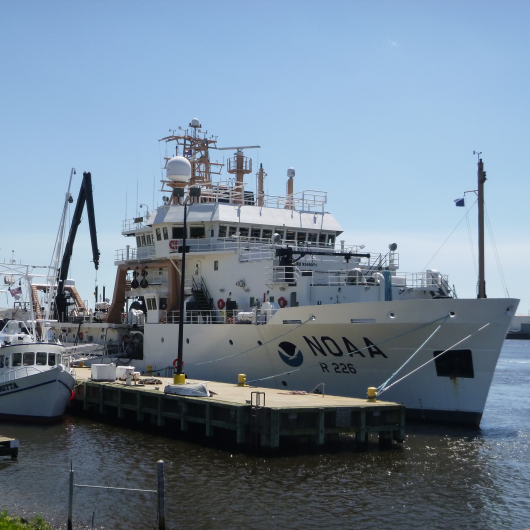
Aboard NOAA Ship Pisces (In Port)
May 04, 2016 – May 12, 2016
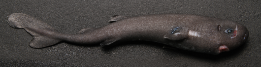
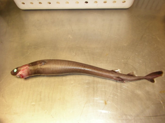
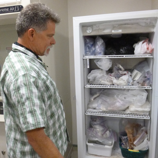
“Gross!”
“Is that an eyeball in its stomach?”
“Can I touch it?”
I hear the inquiry skills of tomorrow’s scientists develop under the guidance of Fisheries Biologists Lisa Jones and Christian Jones during a recent shark dissection at the Pascagoula, Mississippi Laboratories of NOAA’s Southeast Fisheries Science Center. The NOAA mission of “Science, Service, and Stewardship” is taken very seriously as fishery biologists work with students of all ages to learn about our natural resources and how to understand and manage them wisely. But NOAA Fisheries doesn’t just educate people about science, they do research, provide national data collection, collaborate with other scientists, help make everything from nets to policies to help manage our scarce resources, and even sniff our fish to make sure it is safe to eat.
Science
Developing scientific methods to answer questions that can only be answered by collecting data, science, is the first of NOAA’s three part mission. Kevin Rademacher, a Fisheries Biologist, uses his understanding of scientific inquiry and standardized data collection to inspire students. He encourages students to consider characteristics, purpose, and habitat to expand their inquiry when they ask questions like why one shell spiky and the other one is smooth.
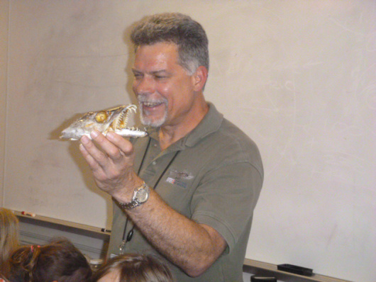
Kevin shows students the head of an Atlantic cutlassfish.
Kevin’s deep understanding of the diversity of life in the Gulf of Mexico is obvious as he inspires students from nearby Pascagoula, and as far away as Tillamook, Oregon to learn more about the ocean and its inhabitants.


Stewardship
While Kevin, Christian and Lisa teach science, other students head outside to learn about stewardship. Stewardship, using sound science to protect and manage people and resources, is another component of NOAA’s mission. The Harvesting Systems Unit helps develop and test more efficient and environmentally friendly gear used to catch fish and other seafood. For example, fishermen are happy to let other marine species like sea turtles escape from nets, leaving more room for the shrimp they are trying to catch and helping sea turtles at the same time.
Provide national fisheries gear engineering support in the development, fishery-dependent assessment and implementation of more efficient and environmentally friendly fishing gear;
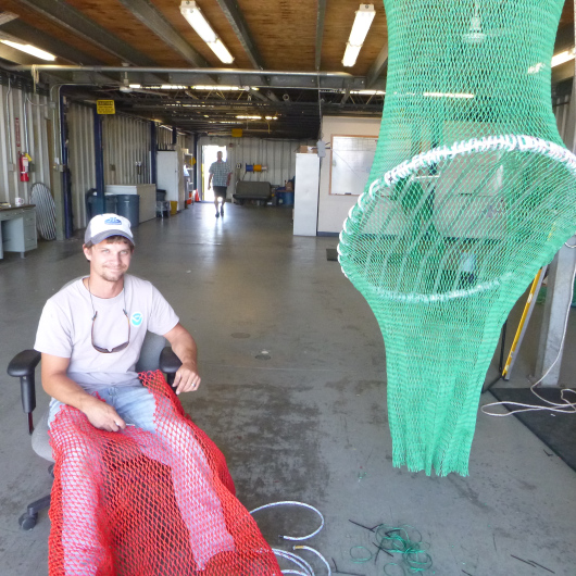
Here, Fisheries Methods and Equipment Specialist Warren Brown builds and makes changes to a Turtle Excluder Device using generations of family history in the shrimp trawling industry to guide his work.
By 1978, all five species of sea turtles in the northern Gulf of Mexico were on endangered or threatened species list, in no small part because of shrimp trawling methods. Sea turtles, who need to take a breath of air at least every 55 minutes, would get caught in the nets and die. NOAA responded to this problem by designing new equipment and gear meant to decrease the amount of by-catch, or other living things, shrimp trawlers and fisherman pulled up in their nets. A Turtle Excluder Device, or TED, allows sea turtles to escape from shrimp nets. Learn more about sea turtles and what you can do to help them through NOAA’s great educational resources.
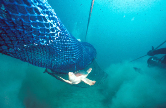
This sea turtle is escaping from a bottom opening TED! Photo Credit: NOAA
Andre DeBose, Fisheries Biologist, educates, inspires, and engages students of all ages as they learn what it feels like to be an endangered sea turtle crawling out of a shrimp net through the TED.
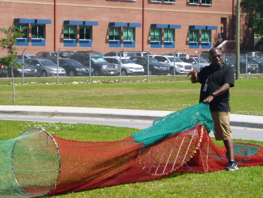
Andre DeBose shows students each component of the TED, how it was designed and how it works.


Service
The three components of NOAAs service, science, and stewardship mission are inseparable. While most scientists work in the field or educate others, the scientists in National Seafood Inspection Laboratory (NSIL) use good science to make sure the seafood we eat is good.
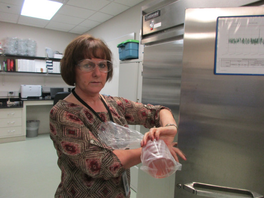
Angela Ruple wears protective glasses to make sure the germs that grow in these petri dishes don’t get in her eyes!
Angela Ruple is the Lead Analyst at NSIL, keeping a close protected eye on any seafood that is tested for hazards like Salmonella and chemical contaminants. She works with other government agencies and encourages food safety education programs such as the Partnership for Food Safety Education’s FightBac program, which uses fun games and other tools, to educate us about food hazards like bacteria.


Shannara Lynn is one of NOAA’s seafood detectives. Untrustworthy seafood dealers may sell fish that are easy to catch as more expensive fish. They will take a piece of less expensive ray or shark and pretend it is a scallop. But each species of fish has DNA and protein markers that make them unique. Looking at proteins, Shannara can run 72 fish in 1 day to see if they match their label, but only 8 fish in 2 days using DNA analysis. So, stores like Kroger, with lots of fish to test, might want to screen with protein banding first to make sure they aren’t getting hoodwinked.
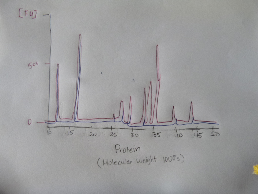
This graph I made is similar to the ones Shannara uses on the computer. A shark (red line) has three characteristic protein peaks above the 500 unit line. The blue line represents a different species of fish. No match!
Cheryl Lassitter, Lead Chemist at NSIL, (pictured below) combined her mathematical, technological, and scientific skills, to make a library that makes the protein identification of each fish easy to find in a computer program.


All senses are used at NOAA’s Seafood Inspection Program (SIP) to test fish. Susan Linn, Approving Officer for SIP, travels around the nation to teach seafood inspection testers to use the same vocabulary and methods when testing fish with their noses. If it smells like “dirty socks,” it’s gone bad.
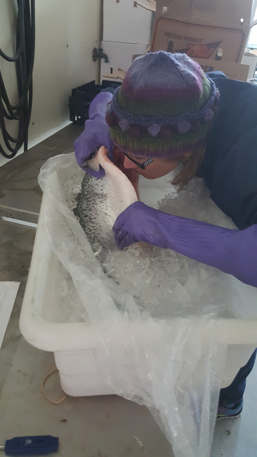
Susan sniffs a salmon for freshness. Photo courtesy of Kevin Rademacher.
Patience and Tenacity
Patience and tenacity do not start with an “S,” but these two life skills are what fuel the “Science, Service, and Stewardship,” three part mission of NOAA aboard the Pisces.
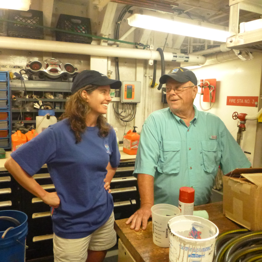
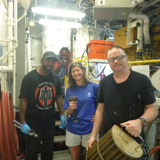
When told there was a problem that would delay our departure, I asked to “see it.” What I learned over the next ten days is that science requires precision, complex tools, experts working in teams, and lots of money. Brent Jones, Chief Engineer and Augmenter William Osborn, showed patience and tenacity as they helped me understand some of the unique features of the power system for the Pisces.
CLICK ON PICTURES BELOW TO MAKE THEM BIGGER AND TO READ ABOUT PARTS OF THE POWER SYSTEM.


For fisheries science, the boat has to be quiet in the water. A simple diesel engine would have been easy to fix, but would scare away many of the fish that scientists are trying to study. Second graders use their “fox feet” in our outdoor classroom, and Pisces scientists use a stealthy diesel electric engine, to sneak up on their specimens. The unique ship requires experts capable of finding problems in a maze of technology without major calamity.
Once again, the more questions I asked, the more questions I had. The problems were in the SCR drives, behind big gray panels. Diodes convert AC power to DC power and the SCR drives smooth out and clean up the pulses of power.
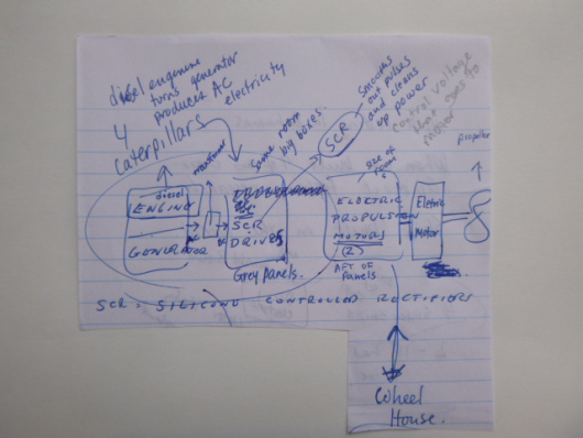
How fortunate I was to meet Eric Richards, from VT Halter Marine, who built Pisces and drew this block diagram, and gave me a builder’s perspective on how the ship operates.
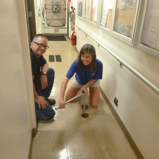
Somewhere in a room of grey closets filled with live wires, pulsing with 600 volts of electricity, was the problem that kept Pisces from sailing. As long as I worked as a Teacher in Port, the problem hid like a second grader after the recess whistle blew.
Here Chief Engineer Brent Jones, “Chief,” sensing my desire to get my hands on the problem, tells me to stay away from the SCR drives. Photo credit: William Osborn
The Reef Fish Survey has four parts or legs. During the first leg, the motor died a couple times while at sea. Fortunately, the crew was able to shut down the engine and restart it. If something like this happened when pulling into a tight space, the ramifications could be scary.
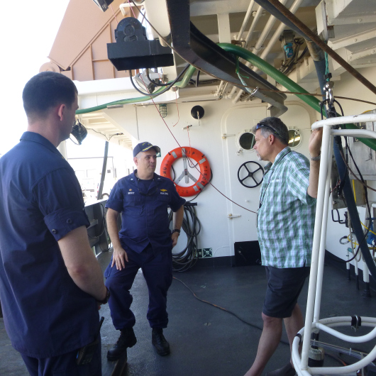
Commanding Officer, Commander William Mowitt, Field Party Chief Scientist Kevin Rademacher, and Junior Officer Nathan Gilliam have one of many brainstorming meetings as they figure out how to tackle mechanical problems and reschedule surveys, so that they can collect the scientific data needed to complete the Reef Fish Survey on time.
Experts took a systematic approach to solving the intermittent problem, complicated by a limited budget, with equanimity. Yet they could not solve the problem fast enough to go on leg two or three of the survey. Now, Kevin Rademacher, the Field Party Chief Scientist has to negotiate other ways to collect the data required for the last two legs of the survey. Junior Officer Nathan Gillman summed it up as follows, “with science, nothing goes according to plan, but it gets done.”
Personal Log
While Pisces ultimately never left port, I imagine that I learned a broader scope of the role NOAA plays in protecting and managing our ocean resources on land than I would have at sea. Thank you, Kevin Rademacher, for showing me the port side of NOAA while juggling a crazy, changing schedule, and teaching me about many intriguing aspects of fisheries science. I also send a big thank you to the scientists in the lab who have inspired me to continue asking curious questions, and to encourage students to embrace science and technology. Thanks to the ship engineers who showed me how the ship works, and sometimes doesn’t. Thank you Keigm and Eric Richards, for showing me the path less traveled.
Thank you to Daeh Kujak, Second Grade Teacher, Karen Thenell, Principal, South Prairie Elementary, and our superintendent Randy Schild for being so flexible and supportive, allowing me to become inspired, ocean literate, and an advocate for our limited natural resources. Thank you TAS administrators for creating a life changing program that inspires teachers and students by getting us out in the field with scientists. It takes the whole team to manage our limited ocean resources, and to educate our leaders of tomorrow. Thanks to the team, I can see the significant, beneficial difference in how I learn and teach.


 Hello from Sacramento, California! My name is Dana Chu and I am a Math and Science teacher and an Education Specialist at Florin High School. This year I also teach a class called Multiple Strategies for Academics and Transitions and support a Spanish 1 class. Florin High School has a diverse population of over 1,400 students that speak nineteen different languages. After school, I serve as an advisor to the Florin High School Watershed Team which is composed of students from all grade levels.
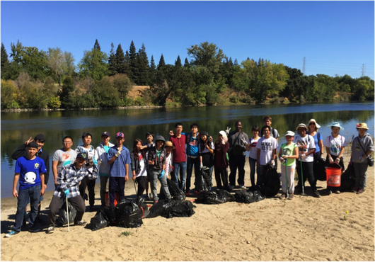


