NOAA Teacher at Sea
Tara Fogleman
Onboard NOAA Ship John N. Cobb
June 1 – 14, 2007
Mission: Alaskan Harbor Seal Pupping Phenology and Site Monitoring
Geographical Area: Southeast Alaska
Date: June 11, 2007
During the past two days, we have been monitoring seal haulouts in glacial areas such as the LeConte Glacier and the Dawes Glacier (located in Endicott Arm). These areas are very different from the sites that we have been visiting in the previous part of this study—instead of hauling out on rocky reef islands, the seals in this area haul out on floating ice that has calved, or broken off, from the glaciers. Because the ice is always available for haulout, regardless of the tides, we are less constricted by the tides when planning our visits to these haulout sites.

Dave Withrow took several photos of Dawes Glacier and stitched them together to create this panoramic views that can help scientists monitor changes in the glacier over time.
Glaciers—Ice on the Move
Glaciers are basically frozen rivers of ice that form between mountain peaks, due to the accumulation and compaction of years of snowfall. As the surface of these glaciers melt due to heat from the sun, meltwater plunges through open crevices in the ice, breaking up the ice and lubricating its base, causing the glacier to move towards the water. Of course, snowfall continues to replenish the tops of these moving glaciers; however, due to an increase in global temperatures during the recent years, these glaciers are melting faster than they can be replenished and are currently moving towards the water at unprecedented rates. Mountain glaciers play an important role in the ecology of Alaska—these ice reservoirs serve as water banks and, as mentioned earlier, provide a place for female harbor seals to give birth to their pups. Scientists are very concerned about the retreat of the glaciers in Alaska, and as a component of our study, we will attempt to document the location of the glaciers that we visit and compare our data with previous years.
LeConte Glacier

Harbor seals haul out on floating ice that calves from nearby glaciers. In this photo of the LeConte Glacier, three harbor seals are visible.
After staying the night in Petersburg, Dan (our Executive Officer) drove the JOHN N. COBB through Frederick Sound, on our way to LeConte Bay. Once anchored, Dave and I secured a packed lunch from Bill, the Chief Steward, and headed in the small skiff towards the LeConte Glacier. The area around the LeConte Glacier was filled with floating ice, which made for a bumpy and loud boat ride. We bounced off chunks of ice as we made our way toward the glacier, stopping to survey the area for harbor seals about every quarter of a mile. Generally, I observed female/pup pairs hauled out on smaller pieces of ice that allowed easy access to the water. However, as we moved towards the face of the glacier, I observed a greater number of seals hauling out in groups, usually without pups. These groupings are most likely pregnant females who have not given birth yet. The glacial sites were different from the rocky reef sites, where the seals were generally concentrated in one area of the reef. Here, near LeConte, the seals were more evenly spread out and in pairs or small groups, which made it a little more difficult to count.

This female harbor seal and her pup were photographed near the LeConte Glacier
Because the female harbor seals give birth to their pups on these floating ice surfaces, we commonly saw icebergs bathed in bright red blood from the birthing process. Dave told me that he has often seen birds, such as bald eagles, feeding on the afterbirth that is delivered after the seal pup is born. This afterbirth also contains white hair, called lanuga, which covers the pup in the uterus and is shed prior to the birth. Other closely-related seals, such as the spotted seal found in the Arctic, are born with this lanuga still covering the body. The white hair provides camouflage, allowing the white seal pup to blend in with the ice and snow. After a few weeks, when the pup is stronger, the lanuga is shed. Scientists believe that harbor seals and spotted seals most likely evolved from a common species, and the development and shedding of lanuga reinforces this belief.

Chief Scientist Dave Withrow poses on an iceberg near the LeConte Glacier.
After surveying for seals and eating a quick lunch, we spent some time photographing and admiring the scenery around LeConte. Because of the large chunks of ice that knocked against each other in the water, it was difficult to maneuver the boat up to the glacier to get a close-up view. However, the area had many other amazing sights, including steep, snow-topped mountains, roaring waterfalls, and large, breathtaking icebergs. Hunks of ice floated around the boat in a variety of shades of white, gray, and blue, some towering thirty feet above us. The bright sun melted them as we passed by, sculpting the ice into fantastic shapes.
Dawes Glacier
The weather turned colder and the sky became cloudier on the morning that we set out for Dawes Glacier at the end of Endicott Arm. I bundled up in layers of long underwear, polypropylene, and wool, and on top of that, I donned my Mustang suit—a thick orange and black suit that protects from cold temperatures and provides personal flotation in an emergency. Our visit to the glacier would take several hours, and it was important that I was protected from the cold wind that blows off of the glacial ice. The Dawes Glacier site provided a better opportunity to approach the actual glacier, as compared to LeConte, where the floating ice made it difficult to maneuver the small skiff. As we traveled towards the glacial ice, we stopped periodically to scan for harbor seals and their pups. As in LeConte, we observed nearly 300 seals, mostly consisting of mom and pup pairs. The seals at this site seemed less afraid of our skiff, most likely due to increased boat traffic in the area. In fact, while we were visiting the site, I noticed at least four small skiffs transporting tourists in the same area that we were conducting our study.

At Dawes Glacier, the seals seemed less frightened of boat traffic, most likely due to the increasingly large number of tour boats and vessels that make their way into Endicott Arm each day.
Throughout my cruise, I have noticed that the water in Alaska varies in color, from steel gray to a bright blue-green. Here at the Dawes Glacier, the water was a light, translucent teal—almost resembling the color of a glass Coke bottle. Chunks of ice were scattered along the surface, moving slowly with the tide and the strong winds. Some of these bergs were translucent and glass-like; others were a cloudy light blue. As we approached the glacier, the water became more opaque, due to a larger amount of sediment stirred up by the calving of the glacier in front of us. The melting glacial ice also forms a layer of fresh water on top of the surrounding saltwater, which can add to the cloudy appearance as the two water types mix slowly.

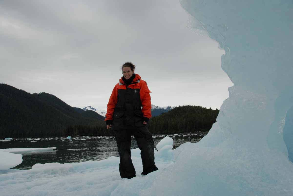
Tara Fogleman, a NOAA Teacher at Sea participant, poses on an iceberg in southeastern Alaska.
From far away, the Dawes Glacier looks like a giant, frozen river wedged between two rows of mountains. It is unevenly streaked with lines of gray sediment picked up as the glacier makes its slow movements across the land. However, I couldn’t grasp the enormity of the glacier until we traveled up to the face, where the ice intermittently calves from the glacier. Up close, the glacier face is daunting and deceivingly large—the bottom is cut away due to the continuous lapping of the tides, and the glacial ice forms towering peaks, caves, and valleys that seem to be on the verge of collapsing into the water below. As we watched, several parts of the face fell into the water, one at a time, creating a large splash and a booming sound that resembled thunder. Often, the large splash of the falling ice created waves that slowly moved towards and rocked our small skiff. We were amazed as the large chunks of opaque ice fell into the water, disappeared for a few seconds, and then bobbed to the top, like ice cubes dropped into a glass of water.
After observing the glacial calving for about an hour, we headed back to the JOHN N. COBB for a warm dinner and a hot shower. Temperatures continued to drop as the sun began to set, and we were all fairly cold, regardless of how many layers we were wearing! Tomorrow we will head to another glacial site, the glacier at Tracy Arm, as we begin to wrap up our study.