Spencer Cody: Farewell Fairweather, June 18, 2016

Spencer Cody

Onboard the NOAA Ship Fairweather

May 29 – June 18, 2016

Mission:  Hydrographic Survey

Geographical Area of the Cruise:  along the coast of Alaska

Date: June 18, 2016

Weather Data from the Bridge: 

Observational Data:

Latitude: 55˚ 20.643′ N

Longitude: 131˚ 37.505′ W

Air Temp: 20˚C (68˚F)

Water Temp: 13˚C (55˚F)

Ocean Depth: 30 m (100 ft.)

Relative Humidity: 65%

Wind Speed: 9 kts (11 mph)

Barometer: 1,022 hPa (1,022 mbar)

Science and Technology Log:.

111_0798 (2)

In order to check whether the tide gauge is working or not, a tidal observation needs to take place.  Over the course of several hours, the tide is measured as it rises or falls on graduated staffs and is recorded and compared to our tidal gauge data.  Credit Brian Glunz for the photo.

While horizontal control base stations are used to improve the accuracy of the positions of all points on a surface by providing a fixed known location to compare to GPS coordinates, constantly changing tides present another challenge in of its own.  With tides in the survey area ranging 3 to 6 meters (10 to 20 ft.), depths can vary widely for various shallow-water hazards depending on the strength of the tide.  Consequently, accurate tide data must be recorded during the survey and in close proximity of the survey site since tides vary widely depending on topography, weather systems, and other factors.  This is where tide stations come into play and are necessary to accurately gauge the vertical level of water throughout the survey area.

111_0930 (2)

Surveying equipment is used to check benchmarks near the tide station in the upper left for any movement.  Hydrographic Assistant Survey Technician Hannah Marshburn is recording data from the leveling process with Ensign Matthew Sharr sighting a staff held in place by Ensign Mason Carroll and Hydrographic Senior Survey Technician Clint Marcus.

Before a survey is started in an area, a tide station can be set up within the survey area to measure local tides. The tide stations use solar cells to generate electricity to power a small compressor on land that sends air through a hose that is attached to the ocean bottom in a near-shore environment.  The tide gauge can measure how much pressure is needed to generate a bubble out the end of the hose, the greater the pressure, the deeper the water.  These pressure gradients correlate to a certain depth of water while the depth of the water is tied to a nearby benchmark of surveyed elevation.  This information is then transmitted out to tide reporting sites online.  For additional data on tide patterns, the information on tide levels can be downloaded from the gauge in refining survey data.  In order to ensure that a tide gauge is working correctly, manual tide observations are periodically made at the same location. Additionally, the benchmarks near the tide gauge go through a process called “leveling.” This is survey work that compares all of the secondary benchmarks in the area to the primary benchmark.  If none of the benchmarks have moved relative to each other, it is safer to assume that the benchmarks still represent the elevation that they were originally surveyed.  Once the survey in the area is completed, the tidal gauge is packed up to be used at another location.  Since the portion of the tidal gauge that releases the pressurized bubble is under the entire tidal water column, a dive team is required to remove the remaining equipment.  The entire tidal gauge site is returned to how it looked before the station was set up.  Only the survey benchmarks remain for future use.

Personal Log:

107_0553 (2).JPG

From left to right Ensign Tyler Fifield charts our course while Able Seaman Godfrey Gittens has the helm with Ensign Lander Van Hoef controlling the power to propulsion.  Bridge usually has at least one officer and one deck member on watch at all times.  Ensign Fifield has been in NOAA and on the Fairweather for two years and has a background in marine safety and environmental protection.  AB Gittens spent 4 years in the Navy, 20 years on commercial and military marine contracted vessels, and has now worked for NOAA for a couple of months.  Ensign Van Hoef has a background in mathematics and has been on the Fairweather for six months.

Dear Mr. Cody,

On our cruise ship there are officers that wear uniforms who run the ship.  They also look out for the safety of everyone onboard.  They are very nice and know a lot about how to keep the ship running and get the cruise ship to each stop on our vacation.  They work with each department on the ship to make sure everything runs properly and people stay safe.  It has been a great trip to Alaska, and now we are at our last stop.  Goodbye Alaska!  (Dillion is one of my science students who went on an Alaska cruise with his family in May and has been corresponding with me about his experiences as I blog about my experiences on the Fairweather.)

Dear Dillion,

The Fairweather also has officers, the NOAA Corps, to help run the ship and carry out NOAA’s mission by utilizing NOAA’s fleet of ships and aircraft and by staffing key land-based positions throughout the organization.  The NOAA Corps ensures that trained personnel are always available to carry out NOAA’s missions using cutting-edge science and technology.  This gives NOAA the flexibility it needs to complete many types of varied research since officers are trained to fulfill many types of missions.  This gives NOAA the ability to respond quickly to scientific and technological needs and helps retain a continuity of operations and protocol throughout the vast fleet and area of operations.  In order to be considered for acceptance into the NOAA Corp, applicants must have at least a four year degree in a field of study relating to NOAA’s scientific and technological interests.  Once accepted into the program, they go through five months of training at the United States Coast Guard Academy where they develop an understanding of NOAA’s mission, maritime and nautical skills, and general ship and boat operation skills.  After successful completion of the training, NOAA officers are placed on a ship in the fleet for three years of sea duty to begin their new career.

109_0606 (2)

Chief Electronics Technician Sean Donovan performs his daily check of communications systems on the bridge.  CET Donovan served as a naval service ground electronic technician for 11 years in the Navy and has been in NOAA for 8 months.

On the Fairweather NOAA Corp officers help run and manage the ship and launch boats.  They navigate the ship and stand watch on the bridge.  They work with the other departments to ensure that the mission is accomplished and everyone remains safe during the mission.  On a hydrographic survey ship such as the Fairweather, Corps officers commonly have the position of sheet manager for hydrographic survey regions as collateral duties allowing them the opportunity to plan the logistics of hydrographic survey areas and learn how to use software associated with hydrographic data collection and analysis. Additionally, officers will be assigned to other scientific missions as they arise since the Fairweather will participate in a variety of scientific projects throughout the year.

109_0599 (2)

Able Seaman Carl Coonce controls the hydraulic system that is picking up a launch boat from a survey mission.  AB Coonce has been in NOAA for 12 years.  He was also on the NOAA ships Albatross and Bigalow.  He has been on the Fairweather for five years.  He started out in NOAA as a second cook and then a chief steward, but he wanted to learn more about ships; so, he made the move to the deck department commenting, “When you go out on deck, all differences are set aside.  We lookout for each other.”

A hydrographic ship such as the Fairweather requires many departments to work together  including the NOAA Corps officers to accomplish the mission.  There is the deck department and engineering department and the steward department as I have discussed their role in previous posts.  However, there are also electronic technicians that assist the survey in all of its technological aspects including the ship’s servers, electronics, radar, and communication systems.  Since technology plays a critical role in the collection and analysis of data, a hydrographic ship depends on these systems to carry out its scientific research.

109_0601 (2)

Acting Chief Hydrographic Survey Technician John Doroba prepares a boat launch for another portion of the hydrographic survey.  ACHST Doroba is the lead survey technician for this leg.  He has a background in geography, physical science, and information systems with a decade of work experience in and out of NOAA relating to surveying and related technology.

The survey department does the bulk of the collection and analysis of hydrographic data.  Depending on experience and education background, someone in survey may start out as a junior survey technician or assistant survey technician and advance up to a survey technician, senior survey technician, and possibly a chief survey technician.  With each step more years of experience is required because a greater amount of responsibility comes with each position concerning that survey.  Survey technicians generally need to have a background in the physical sciences or in computer science.  Technology and physical science go hand-in-hand in hydrographic survey work by applying and analyzing scientific data through the lens of advanced technology and software.  One needs to be capable in both areas in order to be proficient in the survey department.

104_0414 (2)

Hydrographic Assistant Survey Technician Steve Eykelhoff collects hydrographic data during a launch.  HAST Eykelhoff has a background in geology and hydrology.  He has worked on many mapping projects including mapping the Erie Canal and the Hudson River.

It really comes down to people working together as a team to get something done.  In the case of the Fairweather, all of this talent and dedication has been brought together in a team of NOAA Corps, engineers, deck, survey, technicians, and stewards to carry out a remarkable array of scientific work safely and efficiently.  This team is always ready for that next big mission because they work together and help each other.  Yes, Dillion, my time here on the Fairweather is also drawing to a close.  I have enjoyed the three weeks onboard and have learned a lot from a very friendly and informative and driven crew.  I thank all of those who were willing to show me what their job in NOAA is like and the underlying concepts that are important to their careers.  I learned a great deal concerning NOAA careers and the science that is carried out onboard a NOAA hydrographic ship.  Thank you!

Did You Know?

The NOAA Commissioned Officer Corps is one of seven uniformed services of the United States consisting of more than 300 officers that operate NOAA’s fleet of 16 ships and 9 aircraft.

Can You Guess What This Is?111_0918 (2)

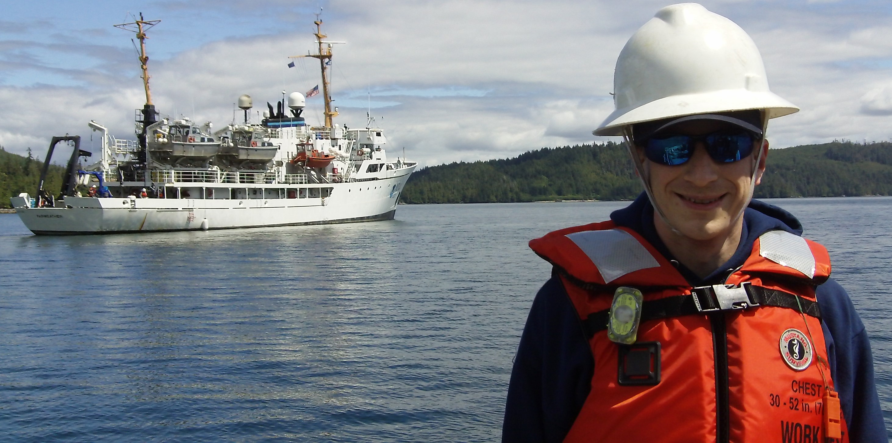
A. a ship  B. a hydrographic survey  C. a NOAA vessel  D. a final farewell to an amazing ship and crew

You should already know the answer if you have been following this blog!

(The answer to the question in the last post was C. an azimuth circle.  The Fairweather has an azimuth circle onboard.  While it is not typically used for navigation, it is yet another technology that remains as a holdover from earlier seafaring times and as a potential navigation tool available when all modern equipment has failed.  The azimuth circle can be used to measure the position of a celestial body for navigation purposes or to get a bearing on an object visible from the ship.)

Spencer Cody: What Remains Unseen, June 17, 2016

NOAA Teacher at Sea

Spencer Cody

Onboard the NOAA Ship Fairweather

May 29 – June 17, 2016

Mission:  Hydrographic Survey

Geographical Area of the Cruise:  along the coast of Alaska

Date: June 17, 2016

Weather Data from the Bridge: 

Observational Data:

Latitude: 55˚ 10.643′ N

Longitude: 132˚ 54.305′ W

Air Temp: 16˚C (60˚F)

Water Temp: 12˚C (54˚F)

Ocean Depth: 30 m (100 ft.)

Relative Humidity: 81%

Wind Speed: 10 kts (12 mph)

Barometer: 1,013 hPa (1,013 mbar)

Science and Technology Log:

106_0507 (2)

Hydrographic Senior Survey Technician Clint Marcus is cataloguing all of the discreet hazards and objects by location and by photographic evidence that will be available for the new nautical charts once the survey is complete.

Uncovering potential dangers to navigation often requires more that acoustic equipment to adequately document the hazard.  Many hazards are in water that is shallow enough to potentially damage equipment if a boat were to be operating in that area and may also require special description to provide guidance for those trying to interpret the hazard through nautical charts and changing tides.  This is one of the key reasons so much planning must be placed into assigning survey areas determining the size and extent of polygons for mapping.  Depending on the complexity of the area’s structures, the polygon assignment will be adjusted to reasonably reflect what can be accomplished in one day by a single launch.  Near-shore objects may require a smaller boat to adequately access the shallow water to move in among multiple hazards.  This is where a smaller boat like the Fairweather’s skiff can play a role.  The skiff can be sent out to map where these near-shore hazards are using equipment that that will mark the object with a GPS coordinate to provide its location.  Additionally, a photograph of the hazard is taken in order to provide a greater reference to the extent of the object and what it looks like above or below the water.  This information is collected and catalogued; so, the resulting nautical chart will have detailed resources and references to existing nautical hazards.

104_0445 (2)

Ensign Pat Debroisse covers nautical hazards such as rocks and kelp indicated throughout a very shallow and hazardous inlet.

Nautical hazards are not the only feature found on charts.  Nautical charts also have a description of the ocean bottom at various points throughout the charts.  These points may indicate a rocky bottom or a bottom consisting of silt, sand, or mud.  This information can be important for local traffic in terms of boating and anchoring and other issues. In order to collect samples from the bottom, a launch boat drops a diving probe that consists of a steel trap door that collects and holds a specimen in a canister that can be brought up to the boat.  Once the sample is brought up to the boat, it is analyzed for rock size and texture along with other components such as shell material in order to assign a designation.  This information is collected and catalogued so that the resulting nautical chart update will include all of the detailed information for all nautical hazards within the survey area.

109_0712 (2)

Bottom samples are taken with a heavy steel torpedo-shaped probe that is designed to sink quickly, dive into the ocean bottom, clamp shut, and return a sample to the boat.  Credit Ensign Joseph Brinkley for the photo.

Personal Log:

Dear Mr. Cody,

The food on the cruise ship is great. They have all of our meals ready and waiting.  There are many people who prepare and serve the food to us to make our trip enjoyable.  (Dillion is one of my science students who went on an Alaska cruise with his family in May and will be corresponding with me about his experiences as I blog about my experiences on the Fairweather.)

Dear Dillion,

The food onboard the Fairweather is also very good.  Much of the work that they do happens so early in the morning that most never see it take place.  Our stewards take very good care of us by providing three meals a day, snacks, and grab bag lunches for all of our launches each day.  They need to start early in morning in order to get all of the bagged lunches for the launches prepared for leaving later that morning and breakfast. They start preparing sandwiches and soup for the launches at 5 AM and need to have breakfast ready by 7 AM; so, mornings are very busy for them.  A morning snack is often prepared shortly after breakfast for those on break followed by lunch and then an afternoon snack and finally dinner.  That is a lot of preparation, tear down, and clean up, and it all starts over the next day.  The steward department has a lot of experience in food preparation aiding them in meeting the daily demands of their careers while preparing delicious and nutritious food that the crew will enjoy.

106_0469 (2)

What are you doing at 5:15 in the morning?  Mornings are very busy for the steward department preparing lunches for the day’s hydrographic launches and breakfast for the entire crew.  From left to right, Chief Steward Frank Ford, Chief Cook Ace Burke, Second Cook Arlene Beahm, and Chief Cook Tyrone Baker.

106_0477 (2)

Chief Steward Frank Ford is preparing a delicious mid-morning snack for the crew.

Frank Ford is the chief steward. He has been in NOAA for six years.  Before joining NOAA he had attended culinary school and worked in food service for 30 years in the restaurant and hotel industry.  “I try to make meals that can remind everyone of a positive memory…comfort food,” Frank goes on to say, “Having good meals is part of having good morale on a ship.”  Frank and the others in the steward department must be flexible in the menu depending on produce availability onboard and available food stores as the mission progresses.


106_0473 (2)

Chief Cook Tyrone Baker helps prepare breakfast.

Tyrone Baker is the chief cook onboard. He has been in NOAA for 10 years and has 20 years of food service experience in the Navy.  Ace Burke has been with NOAA since 1991 and has served in many positions in deck and engineering and has been a steward for the last 15 years.  He came over from the NOAA ship Thomas Jefferson to help the steward department as a chief cook. Arlene Beahm attended chefs school in New Orleans.  She has been with NOAA for 1 ½ years and started out as a general vessel assistant onboard the Fairweather and is now a second cook.


Did You Know?

Relying on GPS to know where a point is in the survey area is not accurate enough.  It can be off by as much as 1/10 of a meter.  In order to increase the accuracy of where all the points charted on the new map, the Fairweather carries horizontal control base stations onboard.  These base stations are set up on a fixed known location and are used to compare to the GPS coordinate points.  Utilizing such stations improves the accuracy of all points with the survey from 1/10 of a meter of uncertainty to 1/100 of a meter or a centimeter.

Can You Guess What This Is?109_0609 (2)

A. an alidade  B. a sextant  C. an azimuth circle  D. a telescope

The answer will be provided in the next post!

(The answer to the question in the last post was D. a CTD.  A CTD or Conductivity, Temperature, and Depth sensor is needed for hydrographic surveys since the temperature and density of ocean water can alter how sound waves move through the water column. These properties must be accounted for when using acoustic technology to yield a very precise measurement of the ocean bottom.  The sensor is able to record depth by measuring the increase of pressure, the deeper the CTD sensor goes, the higher the pressure.  Using a combination of the Chen-Millero equation to relate pressure to depth and Snell’s Law to ray trace sound waves to the farthest extent of an acoustic swath, a vertical point below the water’s surface can be accurately measured.  Density is determined by conductivity, the greater the conductivity of the water sample running through the CTD, the greater the concentration of dissolved salt yielding a higher density.)

Spencer Cody: Killing the Dots, June 13, 2016

NOAA Teacher at Sea

Spencer Cody

Onboard the NOAA Ship Fairweather

May 29 – June 17, 2016

Mission:  Hydrographic Survey

Geographical Area of the Cruise:  along the coast of Alaska

Date: June 13, 2016

Weather Data from the Bridge: 

Observational Data:

Latitude: 55˚ 10.643′ N
Longitude: 132˚ 54.305′ W
Air Temp: 19˚C (66˚F)
Water Temp: 14˚C (58˚F)
Ocean Depth: 33 m (109 ft.)
Relative Humidity: 50%
Wind Speed: 6 kts (7 mph)
Barometer: 1,014 hPa (1,014 mbar)

Science and Technology Log:

104_0366 (2)

“Killing dots” or manually flagging data points that are likely not accurately modeling hydrographic data is only the beginning of a very lengthy process of refining hydrographic data for new high-quality nautical charts.  Credit Hannah Marshburn for the photo.

In the last post, I talked about how we collect the hydrographic data.  The process of hydrographic data collection can be a challenge in of itself with all of the issues that can come up during the process.  But, what happens to this data once it is brought back to the Fairweather?  In many ways this is where the bulk of the work begins in hydrography.  As each boat files back to the ship, the data they bring back is downloaded onto our servers here on the ship to begin processing.  Just the process of downloading and transferring the information can be time consuming since some data files can be gigabytes worth of data.  This is why the Fairweather has servers with terabytes worth of storage to have the capacity to store and process large data files.  Once the data is downloaded, it is manually cleaned up.  A survey technician looks at small slices of hydrographic data and tries to determine what is the actual surface of the bottom and what is noise from the multibeam echosounder.  Leaving too many false data points in the slice of hydrographic data may cause the computer software to adjust the surface topography to reach up or below to something that in reality does not exist. The first phase of this is focused on just cleaning the data enough to prevent the hydrographic software from recognizing false topographies.  Even though the data that does not likely represent accurate hydrographic points are flagged and temporarily eliminated from the topographic calculation, the flagged data points are retained throughout the process to allow for one to go back and see what was flagged versus what was retained. It is important to retain this flagged data through this process in case data that was thought to be noise from the echosounder really did represent a surface feature on the bottom.

104_0365 (2)

Hydrographic Assistant Survey Technician Sam Candio is using a three dimensional viewer to clean the hydrographic data collected from that day’s launches.

Once this process is complete, the day’s section is added to a master file and map of the target survey area.  This needs to happen on a nightly basis since survey launches may need to be dispatched to an area that was missed or one in which the data is not sufficient to produce quality hydrographic images.  Each launch steadily fills in the patchwork of survey data; so, accounting for data, quality, and location are vitally important.  Losing track of data or poor quality data may require another launch to cover the same area.  After the survey area is filled in, refinement of the new map takes place.  This is where the crude cleanup transitions into a fine-tuned and detailed analysis of the data to yield smooth and accurate contours for the area mapped.  Data analysis and processing are the parts of hydrographic work that go unnoticed.  Since this work involves many hours using cutting-edge technology and software, it can be easy to underappreciate the amount of work survey technicians go through to progress the data through all of these steps to get to a quality product.

Personal Log:

20160513_113539 (2)

Dillion and family in Hoonah, Alaska.

Dear Mr. Cody,

Today we docked in Hoonah, Alaska.  We had a whale show right under our balcony!  They are incredible to watch.  There is so much to see for wildlife in Alaska. (Dillion is one of my science students who went on an Alaska cruise with his family in May and will be corresponding with me about his experiences as I blog about my experiences on the Fairweather.)

Dear Dillion,

104_0408 (2)

A friendly humpback is keeping our survey launch company as we map our assigned polygon.

I know what you mean about the wildlife.  I am seeing wildlife all over the place too.  On our transit to our survey site from Juneau, I saw numerous marine mammals: hump back whales, dolphins, and killer whales.  On our last survey launch, we had two humpbacks stay within site of the boat the entire morning.  They are remarkable creatures.  Whenever we locate a marine mammal, we fill out a marine mammal reporting form allowing various interests to use these reports to estimate the population size and range of these animals.  The waters off the Alaskan coast are full of marine life for a reason.  It is a major upwelling area where nutrients from the ocean bottom are being forced up into the photic zone where organisms such as phytoplankton can use both the nutrients and sunlight to grow.  This provides a large amount of feed for organisms all the way up the food chain.  This area is also known for its kelp forests.  Yes, if you were on the sea bottom in these areas dominated by kelp, it would look like a forest!  Kelp are a very long- and fast-growing brown algae that provide food and habitat for many other marine organisms.

104_0437 (2)

Kelp forests form on relatively shallow rocky points and ledges allowing for the holdfasts to form and latch onto the bottom giving the resulting algae growth the opportunity to toward the surface to collect large amounts of sunlight for photosynthesis.

Did You Know?

The RESON 7125sv multibeam echosounders found onboard the survey launches use a 200 kHz or 400 kHz sound frequency.  This means the sound waves used fully cycle 200,000 or 400,000 times per second.  Some humans can hear sounds with pitches as high as 19 kHz while some bat and dolphin species can hear between 100 and 150 kHz.  No animal is known to have the capability to audibly hear any of the sound waves produced by the multibeam onboard our survey boats.  Animals that use echolocation tend to have much higher hearing ranges since they are using the same premise behind acoustic mapping in hydrography but to detect food and habitat.

Can You Guess What This Is?

104_0410 (2)

A. a marker buoy  B. a water purification system  C. an electric bilge pump  D. a CTD sensor

The answer will be provided in the next post!

(The answer to the question in the last post was A. a search and rescue transponder.  If a launch boat were to become disabled with no means of communication or if the boat needs to be abandoned, activating a search and rescue transponder may be the only available option left for help to find someone missing.  When the string is pulled and the cap is twisted, a signal for help is sent out in the form of 12 intense radar screen blips greatly increasing the odds for search and rescue to find someone in a timely manner.  The radar blips become arcs as a radar gets closer to the transponder until the radar source gets within a nautical mile in which the arcs become full circles showing rescue crews that the transponder is nearby.)

Spencer Cody: Filling in the Asterisk, June 10, 2016

NOAA Teahcer at Sea

Spencer Cody

Onboard the NOAA Ship Fairweather

May 29 – June 17, 2016

Mission:  Hydrographic Survey

Geographical Area of the Cruise:  along the coast of Alaska

Date: June 10, 2016

Weather Data from the Bridge: 

Observational Data:

Latitude: 55˚ 10.643′ N

Longitude: 132˚ 54.305′ W

Air Temp: 19˚C (66˚F)

Water Temp: 12˚C (54˚F)

Ocean Depth: 33 m (109 ft.)

Relative Humidity: 60%

Wind Speed: 4 kts (5 mph)

Barometer: 1,014 hPa (1,014 mbar)

Science and Technology Log:

102_0137

Goodbye Juneau, we are off to our survey site just west of Prince of Wales Island in the southernmost part of Southeast Alaska.

On Sunday with everyone who needed to be here for the next leg of the hydrographic survey onboard, we set off for the survey site.  Transiting through Alaskan fjords and associated mountains is a real treat to say the least.  The abundance of wildlife and picturesque views of glaciers, mountains, and forests lend one easily susceptible to camera fatigue.  Every vista resembles a painting or photograph of significance.  The views are stunning and the wildlife breathtaking.  After a day’s worth of transiting, we arrived in our survey area just west of Prince of Wales Island on the southern tip of Southeast Alaska and its Alexander Archipelago.  The chain of islands that makes up the Alexander Archipelago represent the upper reaches of the submerged coastal range of mountains along the Pacific.  A mere 20,000 years ago, the sea level was roughly 120 meters (400 ft.) lower than what it is today as our planet was in the grips of the last major ice age.  To put that into perspective, the Fairweather is currently anchored in a calm bay with about 30 meters (100 ft.) of water.  During the recent ice age, this entire ship would be beached hanging precariously next to ledges dropping 100 meters (300 ft.) to the ocean below.  The mountains and steep island banks continue down to the sea floor providing for wildly changing topography below sea level.  This type of environment is perfectly geared toward Fairweather’s capabilities.

While mapping survey areas that include shallow near-shore water, the Fairweather anchors in a calm bay maximizing ideal conditions for launching and retrieving boats whenever possible.  Survey launches are dispatched out to their assigned polygons with the survey area while a skiff boat carries out near-shore marking of rocks and obstructions.  Each of the four survey launches have a RESON 7125sv multibeam echosounder to collect data for mapping.  Survey launches are sent out for much of the day and return with hydrographic data concerning their assigned area.  All of the data is compiled into one file after extensive processing and quality control.

Personal Log:

20160512_154154 (2)

Dillion enjoying Sitka, Alaska.  Credit Suzi Vail for the photo.

Dear Mr. Cody,

We arrived in Sitka, Alaska, with bald eagles flying overhead.  The islands with the tall mountains are amazing.  Some even have snow on them still.  They have a lot of trees and wildlife.  The mountains are all over the island and come right down to the ocean with a very tall dormant volcano across the sound from Sitka.  (Dillion is one of my science students who went on an Alaska cruise with his family in May and will be corresponding with me about his experiences as I blog about my experiences on the Fairweather.)

102_0213 (2)

Assisting Ensign Joseph Brinkley in lowering a Conductivity, Temperature, and Depth (CTD) sensor.  The CTD records temperature, salinity, and density.  All of these factors affect the speed of sound and must be factored into our data collection.  Credit Todd Walsh for the photo.

Dear Dillion,

We are not that far to the southeast of you in our survey area.  That is part of the challenge of mapping this area and ensuring that nautical maps are accurate and up to date.  Those tall mountains that you see so close to your ship really do continue down into the ocean in many places.  I was able to go out on one of our survey launches to see how hydrographic data is collected using the Fairweather’s fleet of survey launch boats.  It started with a mission and safety briefing before the launches were turned loose.  Our operations officer went over the assigned polygon mapping areas with us.  We were then reminded of some of the hazards that a small boat needs to be cognizant of such as the log debris in the water and the potential of grounding a boat on rocks.  Both our commanding officer and executive officer repeatedly stressed to us the importance of being careful and alert and always defaulting to safety versus more data collection.  Once the briefing was over, our boats were launched one at a time to our assigned survey polygons.  We were to map the area just north of the McFarland Islands.  Parts of the this area had known hazards hidden just below sea level.  Complicating matters was the fact that many of these hazards marked on existing maps were instances in which someone hit a rock but did not know the exact location or a rock was potentially spotted at low tide.  It was our job to carefully map the area without damaging the boat or putting any of the passengers in harm’s way.

102_0185 (2)

Keeping the boat on course as we collect a swath of hydrographic data in deep water devoid of rocks, kelp, or logs.  Credit Todd Walsh for the photo.

Mapping an assigned area can be anywhere between the two extremes of incredibly uneventful to nimbly avoiding obstacles while filling in the map.  Since the multibeam echosounder requires sound waves to travel farther through a deeper column of water, the swath covered by the beam is wider and takes longer to collect.  In such stretches of water, the boat is crawling forward to get the desired amount of pings from the bottom needed to produce quality hydrographic data.  When the boat is in shallow water, the reverse is true.  The beam is very narrow, and the boat is able to move at a relatively fast pace.  This makes mapping shallow regions challenging.  The person navigating the boat must work with a narrower beam at faster speeds while avoiding the very hazards we were sent to map.  Additionally, in this area kelp forests are very common.  The long brown algae forms a tangled mass that can easily bind up a boat propeller.  Add massive floating logs from all the timber on these islands, and now you have a situation in which a trained driver needs to have all their wits about them.

102_0253 (2)

Narrowing the data collection to a range of depths in which the entire swath can be recorded minimizes the cleanup of false data points while not losing any of the pertinent hydrographic data.  Credit Amber Batts for the photo.

While the person navigating the boat tries to orderly fill in the polygon with a swath of hydrographic data, a person must be stationed at a work station inside the cabin modifying the data stream from the beam to help keep out noise from the data making the survey data as clean as possible.  Sloppy data can result in more time in cleanup during the night processing of data once the boats return to the Fairweather.  In addition, to control what is recorded, the station also determines when the multibeam echosounder is on or off.  It takes some practice to try to keep multiple tasks on multiple screens functioning within an acceptable range.  The topography in the map area also adds to the challenge since drop offs are commonplace.  There were many times were the difference from one end of the beam to the other end was 100 meters or more (300 feet or more).  It was like trying to survey the cliff and bottom of the canyon including the wall of the canyon in one swipe.  Sometimes the ridges are so steep underwater that shadows are produced in the data were the sound waves were blocked by the ridge and our relative angle to it preventing a complete swath.  This requires us to move over the ridge on the other side to map the gap.

102_0200 (2)

Slowly but surely, we are painting over the existing map with a detailed color-coating of contours of depth.

There is something inherently exciting about being the first to see topography in such detail.  Much of this area was last surveyed by lead line and other less advanced means of surveying than our current capabilities.  In many respects they were accurate, but as we filled in our data over the existing maps, one could not help but to feel like an explorer or as much as one can feel like an explorer in this modern age.  We were witnessing in our little assigned piece of the ocean something never seen before: land beneath the water in striking detail.  The rocks and navigational hazards no longer resembled mysteriously vague asterisks on a navigation map to be simply avoided.  We were replacing the fear of the unknown with the known by using science to peer into those asterisks on the map and paint them in a vivid array of well-defined contours later to be refined and made ready for the rest of the world to utilize and appreciate through upgraded navigation charts.  Once our assigned polygon was filled to the best of our abilities, we moved on to the next and so on until it was time to head back to the Fairweather completing another successful day of data collection.

Did You Know?

Kelp is a long brown algae that forms underwater forests that serve as an important habitat for many marine organisms.  Kelp is one of the fastest growing organisms on the planet.  Some species can grow a half a meter (1.5 ft.) per day reaching lengths of 80 m (260 ft.) long.

Can You Guess What This Is?

152_3283 (2)A. search and rescue transponder  B. an emergency flashlight  C. a marker buoy  D. a flare gun

The answer will be provided in the next post!

(The answer to the question in the last post was B. an oil filter.  Getting an oil filter change for the Fairweather is a little different than for your car though the premise is similar.  The four long filters used for each of the two diesel engines onboard are many times larger to accommodate the oil volume and are more durable to handle circulating oil 24 hours a day.)

Spencer Cody: No Survey, No Problem, June 8, 2016

Spencer Cody

Onboard the NOAA Ship Fairweather

May 29 – June 17, 2016

Mission:  Hydrographic Survey

Geographical Area of the Cruise:  along the coast of Alaska

Date: June 8, 2016

Weather Data from the Bridge: 

Observational Data:

Latitude: 55˚ 10.643′ N

Longitude: 132˚ 54.305′ W

Air Temp: 17˚C (63˚F)

Water Temp: 11˚C (52˚F)

Ocean Depth: 33 m (109 ft.)

Relative Humidity: 52%

Wind Speed: 10 kts (12 mph)

Barometer: 1,014 hPa (1,014 mbar)

Science and Technology Log:

155_3353 (2)

Refrigeration, boiler, and compressed air are just three of the many systems that are monitored and maintained from engineering.

With much of the survey team either on leave or not yet here for the next leg of the hydrographic survey, it can be easy to be lulled into the sense that not much is going on onboard the Fairweather while she is in port, but nothing could be further from the truth.  Actually, having the ship docked is an important time for departments to prepare for the next mission or carry out repairs and maintenance that would be more difficult to perform or would cause delays during an active survey mission.  On that note while the Fairweather was docked was a perfect time to see the largely unseen and unappreciated: engineering.  Engineering is loud and potentially hazardous even when the engines are not running, much less, when we are underway.  One of the key purposes of engineering is to monitor systems on the ship to make sure many of the comforts and conveniences that we take for granted seemingly just happen.  Sensors constantly monitor temperature, pressure, and other pertinent information alerting the crew when a component drifts outside of its normal range or is not functioning properly.  Catching an issue before it progresses into something that needs to be repaired is a constant goal.  Monitoring in engineering includes a wide array of systems that are vital to ship operations, not just propulsion.  Sanitation, heating, refrigeration, ventilation, fuel, and electric power are also monitored and regulated from engineering.  Just imagine spending the day without any of these systems while the loss of all of them would send us reeling to earlier seafaring days when humanity was entirely at the mercy of nature’s whim.

155_3424 (2)

Tommy Meissner, an oiler in the engineering department, is giving me a tour and overview of engineering.  The day after this photo was taken, he took and passed his junior engineer certification exam.  Congratulations Tommy!

Two diesel generators can produce enough power to power a small town.  Water systems pressurize and regulate water temperatures for use throughout the ship while filtration systems clean used water before it is released according to environmental regulations.  Meanwhile, enough salt water can be converted to freshwater to meet the needs of the ship and crew.  The method of freshwater production ingeniously uses scientific principles from gas laws to our advantage by boiling off freshwater from salt water under reduced air pressures increasing freshwater production while minimizing energy consumption.  Steam is generated to heat the water system and provide heat for radiators throughout the ship, and of course the two large diesel engines that are used to provide propulsion for the ship are also located in engineering.

150_2981 (2)

Chief Engineer Bill Ness using the ship’s crane to unload a crate of materials and equipment onto the pier.

How does one get to work in engineering onboard a ship like the Fairweather?  There are several different positions in the ship’s engineering department.  An oiler is largely responsible for maintenance, repair, and fabrication and must pass a qualifying test for this designation focusing on boilers, diesel technology, electrical, and some refrigeration.  Once the qualifying test is passed, the Coast Guard issues a Merchant Mariner credential.  Only then can one apply for that position.  Junior engineers must pass a test demonstrating that they have the working knowledge of the systems involved with engineering especially in areas of auxiliary systems and repair.  Junior engineers generally need less supervision for various operations than oilers and have a greater scope in responsibility that may also include small boat systems and repair.  The scale of responsibility does not stop there, but continues through Third, Second, and First Engineers.  Each involving a qualifying test and having more requirements involving education and experience.  Finally, the Chief Engineer heads the department.  This too requires a qualifying test and certain experience requirements.  There are two different ways in which one can progress through these different levels of responsibility.  They can attain the formal education or they can document the job-related experience.  Usually both play a role in where someone is ultimately positioned determining their role onboard the ship as part of an engineering team.

Personal Log:

100_0019 (2)

Deck crew Terry Ostermyer (lower, right) with Jason Gosine (middle) and I (left) degreasing cables for the hydraulic boat launching system.  It really needs a before and after photo to be appreciated.  Credit Randy Scott for the photo.

Dear Mr. Cody,

The crew is very friendly.  They take care of everything that we need on our trip to Alaska.  They also take care of the ship.  They must have to do a lot of work to keep such a large ship going and take care of this many people on vacation at sea.  (Dillion is one of my science students who went on an Alaska cruise with his family in May and will be corresponding with me about his experiences as I blog about my experiences on the Fairweather.)

Dear Dillion,

The Fairweather also has a crew that takes care of the ship and its very own fleet of boats.  While in port, I worked with our deck department to get a very small sense of what they do on a day-to-day basis to keep the ship running.  The pitfall of having a lot of equipment and having the capability of doing many multifaceted missions is that all of this equipment needs to be maintained, cleaned, repaired, and operated.  This includes maintaining both the ship’s exterior and interior, deployment and retrieval of boats, buoys, arrays, and various other sampling and sensory systems.  When not assisting with carrying out a component of a mission such as launching a boat, the deck crew is often performing some sort of maintenance, standing watch, mooring and anchoring the ship, unloading and loading supplies, and stowing materials.  Depending on years of experience and whether they have a Merchant Mariner’s certification or not will determine the level of responsibility.  On a survey ship, the deck department specializes in boat launches and maintenance; so, the levels of responsibility reflect that central area of concern.  Beginning experience starts with general vessel assistant and ordinary seaman progressing through able seaman with Merchant Mariner’s certification and seaman surveyor or deck utility man to boatswain group leader to chief boatswain.  The chief boatswain is in charge of training and supervision regarding all of the areas pertinent to the deck department.  This is a stark contrast compared to the deck department on the Pisces that specialized in techniques associated with fish surveys.

100_0033 (2)

Cannot paint because of a rain delay?  No problem.  There is always something else to do like heads and halls.  Deck crewmember Denek Salich is in the background.  Credit Randy Scott for the photo.

When I was with the Fairweather’s deck crew, they were working on taking an old coating of grease off cables and applying a new coating back on.  The cables are used to raise and lower the 28’ long hydrographic survey launches.  This will be a system that will be in use throughout the next leg; so, now is a great time to clean and replace that grease!  After using rags and degreasing agents to strip the old grease off, a new coating was added to the cables.  The crew is always conscientious about using chemicals that are friendly to the environment and proper containment strategies to prevent runoff from the deck directly into the ocean.  Deck crew need to be very flexible with the weather.  Since the weather was not cooperating for painting, we moved indoors and did “heads and halls,” sweeping and mopping hallways and stairs and cleaning bathrooms.  The Fairweather resembles an ant colony in its construction; so, heads and halls can be a lot of work even for a whole team of people, but as I am reminded by one of our deck crew, “Teamwork will make the dream work.”  It is, indeed, teamwork that makes Fairweather’s missions, not only possible, but successful.

Did You Know?

The boiler system produces steam that provides a heat source for the water system and the heating system.

Can You Guess What This Is?

155_3411 (2)A. an ocean desalinization unit  B. an oil filter  C. a fuel tank  D. a sewage treatment unit

The answer will be provided in the next post!

(The answer to the question in the last post was C. an incinerator.  You may not think of it as being a major problem, but one person can produce a lot of trash over the course of a week or weeks.  Imagine this same problem times 50!  Since the Fairweather must utilize its storage and equipment spaces efficiently, burnable wastes must be incinerated; otherwise, we would be stacking the trash to the ceiling in every available space.)

Spencer Cody: Fairweather in Transition – June 5, 2016

Spencer Cody

Onboard the NOAA Ship Fairweather

May 29 – June 17, 2016


Mission:  Hydrographic Survey

Geographical Area of the Cruise:  along the coast of Alaska

Date: June 5, 2016

Weather Data from the Bridge: 

Observational Data:

Latitude: 58˚ 17.882′ N

Longitude: 134˚ 24.759′ W

Air Temp: 15˚C (59˚F)

Water Temp: 8.9˚C (48˚F)

Ocean Depth: 9.7 m (31.8 ft. at low tide)

Relative Humidity: 67%

Wind Speed: 5.2 kts (6 mph)

Barometer: 1,025 hPa (1,025 mbar)

Science and Technology Log:

Fairweather

Yes, the Fairweather needs to be prepared for everything imaginable:  spare parts, lines, tanks, survey equipment, safety equipment, tools, and more.  Preparedness is key to successful mission completion.

Now that I have been on the Fairweather for a few days I have had the opportunity to see much of the ship and learn about how it operates.  If ever there were an embodiment of the phrase newer is not always better, it might be the Fairweather.  Even though the Fairweather is approaching 50 years old, one cannot help but to attain an appreciation for the quality of her original construction and the ingenuity behind her design.  Rooms, compartments, and decks throughout the ship are designed to be watertight and to maximize fire containment.  Multiple compartments can be flooded without putting the entire ship in danger.  The ship is also designed to withstand sea ice due to its densely ribbed construction and extra think hull.  This makes the hull remarkably strong allowing the ship to cut through ice and withstand the additional pressure of ice-covered seas.


155_3414 (2)

One of the two massive Detroit electro-motive diesel engines that propel the ship.  Credit Tommy Meissner for the photo.

The Fairweather is built on redundancy for safety and practicality.  If one system gives out, another can be relied upon to at least allow the ship to get back to port or depending on the system continue the mission.  There are redundant systems throughout the ship involving everything from communications to essentials for sustaining the crew to navigation.  There are even redundant servers in case one set of survey data is compromised or physically damaged the other server may remain untouched.  Storage space is a premium on a ship that needs to be self-sufficient for weeks at a time to address foreseeable and unforeseeable events.  Every free space has a purpose for storing extra equipment, tools, parts, and materials.  Utility and efficiency are running themes throughout the ship.

Personal Log:

152_3311 (2)

The incoming and outgoing commanding officers read off their orders to signify the official change of command of the ship.

Dear Mr. Cody,

Onboard our ship the captain is in charge of the entire crew and ship.  People follow his orders and the chain of command to take care of the ship and its passengers.  It takes a very large crew to take care of all the passengers on a cruise ship and on such a long trip to Alaska and back.  (Dillion is one of my science students who went on an Alaska cruise with his family in May and will be corresponding with me about his experiences as I blog about my experiences on the Fairweather.)

Dear Dillion,

The Fairweather also has a captain whose ultimately responsible for the fate of the crew and the ship. While we are in Juneau, the Fairweather is undergoing a change of command.  On Wednesday we had a change of command ceremony.  It was a day of celebration and reflection on Fairweather‘s accomplishments.  As high-level officials throughout NOAA and other organizations arrived, their arrival was announced or “piped” throughout the entire ship over the intercom system.  Later in the day we had the official change over in a special ceremony attended by all of these dignitaries and guests with NOAA Corps officers dressed in full uniform.

152_3289 (2)

The Fairweather welcoming dignitaries and guests to the Change of Command ceremony.

After everyone read their remarks on the occasion, the time of the official change over was at hand.  The Reading of Orders ceremony was carried out where both the outgoing and incoming commanding officers read their orders for their new assignments.  Insignia on each officer’s uniform was changed by the spouses officially indicating the new commanding officer and the outgoing commanding officer.  With that Lieutenant Commander Mark Van Waes replaced Commander David Zezula as the CO for the Fairweather becoming its 18th commanding officer.  As the new CO gave his arriving remarks, he reminded us that “Command of a ship is many things…it is an honor to know that the leadership of this organization places special trust in your skills and abilities to hold this position…command is a privilege; of the hundreds of those who have served aboard the Fairweather, only 18 have been the commanding officer…command is a responsibility…for the ship…to the mission…and to the people.”  The Dependents Day Cruise and Change of Command Ceremony made for an eventful week while in port in Juneau.  Now we prepare for our first hydrographic mission with our new CO.

Did You Know?

The Fairweather has a total tonnage of 1,591 tons, displacement of 1,800 tons, a length of 231 feet, and is A1 ice rated meaning it can safely navigate ice covered seas with the assistance of an ice breaker.

Can You Guess What This Is?

TrashA. power generator  B. heat sensor  C. an incinerator  D. RESON multibeam echosounder

The answer will be provided in the next post!

(The answer to the question in the last post was B. a speaking tube.  Speaking tubes or voice pipes were commonly used going back to the early 1800s to relay information from a lookout to the bridge or decks below.  They were phased out during the 20th century by sound-powered telephone networks and later communication innovations.  They continue to be used as a reliable backup to more-modern communication methods.)

Spencer Cody: Of Geology, Time, and Ice, June 2, 2016

NOAA Teacher at Sea
Spencer Cody
Onboard the NOAA Ship Fairweather
May 29 – June 17, 2016

Mission:  Hydrographic Survey
Geographical Area of the Cruise:  along the coast of Alaska
Date: June 2, 2016
Observational Data:
Latitude:  58˚ 17.882′ N
Longitude:  134˚ 24.759′ W

Weather Data from the Bridge:  
Air Temp: 16˚C (61˚F)
Water Temp: 8.9˚C (48˚F)
Ocean Depth:  9.7 m (31.8 ft. at low tide)
Relative Humidity:  56%
Wind Speed:  18 kts (21 mph)
Barometer:  1,006 hPa (1,006 mbar)


Science and Technology Log: After a full day of flying, I arrived in Juneau, Alaska, on Sunday.  The Fairweather came into dock early the next morning to host a very special occasion for friends, family, and the public.  It was a Dependents Day Cruise to go with the Memorial Day celebration.  It was an opportunity for those

151_3083 (2)

The NOAA Ship Fairweather in the bottom center docked in Juneau, Alaska, preparing for her next hydrographic leg.

who work onboard the Fairweather to show others outside of NOAA what they do while the crew, friends, family, and guests sailed onboard to the Taku glacier in Taku Inlet and back to dock in Juneau.  The day was filled with demonstrations on what the crew does in order to complete their missions and the significance of having a ship such as the Fairweather fulfill its assigned tasks.  We were split up into multiple groups in order to cover the basics of ship operations and the science and research carried out by the crew.  Guests were treated to demonstrations of bridge operations, hydrographic survey techniques and equipment, dive operations and control station demonstrations.  One highlight of the many demonstrations that were carried out

150_2900 (3)

The crew demonstrate a launch and retrieval of one of the hydrographic survey launches.  The Fairweather has four of these 28′ boats including three additional boats for fast rescue and utility purposes.

was the showing of how the launch boats are lowered into the water and then retrieved.  The Fairweather was maneuvered in such a way that the launch boat was provided a small patch of sea that was calm, a “duck pond,” by blocking the oncoming waves for the launch boat.  While this was not necessary for the weather that day, it did drive home the point about the many ingenious methods that must be employed in carrying out day-to-day operations on a vessel like the Fairweather.  By the time these demonstrations and tours were concluded, we had arrived at the Taku Inlet to see the Taku glacier.

Seeing something that is massive enough to carve solid rock such as the Taku glacier was awe inspiring.  This brings us to one of the key reasons for the complexity of the local geology and the sea channels that the Fairweather will be mapping on the next leg.  After periods of uplift and mountain building, the terrain was recently sculpted with rivers of ice flowing outward to lower sea levels from the ice fields above.  Glaciers encapsulated much of Southeastern Alaska up until the Wisconsin glaciation came to an end about 14,000 years ago.  During this same time, the Laurentide continental glacier still covered much of East River South Dakota.  As the glaciers receded, the ocean levels rose to accommodate the global deluge of melt water.  What was once

150_2940 (2)

The Taku glacier at the end of Taku Inlet displays the forces of erosion at a remarkable scale.

glaciated land is now well below sea level.  Since glaciers have a remarkable power of erosion, U-shaped valleys have been carved throughout this region.  Where these valleys dip below sea level, they frequently end up becoming important bays or passageways for commercial and private traffic.  Glaciation has also given these passageways some unique characteristics that makes having reliable navigation mapping critical.  Many of the navigable passageways in Southeastern Alaska are your characteristic fjords.  They have been carved deeply by the weight of hundreds or even thousands of feet of ice; yet, they are usually narrow with valley walls that run vertically straight into the air.  This topography largely continues below sea level meaning that in many locations the passageways, straits, and canals formed by glacial action can quickly deviate from hundreds of feet deep to shoals in a matter of very short distances.  The complexity and potential hazards of these fjords is enhanced through the process of glacial isostatic adjustment when the earth shifts back upward after the massive weight of a glacier subsides.  Take these relatively recent geological and climatological

150_3025 (2)

Much of the rock of the area shows obvious signs of glacial action scouring across the landscape such as this rock near the Mendenhall glacier outside of Juneau.

processes and apply them to the complex system of islands of the Alexander Archipelago that was formed through shifting transform boundaries between the North American and Pacific plates.  Now one can start to appreciate the degree to which timely mapping is needed for this part of the world requiring precision and accuracy in order to provide nautical charts that cater to the needs of growing commercial and private interests in the area.


Personal Log:

Dear Mr. Cody,

We boarded our ship in San Francisco and cruised under the Golden Gate Bridge passing by Alcatraz Island.  At sea I had the chance to tour the ship.  It is huge!  It holds 1,800 passengers and has a crew of 932.  I am still learning how to get around the ship.  It is like a little city on the ocean.  (Dillion is one of my science students who went on an Alaska cruise with his family in May and will be corresponding with me about his experiences as I blog about my experiences on the Fairweather.)

20160508_085804 (2)

Dillion finally at sea en route to his first stop in Alaska.

Dear Dillion,

I boarded the Fairweather the day after I arrived in Juneau.  I, too, am still learning my way around the ship and learning the names of the crew.  Everyone on the crew has been very helpful in helping me find my way around the ship and learning about what they do to make the Fairweather’s mission successful.  The Fairweather is designed to hold more than 50 crew members consisting of NOAA Corps officers, engineers, deck, survey, stewards, and electronic technicians.  While your cruise ship is built for comfort for vacationers, the Fairweather is built for utility and efficiency in accomplishing a wide range of tasks.  Though the Fairweather’s primary role is to carry out hydrographic mapping of the sea floor in order to provide reliable navigation charts and increase our understanding of the ocean floor, the ship’s crew has been involved in numerous other projects in just the last year including launching wave and weather monitoring buoys, contributing data to surveys tracking changing climate in the Arctic, participating in marine

WIN_20160602_173414 (2)

Unpacking and settling into my stateroom aboard the Fairweather.

mammal observations and new marine mammal survey techniques, carrying out phytoplankton tows, aiding the Navy in glider development, mapping nautical obstructions, and retrieving climate and ocean sensors.


Did You Know?

The Fairweather was launched in 1967 and named after Mount Fairweather in Alaska.  She was constructed along with two other sister ships, the Rainier, in service, and the Mount Mitchell, retired from NOAA service.  All three ships were named after tall mountains in the United States.

Can You Guess What This Is?

152_3230 (2)

A. a vent   B. a speaking tube   C. a horn   D. a periscope

The answer will be provided in the next post!