Britta Culbertson: An Introduction, August 28, 2013

NOAA Teacher at Sea
Britta Culbertson
Aboard NOAA Ship Oscar Dyson
September 4-19, 2013

Mission: Juvenile Walley Pollock and Forage Fish Survey
Geographical Area of Cruise: Gulf of Alaska
Date: Wednesday, August 28, 2013

NOAA instrumentation

Britta checking out some NOAA instrumentation at Summit Station in Greenland

My name is Britta Culbertsonand I am currently serving as anAlbert Einstein Distinguished Educator Fellow in Washington, DC.  Prior to my fellowship, I was a high school science and art teacher in Seattle, Washington at The Center School.   I am serving my fellowship in NOAA’s Office of Education and have spent the last year getting exposed to many aspects of NOAA’s education efforts.

Einstein Fellows are K-12 science, technology, engineering, or math (STEM) educators who come from all over the United States after a competitive selection process to serve in federal agencies or on Capitol Hill.  They typically serve for the duration of one school year.  Fortunately, I was offered to stay one more year in my office and will complete my second year in July 2014.  Through my role as an Einstein Fellow, I have been able share NOAA resources with teachers at national conferences, work on the education website, and network with a community of STEM professionals in Washington, D.C. among other things.  One task that I hope to accomplish this year is figuring out a way to make real-time NOAA datasets more accessible to teachers.

I am really excited about the opportunity to be a NOAA Teacher at Sea to learn more about the fisheries research conducted by NOAA scientists and to see if there might be opportunities to share real data from my cruise with students and their teachers.

After spending a year meeting Teacher at Sea alumni and hearing about their experiences, I am overjoyed to embark on my own cruise and to have a chance to work with scientists in the field.  I think these real-life experiences are crucial for teachers because it allows them get in touch with the scientific process in the field as opposed to the artificial environment in which we conduct experiments in the classroom.  Sharing these real-life research experiences with students is vital to their understanding of science.

Flat White

Britta at Summit Station, Greenland in “flat white” conditions (elevation 10,530 feet)

I spent part of my summer in Greenland working with high school students from Denmark, Greenland, and the United States.  During my three weeks there, I was inspired by the way the students were more interested in the research they conducted.   Being in the field made it more relevant and the students were more engaged.  We had visual teleconferences with scientists who were studying climate change and also worked with scientists who were in Greenland conducting research.  It was such a phenomenal experience for everyone involved.  I wish to use this trip as a model for my future classroom experiences and I am hoping that some of the scientists on my cruise might be willing to stay in touch with me and my students in the future.  Not only do I wish to incorporate more “real world” experiences and data into my science teaching, but I hope to connect more students with scientists.

Russell Glacier

Britta near Russell Glacier, Greenland

I will be departing Washington, D.C. on September 2 and will travel via Seattle and Anchorage to reach my final destination in Kodiak, Alaska.  I will board NOAA’s ship the Oscar Dyson on September 4 at port in Kodiak.  From Kodiak, we will head into the Gulf of Alaska and eventually make our way toward Prince William Sound, which incidentally, was the site of the disastrous Exxon Valdez oil spill in 1989.  During the cruise, we will be collecting and studying walleye pollock.  If you’ve ever eaten fish sticks or imitation crabmeat, you were most likely eating pollock!  According to NOAA’s Fishwatch.gov, “The Alaska pollock fishery is one of the largest, most valuable fisheries in the world.”

Our cruise has several objectives ranging from the study of walleye pollock to physical and chemical oceanography.  I’m also excited about one aspect of the cruise, which is a gear comparison to examine the catch differences for each species between the anchovy trawl and the CamTrawl. We will also be describing the community structure, biomass, and vitality of the other swimming, aquatic organisms we capture along with pollock.  These organisms include capelin, eulachon, Pacific cod, arrowtooth flounder, sablefish, and rockfish.  Additionally, we will examine species that typically prey upon pollock and we will measure the environmental variables that could affect pollock ecology.

It was a wonderful coincidence that I happened to be in Washington State visiting the Olympic Coast National Marine Sanctuary (OCNMS) the NOAA Alaska Fisheries Science Center  when the science team for my cruise had their pre-cruise meeting.  I was able to attend in person and meet the scientists with whom I will spend the next three weeks.  I am really looking forward to working with them!  Visiting the OCNMS was a special treat before my upcoming cruise.  It was pretty awesome to stand along the Olympic Coast and check out all of the tide pools and other things like the huge whale skeleton I found.  In a few days instead of being on the edge of this massive ocean, I’ll be on a boat discovering what is in the depths of the same ocean. I’m looking forward to leaving the hot and humid D.C. weather behind for the cooler weather in Kodiak.  Next time you hear from me, I’ll be a teacher at sea!

Whale Skeleton

Whale skeleton on Lake Ozette Trail, Olympic Coast National Marine Sanctuary

Sea Stack

Sea stack on Lake Ozette Trail at the Olympic Coast National Marine Sanctuary

Liz Harrington: Good to the End, August 25, 2013

NOAA Teacher At Sea
Liz Harrington
 Aboard NOAA Ship Oregon II
August 10 – 25, 2013

Mission : Shark/Red Snapper Bottom Longline
Geographical area of cruise: Western Atlantic Ocean and Gulf of Mexico
Date: Aug 25 , 2013

Weather: current conditions from the bridge:
Partly Sunny
Lat. 30.15 °N  Lon. 88.46 °W
Temp. 80 °F (26.9 °C)
Humidity 82 %
Wind speed   8.26 knots
Barometer  30.08 in (1018.75 mb)
Visibility  10  mi

Science and Career Log

It has been just over two weeks since I boarded the Oregon II. In that time I have had the chance to speak with many people who work aboard the ship. These people are either members of the NOAA Corps, members of the scientific team or civilian mariners employed by NOAA.  The NOAA Commissioned Officers Corps is one of the seven uniform services of the United States. Corps graduates operate NOAA’s ships and aircraft and work in positions to support NOAA’s environmental and scientific missions. Their job assignments alternate between sea duty (or air duty if associated with the aviation program) and land duty. It is an interesting career that offers the opportunity to travel as well as to be a participant in NOAA missions.

Of the five ship officers, four are members of the NOAA Corps: the Executive Officer (second in command of the ship) LCDR Eric Johnson, Operations Officer LTJG Matthew Griffin, Navigation Officer Brian Adornato and Junior Officer Rachel Pryor. The Commanding Officer, Master Dave Nelson, is a civilian captain who has spent his life on the water and has worked his way up from a deck hand. All of the ship’s officers are friendly, knowledgeable and professional. I’m in great hands with them in charge.

During some free time away from her NOAA Corps duties, ENS Rachel Pryor would sometimes help the day shift. Here she teaches Micayla how to remove otoliths.

During some free time away from her NOAA Corps duties, ENS Rachel Pryor would sometimes help the day shift. Here she teaches Micayla how to remove otoliths.

choosing the best course

Officers and Chief Scientists often discuss the best possible course when sites are clustered together.

possible course

One possible route for the day. This may change depending on weather, tide and currents.

The deck crew who worked the day shift with me consisted of the Chief Boatswain Tim Martin and the Skilled Fishermen Chuck Godwin and Mike Conway. They work well together and they were very helpful to me while I was learning the deck routines. The Chief Boatswain (pronounce bō´ sun) supervises members of the deck crew and oversees all deck operations, including safety, training and maintenance.

There are four NOAA scientists onboard, two for each shift. Scientists Lisa Jones and Eric Hoffmayer are both on the night shift with the three volunteers Dave, Al and Muri. The day shift is covered with research biologists Kristin Hannan and Amy Schmitt, along with volunteers Mikayla, Cliff and Daniel. Kristin is the Chief Scientist for this leg of the cruise, so she is in charge of making the decisions dealing with the scientific portion of the cruise. This involves coordination between herself, officers on the bridge (where the ship is being driven) and the deck shift leader. This role is rotated among the some of the scientists. Lisa will be the Chief Scientist for the next leg of the cruise.

Ready to set the line

Kristin and Tim are ready to set the line. They will receive word from the bridge when the ship has reached the correct coordinates.

One important job on this ship that I have to mention is the Chief Steward, which is held by Walter Coghlan.  Walter is in charge of feeding everyone on board and he is great at what he does. As a Chief de Cuisine, he is very well trained and it shows in his meals. When living aboard a ship I think the food takes on more importance. It is not easy to keep everyone happy but Walter is doing it. The menu always has a number of choices and the meals are prepared fresh daily. I’m eating like a queen.

Chief Steward Walter Coghlan keeps everyone well fed.

Chief Steward Walter Coghlan keeps everyone well fed.

Personal Log

My days aboard the Oregon II are coming to an end. We had been working our way north along the western coast of Florida. Now the fishing has stopped and we are traveling along the panhandle towards the home port of Pascagoula, Mississippi. This morning, far on the horizon, I could just barely make out the rectangular shapes of beachside hotels and condominiums. But the fishing remained good to the end with two different shark species being caught. One was an Angel Shark (genus Squatina), which I’m told is not normally caught on a longline. The other was a Cuban Dogfish(Squalus cubensis), which was the first one caught this season. So, we are ending on a good note.  We will now travel to the harbor entrance off the coast of Pascagoula. We will wait until morning and arrive at the dock bright and early.

I have mixed feelings about the going to shore. I’m happy to be going home to see my family and begin school, but I am sorry this experience is coming to an end. I have enjoyed every minute of this trip. Of course it is the people that have made it so rewarding. They have been so friendly and welcoming to me. The science has been very interesting to me as well.  I have lots of stories to share and a new interest in sharks. Back at school we’ll be following the sharks with the satellite tags. One part of this experience that I hadn’t put much thought into before coming is the life at sea. Living aboard a ship is a unique experience with the limited amount of space, the 24/7 schedules, the weather and the constant motion of the waves. It bonds the people into a big family, one that I’m going to miss but will be talking about for a long time.

New Term- Dock rock = The sensation the ground is moving after spending time at sea.

David holds an Angel Shark caught on the last haul back. (photo courtesy of David Seay)

David holds an Angel Shark caught on the last haul back. (photo courtesy of David Seay)

Liz with Tile Fish (photo courtesy of Micayla Keipert)

Liz with Tile Fish (photo courtesy of Micayla Keipert)

Pale Spotted Eel can be difficult to measure.

Pale Spotted Eel can be difficult to measure.

OLYMPUS DIGITAL CAMERA

There is lots of life on this piece of coral that was brought up on the line.

Cliff weighs a Barracuda.

Cliff weighs a Barracuda.

Tagging a Nurse Shark

Tagging a Nurse Shark

door latch

Everything aboard a ship needs to be secured due to the motion of the waves. The doors are secured with a hook like this one.

getting ready for haul back

Getting ready for the haul back – rain or shine. (photo courtesy of Micayla Keipert)

Removing hook

Chuck and Kristin remove a hook from a Sandbar Shark.

"The Day Shift". In back from left: Cliff, Daniel, Kristin and Micayla. Front from left: Liz and Amy. (Photo courtesy of Tim Martin)

“The Day Shift”. In back from left: Cliff, Daniel, Kristin and Micayla. Front from left: Liz and Amy. (Photo courtesy of Tim Martin)

Weighing a shark

Scientists Kristin Hannan and Amy Schmitt prepare to weigh a shark that has been brought up on deck.

Oregon II in Pascagoula.

One last picture before leaving the Oregon II. (photo courtesy of Lisa Jones)

Katie Sard: Happy Hydro from Start to Finish, August 25, 2013

NOAA Teacher at Sea
Katie Sard
Aboard NOAA Ship Rainier
July 29, 2013-August 15, 2013

Mission:  Hydrographic Survey
Geographical Area of the Cruise:  Shumagin Islands, AK
Date:  August 25, 2013

Weather Data from Newport, OR:
GPS location:  44°38’12.63” N, 124°3’12.46”W
Sky condition: OVC
Air temperature:  10.6°C

The sun rising as we finished our transit back to Kodiak.

The sun rising as we finished our transit back to Kodiak.

Science and Technology Log

During my final days aboard the NOAA Ship Rainier, I began to understand the big picture of all that goes in to hydrographic survey.  While we were transiting from the Shumagin Islands back to the Coast Guard Base in Kodiak, the scientists invited me to sit in on a survey review meeting.  During the meeting I listened as the Commanding Officer (CO), the Chief Survey Technician, the Field Operations Officer (FOO), the sheet manager, and others went over the Descriptive Report for a project that had been completed on a previous leg in Behm Canal.  It was interesting to listen to the conversation and actually understand what these researchers were talking about!  I felt as though it was appropriate for me to attend this meeting on my final day on the ship, as this truly is the last step for the scientists on board before the chart and attached data are sent off the ship to the Pacific Hydrographic Branch where the data is further processed in order to ensure accuracy of the data.  As I have now participated in most parts of the survey process, allow me to show you a step-by-step explanation of hydrographic survey from start to finish.

Step One:  Getting to the Survey Location

Several NOAA Corps Officers on the bridge while coming in to port in Kodiak.

Several NOAA Corps Officers on the bridge while coming in to port in Kodiak.

It takes a dedicated and skilled team to safely navigate the ship to the correct survey location.  It is also important that the FOO conducts a survey meeting to review the plan of the leg with the research crew.  When I sat in on this survey meeting at the start of the leg the crew discussed what has been accomplished to date, which sheets we would be focusing on during this leg, and any technical issues that needed to be reviewed with the team.

Step Two:  Setting up Vertical and Horizontal Control Stations

Brandy Geiger (left) and Bill Carrier (right) work on equipment that was set-up on Bird Island as a vertical and horizontal control station.

Brandy Geiger (left) and Bill Carrier (right) work on equipment that was set-up on Bird Island as a vertical and horizontal control station.

Before data can be collected, it is necessary to have a reference of where the data is being collected.  As I discussed in a previous post, tidal gauges are set-up prior to survey in order to guarantee accurate water depths.  The NOAA Ship Rainier is currently setting up a tidal gauge near Cold Bay, Alaska so that they may begin working in their upcoming survey location.  You can track the Rainier at http://shiptracker.noaa.gov/

Step Three:  Running Shoreline Verification

Before the launches (small boats) are able to get data close to the shore, it is important for the skiff to visually check the shoreline to make sure that there are no major hazards to navigation.  The shoreline crew is responsible for marking any dangers, and getting close enough to shore to decide where the sheet limits should be set.  These sheet limits dictate how close the shoreline and rock formations are that the launches need to survey.

Step Four:  Data Collection on Ship and Launches

This is the time when the hydrographers and ship crew can begin “coloring in the lines” by filling in designated polygons with sonar data.  The hydrographers are in charge of determining where the ship or launch needs to be driven in order to gather the required data using navigation software on the ship called HYPACK.  They are also responsible for taking Conductivity Temperature Depth (CTD) measurements in order to apply accurate sound speed profiles to the data.  The deck department and the NOAA Corps officers are responsible for following the plan laid out by the hydrographers in order to navigate the ship to gather data.  This takes attention to detail, because if the ship goes off course, data is missed for a certain area creating a “holiday”, or a gap in the data.  If a holiday is created it means that the crew has to go back and get the missing data later.  Nobody likes a holiday as it costs time and money to fix.  While data is being collected, the hydrographers are in charge of keeping an acquisition log that is a detailed record of everything that is taking place during a specific survey.  The team uses a program called Seafloor Information Systems (SIS) in order to collect the sonar data on the ship.  On the launches, HYPACK serves a dual function as the navigation software and the sonar software.

Randy (left) and Brandy (right) working on ship survey by monitoring the systems, drawing lines for navigation, and ensuring that good data is being collected.

Randy (left) and Brandy (right) working on ship survey by monitoring the systems, drawing lines for navigation, and ensuring that good data is being collected.

Left - Releasing the CTD from one of the launches. Right - Controlling the CTD as it is dropped from the surface to the bottom.

Left – Releasing the CTD from one of the launches.
Right – Controlling the CTD as it is dropped from the surface to the bottom.

Step Five:  Processing and Cleaning the Data

This was one of the most interesting parts of the process as you begin to see the data come to life.  The “lines” of data that are collected using the Konsberg sonar unit are brought over to a program called CARIS.  Certain correctors such as sound velocity and the predicted tides are added to the data in CARIS as well.  While each processing step is being completed, the hydrographer is responsible for making notes in the acquisition log.

Here is an example of some lines of data that have been added into the processing software.

Here is an example of some lines of data that have been added into the processing software.

Next it is important to “clean” the data.  This is done by moving carefully over each line of data to filter out any noise that shouldn’t be there.  When the data has been cleaned it can then be added to the project file for the sheet manager.  This way the hydrographer that is in charge of that specific sheet of data can see what progress has been made and what steps are still required for the work to be completed.

Here is an example of data that needs to be cleaned.  Notice how the data jumps around rather than showing one continuous ocean floor.

Here is an example of data that needs to be cleaned. Notice how the data jumps around rather than showing one continuous ocean floor.

Step Six:  Writing the Descriptive Report (DR) and Conducting a Survey Review

The Descriptive Report (DR) seems to be the most tedious part of the process.  This is the report that is included with the sheet when it is sent to the Pacific Hydrographic Branch for review and further processing.  It thoroughly explains things like the area surveyed, how data was acquired, and results and recommendations.  After a DR is thought to be complete, the ship conducts an internal review.  This is what I got to sit in on during my last day on the ship.  After it has met the expectations of the Chief Survey Technician, the FOO, and the CO, the project can then be sent off the ship to the Pacific Hydrographic Branch before being sent on to the Marine Chart Division (MCD) where the charts are finalized.

This is an image of all of the work that has been completed in the Shumagin Islands by the Rainier.  The colored sections have been completed, and you can see the polygons that need to be finished.

This is an image of all of the work that has been completed in the Shumagin Islands by the Rainier during this field season. The colored sections have been completed, and you can see the polygons that need to be finished.

Like I said in my previous blog post, the scientific process is not easy.  These scientists and crew work tirelessly to ensure that they are producing quality work that can be utilized for safe navigation.  I appreciate their efforts, and I want to thank them for their long hours and their attention to detail.

Personal Log

I find myself unable to fully express my gratitude to the crew of the Rainier for my time with them.  They allowed me to ask endless questions, they welcomed me into their close-knit community, and they provided me with an experience of a lifetime.  I am extremely thankful for this opportunity, and I wanted to be sure to offer my appreciation.

It has been over a week since I’ve been back in Newport, Oregon, and I’ve had a great time reliving my Teacher at Sea (TAS) experience with family, friends, coworkers, and students.  While we were transiting from the Shumigans, Christie Reiser, a Hydrographic Assistant Survey Technician on board gave me an awesome video that she had made with several crew members.  The video gives a tour of the Rainier, and I thought it would be a nice to share it on my blog as a way to show people where I spent my 18 days at sea.

Here is the link for the video that Christie made:  http://www.youtube.com/watch?feature=player_embedded&v=59OqG9tB1RU

Just Another Day at the Office

In this section I usually do a detailed interview with one crew member.  As this is my last blog post, I wanted to be sure to include all of the other interviews that I had while on the ship.  For each of these interviews I have included a snapshot of the conversation that I had with each person.  While I wasn’t able to interview everyone on board, I can say for a fact that each person I met had a unique story.  I was particularly fascinated by the various pathways that people have taken in order to become part of the Rainier crew.  Enjoy!

RosemaryJackson

JohnStarlaRandy

Did You Know…

The NOAA Teacher at Sea community has created a Did You Know website.  Click on the following link to check out an assortment of things you might not have known:  http://teacheratsea.noaa.gov/dyk/#box23_text

Farewell

Thank you for following my blog and for sharing this experience with me.  Thanks again to the crew of the Rainier for giving me this once in a lifetime opportunity.  I’ve learned so much from this experience, and I plan to take the knowledge I’ve gained and pass it along to my students, friends, and community members.

The crew signed this flag and gave it to me as a departing gift.

The crew signed this flag and gave it to me as a departing gift.

Best wishes to the crew of the Rainier, good luck with the rest of your field season, and happy hydro!

TAS Katie Sard

Liz Harrington: Back into Action, August 23, 2013

NOAA Teacher At Sea
Liz Harrington
 Aboard NOAA Ship Oregon II
August 10 – 25, 2013

Mission : Shark/Red Snapper Bottom Longline
Geographical area of cruise: Western Atlantic Ocean and Gulf of Mexico
Date: Aug. 23, 2013

Weather: current conditions from the bridge:
Partly cloudy
Lat. 29.31 °N  Lon. 84.18 °W
Temp.  83 °F (28.8 °C)
Humidity 79%
Wind speed   10-15 kts
Barometer  30.03 in ( 1017.15mb)
Visibility  10 mi

Science and Technology Log:

The weather hasn’t been cooperating with us too well as we have run in to an occasional squall. It is amazing just how quickly that wind can pick up. Yesterday in the course of hauling in the line the wind increased from 18 to 34 knots (A knot is similar to mph, but it uses a nautical mile as a distance. One knot = 1.15 mph).

Red Grouper await processing. Occasionally the catch becomes the bait and we pull in half of a fish.

Red Grouper await processing. Occasionally the catch becomes the bait and we pull in half of a fish.

But the fish have been cooperating. The lull is over and the catch has increased. For the most part we are catching Red Grouper, an occasional Red Snapper and a variety of sharks. Click here to see the shark species found in the Gulf of Mexico. The majority of the sharks have been large enough to cradle. When we hear “hard hats that means it’s a big one” and our team jumps into action. Some of the sharks come up in the cradle quietly, but others come up thrashing about.  They are quickly held down by the fishermen of the deck crew which keeps the sharks quiet and safe. Then the science team steps in to collect the data and insert a tag.  As the cradle is lowered back down it is paused to obtain the shark’s weight. There is an electronic scale located at the top of the cradle. It is then lowered into the water and the shark swims away. I’m still amazed at how efficient the process is. The sharks are measured, tagged and weighed in a matter of just a few minutes.

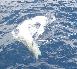
There is a level of excitement when catching any of these fish and sharks, but the exceptional catch raises that level.  This occurred a couple of days ago. We had something on the line and it was big – really big. Even the crew was yelling about its size.  I knew it was something special. As it got closer to the boat it was identified as a huge Tiger Shark (Galeocerdo cuvier). The crane operator was bringing the cradle and the science team was getting ready when ……it was gone. It had bitten through the line. I guess there always has to be that big one that got away.

The huge Tiger Shark that got away.

The huge Tiger Shark that got away.

The level of excitement rose again when the next day we caught a Great Hammerhead shark (Sphyrna mokarran). Any of the larger Hammerheads or Tiger Sharks are being fitted with a satellite tag. This is attached to their dorsal fin (the large fin on their back).  Whenever the shark comes to the surface, the tag will transmit its location via radio waves to a satellite. The satellite will then send the signal back down to a receiving antennae and on to various labs. This is a type of remote sensing that is commonly used to track animals.  It gives scientists  information about animal’s behavior and migration patterns. These particular satellite tags are from the Louisiana Department of Wildlife and Fisheries.  It is a collaborative effort to get the tags on as many sharks as possible so they can study where they go after being caught.

Satellite tag on Great Hammerhead

Attaching a satellite tag to the dorsal fin of a Great Hammerhead Shark.

While working with the scientists I noticed that they use a combination of metric units, maritime units and imperial units. The fish are measured in millimeters, the electronic scale measured in pounds (normally it measures in  kilograms, but there was a technical issue that required changing to pounds), the handheld scale measure in kilograms, the water current is measured in knots, the depth for the CTD is measured in meters, the distance is measured in nautical miles and the survey areas are divided by fathoms ( 1 fathom = 6 feet), just to name a few.  It is helpful to be familiar with all of them and be able to convert from one type of unit to another.  It has made me think that we should be practicing our metric conversions even more than we currently do in class.  So, my incoming freshmen, get ready.

Personal Log :

The time is passing so quickly here on the ship. I think that is because there is always something happening here.  My daily routine consists of rising around 7:30 am, grabbing a light breakfast and then going to see what the night shift is doing. Often times they are preparing to haul in the line and I can’t resist watching that.  I have an early lunch since my shift will begin at noon, but we are usually prepared to go before that time. For the next twelve hours we will set the line, run the CTD, haul in the line and move on to the next site. Dinner is at 17:00 ( 5:00 pm) but if we are busy we can request a plate be set aside for us.  The distance between sites can be anywhere from less than a nautical mile (nm) to over 60 nm.  The ship can travel about 10 knots depending upon the wind and the current. So, there are times when we have a number of hours between sites. On these occasions I check my email, work on my blog, edit my pictures or just stand on the deck and look out over the water.  I always have my eyes open for animals, but it isn’t often that I see any.  Just water as far as the eye can see.  It gives me a sense of the vastness of the ocean. And I am seeing lots of beautiful cloud features and sunsets.

A beautiful sunset over the Gulf of Mexico.

A beautiful sunset over the Gulf of Mexico.

I had the special privilege of getting a tour by the Chief Marine Engineer, Sean Pfarrer, of the engine room. It is very  loud down there so we had to wear ear plugs.  Sean pointed to different things and I took  pictures. Then upstairs, in the relative quiet of the galley, he took the time to explain to me the role of each component. We had a really interesting discussion. Any mechanical questions that arose after that, Sean was the one I’d go to.  When I return, anyone interested in mechanics can listen to my presentation of the engine room – it’s more interesting than you may think.

The two main engines of the Oregon II

The two main engines of the Oregon II

wind picks up

As the wind picks up the day team scurries to clean up and put gear away because it is too rough to fish. Amy and Cliff clean and rinse the deck.

Sharpnose Shark

Weighing a Sharpnose Shark. photo courtesy of David Seay.

satellite tag

A closer view of the satellite tag attached to the dorsal fin.

measuring shark

Kristin calls out measurements to Amy as Daniel and Eric help hold the shark still.

otoliths

A pair of otoliths from a Red Grouper (Epinephelus morio).

yellowedge grouper

The day team only caught one Yellowedge Grouper (Hyporthodus flavolimbatus). Photo courtesy of David Seay.

sharpnose shark

Teamwork is the key to the quick processing of this Sharpnose Shark. Amy, Daniel and I were done in no time. Photo courtesy of David Seay.

Liz Harrington: The Temporary Lull in the Action, August 21, 2013

NOAA Teacher At Sea
Liz Harrington
 Aboard NOAA Ship Oregon II
August 10 – 25, 2013

Mission : Shark/Red Snapper Bottom Longline
Geographical area of cruise: Western Atlantic Ocean and Gulf of Mexico
Date: August 21, 2013

Weather: current conditions from the bridge:
Partly cloudy
Lat. 29.18 °N  Lon. 84.06 °W
Temp. 75 °F (24 ° C)
Wind speed  10-15  mph
Barometer  30.04 in ( 1017.3 mb)
Visibility  10 mi

Science and Technology Log:

It has been just over a week now since I’ve been aboard the Oregon II.  The catch has not been as abundant as it was the first couple of days of fishing, but that tells the scientist something as well. So far I’ve experienced three water hauls – not one fish on any of the 100 hooks!  Even though we are not catching many fish (for now), the fishing will continue until it is time to return to port.  Don’t get me wrong, we are still catching fish, just not as many as we had been.  Occasionally we pull up something other than fish, like eels, skates, crabs or sea stars. This is called the bycatch. In the previous blog I explained how the line was set. In this one I’ll explain about the catch.

OLYMPUS DIGITAL CAMERA

“Fish On”. A Sandbar Shark is brought alongside the ship to be cradled.

crab as bycatch

This crab, part of the bycatch, wouldn’t let go of the bait.

preparing for haul back

Lead Fisherman Chris Nichols (right) and Fisherman Buddy Gould prepare to retrieve the high flyer.

Hauling in the line is similar to setting it out.  The fisherman handle the line and the science team process the fish. Our team includes a person manning the computer to keep track of the hook numbers and the condition of any remaining bait;  a person “racking” (carefully but quickly returning the gangions into the storage barrels); and a “data” person to write down information about each fish, and the rest of the team will be “wranglers” (those who handle the catch).  We all rotate through the jobs.  I like to be a wrangler, but the racker and computer folks get a nice view of the fish being brought on board.  Everything we catch is brought on board, weighed and measured.

tagging Tiger Shark

The Day Team tagging a Tiger Shark

Many species of sharks are tagged and a fin clip is taken to obtain its DNA.  They are given an injection of a chemical which will help to age the shark if it is caught again.  The entire process only takes a few minutes because they are trying to get the sharks back into the water as soon as possible. The scientists and crew are all very conscientious about doing what is best for the marine life.  What’s really nice is that we all take turns tagging the sharks.  It is just so exciting to be up close to them, especially the big ones. You can feel the strength and power beneath that sandy skin.

weighing a shark

Sometimes sharks are too heavy for the handheld scale, so they are hoisted up to be weighed. Notice the scientist to the right to get sense of its weight.

processing fish

Kristin and Cliff find otoliths at the end of the rainbow.

The boney fish that are caught are also weighed and measured. After the haul back (when the line is in, gangions are stored, high flyers returned and deck hosed down), they are brought to the back of the ship to have otoliths removed and tissue samples taken. The otoliths are boney structures in the fish’s inner ear which are sensitive to gravity and acceleration. As the fish grows, each year a new layer is added to the otoliths – similar to tree rings. By examining the otoliths under a microscope its age can be determined. I was taught how to remove the otoliths, so now (given enough time – I need plenty) I can help process the fish. Learn more about the procedure here.

Personal Log

stateroom

I have the bottom bunk in stateroom #5

It has been easy for me to acclimate to life aboard the ship because all of the people are so friendly and interesting.  The ship is always rocking but I don’t even notice it any more. It actually lulls me to sleep at night, along with the constant sound of the engine and particularly the gurgling sound of the water moving along the hull (frame of ship). I was a little worried that I might get seasick in the beginning of the cruise, but I didn’t. The only problem I had was that reading or working on the computer made me queasy, but that only lasted for a couple of days.  Quarters are tight, but they make good use of all of the space. Most of the bedrooms (called staterooms) sleep two people. We all eat in a room called the galley. It only holds twelve people at a time, so when we are done eating we leave to make room for someone else. The food on board is delicious and abundant. The chief steward, Walter Coghlan, does a great job providing a variety of choices. There is literally something for everyone.  If we have free time, there is a lounge area with a huge selection of movies.

I like to spend my free time out on the decks, if I can find a place in the shade and the breeze. I love to look out over the water. And the sky stretches from horizon to horizon in all directions, something I don’t see in the mountains of Vermont.  The cumulus clouds develop during the day and I can usually see a thunderstorm somewhere by late afternoon. It’s a beautiful view.  Yesterday we were visited briefly by a small group of dolphins. Their acrobatics were very entertaining. They were here and then gone. That seems to be the continuing theme here; you never know what you are going to see.

Dolphin visit

A small group of dolphins swim along side the ship.

thunderstorm

A distant passing thunderstorm.

Did you know?  The ship makes it own fresh water from the sea water.  There is a reverse osmosis desalination system located down in the engine room. The fresh water is stored in large tanks, so it is always available.

volunteers await a haul

Volunteers Micayla, Daniel, David and Cliff waiting to do some wrangling.

New Term

Foul Hook – when a fish is hooked in a place other than its mouth (ie -fin or body)

More examples of bycatch.

clearnose skate

Clearnose Skate

little tunny

Micayla holds a Little Tunny (yes, that’s it’s real name)

yellowedge grouper

Yellowedge Grouper ready for processing

sea star

Sea Star

Liz Harrington: Let’s Go Fishing! August 17, 2013

NOAA Teacher At Sea
Liz Harrington
 Aboard NOAA Ship Oregon II
August 10 – 25, 2013

Mission : Shark/Red Snapper Bottom Longline
Geographical area of cruise: Western Atlantic Ocean and Gulf of Mexico
Date: Aug 17, 2013

Weather: current conditions from the bridge:
Partly cloudy, scattered showers and thunder storms
Lat. 27.19 °N  Lon. 84.38 °W
Temp. 92 °F ( 33.4° C)
Wind speed   10-15 knots
Barometer  30.1 in  (1015 mb)
Visibility  10 mi
Sea temp  83 ° F   (28.8  ° C)

Science and Technology Log

We have arrived at the survey sites, the fishing has begun and I’m having the time of my life! The process is a collaborative effort between the science team and the crew of the ship.  In upcoming blogs I’ll focus on all the different people on board the ship and their roles, but I’d like to first tell you about the fishing from my perspective as part of the science team. The science team consists of four scientists and seven volunteers. We are divided into day shift (noon to midnight) and night shift (midnight to noon). I am assigned to the day shift.

I was told that about a mile of line with 100 hooks would be let out and weighted to stay close to the bottom.  I was interested to see how they could let the line out and haul it back in again without all those hooks getting tangled. Well, I learned that the hooks are removable.  The hooks are attached to one end of a 12 foot section of line. The other end holds a snap. This set up is called a gangion.  The gangions are snapped onto the longline as it is let out and taken off the line as it is reeled in.  They are stored in a very orderly way to avoid tangles, although an occasional tangle does occur.  As the ship is approaching a designated site we prepare for setting the line. This is done from the rear of the ship, called the stern.

gangion

Parts of a gangion

baited gangions

Gangions baited and ready to set

We bait the hooks and decide on job assignments.  The jobs that need to be done while setting the line are “Data” (manning the computer to keep a count of the gangions that are put on the line); “High Flyer” (throwing out the buoys that will mark the beginning and end of the line); “Slinger” (throwing the baited hook over the edge of the ship and holding the other end of the gangion to receive a numbered tag); and “Numbers” (snapping numbered tags on to the gangions).  The weather conditions and the speed of the current must be checked before the final approval is given to set the line.  When the signal is given our team gets to work.

high flyer

Skilled fisherman Chuck Godwin and I get ready to put out the high flyer

High Flyers mark each end of the longline

High Flyers mark each end of the longline

slinging

Lead scientist for this trip, Kristin Hannan, slinging while we set out the line. The bait is Atlantic Mackerel.

After the line is set and the work station is cleaned up (that bait can get a little messy!), a CTD is deployed to gather data on the water – Conductivity (a measure of salinity), Temperature and Depth. The CTD also measures the dissolved oxygen in the water – remember that fish breathe by absorbing oxygen from the water as it runs over their gills.

An hour after the last high flyer is set, the line is hauled in. This is done from the bow (the front deck of the ship). During this part of the process I am full of anticipation as we wait to see what each hook holds. It might be a light catch with a couple of fish or it might be a very busy catch.  When the crew yells “fish on”, the action begins. Anything that is caught is brought on board and data is collected (more on this later). If it is too big to be pulled in, then it is lifted into a cradle and worked on along the side of the ship. The crew will determine if cradling is needed and will shout out “hard hats”, as we all need to be wearing hard hats when the crane is being used to move the cradle. In our first two days of fishing, the day shift has cradled five sharks. It is so exciting to be next to such a big, beautiful creature.

The final step to the fishing process is clean up. Our gear is put away, the deck is hosed down (using salt water, as fresh water is in precious on a ship), numbers are checked for proper order and damaged gangions are repaired. If there were fish caught that require dissection, this would be done now as well. In the meantime, Oregon II steams on to the next survey site.  So, you can see that the ship is a busy place 24 hours a day.

repairing or replacing worn gangions

Members of the day shift science team repair gangions after a recent haul. Foreground- Micayla and Cliff, volunteers. Background – Amy Schmidt, scientist.

Personal Log

I am having so much fun on the Oregon II. The work is really interesting and the people have been fantastic.  Not only has everyone on board been very friendly and helpful, but they have really made me feel like a member of the team. Right from the start we were trained for the various jobs and expected to do them, with lots of help and encouragement always available. I initially thought I’d be more of an observer, but that is not the case at all.  All of the volunteers are actively involved in every aspect of the fishing routine.

sharpnose shark

Here I am taking measurements on a Sharpnose Shark

I find it fascinating that people from all over the country have come together to cross paths here aboard a ship in the Gulf of Mexico. In future blogs I’d like to highlight some of their stories, but for now there is work to be done (although I’m not to the point where I can call this work. It’s way too much fun!)

New Terms

Shark Burn – the abrasion received when a wiggling shark rubs against your skin.

Water Haul – nothing at all is caught during a set.

night shark

Daniel, volunteer, prepares to release a Night Shark

removing hook

Removing a hook from a cradled Sandbar shark

CTD

Micayla and Cliff stabilize the CTD during deployment.

data collection

Micayla logs hook numbers as line is let out.

Julie Karre: Back to My Reality, August 12, 2013

NOAA Teacher at Sea
Julie Karre
Aboard NOAA Ship Oregon II
July 26 – August 8, 2013  

Mission: Shark and Red snapper Longline Survey
Geographical Range of Cruise: Atlantic
Date: Monday August 12, 2013

Weather Data from the Bridge
Sadly, I don’t know because I’m not there anymore.

The sunset on the last night. Exquisite. Photo Credit: Holly Perryman

The sunset on the last night. Exquisite. Photo Credit: Holly Perryman

Post-Cruise Log

I have been back on land for three days now and all I want to talk about are my adventures aboard the Oregon II. I miss everyone I met and hope that we all remain friends. But now that I am not in the moment and experiencing the adrenaline rush of handling sharks, I have time to think about all that I have learned and how I will make this experience valuable to my students. Because, while it was a true honor and privilege to have been aboard the Oregon II for two weeks, the real honor and privilege of my life is spending 10 months with students of Baltimore City Public Schools. And they matter the most right now.

I begin school in two weeks. Two weeks from now I will be standing in my classroom setting up what I hope to be a remarkable year of learning with 40 or so 7th graders and 40 or so 8th graders. Just picturing their faces coming through the door and the hugs and the squeals of delight as we get excited about seeing each other makes me the happiest version of myself.

My Armistead Gardens 7th graders received homemade cookies as a New Years Gift. I look forward to seeing them for a new year beginning August 26th.

My Armistead Gardens 7th graders received homemade cookies as a New Years Gift. I look forward to seeing them for a new year beginning August 26th.

IMG_0914

So what am I going to do with this experience? How will I make two of the most meaningful weeks of my life meaningful for kids who were not involved? How will I make what was mine, theirs?

Those are the questions that bounce around in my head all of the time now. No amount of blog writing and sharing pictures on Facebook matters if I don’t do this justice to those kids. And in the meantime, I would really like to make the people who made this possible proud. From the NOAA employees who run Teacher at Sea to the crew and scientists on the Oregon II to the volunteers who cheered me on and supported me to my parents who watched my dog, I want to make them proud.

So the brainstorming begins and this is where it starts. Over the course of the cruise, I kept track of our latitude and longitude at 11am each day and at each of our stations. During a 1-2 week unit during my Ecosystems In and Out of Balance semester of study, we will be using the research from my cruise to celebrate Shark Week – Armistead Gardens Style. We will begin by plotting the course of the Oregon II from July 26 to August 8. We will study the written descriptions of the shark species I encountered and see if we can match them with pictures. We will hypothesize how the flow of energy works in the marine ecosystems where these sharks are found – will the students guess that some of the big sharks eat some of the little sharks? I didn’t know that. Then we will begin to study what struggles these species encounter in an out-of-balance ecosystem – things like fishing and hypoxia and oil spills.

Beyond the marine science, we will look at who makes marine science possible. I cannot wait to share with these students the opportunities that abound in marine careers, from becoming a scientist like Kristin to driving a ship like Rachel.

This is just a beginning and I look forward to sharing the final product as I continue to develop it.

Thank you so much to everyone who followed my adventure. Thank you so much to everyone who made this possible. I will not let you down.

The volunteers from the first leg take their leave of the Oregon II and head back to their other lives. Photo Credit: Amy Schmitt

The volunteers from the first leg take their leave of the Oregon II and head back to their other lives. Photo Credit: Amy Schmitt

And now I am home with my lovely dog, Maddox.

And now I am home with my lovely dog, Maddox.


Animals Seen Over Two Weeks

Atlantic Sharpnose Shark

I handle an Atlantic Sharpnose in one of my last hauls aboard the ship. Photo Credit: Claudia Friess

I handle an Atlantic Sharpnose in one of my last hauls aboard the ship. Photo Credit: Claudia Friess

Blacknose Shark

Nurse Shark

Scalloped Hammerhead

Bull Shark

Sandbar Shark

Night Shark

Silky Shark

Ribbonfish

IMG_0977

A ribbonfish makes an appearance. Quite the face it has.

A ribbonfish makes an appearance. Quite the face it has.

Grouper

Red Snapper

Black Sea Bass

A black sea bass makes a guest appearance in one of the final hauls on the Oregon II's first leg.

A black sea bass makes a guest appearance in one of the final hauls on the Oregon II’s first leg. Photo Credit: Claudia Friess

Sea Turtles

Dolphins

Pilot Whales

Mahi Mahi

Mahi Mahi swim along as the night shift brings in the line. Photo Credit: Holly Perryman

Mahi Mahi swim along as the night shift brings in the line. Photo Credit: Holly Perryman

Sea stars

Jelly fish

Sea Pansy