Heavy rain has finally come to an end over the southeastern U.S. but river flooding will continue to be a concern over the next few days. To the north, precipitation over portions of the Midwest, Ohio Valley and Mid-Atlantic will wind down late Tuesday into Wednesday. Snow will move into the Northeast late Tuesday and is expected to continue through Thursday.
Read More...
These images show the most recent image of the United States, from NOAA geostationary (GOES) satellites. They are generated every 30 minutes using either the Visible, Infrared, Shortwave Infrared (4um), or the Water Vapor images into one larger composite image using GOES East and West Imagers.
Other Areas: Alaska | Hawaii | Guam | Puerto Rico | American Samoa

This image is taken in the infrared band of light and show relative warmth of objects. Colder objects are brighter and warmer objects are darker. Lower layers of clouds, generally warmer and lower in altitude, are colored gray. Colder and generally higher clouds tops are highlighted in colors. Infrared imagery is useful for determining cloud features both at day and night.

This image is taken in visible light, or how the human eye would see from the satellite. Sunrise and set can be tracked in this image.
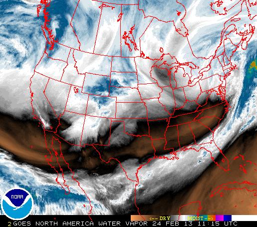
This image is taken using a wavelength sensitive to the content of water vapor in the atmosphere. Bright and colored areas indicate high water vapor (moisture) content (colored and white areas indicate the presence of both high moisture content and/or ice crystals). Black and brown areas indicate little or no moisture present. Water vapor imagery is useful for both determining locations of moisture and atmospheric circulations.

This infrared image of Alaska is normally updated every 30 minutes.

This infrared image of Hawaii is normally updated every 30 minutes.

This infrared image of Guam is normally updated every 30 minutes.

This infrared image of Puerto Rico is normally updated every 30 minutes.

This infrared image of American Samoa is normally updated every 30 minutes.


