Maps and Data - BioFuels Atlas
Find maps and charts showing transportation data and trends related to alternative fuels and vehicles.
OR
Sort by:
130 results
-
Fuels & Infrastructure: Idle Reduction
-
-
Truck Stop Electrification Sites
Trend of TSE sites by state from 2006-2014 Last update August 2015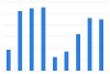
-
-
-
Truckstop Electrification Facilities
Last update May 2013
-
-
Fuels & Infrastructure: Emissions
-
-
U.S. Greenhouse Gas Emissions by Economic Sector
Last update August 2015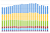
-
-
-
U.S. Life Cycle Greenhouse Gas Emissions of Biofuels
Comparison of greenhouse gas emissions from biofuels, developed by the EPA for Renewable Fuel Standard 2 rule Last update February 2010
-
-
Regulated Fleets: State & Alt Fuel Providers
-
-
Vehicle Credits Traded by Regulated Fleets
Trend of S&FP EPAct credits traded and transactions from 1997-2015 Last update August 2016
-


BioFuels Atlas is an interactive map that allows users to view and compare the locations of biomass feedstocks, biofuels production facilities, bioenergy plants, biofuels stations, and densities of vehicles that can run on biodiesel or E85. Users can select from and apply biomass data layers to customize maps according to their needs. BioFuels Atlas was developed by the National Renewable Energy Laboratory with funding from the DOE Bioenergy Technologies Office.
Print