Maps and Data
Find maps and charts showing transportation data and trends related to alternative fuels and vehicles.
OR
Sort by:
13 results
-
-
ARRA Electrification Projects
Last update November 2012
-
-
-
BioFuels Atlas
BioFuels Atlas is an interactive map for comparing biomass feedstocks and biofuels by location. This tool helps users select from and apply biomass data layers to a map, as well as query and download biofuels and feedstock data. The state zoom function summarizes state energy use and infrastructure for traditional and bioenergy power, fuels, and resources. The tool also calculates the biofuels potential for a given area. BioFuels Atlas was developed by the National Renewable Energy Laboratory with funding from the DOE Biomass Program.
-
-
-
Daily Truck Freight Tons
Last update February 2013
-
-
-
TransAtlas
TransAtlas is an interactive map that uses a Google Maps interface to display: Existing and planned alternative fueling stations Alternative fuel production facilities Light-duty vehicle density Roads and political boundaries Users can customize the map display and print and query the underlying data. TransAtlas is part of a suite of geographic analysis tools for renewable energy developed at the National Renewable Energy Laboratory.
-
-
-
U.S. Alternative Fueling Stations by Fuel Type
Download station data for a variety of alternative fuels. Last update September 2016
-


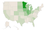


The U.S. Department of Energy funded multiple electrification projects through the American Recovery and Reinvestment Act to accelerate the deployment of electric drive vehicles and charging equipment. These included Clean Cities electric drive projects and transportation electrification projects. Use the interactive map above to learn more about the plan and status of the various projects.
Print