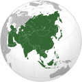
File:Asia (orthographic projection).svg
From Wikipedia, the free encyclopedia
Asia_(orthographic_projection).svg (SVG file, nominally 541 × 541 pixels, file size: 161 KB)
File history
Click on a date/time to view the file as it appeared at that time.
| Date/Time | Thumbnail | Dimensions | User | Comment | |
|---|---|---|---|---|---|
| current | 22:43, 20 September 2012 |  | 541 × 541 (161 KB) | Chipmunkdavis | Given that Eastern Thrace isn't included Papua needn't be included either. |
| 06:32, 14 September 2012 |  | 541 × 541 (175 KB) | Palosirkka | Added Papua per request | |
| 20:18, 12 September 2012 |  | 541 × 541 (161 KB) | Palosirkka | Scrubbed with http://codedread.com/scour/ | |
| 03:11, 13 April 2011 |  | 541 × 541 (594 KB) | Wsiegmund | Reverted to version as of 03:26, 12 March 2011; last stable version. | |
| 02:37, 13 April 2011 |  | 541 × 541 (194 KB) | Gerge | Reverted to version as of 06:07, 12 April 2011 | |
| 23:14, 12 April 2011 |  | 541 × 541 (594 KB) | Green, White and Gold | Reverted to Dbachmann's version as of 20:34, 9 April 2011 | |
| 06:07, 12 April 2011 |  | 541 × 541 (194 KB) | Gerge | Reverted to version as of 20:41, 9 April 2011 | |
| 00:56, 12 April 2011 |  | 541 × 541 (594 KB) | Green, White and Gold | Reverted to Dbachmann's version as of 20:34, 9 April 2011 | |
| 20:41, 9 April 2011 |  | 541 × 541 (194 KB) | ComtesseDeMingrelie | rv. to a stable version found throughout articles | |
| 20:34, 9 April 2011 |  | 541 × 541 (594 KB) | Dbachmann | Reverted to version as of 12:15, 8 April 2011 | |
| 18:52, 8 April 2011 |  | 541 × 541 (194 KB) | ComtesseDeMingrelie | Reverted to version as of 01:06, 5 April 2011 | |
| 12:15, 8 April 2011 |  | 541 × 541 (594 KB) | Chipmunkdavis | Revert to stable Caucasus mountains | |
| 01:06, 5 April 2011 |  | 541 × 541 (194 KB) | ComtesseDeMingrelie | Reverted to version as of 19:45, 4 April 2011 | |
| 20:45, 4 April 2011 |  | 541 × 541 (594 KB) | Green, White and Gold | Reverted to version as of 03:26, 12 March 2011 Revert POV | |
| 19:45, 4 April 2011 |  | 541 × 541 (194 KB) | ComtesseDeMingrelie | consistent with other pages | |
| 18:44, 4 April 2011 |  | 541 × 541 (594 KB) | Green, White and Gold | Reverted to version as of 03:26, 12 March 2011 | |
| 04:52, 3 April 2011 |  | 541 × 541 (194 KB) | ComtesseDeMingrelie | corrected Phasis riverbank | |
| 03:26, 12 March 2011 |  | 541 × 541 (594 KB) | Luthfi94 | Reverted to version as of 22:17, 15 November 2009 | |
| 03:24, 12 March 2011 |  | 541 × 541 (579 KB) | Luthfi94 | Reverted to version as of 08:41, 15 March 2009 | |
| 22:17, 15 November 2009 |  | 541 × 541 (594 KB) | Shibo77 | File:Location_Asia.svg | |
| 08:41, 15 March 2009 |  | 541 × 541 (579 KB) | Koyos | {{Information |Description={{en|1=orto}} |Source=Own work by uploader |Author=Koyos |Date= |Permission= |other_versions= }} <!--{{ImageUpload|full}}--> Category:Ortographic projections |
File usage
More than 100 pages link to this file. The following list shows the first 100 page links to this file only. A full list is available.
- Afghanistan
- Ajman
- Americas
- Andaman and Nicobar Islands
- Andhra Pradesh
- Asia
- Asian American
- Association of Southeast Asian Nations
- Atlantis
- Azad Kashmir
- Azerbaijan
- Balochi language
- Balochistan, Pakistan
- Bangladesh
- Brunei
- Burma
- Caucasus
- Central Asia
- Chhattisgarh
- China
- Christmas Island
- Cocos (Keeling) Islands
- Cyprus
- Europe
- Gaza Strip
- Haryana
- Himachal Pradesh
- Hmong people
- Hong Kong
- Indochina
- Indonesia
- Iran
- Islamabad Capital Territory
- Jammu and Kashmir
- Kalahari Desert
- Karachi
- Karnataka
- Kazakhstan
- Korea
- Kurdistan
- Lahore
- Laos
- Laurasia
- Lebanon
- List of sovereign states and dependent territories by continent
- Macau
- Maharashtra
- Maldives
- Middle East
- Mongolia
- North America
- North Korea
- Oceania
- Old World
- Oman
- Pakistan
- Philippines
- Puducherry
- Punjab, Pakistan
- Rajasthan
- Region
- Rodinia
- Russia
- Shanghai
- Sikkim
- Sindh
- Singapore
- South America
- South Korea
- Soy sauce
- Sri Lanka
- Supercontinent
- Taiwan
- Tajikistan
- Terra Australis
- Thailand
- Tibet Autonomous Region
- United Arab Emirates
- Uzbekistan
- West Bengal
- Talk:Arabic language
- Talk:Asia
- Talk:Bread
- Talk:China
- Talk:Cyprus
- Talk:Gaza Strip
- Talk:Georgia (country)
- Talk:Gulf War
- Talk:Imperialism in Asia
- Talk:Israel
- Talk:Japan
- Talk:Malaysia
- Talk:Musa (genus)
- Talk:Nostratic languages
- Talk:Palestine
- Talk:Palestinian National Authority
- Talk:Palestinian territories
- Talk:Syria
- Talk:Taiwan
- Talk:The Bible and history
Global file usage
The following other wikis use this file:
- Usage on af.wikipedia.org
- Usage on am.wikipedia.org
- Usage on ang.wikipedia.org
- Usage on an.wikipedia.org
- Usage on ar.wikipedia.org
- آسيا
- أوروبا
- قارة
- أستراليا
- أنتاركتيكا
- أوقيانوسيا
- أمريكا الشمالية
- بوابة:اليابان
- أمريكا الجنوبية
- أوراسيا
- أطلانطس
- أمريكيتان
- بانجيا
- قارة عظمى
- غندوانا
- بوابة:اليابان/بوابات شقيقة
- أفرو-أوراسيا
- نقاش ويكيبيديا:بلد الأسبوع
- قالب:معلومات قارة
- قالب:معلومات قارة/شرح
- أستراليا (قارة)
- أفريقيا
- بوابة:روسيا
- القارات في العصر الجوراسي
- بوابة:أوقيانوسيا
- بوابة:أوقيانوسيا/بوابات شقيقة
- قالب:قارات العالم
- أطلانتيكا
- قارة غارقة
- أركتيكا
- آسيامريكا
- بانجيا الأخرى
- أماسيا (قارة)
View more global usage of this file.


