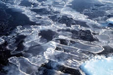
- ablation
- (1) combined processes (such as sublimation, fusion or melting, evaporation) which remove snow or ice from the surface of a glacier or from a snow-field; also used to express the quantity lost by these processes (2) reduction of the water equivalent of a snow cover by melting, evaporation, wind and avalanches.

Russian translation prepared by Nina A. Zaitseva for the Arctic Climatology Project Arctic Meteorology and Climate Atlas.
- ablation area
- the area of a glacier where more glacier mass is lost than gained.
- ablation hollows
- depressions in the snow surface caused by the sun or warm, gusty wind.
- ablation moraine
- mound or layer of moraine in the ablation zone of a glacier; the rock has been plucked from the mountainside by the moving glacier and is melting out on the ice surface.
- ablation season
- period during which glaciers lose more mass than they gain; usually coincides with summer.
- ablation zone
- area or zone of a glacier where snow and ice ablation exceed accumulation.
- absolute difference
- the difference, taken without regard to sign, between the values of two variables
- absolute error
- the difference between the measured or inferred value of a quantity and its actual value.
- absolute humidity
- (1) the ratio of the mass of water vapor to the volume occupied by a mixture of water vapor and dry air (2) mass of water contained in a unit volume of moist air.
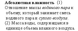
Russian translation prepared by Nina A. Zaitseva for the Arctic Climatology Project Arctic Meteorology and Climate Atlas.
- accretion
- growth of a cloud or precipitation particle by the collision and union of a frozen particle (ice crystal or snowflake) with a super-cooled liquid droplet which freezes on impact.

Russian translation prepared by Nina A. Zaitseva for the Arctic Climatology Project Arctic Meteorology and Climate Atlas.
- accumulation
- all processes by which snow or ice are added to a glacier, this is typically the accumulation of snow, which is slowly transformed into ice; other accumulation processes can include avalanches, wind-deposited snow, and the freezing of rain within the snow pack.
- accumulation area
- area of a glacier where more mass is gained than lost.
- accumulation season
- period during which a glacier gains more mass than it loses; usually coincides with winter.
- accumulation zone
- area of a glacier where more mass is gained than lost.
- accuracy
- the extent to which the readings of an instrument approach the true value of the calculated or measured quantities, supposing that all possible corrections are applied.
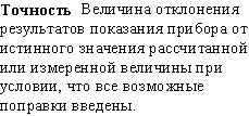
Russian translation prepared by Nina A. Zaitseva for the Arctic Climatology Project Arctic Meteorology and Climate Atlas.
- acid precipitation
- rain or snow containing acidic substances, resulting from the atmospheric pollution mainly with sulfur and nitrogen; acid precipitation has a lower pH than unpolluted rain.

Russian translation prepared by Nina A. Zaitseva for the Arctic Climatology Project Arctic Meteorology and Climate Atlas.
- active air-cooled thermal pile
- a foundation pile on which a cold air refrigeration system has been installed to remove heat from the ground.
- active construction methods in permafrost
- special design and construction methods used for engineering works in permafrost areas where permafrost degradation cannot be prevented.
- active ice wedge
- an ice wedge that is growing as a result of repeated (but not necessarily annual) winter cracking.
- active layer
- the layer of ground that is subject to annual thawing and freezing in areas underlain by permafrost; also known as seasonal frost.
- active liquid refrigerant pile
- a foundation pile on which a liquid coolant refrigeration system has been installed to remove heat from the ground.
- active rock glacier
- a mass of rock fragments and finer material, on a slope, that contains either an ice core or interstitial ice, and shows evidence of present movement.
- active thermokarst
- the process by which characteristic landforms are currently developing as a result of thawing of ice-rich permafrost or melting of massive ice.
- active-layer failure
- a general term referring to several forms of slope failures or failure mechanisms commonly occurring in the active layer overlying permafrost.
- active-layer thickness
- the thickness of the layer of the ground that is subject to annual thawing and freeing in areas underlain by permafrost.
- adfreeze strength
- the tensile or shear strength which has to be overcome to separate two objects that are bonded together by ice.
- adfreeze/adfreezing
- the process by which two objects are bonded together by ice formed between them.
- advance
- when a mountain glacier's terminus extends farther downvalley than before; glacial advance occurs when a glacier flows downvalley faster than the rate of ablation at its terminus.
- advection
- the horizontal transfer of air mass properties by the velocity field of the atmosphere.

Russian translation prepared by Nina A. Zaitseva for the Arctic Climatology Project Arctic Meteorology and Climate Atlas.
- advection fog
- fog which forms in the lower part of a warm moist air mass moving over a colder surface (land or water).

Russian translation prepared by Nina A. Zaitseva for the Arctic Climatology Project Arctic Meteorology and Climate Atlas.
- aerosol
- non-gaseous substances, divided into solid particles or liquid droplets, held in suspension in the atmosphere.

Russian translation prepared by Nina A. Zaitseva for the Arctic Climatology Project Arctic Meteorology and Climate Atlas.
- aggradational ice
- the additional ground ice formed as a direct result of permafrost aggradation.
- air freezing index
- the cumulative number of degree-days below 0° C for the air temperature during a given time period.
- air mass
- an extensive body of the atmosphere in which physical properties, particularly temperature and humidity, exhibit only small and continuous differences in the horizontal plane; it may extend over an area of several million square kilometers and over a height of several kilometers.

Russian translation prepared by Nina A. Zaitseva for the Arctic Climatology Project Arctic Meteorology and Climate Atlas.
- air temperature
- the ambient temperature indicated by a thermometer exposed to the air but sheltered from direct solar radiation, or placed in an instrument shelter 1.5 to two meters above ground; also called surface temperature.
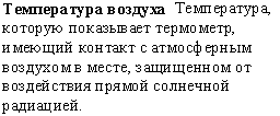
Russian translation prepared by Nina A. Zaitseva for the Arctic Climatology Project Arctic Meteorology and Climate Atlas.
- air thawing index
- the cumulative number of degree-days above 0°C for the air temperature during a given period.
- alas/alass
- a large depression of the ground surface produced by thawing of a large area of very thick and exceedingly ice-rich permafrost.
- albedo
- a non-dimensional, unitless quantity that measures how well a surface reflects solar energy; ranges from 0 - 1; a value of 0 means the surface is a “perfect absorber,” where all incoming energy is absorbed, a value of 1 means the surface is a “perfect reflector,” where all incoming energy is reflected and none is absorbed.
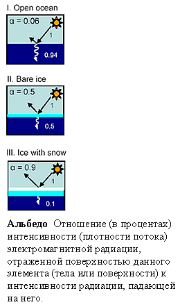
(Top) Schematic demonstrating how sea ice and snow-covered sea ice alter surface albedo. (Bottom) Russian translation prepared by Nina A. Zaitseva for the Arctic Climatology Project Arctic Meteorology and Climate Atlas.
- Alberta low
- a low centered on the eastern slope of the Canadian Rockies in the province of Alberta, Canada.

Russian translation prepared by Nina A. Zaitseva for the Arctic Climatology Project Arctic Meteorology and Climate Atlas.
- Aleution low
- the low pressure center located near the Aleutian Islands on mean charts of sea level pressure during the winter; it represents one of the main centers of action in the atmospheric circulation of the northern hemisphere.

Russian translation prepared by Nina A. Zaitseva for the Arctic Climatology Project Arctic Meteorology and Climate Atlas.
- alpine
- refers to high mountain areas above the timber line (where trees cease to inhabit extremely cold environments).
- alpine glacier
- a glacier that is confined by surrounding mountain terrain; also called a mountain glacier.

Muddy River Glacier carves its way through forested mountains near Frederick Sound in southeast Alaska. Typical of mountain glaciers, it is constrained on all sides by mountainous terrain. (Photo courtesy of U. S. Navy. Archived at the World Data Center for Glaciology, Boulder, CO.)
- alpine layers
- annual accumulations of snow and dust on a glacier.
- altitudinal limit of permafrost
- the lowest altitude at which mountain permafrost occurs in a given highland area outside the general permafrost region.
- altitudinal zonation of permafrost
- the vertical subdivision of an area of mountain permafrost into permafrost zones, based on the proportion of the ground that is perennially cryotic.
- altocumulus
- a principal middle level cloud type (cloud genus), white or gray, or both white and gray, which occurs as a layer or patch with a wave aspect, the elements of which appear as laminae, rounded masses, rolls, etc; these elements usually are sharply outlined, but they may become partly fibrous or diffuse; they may or may not be merged, and they generally have shadowed parts; most of the regularly arranged altocumulus elements have an apparent width of 1 - 5 degrees.
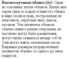
Russian translation prepared by Nina A. Zaitseva for the Arctic Climatology Project Arctic Meteorology and Climate Atlas.
- altostratus
- a principal middle level cloud type (cloud genus) in the form of a grayish (gray) or bluish cloud sheet or layer of striated, fibrous, or uniform appearance, totally or partly covering the sky; the layer has parts thin enough to reveal the position of the sun; halo phenomena do not usually occur.

Russian translation prepared by Nina A. Zaitseva for the Arctic Climatology Project Arctic Meteorology and Climate Atlas.
- anabatic wind
- any wind blowing up a steep incline or mountain; the opposite of katabatic wind.
- analysis
- in synoptic meteorology, a detailed study of the state of the atmosphere over a particular region based on the actual observations.
Russian translation prepared by Nina A. Zaitseva for the Arctic Climatology Project Arctic Meteorology and Climate Atlas.
- anchor ice
- submerged ice which is attached to the bottom.
- anemometer
- an instrument which measures wind speed or wind speed and direction; a cup anemometer measures the wind speed from the speed of rotation of a windmill which consist of 3 or 4 hemispherical or conical cups, each fixed to the ends of horizontal arms attached to a vertical axis; a byram anemometer is a variety of the cup anemometer; a counting anemometer has cups or a fan whose rotation is transmitted to a technical counter which integrates directly the air movement speed; a hand anemometer is small portable anemometer held at arm's length by an observer making a wind speed measurement; a pressure tube anemometer (dines anemometer) is an instrument which derives wind speed from measurements of the dynamic wind pressures - wind blowing into a tube develops a pressure greater than the static pressure, while wind blowing across a tube develops a pressure less than the static, this pressure difference is proportional to the square of the wind speed.

Russian translation prepared by Nina A. Zaitseva for the Arctic Climatology Project Arctic Meteorology and Climate Atlas.
- anemorumbograph
- a Russian anemograph (recording anemometer) which is equipped with a device to record the wind direction in addition to wind speed.
Russian translation prepared by Nina A. Zaitseva for the Arctic Climatology Project Arctic Meteorology and Climate Atlas.
- anemorumbometer
- a Russian anemometer combined with a vane to determine the wind direction.
Russian translation prepared by Nina A. Zaitseva for the Arctic Climatology Project Arctic Meteorology and Climate Atlas.
- aneroid barometer
- an instrument for measuring atmospheric pressure; it is constructed on the following principles: an aneroid capsule (vidie capsule, which is a thin, disk-shaped box or capsule, usually metallic) is partially evacuated of gas, and is restrained from collapsing by an external or internal spring; the deflection of the spring will be nearly proportional to the difference between the internal and external pressures; magnification of the spring deflection is obtained both by connecting capsules in series and by mechanical linkages.
Russian translation prepared by Nina A. Zaitseva for the Arctic Climatology Project Arctic Meteorology and Climate Atlas.
- anomaly
- deviation of a meteorological quantity value in a given region from the normal (mean) value for the same period.

Russian translation prepared by Nina A. Zaitseva for the Arctic Climatology Project Arctic Meteorology and Climate Atlas.
- antarctic circle
- the line of latitude 66° 34′ S (often taken as 66.5° S); along this line the sun does not set on the day of the summer solstice, and does not rise on the day of the winter solstice.
- antarctic polar front
- also known as the antarctic convergence; the southern front of the antarctic circumpolar current that separates the antarctic zone in the south from the polar frontal zone in the north; taken by many to delineate the actual northern boundary of the antarctic zone; characterized by sea surface temperatures near 5°–6° C and a salinity minimum of 33.8–34.0 psu produced by high rainfall.
- antarctic zone
- the region between the antarctic circle (66° 34′ S) and the South Pole; climatically, the limit of the zone may be set at about 60° S, poleward of which the prevailing westerly winds give place to easterly or variable winds; over most of this region the average temperature does not rise above 0°C (32°F) even in summer.
- anti-icing
- the prevention of ice accumulation of aircraft, ships and other objects; the most common measures are heating or applying a dressing by brush or spray to weaken adhesion and facilitate removal.
- anti-syngenetic ice wedge
- an ice wedge that grows progressively downwards into a receding slope, in a direction normal (perpendicular) to the surface.
- anticyclone
- area of increased atmospheric pressure relative to surrounding pressure field in the atmosphere; it is outlined by closed isobars on a synoptic surface chart, and by closed contours on a constant-pressure chart; this term is used interchangeably with high.
- anticyclone
- area of increased atmospheric pressure relative to surrounding pressure field in the atmosphere; outlined by closed isobars on a synoptic surface chart, and by closed contours on a constant-pressure chart; used interchangeably with high..
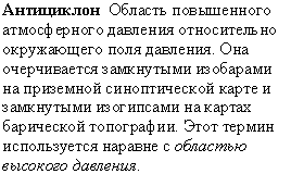
Russian translation prepared by Nina A. Zaitseva for the Arctic Climatology Project Arctic Meteorology and Climate Atlas.
- anticyclonic circulation
- system of air movements (atmospheric circulation) associated with an anticyclone, which is clockwise in the northern hemisphere and counter-clockwise in the southern hemisphere.
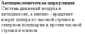
Russian translation prepared by Nina A. Zaitseva for the Arctic Climatology Project Arctic Meteorology and Climate Atlas.
- apparent head capacity
- the amount of heat required to raise the temperature of a unit mass of frozen ground by one degree.
- approximate freezing index
- the cumulative number of degree-days below 0 degrees Celsius for a given time period, calculated from the mean monthly temperatures for a specific station without making corrections for positive degree-days in spring and fall.
- approximate thawing index
- the cumulative number of degree-days above 0 degrees Celsius for a given time period, calculated from the mean monthly temperatures for a specific station without making corrections for negative degree-days in spring and fall.
- arctic
- (from Greek arktikos which means northern) northern polar region of the earth which includes almost the whole area of the Arctic Ocean and adjacent areas of Eurasian and North American continents.
Russian translation prepared by Nina A. Zaitseva for the Arctic Climatology Project Arctic Meteorology and Climate Atlas.
- arctic air mass
- mass of very cold air in the arctic regions which invades lower latitudes at irregular intervals.

Russian translation prepared by Nina A. Zaitseva for the Arctic Climatology Project Arctic Meteorology and Climate Atlas.
- arctic circle
- the line of latitude 66 degrees 34 minutes N (often taken as 66.5 degrees N); along this line, the sun does not set on the day of the summer solstice, and does not rise on the day of the winter solstice.

Russian translation prepared by Nina A. Zaitseva for the Arctic Climatology Project Arctic Meteorology and Climate Atlas.
- arctic front
- (1) the semi-permanent, semi-continuous front between the deep, cold arctic air and the shallower, basically less cold polar air of northern latitudes (2) south boundary of the arctic air mass.
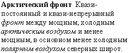
Russian translation prepared by Nina A. Zaitseva for the Arctic Climatology Project Arctic Meteorology and Climate Atlas.
- arctic haze
- haze in arctic regions which reduces horizontal and slant visibility and which may extend to a height of about 10 km; it appears blue-grey when viewed away from the sun, and reddish-brown toward it.

Russian translation prepared by Nina A. Zaitseva for the Arctic Climatology Project Arctic Meteorology and Climate Atlas.
- arctic high
- a weak high which appears over the arctic basin during late spring, summer and early autumn; one of the centers of action in the atmosphere.

Russian translation prepared by Nina A. Zaitseva for the Arctic Climatology Project Arctic Meteorology and Climate Atlas.
- arctic mist
- a mist of ice crystals; a very light ice fog.

Russian translation prepared by Nina A. Zaitseva for the Arctic Climatology Project Arctic Meteorology and Climate Atlas.
- arctic oscillation
- an atmospheric circulation pattern in which the atmospheric pressure over the polar regions varies in opposition with that over middle latitudes (about 45 degrees N) on time scales ranging from weeks to decades; the oscillation extends through the depth of the troposphere, and from January to March, it extends upward into the stratosphere where it modulates in the strength of the westerly vortex that encircles the arctic polar cap region; the north atlantic oscillation and arctic oscillation are different ways of describing the same phenomenon.
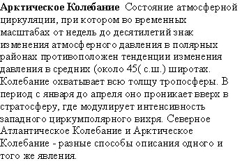
Russian translation prepared by Nina A. Zaitseva for the Arctic Climatology Project Arctic Meteorology and Climate Atlas.
- arctic sea smoke
- evaporation (steam) fog produced above a surface of open water within arctic ice when the air is stable and relatively cold.

Russian translation prepared by Nina A. Zaitseva for the Arctic Climatology Project Arctic Meteorology and Climate Atlas.
- arctic tree line
- the northern limit of tree growth; the sinuous boundary between tundra and boreal forest; taken by many to delineate the actual southern boundary of the arctic zone.
- arctic zone
- (1) geographically, the area north of the arctic circle (66° 34′ N) (2) (same as tundra) biogeographically, the area extending northward from the arctic tree line; also used for the level above the timber line in mountains.
- arete
- sharp, narrow ridge formed as a result of glacial erosion from both sides.
- artificial ground freeezing
- the process of inducing or maintaining a frozen condition in earth materials by artificial means.
- atmosphere
- the envelope of air surrounding the earth and bound to it more or less permanently by virtue of the earth's gravitational attraction; the system whose chemical properties, dynamic motions, and physical processes constitute the subject matter of meteorology.

Russian translation prepared by Nina A. Zaitseva for the Arctic Climatology Project Arctic Meteorology and Climate Atlas.
- atmospheric circulation
- the large-scale movement of air, and the means by which heat is distributed on the surface of the Earth; may vary from year to year.
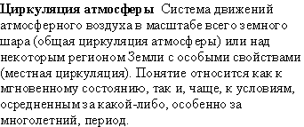
Russian translation prepared by Nina A. Zaitseva for the Arctic Climatology Project Arctic Meteorology and Climate Atlas.
- atmospheric phenomenon
- as commonly used in weather observing practice, an observable occurrence of particular physical significance within the atmosphere; from the viewpoint of weather observations, the atmospheric phenomena include all hydrometeors (precipitation types and fogs), blowing snow, thunderstorms, tornadoes, waterspouts, and others.

Russian translation prepared by Nina A. Zaitseva for the Arctic Climatology Project Arctic Meteorology and Climate Atlas.
- atmospheric pressure
- pressure (force per unit area) exerted by the atmosphere on any surface by virtue of its weight; it is equivalent to the weight of a vertical column of air extending above a surface of unit area to the outer limit of the atmosphere.

Russian translation prepared by Nina A. Zaitseva for the Arctic Climatology Project Arctic Meteorology and Climate Atlas.
- atmospheric radiation
- longwave (infrared) radiation emitted by or being propagated through the atmosphere.

Russian translation prepared by Nina A. Zaitseva for the Arctic Climatology Project Arctic Meteorology and Climate Atlas.
- aurora
- luminous phenomena, in the form of arcs, bands, draperies, or curtains in the high atmosphere over high latitudes; auroras are related to magnetic storms and the influx of charged particles from the sun, the phenomena are called aurora borealis in the northern hemisphere and aurora australis in the southern hemisphere.

Russian translation prepared by Nina A. Zaitseva for the Arctic Climatology Project Arctic Meteorology and Climate Atlas.
- avalanche
- mass of snow which becomes detached and slides down a slope, often acquiring great bulk by fresh addition as it descends.

An avalanche in motion. (Photograph courtesy of © Richard Armstrong, National Snow and Ice Data Center.)
- average value
- arithmetic mean (m) of a number (n) of values (x1, x2, ... xn), defined by the equation: m = sxi/n; annual average value is calculated from 12 monthly means; daily average (or mean) value is calculated from 24 hourly readings of a meteorological element, or often from the average of the daily maximum and minimum values (for example, of temperature); monthly average is usually calculated as the average of the daily average values.
Russian translation prepared by Nina A. Zaitseva for the Arctic Climatology Project Arctic Meteorology and Climate Atlas.
- Azores high
- the semipermanent subtropical high over the North Atlantic Ocean, especially when it is located over the eastern part of the ocean; the same high over the western part of the Atlantic is called the Bermuda high; on mean charts of sea level pressure, this high is one of the primary centers of action in northern latitudes.
- band ogives
- alternate bands of light and dark on a glacier; usually found below steep narrow icefalls and thought to be the result of different flow and ablation rates between summer and winter.
- banded cryogenic fabric
- a distinct soil micromorphology, resulting from the effects of freezing and thawing processes, in which soil particles form subhorizontal layers.
- barograph
- a barometer that records barometric pressure over time (days or weeks).

Russian translation prepared by Nina A. Zaitseva for the Arctic Climatology Project Arctic Meteorology and Climate Atlas.
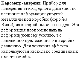
- barometer
- an instrument for measuring atmospheric pressure; two types of barometers are commonly used in meteorology: the mercury barometer and the aneroid barometer.

Russian translation prepared by Nina A. Zaitseva for the Arctic Climatology Project Arctic Meteorology and Climate Atlas.
- barrens
- areas of discontinuous vegetation cover in the polar semi-desert of the high arctic.
- basal cryopeg
- a layer of unfrozen ground that is perennially cryotic (t < 0 degrees Celsius), forming the basal portion of the permafrost.
- basal cryostructure
- the cryostructure of a frozen deposit of boulders that is saturated with ice.
- basal sliding
- the sliding of a glacier over bedrock.
- basal-layered cryostructure
- the cryostructure of a frozen layered deposit of gravel and boulders that is saturated with ice.
- beaded stream
- a stream characterized by narrow reaches linking pools or small lakes.
- Beaufort Gyre
- an ocean and ice circulation pattern in the Beaufort Sea, north of Alaska. This gyre moves in a clockwise direction, fed by an average high-pressure system that fosters anti-cyclonic winds. Ice that forms in or drifts into the Beaufort Gyre has historically remained in the Arctic ice system for years, accumulating snow and thickening each winter. Beginning in the late 1990s, the ice began melting away while in the southern parts of the gyre, before completing the circulation.
- bedrock
- hard-packed rock lying below the Earth’s surface; lies in beds or layers; can be variable across geographic space; above bedrock is a layer of broken, weathered rock.
- belt
- a long area of pack ice from a few km to more than 100 kilometers in width.
- bergschrund
- crevasse that separates flowing ice from stagnant ice at the head of a glacier.

Explorer on Skillet Glacier in 1936. Bergschrund is visible as the dark band of ice in the background.
- bergy bit
- large chunk of glacier ice (a very small iceberg) floating in the sea; bergy bits are usually less than 5 meters (15 feet) in size and are generally spawned from disintegrating icebergs.
- Bermuda high
- the semipermanent subtropical high over the North Atlantic Ocean, especially when it is located over the western part of the ocean; the same high over the eastern part of the Atlantic is called the Azores high; on mean charts of sea level pressure, this high is one of the primary centers of action in northern latitudes.
- beset
- situation of a vessel surrounded by ice and unable to move.
- bight
- an extensive crescent-shaped indentation in the ice edge, formed either by wind or current.
- blind lead
- a lead closed off on all sides within the ice pack.
- blizzard
- winds of at least 35 miles per hour along with considerable falling and/or blowing snow reducing visibility to less than one-quarter mile for a period of at least three hours (extremely cold temperatures are often associated with dangerous blizzard conditions, but are not a formal part of the modern definition).

(Top) The Great Blizzard of 12 March 1888. New York, New York. (Photo courtesy of the Historic National Weather Service Collection, NOAA/Department of Commerce.) (Bottom) Russian translation prepared by Nina A. Zaitseva for the Arctic Climatology Project Arctic Meteorology and Climate Atlas.
- block field
- a surficial layer of angular shattered rocks formed in either modern or pleistocene periglacial environments.
- blow hole
- opening through a snow bridge into a crevasse or system of crevasses which are otherwise sealed by snow bridges; a snowdrift usuallly forms on the lee side.
- blowing snow
- an ensemble of snow particles raised by the wind to moderate or great heights above the ground; the horizontal visibility at eye level is generally very poor.
- bora
- a cold wind blowing down an incline; a kind of katabatic wind.
- boreal forest
- the forested region that adjoins the tundra along the arctic tree line, which has two main divisions: its northern portion is a belt of taiga or boreal woodland, while its southern portion is a belt of true forest, mainly conifers but with some hardwoods; on its southern boundary the boreal forest passes into “mixed forest” or “parkland,” prairie, or steppe, depending on the rainfall.
- bottom bergs
- icebergs that originate from near the bottom of a glacier; the color is usually black from trapped rock material or dark blue because of old, coarse, bubble-free ice; they sit low in the water due to the weight of the embedded rocks.
- bottom temperature of snow cover
- temperature measured at the base of the snow cover during mid- to late-winter (February/March).
- branched-valley glacier
- glacier that has one or more tributary glaciers that flow into it; distinguished from a simple valley glacier that has only a single tributary glacier.

In this photograph from 1969, small glaciers flow into the larger Columbia Glacier from mountain valleys on both sides. Columbia Glacier flows out of the Chugach Mountains into Columbia Bay, Alaska. (Photo courtesy of the United States Geological Survey. Archived at the World Data Center for Glaciology, Boulder, CO.)
- brash ice
- accumulation of floating ice made up of fragments not more than 2 meters (6.6 feet) across, the wreckage of other forms of ice.
- brine
- small droplets of highly saline water that form in pockets between ice crystals, as sea ice forms and expels salt into the underlying ocean water.
- BTS method
- method to predict the presence or absence of permafrost in a mountain area, using measurements of the bottom temperature of snow cover mid- to late-winter.
- bummocks
- smooth hills of ice that form on the bottom of sea ice from eroding keels, particularly during the summer melt.
- buoy weather station
- a buoy, either fixed or floating, which carries instruments for sensing various meteorological elements and for transmitting the data by radio.

Russian translation prepared by Nina A. Zaitseva for the Arctic Climatology Project Arctic Meteorology and Climate Atlas.
- buried ice
- ice formed or deposited on the ground surface and later covered by sediments.
- Buys Ballots Law
- Meterological law which states that if you are standing with your back to the wind in the Northern Hemisphere, low pressure will be on your left, and high pressure will be on your right. Ballot was a 19th century Dutch climatalogist.
- calve
- break off from a larger ice shelf or ice sheet into the water.
- calving
- process by which ice breaks off a glacier's terminus; usually the term is reserved for tidewater glaciers or glaciers that end in lakes, but it can refer to ice that falls from hanging glaciers.
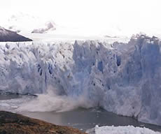
Ice pinnacle separating from Perito Moreno Glacier. (Photo courtesy of Martyn Clark.)
- calving glacier
- glacier that loses material by calving, usually a glacier that terminates in sea, lake, or river water.
- carbon sink
- A reservoir of carbon dioxide that is increasing in size.
- catchment glacier
- a semipermanent mass of firn formed by drifted snow behind obstructions or in the ground; also called a snowdrift glacier or a drift glacier.
- cave ice
- ice formed in a closed or open cave.
- chattermarks
- striations or marks left on the surface of exposed bedrock caused by the advance and retreat of glacier ice.

Close up of chatter marks, Mt. Sirius, Antarctica. Lens cap in the photo is five centimeters across. (Photo courtesy of Tom Lowell, University of Cincinnati.)
- chinook
- a warm wind blowing down an incline; a kind of katabatic wind.
- circumpolar vortex
- the large-scale cyclonic circulation in the middle and upper troposphere centered generally in the polar region; also called polar vortex.
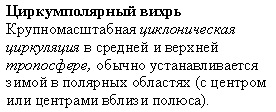
Russian translation prepared by Nina A. Zaitseva for the Arctic Climatology Project Arctic Meteorology and Climate Atlas.
- cirque
- bowl shape or amphitheater usually sculpted out of the mountain terrain by a cirque glacier.

Cirque on Cirque Mountain in the Torngat Mountains, Newfoundland, Canada. (Photo courtesy of Hazen Russel, Natural Resources Canada. Copyright Terrain Sciences Division, Geological Survey of Canada.)
- cirque glacier
- glacier that resides in basins or amphitheaters near ridge crests; most cirque glaciers have a characteristic circular shape, with their width as wide or wider than their length.
- cirrocumulus
- a principal high-level cloud type (cloud genus), appearing as a thin, white patch or layer of cloud without shading, composed of very small elements in the form of grains, ripples, etc., merged or separated, and more or less regularly arranged; most of the elements have an apparent width of less than 1 degree.
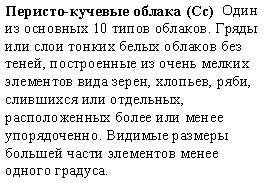
Russian translation prepared by Nina A. Zaitseva for the Arctic Climatology Project Arctic Meteorology and Climate Atlas.
- cirrostratus
- a principal high-level cloud type (cloud genus), appearing as a transparent, whitish cloud veil of fibrous (hair-like) or smooth appearance, totally or partially covering the sky, and often producing halo phenomena, either partial or complete.
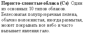
Russian translation prepared by Nina A. Zaitseva for the Arctic Climatology Project Arctic Meteorology and Climate Atlas.
- cirrus
- a principal high-level cloud type (cloud genus), appearing as detached clouds in the form of white, delicate filaments or white or mostly white patches or narrow bands; these clouds have a fibrous (hair-like) appearance, or a silky sheen, or both; because cirrus elements are too narrow, they do not produce a complete circular halo.

Russian translation prepared by Nina A. Zaitseva for the Arctic Climatology Project Arctic Meteorology and Climate Atlas.
- clear sky
- sky with a total cloud cover of less than one okta (or one-tenth in the united states).

Russian translation prepared by Nina A. Zaitseva for the Arctic Climatology Project Arctic Meteorology and Climate Atlas.
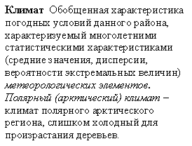
- climate
- synthesis of weather conditions in a given area, characterized by long-term statistics (mean values, variances, probabilities of extreme values, etc.) of the meteorological elements in that area; polar climate (arctic climate) is generally the climate of a geographical polar region, most commonly taken to be a climate which is too cold to support the growth of trees.
Russian translation prepared by Nina A. Zaitseva for the Arctic Climatology Project Arctic Meteorology and Climate Atlas.
- climate change
- a study dealing with variations in climate on many different time scales from decades to millions of years, and the possible causes of such variations; (1) in the most general sense, the term climate change encompasses all forms of climatic inconstancy (that is, any differences between long-term statistics of the meteorological elements calculated for different periods but relating to the same area) regardless of their statistical nature or physical causes; climate change may result from such factors as changes in solar activity, long-period changes in the earth's orbital elements (eccentricity, obliquity of the ecliptic, precession of equinoxes), natural internal processes of the climate system, or anthropogenic forcing (for example, increasing atmospheric concentrations of carbon dioxide and other greenhouse gases) (2) the term climate change is often used in a more restricted sense, to denote a significant change (such as a change having important economic, environmental and social effects) in the mean values of a meteorological element (in particular temperature or amount of precipitation) in the course of a certain period of time, where the means are taken over periods of the order of a decade or longer.
- climate model
- representation of the climate system based on the mathematical equations governing the behavior of the various components of the system and including treatment of key physical processes and interactions, cast in a form suitable for numerical approximation with computers.

Russian translation prepared by Nina A. Zaitseva for the Arctic Climatology Project Arctic Meteorology and Climate Atlas.
- climate variability
- (1) in the most general sense, the term climate variability denotes the inherent characteristic of climate which manifests itself in changes with time; the degree of climate variability can be described by the differences between long-term statistics of meteorological elements calculated for different periods, (in this sense, the measure of climate variability is the same as the measure of climate change) (2) the term climate variability is often used to denote deviations of climate statistics over a given period of time (such as a specific month, season or year) from the long-term climate statistics relating to the corresponding calendar period; (in this sense, climate variability is measured by those deviations, which are usually termed anomalies).
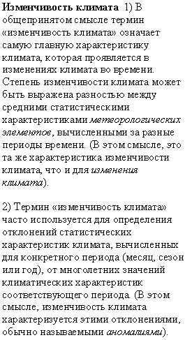
Russian translation prepared by Nina A. Zaitseva for the Arctic Climatology Project Arctic Meteorology and Climate Atlas.
- climatological atlas
- atlas composed mainly of climatological charts; it represents especially the monthly and annual distributions of the principal climatic elements of a specific region for a relatively long period.

Russian translation prepared by Nina A. Zaitseva for the Arctic Climatology Project Arctic Meteorology and Climate Atlas.
- climatology
- the scientific study of climate; the aspect of meteorology which studies processes of climate formation, distribution of climates over the globe, analysis of the causes of differences of climate (physical climatology), and the application of climatic data to the solution of specific design or operational problems (applied climatology); climatology may be further subdivided according to purpose or point of view: agricultural climatology, air-mass climatology, aviation climatology, bioclimatology, dynamic climatology, medical climatology, macroclimatology, mesoclimatology, microclimatology, paleoclimatology, synoptic climatology, etc..

Russian translation prepared by Nina A. Zaitseva for the Arctic Climatology Project Arctic Meteorology and Climate Atlas.
- close cavity ice
- ice formed in a closed space, cavity or cave in permafrost.
- close pack ice
- composed of close ice that is mostly in contact; ice cover 7/10ths to 9/10ths.
- closed talik
- a layer or body of unfrozen ground occupying a depression in the permafrost table below a lake or river.
- closed-system freezing
- freezing that occurs under conditions that preclude the gain or loss of any water by the system.
- closed-system pingo
- a pingo formed by doming of frozen ground due to freezing of injected water supplied by expulsion of pore water during permafrost aggradation in the closed talik under a former water body.
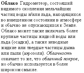
- cloud
- a hydrometeor consisting of a visible aggregate of minute particles of liquid water or ice, or both, suspended in the free air and usually not touching the earth's surface; it may also include larger particles of liquid water or ice (precipitation particles) and non-aqueous liquid or solid particles such as those present in fumes, smoke and dust (aerosols); cloudiness is the same as cloud cover; but usually it is used in a very general sense.
Russian translation prepared by Nina A. Zaitseva for the Arctic Climatology Project Arctic Meteorology and Climate Atlas.
- cloud amount
- that portion of the sky cover which is attributed to clouds; the unit of measurement is the okta or tenths (meaning one-eighth or one-tenth) of the sky dome as seen by the observer.

Russian translation prepared by Nina A. Zaitseva for the Arctic Climatology Project Arctic Meteorology and Climate Atlas.
- coefficient of compressibility
- decrease in volume per unit volume of a substance resulting from a unit increase in pressure, under isothermic conditions.
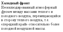
- cold front
- any non-occluded front that moves in such a way so that colder air replaces warmer air; the leading edge of a relatively cold air mass.
Russian translation prepared by Nina A. Zaitseva for the Arctic Climatology Project Arctic Meteorology and Climate Atlas.
- cold glacier
- glacier in which most of the ice is below the pressure melting point; nonetheless, the glacier's surface may be susceptible to melt due to incoming solar radiation, and the ice at the rock/ice interface may be warmed as a result of the natural (geothermal) heat from the earth's surface.
- cold low
- at a given level in the atmosphere, any low that is generally characterized by colder air near its center than around its periphery; the opposite of a warm low.

Russian translation prepared by Nina A. Zaitseva for the Arctic Climatology Project Arctic Meteorology and Climate Atlas.
- cold pole
- the location that has the lowest annual mean temperature in its hemisphere.
- collapse scar
- that portion of a peatland where the whole or part of a palsa or peat plateau has thawed and collapsed to the level of the surrounding peatland.
- composite wedge
- a wedge showing evidence of both primary and secondary filling.
- compression flow
- flow that occurs when glacier motion is decelerating down-slope.
- condensation
- the physical process by which a vapor becomes a liquid or solid; the opposite of evaporation; in meteorological usage, this term is applied only to transformation from vapor to liquid; any process in which a solid forms directly from its vapor is termed sublimation, as is the reverse process.

Russian translation prepared by Nina A. Zaitseva for the Arctic Climatology Project Arctic Meteorology and Climate Atlas.
- conduction
- the transport of energy entirely resulting from the random motions of individual molecules, and not from any concerted group movement; occurs in response to temperature gradients; contrasts with convection, in which energy is transported by molecules moving together in coherent groups.
- congelation ice
- an advanced form of new ice that forms as a stable sheet with a smooth bottom surface.

A photograph in natural light of the vertically oriented pores in congelation ice. (Photo courtesy of Ted Maksym, United States Naval Academy.)
- conglomeric cryogenic fabric
- a distinct soil micromorphology, resulting from the effects of freezing and thawing processes, in which coarser soil particles form compound arrangements.
- consolidated pack ice
- pack ice in which the floes are frozen together; ice cover 10/10ths.
- construction methods in permafrost
- special design and construction procedures required when engineering works are undertaken in permafrost areas.
- constructive metamorphism
- snow metamorphism that adds molecules to sharpen the comers and edges of an ice crystal.
- continuous permafrost
- geographic area in which permafrost occurs everywhere beneath the exposed land surface with the exception of widely scattered sites, such as newly deposited unconsolidated sediments that have just been exposed to the freezing climate; mean annual soil surface temperatures are typically below -5 degrees Celsius (23 degrees Fahrenheit).
- continuous permafrost zone
- the major subdivision of a permafrost region in which permafrost occurs everywhere beneath the exposed land surface with the exception of widely scattered sites.
- convection
- the transport of energy resulting from the concerted movement of molecules in coherent groups; contrasts with conduction in which energy is transported by the random motions of molecules; atmospheric convection is nearly always turbulent and results in the vertical transport and mixing of atmospheric properties.

Russian translation prepared by Nina A. Zaitseva for the Arctic Climatology Project Arctic Meteorology and Climate Atlas.
- convection cloud
- cumuliform cloud which forms in the atmosphere as a result of convection; such clouds are also called clouds of vertical development, a cloud that has its base in the low height range but extends upward into the middle or high altitudes.
Russian translation prepared by Nina A. Zaitseva for the Arctic Climatology Project Arctic Meteorology and Climate Atlas.
- coriolis force
- apparent force, due to the rotation of the earth, which acts normal to, and to the right of the velocity of a moving particle in the northern hemisphere, the movement of the particle being considered relative to that of the earth.

Russian translation prepared by Nina A. Zaitseva for the Arctic Climatology Project Arctic Meteorology and Climate Atlas.
- cornice
- an overhanging accumulation of ice and wind-blown snow, characteristically found on the edge of a ridge or cliff face.
- crack
- any fracture or rift in floating ice not sufficiently wide to be described as a lead.
- creep
- a way that snow or ice can move by deforming its internal structure.
- creep of frozen ground
- the slow deformation (or time-dependent shear strain) that results from long-term application of a stress too small to produce failure in the frozen material.
- creep strength
- the failure strength of a material at a given strain rate or after a given period under deviatoric stress.
- crevasse
- open fissure in the glacier surface.

Explorers examine a crevasse on Lyman Glacier in 1916. (Photo courtesy of the United States Forest Service. Archived at the World Data Center for Glaciology, Boulder, CO.)
- crevasse hoar
- a kind of hoarfrost; ice crystals that develop by sublimation in glacial crevasses and in other cavities with cooled space and calm, still conditions under which water vapor can accumulate; physical origin is similar to depth hoar.
- crust
- a hard snow surface lying upon a softer layer; crust may be formed by sun, rain or wind, and is described as breakable crust or unbreakable crust, depending upon whether it wil break under the weight of a turning skier.
- crust-like cryostructure
- the cryostructure of a frozen deposit of angular blocks that are coated with ice, whereas large spaces between the blocks are not filled with ice.
- cryofront
- the boundary between cryotic and noncryotic ground as indicated by the position of the 0 degrees Celsius isotherm in the ground.
- cryogenesis
- the combination of thermophysical, physico-chemical and physico-mechanical processes occurring in freezing, frozen and thawing earth materials.
- cryogenic aquiclude
- a layer of ground which, because of its frozen state, has a low enough permeability to act as a confining bed for an aquifer.
- cryogenic fabric
- the distinct soil micromorphology resulting from the effects of freezing and thawing processes.
- cryogenic temperature
- in international materials science, this term refers to temperatures generally below -50 degrees Celsius, but usually to temperatures within a few degrees of absolute zero (-273 degrees Celsius).
- cryolithology
- the study of the genesis, structure and lithology of frozen earth materials.
- cryopedology
- the study of soils at temperatures below 0 degrees Celsius, with particular reference to soils subject to intensive frost action, and to soils overlying permafrost.
- cryopeg
- a layer of unfrozen ground that is perennially cryotic (forming part of the permafrost), in which freezing is prevented by freezing-point depression due to the dissolved-solids content of the pore water.
- cryoplanation
- the process through which cryoplanation terraces form.
- cryoplanation terrace
- a step-like or table-like bench cut in bedrock in cold climate regions.
- cryosol
- soil formed in either mineral or organic materials having permafrost either within 1 meter (3.3 feet) below the surface or, if the soil is strongly cryoturbated, within 2 meters (6.6 feet) below the surface, and having a mean annual ground temperature below 0 degrees Celsius.
- cryosphere
- one of the earth's spheres of irregular form existing in the zone of interaction of the atmosphere, hydrosphere and lithosphere, distinguished by negative or zero temperature and the presence of water in the solid or super-cooled state; the term refers collectively to the portions of the earth where water is in solid form, including snow cover, floating ice, glaciers, ice caps, ice sheets, seasonally frozen ground and perennially frozen ground (permafrost).

Russian translation prepared by Nina A. Zaitseva for the Arctic Climatology Project Arctic Meteorology and Climate Atlas.
- cryostructure
- the structural characteristics of frozen earth materials.
- cryosuction
- a suction developed in freezing or partially frozen fine-grained materials as a result of temperature-dependent differences in unfrozen water content.
- cryotexture
- the textural characteristics of frozen, fine-grained organic and mineral earth materials cemented together with ice.
- cryotic ground
- soil or rock at temperatures of 0 degrees Celsius or lower.
- cryoturbate
- a body of earth material moved or disturbed by frost action.
- cryoturbation
- (1) (singular) a collective term used to describe all soil movements due to frost action (2) (plural) irregular structures formed in earth materials by deep frost penetration and frost action processes, and characterized by folded, broken and dislocated beds and lenses of unconsolidated deposits, included organic horizons and even bedrock.
- cumuliform
- like cumulus; generally descriptive of all clouds; vertical development in the form of rising mounds, domes or towers; driven by thermal convection and have vertical velocities greater than 1 meter (3.3 feet) per second.
- cumulonimbus
- a principal cloud type (cloud genus) of vertical development, exceptionally dense and vertically developed clouds, occurring either as isolated clouds or as a line or wall of clouds with separated upper portions; these clouds appear as mountains or huge towers, at least a part of the upper portions of which are usually smooth, fibrous, or striated, and almost flattened; this part often spreads out in the form of an anvil (incus) or vast plume; under the base of cumulonimbus, which is very dark, there frequently exist virga, precipitation, and low, ragged clouds, either merged with it or not; its precipitation is often heavy and always of a showery nature.

Russian translation prepared by Nina A. Zaitseva for the Arctic Climatology Project Arctic Meteorology and Climate Atlas.
- cumulus
- a principal low-level cloud type (cloud genus) in the form of individual, detached elements which are generally dense and possess sharp non-fibrous outlines; these elements develop vertically, appearing as rising mounds, domes, or towers, the upper parts of which often resembles a cauliflower; the sunlit parts of these clouds are mostly brilliant white; their bases are relatively dark and nearly horizontal; near the horizon the vertical development of cumulus often causes the individual clouds to appear merged; if precipitation occurs, it is usually of a showery nature.

Russian translation prepared by Nina A. Zaitseva for the Arctic Climatology Project Arctic Meteorology and Climate Atlas.
- cyclogenesis
- process of initiation or intensification of a cyclonic circulation in the atmosphere; the opposite to cyclolysis.

Russian translation prepared by Nina A. Zaitseva for the Arctic Climatology Project Arctic Meteorology and Climate Atlas.
- cyclolysis
- process of weakening or terminating of a cyclonic circulation in the atmosphere; the opposite of cyclogenesis.

Russian translation prepared by Nina A. Zaitseva for the Arctic Climatology Project Arctic Meteorology and Climate Atlas.
- cyclone
- area in the atmosphere in which the pressures are lower than those of the surrounding region at the same level; it is represented on a synoptic chart by a system of isobars at a specified altitude level (or a system of contours at a specified pressure level) which enclose relatively low values of pressure (or altitude); a cyclone begins when a wave (young) cyclone forms and moves along a front; a mature cyclone has well-developed warm sectors and both cold and warm fronts; an occluded cyclone is that within which there has developed an occluded front.

Russian translation prepared by Nina A. Zaitseva for the Arctic Climatology Project Arctic Meteorology and Climate Atlas.
- cyclone ciruculation
- atmospheric circulation associated with a cyclone (depression, low pressure area); it is counterclockwise in the northern hemisphere and clockwise in the southern hemisphere.

Russian translation prepared by Nina A. Zaitseva for the Arctic Climatology Project Arctic Meteorology and Climate Atlas.
- cyclone movement
- the spatial displacement of a center of low pressure caused by the local redistribution of mass in the atmosphere; the trajectory of the center is often altered by heating or cooling on the air column, which can result from thermal fluxes at the surface or latent heat transformations associated with cloud formation and precipitation; these processes change the temperature distribution in the air column, resulting in density changes which modify the surface pressures.

Russian translation prepared by Nina A. Zaitseva for the Arctic Climatology Project Arctic Meteorology and Climate Atlas.
- de-icing
- the removal of ice accumulation on aircraft, ships and other objects by mechanical, thermal or chemical devices.
- dead ice
- any part of a glacier which has ceased to flow; dead ice is usually covered with moraine.
- debris flow
- a sudden and destructive variety of landslide, in which loose material on a slope, with more than 50% of particles larger than sand size, is mobilized by saturation and flows down a channel or canyon.
- deformability
- the ability of a material to change its shape or size under the influence of an external or internal agency, such as stress, temperature, or pore pressure.
- degree of saturation
- (1) the total degree of saturation of frozen soil is the ratio of the volume of ice and unfrozen water in the soil pores to the volume of the pores (2) the degree of saturation of frozen soil by ice is the ratio of the volume of ice in the soil pores to the volume of the pores.
- degree-day (C or F)
- a derived unit of measurement used to express the departure of the mean temperature for a day from a given reference (or base) temperature.
- delayed strength
- the failure strength of a material at a given strain rate or after a given period under deviatoric stress.
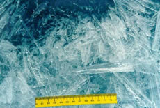
- dendrite
- hexagonal ice crystals with complex and often fernlike branches.
- density of frozen ground
- the mass of a unit volume of frozen soil or rock.
- depression
- in meteorology, an area of low pressure (i.e. a low); usually applies to a particular stage in the development of a cyclone.
- depth hoar
- a kind of hoarfrost; ice crystals that develop by sublimation within a layer of dry snow; characterized by rapid recrystallization, usually caused by large temperature gradients; similar in physical origin to crevasse hoar; crystals are faceted, rather than rounded.
- depth of seasonal frost penetration
- the maximum thickness of the seasonally frozen layer.
- depth of snow
- vertical interval between the top surface of a snow layer and the ground beneath; the layer is assumed to be evenly spread over the ground which it covers.
- depth of thaw
- the minimum distance between the ground surface and frozen ground at any time during the thawing season in an area subject to seasonal freezing and thawing.
- depth of zero annual amplitude
- the distance from the ground surface downward to the level beneath which there is practically no annual fluctuation in ground temperature.
- desiccation crack
- crack or fissure developed in fine-grained soil material as a result of shrinkage during drying.
- desiccation polygon
- closed, multi-sided, patterned ground feature formed by desiccation cracks in fine-grained soil material, usually less than 2 meters (6.6 feet) in diameter.
- design depth of frost penetration
- (1) (North American usage) the mean of the three largest depths of seasonal frost penetration measured during the past thirty years, or the largest depth of seasonal frost penetration beneath a snow-free soil surface measured during the past ten years (2) (Russian usage) the mean of the depths of seasonal frost penetration measured during at least the last ten years with the ground surface free of snow and the groundwater level below the depth of seasonal frost penetration.
- design freezing index
- the cumulative number of degree-days below 0 degrees Celsius, calculated by taking the average of the seasonal freezing indices for the three coldest winters in the most recent 30 years of record.
- design thawing index
- the cumulative number of degree-days above 0 degrees Celsius, calculated by taking the average of the seasonal thawing indices for the three warmest summers in the most recent 30 years of record.
- destructive metamorphism
- snow metamorphism that rounds the comers and edges of an ice crystal.
- detachment failure
- a slope failure in which the thawed or thawing portion of the active layer detaches from the underlying frozen material.
- dew point
- the temperature to which a given parcel of air must be cooled at constant pressure and constant water-vapor content in order for saturation to occur; when this temperature is below 0 degrees Celsius, it is called the frost point.
- diamond dust
- a type of precipitation composed of slowly falling, very small, unbranched crystals of ice which often seem to float in the air; it may fall from a high cloud or from a cloudless sky, it usually occurs under frosty weather conditions (under very low air temperatures).
- dielectric constant
- measure of the ability of the soil to store electrical energy in the presence of an electrostatic field.
- dilation crack
- a tensile fracture in a frozen material due to surface extension caused by doming.
- dilation crack ice
- ice that forms in dilation cracks.
- dip pole
- either of the two points on the earth's surface at which magnetic meridians converge; the horizontal component of the magnetic field of the earth becomes zero at this point; also called the magnetic pole.
- dipole anomaly
- An Arctic atmospheric pressure pattern characterized by high pressure centered over the northern Beaufort Sea and unusually low pressure centered over the Kara Sea. This pattern contributes to ice loss in summer, causing winds to blow ice away from the coast.
- dirt cone
- a cone-shaped formation of ice that is covered by dirt; a dirt cone is caused by a differential pattern of ablation between the dirt covered surface and bare ice.
- dirty ice
- ice that contains sediments stirred up and tangled in the ice as it grows.
(Photo courtesy of Terry Whitledge, National Oceanic and Atmospheric Administration/Department of Commerce.)
- discontinuous permafrost
- permafrost occurring in some areas beneath the exposed land surface throughout a geographic region where other areas are free of permafrost.
- discontinuous permafrost zone
- the major subdivision of a permafrost region in which permafrost occurs in some areas beneath the exposed land surface, whereas other areas are free of permafrost.
- disequilibrium permafrost
- permafrost that is not in thermal equilibrium with the existing mean annual surface or sea-bottom temperature and the geothermal heat flux.
- drain channel
- preferred path for meltwater to flow from the surface through a snow cover.
- drift glacier
- a semipermanent mass of firn formed by drifted snow behind obstructions or in the ground; also called a catchment glacier or a snowdrift glacier.
- drift ice
- ice that moves from winds, currents, or other forces.
- drift of ice
- displacement of a sea ice field from its place of origin under the effect of ocean currents and winds.
- drifting buoy
- floating (or drifting on ice) ocean buoy equipped with meteorological and/or oceanographic sensing instruments linked to transmitting equipment for sending the observed data to collecting centers.
- drifting snow
- snow raised from the surface of the earth by the wind to a height of less than 1.5 to 2.0 meters (5 to 6.6 feet) above the surface; it dose not restrict horizontal visibility at 2 meters (6.6 feet) or more above the surface.
- drifting stations
- research stations on the floes of the arctic ocean.
- drizzle
- very small, uniformly distributed water drops that appear to float while following air currents; unlike fog droplets, drizzle falls to the ground.
- drumlin
- remnant elongated hills formed by historical glacial action; it is not clear exactly how they are formed and why they form only in some glaciated regions.
Drumlin field. Manitoba, Canada.
- drunken forest
- trees leaning in random directions caused by melting permafrost.
- dry density
- the mass of a unit volume of dried material (e.g. soil).
- dry frozen ground
- frozen ground with a very low total water content consisting almost completely of interfacial water, and not cemented by ice.
- dry permafrost
- permafrost containing neither free water nor ice.
- dump moraine
- a mound or layer of moraine formed along the edge of a glacier by rock that falls off the ice; sometimes called a ground moraine.
- dynamic modulus of elasticity
- the ratio of stress to strain for a material under dynamic loading conditions.
- dynamic Poisson's ratio
- the absolute value of the ratio between the linear strain changes, perpendicular to and in the direction of a given uniaxial stress change, respectively, under dynamic loading conditions.
- earth hummock
- a hummock having a core of silty and clayey mineral soil which may show evidence of cryoturbation.
- earth radiation
- the total infrared radiation emitted from the earth's surface; to be carefully distinguished from effective terrestrial radiation, atmospheric radiation, and insolation.
- edge wasting
- process by which warm water erodes iceberg above the waterline
- effective terrestrial radiation
- the difference between the outgoing infrared (longwave) terrestrial radiation of the earth's surface and the downward infrared counter-radiation from the atmosphere.
- electrical conductivity
- the inverse of electrical resistivity.
- electrical properties of frozen ground
- the dielectric constant (or relative permitivity), electrical conductivity and electrical resistivity are the major electrical properties governing the flow of electric current through frozen ground.
- electricity resistivity
- the property of a material that determines the electrical current flowing through a centimetre cube of the material when an electrical potential is applied to opposite faces of the cube.
- electromagnetic wave
- an oscillation of the electric or magnetic field associated with the propagation of energy; characterized by their wavelengths and amplitude; propagate at the speed of light.
- emissivity
- the amount of electromagnetic energy (primarily at wavelengths longer than 1.0 micrometer) that an object emits; for example, the earth emits longwave radiation primarily in the infrared part of the electromagnetic spectrum, but also in longer microwave wavelengths; the emissivity of an object varies as the fourth power of its absolute temperature.
- end moraine
- an arch-shaped ridge of moraine found near the end of a glacier.
- epigenetic ice
- ground ice developed in epigenetic permafrost, or in previously formed syngenetic permafrost.
- epigenetic ice wedge
- an ice wedge developed in epigenetic permafrost, or in previously formed syngenetic permafrost.
- epigenetic permafrost
- permafrost that formed through lowering of the permafrost base in previously deposited sediment or other earth material.
- equator
- the line of latitude 0°, which is equidistant from the poles, and which separates the Northern Hemisphere from the Southern Hemisphere.
- equi-temperature metamorphism
- snow metamorphism that occurs under relatively consistent temperature conditions.
- equilibrium line
- boundary between the accumulation area and ablation area where the mass balance is zero.
- equilibrium metamorphism
- snow metamorphism that occurs when there are large differences in convex and concave portions of a crystal.
- equilibrium permafrost
- permafrost that is in thermal equilibrium with the existing mean annual surface or sea-bottom temperature and with the geothermal heat flux.
- equilibrium zone
- zone of a glacier in which the amount of precipitation that falls is equal to the amount that melts the following summer.
- equinox
- either of the two points of intersection of the sun's apparent annual path and the plane of the earth's equator; in the northern hemisphere the spring (vernal) equinox falls on or about 21 March, and the autumnal equinox on or about 22 September.
- error
- the difference between a measured value of a quantity and its true value; different types of errors are inherent to observations.
- esker
- a sinuous ridge of sedimentary material (typically gravel or sand) deposited by streams that cut channels under or through the glacier ice.
- evaporation
- the physical process by which a liquid or solid substance is transformed to the gaseous state; the opposite of condensation; in meteorology, evaporation usually is restricted in use to the change of water from liquid to gas, while sublimation is used to the change from solid to gas as well as from gas to solid.
- evaporation fog
- fog formed as a result of evaporation of water that is warmer than the air.
- excess ice
- the volume of ice in the ground which exceeds the total pore volume that the ground would have under natural unfrozen conditions.
- extending flow
- when glacier motion is accelerating down-slope.
- extensive discontinuous permafrost
- (1) (North American usage) permafrost underlying 65 - 90% of the area of exposed land surface (2) (Russian usage) permafrost underlying 70 - 80% of the area of exposed land surface.
- fabric
- soil micromorphology.
- fall wind
- a cold wind blowing down an incline; a kind of katabatic wind.
- false ogives
- bands of light and dark on a glacier that were formed by rock avalanching.
- fast ice
- ice that is anchored to the shore or ocean bottom, typically over shallow ocean shelves at continental margins; fast ice is defined by the fact that it does not move with the winds or currents.
Note: This is land fast ice. (Photo courtesy of Michael Van Woert, National Oceanic and Atmospheric Administration/Department of Commerce.)
- field
- a region of space at each point of which a given physical or mathematical quantity has some definite value; for example, a gravitational field, magnetic field, or electric field; and, in meteorology, a pressure field, temperature field, etc; if the quantity specified at each point is a vector quantity, the field is said to be a vector field.
- finger rafting
- a process by which currents or winds push around thin ice so they slide over each other.
Nilas showing finger rafting. (Photo courtesy of Antarctic Sea-Ice Processes and Climate (ASPeCt).)
- firn
- rounded, well-bonded snow that is older than one year; firn has a density greater than 550 kilograms per cubic-meter (35 pounds per cubic-foot); called névé during the first year.
- firn limit
- the minimum elevation of firn lying on a glacier surface; each year's firn line marks a glacier's annual equilibrium line; also called firn line.
- firn line
- the minimum elevation of firn lying on a glacier surface; each year's firn line marks a glacier's annual equilibrium line; also called firn limit.
- firn water table
- the height of meltwater within saturated firn that is trapped over ice in a glacier.
- firnspiegel
- a thin sheet of ice formed on the glacier surface by rapid refreezing of solar-heated snow or firn, usually at high elevations during spring.
- first-year ice
- floating ice of no more than one year's growth developing from young ice; thickness from 0.3 to 2 meters (1 to 6.6 feet); characteristically level where undisturbed by pressure, but where ridges occur, they are rough and sharply angular.
(Photo courtesy of Ted Maksym, United States Naval Academy.)
- fjord
- glacial troughs that fill with sea water.
- flaw lead
- a navigable passage between pack ice and fast ice.
- floating ice
- any form of ice found floating in water.
- floe
- separate patch of floating ice or flat sheet of unbroken pack ice, greater than 20 meters (22 yards) across.
- flooded sea ice
- ice that is pushed into the underlying ocean water by the weight of thick snow cover on its surface; the salty ocean water floods the snow cover and creates a salty, slushy layer; flooded sea ice is more common in the antarctic because of more snowfall and thinner sea ice than in the arctic.
(Photo courtesy of Ted Maksym, Unites States Naval Academy.)
- flow finger
- a small percolation channel that is a beginning path for surface meltwater through snow or firn.
- fluted berg
- an iceberg that is grooved into a curtain-like pattern; thought to be carved by small meltwater streams.
- foehn
- a warm wind blowing down an incline; a kind of katabatic wind.
- fog
- a hydrometeor consisting of a visible aggregate of minute water droplets (or ice crystals), suspended in the atmosphere near the earth's surface; according to international definition, fog reduces visibility below one kilometer, fog differs from cloud only in that the base of fog is at the earth's surface while clouds are above the surface; when composed of ice crystals, it is termed ice fog.
- foliation
- layering in glacier ice that has distinctive crystal sizes and/or bubbles; foliation is usually caused by stress and deformation that a glacier experiences as it flows over complex terrain, but can also originate as a sedimentary feature.
- forbes bands
- alternate bands of light and dark on a glacier; usually found below steep narrow icefalls and thought to be the result of different flow and ablation rates between summer and winter.
- forel stripes
- shallow, parallel grooves on the face of a large melting ice crystal.
- foundation pile
- structure used when the soil near the ground surface is not strong and the weight of the building must be carried by deeper soil layers.
- fragmic cryogenic fabric
- a distinct soil micromorphology, resulting from the effects of freezing and thawing processes, in which soil particles form discrete units that are densely packed.
- fragmoidal cryogenic fabric
- a distinct soil micromorphology, resulting from the effects of freezing and thawing processes, in which soil particles form discrete units that are coalescing.
- Fram Strait
- a sea channel connecting the Arctic Ocean and the Nordic Seas, running between Greenland and Spitsbergen. Fram Strait is the passageway where most drifting sea ice exits the Arctic.
- frazil
- small needle-like ice crystals, typically 3 to 4 millimeters in diameter, suspended in water, that represent the first stages of sea ice growth; they merge under calm conditions to form thin sheets of ice on the surface, frazil crystals consist of nearly pure fresh water.
Frazil crystals. (Photo courtesy of Don Perovich, U.S. Army Cold Regions Research and Engineering Laboratory.)
- frazil ice
- fine spicules or plates of ice in suspension in water.
Frazil crystals. (Photo courtesy of Don Perovich, U.S. Army Cold Regions Research and Engineering Laboratory.)
- free water
- free water is that portion of the pore water that is free to move between interconnected pores under the influence of gravity.

Free water at the base of Dirt Glacier, British Columbia, in 1904. (Photo courtesy of C.W. Wright. Archived at the World Data Center for Glaciology, Boulder, CO.)
- freeze-thaw cycle
- freezing of a material followed by thawing.
- freezeback
- refreezing of thawed materials.
- freezing (of ground)
- the changing of phase from water to ice in soil or rock.
- freezing degree-days
- a measure of how cold it has been and how long it has been cold; the cumulative fdd is usually calculated as a sum of average daily degrees below freezing for a specified time period (10 days, month, season, etc.).
- freezing drizzle
- drizzle, the drops of which freeze on impact with the ground or with objects on the earth's surface or with aircraft in flight.
- freezing front
- the advancing boundary between frozen (or partially frozen) ground and unfrozen ground.
- freezing index
- the cumulative number of degree-days below 0 degrees Celsius for a given time period.
- freezing point
- (1) the temperature at which a pure liquid solidifies under atmospheric pressure (2) the temperature at which a ground material starts to freeze.
- freezing pressure
- the positive pressure developed at ice-water interfaces in soil as it freezes.
- freezing rain
- rain, the drops of which freeze on impact with the ground or with objects on the earth's surface or with aircraft in flight.
- freezing-point depression
- the number of degrees by which the freezing point of an earth material is depressed below 0 degrees Celsius.
- friable permafrost
- permafrost in which the soil particles are not held together by ice.
- friendly ice
- from the point of view of the submariner, an icey canopy containing many large ice skylights or other features which permit a submarine to surface; there must be more than ten such features per 37 kilometers (30 nautical miles) along the submarine's track.
- front
- in meteorology, generally, the interface or transition zone between two air masses of different density; since the temperature distribution is the most important regulator of the atmosphere density, a front almost invariably separates air masses of different temperature; when warmer air replaces the colder, it is a warm front, and vice-versa.
- frost
- the condition which exists when the temperature near the earth's surface and earth-bound objects falls below freezing (0 degrees Celsius or 32 degrees Fahrenheit).
- frost action
- the process of alternate freezing and thawing of moisture in soil, rock and other materials, and the resulting effects on materials and on structures placed on, or in, the ground.
- frost blister
- a seasonal frost mound produced through doming of seasonally frozen ground by a subsurface accumulation of water under elevated hydraulic potential during progressive freezing of the active layer.
- frost boil
- a small mound of soil material, presumed to have been formed by frost action.
- frost bulb
- a more or less symmetrical zone of frozen ground formed around a buried chilled pipeline or beneath or around a structure maintained at temperatures below 0 degrees Celsius.
- frost creep
- the net downslope displacement that occurs when a soil, during a freeze-thaw cycle, expands normal (perpendicular) to the ground surface and settles in a nearly vertical direction.
- frost flowers
- crystals of ice that form when water vapor becomes a solid (bypassing the liquid phase) and deposits itself on the sea ice surface; frost flowers roughen the surface and dramatically affect its electromagnetic signal.
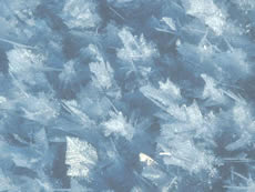
Close-up view of frost flowers. (Photo courtesy of Don Perovich, U.S. Army Cold Regions Research and Engineering Laboratory.)
- frost heave
- the upward or outward movement of the ground surface (or objects on, or in, the ground) caused by the formation of ice in the soil.
- frost heave extent
- the difference between the elevations of the ground surface before and after the occurrence of frost heave.
- frost jacking
- cumulative upward displacement of objects embedded in the ground, caused by frost action.
- frost mound
- any mound-shaped landform produced by ground freezing combined with accumulation of ground ice due to groundwater movement or the migration of soil moisture.
- frost penetration
- the movement of the freezing front into the ground during freezing.
- frost phenomena
- effects of frost action on earth materials and on structures placed in or on the ground.
- frost point
- the highest temperature at which atmospheric moisture will sublimate in the form of hoarfrost on a cooled surface; it is analogous to the dew point.
- frost shattering
- the mechanical disintegration of rock by the pressure of water freezing in pores and along grain boundaries.
- frost smoke
- fog-like clouds, due to the contact of cold air with relatively warm water, which appear over newly-formed leads, or leeward of the ice edge, and which may persist while new ice is forming.
- frost sorting
- the differential movement of soil particles of different sizes as a result of frost action.
- frost weathering
- the disintegration and break-up of soil or rock by the combined action of frost shattering, frost wedging and hydration shattering.
- frost wedging
- the mechanical disintegration, splitting or break-up of rock by the pressure of water freezing in cracks, crevices, pores, joints or bedding planes.
- frost-stable ground
- ground (soil or rock) in which little or no segregated ice forms during seasonal freezing.
- frost-stable soil
- soil in which little or no segregated ice forms during seasonal freezing.
- frost-susceptible ground
- ground (soil or rock) in which segregated ice will form (causing frost heave) under the required conditions of moisture supply and temperature.
- frost-susceptible soil
- soil in which segregated ice will form (causing frost heave) under the required conditions of moisture supply and temperature.
- frozen fringe
- the zone in a freezing, frost-susceptible soil between the warmest isotherm at which ice exists in pores and the isotherm at which the warmest ice lens is growing.
- frozen ground
- soil or rock in which part or all of the pore water has turned into ice.
- fusion
- the phase transition of a substance passing from the solid to the liquid state, melting; in meteorology, fusion is understood to refer to the melting of ice, which, if the ice is pure and subjected to one standard atmosphere of pressure, takes place at the ice point of 0 degrees Celsius (32 degrees Fahrenheit).
- gas hydrate
- a special form of solid clathrate compound in which crystal lattice cages or chambers, consisting of host molecules, enclose guest molecules.
- gauge
- in meteorology, general term for any device that measures strength of wind, pressure, and other parameters; the most widespread gauges on meteorology are balance snow gauge, barometer gauge, density-of-snow gauge, dew gauge, distance gauge, rain-and snow gauge, rain-intensity gauge, standard gauge, wind gauge, etc..
- gelifluction
- the slow downslope flow of unfrozen earth materials on a frozen substrate.
- general circulation
- of the atmosphere; complete statistical description of atmospheric motions over the earth.
- general circulation model
- numerical representation of the atmosphere and its phenomena over the entire earth, using the equations of motion and including radiation, photochemistry, and the transfer of heat, water vapor, and momentum.
- geocryology
- the study of earth materials having a temperature below 0 degrees Celsius.
- geomagnetic pole
- the point of intersection of the Earth's surface with the axis of a simple magnetic dipole that best approximates the Earth's actual, more complex magnetic field; if the Earth's magnetic field were a perfect dipole then the field lines would be vertical at the geomagnetic poles, and they would therefore coincide with the magnetic poles: however, the dipole approximation is in fact far from perfect, so in reality the magnetic and geomagnetic poles lie some distance apart.
- geostrophic wind
- theoretical wind which results from the equilibrium between horizontal components of the pressure gradient force and the coriolis force (deviating force) above the friction layer; only these two forces (no frictional force) are supposed to act on the moving air; it blows parallel to straight isobars or contours.
- geothermal gradient
- the rate of temperature increase with depth in the subsurface.
- geothermal heat flux
- the amount of heat moving steadily outward from the interior of the earth through a unit area in unit time.
- geyser
- fountain that develops when water from a conduit is forced up to the surface of a glacier; also called a negative mill.
- glacial advance
- when a mountain glacier's terminus extends farther downvalley than before; occurs when a glacier flows downvalley faster than the rate of ablation at its terminus.
- glacial erratic
- a boulder swept from its place of origin by glacier advance or retreat and deposited elsewhere as the glacier melted; after glacial melt, the boulder might be stranded in a field or forest where no other rocks of its type or size exist.

Erratic boulder, northeastern Manitoba, Canada. A sense of the size of the glacial erratic can be estimated by noting the person standing in front of the boulder, on the left side. This erratic, as well as neighboring ones, were carried by the Keewatian Ice Sheet. (Photo courtesy of Lynda Dredge, Natural Resources Canada. Copyright Terrain Sciences Division, Geological Survey of Canada.)
- glacial grooves
- grooves or gouges cut into the bedrock by gravel and rocks carried by glacial ice and meltwater; also called glacial striations.
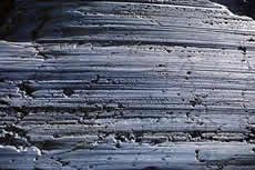
Striated Graywackie, Yale Glacier, Alaska. 1997. Parallel striations and bedrock fracture trends (across the left side of the image) are clearly visible in this photo. (Photo courtesy of Tom Lowell, University of Cincinnati.)
- glacial retreat
- when the position of a mountain glacier's terminus is farther upvalley than before; occurs when a glacier ablates more material at its terminus than it transports into that region.

Muir Glacier, Glacier Bay National Park and Reserve's White Thunder Ridge as seen on August 13, 1941 (left) and August 31, 2004 (right). (2004 photo courtesy of B. Molnia, USGS; 1941 photo courtesy of W. Field. Archived in the Long-Term Change Photograph Pairs Special Collection in the Glacier Photograph Database.)
- glacial striations
- grooves or gouges cut into the bedrock by gravel and rocks carried by glacial ice and meltwater; also called glacial grooves.
Striated Graywackie, Yale Glacier, Alaska. 1997. Parallel striations and bedrock fracture trends (across the left side of the image) are clearly visible in this photo. (Photo courtesy of Tom Lowell, University of Cincinnati.)
- glacial till
- accumulations of unsorted, unstratified mixtures of clay, silt, sand, gravel, and boulders; the usual composition of a moraine.
- glacial trough
- a large u-shaped valley formed from a v-shaped valley by glacial erosion.

Western Brook glacial trough, Newfoundland, Canada. The sheer walls of this glacial trough soar up to 700 m high, and the glacial basin is 500 m deep in places. (Photo courtesy of Natural Resources Canada. Copyright Terrain Sciences Division, Geological Survey of Canada.)
- glaciated
- land covered in the past by any form of glacier is said to be glaciated.
- glacier
- a mass of ice that originates on land, usually having an area larger than one tenth of a square kilometer; many believe that a glacier must show some type of movement; others believe that a glacier can show evidence of past or present movement.

Taku Glacier winds through the mountains of southeastern Alaska, calving small icebergs into Taku Inlet. This photograph dates from 1929. (Photo courtesy of the U. S. Navy, archived at the World Data Center for Glaciology, Boulder, CO.)
- glacier cave
- a cave of ice, usually underneath a glacier and formed by meltwater; cave entrances are often enlarged near a glacier terminus by warm winds; most common on stagnant portions of glaciers.

A small stream flows from the glacier cave at the terminus of Arolla Glacier in the Pennine Alps. Photograph from 1902. (Photo courtesy of H.F. Reid, archived at the World Data Center for Glaciology, Boulder, CO.)
- glacier fire
- a phenomenon in which strong reflection of the sun on an icy surface causes a glacier to look like it is on fire.
- glacier flood
- a sudden outburst of water released by a glacier.
- glacier flour
- a fine powder of silt- and clay-sized particles that a glacier creates as its rock-laden ice scrapes over bedrock; usually flushed out in meltwater streams and causes water to look powdery gray; lakes and oceans that fill with glacier flour may develop a banded appearance; also called rock flour.
- glacier ice
- well-bonded ice crystals compacted from snow with a bulk density greater than 860 kilograms per cubic-meter (55 pounds per cubic-foot).
- glacier mill
- a nearly vertical channel in ice that is formed by flowing water; usually found after a relatively flat section of glacier in a region of transverse crevasses.
- glacier pothole
- potholes formed at the bottom of glaciers through erosion caused by sand and gravel in melt-water; melt-water seeps through crevasses in the glaciers, sometimes forming whirpools; at the bottom of the glacier, the water is under very high pressure, leading to erosion of underlying rocks.
- glacier remainie
- a glacier that is reconstructed or reconstituted out of other glacier material; usually formed by seracs falling from a hanging glacier, then re-adhering; also called reconstituted, reconstructed or regenerated glacier.
- glacier snout
- the lowest end of a glacier; also called glacier terminus or toe.

Glacier at the head of Canon Fiord, Ellesmere Island, Canada
- glacier sole
- the bottom of the ice of a glacier.
- glacier table
- a rock that resides on a pedestal of ice; formed by differential ablation between the rock-covered ice and surrounding bare ice.

Talefre Glacier on Mont Blanc Massif in the European Alps sported a prominent glacier table when this undated photograph was taken. The rock protected the ice directly below it from melting, resulting in the characteristic pedestal that remains after the surrounding ice melts. For scale, note the man standing behind and to the left of the pedestal. (Photo courtesy of Cairrar, archived at the World Data Center for Glaciology, Boulder, CO.)
- glacier terminus
- the lowest end of a glacier; also called glacier snout or toe.
Glacier at the head of Canon Fiord, Ellesmere Island, Canada
- glacier toe
- the lowest end of a glacier; also called glacier snout or terminus.
Glacier at the head of Canon Fiord, Ellesmere Island, Canada
- glacier tongue
- an extension of a glacier or ice stream projecting seaward, usually afloat.
- glacier trough
- u-shaped valleys transformed from v-shaped stream valleys due to erosion caused by passing glaciers.
- glacier wind
- a localized current of air occuring as a result of a glacier's melting processes; when the surface of glacial ice melts, the air above the glacier cools and becomes heavier than the surrounding air and flows down the glacial valley; glacier wind can also be wind that flows out of ice caves; a kind of katabatic wind.
- glacieret
- a very small glacier.
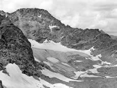
Arapaho Glacier, located along the Front Range, Colorado, in 1956. Although relatively small in terms of glacier size, the city of Boulder, Colorado, still receives some of its drinking water from Arapaho Glacier runoff. (Photo courtesy of the World Data Center for Glaciology, Boulder, CO.)
- glacierized
- land overlaid at present by a glacier is said to be covered; the alternative term glacierized has not found general favour.
- glaze
- a coating of ice, generally clear and smooth but usually containing some air pockets, formed on exposed objects by freezing of a film of super-cooled water deposited by rain, drizzle, fog, or possibly condensed from super-cooled water vapor; glaze is denser, harder and more transparent, than either rime or hoarfrost.
- global observing system
- global network of observational stations which is the coordinated system of methods, techniques and facilities for making observations on a world-wide scale in the framework of the World Weather Watch, a World Meteorological Organization program.

Russian translation prepared by Nina A. Zaitseva for the Arctic Climatology Project Arctic Meteorology and Climate Atlas.
- global telecommunication system
- the coordinated global system of telecommunication facilities and arrangements for the rapid collection, exchange and distribution of observational data in the framework of the World Weather Watch, a World Meteorological Organization program.

Russian translation prepared by Nina A. Zaitseva for the Arctic Climatology Project Arctic Meteorology and Climate Atlas.
- gradient wind
- the same as geostrophic wind, but blowing parallel to curved isobars or contours; the curved airflow pattern around a pressure center results from a balance among pressure-gradient force, coriolis force, and centrifugal force.
Russian translation prepared by Nina A. Zaitseva for the Arctic Climatology Project Arctic Meteorology and Climate Atlas.
- granic cryogenic fabric
- a distinct soil micromorphology, resulting from the effects of freezing and thawing processes, in which soil particles form discrete loosely packed units.
- granoidic cryogenic fabric
- a distinct soil micromorphology, resulting from the effects of freezing and thawing processes, in which soil particles form more or less discrete loosely packed units.
- graupel
- snowflakes that become rounded pellets due to riming; typical sizes are 2 to 5 millimeters in diameter (0.1 to 0.2 inch); graupel is sometimes mistaken for hail.
- gravimetric (total) water content
- the ratio of the mass of the water and ice in a sample to the dry mass of the sample, commonly expressed as a percentage.
- gravity wave
- a wave disturbance in which buoyancy (or reduced gravity) acts as a restoring force on parcels displaced from hydrostatic equilibrium; there is a direct oscillatory conversion between potential and kinetic energy in the wave motion.

Russian translation prepared by Nina A. Zaitseva for the Arctic Climatology Project Arctic Meteorology and Climate Atlas.
- gravity wind
- a cold wind blowing down an incline; a kind of katabatic wind.
- grease ice
- a very thin, soupy layer of frazil crystals clumped together, which makes the ocean surface resemble an oil slick.
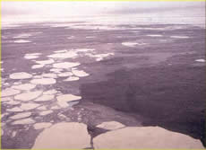
Grease ice (thin, light-grey area) with thick ice floes. (Photo courtesy of Ted Maksym, United States Naval Academy.)
- Greenland high
- the anticyclone that appears to overlie Greenland; analogous to the antarctic anticyclone.
Russian translation prepared by Nina A. Zaitseva for the Arctic Climatology Project Arctic Meteorology and Climate Atlas.
- grey-white ice
- a category of young ice 15 to 30 centimeters (6 to 12 inches) thick, named for its color.

Thin grey-white ice showing the effects of ridging and rafting. (Photo courtesy of the Antarctic Sea-Ice Processes and Climate program (ASPeCt).)
- grid
- a finite collection of points to which the meteorological variables used in a numerical model, or interpolated from observations, apply; a field of such regular values (points) is termed gridded field.
Russian translation prepared by Nina A. Zaitseva for the Arctic Climatology Project Arctic Meteorology and Climate Atlas.
- ground ice
- a general term referring to all types of ice contained in freezing and frozen ground.
- ground moraine
- continuous layer of till near the edge or underneath a steadily retreating glacier.
- growler
- an iceberg less than 2 meters (6.6 feet) across that floats with less than 1 meter (3.3 feet) showing above water; smaller than a bergy bit.
- hail
- precipitation of small balls or pieces of ice (hailstones) with a diameter ranging from 5 to 50 millimeters (0.2 to 2.0 inches), or sometimes bigger, falling either separately or agglomerated into irregular lumps; when the diameter is less than about 5 millimeters (0.2 inch), the balls are called ice pellets.
- halo
- group of optical phenomena, in the form of rings, arcs, pillars or bright spots around the sun or moon, produced by the refraction or reflection of light by ice crystals suspended in the atmosphere (cirrus clouds, diamond dust, etc.).

Russian translation prepared by Nina A. Zaitseva for the Arctic Climatology Project Arctic Meteorology and Climate Atlas.
- hanging glacier
- a glacier that terminates at or near the top of a cliff.
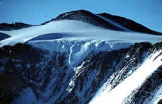
Mt. Kefton, Antarctica
- hanging valley
- a valley formed by a small glacier that has a valley bottom relatively higher than nearby valleys formed by larger glaciers.
- hard frozen ground
- frozen ground (soil or rock) which is firmly cemented by ice.
- haze
- fine dust or salt particles dispersed through a portion of the atmosphere; the particles are so small that they cannot be felt or individually seen with the naked eye, but they diminish horizontal visibility and give the atmosphere a characteristic opalescent appearance that subdues all colors; a type of lithometeor.

Russian translation prepared by Nina A. Zaitseva for the Arctic Climatology Project Arctic Meteorology and Climate Atlas.
- headwall
- a steep cliff, usually the uppermost part of a cirque.
- heat balance
- equilibrium between the gain and loss of heat at a specific place or for a specific system.

Russian translation prepared by Nina A. Zaitseva for the Arctic Climatology Project Arctic Meteorology and Climate Atlas.
- heat balance of the earth-atmosphere system
- the equilibrium that exists between the radiation received by the earth and atmosphere from the sun and that emitted by the earth and atmosphere.

Russian translation prepared by Nina A. Zaitseva for the Arctic Climatology Project Arctic Meteorology and Climate Atlas.
- heat budget
- relation between fluxes of heat into and out of a given region or body and the heat stored by the system; in general, this budget includes advective, evaporative, and other terms as well as a radiation term.

Russian translation prepared by Nina A. Zaitseva for the Arctic Climatology Project Arctic Meteorology and Climate Atlas.
- heat capacity
- the amount of heat required to raise the temperature of a unit mass of a substance by one degree.
- heat flux
- the amount of heat transferred across a surface of unit area in a unit time.
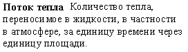
Russian translation prepared by Nina A. Zaitseva for the Arctic Climatology Project Arctic Meteorology and Climate Atlas.
- heat sink
- process, or region, in which energy is removed from the atmosphere in the form of heat.

Russian translation prepared by Nina A. Zaitseva for the Arctic Climatology Project Arctic Meteorology and Climate Atlas.
- heat source
- process, or region, in which energy is added to the atmosphere in the form of heat.

Russian translation prepared by Nina A. Zaitseva for the Arctic Climatology Project Arctic Meteorology and Climate Atlas.
- heaving pressure
- upward pressure developed during freezing of the ground.
- high
- area of high pressure in the atmosphere; used interchangeably with anticyclone.

Russian translation prepared by Nina A. Zaitseva for the Arctic Climatology Project Arctic Meteorology and Climate Atlas.
- high-center polygon
- an ice-wedge polygon in which melting of the surrounding ice wedges has left the central area in a relatively elevated position.
- high-level clouds
- typically thin, white clouds above 6,000 meters (20,000 feet); at these altitudes, temperatures are so cold that clouds are composed primarily of ice crystals; includes cirrus, cirrocumulus and cirrostratus clouds.

Russian translation prepared by Nina A. Zaitseva for the Arctic Climatology Project Arctic Meteorology and Climate Atlas.
- hoarfrost
- a deposit of interlocking ice crystals (hoar crystals) formed by direct sublimation on objects, usually those of small diameter freely exposed to the air, such as tree branches, plant stems and leaf edges, wires, poles, etc.; the surfaces of these objects are sufficiently cooled, mostly by nocturnal radiation, to cause the direct sublimation of the water vapor contained in the ambient air.

(Top) A new layer of surface hoar on the snow. Note the quarter for scale. (Photo courtesy of K. Williams.) (Bottom) Russian translation prepared by Nina A. Zaitseva for the Arctic Climatology Project Arctic Meteorology and Climate Atlas.
- horn
- a peak or pinnacle thinned and eroded by three or more glacial cirques.

The Matterhorn in Switzerland was carved away by glacial erosion. (Photo courtesy of the World Data Center for Glaciology, Boulder, CO.)
- hostile ice
- from the point of view of the submariner, an ice canopy containing no large ice skylights or other features which permit a submarine to surface.
- humidity
- (1) water vapor content of the air. (2) some measure of the water-content of air; see also absolute humidity, relative humidity, specific humidity, dew point.

Russian translation prepared by Nina A. Zaitseva for the Arctic Climatology Project Arctic Meteorology and Climate Atlas.
- hummock
- (1) [sea ice] a smooth hill of ice that forms on the sea ice surface from eroding ridges, particularly during the summer melt; the formation of hummocks is similar to young mountain peaks with steep slopes that erode into smooth, rolling hills. (2) [frozen ground] Small lumps of soil pushed up by frost action, often found in uniformly spaced in large groups. Hummocks can form in areas of permafrost or seasonally frozen ground, and are one of the most common surface features of the Arctic.

Hummocks make the sea ice surface appear as rolling hills. (Photo courtesy of Ted Maksym, United States Naval Academy.)
- hummocking
- [sea ice] pressure process by which floating ice becomes broken up into hummocks.
- hydration shattering
- a form of weathering that affects all rocks; water freezes in pores and cracks, which leads to an increase in specific volume (vol/unit mass) of the water, producing stress that is greater than the tensile strength of all common rocks; ultimately leads to shattering and fracturing of the rocks.
- hydraulic conductivity
- the volume of fluid passing through a unit cross section in unit time under the action of a unit hydraulic potential gradient.
- hydraulic diffusivity
- the ratio of the hydraulic conductivity and the storage capacity of a groundwater aquifer.
- hydraulic thawing
- artificial thawing (and removal) of frozen ground by the use of a stream or jet of water under high pressure.
- hydrochemical talik
- a layer or body of cryotic (but unfrozen) ground in a permafrost area, maintained by moving mineralized groundwater.
- hydrometeor
- any product of condensation or sublimation of atmospheric vapor, whether formed in free atmosphere or at the earth's surface; also any water particles blown by the wind from the earth's surface.

Russian translation prepared by Nina A. Zaitseva for the Arctic Climatology Project Arctic Meteorology and Climate Atlas.
- hydrothermal talik
- a layer or body of noncryotic unfrozen ground in a permafrost area, maintained by moving groundwater.
- hygrometer
- an instrument which measures the water vapor content in the atmosphere; there are several different means of transduction used in measuring this quantity and hence various types of hygrometers; these are: a) the psychrometer, which utilizes the thermodynamic method; b) the class of instruments which depends upon a change of physical dimension due to absorption of moisture (hair hygrometer, for example); c) those which depend upon condensation of moisture (dew point hygrometer); d) the class of instruments which depend upon the change of chemical or electrical properties due to absorption of moisture, and some others.
Russian translation prepared by Nina A. Zaitseva for the Arctic Climatology Project Arctic Meteorology and Climate Atlas.
- ice
- the solid crystalline form of water.
Russian translation prepared by Nina A. Zaitseva for the Arctic Climatology Project Arctic Meteorology and Climate Atlas.
- ice apron
- a mass of ice adhering to a mountainside.
- ice blink
- white glare on the underside of low clouds indicating presence of ice which may be beyond the range of vision.

Russian translation prepared by Nina A. Zaitseva for the Arctic Climatology Project Arctic Meteorology and Climate Atlas.
- ice cake
- a floe smaller than 20 meters (66 feet) across.
- ice canopy
- pack ice from the point of view of the submariner.
- ice cap
- a dome-shaped mass of glacier ice that spreads out in all directions; an ice cap is usually larger than an icefield but less than 50,000 square-kilometers (12 million acres).
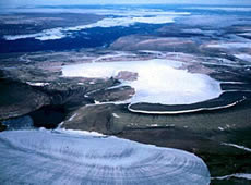
Ellesmere Island, Canada
- ice cave
- a cave of ice, usually underneath a glacier and formed by meltwater; cave entrances are often enlarged near a glacier terminus by warm winds; most common on stagnant portions of glaciers.

Ice cave under Mendenhall Glacier, 1991. (Photo courtesy of Commander John Bortniak, NOAA Corps, National Oceanic and Atmospheric Administration/Department of Commerce.)
- ice cluster
- a concentration of sea ice, covering 100's of square kilometers, which is found in the same region every summer.
- ice concentration
- the fraction of an area that is covered by sea ice.
- ice content
- the amount of ice contained in frozen or partially frozen soil or rock.
- ice core
- a core sample drilled from the accumulation of snow and ice over many years that have recrystallized and have trapped air bubbles from previous time periods, the composition of which can be used to reconstruct past climates and climate change; typically removed from an ice sheet (Antarctica and Greenland) or from high mountain glaciers elsewhere.
- ice covered
- land overlaid at present by a glacier is said to be covered; the alternative term glacierized has not found general favour.
- ice divide
- the boundary separating opposing flow directions of ice on a glacier or ice sheet.
- ice edge
- the boundary at any given time between open water and sea, river or lake ice of any kind, whether drifting or fast; may be termed compacted when it is clear-cut, or open when it forms the indefinite edge of an area of dispersed ice.

Aerial view of the sea ice edge. (Photo courtesy of Todd Arbetter, National Snow and Ice Data Center.)
- ice extent
- the total area covered by some amount of ice, including open water between ice floes; ice extent is typically reported in square kilometers.
- ice floe
- a cohesive sheet of ice floating in the water; the sea ice cover is made up of conglomerates of floes; ice floes are not unique to sea ice, as they also occur in rivers and lakes.

Aerial view of ice floes.
- ice fog
- a suspension of numerous minute ice crystals in the air, reducing visibility at the earth's surface; the crystals often glitter in the sunshine; ice fog produces optical phenomena such as luminous pillars and small haloes.
- ice fringe
- a very narrow ice piedmont, extending less than about 1 km inland from the sea.
- ice front
- the vertical cliff forming the seaward face of an ice shelf or other floating glacier, varying in height from 2 to 50 meters (2.2 to 55 yards) above sea level.
- ice island
- a form of tabular berg found in the Arctic Ocean, with a thickness of 30 - 50 meters (33 to 55 yards) and an area from a few thousand square meters to 500 square kilometers (123,550 acres); ice islands often have an undulating surface, which gives them a ribbed appearance from the air.
- ice jam
- an accumulation of broken river or sea ice caught in a narrow channel.
- ice keel
- from the point of view of the submariner, a downward-projecting ridge on the underside of the ice canopy; the counterpart of a ridge; ice keels may extend as much as 50 meters (55 yards) below sea level.
- ice lens
- a dominantly horizontal, lens-shaped body of ice of any dimension.
- ice limit
- the average position of the ice edge in any given month or period based on observations over a number of years.
- ice patrol ship
- a research ship which performs ice surveys in polar regions.

Russian translation prepared by Nina A. Zaitseva for the Arctic Climatology Project Arctic Meteorology and Climate Atlas.
- ice pellet
- precipitation of small balls or pieces of ice (hailstones) with a diameter ranging from 5 to 50 millimeters (0.2 to 2.0 inches), or sometimes more, falling either separately or agglomerated into irregular lumps; when the diameter is less that about 5 millimeters (0.2 inch), the balls are called ice pellets.
- ice piedmont
- ice covering a costal strip of low-lying land backed by mountains; the surface of an ice piedmont slopes gently seawards and may be anything from 1 to 50 kilometers (0.6 to 31 miles) wide, fringing long stretches of coastline with ice cliffs; ice piedmonts frequently merge into ice shelves; a very narrow ice piedmont may be called an ice fringe.
- ice prisms
- a fall of unbranched ice crystals, in the form of needles, columns, or plates, often so tiny that they seem to be suspended in the air; these are visible mainly when they glitter in the sunshine (diamond dust); they may then produce a luminous pillar or other halo phenomena; this hydrometeor, which is frequent in polar regions, occurs at very low temperatures and in stable air masses.
- ice quake
- a shaking of ice caused by crevasse formation or jerky motion.
- ice rind
- a brittle, shiny crust of floating ice, formed on a quiet surface by direct freezing or from grease ice, usually in water of low salinity; thickness less than 5 centimeters (2 inches); easily broken by wind or swell, commonly breaking into rectangular pieces.
- ice rise
- a mass of ice resting on rock and surrounded either by an ice shelf, or partly by an ice shelf and partly by sea; no rock is exposed and there may be none above sea level; ice rises often have a dome-shaped surface; the largest known is about 100 kilometers (62 miles) across.
- ice segregation
- the formation of discrete layers or lenses of segregated ice in freezing mineral or organic soils, as a result of the migration (and subsequent freezing) of pore water.
- ice sheet
- a dome-shaped mass of glacier ice that covers surrounding terrain and is greater than 50,000 square kilometers (12 million acres) (e.g., the Greenland and Antarctic ice sheets).
- ice shelf
- portion of an ice sheet that spreads out over water.
- ice skylight
- from the point of view of the submariner, thin places in the ice canopy, usually less than 1 meter (3.3 feet) thick and appearing from below as relatively light, translucent patches in dark surroundings; the under-surface of an ice skylight is normally flat; ice skylights are called large if big enough for a submarine to attempt to surface through them (120 meters, 131 yards), or small if not.
- ice stream
- (1) a current of ice in an ice sheet or ice cap that flows faster than the surrounding ice (2) sometimes refers to the confluent sections of a branched-valley glacier (3) obsolete synonym of valley glaciers.
- ice vein
- an ice-filled crack or fissure in the ground.
- ice wall
- an ice cliff forming the seaward margin of an inland ice sheet, ice piedmont or ice rise; the rock basement may be at or below sea level.
- ice wedge
- narrow ice mass that is 3 to 4 meters (10 to 13 feet) wide at the ground surface, and extends as much as 10 meters (33 feet) down; a decrease in temperature during the winter leads to ice wedge cracks in the ground around ice wedges; during the summer, these cracks accumulate melt-water and sediment, forming pseudomorphs.
- ice worm
- an oligochaete worm that lives on temperate glaciers or perennial snow; there are several species that range in color from yellowish-brown to reddish-brown or black; they are usually less than 1 millimeter (0.04 inch) in diameter and average about 3 millimeters (0.1 inch) long; some eat red algae.
- ice-bearing permafrost
- permafrost that contains ice.
- ice-bonded permafrost
- ice-bearing permafrost in which the soil particles are cemented together by ice.
- ice-cemented glacier
- a rock glacier that has interstitial ice a meter or so below the surface.
- ice-cored glacier
- a rock glacier that has a buried core of ice.
- ice-cored topography
- topography that is due almost solely to differences in the amount of excess ice underlying its surface.
- ice-nucleation temperature
- the temperature at which ice first forms during freezing of a soil/water system that does not initially contain ice.
- ice-rich permafrost
- permafrost containing excess ice.
- ice-wedge cast
- a filling of sediment in the space formerly occupied by an ice wedge.
- ice-wedge polygon
- a polygon outlined by ice wedges underlying its boundaries.
- iceberg
- a piece of ice that has broken off from the end of a glacier that terminates in water.
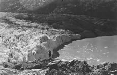
Lamplugh Glacier, in Glacier Bay Alaska, shows the terminus of a typical tidewater glacier. The terminus of the glacier is heavily crevassed and jagged, and is calving small icebergs. For scale, note the man standing on the rocks in the foreground (near the center of the photograph). This photograph was taken in 1941. (Photo courtesy of W. O. Field, archived at the World Data Center for Glaciology, Boulder, CO.)
- iceberg tongue
- a major accumulation of icebergs projecting from the coast, held in place by grounding and joined together by fast ice.
- icebound
- a harbour, inlet, etc, is said to be icebound when navigation by ships is prevented due to ice, except possibly with the assistance of an icebreaker.
- icefall
- part of a glacier with rapid flow and a chaotic crevassed surface; occurs where the glacier bed steepenes or narrows.

Icefalls on three parallel glaciers. (Photo courtesy of Tom Lowell, University of Cincinnati.)
- icefield
- a mass of glacier ice; similar to an ice cap, and usually smaller and lacking a dome-like shape; somewhat controlled by terrain.
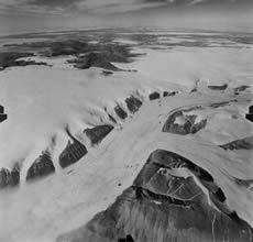
Kalstenius Icefield, located on Ellesmere Island, Canada, shows vast stretches of ice. The icefield produces multiple outlet glaciers that flow into a larger valley glacier. The glacier in this photograph is three miles wide. (Photo courtesy of the Royal Canadian Air Force, archived at the World Data Center for Glaciology, Boulder, CO.)
- icefoot
- a narrow fringe of ice attached to the coast, unmoved by tides and remaining after the fast ice has broken free.
- Icelandic low
- the low pressure center near Iceland (mainly between Iceland and southern Greenland); on mean charts of sea-level pressure, it is a principal center of action in the atmosphere circulation of the northern hemisphere.

Russian translation prepared by Nina A. Zaitseva for the Arctic Climatology Project Arctic Meteorology and Climate Atlas.
- iceport
- an embayment in an ice front, often of temporary nature, where ships can moor alongside and unload directly into the ice shelf.
- icicle
- hanging spike of clear ice formed by the freezing of dripping water.
- iciness
- a qualitative term describing the quantity of ice in frozen ground.
- icing
- a sheetlike mass of layered ice formed on the ground surface, or on river or lake ice, by freezing of successive flows of water that may seep from the ground, flow from a spring or emerge from below river or lake ice through fractures.
Russian translation prepared by Nina A. Zaitseva for the Arctic Climatology Project Arctic Meteorology and Climate Atlas.
- icing blister
- a seasonal frost mound consisting only of ice and formed at least in part through lifting of one or more layers of an icing by injected water.
- icing glade
- an area kept clear of trees and shrubs by the annual occurrence of icings.
- icing mound
- a seasonal frost mound consisting exclusively of thinly layered ice, formed by freezing of successive flows of water issuing from the ground or from below river ice.
- inactive ice wedge
- an ice wedge that is no longer growing.
- inactive rock glacier
- a mass of rock fragments and finer material, on a slope, that contains either an ice core or interstitial ice, and shows evidence of past, but not present, movement.
- infrared radiation
- electromagnetic radiation of wavelengths between approximately 0.75 and 1000 millimeters; see also atmospheric radiation, terrestrial radiation, longwave radiation.

Russian translation prepared by Nina A. Zaitseva for the Arctic Climatology Project Arctic Meteorology and Climate Atlas.
- inland ice sheet
- an ice sheet of considerable thickness and an area of more than about 50,000 square kilometers (12.4 million acres), resting on rock; inland ice sheets near sea level may merge into ice shelves.
- insolation
- (1) exposure of an object to the sun (2) intensity of incoming solar radiation incident on a unit horizontal surface at a specific level.
Russian translation prepared by Nina A. Zaitseva for the Arctic Climatology Project Arctic Meteorology and Climate Atlas.
- instrument shelter
- structure to protect certain instruments from insolation and weather while at the same time ensuring sufficient ventilation.
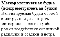
Russian translation prepared by Nina A. Zaitseva for the Arctic Climatology Project Arctic Meteorology and Climate Atlas.
- interfacial water
- water that forms transition layers at mineral/water and mineral/water/ice interfaces in frozen ground.
- intermediate discontinuous permafrost
- (1) (North American usage) permafrost underlying 35 - 65% of the area of exposed land surface (2) (Russian usage) permafrost underlying 40 - 60% of the area of exposed land surface.
- internal ice stress
- a measure of the compactness, or strength of the ice; plays an important role in the deformation of the ice and formation of features such as ridges and leads.
- interstitial ice
- ice formed in narrow spaces between small rocks and sediment in soil.
- intrapermafrost water
- water occurring in unfrozen zones (taliks and cryopegs) within permafrost.
- intrusive ice
- ice formed from water injected into soils or rocks.
- inversion
- in meteorology, a departure from the usual (normal) decrease or increase with altitude of the value of an atmospheric property; also, the layer through which this departure occurs (the inversion layer); this term almost always refers to a temperature inversion.

Russian translation prepared by Nina A. Zaitseva for the Arctic Climatology Project Arctic Meteorology and Climate Atlas.
- isoband cryogenic fabric
- a distinct soil micromorphology, resulting from the effects of freezing and thawing processes, in which soil particles form subhorizontal layers of similar thickness.
- isobar
- a line of equal or constant pressure; it most often refers to a line drawn through all points of equal atmospheric pressure.

Russian translation prepared by Nina A. Zaitseva for the Arctic Climatology Project Arctic Meteorology and Climate Atlas.
- isohyet
- a line drawn through geographical points recording equal amounts of precipitation during a specific period.

Russian translation prepared by Nina A. Zaitseva for the Arctic Climatology Project Arctic Meteorology and Climate Atlas.
- isolated cryopeg
- a body of unfrozen ground, that is perennially cryotic (T < 0 degrees Celsius) and entirely surrounded by perennially frozen ground.
- isolated patches of permafrost
- permafrost underlying less than 10% of the exposed land surface.
- isolated talik
- a layer or body of unfrozen ground entirely surrounded by perennially frozen ground.
- isotherm
- a line of equal or constant temperature.

Russian translation prepared by Nina A. Zaitseva for the Arctic Climatology Project Arctic Meteorology and Climate Atlas.
- jet stream
- relatively strong winds concentrated within a narrow stream in the atmosphere; generally refers to a quasi-horizontal jet stream of maximum winds embedded in the midlatitude westerlies, and concentrated in the high troposphere.

Russian translation prepared by Nina A. Zaitseva for the Arctic Climatology Project Arctic Meteorology and Climate Atlas.
- jokulhlaup
- (1) a large outburst flood that usually occurs when a glacially dammed lake drains catastrophically (2) any catastrophic release of water from a glacier.
- katabatic wind
- any wind blowing down an incline; if the wind is warm, it is called a foehn or chinook; if cold, it may be a fall wind (bora), or a gravity wind (mountain wind); the opposite of anabatic wind.

Russian translation prepared by Nina A. Zaitseva for the Arctic Climatology Project Arctic Meteorology and Climate Atlas.
- keel
- the part of a ridge below the ocean surface; wind, ocean currents, and other forces can push sea ice into piles that rise and form small mountains below the level sea ice surface.
- kinetic-growth metamorphism
- snow metamorphism that builds angular facets on crystals and makes cup and scroll shaped crystals.
- kurum
- a general term for all types of coarse clastic formations on slopes of 2-3 to 40 degrees, moving downslope mainly due to creep.
- lake ice
- floating ice formed in lakes.
- lake talik
- a layer or body of unfrozen ground occupying a depression in the permafrost table beneath a lake.
- lamina
- thin plate, sheet or layer; laminae (plural).
- land sky
- the relatively dark appearance of the underside of a cloud layer when it is over land that is not snow covered; this term is used largely in polar regions with reference to the sky map; land sky is brighter than water sky, but is much darker than ice blink or snow blink.

Russian translation prepared by Nina A. Zaitseva for the Arctic Climatology Project Arctic Meteorology and Climate Atlas.
- lapse rate
- the rate of change of any meteorological element with height.

Russian translation prepared by Nina A. Zaitseva for the Arctic Climatology Project Arctic Meteorology and Climate Atlas.
- large-scale atmospheric processes
- atmospheric processes with a representative scale (large-scale) of 10,000 kilometers (6,200 miles); in meteorology, it is a scale in which the curve of the earth is not negligible; the large-scale atmospheric flows are essentially nearly hydrostatic, nearly geostrophic and wave-like in appearance; they exist mainly in response to the latitudinal differences in radiative heating, to the particular value of the coriolis force and to the spatial distribution of the oceans and continents.

Russian translation prepared by Nina A. Zaitseva for the Arctic Climatology Project Arctic Meteorology and Climate Atlas.
- latent heat of fusion
- the amount of heat required to cause a change of phase from solid to liquid, or the heat released when the phase change is from liquid to solid; in the case of melting snow, the phase change from ice to water requires a significant amount of heat—160 times that required to raise the temperature of the same amount of ice by just 1 degree Celsius; until the required amount of heat is supplied to completely melt all of the ice being considered, no further increase in temperature will occur.

Russian translation prepared by Nina A. Zaitseva for the Arctic Climatology Project Arctic Meteorology and Climate Atlas.
- latent heat polynya
- a polynya that forms from strong winds in a persistent direction that push the ice away from a barrier (the coast, fast ice, a grounded iceberg, or an ice shelf).
- lateral moraine
- a ridge-shaped moraine deposited at the side of a glacier and composed of material eroded from the valley walls by the moving glacier.
- lateral talik
- a layer or body of unfrozen ground, overlain and underlain by perennially frozen ground.
- latitudinal limit of permafrost
- the southernmost (northernmost) latitude at which permafrost occurs in a lowland region in the northern (southern) hemisphere.
- latitudinal zonation of permafrost
- the subdivision of a permafrost region into permafrost zones, based on the percentage of the area that is underlain by permafrost.
- layered cryostructure
- the cryostructure of frozen silt or loam in which ice layers alternate with mineral layers that have a massive cryostructure.
- lead
- long, linear areas of open water that range from a few meters to over a kilometer in width, and tens of kilometers long; they develop as ice diverges, or pulls apart.

Lead that developed through the middle of an Arctic camp site. (Photo courtesy of Don Perovich, U.S. Army Cold Regions Research and Engineering Laboratory.)
- lead shore
- a lead that forms between drift ice and the coast.
- leeward/lee side
- the downwind side.
- lens ice
- ground ice occurring as ice lenses.
- lens-type cryostructure
- the cryostructure of frozen silt or loam containing numerous ice lenses.
- level ice
- floating ice with a flat surface which has never been hummocked.
- lithometer
- general term for dry atmospheric suspensoids, including dust, haze, smoke and sand.
- little ice age
- a period of cooling that occurred from the 16th through the early 19th century, and was marked by expanding glaciers in Europe, North America, and Asia
- long-term strength
- the failure strength of a material after a long period of creep deformation.
- longwave radiation
- heat radiation with wavelengths greater than 4 millimeters.

Russian translation prepared by Nina A. Zaitseva for the Arctic Climatology Project Arctic Meteorology and Climate Atlas.
- low
- area of low pressure in the atmosphere.

Russian translation prepared by Nina A. Zaitseva for the Arctic Climatology Project Arctic Meteorology and Climate Atlas.
- low-center polygon
- an ice-wedge polygon in which thawing of ice-rich permafrost has left the central area in a relatively depressed position.
- low-level clouds
- clouds in the lower region of the atmosphere, from ground level to 6500 feet (2000 meters); includes stratus, stratocumulus, the bases of cumulus and cumulonimbus, and sometimes nimbostratus clouds.

Russian translation prepared by Nina A. Zaitseva for the Arctic Climatology Project Arctic Meteorology and Climate Atlas.
- luminous pillars
- white or sometimes reddish vertical streaks of light extending from above and below the sun; they are caused by light reflected off the mirror-like surfaces of ice; most commonly seen at sunrise and sunset.
- macro-scale polygons
- closed, multi-sided, roughly equidimensional, patterned ground features, typically 15 to 30 meters (16 to 33 yards) across; commonly resulting from thermal contraction cracking of the ground.
- magnetic pole
- either of the two points on the earth's surface at which magnetic meridians converge; the horizontal component of the magnetic field of the earth becomes zero at this point; also called the dip pole.

Russian translation prepared by Nina A. Zaitseva for the Arctic Climatology Project Arctic Meteorology and Climate Atlas.
- marginal crevasse
- a crevasse near the side of a glacier formed as the glacier moves past stationary valley walls; usually oriented about 45 degrees up-glacier from the side wall.
- marginal ice zone
- a part of the seasonal ice zone that varies in width (100 to 200 kilometers, 62 to 124 miles) that extends from the ice edge into the ice pack, where waves and swells affect the ice; often characterized by highly variable ice conditions; in general, it is wider in the Antarctic than the Arctic.

A scenic view within the marginal ice zone.
- marine climate
- a climate dominated by the ocean; because of the moderating effect of water, sites having this climate are considered relatively mild.

Russian translation prepared by Nina A. Zaitseva for the Arctic Climatology Project Arctic Meteorology and Climate Atlas.
- marine cryopeg
- a layer or body of unfrozen ground, that is perennially cryotic (T < 0 degrees Celsius), forming part of the coastal or subsea permafrost.
- maritime
- of, relating to, or adjacent to the sea.
- mass balance
- the difference between accumulation and ablation on a glacier; usually calculated on an annual basis.
- mass wasting
- downslope movement of soil or rock on, or near, the earth's surface under the influence of gravity.
- massive cryostructure
- the cryostructure of frozen sand in which all mineral particles are bonded together with ice.
- massive ice
- a comprehensive term used to describe large masses of ground ice, including ice wedges, pingo ice, buried ice and large ice lenses.
- massive-agglomerate cryostructure
- the cryostructure of frozen silt or loam in which ice veins form an irregular three-dimensional network.
- massive-porous cryostructure
- the cryostructure of frozen sand and gravel in which all mineral particles are bonded together with ice, but larger pore spaces are not completely filled with ice.
- maximum ice extent
- the largest sea ice extent during a given year; maximum ice extent marks the end of the growth period for sea ice, and the start of the melt season
- mean annual ground temperature (MAGT)
- mean annual temperature of the ground at a particular depth.
- mean annual ground-surface temperature (MAGST)
- mean annual temperature of the surface of the ground.
- mechanical properties of frozen ground
- the properties of frozen ground governing its deformability and strength.
- mechanical strength
- the failure strength of a material under given loading conditions.
- medial moraine
- a ridge-shaped moraine in the middle of a glacier originating from a rock outcrop, nunatak, or the converging lateral moraines of two or more ice streams.
- megadunes
- unlike snow dunes that are piles of drifted snow, antarctic megadunes are long, undulating waves in the surface of the ice sheet that are 2 to 4 meters (6.5 to 13 feet) high and 2 to 5 kilometers (1 to 3 miles) apart; they are slightly rounded at their crests and are so subtle that a person on the ground cannot see the pattern.

This NASA satellite image shows a five-mile scale in a megadune area
- melt ponds
- pools of melted snow and ice on the sea ice surface created during the summer melt.

Scientist taking measurements in a melt pond. (Photo courtesy of Don Perovich, U.S. Army Cold Regions Research and Engineering Laboratory.)
- meltwater conduit
- a channel within, underneath, on top of, or near the side of a glacier that drains meltwater out of the glacier; usually kept open by the frictional heating of flowing water that melts the ice walls of the conduit.
- mercury barometer
- a mercury-filled glass tube in which the height of the mercury column is a measure of air pressure.

Russian translation prepared by Nina A. Zaitseva for the Arctic Climatology Project Arctic Meteorology and Climate Atlas.
- meridional circulation
- an atmospheric circulation in a vertical plane oriented along a meridian; it consists of the vertical and the meridional (north or south) components of motion only.

Russian translation prepared by Nina A. Zaitseva for the Arctic Climatology Project Arctic Meteorology and Climate Atlas.
- mesopause
- top of the mesosphere, situated at about 80-85 kilometers (50-53 miles).
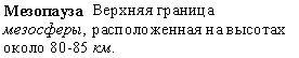
Russian translation prepared by Nina A. Zaitseva for the Arctic Climatology Project Arctic Meteorology and Climate Atlas.
- mesosphere
- the region of the atmosphere between about 50 kilometers (31 miles) and 80-85 kilometers (50-53 miles), extending from the top of the stratosphere to the upper temperature minimum; it is characterized by a broad temperature maximum (near 0 degrees Celsius) at its base, from which the temperature decreases to a minimum (about -90 degrees Celsius) at the mesopause level.
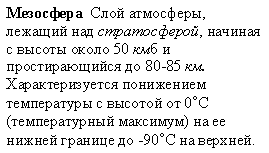
Russian translation prepared by Nina A. Zaitseva for the Arctic Climatology Project Arctic Meteorology and Climate Atlas.
- metamorphism
- changes in the structure and texture of snow grains which result from variations in temperature, migration of liquid water and water vapor, and pressure within the snow cover.
- meteorological element
- any one of the properties or conditions of the atmosphere which together specify the weather at a given place for any particular time (for example, air temperature, pressure, wind, humidity, thunderstorm and fog).
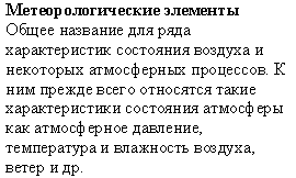
Russian translation prepared by Nina A. Zaitseva for the Arctic Climatology Project Arctic Meteorology and Climate Atlas.
- meteorology
- study of the atmosphere and its phenomena, including its structure, properties, and physical processes.
- micro-scale polygon
- closed, multi-sided, roughly equidimensional, patterned ground features, less than 2 meters (6.6 feet) in diameter; usually caused by desiccation cracking of fine-grained soil materials.
- microwave sensors
- in terms of wavelength, microwaves range from 1 millimeter to 1 meter, and are much longer than the shorter visible (0.38-0.78 micrometer) wavelengths; these longer wavelengths allow microwave energy to penetrate through clouds; because these sensors measure microwave energy, they do not rely on sunlight for illumination so they can acquire images regardless of time of day; can be either passive or active; passive sensors detect and record naturally upwelling microwave energy emitted from objects; active sensors generate their own beam of energy, generally with an antenna, which then detects the returned energy patterns (backscatter) that indicate the presence of features and their position relative to the sensor; radar (radio detection and ranging) was an original active microwave sensor that became widely operational with the onset of World War II.
- middle-level clouds
- clouds composed of ice crystals and water droplets in the middle region of the atmosphere, from 2,000 - 6,000 meters (6,500 to 23,000 feet); includes altocumulus, altostratus, nimbostratus, and portions of cumulus and cumulonimbus clouds.
- minerogenic palsa
- a palsa in which the frozen core extends below the peat into underlying mineral material.
- mires
- Also known as tundra mires, generally described as an area of wet, soggy, muddy ground., and often feature a layer of peat over permafrost.
- mixed precipitation
- precipitation consisting of a mixture of rain and wet snow; it usually occurs when the temperature of the air layer near the ground is slightly above freezing; the British term for this mixture is sleet (which has a different meaning in the United States).
- moraine
- a mound, ridge, or other distinct accumulation of glacial till.
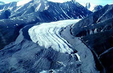
Lateral and terminal moraines of a valley glacier, Bylot Island, Canada. The glacier formed a massive sharp-crested lateral moraine at the maximum of its expansion during the Little Ice Age. The more rounded terminal moraine at the front consists of medial moraines that were created by the junction of tributary glaciers upstream. (Photo courtesy of the Natural Resources Canada. Copyright Terrain Sciences Division, Geological Survey of Canada.)
- moraine shoal
- glacial moraine that has formed a shallow place in water.
- moulin
- a nearly vertical channel in ice that is formed by flowing water; usually found after a relatively flat section of glacier in a region of transverse crevasses; also called a pothole.
- mountain glacier
- a glacier that is confined by surrounding mountain terrain; also called an alpine glacier.
Muddy River Glacier carves its way through forested mountains near Frederick Sound in southeast Alaska. Typical of mountain glaciers, it is constrained on all sides by mountainous terrain. (Photo courtesy of the U. S. Navy, archived at the World Data Center for Glaciology, Boulder, CO.)
- mountain permafrost
- permafrost existing at high altitudes in high, middle, and low latitudes.
- mountain wind
- a cold wind blowing down an incline; a kind of katabatic wind.
- mud circle
- a type of nonsorted circle developed in fine-grained materials.
- multiple retrogressive slide
- a type of mass movement associated with shear failure in unfrozen sediments underlying permafrost, leading to detachment of blocks of frozen ground that move downslope.
- multiyear ice
- ice that has survived at least one melt season; it is typically 2 to 4 meters (6.6 to 13.1 feet) thick and thickens as more ice grows on its underside.
Multiyear ice. (Photo courtesy of Ted Maksym, United States Naval Academy.)
- n-factor
- the ratio of the surface freezing or thawing index to the air freezing or thawing index.
- needle ice
- thin, elongated ice crystals that form perpendicular to the ground surface.
- negative mill
- a geyser; a fountain that develops when water from a conduit is forced up to the surface of a glacier.
- net budget
- the difference between accumulation and ablation; usually expressed in terms of volumes of water equivalent per unit area.
- net terrestrial radiation
- difference between the downward and upward terrestrial radiation fluxes; net flux of terrestrial radiation.
- new ice
- a general category of ice that consists of frazil, grease ice, slush, and shuga.
- new snow
- a recent snow deposit in which the original form of the ice crystals can be recognized.
- niche glacier
- very small glacier that occupies gullies and hollows on north-facing slopes (northern hemisphere); may develop into cirque glacier if conditions are favorable.
- nilas
- a thin sheet of smooth, level ice less than 10 centimeters (4 inches) thick; appear darkest when thin.

Nilas are the dark sheets of ice near the bottom of the photo. (Photo courtesy of Ted Maksym, United States Naval Academy.)
- nimbostratus
- a principal cloud type (cloud genus); gray and often dark; rendered diffuse by more or less continuously falling rain, snow, sleet, etc. of the ordinary varieties and not accompanied by lightning, thunder, or hail; precipitation in most cases reaches the ground; may or may not merge with low, ragged clouds that frequently occur below.
- nip
- ice is said to nip when it forcibly presses against a ship which is beset; a vessel so caught, though undamaged, is said to have been nipped.
- noncryotic ground
- soil or rock at temperatures above 0 degrees Celsius.
- nonsorted circle
- a patterned ground form that is equidimensional in several directions, with a dominantly circular outline which lacks a border of stones.
- nonsorted net
- a patterned ground with cells that are equidimensional in several directions, neither dominantly circular nor polygonal, and lacking borders of stones.
- nonsorted polygon
- a patterned ground form that is equidimensional in several directions, with a dominantly polygonal outline which lacks a border of stones.
- nonsorted step
- a patterned ground feature with a step-like form and a downslope border of vegetation embanking an area of relatively bare ground upslope.
- nonsorted stripe
- form patterned ground with a striped and nonsorted appearance, due to parallel strips of vegetation-covered ground and intervening strips of relatively bare ground, oriented down the steepest available slope.
- North American high
- the relatively weak general area of high pressure which, as shown on mean charts of sea-level pressure, covers most of North America during winter; this pressure system is not nearly as well-defined as the analogous Siberian high.
- North Atlantic Oscillation
- an oscillation in the strength of the Icelandic Low and Azores High, the two dominant surface pressure features in the North Atlantic. When both are unusually strong, the North Atlantic Oscillation (NAO) is in its positive phase; when both are unusually weak, it is in its negative phase. The NAO has climate impacts not just in the Arctic, but in North America and Europe. The NAO, identified by Sir Gilbert Walker in the 1920s, is similar to the Arctic Oscillation.
- north pole
- 90° N latitude; one of the two points where the Earth's axis of rotation meets the Earth's surface (the other being the south pole, diametrically opposite).
- nunatak
- a rocky crag or small mountain projecting from and surrounded by a glacier or ice sheet.
- névé
- (1) young, granular snow that has been partially melted, refrozen and compacted; névé that survives a full season is called firn; firn becomes glacial ice; (2) also refers to the accumulation zone of a glacier.
- observation
- a weather or meteorological observation is an evaluation of one or more meteorological elements that describes the state of the atmosphere either at the earth's surface or aloft.
- observational network
- a group of stations (surface meteorological, upper-air, or other) spread over a given area for making regular observations.
- ogives
- alternate bands of light and dark ice seen on a glacier surface.

Ogives, Juno Icefield, Alaska
- old ice
- sea ice more than 2-years-old, up to 3 meters (10 feet) or more thick; hummocks on old ice are even smoother than in second-year ice, and the ice is almost salt-free; when old ice is bare of snow, it is blue and lacks the greenish tint of second-year ice.
- old snow
- deposited snow whose transformation into firn is so far advanced that the original form of the ice crystals can no longer be recognized.
- onshore permafrost
- permafrost occurring beneath exposed land surfaces.
- open lead
- a lead that connects two open bodies of water; ships can traverse between them through this lead; it also refers to a lead where open water is found, or a lead that has not completely frozen.
- open pack ice
- composed of floes seldom in contact and with many leads; ice cover 4/10ths to 6/10ths.
- open talik
- a body of unfrozen ground that penetrates the permafrost completely, connecting suprapermafrost and subpermafrost water.
- open water
- a large area of freely navigable water in which floes may be present in concentration under 1/10th; if there is no sea ice present, the area may be termed open water, even though icebergs are present.
- open-cavity ice
- ice formed in an open cavity or crack in the ground by reverse sublimation of water vapour.
- open-system freezing
- freezing that occurs under conditions that allow gain or loss of water by the system.
- open-system pingo
- a pingo formed by doming of frozen ground; caused by groundwater that moves downslope through taliks and onto the pingo surface, where it freezes.
- orbiculic cryogenic fabric
- a distinct soil micromorphology, resulting from the effects of freezing and thawing processes, in which coarser soil particles form circular to ellipsoidal patterns.
- organic cryosol
- an organic soil having a surface layer containing more than 17% organic carbon by weight, with permafrost within 1 meter (3.3 feet) below the surface.
- oriented lake
- one of a group of lakes possessing a common, preferred, long-axis orientation.
- outburst flood
- any catastrophic flooding from a glacier; may originate from trapped water in cavities inside a glacier or at the margins of glaciers or from lakes that are dammed by flowing glaciers.
- outlet glacier
- a valley glacier which drains an inland ice sheet or ice cap and flows through a gap in peripheral mountains.
- ozone
- a nearly colorless (but faintly blue) gaseous form of oxygen, with a characteristic odor like chlorine; has a formula of O3 and a molecular weight of 48; found in trace quantities in the earth's atmosphere at all times, primarily in the stratosphere between heights of about 10 to 50 kilometers (6 to 31 miles; the ozonosphere or ozone shield) where its production results from photochemical processes involving ultraviolet radiation; its maximum concentration occurs between 20 to 25 kilometers (12 to 16 miles); in the lower atmosphere, ozone is commonly formed as a product of electrical discharges through the air.
- ozone shield
- stratospheric ozone layer, giving protection to the earth's surface due to intense absorption of harmful solar ultraviolet radiation by the gas.
- ozonosphere
- stratospheric ozone layer, giving protection to the earth's surface due to intense absorption of harmful solar ultraviolet radiation by the gas.
- pack ice
- ice that is not attached to the shoreline and drifts in response to winds, currents, and other forces; some prefer the generic term drift ice, and reserve pack ice to mean drift ice that is closely packed.
- palsa
- a peaty permafrost mound possessing a core of alternating layers of segregated ice and peat or mineral soil material.
- palsa bog
- a poorly-drained lowland underlain by organic-rich sediments, which contains perennially frozen peat bodies (peat plateaux) and, occasionally, palsas.
- pancake ice
- pieces of new ice approximately circular, up to 10 centimeters (4 inches) thick and 0.03 to 3 meters (0.1 to 9.8 feet) in diameter, with raised edges that form from rubbing against each other; formed from the freezing together of grease ice, slush or shuga, or the reaking up of ice rind or nilas.

(Photo courtesy of the National Oceanic and Atmospheric Administration/Department of Commerce.)
- parameter
- (1) a term used loosely by many meteorologists for almost any meteorological quantity or element (2) an arbitrary constant or variable appearing in a mathematical expression; changing it can give various outcomes for the phenomena represented.
- partial pressure
- in a mixture of gases, each gas has a partial pressure, which is the pressure the gas would have if it occupied that volume alone.
- partially-bonded permafrost
- ice-bearing permafrost in which some of the soil particles are not held together by ice.
- passive construction methods in permafrost
- special design and construction methods used for engineering works in permafrost areas where preservation of the frozen condition is feasible.
- passive single-phase thermal pile
- a foundation pile provided with a single-phase natural convection cooling system to remove heat from the ground.
- passive two-phase thermal pile
- a foundation pile provided with a two-phase natural convection cooling system to remove heat from the ground.
- past weather
- predominant characteristic of the weather which had existed at an observing station during a given period of time (during the preceding hour or six hours), specified in the international synop code.
- patch
- a collection of pack ice, less than 10 kilometers (6.2 miles) across, whose limits can be seen from the masthead.
- patterned ground
- a general term for any ground surface exhibiting a discernibly ordered, more or less symmetrical, morphological pattern of ground and, where present, vegetation.

A photograph taken from the air reveals patterned ground surrounding thaw lakes in Alaska’s Arctic National Wildlife Refuge. —Credit: U.S. Fish and Wildlife Service
- peat
- a deposit consisting of decayed or partially decayed humified plant remains.
- peat hummock
- a hummock consisting of peat.
- peat plateau
- a generally flat-topped expanse of peat, elevated above the general surface of a peatland, and containing segregated ice that may or may not extend downward into the underlying mineral soil.
- peatland
- peat-covered terrain.
- penitents
- the extreme relief of ablation hollows found most often at high altitudes in the tropics; the resulting spikes of snow resemble repentant souls.
- pereletok
- a layer of frozen ground which forms as part of the seasonally frozen ground (in areas free of permafrost or with a lowered permafrost table); remains frozen throughout one or several summers, and then thaws.
- perennial snow
- snow that persists on the ground year after year.
- periglacial
- the conditions, processes and landforms associated with cold, nonglacial environments.
- periglacial phenomena
- landforms and soil characteristics produced by periglacial processes.
- periglacial processes
- processes associated with frost action in cold, nonglacial environments.
- permacrete
- an artificial mixture of frozen soil materials cemented by pore ice, which forms a concrete-like construction material used in cold regions.
- permafrost
- layer of soil or rock, at some depth beneath the surface, in which the temperature has been continuously below 0°C for at least several years; it exists where summer heating fails to reach the base of the layer of frozen ground.
- permafrost aggradation
- a naturally or artificially caused increase in the thickness and/or areal extent of permafrost.
- permafrost base
- the lower boundary surface of permafrost, above which temperatures are perennially below 0 degrees Celsius (cryotic) and below which temperatures are perennially above 0 degrees Celsius (noncryotic).
- permafrost boundary
- (1) the geographical boundary between the continuous and discontinuous permafrost zones (2) the margin of a discrete body of permafrost.
- permafrost degradation
- a naturally or artificially caused decrease in the thickness and/or areal extent of permafrost.
- permafrost extent
- the total geographic area containing some amount of permafrost; typically reported in square kilometers.
- permafrost limit
- outermost (latitudinal) or lowest (altitudinal) limit of the occurrence of permafrost.
- permafrost region
- a region in which the temperature of some or all of the ground below the seasonally freezing and thawing layer remains continuously at or below 0 degrees Celsius for at least two consecutive years.
- permafrost table
- the upper boundary surface of permafrost.
- permafrost thickness
- the vertical distance between the permafrost table and the permafrost base.
- permafrost zone
- a major subdivision of a permafrost region.
- permanent ice zone
- a region that is covered with sea ice year-round; most of the sea ice in the permanent ice zone is multiyear ice, but younger ice and open water may still be present; the permanent ice zone is what remains in summer after all melting has occurred (often called the summer minimum extent).
- pH
- power of hydrogen; a measure of the activity of hydrogen ions in solution, and therefore, its acidity or alkalinity.
- piedmont glacier
- large ice lobe spread out over surrounding terrain, associated with the terminus of a large mountain valley glacier.
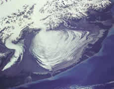
The massive lobe of Malaspina Glacier in Alaska is clearly visible in this photograph taken from a Space Shuttle flight in 1989. Agassiz Glacier is the smaller glacier to the left. The Malaspina Glacier is one of the most famous examples of this type of glacier, and is the largest piedmont glacier in the world. Spilling out of the Seward Ice Field (visible near the top of the photograph), it covers over 5,000 square kilometers as it spreads across the coastal plain. (Photo courtesy of SPACE.com and NASA.)
- pingo
- an eskimo term for a perennial frost mound consisting of a core of massive ice with soil and vegetation cover; the size can range from a few meters to tens of meters, in both diameter and height; can be found in continuous and discontinuous permafrost zones.
- pingo ice
- massive ice forming the core of a pingo.
- pingo remnant
- a collapsed pingo.
- pingo scar
- a pingo remnant in a contemporary non-permafrost environment.
- planetary permafrost
- permafrost occurring on other planetary bodies (planets, moons, asteroids).
- plastic frozen ground
- fine-grained soil in which only a portion of the pore water has turned into ice.
- Pleistocene
- part of the geologic timescale, corresponding to the time period from 1.81 million to 11,550 years before the present.
- Poisson's ratio
- the absolute value of the ratio between linear strain changes, perpendicular to and in the direction of a given uniaxial stress change.
- polar day
- in polar regions, the portion of the year when the sun is continuously in the sky; its length changes from twenty hours at the arctic/antarctic circle (latitude 66 degrees, 33 minutes N or S) to 186 days at the north and south poles.
- polar explorer
- a person working for a long time at one of the polar observing stations; Russian word is polyarnik.
- polar glacier
- a glacier entirely below freezing, except possibly for a thin layer of melt near the surface during summer or near the bed; polar glaciers are found only in polar regions of the globe or at high altitudes.
- polar ice cap
- a high-latitude region covered in ice; not a true ice cap, which are less than 50,000 square kilometers (12.4 million acres) and are always over land; more like an ice sheet; also called polar ice sheet.
- polar low
- small, shallow depression which forms mainly in winter over some high-latitude seas within a polar or arctic air mass; its motion is approximately the same as the air stream in which it is embedded.
- polar night
- in polar regions, the portion of the year when the sun does not rise above the horizon; its length changes from twenty hours at the arctic/antarctic circle (latitude 66 degrees, 33 minutes N or S) to 179 days at the North and South Poles.
- polar region
- regions around the North and South Poles, north of the Arctic, or south of the Antarctic Circles, respectively; characterized by polar climate, very cold temperatures, heavy glaciation, and dramatic variations in daylight hours (24 hrs darkness in winter, 24 hrs daylight in summer).
- polar vortex
- large-scale cyclonic circulation in the middle and upper troposphere centered generally in the polar regions; it is often called circumpolar vortex.
- pole of inaccessibility
- in the northern hemisphere, the point in the Arctic Ocean farthest from land; in the southern hemisphere, the point on the Antarctic continent farthest from the Southern Ocean.
- polyarnik
- Russian word for a person working for a long time at one of the polar observing stations.
- polycrystal
- a snowflake composed of many individual ice crystals.
- polygon
- literally means many angled; polygons are closed, multi-sided, roughly equidimensional shapes, bounded by more or less straight sides; some of the sides may be irregular; in cryospheric science, it refers to patterned ground formations.
- polygon trough
- the narrow depression surrounding a high-centre polygon.
- polygonal pattern
- a pattern consisting of numerous multi-sided, roughly equidimensional figures bounded by more or less straight sides.
- polygonal peat plateau
- a peat plateau with ice-wedge polygons.
- polynya
- irregularly shaped areas of persistent open water that are sustained by winds or ocean heat; they often occur near coasts, fast ice, or ice shelves.
Satellite view of polynyas (dark areas) near Oates Coast, Antarctica (solid white area at bottom of photo). (Photo courtesy of NASA.)
- poorly-bonded permafrost
- ice-bearing permafrost in which few of the soil particles are held together by ice.
- pore ice
- ice occurring in the pores of soils and rocks.
- pore water
- water occurring in the pores of soils and rocks.
- pothole
- a nearly vertical channel in ice that is formed by flowing water; usually found after a relatively flat section of glacier in a region of transverse crevasses; also called a moulin.
- powder snow
- a thin, dry snow surface which is composed of loose, fresh ice crystals.
- prairie
- a treeless grassy plain.
- precipitation
- (1) any of the forms of water particles, whether liquid or solid, that fall from the atmosphere and reach the ground; includes: rain, drizzle, snow, snow grains, snow pellets, diamond dust, hail, and ice pellets; see also acid precipitation (2) accumulated depth of rain, drizzle and the melted water content of frozen forms of precipitation.
- precision
- the degree of agreement between independent measurements of a single quantity obtained by applying a specific measurement procedure several times under prescribed conditions.
- present weather
- weather at a station at the time of observation.
- pressure
- a type of stress characterized by uniformity in all directions; in dynamics, it is that part of the stress tensor that is independent of viscosity and depends only upon the molecular motion appropriate to the local temperature and density; it is the negative of the mean of the three normal stresses, and is, therefore, a scalar quantity expressed in units of force per unit area; in meteorology, commonly used for atmospheric pressure.
- pressure ice
- a general term for floating ice which has been squeezed together and in places forced upwards; includes rafted ice, telescoped ice, hummocked ice and ridge ice.
- pressure melting
- melting that occurs in ice at temperatures colder than normal melting temperature because of added pressure.
- pressure ridge
- process that occurs when wind, ocean currents, and other forces push sea ice around into piles that rise and form small mountains above the level sea ice surface; ridges are initially thin and transparent with very sharp edges from blocks of ice piling up; also see keels.
- pressure tendency
- the character and amount of atmospheric pressure change for a three-hour or other specified period ending at the time of observation.
- pressure-melting
- lowering the melting point of ice by applying pressure.
- prime meridian
- the meridian (line of longitude) defined to be 0 degrees and passing through the Royal Greenwich Observatory in London; also known as the International Meridian or Greenwich Meridian; the Prime Meridian and the opposite 180th meridian (at 180 degrees longitude) separate the Eastern and Western Hemispheres.
- pseudomorph
- in geology, a mineral compound resulting from a process by which the primary mineral component is replaced by another, although the compound maintains constant appearance and dimensions.
- psychrometer
- an instrument used for measuring the water vapor content of the atmosphere; a type of hygrometer; it consists of two thermometers, one of which (the dry bulb) is an ordinary glass thermometer, while the other (wet bulb) has its bulb covered with a jacket of clean muslin which is saturated with distilled water prior to an observation; when the bulbs are suitably ventilated, they indicate the thermodynamic wet- and dry-bulb temperatures of the atmosphere; one variety is the assman psychrometer (a special form of aspiration psychrometer for which the ventilation is provided by a suction fan).
- psychrometric tables
- tables prepared from psychrometric data and used to obtain vapor pressure, relative humidity, and dew point from wet- and dry-bulb temperatures.
- puddle
- an accumulation of melt water on an ice surface, mainly due to melting snow, but in later stages also to the melting of ice; the initial stage consists of patches of slush.
- push moraine
- moraine built out ahead of an advancing glacier.
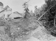
The Columbia Glacier surged (advanced rapidly) earlier this century, part of it flowing into a forest. The push moraine in this photograph from 1914 shows Columbia Glacier literally pushing up trees and dirt as it advanced. (Photo courtesy of D.K. Handy, archived at the World Data Center for Glaciology, Boulder, CO.)
- radar
- RAdio Detection And Ranging was an original active microwave sensor that became widely operational with the onset of World War II.
- radiation
- (1) emission or transfer of energy in the form of electromagnetic waves (2) the process by which electromagnetic radiation is propagated through free space by virtue of joint undulatory variations in the electric and magnetic fields in space; this concept is to be distinguished from conduction and convection.
- radiosonde
- instrument intended to be carried by a balloon up through the atmosphere, equipped with sensors to measure one or several meteorological variables (pressure, temperature, humidity, etc.), and provided with a radio transmitter for sending this information to the observing station.
- radius-dependent metamorphism
- snow metamorphism that occurs when there are large differences in convex and concave portions of a crystal.
- rafted ice
- deformed sea ice in which one piece has overridden another; also called telescoped ice.
- rafting
- a process by which currents or winds push around thin ice so they slide over each other; also called finger rafting.
Nilas showing finger rafting. (Photo courtesy of the Antarctic Sea-Ice Processes and Climate program (ASPeCt).)
- ram
- a horizontal underwater projection of ice from an ice front, ice wall, iceberg or floe.
- randkluft
- a fissure that separates a moving glacier from its headwall rock; like a bergschrund.
- rawinsonde
- radiosonde which is tracked by radar or radio-theodolite to measure the wind aloft.
- reconstituted glacier
- a glacier that is reconstructed or reconstituted out of other glacier material; usually formed by seracs falling from a hanging glacier then re-adhering; also called reconstructed glacier, regenerated glacier, or glacier remainie.
- reconstructed glacier
- a glacier that is reconstructed or reconstituted out of other glacier material; usually formed by seracs falling from a hanging glacier then re-adhering; also called reconstituted glacier, regenerated glacier, or glacier remainie.
- recurring polynya
- irregularly shaped areas of persistent open water that are sustained by winds or ocean heat; they often occur near coasts, fast ice, or ice shelves.
- red algae
- algae common on temperate glaciers and perennial snow; its red color sometimes prompts people to call it watermelon snow.
- regelation
- motion of an object through ice by melting and freezing that is caused by pressure differences; this process allows a glacier to slide past small obstacles on its bed.
- regenerated glacier
- a glacier that is reconstructed or reconstituted out of other glacier material; usually formed by seracs falling from a hanging glacier then re-adhering; also called reconstituted or reconstructed glacier, or glacier remainie.
- relative error
- The ratio of the absolute error in a measurement to the size of the measurement.
- relative humidity
- the (dimensionless) ratio of the actual vapor pressure of the air to the saturation vapor pressure; usually expressed as a percent, and can be computed from psychrometric data.
- relative permittivity
- the relative permitivity of a soil is the ratio of the permitivity of the soil to the permitivity of a vacuum.
- relict active layer
- a layer of ground, now perennially frozen, lying immediately below the modern active layer; its thickness indicates the greater annual depth of thaw that occurred during a previous period.
- relict ice
- ice formed in, and remaining from, the geologically recent past.
- relict permafrost
- permafrost existing in areas where permafrost can not form under present climatic conditions; reflects past climatic conditions that were colder.
- residual stress
- the effective stress generated in a thawing soil if no volume change is permitted during thaw.
- residual thaw layer
- a layer of thawed ground between the seasonally frozen ground and the permafrost table.
- reticulate cryostructure
- the cryostructure in which horizontal and vertical ice veins form a three-dimensional, rectangular or square lattice.
- reticulate ice
- a network of horizontal and vertical ice veins forming a three-dimensional, often rectangular or square lattice.
- reticulate-blocky cryostructure
- the cryostructure in which horizontal and vertical ice veins form a three-dimensional, irregular rectangular lattice.
- retreat
- when a mountain glacier's terminus doesn't extend as far downvalley as it previously did; occurs when ablation surpasses accumulation.
Muir Glacier, Glacier Bay National Park and Reserve's White Thunder Ridge as seen on August 13, 1941 (left) and August 31, 2004 (right). (2004 USGS photo courtesy of B. Molnia; 1941 photo courtesy of W. Field. Archived at the Long-Term Change Photograph Pairs Special Collection in the Glacier Photograph Database.)
- retreating glacier
- a glacier whose terminus is increasingly retreating upvalley compared to its previous position due to a higher level of ablation compared to accumulation.
- retrogressive thaw slump
- a slope failure resulting from thawing of ice-rich permafrost.
- ridge
- in meteorology, an elongated area of relatively high atmospheric pressure, almost always associated with and most clearly identified as an area of maximum anticyclonic curvature of wind flow.
- ridge ice
- piled ice formed by ridging.

Ridged sea ice. (Photo courtesy of Don Perovich, U.S. Army Cold Regions Research and Engineering Laboratory.)
- ridging
- process that occurs when wind, ocean currents, and other forces push sea ice around into piles that rise and form small mountains above the level sea ice surface; ridges are initially thin and transparent with very sharp edges from blocks of ice piling up; also see keels.
Ridged sea ice. (Photo courtesy of Don Perovich, U.S. Army Cold Regions Research and Engineering Laboratory.)
- rime
- a white or milky and opaque granular deposit of ice formed by the rapid freezing of super-cooled water drops as they impinge upon an exposed object; it is denser and harder than hoarfrost, but lighter, softer, and less transparent than glaze.
- ripple marks
- corrugation on a snow surface caused by wind (as on sand).
- river ice
- floating ice formed in rivers.
- river talik
- a layer or body of unfrozen ground occupying a depression in the permafrost table beneath a river.
- rock flour
- a fine powder of silt- and clay-sized particles that a glacier creates as its rock-laden ice scrapes over bedrock; usually flushed out in meltwater streams, causing water to look powdery gray; lakes and oceans that fill with glacier flour may develop a banded appearance.
- rock glacier
- looks like a mountain glacier and has active flow; usually includes a poorly sorted mess of rocks and fine material; may include: (1) interstitial ice a meter or so below the surface (“ice-cemented”), (2) a buried core of ice (“ice-cored”), and/or (3) rock debris from avalanching snow and rock.
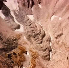
Frying Pan Glacier, Colorado, is almost entirely covered by rocks and debris in this photograph from 1966. (Photo courtesy of George L. Snyder, archived at the World Data Center for Glaciology, Boulder, CO.)
- rotten ice
- floating ice which has become honeycombed in the course of melting, and which is in an advanced state of disintegration.
- sail
- the part of a ridge above sea level; like a sail on a sailboat, it catches wind and moves the ice.
- saline permafrost
- permafrost in which part or all of the total water content is unfrozen because of freezing-point depression due to a high dissolved-solids content of the pore water.
- salinity
- (1) a general property of aqueous solutions caused by the alkali, alkaline earth, and metal salts of strong acids (Cl, SO4 and NO3) that are not hydrolyzed (2) in soil science, the ratio of the weight of salt in a soil sample to the total weight of the sample.
- sand wedge
- a wedge-shaped body of sand produced by filling of a thermal contraction crack with sand either blown in from above or washed down the walls of the crack.
- sand-wedge polygon
- a polygon outlined by sand wedges underlying its boundaries.
- sastrugi
- complex, fragile shapes of snow on top of sea ice that resemble sand dunes; they form parallel to the prevailing wind direction; sastrugi can also form on snow cover over land.
Sastrugi at South Pole Station, Antarctica. (Photo courtesy of Fred Walton, NOAA Corps Collection.)
- saturation
- the condition in which the partial pressure of any fluid constituent (water in the atmospheric air) is equal to its maximum possible partial pressure under the existing environmental conditions, such that any increase in the amount of that constituent will initiate within it a change to a more condensed state; evaporation ceases under such conditions.
- saturation vapor pressure (water)
- the maximum amount of water vapor necessary to keep moist air in equilibrium with a surface of pure water; this is the maximum water vapor the air can hold for any given combination of temperature and pressure.
- scale
- (1) a series of marks at regular intervals for the purpose of measuring (scale of an instrument, for example, a thermometer) (2) system of units for measuring ( 3) proportion between the size of something and the map, diagram, etc. which represents it (4) order of magnitude of a phenomenon or of a meteorological parameter.
- sea ice
- any form of ice found at sea which has originated from the freezing of sea water.
- sea ice extent
- see ice extent.
- sea ice maximum extent
- the day of the year when the sea ice covers the largest area of the Arctic or Antarctic.
- sea ice minimum extent
- the day of the year when the sea ice covers the smallest area of the Arctic or Antarctic
- sea smoke
- evaporation fog formed when water vapor is added to air which is much colder than the vapor's source; most commonly, when very cold air drifts across relatively warm water; also called steam fog.
- sea surface temperature
- temperature of the water film at the sea surface.
- sea-level pressure
- the atmospheric pressure at mean sea level, either directly measured or, most commonly, empirically determined from the observed station pressure.
- seasonal freezing index
- the cumulative number of degree-days below 0 degrees Celsius, calculated as the arithmetic sum of all the negative and positive mean daily air temperatures (degrees Celsius) for a specific station during the time period between the highest point in the fall and the lowest point the next spring on the cumulative degree-day time curve.
- seasonal frost
- the occurrence of ground temperatures below 0 degrees Celsius for only part of the year; see also active layer.
- seasonal ice zone
- an area of ocean that extends from the permanent ice zone to the boundary where winter sea ice extent is at a maximum; here, sea ice is present only part of the year; this zone primarily consists of first-year ice.
- seasonal snow
- (1) snow that accumulates during one season (2) snow that lasts for only one season.
- seasonal thawing index
- the cumulative number of degree-days above 0 degrees Celsius, calculated as the arithmetic sum of all the positive and negative mean daily air temperatures (degrees Celsius) for a specific station during the time period between the lowest point in the spring and the highest point the next fall on the cumulative degree-day time curve.
- seasonally frozen ground
- ground that freezes and thaws annually.
- seasonally frozen layer (SFL)
- the active layer in areas without permafrost.
- seasonally thawed ground
- ground that thaws and refreezes annually.
- seasonally thawed layer (STL)
- the active layer in permafrost areas.
- seasonally-active permafrost
- the uppermost layer of the permafrost which undergoes seasonal phase changes due to the lowered thawing temperature and freezing-point depression of its pore water.
- second-year ice
- sea ice which has not melted in the first summer of its existence; by the end of the second winter, it attains a thickness of 2 meters (6.6 feet) or more; it stands higher out of the water than first-year ice; summer melting has somewhat smoothed and rounded the hummocks, which accentuation of minor relief by differential melting may have caused others to develop; bare patches and puddles are usually greenish-blue.
- sedimentary ogives
- alternating bands of light and dark at the firn limit of a glacier; the light bands are usually young and lightest at the highest level up-glacier, becoming increasingly older and darker as they progress down-glacier.
- segregated ice
- ice in discrete layers or ice lenses, formed by ice segregation.
- segregation potential
- the ratio of the rate of moisture migration to the temperature gradient in a frozen soil near the 0 degrees Celsius isotherm.
- semipermanent anticyclone
- high pressure area largely predominate during a major portion of the year where an anticyclone appears on the mean monthly pressure charts.
- semipermanent depression
- slowly moving or motionless cyclone.
- sensible heat
- same as enthalpy; the heat absorbed or transmitted by a substance during a change of temperature which is not accompanied by a change of state; used in meteorology in contrast to latent heat.
- sensible heat polynya
- a polynya that forms from the upwelling of warm (above-freezing) ocean water from lower depths; these can form in mid-ocean areas, far from coasts or other barriers.
- serac
- an isolated block of ice that is formed where the glacier surface is fractured.
- shear strength
- in geology, describes the compressive strength (ability to withstand pushing forces) of soils; results from two internal mechanisms: cohesion between soil particles, and friction caused by contact between particles; variable among different soils.
- shield
- a screen to shield a rain-gauge from the influence of the wind, or to shield a thermometer against insolation.
- shore lead
- a stretch of navigable water between pack ice and the shore.
- short-term strength
- the failure strength of a material under a short-term loading (e.g. up to about 10 minutes in a uniaxial compression test).
- shortwave radiation
- in meteorology, a term used loosely to distinguish radiation in the visible and near-visible portions of the electromagnetic spectrum (roughly 0.4 to 4.0 microns in wavelength) from longwave (terrestrial) radiation.
- shuga
- a form of new ice, composed of spongy, white lumps a few cm across, that tend to form in rough seas; they resemble slushy snow balls.
(Photo courtesy of the Antarctic Sea-Ice Processes and Climate program (ASPeCt).)
- Siberian high
- an area of high pressure which forms over Siberia in winter, and which is particularly apparent on mean charts of sea-level pressure.
- sikussak
- very old, thick sea ice that forms in fjords; it often resembles glacial ice, because snow can pile up on the ice over many years.
- single-phase thermosyphon
- a passive heat transfer device, filled with either a liquid or a gas, installed to remove heat from the ground.
- sintering
- the bonding together of ice crystals.
- sleet
- (1) (United States) frozen raindrops that bind on impact with the ground (2) (elsewhere) a mix of rain and snow, a mix of rain and hail, or melting snow.
- slope failure
- mass movement of earth material down a slope; includes landslides, mudslides, debris flows, avalanches, etc; speed of movement can be sudden and catastrophic or slow.
- slush
- a mixture of snow and grease ice.
- slush zone
- common near the snow line on a relatively flat portion of a glacier where melting snow forms slush.
- smog
- currently used as a synonym for general air pollution; it was originally created by combining the words smoke and fog.
- snow
- (1) an ice particle formed by sublimation of vapor in the atmosphere (2) a collection of loosely bonded ice crystals deposited from the atmosphere; high density snow (greater than 550 kilograms per cubic meter; 34 pounds per cubic foot) is called firn if it is older than one year.
- snow barchan
- horseshoe-shaped snowdrift, with the ends pointing down-wind.
- snow board
- a specially constructed board used to identify the surface of snow that has been recently covered by snowfall.
- snow bridge
- an arch formed by snow which has drifted aross a crevasse, forming first a cornice, and ultimately a covering which may completely obscure the opening.
- snow core
- a sample of snow, either just the freshly fallen snow or the combined old and new snow on the ground, obtained by pushing a cylinder down through the snow layer and extracting it.
- snow cover
- (1) in general, the accumulation of snow on the ground surface (2) the areal extent of snow-covered ground, usually expressed as percent of total area in a given region.
- snow density
- the mass of snow per unit volume which is equal to the water content of snow divided by its depth.
- snow depth
- the combined total depth of both old and new snow on the ground.
- snow extent
- the total land area covered by some amount of snow; typically reported in square kilometers.
- snow flurry
- snow that falls for short durations and which often changes in intensity; flurries usually produce little accumulation.
- snow grains
- precipitation in the form of very small, white opaque ice particles; they resemble snow pellets but are more flattened and elongated, with a diameter less than 1 mm; the solid equivalent of drizzle.
- snow layer
- a layer of ice crystals with similar size and shape.
- snow line
- the minimum elevation of snow lying on the ground or glacier surface; the snow line at the end of an ablation season marks a glacier's current equilibrium line.
- snow load
- the downward force on an object or structure caused by the weight of accumulated snow.
- snow patch
- relatively small area of snow cover remaining after the main snowmelt period.
- snow pellets
- precipitation in the form of small, white opaque ice particles; resemble ice grains, but are round (sometimes conical) and about 2-5 mm in diameter.
- snow roller
- roll-like snow formation, caused by a unique combination of snow, wind, temperature and moisture
- snow squall
- a brief, but intense fall of snow that greatly reduces visibility and which is often accompanied by strong winds.
- snow water equivalent
- the water content obtained from melting.
- snow worm
- an oligochaete worm that lives on temperate glaciers or perennial snow; there are several species that range in color from yellowish-brown to reddish-brown or black; they are usually less than 1 millimeter (0.04 inch) in diameter and average about 3 millimeters (0.1 inch) in length; some feed off red algae.
- snowblink
- a bright white glare on the underside of clouds, produced by the reflection of light from a snow-covered surface; snowblink is lighter than ice blink, and much lighter than land sky or water sky.
- snowbursts
- very intense showers of snow, often of short duration, that greatly restrict visibility and produce periods of rapid snow accumulation.
- snowdrift
- an accumulation or bank of snow formed when wind blows snow against an obstruction; often considerably thicker than the surrounding snowcover.
- snowdrift glacier
- a semipermanent mass of firn formed by drifted snow behind obstructions or in the ground; also called a catchment glacier or a drift glacier.
- snowfall
- the depth of new snow that has accumulated since the previous day or since the previous observation.
- snowflake
- a cluster of ice crystals that falls from a cloud.
- snowmelt
- melting of the snowcover, and also the period during which melting of the snow cover occurs at the end of the winter.
- snowpack
- the total snow and ice on the ground, including both new snow and the previous snow and ice which have not melted.
- snowstorm
- strong wind with snow.
- soil wedge
- a wedge-shaped body of soil that is different in structure and texture from the surrounding soil.
- solar radiation
- the total electromagnetic radiation emitted by the sun.
Russian translation prepared by Nina A. Zaitseva for the Arctic Climatology Project Arctic Meteorology and Climate Atlas.
- solifluction
- slow downslope flow of saturated unfrozen earth materials.
- solifluction apron
- a fan-like deposit at the base of a slope, produced by solifluction.
- solifluction features
- geomorphological features of varying scale produced by the process of solifluction.
- solifluction lobe
- an isolated, tongue-shaped solifluction feature, up to 25 meters (27 yards) wide and 150 meters (164 yards) or more long; formed by more rapid solifluction on certain sections of a slope showing variations in gradient.
- solifluction sheet
- a broad deposit of nonsorted, water-saturated, locally derived materials that is moving or has moved downslope.
- solifluction terrace
- a low step, or bench, with a straight or lobate front, the latter reflecting local differences in the rate of solifluction movement.
- solstice
- the point in time when the vertical rays of the sun are striking either the Tropic of Cancer (23 degrees, 30 minutes N, the summer solstice in the northern hemisphere) or the Tropic of Capricorn (23 degrees, 30 minutes S, the winter solstice in the northern hemisphere); represents the longest or shortest day of the year; in the northern hemisphere, the summer solstice falls on or about 21 June, and the winter solstice on or about 22 December.
Russian translation prepared by Nina A. Zaitseva for the Arctic Climatology Project Arctic Meteorology and Climate Atlas.
- sorted circle
- a patterned ground form that is equidimensional in several directions, with a dominantly circular outline, and a sorted appearance commonly due to a border of stones surrounding a central area of finer material.
- sorted net
- a type of patterned ground with cells that are equidimensional in several directions, neither dominantly circular nor polygonal, with a sorted appearance commonly due to borders of stones surrounding central areas of finer material.
- sorted polygon
- a patterned ground form that is equidimensional in several directions, with a dominantly polygonal outline, and a sorted appearance commonly due to a border of stones surrounding a central area of finer material.
- sorted step
- a patterned ground feature with a step-like form and a downslope border of stones embanking an area of relatively fine-grained bare ground upslope.
- sorted stripe
- patterned ground with a striped and sorted appearance, due to parallel strips of stones and intervening strips of finer material, oriented down the steepest available slope.
- south pole
- 90° S latitude; one of the two points where the Earth's axis of rotation meets the Earth's surface (the other being the north pole, diametrically opposite).
- specific heat capacity
- the amount of heat required to raise the temperature of a unit mass of a substance by one degree.
- specific humidity
- the mass of water vapor per unit mass of air, including the water vapor (usually expressed as grams of water vapor per kilogram of air).

Russian translation prepared by Nina A. Zaitseva for the Arctic Climatology Project Arctic Meteorology and Climate Atlas.
- splay crevasse
- a crevasse pattern that forms where ice slowly spreads out sideways; commonly found near a glacier terminus.
- sporadic discontinuous permafrost
- (1) (North American usage) permafrost underlying 10 - 50% of the exposed land surface (2) (Russian usage) permafrost underlying 5 - 30% of the exposed land surface.
- spring equinox
- either of the two points of intersection of the sun's apparent annual path and the plane of the earth's equator; in the northern hemisphere, the spring (vernal) equinox falls on or about 21 March, and the autumnal equinox on or about 22 September.
Russian translation prepared by Nina A. Zaitseva for the Arctic Climatology Project Arctic Meteorology and Climate Atlas.
- stable air mass
- air mass having static stability in its lower layers; it is free from convection, has a low degree of turbulence and may have stratiform clouds or fog, or no clouds.

Russian translation prepared by Nina A. Zaitseva for the Arctic Climatology Project Arctic Meteorology and Climate Atlas.
- stamukhi
- thick ridges that become grounded during the winter and become part of the fast ice zone; while the rest of the fast ice melts during the summer, a stamukhi remains throughout the summer attached to the ocean bottom.
- standard deviation
- Statistical measurement of the variation in a distribution: In science, standard deviation serves as measure of the spread of the data, or how likely a data point will fall close to the mean.
- static cryosol
- a mineral soil showing little or no evidence of cryoturbation, with permafrost within 1 meter (3.3 feet) below the surface.
- station pressure
- atmospheric pressure observed at a station.

Russian translation prepared by Nina A. Zaitseva for the Arctic Climatology Project Arctic Meteorology and Climate Atlas.
- steam fog
- evaporation fog formed when water vapor is added to air which is much colder than the vapor's source; most commonly, when very cold air drifts across relatively warm water; also called sea smoke.
- steering flow
- in meteorology, a basic fluid flow which exerts a strong influence upon the direction of movement of disturbances embedded in it; in the atmosphere, it is usually an air flow in the middle or upper troposphere which govern directions of the disturbances at low levels.

Russian translation prepared by Nina A. Zaitseva for the Arctic Climatology Project Arctic Meteorology and Climate Atlas.
- stone earth circle
- a type of nonsorted circle developed in gravelly materials.
- stone garland
- the downslope border of stones along a sorted step, embanking an area of relatively fine-grained bare ground upslope.
- stone-banked (solifluction) lobe
- a solifluction lobe with a stony front.
- stone-banked (solifluction) terrace
- a solifluction terrace with a stony front.
- strand crack
- a fissure at the junction between an inland ice sheet, ice piedmont or ice rise and an ice shelf, the latter being subject to the rise and fall of the tide.
- stratocumulus
- a principal low-level cloud type (cloud genus), predominantly stratiform, in the form of relatively low gray and/or whitish layer, sheet or patch; its elements are often arranged in bands or rolls that lie across the wind; light rain, snow, or sleet may fall from stratocumulus.

Russian translation prepared by Nina A. Zaitseva for the Arctic Climatology Project Arctic Meteorology and Climate Atlas.
- stratopause
- the boundary layer between the stratosphere and the mesosphere at about 50 to 55 kilometers (31 to 34 miles).

Russian translation prepared by Nina A. Zaitseva for the Arctic Climatology Project Arctic Meteorology and Climate Atlas.
- stratosphere
- a layer of the Earth’s atmosphere, between the troposphere and mesosphere, that is stratified in temperature such that cooler layers are closer to the Earth’s surface, and warmer layers are higher up (opposite the pattern of the troposphere near the Earth’s surface); situated between about 10 to 50 kilometers (6 to 31 miles) in altitude above the surface of the moderate latitudes; at the poles, it starts at about 8 km in altitude; composition is basically the same as that of the lower atmosphere, with the addition of ozone.
Russian translation prepared by Nina A. Zaitseva for the Arctic Climatology Project Arctic Meteorology and Climate Atlas.
- stratus
- a principal low-level cloud type (cloud genus) in the form of a low-altitude, light to dark gray cloud layer with a rather uniform base; generally diffuse and dull; this cloud formation has little structure and looks like fog, except that it is above the ground, stratus does not usually produce precipitation, but when it does occur, it is in the form of minute particles, such as drizzle, ice crystals, or fine snow grains.

Russian translation prepared by Nina A. Zaitseva for the Arctic Climatology Project Arctic Meteorology and Climate Atlas.
- string fen
- a peatland with roughly parallel narrow ridges of peat dominated by fenland vegetation interspersed with slight depressions, many of which contain shallow pools.
- strip
- a long narrow area of pack ice, about 1 kilometer (0.6 mile) or less in width, usually composed of small fragments detatched from the main mass of ice, and run together under the influence of wind or current.
- subglacial permafrost
- permafrost beneath a glacier.
- subglacial talik
- a layer or body of unfrozen ground beneath a glacier in an area with permafrost.
- sublimation
- the transition of a substance from the solid phase directly to the vapor phase, or vice versa, without passing through an intermediate liquid phase.

Russian translation prepared by Nina A. Zaitseva for the Arctic Climatology Project Arctic Meteorology and Climate Atlas.
- sublimation ice
- ice formed by reverse sublimation of water vapour on cold surfaces.
- subpermafrost water
- water occurring in the noncryotic ground below the permafrost.
- subpolar glacier
- a glacier whose temperature regime is between polar and temperate; usually predominantly below freezing, but could experience extensive summer melt.
- subsea permafrost
- permafrost occurring beneath the sea bottom.
- subsea talik
- a layer or body of unfrozen ground beneath the seabottom, and forming part of the subsea permafrost.
- summer minimum extent
- the permanent ice zone that remains in summer after all melting has occurred.
- sun cups
- ablation hollows that develop during intense sunshine.
- sunspot
- dark spot on the sun, with cooler-than-average temperatures and strong magnetic activity
- supercooled
- the condition when a liquid remains in the liquid state even through its temperature is below its freezing point.
- supercooling
- cooling of a liquid to a temperature below its freezing point, without causing solidification.
- supersaturation
- the condition which occurs in the atmosphere when the relative humidity is greater than 100%.
- suprapermafrost water
- water occurring in unfrozen ground above perennially frozen ground.
- surface cryogenic fabric
- a distinct soil micromorphology, resulting from the effects of freezing and thawing processes, in which coarser soil particles have vertical or near-vertical orientation.
- surface freezing index
- the cumulative number of degree-days below 0 degrees Celsius for the surface temperature (of the ground, pavement, etc.) during a given time period.
- surface hoar
- the deposition (sublimation) of ice crystals on a surface which occurs when the temperature of the surface is colder than the air above and colder than the frost point of that air.
A new layer of surface hoar on the snow. Note the quarter for scale. (Photo courtesy of K. Williams.)
- surface observation
- a meteorological observation made on the earth's surface, in contrast with an upper-air observation.

Russian translation prepared by Nina A. Zaitseva for the Arctic Climatology Project Arctic Meteorology and Climate Atlas.
- surface temperature
- the ambient temperature indicated by a thermometer exposed to the air but sheltered from direct solar radiation, or placed in an instrument shelter 1.5 - 2.0 meters (5.0 - 6.6 feet) above ground; also called air temperature.
- surface wind
- wind blowing near the earth's surface; it is measured, by convention, at a height of 10 meters (33 feet) above ground in an area where the distance between the anemometer and any obstruction is at least 10 times the height of the obstruction.

Russian translation prepared by Nina A. Zaitseva for the Arctic Climatology Project Arctic Meteorology and Climate Atlas.
- surging glacier
- a glacier that experiences a dramatic increase in flow rate, 10 to 100 times faster than its normal rate; usually surge events last less than one year and occur periodically, between 15 and 100 years.
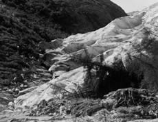
In 1941, Hole-in-the-Wall Glacier surged, also knocking over trees during its advance. (Photo courtesy of the World Data Center for Glaciology, Boulder, CO. Photo probably taken by W.O. Field.)
- suspensoid
- a substance dispersed throughout another substance; also called suspended phase.
- syngenetic ice
- ground ice developed during the formation of syngenetic permafrost.
- syngenetic ice wedge
- an ice wedge developed during the formation of syngenetic permafrost.
- syngenetic permafrost
- permafrost that formed through a rise of the permafrost table during the deposition of additional sediment or other earth material on the ground surface.
- synoptic analysis
- the study of the synoptic observation data plotted on synoptic charts aimed at analysis of the atmospheric disturbances (for example, fronts, cyclones, and anticyclones).

Russian translation prepared by Nina A. Zaitseva for the Arctic Climatology Project Arctic Meteorology and Climate Atlas.
- synoptic chart
- a weather chart reflecting the state of the atmosphere over a large area at a given moment.

Russian translation prepared by Nina A. Zaitseva for the Arctic Climatology Project Arctic Meteorology and Climate Atlas.
- synoptic code
- a code approved by the World Meteorological Organization, by which meteorological elements observed at the earth's surface at synoptic times are encoded in groups of five figures and transmitted internationally through the GTS (Global Telecommunications System).
Russian translation prepared by Nina A. Zaitseva for the Arctic Climatology Project Arctic Meteorology and Climate Atlas.
- synoptic hour
- hour (UTC - Coordinated Universal Time) determined by international agreement at which meteorological observations are made simultaneously throughout the world; the primary synoptic hours are every six hours, commencing at 00:00 UTC.

Russian translation prepared by Nina A. Zaitseva for the Arctic Climatology Project Arctic Meteorology and Climate Atlas.
- synoptic meteorology
- the study and analysis of synoptic weather information (synoptic charts, synoptic weather observations); thus, it is a study of macro-scale atmospheric processes, as well as weather prediction based on results of synoptic studies.

Russian translation prepared by Nina A. Zaitseva for the Arctic Climatology Project Arctic Meteorology and Climate Atlas.
- synoptic weather observation
- an observation made at periodic times (usually at 3-hour and 6-hour intervals specified by the World Meteorological Organization) of sky cover, state of the sky, cloud height, atmospheric pressure at sea level, temperature, dew point, wind speed and direction, amount of precipitation, hydrometeors and lithometeors, and special phenomena that prevail at the time of the observation or observed since the previous specified observation.

Russian translation prepared by Nina A. Zaitseva for the Arctic Climatology Project Arctic Meteorology and Climate Atlas.
- synoptic-scale
- the scale of the high- and low-pressure systems of the lower atmosphere; dimensions typically range from 1000 to 2500 kilometers (620 to 1550 miles; synoptic-scale circulation).
Russian translation prepared by Nina A. Zaitseva for the Arctic Climatology Project Arctic Meteorology and Climate Atlas.
- tabular berg
- a flat-topped iceberg that shows horizontal banding; typically form by breaking from an ice shelf.
- taiga
- the open northern part of the boreal forest; consists of open woodland of coniferous trees growing in a rich floor of lichen (mainly reindeer moss or caribou moss), and is generally cold and swampy; lies immediately south of the tundra; in spring, it is often flooded by water from northward flowing rivers, the lower reaches of which are still frozen.
- talik
- a layer or body of unfrozen ground occurring in a permafrost area due to a local anomaly in thermal, hydrological, hydrogeological, or hydrochemical conditions.
- tarn
- a small mountain lake or pool.
- telescoped ice
- deformed sea ice in which one piece has overridden another; also called rafted ice.
- temperature
- a physical quantity characterizing the mean random motion of molecules in a physical body; in other words, it is a measure of the degree of hotness or coldness of a substance.
Russian translation prepared by Nina A. Zaitseva for the Arctic Climatology Project Arctic Meteorology and Climate Atlas.
- temperature profile
- the graphic or analytical expression of the variation in ground temperature with depth.
- temperature-gradient metamorphism
- snow metamorphism that occurs when there are strong differences in temperature between the bottom and top of a snow layer.
- terminus
- the lowest end of a glacier, also called the glacier toe or glacier snout.
Glacier at the head of Canon Fiord, Ellesmere Island, Canada
- terrestrial radiation
- longwave radiation emitted by the earth, including its atmosphere.

Russian translation prepared by Nina A. Zaitseva for the Arctic Climatology Project Arctic Meteorology and Climate Atlas.
- thaw bulb
- a zone of thawed ground below or surrounding a man-made structure placed on or in permafrost and maintained at temperatures above 0 degrees Celsius.
- thaw consolidation
- time-dependent compression resulting from thawing of frozen ground and subsequent draining of excess water.
- thaw consolidation ratio
- a dimensionless ratio describing the relationship between the rate of thaw and the rate of consolidation of a thawing soil, which is considered to be a measure of the relative rates of generation and expulsion of excess water during thaw.
- thaw hole
- vertical hole in floating ice formed when a puddle melts through to the underlying water.
- thaw penetration
- the downward movement of the thawing front during thawing of frozen ground.
- thaw settlement
- compression of the ground due to thaw consolidation.
- thaw sink
- a closed thaw basin with subterranean drainage.
- thaw slumping
- a slope failure mechanism characterized by the melting of ground ice, and downslope sliding and flowing of the resulting debris.
- thaw strain
- the amount that frozen ground compresses upon thawing.
- thaw unconformity
- a boundary sometimes identified in perennially frozen ground, representing the base of a relict active layer, as well as the corresponding earlier permafrost table.
- thaw weakening
- the reduction in shear strength due to the decrease in effective stresses resulting from the generation and slow dissipation of excess pore pressures when frozen soils containing ice are thawing.
- thaw-sensitive permafrost
- perennially frozen ground which, upon thawing, will experience significant thaw settlement and suffer loss of strength to a value significantly lower than that for similar material in an unfrozen condition.
- thaw-stable permafrost
- perennially frozen ground which, upon thawing, will not experience either significant thaw settlement or loss of strength.
- thawed ground
- previously frozen ground in which all ice has melted.
- thawing (of frozen ground)
- melting of the ice in frozen ground, usually as a result of a rise in temperature.
- thawing front
- the advancing boundary between thawed ground and frozen ground.
- thawing index
- the cumulative number of degree-days above 0 degrees Celsius for a given time period.
- theodolite
- an optical instrument used to visually track a radiosonde balloon and determine its bearing and elevation while in flight.
- thermal conductivity
- the quantity of heat that will flow through a unit area of a substance in unit time under a unit temperature gradient.
- thermal diffusivity
- the ratio of the thermal conductivity to the volumetric heat capacity.
- thermal erosion
- the erosion of ice-bearing permafrost by the combined thermal and mechanical action of moving water.
- thermal expansion (or contraction) coefficient
- the volume change per unit volume of a substance due to a one degree change in its temperature.
- thermal pile
- a foundation pile on which natural convection or forced circulation cooling systems or devices have been installed to remove heat from the ground.
- thermal properties of frozen ground
- the properties of the ground governing the flow of heat through it, and its freezing and thawing conditions.
- thermal regime of the ground
- a general term encompassing the temperature distribution and heat flows in the ground and their time-dependence.
- thermal talik
- a layer or body of unfrozen ground (in a permafrost area) in which the temperature is above 0 degrees Celsius due to the local thermal regime of the ground.
- thermal-contraction crack
- a tensile fracture resulting from thermal stresses in frozen ground.
- thermal-contraction-crack ice
- ice formed in thermal contraction cracks in the ground.
- thermo-erosional cirque
- the usually steep, horseshoe-shaped headwall of a retrogressive thaw slump.
- thermo-erosional niche
- a recess at the base of a river bank or coastal bluff, produced by thermal erosion of ice-bonded permafrost.
- thermodynamic equilibrium thickness
- the thickness at which ice no longer grows because it is so thick that heat from the ocean can no longer be conducted through the ice; it may take several years of growth and melt for ice to reach an equilibrium thickness.
- thermodynamics
- study of the links between heat and energy. First law of thermodynamics states that heat is energy and the amount of energy within a system cannot change.
- thermograph
- an instrument continuously recording temperature.

Russian translation prepared by Nina A. Zaitseva for the Arctic Climatology Project Arctic Meteorology and Climate Atlas.
- thermokarst
- the process by which characteristic landforms result from the thawing of ice-rich permafrost or the melting of massive ice.
- thermokarst lake
- a lake occupying a closed depression formed by settlement of the ground following thawing of ice-rich permafrost or the melting of massive ice.

Increased thawing of frozen ground could create more thermokarst features, like this lake. —Credit: Andrew Slater
- thermokarst mound
- a hummock remaining after melting of the ice wedges surrounding an ice-wedge polygon.
- thermokarst terrain
- the often irregular topography resulting from the melting of excess ground ice and subsequent thaw settlement.
- thermometer
- an instrument for measuring temperature; in meteorology, generally used to measure the temperature of the air or the soil.
Russian translation prepared by Nina A. Zaitseva for the Arctic Climatology Project Arctic Meteorology and Climate Atlas.
- thermosyphon
- a passive heat transfer device installed to remove heat from the ground.
- thomson crystal
- a large ice crystal found in deep, stagnant water-filled cavities of a glacier.
- thufur
- perennial hummocks formed in either the active layer in permafrost areas, or in the seasonally frozen ground in non-permafrost areas, during freezing of the ground.
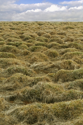
These big lumps in the ground are called thufur. Thufur can form when the ground freezes and thaws. These thufur are in Iceland. —Credit: Reinhold Richter
- tide crack
- the fissure at the line of junction between an immovable icefoot or ice wall and fast ice, the latter being subject to the rise and fall of the tide.
- tidewater glacier
- mountain glacier that terminates in the ocean.

Holgate Glacier, Kenai Peninsula, Alaska
- timber line
- (1) in mountainous regions, the line above which climatic conditions do not allow the upright growth of trees (2) the poleward limit of tree growth, also known as the tree line.
- tongue
- a projection of the ice edge up to several km in length caused by wind and current; usually forms when a valley glacier moves very quickly into a lake or ocean.
- total annual freezing index
- the cumulative number of degree-days, calculated by adding all the negative mean daily air temperatures (degrees Celsius) for a specific station during a calendar year.
- total annual thawing index
- the cumulative number of degree-days, calculated by adding all the positive mean daily air temperatures (degrees Celsius) for a specific station during a calendar year.
- total water content (of frozen ground)
- the total amount of water (unfrozen water plus ice) contained in soil or rock.
- transient talik
- a layer or body of unfrozen ground (in a permafrost area) that is gradually being eliminated by freezing.
- tributary glacier
- a small glacier that flows into a larger glacier.
- Tropic of Cancer
- the northern parallel of maximum solar declination, approximately 23° 27′ N latitude; the farthest northern latitude at which the sun can appear directly overhead, which occurs on the day of the summer solstice.
- Tropic of Capricorn
- the southern parallel of maximum solar declination, approximately 23° 27′ S latitude; the farthest southern latitude at which the sun can appear directly overhead, which occurs on the day of the summer solstice.
- tropopause
- the boundary layer between the troposphere and stratosphere, where an abrupt change in temperature lapse rate usually occurs; it is defined as the lowest level at which the lapse rate decreases to 2 degrees Celsius per kilometer or less, provided that the average lapse rate between this level and all higher levels within 2 kilometers does not exceed 2 degrees Celsius per kilometer; occasionally, a second tropopause may be found if the lapse rate above the first tropopause exceeds 3 degrees Celsius per kilometer.

Russian translation prepared by Nina A. Zaitseva for the Arctic Climatology Project Arctic Meteorology and Climate Atlas.
- troposphere
- lower part of the atmosphere, extending from the surface up to a height varying from about 7 to 9 kilometers (4.3 to 5.6 miles) at polar regions to approximately 17 kilometers (10.6 miles) in tropics; characterized by decreasing temperature with height, appreciable vertical wind motion, appreciable water vapor content, and weather.

Russian translation prepared by Nina A. Zaitseva for the Arctic Climatology Project Arctic Meteorology and Climate Atlas.
- trough
- in meteorology, an elongated area of relatively low atmospheric pressure; the opposite of a ridge.

Russian translation prepared by Nina A. Zaitseva for the Arctic Climatology Project Arctic Meteorology and Climate Atlas.
- tundra
- treeless terrain, with a continuous cover of vegetation, found at both high latitudes and high altitudes.
- turbic cryosol
- a mineral soil showing marked evidence of cryoturbation, as indicated by broken horizons and displaced material.
- turf hummock
- a hummock consisting of vegetation and organic matter with or without a core of mineral soil or stones.
- turf-banked (solifluction) lobe
- a solifluction lobe with its front covered by a vegetation mat.
- turf-banked (solifluction) terrace
- a solifluction terrace with its front covered by a vegetation mat.
- two-layer permafrost
- ground in which two layers of permafrost are separated by a layer of unfrozen ground.
- two-phase thermosyphon
- a passive heat transfer device, filled with a temperature-dependent liquid/vapour combination, installed to remove heat from the ground.
- ultraviolet radiation
- electromagnetic radiation of shorter wavelength than visible radiation but longer than x-rays; roughly, radiation in the wavelength interval from 10 to 4000 angstroms.
Russian translation prepared by Nina A. Zaitseva for the Arctic Climatology Project Arctic Meteorology and Climate Atlas.
- unbreakable crust
- a hard snow surface lying upon a softer layer; may be formed by sun, rain or wind, and is described as breakable crust or unbreakable crust, depending upon wether it will break under the weight of a turning skier.
- unfrozen ground
- soil or rock that does not contain any ice.
- unfrozen water content
- the amount of unfrozen (liquid) water contained in frozen soil or rock.
- uniaxial compression test
- a method to determine the short-term strength of rocks; conducted by employing a constant loading rate until failure; the failure load is used to calculate the failure stress; can also be used to determine the elastic constants of rocks (i.e. Young's modulus, Poisson's ratio).
- unstable air
- air in which static instability prevails; this condition is determined by the vertical gradients of air temperature and humidity.
Russian translation prepared by Nina A. Zaitseva for the Arctic Climatology Project Arctic Meteorology and Climate Atlas.
- upper air observation
- an observation made in the free atmosphere either directly or indirectly.
Russian translation prepared by Nina A. Zaitseva for the Arctic Climatology Project Arctic Meteorology and Climate Atlas.
- upper atmosphere
- the general term applied to the atmosphere above the mesopause.
Russian translation prepared by Nina A. Zaitseva for the Arctic Climatology Project Arctic Meteorology and Climate Atlas.
- upward freezing
- the advance of a freezing front upwards from the permafrost table during annual freezing of the active layer.
- valley glacier
- a mountain glacier whose flow is confined by valley walls.
- vane
- instrument used to measure wind direction; also called wind vane.
- vapor pressure
- the pressure exerted by water vapor molecules in a given volume of air.
- vein ice
- a comprehensive term for ice of any origin occupying cracks in permafrost.
- very close pack ice
- pack ice in which the floes are tightly packed but not frozen together, with very little, if any, sea water visible; ice cover practically 10/10th.
- very open pack ice
- pack ice composed of loose, widely spaced floes; ice cover 1/10th to 3/10th.
- virga
- precipitation that evaporates before reaching the ground.
- viscosity
- a measure of a fluid’s resistance to flow; can be thought of as a measure of fluid friction.
- visibility
- the greatest distance that prominent objects can be seen and identified by unaided, normal eyes.

Russian translation prepared by Nina A. Zaitseva for the Arctic Climatology Project Arctic Meteorology and Climate Atlas.
- volumetric (total) water content
- the ratio of the volume of the water and ice in a sample to the volume of the whole sample, expressed as a fraction (or, less commonly, as a percentage).
- volumetric heat capacity
- the amount of heat required to raise the temperature of a unit volume of a substance by one degree.
- volumetric latent heat of fusion
- the amount of heat required to melt all the ice (or freeze all the pore water) in a unit volume of soil or rock.
- warm front
- the forward edge of an advancing warm air mass that is displacing cooler air in its path.

Russian translation prepared by Nina A. Zaitseva for the Arctic Climatology Project Arctic Meteorology and Climate Atlas.
- warm low
- at a given level in the atmosphere, any low that is generally characterized by warmer air near its center than around its periphery; the opposite of a cold low.
- water sky
- the dark appearance of the underside of a cloud layer when it is over a surface of open water; it is darker than land sky, and much darker than ice blink or snow blink.
Russian translation prepared by Nina A. Zaitseva for the Arctic Climatology Project Arctic Meteorology and Climate Atlas.
- water vapor
- water substance in vapor (gaseous) form; one of the most important of all constituents of the atmosphere.

Russian translation prepared by Nina A. Zaitseva for the Arctic Climatology Project Arctic Meteorology and Climate Atlas.
- waterbody encircling a palsa
- a water-filled depression surrounding a palsa.
- watermelon snow
- snow with red algae growing on it.
- wave ogives
- ogives that show some vertical relief on a glacier; usually the dark bands are in the hollows and the light bands are in the ridges; form at the base of steep, narrow ice falls.
- weather
- the state of the atmosphere, mainly with respect to its effects upon life and human activities; distinguished from climate by focusing on short-term (minutes to about 15 days) variations of the atmosphere state.

Russian translation prepared by Nina A. Zaitseva for the Arctic Climatology Project Arctic Meteorology and Climate Atlas.
- weathered ice
- glacier ice that has been exposed to sun or warm wind so that the boundaries between ice crystals are partly disintegrated.
- weathering
- the processes of ablation and accumulation which gradually eliminate irregularities in an ice surface.
- wedge ice
- ice occurring in an ice wedge.
- well-bonded permafrost
- ice-bearing permafrost in which all the soil particles are held together by ice.
- westerlies
- the dominant west-to-east motion of the atmosphere, centered over the middle latitudes (35 to 65 degrees latitude) of both hemispheres.
- whiteout
- a condition in which daylight is diffused by multiple reflections between a snow surface and an overcast sky; contrasts vanish, and the observer is unable to distinguish the horizon or any snow surface feature.
- World Meteorological Organization
- created by the World Meteorological Convention and recognized as a special agency of the United Nations in 1951; the WMO consists of more than 185 member countries; and facilitates international cooperation in all aspects of meteorology.

Russian translation prepared by Nina A. Zaitseva for the Arctic Climatology Project Arctic Meteorology and Climate Atlas.
- World Meteorological Organization Program
- any scientific project (field experiment, inter-comparison, etc.) internationally performed under the aegis of the World Meteorological Organization.
Russian translation prepared by Nina A. Zaitseva for the Arctic Climatology Project Arctic Meteorology and Climate Atlas.
- World Weather Watch
- the world-wide, coordinated system of meteorological facilities and services provided by World Meteorological Organization members for the purpose of ensuring that all members obtain the meteorological information required both for operational work and for research; the essential elements of the WWW are: the global observing system, the global data-processing system, and the global telecommunication system.
Russian translation prepared by Nina A. Zaitseva for the Arctic Climatology Project Arctic Meteorology and Climate Atlas.
- yedoma
- A type of Pleistocene-age (formed 1.8 million to 10,000 years before present) permafrost that contains a significant amount of organic material with ice content of 50–90% by volume. Thawing yedoma is a significant source of atmospheric methane.
A yedoma in Russia shows the thick layer of ice and carbon material exposed along this body of water. --Credit: Vladimir Romanovsky
- young ice
- a general category of ice that represents the transition between nilas and first-year ice; usually 10 to 30 centimeters (4 to 12 inches) thick.
- Young's Modulus
- the ratio of increase in stress acting on a test specimen, to the resulting increase in strain, under constant transverse stress.
- zero curtain
- the persistence of a nearly constant temperature, very close to the freezing point, during annual freezing (and occasionally during thawing) of the active layer.
- zone of gas-hydrate stability
- that portion of the subsurface where the conditions of temperature and pressure are suitable for the formation and preservation of gas hydrates.

 NSIDC's Glossary contains general and scientific terms related to
Earth's frozen places.
NSIDC's Glossary contains general and scientific terms related to
Earth's frozen places.