This page discusses information related to the flood risk mapping process for coastal regions.
The National Flood Insurance Program (NFIP) was established in 1968 to reduce the Nation’s flood losses through sound, local floodplain management and mitigation practices. The NFIP also created a means for property owners to financially protect themselves by offering flood insurance to homeowners, renters, and business owners.
Flood Insurance Rate Maps (FIRMs) are foundational to proper floodplain management practices and the determination of flood insurance premiums. FEMA conducts flood hazard analyses and mapping studies to produce FIRMs and other flood risk products that inform local communities and residents about flood risks.
The purpose of a FIRM, or “flood map” as it is commonly called, is to identify the areas subject to high-risk flood hazards, i.e., the areas subject to the 1-percent-annual-chance flood, also called the base flood.
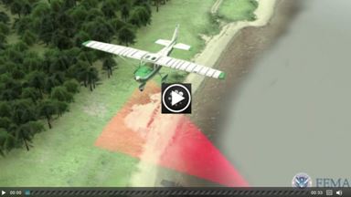
This video provides more information on the base flood. (The video was initially developed by FEMA Region IV to support their coastal flood mapping studies.)

Several factors can affect the flood risk depicted on a FIRM. For instance, changes in coastal development and land use can change the way coastal flooding impacts a community. Advances in science and technology can enable more accurate flood hazard determinations. FEMA strives to maintain the most accurate flood maps possible with the resources available.
Over the past several years, FEMA has been evaluating and updating the flood maps along all populated coastlines, in close collaboration with other Federal agencies, States, local communities, non-profits and academia, and the private sector. Through collaboration with these partners, FEMA has developed methodologies for determining the flood risk along the coast, which are used to update the FIRMs.
To learn more about coastal flood hazards, the coastal flood hazard analysis and mapping study process, and how to look up your community’s effective FIRM, please visit the Coastal Flood Risk Study Process webpage. Additional information and resources are also available on the Coastal Resources for Homeowners, Renters, Business Owners, and General Public webpage.
Coastal Mapping Methodology
FEMA works with State and local partners, coastal scientists and engineers, and other stakeholders to identify and map coastal flood hazards. While each coastal study is unique, the coastal hazard analysis and mapping process generally includes the following steps:
1. Define base topography data sets sufficient for modeling, flood analysis, and mapping;
2. Identify flood water levels using historic flood data and computer modeling;
3. Define cross-shore transects to represent the terrain and variability of shoreline features;
4. Conduct an analysis to characterize storm-induced erosion;
5. Conduct wave modeling to define coastal flood hazard areas and establish Base Flood Elevations (BFEs);
6. Map coastal flood hazard areas using the results of the modeling and analysis; and
7. Produce the FIRM and non-regulatory flood risk products to indicate the coastal flood risks within communities.
The following sections provide more information on each of these steps. The Coastal Mapping Process is also presented in this infographic.
1. Defining Base Topography

The first step in a coastal flood hazard analysis study is to collect accurate topographic information. FEMA starts the process by reaching out to scientists and engineers to identify all readily available sources of data from:
Other Federal agencies, such as the National Oceanic and Atmospheric Administration (NOAA), the U.S. Geological Survey (USGS), and the U.S. Army Corps of Engineers (USACE),
State and local agencies,
Communities,
Tribal entities,
Contractors,
Academia,
Local sponsors, and
Public officials.
If topographic data are not available, FEMA may work with stakeholders to collect new data. The technology most typically used to gather topographic data is called airborne Light Detection and Ranging (LiDAR). In this process, an airplane equipped with special instrumentation uses a laser to bounce light off of the ground to obtain a highly accurate map of the shape and features of the Earth’s surface. LiDAR specifications for flood hazard mapping are available on FEMA’s website.
This video provides additional information about the use of LiDAR to gather topographic data. (Video produced by FEMA Region VI for the Louisiana Mapping Project.)
2. Water Level Analysis
The two fundamental components of coastal flood hazards are water level and waves. The water level, on which the waves ride, can be composed of several parts: mean sea level, the astronomic tide, wave setup, and storm surge. These components of water level can vary in their magnitude and impact, by geography.
The following subsections describe the significant contributors to flood water levels in each of the major coastal geographic locations in the United States: the Atlantic and Gulf Coasts, the Great Lakes, and the Pacific Coast.

Along the Atlantic Ocean and the Gulf of Mexico, storm-induced water levels—a significant contributor to flood hazards along these coasts—are significantly influenced by the barometric pressure variations and wind stress on the ocean’s surface during storms. The resulting increase in water level is referred to as storm surge. Storm surge occurs when water combines with normal tides and is pushed towards the shore by strong winds and low pressure, and is often the greatest threat to life and property during a coastal storm.
This video provides an overview of what storm surge is. (Edited clip from the Northwest Florida Water Management District.)

To learn more about storm surge and its effects on coastal communities, please visit NOAA’s National Hurricane Center Storm Surge website, which features a variety of resources including:
Introduction to Storm Surge Guide (PDF); Spanish (PDF)
Storm Surge Can Be Deadly - 10 Tips to Be Ready (PDF); Tri-Fold (PDF)
Potential Storm Surge Flooding - Tips for Media Professionals (PDF)
Potential Storm Surge Flooding - Tips for Emergency Managers (PDF)
The USGS’s Exploring Storm Surge video also includes a brief history and description of storm surge effects.
There are differences in how water levels are analyzed on the:
3. Define Cross-Shore Transects

This video provides an overview of how cross-shore transects are created.
The coastal models used in developing a coastal flood hazard study take into account land features throughout the study area, such as coastal beaches, bluffs, dunes, and other features that can affect storm surge and waves. To determine the coastal flood hazards impacting a community, cross-shore transects are placed and analyzed along the shoreline to characterize topography, development, land use, and features within the study area.
Engineers and surveyors go into the field to verify shoreline characteristics and to collect additional detailed topographic and land use/land cover measurements along portions of the transects. Transect data are documented with photographs, measurements, and survey field notes. The height of the land and the type and density of land cover are important to the calculation of wave propagation and dissipation over land. These transects are used for subsequent modeling steps including erosion, overland wave modeling, and wave runup.
4. Storm-Induced Erosion

Dunes and erodible bluffs are present across much of the Nation’s coastline, including along the Great Lakes. Although dunes can help reduce a community’s flood risk, they are also vulnerable to erosion and overtopping, or breaching from high water levels and waves during storms and other flood events. Although bluffs may seem to be more stable than sand dunes, the collapse of a bluff is often immediate and catastrophic, leaving little to no planning time for the property owners to mitigate the damage to their property. Therefore, FEMA accounts for storm-induced erosion on dunes and bluffs when conducting coastal flood hazard studies.
FEMA uses the Primary Frontal Dune (PFD) designation to determine coastal flood zones. A PFD is defined by FEMA as a continuous or nearly continuous ridge of sand with relatively steep seaward and landward slopes immediately landward of and adjacent to the beach. These geomorphic features are mapped as Coastal High Hazard Areas (CHHAs), or VE zones, to ensure that they are not subject to manmade alterations that could increase potential flood damage. Therefore, development in CHHAs or VE zones is highly restricted. More information on Primary Frontal Dunes can be found here.
5. Overland Wave Modeling including Wave Runup and Overtopping

After defining the transects for the study area, examining coastal structures (seawalls, artificial dunes, jetties, bulkheads, etc.), and performing an erosion analysis, coastal analysts conduct overland wave modeling to determine the BFEs and evaluate wave hazards. Overland wave computer models use water depth, wind speed, vegetative cover, building density, and other factors to calculate wave heights. This information is then used to determine the elevation of flooding—including wave effects—and the extent of the area that would be inundated by the base flood.
On steep shorelines, the extent of wave runup and overtopping is often the main contributor to flood risk. Wave runup occurs when an incoming wave hits the shoreline and the water is propelled up the face of the structure. When the height of the propelled water exceeds the top of the structure, overtopping occurs. The amount of wave runup and overtopping is determined using equations and software developed by the USACE and based on laboratory observations. The calculations require water depths, bathymetric and topographic data, and incoming wave conditions.
For information on how FEMA determines the 1-percent-annual-chance wave heights and BFEs, view the video below. (Video initially developed by FEMA Region IV for their coastal mapping studies.)

6. Coastal Flood Hazard Mapping
In the next step, FEMA prepares the Flood Insurance Study (FIS) report, which describes the scope of the project, the area that was studied, and the engineering methods used for the flood hazard analysis. The coastal Special Flood Hazard Area (SFHA) boundary and other flood hazard zones are also determined in this step.
V Zones, which are also referred to as Coastal High Hazard Areas or CHHAs, are areas where:
The computed wave heights for the base flood are 3 feet or more;
Wave runup depths exceed 3 feet;
Wave overtopping exceeds a certain value; or
A PFD exists.

V zones—which include any flood hazard zone that begins with a “V”—carry higher insurance premium rates than other flood hazard zones because flood damages in those areas are likely to be greater. In addition, new and substantially improved structures in V zones must have open foundations elevated on piles, piers, or columns, so that water can flow freely around and through the building, reducing the risk of structural failure. In A zones—any zone beginning with the letter “A”—new and substantially improved buildings may have open foundations or be elevated on slabs, crawlspaces, or other types of foundations.
When the wave height, wave runup, and wave overtopping are less than 3 feet, the area is mapped as an A zone. The Limit of Moderate Wave Action (LiMWA) divides the A zone into two parts: areas with wave heights between 1.5 and 3 feet, and areas with wave heights less than 1.5 feet.
Areas with wave heights between 1.5 and 3 feet are often referred to as “coastal A zones,” which are referenced by certain building codes and standards. While the wave forces in coastal A zones are not as severe as those in V zones, the potential for the damage or destruction of buildings still exists.
Although FEMA currently does not establish different insurance premium rates or floodplain management requirements for coastal A zones (they are the same as for other A zones), it is likely that many A zone-compliant structures on shallow or solid wall foundations in coastal areas will sustain wave and erosion damage during the base flood. As a result, many community building codes require the more stringent V zone building standards in the coastal A zone.
For more information on coastal flood hazard zones and the LiMWA, view the following video:

7. FIRM Production

After the coastal modeling, analysis, and mapping have been completed, the delineated flood zones, BFEs, and other information are made into a digital map. The FIRM displays the mapped flood zones overlaid on a base map, along with appropriate annotations, a legend, and notes to users.
FIRMs represent a snapshot in time and therefore do not include the impacts of future conditions, such as long-term erosion, sea level change/sea level rise, changes in precipitation patterns, or changes in upland land use and development. Many of these changes could mean that the actual flood risk is greater than the risk shown on the FIRM, and purchasing flood insurance in areas in or near the SFHA would be a wise move. For more information on sea level change/sea level rise, coastal erosion, and other coastal hazards, please visit NOAA’s National Ocean Service Coastal Hazards webpage.
The data and analysis that goes into making the FIRM is also used for other (non-regulatory) flood risk products offered by FEMA. The FEMA Risk Mapping, Analysis and Planning (Risk MAP) webpage provides more details on these products and the vision and goals for the program.
Geographical Information Systems (GIS) data from the flood studies are also made available through FEMA’s National Flood Hazard Layer and other GIS mapping tools available in the FEMA GeoPortal platform.
To access the effective FIRM for your community online, visit FEMA’s Map Service Center. FEMA’s How To Read a Flood Insurance Rate Map Tutorial offers guidance about understanding the information on a FIRM. For more information, please contact a Map Specialist at the FEMA Map Information eXchange, toll free, at 1-877-336-2627, or by email at FEMAMapSpecialist@riskmapcds.com.
For More Information
If your community’s FIRM is in preliminary form at this time and the appeal period is open (stakeholders are provided a 90-day appeal period in which they can appeal information), you can access your community’s preliminary FIRM and FIS text on FEMA’s Preliminary Flood Hazard Data page.
For more specific information about your coastal flood risk and links to FEMA Regional webpages, visit the Coastal Regions page.
To understand the map change process, go to FEMA’s Letter of Map Change page.
Congress created the NFIP to help provide a means for property owners to financially protect themselves. Since its inception, additional legislation has been enacted to strengthen the program. Visit Flood Insurance Reform to learn more.
Learn about what resources, grants, and other information are available when Rebuilding After a Coastal Storm.
Find answers to many of your questions by visiting our Coastal Frequently Asked Questions page.
The Coastal Flood Risk Resources page, organized by resources type, contains links to useful fact sheets, flyers, brochures, and other helpful documents produced by FEMA, other Federal agencies, State agencies, Water Management Districts, and other entities.
Subscribe to the Coastal Flood Risks email updates.