Flood hazard maps are used for insurance, planning, and floodplain management purposes

When a new flood map is released, communities often hold open houses to present them to citizens
This page captures Frequently Asked Questions (FAQs) for multiple stakeholder groups, including homeowners; engineers, surveyors, and architects; and insurance professionals and lenders, and floodplain managers. Select the links below to get answers to your most frequently asked questions.
Homeowners
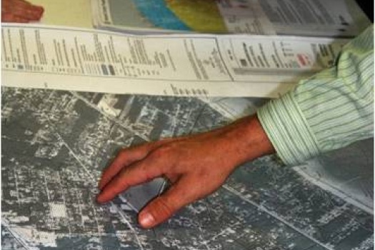
- How do I obtain or review the flood map for my area and how do I read it?
- How do I find out in which "flood hazard area" or "flood zone" my home is located?
- If I disagree with my lender's determination that I am in a Special Flood Hazard Area (SFHA), what can I do?
- New maps (preliminary or effective) show my home now to be located in a Special Flood Hazard Area (SFHA); how does this affect my property and me?
- Where can I learn more about purchasing flood insurance?
- I have looked at the Flood Insurance Rate Map (FIRM) for the area of my property and think the map is wrong. How can the map be changed?
- My lender says I need to buy flood insurance. However, I looked on the Floodsmart.gov site and it says I am at low risk. Which one is FEMA's official answer as to which flood zone my house is located?
- How do I obtain a copy of the Elevation Certificate for my property?
- What is a Flood Insurance Study (FIS) report and where can I obtain one for my community?
- Does my community participate in the National Flood Insurance Program (NFIP)? If it does, how does that affect me?
- Who can I contact for additional assistance?
For more information, please review FAQs for Homeowners.
Engineers, Surveyors, and Architects
- How do I determine a Base Flood Elevation (BFE) for an approximate Zone A area?
- Where can I obtain the backup or supporting data for a Flood Insurance Study (FIS)?
- What are the FEMA requirements for removing a structure from the Special Flood Hazard Area (SFHA)?
- When should I request a revision to a Flood Insurance Rate Map (FIRM)?
- When should a Conditional Map Revision be requested?
- Who can prepare an Elevation Certificate?
- How do I determine whether a hydrologic and hydraulic model is accepted for use by the National Flood Insurance Program (NFIP)?
- Where can I view or obtain a copy of a Flood Insurance Rate Map (FIRM) or Flood Insurance Study (FIS) report?
- Why are temporary benchmarks included on some Flood Insurance Rate Maps (FIRMs) and not on others?
- How do I find out when a Flood Insurance Rate Map (FIRM) was last updated?
- I plan to request a map update or revision. What are my options and where can I obtain more information?
- What are the different types of Letters of Map Change (LOMCs)?
- What are the different flood insurance risk zone designations and what do they mean?
- What is the base, or 1-percent-annual-chance, flood?
- What is the Base Flood Elevation?
- Which elevation datum should I use?
- How long does it take to obtain a Letter of Map Amendment (LOMA) or a Letter of Map Revision Based on Fill (LOMR-F)?
FEMA Engineering Library FAQs
For more information, please review FAQs for Engineers, Surveyors, and Architects or the Engineering Library Page.
Insurance Professionals and Lenders
- What does community participation in the National Flood Insurance Program (NFIP) mean, and how does that affect a homeowner?
- What does a property owner need to do for FEMA to remove the flood insurance requirement?
- What elevation is used when rating a structure for a flood insurance policy?
- How do I determine if a community is participating in the National Flood Insurance Program (NFIP)?
- What can be done when a lender and insurer have differing flood zone determinations?
- What is a "100-year flood" and how is it different from a "1-percent-annual-chance flood" or a "base flood"?
- What is the Coastal Barrier Resources System and how does it affect flood insurance?
- What are the different flood hazard zone designations shown on a Flood Insurance Rate Map (FRIM), and what do they mean?
- How is an Elevation Certificate used?
- Where can I view specific information about flood insurance?
For more information, please review FAQs for Insurance Professionals and Lenders.
Floodplain Managers
- By signing the Community Acknowledgement Form (MT-1 Form), to what am I attesting? What is the difference between Sections A and B?
- Where can I obtain a copy of the Federal Regulations and the advisory Technical Bulletins?
- What are the community's responsibilities in the Conditional Letter of Map Revision (CLOMR)/ Letter of Map Revision (LOMR) process?
- What are the community's responsibilities during the development, distribution, and approval of new Flood Insurance Rate Maps (FIRMs)?
- How do I obtain a list of all the map actions that have occurred in my community?
- As a local official, I am interested in requesting a map update or revision, and I would like to be involved in the process. I have heard about the FEMA Cooperating Technical Partners (CTP) program, where can I get more information about that program?
- What is the Biennial Report, and what are my responsibilities with regard to that report?
For more information, please review FAQs for Floodplain Managers.