Jacksonville, Florida
| Jacksonville, Florida | |||
|---|---|---|---|
| Consolidated city–county | |||
| City of Jacksonville | |||

Top, left to right: Downtown Jacksonville, Riverplace Tower, statue in Memorial Park, Jacksonville Skyway, Florida Theatre, Prime F. Osborn III Convention Center, Hemming Park
|
|||
|
|||
| Nickname(s): "Jax", "The River City", "J-ville", "The Bold New City of the South" | |||
| Motto: Where Florida Begins | |||
 Location in Duval County and the state of Florida |
|||

Jacksonville

Jacksonville
|
|||
| Coordinates: 30°20′13″N 81°39′41″W / 30.33694°N 81.66139°WCoordinates: 30°20′13″N 81°39′41″W / 30.33694°N 81.66139°W[1] | |||
| Country | United States | ||
| State | Florida | ||
| County | Duval | ||
| Founded | 1791 | ||
| Incorporated | 1832 | ||
| Named for | Andrew Jackson | ||
| Government | |||
| • Type | Strong Mayor–Council | ||
| • Body | Jacksonville City Council | ||
| • Mayor | Lenny Curry (R) | ||
| Area[2] | |||
| • Total | 874.6 sq mi (2,265 km2) | ||
| • Land | 747.0 sq mi (1,935 km2) | ||
| • Water | 127.6 sq mi (330 km2) | ||
| Elevation[1] | 16 ft (5 m) | ||
| Population (2010)[3] | |||
| • Total | 821,784 | ||
| • Estimate (2015)[4] | 868,031 | ||
| • Rank | US: 12th | ||
| • Density | 1,142/sq mi (441/km2) | ||
| • Urban | 1,065,219 (US: 40th) | ||
| • Metro | 1,449,481 (US: 41st) | ||
| • CSA | 1,573,606 (US: 34th) | ||
| Demonym(s) | Jacksonvillian, Jaxson[5][6] | ||
| Time zone | Eastern (EST) (UTC-5) | ||
| • Summer (DST) | EDT (UTC-4) | ||
| ZIP code(s) | 32099, 32201–32212, 32214–32241, 32244–32247, 32250, 32254–32260, 32266, 32267, 32277, 32290 | ||
| Area code(s) | 904 | ||
| FIPS code | 12-35000 | ||
| GNIS feature ID | 0295003[2] | ||
| Interstates | |||
| Interstate Spurs | |||
| U.S. Routes | |||
| Major State Routes | |||
| Waterways | St. Johns River, Fall Creek, Arlington River | ||
| Airports | Jacksonville International Airport | ||
| Website | City of Jacksonville | ||


Jacksonville is a seaport city and the seat of Duval County, Florida, United States. With an estimated 868,031 residents as of 2015, Jacksonville is the most populous city in both the state of Florida[7] and the southeastern United States.[8] It is estimated to be the 12th most populous city in the United States and is the largest city by area in the contiguous United States.[9] The Jacksonville metropolitan area has a population of 1,573,606 and is the 40th largest in the United States and fourth largest in the state of Florida. [10] The city is situated on the banks of the St. Johns River, in the First Coast region of North Florida, about 25 miles (40 km) south of the Georgia state line and 340 miles (550 km) north of Miami.
Prior to European settlement the Jacksonville area was inhabited by Native American people known as the Timucua. In 1564, the French established the short-lived colony of Fort Caroline at the mouth of the St. Johns River, becoming one of the earliest European settlements in the continental United States. In 1822, a year after the United States gained Florida from Spain, the town of Jacksonville was platted along the St. Johns River. Established at a narrow point in the river known as Wacca Pilatka to the Seminole and the Cow Ford to the British, the enduring name derives from the first military governor of the Florida Territory and seventh President of the United States, Andrew Jackson.
Jacksonville is the cultural, commercial and financial center of North Florida. A major military and civilian deep-water port, the city's riverine location supports two United States Navy bases and the Port of Jacksonville, Florida's third largest seaport.[11] The two US Navy bases, Blount Island Command and the nearby Naval Submarine Base Kings Bay, form the third largest military presence in the United States.[12] Jacksonville serves as the headquarters of various banking, insurance, healthcare, logistics, and other institutions such as CSX Corporation, Fidelity National Financial, FIS, Landstar System, Ameris Bancorp, Atlantic Coast Financial, Black Knight Financial Services, EverBank, Rayonier Advanced Materials, Regency Centers, Stein Mart, Web.com, Fanatics, Gate Petroleum, Haskell Company, Interline Brands, Sally Corporation, and Southeastern Grocers. Jacksonville is also home to several colleges and universities, most notably the University of North Florida, located southeast of downtown.
Contents
History[edit]
![]() Kingdom of France 1562–1565
Kingdom of France 1562–1565
![]() Spanish Empire 1565–1763
Spanish Empire 1565–1763
![]() Great Britain 1763–1783
Great Britain 1763–1783
![]() Spanish Empire 1783-1821
Spanish Empire 1783-1821
![]() United States 1821-1861
United States 1821-1861
![]() Confederate States of America 1861-1862
Confederate States of America 1861-1862
![]() United States 1862-Present
United States 1862-Present
Early history[edit]
The area of the modern city of Jacksonville has been inhabited for thousands of years. On Black Hammock Island in the national Timucuan Ecological and Historic Preserve, a University of North Florida team discovered some of the oldest remnants of pottery in the United States, dating to 2500 BC.[13] In the 16th century, the beginning of the historical era, the region was inhabited by the Mocama, a coastal subgroup of the Timucua people. At the time of contact with Europeans, all Mocama villages in present-day Jacksonville were part of the powerful chiefdom known as the Saturiwa, centered around the mouth of the St. Johns River.[14] One early map shows a village called Ossachite at the site of what is now downtown Jacksonville; this may be the earliest recorded name for that area.[15]

French Huguenot explorer Jean Ribault charted the St. Johns River in 1562 calling it the River of May because he discovered it in May. Ribault erected a stone column near present-day Jacksonville claiming the newly discovered land for France.[16] In 1564, René Goulaine de Laudonnière established the first European settlement, Fort Caroline, on the St. Johns near the main village of the Saturiwa. Philip II of Spain ordered Pedro Menéndez de Avilés to protect the interest of Spain by attacking the French presence at Fort Caroline. On September 20, 1565, a Spanish force from the nearby Spanish settlement of St. Augustine attacked Fort Caroline, and killed nearly all the French soldiers defending it.[17] The Spanish renamed the fort San Mateo, and following the ejection of the French, St. Augustine's position as the most important settlement in Florida was solidified. The location of Fort Caroline is subject to debate but a reconstruction of the fort was established on the St. Johns River in 1964.[18]
Spain ceded Florida to the British in 1763 after the French and Indian War, and the British soon constructed the King's Road connecting St. Augustine to Georgia. The road crossed the St. Johns River at a narrow point, which the Seminole called Wacca Pilatka and the British called the Cow Ford; these names ostensibly reflect the fact that cattle were brought across the river there.[19][20][21] The British introduced the cultivation of sugar cane, indigo and fruits as well the export of lumber. As a result, the northeastern Florida area prospered economically more than it had under the Spanish.[22] Britain ceded control of the territory back to Spain in 1783, after its defeat in the American Revolutionary War, and the settlement at the Cow Ford continued to grow. After Spain ceded the Florida Territory to the United States in 1821, American settlers on the north side of the Cow Ford decided to plan a town, laying out the streets and plats. They soon named the town Jacksonville, after Andrew Jackson. Led by Isaiah D. Hart, residents wrote a charter for a town government, which was approved by the Florida Legislative Council on February 9, 1832.
Civil War and the Gilded Age[edit]

During the American Civil War, Jacksonville was a key supply point for hogs and cattle being shipped from Florida to aid the Confederate cause. The city was blockaded by Union forces, who gained control of the nearby Fort Clinch. Though no battles were fought in Jacksonville proper, the city changed hands several times between Union and Confederate forces. The Skirmish of the Brick Church in 1862 just outside Jacksonville proper resulted in the first Confederate victory in Florida.[23] However, Union forces captured a Confederate position at the Battle of St. Johns Bluff leading to the Union occupation of Jacksonville in 1862. In February 1864 Union forces left Jacksonville and confronted a Confederate Army at the Battle of Olustee resulting in a Confederate victory. Union forces then retreated to Jacksonville and held the city for the remainder of the war. In March 1864 a Confederate cavalry confronted a Union expedition resulting in the Battle of Cedar Creek. Warfare and the long occupation left the city disrupted after the war.[24]
During Reconstruction and the Gilded Age, Jacksonville and nearby St. Augustine became popular winter resorts for the rich and famous. Visitors arrived by steamboat and later by railroad. President Grover Cleveland attended the Sub-Tropical Exposition in the city on February 22, 1888 during his trip to Florida.[25] This highlighted the visibility of the state as a worthy place for tourism. The city's tourism, however, was dealt major blows in the late 19th century by yellow fever outbreaks. In addition, extension of the Florida East Coast Railway further south drew visitors to other areas. From 1893 to 1938 Jacksonville was the site of the Florida Old Confederate Soldiers and Sailors Home with a nearby cemetery.[26]
Great Fire of 1901[edit]

On May 3, 1901, downtown Jacksonville was ravaged by a fire that started as a kitchen fire. Spanish moss at a nearby mattress factory was quickly engulfed in flames and enabled the fire to spread rapidly. In just eight hours, it swept through 146 city blocks, destroyed over 2,000 buildings, left about 10,000 homeless and killed 7 residents. The Confederate Monument in Hemming Park was one of the only landmarks to survive the fire. Governor Jennings declare martial law and sent the state militia to maintain order. On May 17 municipal authority resumed in Jacksonville.[27] It is said the glow from the flames could be seen in Savannah, Georgia, and the smoke plumes seen in Raleigh, North Carolina. Known as the "Great Fire of 1901", it was one of the worst disasters in Florida history and the largest urban fire in the southeastern United States. Architect Henry John Klutho was a primary figure in the reconstruction of the city. The first multi-story structure built by Klutho was the Dyal-Upchurch Building in 1902.[28][29] The St. James Building, built on the previous site of the St. James Hotel that burned down, was built in 1912 as Klutho's crowning achievement.[30]
Modern Jacksonville[edit]

In the 1910s, New York–based filmmakers were attracted to Jacksonville's warm climate, exotic locations, excellent rail access, and cheap labor. Over the course of the decade, more than 30 silent film studios were established, earning Jacksonville the title of "Winter Film Capital of the World". However, the emergence of Hollywood as a major film production center ended the city's film industry. One converted movie studio site, Norman Studios, remains in Arlington; It has been converted to the Jacksonville Silent Film Museum at Norman Studios.[31]
During this time, Jacksonville also became a banking and insurance center, with companies such as Barnett Bank, Atlantic National Bank, Florida National Bank, Prudential, Gulf Life, Afro-American Insurance, Independent Life and American Heritage Life thriving in the business district. The U.S. Navy also became a major employer and economic force during the 1940s, with the construction of three naval bases in the city.
Jacksonville, like most large cities in the United States, suffered from negative effects of rapid urban sprawl after World War II. The construction of highways led residents to move to newer housing in the suburbs. After World War II, the government of the city of Jacksonville began to increase spending to fund new public building projects in the boom that occurred after the war. Mayor W. Haydon Burns' Jacksonville Story resulted in the construction of a new city hall, civic auditorium, public library and other projects that created a dynamic sense of civic pride. However, the development of suburbs and a subsequent wave of middle class "white flight" left Jacksonville with a much poorer population than before. The city's most populous ethnic group, non-Hispanic white,[32] declined from 75.8% in 1970 to 55.1% by 2010.[33]
Much of the city's tax base dissipated, leading to problems with funding education, sanitation, and traffic control within the city limits. In addition, residents in unincorporated suburbs had difficulty obtaining municipal services, such as sewage and building code enforcement. In 1958, a study recommended that the city of Jacksonville begin annexing outlying communities in order to create the needed tax base to improve services throughout the county. Voters outside the city limits rejected annexation plans in six referendums between 1960 and 1965.

On December 29, 1963 the Hotel Roosevelt fire killed 22 people making it the highest one-day death toll in Jacksonville.[34] One year later on September 10, 1964 Hurricane Dora made landfall near St. Augustine causing major damage to buildings in North Florida. Hurricane Dora was the first hurricane to make a direct hit to North Florida.[35] In the mid-1960s, corruption scandals began to arise among many of the city's officials, who were mainly elected through the traditional old boy network. After a grand jury was convened to investigate, 11 officials were indicted and more were forced to resign. Jacksonville Consolidation, led by J. J. Daniel and Claude Yates, began to win more support during this period, from both inner city blacks, who wanted more involvement in government, and whites in the suburbs, who wanted more services and more control over the central city. In 1964 all 15 of Duval County's public high schools lost their accreditation. This added momentum to proposals for government reform. Lower taxes, increased economic development, unification of the community, better public spending and effective administration by a more central authority were all cited as reasons for a new consolidated government.
When a consolidation referendum was held in 1967, voters approved the plan. On October 1, 1968, the governments merged to create the Consolidated City of Jacksonville. Fire, police, health & welfare, recreation, public works, and housing & urban development were all combined under the new government. In honor of the occasion, then-Mayor Hans Tanzler posed with actress Lee Meredith behind a sign marking the new border of the "Bold New City of the South" at Florida 13 and Julington Creek.[36] The consolidation created a 900 square mile entity.
The Better Jacksonville Plan, promoted as a blueprint for Jacksonville's future and approved by Jacksonville voters in 2000, authorized a half-penny sales tax. This would generate most of the revenue required for the $2.25 billion package of major projects that included road & infrastructure improvements, environmental preservation, targeted economic development and new or improved public facilities.[37]
The NFL awarded Jacksonville an NFL franchise called the Jacksonville Jaguars on November 30, 1993.[38] In 2005, Jacksonville hosted Super Bowl XXXIX that was seen by an estimated 86 million viewers.[39]
In October 2016, Hurricane Matthew caused major flooding and damage to Jacksonville, Jacksonville Beach, Atlantic Beach and Neptune Beach, the first such damage in the area since 2004.[40]
Geography[edit]
According to the United States Census Bureau, the city has a total area of 874.3 square miles (2,264 km2), making Jacksonville the largest city in land area in the contiguous United States; of this, 86.66% (757.7 sq mi or 1,962 km2) is land and ; 13.34% (116.7 sq mi or 302 km2) is water. Jacksonville surrounds the town of Baldwin. Nassau County lies to the north, Baker County lies to the west, and Clay and St. Johns County lie to the south; the Atlantic Ocean lies to the east, along with the Jacksonville Beaches. The St. Johns River divides the city. The Trout River, a major tributary of the St. Johns River, is located entirely within Jacksonville.
The state of Florida, including Jacksonville, is a huge flat plateau with a high water table, and surface lakes are very shallow.[41] The United States Geological Survey states that the highest point in Jacksonville is only 40 feet (12.2 meters) above sea level, making the area susceptible to flooding and storm surge.[42] Soil composition is primarily sand and clay rather than limestone, so very few sinkholes develop; however deep, large diameter sinkholes do occur.[43]
Cityscape[edit]


Architecture[edit]
The architecture of Jacksonville varies in style and is not defined by any one characteristic. Few structures in the city center predate the Great Fire of 1901.[44] The city is home to one of the largest collections of Prairie School style buildings outside of the Midwest.[45] following the Great Fire of 1901, Henry John Klutho would come to influence generations of local designers with his works by both the Chicago School, championed by Louis Sullivan, and the Prairie School of architecture, popularized by Frank Lloyd Wright. Jacksonville is also home to a notable collection of Mid-Century modern architecture.[46] Local architects Robert C. Broward, Taylor Hardwick, and William Morgan adapted a range design principles, including International style, Brutalism, Futurism and Organicism, all applied with an American interpretation generally referred to today as Mid-century modern design.[46] The architecture firms of Reynolds, Smith & Hills (RS&H)[47] and Kemp, Bunch & Jackson (KBJ) have also contributed a number of important works to the city's modern architectural movement.
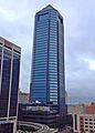
Jacksonville's early predominant position as a regional center of business left an indelibly mark on the city's skyline. Many of the earliest skyscrapers in the state were constructed in Jacksonville, dating as far back as 1902.,[48] The city last held the state height record from 1974 to 1981.[49] The tallest building in Downtown Jacksonville's skyline is the Bank of America Tower, constructed in 1990 as the Barnett Center. It has a height of 617 ft (188 m) and includes 42 floors.[50][51] Other notable structures include the 37-story Wells Fargo Center (with its distinctive flared base making it the defining building in the Jacksonville skyline),[52][53] originally built in 1972-74 by the Independent Life and Accident Insurance Company, and the 28 floor Riverplace Tower which, when completed in 1967, was the tallest precast, post-tensioned concrete structure in the world.[54][55]
-

Laura Street Trio (1902-1912)
-

The Carling (1925)
-

11 East Forsyth (1926)
-
Aetna Building (1955)
-

Riverplace Tower (1967)
-

Wells Fargo Center (1974)
-

EverBank Center (1983)
-
Bank of America (1990)


Neighborhoods[edit]
There are more than 500 neighborhoods within Jacksonville's vast area.[56] These include Downtown Jacksonville and its surrounding neighborhoods, including LaVilla, Brooklyn, Riverside and Avondale, Springfield, Eastside, and San Marco.[57] Additionally, greater Jacksonville is traditionally divided into several amorphous areas, comprising large parts of Duval County. These are Northside, Westside, Southside, and Arlington, as well as the Jacksonville Beaches.[58]
There are four municipalities that have retained their own governments since consolidation; these are Baldwin and the three Jacksonville Beaches towns of Atlantic Beach, Neptune Beach, and Jacksonville Beach.[59] Four of Jacksonville's neighborhoods, Avondale, Ortega, Springfield, and Riverside, have been identified as U.S. historic districts and are in the National Register of Historic Places.[60]


Climate[edit]
.jpg)
| Jacksonville | ||||||||||||||||||||||||||||||||||||||||||||||||||||||||||||
|---|---|---|---|---|---|---|---|---|---|---|---|---|---|---|---|---|---|---|---|---|---|---|---|---|---|---|---|---|---|---|---|---|---|---|---|---|---|---|---|---|---|---|---|---|---|---|---|---|---|---|---|---|---|---|---|---|---|---|---|---|
| Climate chart (explanation) | ||||||||||||||||||||||||||||||||||||||||||||||||||||||||||||
|
||||||||||||||||||||||||||||||||||||||||||||||||||||||||||||
|
||||||||||||||||||||||||||||||||||||||||||||||||||||||||||||
Like much of the south Atlantic region of the United States, Jacksonville has a humid subtropical climate (Köppen Cfa), with mild weather during winters and hot and humid weather during summers. Seasonal rainfall is concentrated in the warmest months from May through September, while the driest months are from November through April. Rainfall averages around 52 inches (1,300 mm) a year.[61] Due to Jacksonville's low latitude and coastal location, the city sees very little cold weather, and winters are typically mild and sunny. Summer thunderstorms with torrential but brief downpours are common.
Mean monthly temperatures range from around 53 °F (12 °C) in January to 82 °F (28 °C) in July. High temperatures average 64 to 92 °F (18 to 33 °C) throughout the year.[62] High heat indices are common for the summer months in the area, with indices above 110 °F (43.3 °C) possible. The highest temperature recorded was 104 °F (40 °C) on July 11, 1879 and July 28, 1872.[63] It is common for thunderstorms to erupt during a typical summer afternoon. These are caused by the rapid heating of the land relative to the water, combined with extremely high humidity.
During winter, there can be hard freezes during the night. Such cold weather is usually short lived, as the city averages only 10 to 15 nights at or below freezing and around 5 days where the high does not rise above 50 °F (10 °C).[64] The coldest temperature recorded at Jacksonville International Airport was 7 °F (−14 °C) on January 21, 1985. Jacksonville has recorded three days with measurable snow since 1911, most recently a one-inch snowfall in December 1989[65] and flurries in December 2010.[66]
Jacksonville has suffered less damage from hurricanes than most other east coast cities, although the threat does exist for a direct hit by a major hurricane. The city has only received one direct hit from a hurricane since 1871; however, Jacksonville has experienced hurricane or near-hurricane conditions more than a dozen times due to storms crossing the state from the Gulf of Mexico to the Atlantic Ocean, or passing to the north or south in the Atlantic and brushing past the area.[67] The strongest effect on Jacksonville was from Hurricane Dora in 1964, the only recorded storm to hit the First Coast with sustained hurricane-force winds. The eye crossed St. Augustine with winds that had just barely diminished to 110 mph (180 km/h), making it a strong Category 2 on the Saffir-Simpson Scale. Jacksonville also suffered damage from 2008's Tropical Storm Fay which crisscrossed the state, bringing parts of Jacksonville under darkness for four days. Similarly, four years prior to this, Jacksonville was inundated by Hurricane Frances and Hurricane Jeanne, which made landfall south of the area. These tropical cyclones were the costliest indirect hits to Jacksonville. Hurricane Floyd in 1999 caused damage mainly to Jacksonville Beach. During Floyd, the Jacksonville Beach pier was severely damaged, and later demolished. The rebuilt pier was later damaged by Fay, but not destroyed. Tropical Storm Bonnie would cause minor damage in 2004, spawning a minor tornado in the process.[68] On May 28, 2012, Jacksonville was hit by Tropical Storm Beryl, packing winds up to 70 miles per hour (113 km/h) which made landfall near Jacksonville Beach.
| Climate data for Jacksonville, Florida (Jacksonville Int'l), 1981−2010 normals, extremes 1871−present[a] | |||||||||||||
|---|---|---|---|---|---|---|---|---|---|---|---|---|---|
| Month | Jan | Feb | Mar | Apr | May | Jun | Jul | Aug | Sep | Oct | Nov | Dec | Year |
| Record high °F (°C) | 85 (29) |
88 (31) |
91 (33) |
95 (35) |
100 (38) |
103 (39) |
104 (40) |
102 (39) |
99 (37) |
95 (35) |
89 (32) |
84 (29) |
104 (40) |
| Average high °F (°C) | 64.8 (18.2) |
68.2 (20.1) |
73.7 (23.2) |
79.2 (26.2) |
85.5 (29.7) |
89.9 (32.2) |
92.0 (33.3) |
90.9 (32.7) |
86.9 (30.5) |
80.4 (26.9) |
73.5 (23.1) |
66.6 (19.2) |
79.3 (26.3) |
| Average low °F (°C) | 41.4 (5.2) |
44.7 (7.1) |
49.7 (9.8) |
54.7 (12.6) |
62.7 (17.1) |
70.0 (21.1) |
72.6 (22.6) |
72.7 (22.6) |
69.5 (20.8) |
60.5 (15.8) |
50.9 (10.5) |
43.9 (6.6) |
57.8 (14.3) |
| Record low °F (°C) | 7 (−14) |
10 (−12) |
23 (−5) |
31 (−1) |
45 (7) |
47 (8) |
61 (16) |
63 (17) |
48 (9) |
33 (1) |
21 (−6) |
11 (−12) |
7 (−14) |
| Average precipitation inches (mm) | 3.30 (83.8) |
3.19 (81) |
3.95 (100.3) |
2.64 (67.1) |
2.48 (63) |
6.45 (163.8) |
6.55 (166.4) |
6.80 (172.7) |
8.19 (208) |
3.93 (99.8) |
2.11 (53.6) |
2.80 (71.1) |
52.39 (1,330.7) |
| Average precipitation days (≥ 0.01 in) | 8.3 | 7.6 | 8.2 | 5.7 | 6.4 | 13.9 | 13.8 | 15.0 | 12.2 | 8.2 | 6.8 | 7.4 | 113.5 |
| Average relative humidity (%) | 74.9 | 72.2 | 71.2 | 69.5 | 72.7 | 76.8 | 77.7 | 80.3 | 80.8 | 78.6 | 77.7 | 76.7 | 75.8 |
| Mean monthly sunshine hours | 189.4 | 193.8 | 257.9 | 286.4 | 303.9 | 283.6 | 282.0 | 262.4 | 228.2 | 214.6 | 193.9 | 183.6 | 2,879.7 |
| Percent possible sunshine | 59 | 62 | 69 | 74 | 72 | 67 | 65 | 64 | 62 | 61 | 61 | 58 | 65 |
| Source: NOAA (relative humidity and sun 1961−1990)[63][69][70][71] | |||||||||||||
Parks[edit]
The City of Jacksonville has a unique park system, with various lands operated by the National Park Service, Florida State Parks and the City of Jacksonville Department of Parks and Recreation. Jacksonville operates the largest urban park system in the United States, providing facilities and services at more than 337 locations on more than 80,000 acres (320 km2) located throughout the city.[72] Jacksonville enjoys natural beauty from the St. Johns River and Atlantic Ocean. Many parks provide access for people to boat, swim, fish, sail, jetski, surf and waterski. Several parks around the city have received international recognition.
National parks[edit]

The Timucuan Preserve is a U.S. National Preserve comprising over 46,000 acres (19,000 ha) of wetlands and waterways. It includes natural and historic areas such as the Fort Caroline National Memorial and the Kingsley Plantation, the oldest standing plantation in the state.
State parks[edit]
There are several state parks within the city limits of Jacksonville, these included Amelia Island State Park, Big Talbot Island State Park, Fort George Island Cultural State Park, George Crady Bridge Fishing Pier State Park, Little Talbot Island State Park, Pumpkin Hill Creek Preserve State Park and Yellow Bluff Fort Historic State Park.
City parks[edit]
- Confederate Park is a public park on the southern bounds of the historic neighborhood of Springfield, and is part of a network of parks that parallel Hogans Creek. The park opened in 1907 as Dignan Park, named for a former chairman of the city's Board of Public Works. In 1914, the park hosted the annual reunion of the United Confederate Veterans, a gathering of former Confederate soldiers. Five months after the reunion the city renamed the park "Confederate Park." A Confederate monument was erected in 1915 honoring the Women of the Southland.[73]

- Friendship Fountain is a large fountain located in St. Johns River Park at the west end of Downtown Jacksonville's Southbank Riverwalk. It opened in 1965 as the world's largest and tallest fountain, and has been one of Jacksonville's most recognizable and popular attractions. The fountain's three pumps could push 17,000 US gallons (64,000 L) of water per minute up to 100 feet (30 m) in height. Designed by Jacksonville architect Taylor Hardwick in 1963 and, in 2011 the city completed a $3.2 million renovation to the fountain and the surrounding park. It currently features a light show and music each evening.[74]
- Hanna Park is a 1.5-mile (2.4 km) public beach and city park located near Mayport in the Jacksonville Beaches area. It consists of 447 acres (1.81 km2) of mature coastal hammock, and was formerly known as Manhattan Beach, Florida's first beach community for African Americans during the period of segregation in the United States.[75]

- Hemming Park is a 1.54-acre (6,200 m2) public park located in the heart of the government center in downtown. Originally a village green, it was the first and is the oldest park in the city. The area was established as a public square in 1857 by Isaiah Hart, founder of Jacksonville. The first Wednesday of every month, Hemming Park is converted into the centerpiece of Jacksonville's Downtown Art Walk. The third Thursday of every month Hemming Park hosts a night market called Jaxsons Night Market. [76]
- Klutho Park is a 18.34-acre (74,200 m2) public park, located between downtownand the historic neighborhood of Springfield. It is part of a network of parks that parallel Hogans Creek, Klutho Park being the largest. Created between 1899 and 1901 on land donated by the Springfield Company. The park also once housed the City’s first zoo, opening at the park in 1914. The Hogans Creek Improvement Project of 1929–30, designed by architect Henry J. Klutho, turned much of the park grounds into a Venetian-style promenade.[77]
- Jacksonville-Baldwin Rail Trail is a 14.5-mile (23.3 km) Rail Trail that extends northwest to Baldwin, Florida. It includes three separate paths; a multi-use asphalt trail for hiking, jogging, in-line skating or cycling; an off-road bike trail; and a horseback riding trail.[78]
- Jessie Ball DuPont Park is a 7-acre (2.8 ha) park, home to Treaty Oak, a massive 250-year-old tree in the Southbank..[79]
- Metropolitan Park is a 32-acre (130,000 m2) waterfront park located on the St. Johns River, in the Sports Complex area of downtown. The multi-purpose facility contains an exhibition area, picnic and playground area, and a performance pavilion which has a capacity of 10,000 persons.[80]
- Memorial Park is a 5.85-acre (23,700 m2) public park, located on the St. Johns River in the historic neighborhoods Riverside. Completed in 1924, it is the third oldest park in the city. Built to honor of the 1,200 Floridians who died serving during World War I, the notable Olmsted Brothers were commissioned to design the park, along with local architect Roy A. Benjamin. Charles Adrian Pillars designed the bronze sculpture, 'Life', prominently showcased in the park.[81]
- Riverside Park is an 11.4-acre (46,000 m2) public park, located in the historic neighborhood of Riverside. It is the second oldest park in the city.[82]
- Riverwalk 2.0 miles (3.2 km) along the St. Johns from Berkman Plaza to I-95 at the Fuller Warren Bridge while the Southbank Riverwalk stretches 1.2 miles (1.9 km) from the Radisson Hotel to Museum Circle. The Jacksonville Landing is a popular riverfront dining and shopping venue, accessible by River Taxi from the Southbank Riverwalk. Adjacent to Museum Circle is St. Johns River Park, also known as Friendship Park. It is the location of Friendship Fountain, one of the most recognizable and popular attractions for locals as well as tourists in Jacksonville. This landmark was built in 1965 and promoted as the "World's Tallest and Largest" fountain at the time.[83]
- Veterans Memorial Wall is a tribute to local servicemen and women killed while serving in US armed forces. A ceremony is held each Memorial Day recognizing any service woman or man from Jacksonville who died in the previous year.[84]
Other[edit]
- Evergreen Cemetery is a large historic cemetery added to the National Register of Historic Places on April 8, 2011.[85][86][87][88]
- Jacksonville Arboretum & Gardens broke ground on a new center in April 2007 and held their grand opening on November 15, 2008.
- Jacksonville Zoo and Gardens
- Jacksonville National Cemetery
- Old City Cemetery
- Tree Hill Nature Center is a nature preserve and environmental education center located five minutes from Downtown Jacksonville.
Demographics[edit]

Held annually in October, Jacksonville Pride is a weekend-long festival generally centered around the Five-Points area of Riverside
|
| City compared to State & U.S. | |||
|---|---|---|---|
| Jacksonville Demographics | |||
| 2010 Census | Jacksonville | Duval County | Florida |
| Total population | 821,784 | 864,263 | 18,801,310 |
| Population, percent change, 2000 to 2010 | +11.7% | +11.0% | +17.6% |
| Population density | 1,100.1/sq mi | 1,133.9/sq mi | 350.6/sq mi |
| White or Caucasian (including White Hispanic) | 59.4% | 60.9% | 75.0% |
| (Non-Hispanic White or Caucasian) | 55.1% | 56.6% | 57.9% |
| Black or African-American | 30.7% | 29.5% | 16.0% |
| Hispanic or Latino (of any race) | 7.7% | 7.6% | 22.5% |
| Asian | 4.3% | 4.2% | 2.4% |
| Native American or Native Alaskan | 0.4% | 0.4% | 0.4% |
| Pacific Islander or Native Hawaiian | 0.1% | 0.1% | 0.1% |
| Two or more races (Multiracial) | 2.9% | 2.9% | 2.5% |
| Some Other Race | 5.2% | 3.9% | 3.6% |
| Demographic profile | 2010[32] | 2000[89] | 1990[33] | 1970[33] |
|---|---|---|---|---|
| White | 59.4% | 64.5% | 71.9% | 77.1% |
| —Non-Hispanic | 55.1% | 62.2% | 70.3% | 75.8%[90] |
| Black or African American | 30.7% | 29.0% | 25.2% | 22.3% |
| Hispanic or Latino (of any race) | 7.7% | 4.2% | 2.6% | 1.3%[90] |
| Asian | 4.3% | 2.8% | 1.9% | 0.4% |
| Historical population | |||
|---|---|---|---|
| Census | Pop. | %± | |
| 1850 | 1,045 | — | |
| 1860 | 2,118 | 102.7% | |
| 1870 | 6,912 | 226.3% | |
| 1880 | 7,650 | 10.7% | |
| 1890 | 17,201 | 124.8% | |
| 1900 | 28,429 | 65.3% | |
| 1910 | 57,699 | 103.0% | |
| 1920 | 91,558 | 58.7% | |
| 1930 | 129,549 | 41.5% | |
| 1940 | 173,065 | 33.6% | |
| 1950 | 204,275 | 18.0% | |
| 1960 | 201,030 | −1.6% | |
| 1970 | 528,865 | 163.1% | |
| 1980 | 540,920 | 2.3% | |
| 1990 | 635,230 | 17.4% | |
| 2000 | 735,503 | 15.8% | |
| 2010 | 821,784 | 11.7% | |
| Est. 2015 | 868,031 | [91] | 5.6% |
| U.S. Decennial Census[92] 2014 Estimate[4] |
|||
Jacksonville is the most populous city in Florida, and the twelfth most populous city in the United States. As of 2010[update], there were 821,784 people and 366,273 households in the city. Jacksonville has the country's tenth-largest Arab population, with a total population of 5,751 according to the 2000 United States Census.[93][94] Jacksonville has Florida's largest Filipino American community, with 25,033 in the metropolitan area as of the 2010 Census. Much of Jacksonville's Filipino community served in or has ties to the United States Navy.[95]
As of 2010[update], those of Hispanic or Latino ancestry accounted for 7.7% of Jacksonville's population. Out of the 7.7%, 2.6% Puerto Rican, 1.7% Mexican, and 0.9% were Cuban.[96]
As of 2010[update], those of African ancestry accounted for 30.7% of Jacksonville's population, which includes African Americans. Out of the 30.7%, 1.8% were Subsaharan African, 1.4% were West Indian or Afro-Caribbean American (0.5% Haitian, 0.4% Jamaican, 0.1% Other or Unspecified West Indian, 0.1% Bahamian, 0.1% Barbadian), and 0.6% were Black Hispanics.[96][97][98]
As of 2010[update], those of (non-Hispanic white) European ancestry accounted for 55.1% of Jacksonville's population. Out of the 55.1%, 10.4% were German, 10.2% Irish, 8.8% English, 3.9% Italian, 2.2% French, 2.0% Scottish, 2.0% Scotch-Irish, 1.7% Polish, 1.1% Dutch, 0.6% Russian, 0.5% Norwegian, 0.5% Swedish, 0.5% Welsh, and 0.5% were French Canadian.[98]
As of 2010[update], those of Asian ancestry accounted for 4.3% of Jacksonville's population. Out of the 4.3%, 1.8% Filipino, 0.9% were Indian, 0.6% Other Asian, 0.5% Vietnamese, 0.3% Chinese, 0.2% Korean, and 0.1% were Japanese.[98]
In 2010, 6.7% of the population considered themselves to be of only American ancestry (regardless of race or ethnicity.)[97][98] And 0.9% were of Arab ancestry, as of 2010[update].[98]
As of 2010[update], there were 366,273 households out of which 11.8% were vacant. 23.9% of households had children under the age of 18 living with them, 43.8% were married couples, 15.2% had a female householder with no husband present, and 36.4% were non-families. 29.7% of all households were made up of individuals and 7.9% had someone living alone who was 65 years of age or older. The average household size was 2.55 and the average family size was 3.21. In the city, the population was spread out with 23.9% under the age of 18, 10.5% from 18 to 24, 28.5% from 25 to 44, 26.2% from 45 to 64, and 10.9% who were 65 years of age or older. The median age was 35.5 years. For every 100 females there were 94.1 males. For every 100 females age 18 and over, there were 91.3 males.[98][99]
In 2010, the median income for a household in the county was $48,829, and the median income for a family was $59,272. Males had a median income of $42,485 versus $34,209 for females. The per capita income for the county was $25,227. About 10.5% of families and 14.3% of the population were below the poverty line, including 20.4% of those under age 18 and 9.9% of those aged 65 or over.[100]
In 2010, 9.2% of the county's population was foreign born, with 49.6% being naturalized American citizens. Of foreign born residents, 38.0% were born in Latin America, 35.7% born in Asia, 17.9% were born in Europe, 5.9% born in Africa, 1.9% in North America, and 0.5% were born in Oceania.[98]
As of 2010[update], 87.1% of Jacksonville's population age five and over spoke only English at home while 5.8% of the population spoke Spanish at home. About 3.3% spoke other Indo-European languages at home. About 2.9% spoke Asian languages or Pacific Islander languages/Oceanic languages at home. The remaining 0.9% of the population spoke other languages at home. In total, 12.9% spoke another language other than English.[98]
As of 2000, speakers of English as a first language accounted for 90.60% of all residents, while those who spoke Spanish made up 4.13%, Tagalog 1.00%, French 0.47%, Arabic 0.44%, German 0.43%, Vietnamese at 0.31%, Russian was 0.21% and Italian made up 0.17% of the population.[101]
Religion[edit]Jacksonville has a diverse religious population. The largest religious group is Protestant. According to the Association of Religion Data Archives (ARDA), in 2010 the Jacksonville metropolitan area had an estimated 365,267 Evangelical Protestants, 76,100 Mainline Protestants, and 56,769 Black Protestants, though figures for the latter were incomplete. There were around 1200 Protestant congregations in various denominations.[102] Notable Protestant churches include Bethel Baptist Institutional Church and First Baptist Church, the city's oldest Baptist churches. The Episcopal Diocese of Florida has its see at St. John's Cathedral, the current building dating to 1906. Jacksonville is part of the Catholic Diocese of St. Augustine, which covers seventeen counties in North Florida.[103] ARDA estimated 133,155 Catholics attending 25 parishes in the Jacksonville metropolitan area in 2010.[102] One notable Catholic church in Jacksonville is the Basilica of the Immaculate Conception, a minor basilica added to the National Register of Historic Places in 1992.[104][105] There are also two Eastern Catholic parishes, one of the Syriac Catholic Church and one of the Maronite Church.[106] According to ARDA, in 2010 there were 2520 Eastern Orthodox Christians representing four churches in the Eastern Orthodox communion, as well as congregations of Syriac Orthodox, Armenian Apostolic, Ethiopian Orthodox, and Coptic Orthodox Christians.[102] ARDA also estimated 14,886 members of The Church of Jesus Christ of Latter-day Saints (LDS Church) and 511 Unitarian Universalists in 2010.[102] There were an estimated 8,581 Muslims attending seven mosques, the largest being the Islamic Center of Northeast Florida.[102][107] The Jewish community, which numbered 6,028 in 2010,[102] is largely centered in the neighborhood of Mandarin.[108] There are five Orthodox, two Reform, two Conservative, and one Reconstructionist synagogues. The Rohr Jewish Learning Institute teaches courses for the community.[102][109] ARDA also estimated 4,595 Hindus, 3,530 Buddhists and 650 Bahá'ís in the Jacksonville area in 2010.[102] Economy[edit]For more details on this topic, see List of companies based in the Jacksonville area.
Jacksonville's location on the St. Johns River and the Atlantic Ocean proved providential in the growth of the city and its industry. Jacksonville has the largest deepwater port in the South (as well as the second-largest port on the U.S. East coast) and a leading port in the U.S. for automobile imports, as well as the leading transportation and distribution hub in the state. However, the strength of the city's economy lies in its broad diversification. While the area once had many thriving dairies such as Gustafson's Farm and Skinner Dairy, this aspect of the economy has declined over time. The area's economy is balanced among distribution, financial services, biomedical technology, consumer goods, information services, manufacturing, insurance and other industries. Jacksonville is home to many prominent corporations and organizations, including the headquarters of four Fortune 500 companies: CSX Corporation, Fidelity National Financial, Fidelity National Information Services and Southeastern Grocers.[110] Interline Brands is based in Jacksonville and is currently owned by The Home Depot.[111] The Florida East Coast Railway, Swisher International, Inc., and the large short line railroad holding company RailAmerica are also based in Jacksonville. In 2008, Jacksonville had approximately 2.8 million visitors who stayed overnight, spending nearly $1 billion. Research Data Services of Tampa was commissioned to undertake the study, which quantified the importance of tourism. The total economic impact was $1.6 billion and supported nearly 43,000 jobs, 10% of the local workforce.[112] Banking and financial services[edit]Jacksonville has long had a regional legacy in banking and finance. Locally headquartered Atlantic National Bank, Florida National Bank and Barnett Bank dominated the industry in Florida from the turn of the 20th century through the 1980s, before all being acquired in a national wave of mergers and acquisitions throughout the entire financial sector beginning in the 1970s.[113] The city still holds distinction nationally and internationally, boosting two Fortune 500 financial services companies, Fidelity National Financial and FIS, FIS being well recognized as a global leader in financial technology.[114] Headquartered on the banks of the St. Johns River in Downtown Jacksonville, EverBank holds the title of largest bank in the state by deposits.[115] The city is home to other notable financial services institutions including Ameris Bancorp, Atlantic Coast Financial, Black Knight Financial Services, MedMal Direct Insurance Company, US Assure, and VyStar Credit Union. The city is also home to the Federal Reserve Bank of Atlanta Jacksonville Branch.[116] Jacksonville's financial sector has benefited from a changing business culture in the wake of the Great Recession, as have other Sunbelt cities like Atlanta, Tampa, and Charlotte. Financial intuitions have begun reevaluating the need of certain operations at high-cost addresses like Wall Street. With relatively low-cost real estate, easy access to New York City, and high-quality of life, Jacksonville has become an appealing option for relocating operations.[117] Perhaps the best example of this is the growth of Deutsche Bank's presence in the city. Jacksonville is home to Deutsche Bank's second largest US operation, only New York is larger.[118] Other institutions with a notable presence in Jacksonville include Macquarie Group, Bank of America, Wells Fargo, JPMorgan Chase, Citi, Citizens Property Insurance, Fidelity Investments, Ally Financial and Aetna.[119] Logistics[edit]Jacksonville is a rail, air, and highway focal point and a busy port of entry, with Jacksonville International Airport, ship repair yards and extensive freight-handling facilities. Lumber, phosphate, paper, cigars and wood pulp are the principal exports; automobiles and coffee are among imports. The city's manufacturing base provides just 4.5% of local jobs, versus 8.5% nationally.[120] According to Forbes in 2007, Jacksonville, Florida ranked 3rd in the top ten U.S. cities to relocate to find a job.[121] Jacksonville was also the 10th fastest growing city in the U.S.[122] To emphasize the city's transportation business and capabilities, the Jacksonville Regional Chamber of Commerce filed Jacksonville America's Logistics Center as a trademark on November 9, 2007. It was formally registered on August 4, 2009.[123] Cornerstone began promoting the city as "Jacksonville: America's Logistics Center" in 2009. Signs were added to the existing city limit markers on Interstate 95.[124] The Port of Jacksonville, a seaport on the St. Johns River, is a large component of the local economy. Approximately 50,000 jobs in Northeast Florida are related to port activity and the port has an economic impact of $2.7 billion in Northeast Florida:[125] Cecil Commerce Center is located on the site of the former Naval Air Station Cecil Field which closed in 1999 following the 1993 Base Realignment and Closure (BRAC) decision. Covering a total area of 22,939 acres (92.83 km2), it was the largest military base in the Jacksonville area. The parcel contains more than 3% of the total land area in Duval County (17,000 acres (69 km2)). The industrial and commercial-zoned center offers mid to large-size parcels for development and boasts excellent transportation and utility infrastructure as well as the third-longest runway in Florida. Media and technology[edit]Main article: Media in Jacksonville, Florida

The Florida Times-Union Building
The Florida Times-Union is the major daily newspaper in Jacksonville and the First Coast. Jacksonville.com is its official website. The Financial News & Daily Record is a daily paper focused on the business and legal communities. Weekly papers include the Jacksonville Business Journal, an American City Business Journals publication focused on business news, Folio Weekly, the city's chief alternative weekly, and The Florida Star and the Jacksonville Free Press, two weeklies catering to African Americans. Jax4Kids, a monthly newspaper, caters to parents. Jax4Kids.com is its official website. EU Jacksonville is a monthly entertainment magazine. Metro Jacksonville is an online-only publication. Jacksonville is the 47th largest local television market in the United States,.[126] Despite its large population, Jacksonville has always been a medium-sized market because the surrounding suburbs and rural areas are not much larger than the city itself. It is served by television stations affiliated with major American networks including WTLV (NBC/Justice Network), WJXX (ABC/NBC Weather Plus), WJAX-TV (CBS/GetTV), WFOX-TV (Fox/MyNetworkTV/Me-TV), WJCT (PBS), and WCWJ (CW). WJXT is a former longtime CBS affiliate that turned independent in 2002. Jacksonville is the 46th largest local radio market in the United States,[127] and is dominated by the same two large ownership groups that dominate the radio industry across the United States: Cox Radio[128] and iHeartMedia.[129] The dominant AM radio station in terms of ratings is WOKV 690AM, which is also the flagship station for the Jacksonville Jaguars.[130] In May 2013, WOKV began simulcasting on 104.5 FM as WOKV FM. There are two radio stations broadcasting a primarily contemporary hits format; WAPE 95.1 has dominated this niche for over twenty years, and more recently has been challenged by WKSL 97.9 FM (KISS FM). WJBT 93.3 (The Beat) is a hip-hop/R&B station, 96.9 The Eagle WJGL operates a Classic Hits format while its HD subchannel WJGL-HD2 operates an Urban CHR format under the moniker Power 106.1, WWJK 107.3 is an Adult Variety station. WXXJ 102.9 is an alternative station, WQIK 99.1 is a country station as well as WGNE-FM 99.9, WCRJ FM 88.1/WSOS-FM 94.1 (The Promise) is the main Contemporary Christian music station operating since 1984, WHJX 105.7 and WFJO 92.5 plays music in Spanish like salsa, merengue, and reggaeton, and WJCT 89.9 is the local National Public Radio affiliate. WJKV 90.9 FM is an Educational Media Foundation K-LOVE outlet. The NPR and PRX radio show, State of the Re:Union, hosted by performance poet and playwright, Al Letson, is headquartered and produced in Jacksonville. Military and defense[edit]Jacksonville is home to multiple military facilities, and with Naval Submarine Base Kings Bay nearby gives Jacksonville the third largest naval presence in the country.[12] Only Norfolk, Virginia and San Diego, California are bigger. The military is by far the largest employer in Jacksonville and its total economic impact is approximately $6.1 billion annually. Several veterans service organizations are also headquartered in Jacksonville including Wounded Warrior Project.[131] Naval Air Station Jacksonville is a military airport located 4 miles (6.4 km) south of the central business district. Approximately 23,000 civilian and active-duty personnel are employed on the base. There are 35 operational units/squadrons assigned there and support facilities include an airfield for pilot training, a maintenance depot capable of virtually any task, from changing a tire to intricate micro-electronics or total engine disassembly. Also on-site is a Naval Hospital, a Fleet Industrial Supply Center, a Navy Family Service Center, and recreational facilities.[132] Naval Station Mayport is a Navy Ship Base that is the third largest fleet concentration area in the United States. Mayport's operational composition is unique, with a busy harbor capable of accommodating 34 ships and an 8,000-foot (2,400 m) runway capable of handling any aircraft used by the Department of Defense. Until 2007, it was home to the aircraft carrier USS John F. Kennedy, which locals called "Big John". In January 2009, the Navy committed to stationing a nuclear-powered carrier at Mayport when the official Record of Decision was signed. The port will require approximately $500 million in facility enhancements to support the larger vessel, which will take several years to complete.[133] The carrier is projected to arrive in 2019, however an amphibious group is coming sooner.[134] Blount Island Command is a Marine Corps Logistics Base whose mission is to support the Maritime Prepositioning Force (MPF) which provides for rapid deployment of personnel to link up with prepositioned equipment and supplies embarked aboard forward deployed Maritime Prepositioning Ships (MPS).[135] USS Jacksonville, a nuclear-powered Los Angeles class submarine, is a US Navy ship named for the city. The ship's nickname is The Bold One and Pearl Harbor is her home port. The Florida Air National Guard is based at Jacksonville International Airport. Coast Guard Sector Jacksonville is located on the St. Johns River next to Naval Station Mayport. Sector Jacksonville controls operations from Kings Bay, Ga. south to Cape Canaveral, Fla.. The CGC Kingfisher, CGC Maria Bray, and CGC Hammer are stationed at the Sector. Station Mayport is co-located with Sector Jacksonville and includes 25-foot (7.6 m) Response Boats, and 47-foot (14 m) Motor Life Boats. Culture[edit]Leisure and entertainment[edit]
Throughout the year, many annual events of various types are held in Jacksonville. In sports, the annual Gate River Run has been held annually since March 1977.[136] It has been the US National 15-kilometre (9.3 mi) road race Championship since 1994 and is the largest race of its distance in the country with over 13,000 runners, spectators, and volunteers, making it Jacksonville's largest participation sporting event.[137] In college football, the Gator Bowl is held on January 1. It has been continuously held since 1946. Also, the Florida–Georgia game (also known as the "World's Largest Outdoor Cocktail Party"), the annual college football game between the rival Florida Gators and Georgia Bulldogs has been held in Jacksonville almost yearly since 1933. For six days in July the Jacksonville Kingfish Tournament is held for fishermen of all skills. With $500,000 of prizes up for grabs, up to 1000 boats participate with almost 30,000 spectators watching. A number of cultural events are also held in Jacksonville. The Jacksonville Jazz Festival, held downtown, is the second-largest jazz festival in the nation,[138] while Springing the Blues, one of the oldest and largest blues festivals, has been held in Jacksonville Beach since 1990.[139] The World of Nations Celebration has been held in Metropolitan Park since 1993, and features a number of events, food and souvenirs from various countries. 
Hemming Park plays host to a variety of cultural events throughout the year.
The Art Walk, a monthly outdoor art festival on the first Wednesday of each month, is sponsored by Downtown Vision, Inc, an organization which works to promote artistic talent and venues on the First Coast. Other events include the Blessing of the Fleet held in March since 1985 and the Greater Jacksonville Agricultural Fair in November at the Jacksonville Fairgrounds and Exposition Center featuring games, rides, food, entertainment and livestock exhibition. One Spark is an annual and the largest crowdfunding event held for creators to showcase their ideas for a chance to win part of $300,000 in funding. Holiday celebrations include the Freedom, Fanfare & Fireworks celebration on July 4, the lighting of Jacksonville's official Christmas tree at the Jacksonville Landing on the day after Thanksgiving and the Jacksonville Light Parade of boats the following day. The Jacksonville Veterans Memorial Arena, which opened in 2003, is a 16,000-seat performance venue that attracts national entertainment, sporting events and also houses the Jacksonville Sports Hall of Fame. It replaced the outdated Jacksonville Coliseum that was built in 1960 and demolished on June 26, 2003. The Jacksonville Zoo and Gardens boasts the second largest animal collection in the state. The zoo features elephants, lions, and, of course, jaguars (with an exhibit, Range of the Jaguar, hosted by the former owners of the Jacksonville Jaguars, Delores and Wayne Weaver). It also has a multitude of reptile houses, free flight aviaries, and many other animals.Adventure Landing is an amusement park with locations in Jacksonville and Jacksonville Beach. The Jacksonville Beach location contains Shipwreck Island, Duval County's only waterpark. Theatre Jacksonville was organized in 1919 as the Little Theatre and is one of the oldest continually producing community theatres in the United States. The Alhambra Dinner Theatre, located on the Southside near the University of North Florida, has offered professional productions that frequently starred well-known actors since 1967. There are also a number of popular community theatres such as Players by the Sea at Jacksonville Beach. The Murray Hill Art Center was reopened in February 2012 through a partnership of the City of Jacksonville Parks and Recreation Department (JaxParks) and the Art League of Jacksonville (a 501(c)(3) nonprofit dedicated to community arts education). The center is located at 4327 Kerle Street in the historic Murray Hill area on the westside of Jacksonville and offers community arts classes as well as shared studio space for aspiring artists. Visitors are welcomed year around for events and classes. Jacksonville has two fully enclosed shopping malls. The oldest is the Regency Square Mall, which opened in 1967 and is located on former sand dunes in the Arlington area. The other is The Avenues Mall, which opened in 1990 on the Southside, at the intersection of I-95 and US 1. The Orange Park Mall is another mall located just south of the city in the suburb of Orange Park, Florida, in Clay County, off of Blanding Boulevard (State Road 21). The end of the indoor shopping mall may be indicated by the opening of The St. Johns Town Center in 2005 and the River City Marketplace, on the Northside in 2006. Both of these are "open air" malls, with a similar mix of stores, but without being contained under a single, enclosed roof. According to the International Council of Shopping Centers (ICSC), only one enclosed mall has been built in the United States since 2006.[140] The Avenues, Orange Park Mall, and St. Johns Town Center are all owned by Simon Property Group; Regency is owned by General Growth Properties; River City Marketplace is owned by Ramco-Gershenson. Literature, film and television[edit]Main article: Media in Jacksonville, Florida

Motion picture scene at Gaumont Studios, 1910
A handful of significant literary works are associated with Jacksonville and the surrounding area. Perhaps the most important of these is that of James Weldon Johnson. His first success as a writer was the poem "Lift Ev'ry Voice and Sing" (1899), which his brother Rosamond set to music; the song became unofficially known as the "Negro National Anthem."[141] Already famous for having written Uncle Tom's Cabin (1852), Harriet Beecher Stowe published Palmetto Leaves in 1873. A travel guide and memoir about her winters in the town of Mandarin, Florida, it was one of the first guides written about Florida and stimulated Florida's first boom of tourism and residential development in the 1880s. Sun-Ray Cinema, formerly the 5 Points Theatre and Riverside Theatre, opened in 1927. It was the first theater equipped to show talking pictures in Florida and the third nationally. It is located in the Five Points section of town and was renamed the Five Points Theater in 1949.[142][143] The Florida Theatre, opened in 1927, is located in downtown Jacksonville and is one of only four remaining high-style movie palaces built in Florida during the Mediterranean Revival architectural boom of the 1920s. Since that time, Jacksonville has been chosen by a number of film and television studios for on-location shooting. Notable motion pictures that have been partially or completely shot in Jacksonville since the silent film era include Creature from the Black Lagoon (1954), The New Adventures of Pippi Longstocking (1988), Brenda Starr (1989), G.I. Jane (1997), The Devil's Advocate (1997), Ride (1998), Why Do Fools Fall In Love (1998), Forces of Nature (1999), Tigerland (2000), Sunshine State (2002), Basic (2003), The Manchurian Candidate (2004), Lonely Hearts (2006), Moving McAllister (2007), The Year of Getting to Know Us (2008), The Ramen Girl and Like Dandelion Dust.[144] Notable television series or made-for-television films that have been partially or completely shot in Jacksonville include Inherit the Wind (1988), Orpheus Descending (1990), Saved by the Light (1995), The Babysitter's Seduction (1996),[145] First Time Felon (1997), Safe Harbor (2009), Recount (2008), American Idol (2009), and Ash vs Evil Dead (2015). Museums and art galleries[edit]The Cummer Museum of Art and Gardens is an art museum in Jacksonville's Riverside neighborhood. It was founded in 1961, following the death of Ninah Mae Holden Cummer, who willed her collection, home, and gardens to the museum. Its galleries display one of the world's three most comprehensive collections of Meissen porcelain as well as large collections of American, European, and Japanese art. The grounds also contain two acres of Italian and English gardens begun by Ninah Cummer.[146] The Museum of Contemporary Art Jacksonville (MOCA Jacksonville) is a contemporary art museum funded and operated as a "cultural resource" of the University of North Florida. Tracing its roots back to the formation of Jacksonville's Fine Arts Society in 1924, it opened its current 60,000-square-foot (6,000 m2) facility next to the Main Library downtown in 2003. The museum features eclectic permanent and traveling exhibitions and a collection of over 700 works.[146] The Museum of Science & History (MOSH), located in downtown's Southbank Riverwalk, specializes in science and local history exhibits. It features a main exhibit that changes quarterly, plus three floors of nature exhibits, an extensive exhibit on the history of Northeast Florida, a hands-on science area and the area's only astronomy theater, the Bryan Gooding Planetarium.[146][147][148] Kingsley Plantation is a historic plantation built in 1798. The house of Zephaniah Kingsley, barn, kitchen and slave cabins still exist today. Alexander Brest, founder of Duval Engineering and Contracting Co., was also the benefactor for the Alexander Brest Museum and Gallery on the campus of Jacksonville University. The exhibits are a diverse collection of carved ivory, Pre-Columbian artifacts, Steuben glass, Chinese porcelain and Cloisonné, Tiffany glass, Boehm porcelain and rotating exhibitions containing the work of local, regional, national and international artists.[149] The Jacksonville Maritime Museum, located in the Jacksonville Landing, includes models of ships, paintings, photographs and artifacts dating to 1562.[150] Three other art galleries are located at educational institutions in town. Florida State College at Jacksonville has the Kent Gallery on their westside campus and the Wilson Center for the Arts at their main campus. The University Gallery is located on the campus of the University of North Florida.[151] The Jacksonville Karpeles Manuscript Library Museum is a branch of the world's largest private collection of original manuscripts and documents. The museum in Jacksonville is in a 1921 neoclassical building on the outskirts of downtown.[152][153] In addition to document displays, there is also an antique-book library, with volumes dating from the late 19th century. The Catherine Street Fire Station building is on the National Register of Historic Places and was relocated to Metropolitan Park in 1993. It houses the Jacksonville Fire Museum and features 500+ artifacts including an 1806 hand pumper. The LaVilla Museum opened in 1999 and features a permanent display of African-American history. The art exhibits are changed periodically. There are also several historical properties and items of interest in the city, including the Klutho Building, the Old Morocco Temple Building, the Palm and Cycad Arboretum, and the Prime F. Osborn III Convention Center, originally built as Union Station train depot. The Jacksonville Historical Society showcases two restoration projects: the 1887 St. Andrews Episcopal Church and the 1879 Merrill House, both located near the sports complex. Music[edit]
The Ritz Theatre, opened in 1929, is located in the LaVilla neighborhood of the northern part of Jacksonville's downtown. The Jacksonville music scene was active in the 1930s in LaVilla, which was known as "Harlem of the South".[154] Black musicians from across the country visited Jacksonville to play standing room only performances at the Ritz Theatre and the Knights of Pythias Hall. Cab Calloway, Duke Ellington, Ella Fitzgerald and Louis Armstrong were a few of the legendary performers who appeared. After his mother died when he was 15, Ray Charles lived with friends of his mother while he played piano at the Ritz for a year, before moving on to fame and fortune. The Ritz Theatre was rebuilt and opened in October 1999. Jacksonville native Pat Boone was a popular 1950s singer and teen idol. During the 1960s, the Classics IV was the most successful pop rock band from Jacksonville. Southern Rock was defined by the Allman Brothers Band, which formed in 1969 in Jacksonville. Lynyrd Skynyrd achieved near cult status and inspired Blackfoot, Molly Hatchet and .38 Special, all successful in the 1970s. The 1980s were a quiet decade for musical talent in Jacksonville. The Times-Union Center for the Performing Arts consists of three distinct halls: the Jim & Jan Moran Theater, a venue for touring Broadway shows; the Jacoby Symphony Hall, home of the Jacksonville Symphony Orchestra; and the Terry Theater, intended for small shows and recitals. The building was originally erected as the Civic Auditorium in 1962 and underwent a major renovation and construction in 1996. The next local group to achieve national success was the nu metal band Limp Bizkit, formed in 1994. Other popular Hip Hop acts in the 1990s included 95 South, 69 Boyz and the Quad City DJ's. The bands Inspection 12, Cold and Yellowcard were also well known and had a large following. Following the millennium, Fit For Rivals, Burn Season, Evergreen Terrace, Shinedown, The Red Jumpsuit Apparatus, and Black Kids became notable bands from the city. Sports[edit]Main article: Sports in Jacksonville

Jacksonville is home to one major league sports team, the Jacksonville Jaguars of the National Football League (NFL). The Jaguars joined the NFL as an expansion team in the 1995 season; they play their home games at EverBank Field.[155] In 2005, Jacksonville hosted Super Bowl XXXIX. The PGA Tour, which organizes the main professional golf tournaments in the U.S., is headquartered in the suburb of Ponte Vedra Beach, where it holds The Players Championship every year.[156] Jacksonville is also home to several minor league-level teams. The Jacksonville Jumbo Shrimp, a class Double-A baseball team, have played in Jacksonville continuously since 1970, longer than any other Double-A team has been in its city, and are the top-selling franchise in the Southern League.[157][158] The Jacksonville Sharks, who began play in 2010, were the champions of the Arena Football League's ArenaBowl XXIV in 2011[159][160] and now play in the National Arena League. The Jacksonville Axemen are a semi-professional rugby league team founded in 2006, and now play in the USA Rugby League.[161] The Jacksonville Giants basketball team started play in the new American Basketball Association in December 2010. The Giants won the 2012 ABA National Championship in March 2012 in Tampa, Florida.[162][163][164] The Jacksonville Armada FC is a soccer team that began play in the North American Soccer League (NASL) in 2015.[165] College sports, especially college football, are popular in Jacksonville. The city hosts the Florida–Georgia game, an annual college football game between the University of Florida and the University of Georgia, and the Gator Bowl, a post-season college bowl game. Jacksonville's two universities compete in NCAA Division I: the University of North Florida Ospreys and the Jacksonville University Dolphins, both in the Atlantic Sun Conference.[166][167]
|


.jpg)
_129,_based_at_Naval_Air_Station_Whidbey_Island,_pract.jpg)

.jpg)
.JPG)


- 1791 establishments in the United States
- Census balances in the United States
- Cities in Duval County, Florida
- County seats in Florida
- Port cities in Florida
- Port cities and towns of the United States Atlantic coast
- Populated places established in 1791
- Populated places on the St. Johns River
- Cities in Jacksonville metropolitan area
- Jacksonville, Florida
- Consolidated city-counties in the United States
- Cities in Florida
- Populated coastal places in Florida on the Atlantic Ocean