Latest Earthquakes
 Latest earthquakes map and list (past 24 hours, M2.5+). Tap/click on "gear icon" for options and settings.
Significant Earthquakes, Past 30 Days
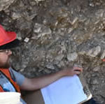
Some Early 20th Century Earthquakes in Los Angeles Area Might Have Been Man-Made

A new study from the USGS suggests that some early 20th century earthquakes in southern California might have been induced (man-made) by past practices that were used by the oil and gas industry.
Wastewater Disposal Likely Induced February 2016 Magnitude 5.1 Oklahoma Earthquake

Distant wastewater disposal wells likely induced the third largest earthquake in recent Oklahoma record, the Feb. 13, 2016, magnitude 5.1 event roughly 32 kilometers northwest of Fairview, Oklahoma.
 Subscribe to Earthquake Hazards Program Highlights
-

Earthquakes
Information about real-time earthquakes, online catalog search of archives, seismicity maps and statistics.
-

Hazards
US faults, information about seismic hazards in various areas, tools for seismic design values.
-

Data & Products
Monitoring, station, and other various seismic data available for download. Data products to view and download.
-

Learn
The science of earthquakes, FAQ, glossary, links to earthquake topics, Earthquakes for kids.
-

Monitoring
Global, national and regional networks recording earthquakes and crustal movements, maps, station information, real-time seismic waveforms.
-
Research
Research projects in the Earthquake Hazards Program, external research support, science center activities, software.
 The USGS Earthquake Hazards Program is part of the National Earthquake Hazards Reduction Program (NEHRP), established by Congress in 1977. We monitor and report earthquakes, assess earthquake impacts and hazards, and research the causes and effects of earthquakes.