Volpe-Developed SeaVision Deployed to Help Preserve Our Oceans
It’s nearly unfathomable how much we rely on healthy oceans. These remarkable ecosystems feed us, provide jobs, and generate trillions of dollars in economic activity. But, every day, our oceans are threatened by unsustainable illegal fishing, marine pollution and climate change.
Secretary of State John Kerry launched the Our Ocean Conference in 2014 to draw attention to these threats and to empower future generations to be responsible stewards of our oceans. It’s a privilege for me to let FastLane readers know that SeaVision — developed by DOT’s go-to multimodal research arm, Volpe, the National Transportation Systems Center, on behalf of the U.S. Navy — will be one of the three featured exhibits at Our Ocean 2016.
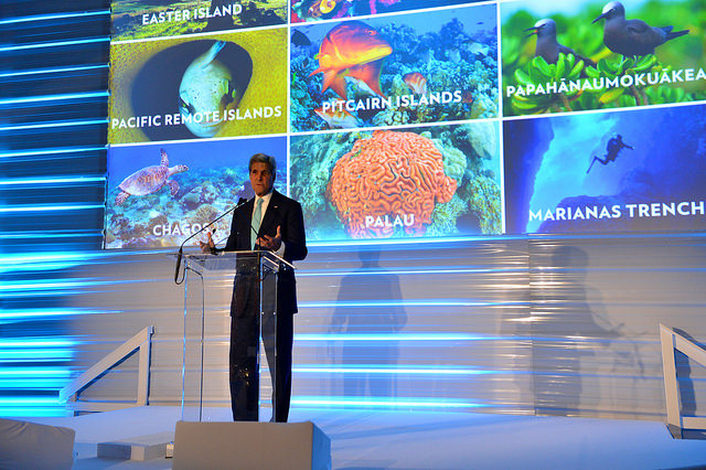
Secretary Kerry is hosting the third annual Our Ocean Conference in Washington, DC, September 15 - 16. Photo courtesy Department of State on Flickr.
SeaVision will also be on display at Secretary of Defense Ash Carter’s upcoming trip to Hawaii to meet with ten Defense Ministers of the Association of Southeast Asian Nations (ASEAN).
SeaVision is a web-based maritime situational awareness tool that enables governments from around the world to view, track, understand and analyze vessel movements. It leverages Google Maps to display tens of thousands of ships around the world at once, and offers dynamic data such as position, course, and speed, as well as static data such as the name and size of a vessel.
Users can select from a wide range of filters and functions within SeaVision’s menu of tools, including the ability to display vessels within a user’s region of interest, allowing for a more personalized view of vessel activities.
SeaVision draws from Automatic Identification System (AIS) data, which is transmitted over marine very high frequency (VHF) radio frequencies. AIS allows for the automatic exchange of near real-time vessel data either between ships or between ships and shore stations.
Foreign governments, particularly those along the western coast of Africa, use SeaVision to combat human trafficking, weapons smuggling, illicit drug trading, piracy, and illegal fishing within their waterways. A few notable examples of how SeaVision has improved the health of our oceans:
- A historic $100 million drug bust off of the coast of Cape Verde;
- A post-tropical storm rescue off of the coast of Mexico;
- The identification of illegal fishing in Senegal; and
- The reduction of vessel collisions with the endangered North Atlantic right whale.
I know that I speak for DOT and all of our partners when I say that it is an honor to have the Volpe-developed maritime awareness tool, SeaVision, on display at Our Ocean 2016.
Thanks to Secretary Kerry, Secretary Carter, and to all of the Our Ocean organizers for recognizing a tool that continually serves to improve the safety, security and health of our global waterways.
.@POTUS delivers keynote address at 2016 #OurOcean Conference https://t.co/jQMpfFJ8bE
— Department of State (@StateDept) September 15, 2016
Post new comment