Collapse All Expand All
These five steps will help you to anchor safely:
-
Use anchor lines that are 5-7 times the depth of the water. The Columbia River's depth may exceed 100 feet in some places.
-
Use a float for the anchor line to serve as a buffer and to reduce the risk of getting the anchor line tangled in the propeller.
-
Lower, do not throw, the anchor to avoid tangles in the line.
-
Anchor only off the point of the bow. Anchoring off the stern or the side will capsize your boat.
-
Power upstream of anchor before retrieving it. Maintain position in line with the flow of the current while retrieving anchor. Turning cross-wise to the current increases the risk of capsizing.
-
Rivers can become turbulent with little or no warning. You are advised to wear a Coast Guard-approved Personal Flotation Device at all times. Also, take precautions against hypothermia. River temperatures can range from 70 degrees in the summer to near freezing during the winter.
-
River users are reminded that although it is legal to anchor in the channel, it is illegal to block the right-of-way of a vessel that is restricted to using the channel.
-
Five blasts of the horn signify danger, and you must take action to avoid that danger.
For more tips, visit the Corps of Engineers National Water Safety site: http://watersafety.usace.army.mil
Click here for a print version of this information.
- LePage reservation park
- River campsite $22 per night
- Back-in campsite $20 per night
- Gazebo tent sites $16
- Tent campsite $14 per night, $5 per day per extra vehicle
- Overflow campsite $14
- Day-use fee $1
- Boat ramp and tie-up dock $3 per day
- Dump station $5 per dump (applies only if not staying at campground)
- Senior / Access discounts accepted
- Plymouth reservation park
- Full hook-up campsite $24
- Partial hook-up campsite $22
- Tent campsite $14, $5 per day per extra vehicle
- Day-use $1
- Boat dock and ramp $3
- Dump station fee $5 (applies only if not staying at campground)
- Senior / Access discounts accepted
Day-use fees, including boat ramp and dump station fees, will be collected while parks are available for camping. No fees are collected during park closure dates. Some boat ramps outside fee campgrounds will charge a $3 launch fee per day, which is valid at any Corps-managed recreation site for day it was purchased.
Some designated swim beaches outside fee campgrounds may charge a use fee of $1 per person over the age of 12 or in a vehicle up to $4. However, if a vehicle has more than 8 passengers over the age of 12, there will be a fee of $1 for each additional individual over the age of 12.
All fees have been set to maintain comparable fee schedules with other federal, state, county and private campgrounds. All fees meet the requirements set in Engineering Publication 1130-2-550. Fee comparability within the same state and district is outlined in Paragraph 9 of EP 1130-2-550.
DEPARTMENT OF THE ARMY
US ARMY CORPS OF ENGINEERS
PORTLAND DISTRICT
333 SW 1st AVE
PORTLAND, OREGON 97201-2946
CENWP-DE 27 September 2012
SUBJECT: Commander’s Policy Letter #19, Geocaching Within Portland District Boundaries
1. Purpose. Geocaching may be allowed on public lands managed by the U.S. Army Corps of Engineers in accordance with the Code of Federal Regulations Title 36 (CFR 36) and any applicable state or local rules and regulations, provided the activity is conducted in an unobtrusive manner. Geocaching can be an appropriate and compatible recreational activity on public land and water, as long as common sense guidelines are followed. Some Corps projects have used the popularity of the sport as an innovative tool to distribute information, such as water safety, in geocaches on Corps-managed lands.
2. Definition of Geocaching. Geocaching is an outdoor adventure activity for users of global positioning systems (GPS). Individuals and organizations set up geocaches (caches) all over the world and share their locations, often through the Internet. Numerous web sites are available, with one of the most popular being http://www.geocaching.com/. GPS users can then find the caches through published coordinates and site descriptions. Most commonly, a geocache is an object or container holding small objects for exchange. The finder may remove the enclosed "prize" and leave another, sign a logbook, or utilize a number of variations. Some "caches" are simply locations with unusual vegetation or unique land features the cache owner wants the cache hunter to experience (virtual caches). There is also a derivative form of the sport that searches for published coordinates of an existing historical monument, plaque, or benchmark.
While geocaching has become the standard name for the sport, other terms include Navicaching, GPS Orienteering, GPS Stash Hunt, and Benchmarking.
3. Policy. In accordance with 36 CFR 327.19 or 327.21, District Engineers, or their designees, may develop permit systems or policies to track and/or control placement of geocaches on project lands, provided this use does not conflict with project missions or security. Simplicity and ease of compliance should be emphasized. Information needed from the proposed geocache owner will include the cache coordinates (location), his/her name, and his/her address and phone number. The intent of collecting this information is to keep track of the location and number of caches on the project and to contact the owner if the cache needs to be removed. During application, the project should ask the proposed cache owner to provide a current picture form of identification with an address to confirm the applicant's identity. This information is voluntary; however, the applicant’s request can be denied for failure to comply with the information request. The project is required to store this information in a secure manner. Geocache objects or containers should be clearly identified as such when placed on public lands. Transparent containers are required, due to homeland security issues. Caches should not contain alcohol, illicit, or other inappropriate materials. It is the due diligence responsibility of the Project Operations Manager to work with the cache owners and jointly conduct periodic cache inspections to insure they are not being used for illicit and/or inappropriate purposes.
a. Individuals or groups that participate in geocaching activities on Corps property must be responsible for coordinating these activities with the Portland District, to help prevent potential conflicts with management activities (i.e., controlled burns, timber sales, planting, etc.)
4. Restrictions. It is the due diligence responsibility of the Project Operations Manager to establish designated areas where geocaching will be allowed and other areas where it will be restricted. Geocaching activities will not be allowed to occur in restricted areas where there could be conflicts with project missions, project security, or the safety of the general public.
Examples where geocaching would not be allowed include but are not limited to:
a. In designated restricted areas.
b. lf the cache, directly or indirectly, would negatively affect ecologically, environmentally, or socially sensitive areas (i.e., threatened or endangered species, critical habitats, cultural resources, tribal lands without consent, etc.).
c. In areas with potential safety risks, such as unstable banks, cliffs, or other hazards.
d. Where geocaching activities may interfere with established public uses, such as boat launching, picnicking, swimming, etc.
f. Where geocaching activities may interfere with the operation or security of the project.
5. Management Considerations. Management considerations at individual projects may require other permanent or temporary measures to ensure that geocaching activities are compatible with other project uses. For example, a project may need to prohibit geocaching during active management in an area for timber harvest, prescribed burning, hunting, or other wildlife management activities. Some projects may want to encourage and actively participate in geocaching activities to promote the Corps message in a positive way.
a. In certain instances, it may be necessary to issue a Special Event Permit in compliance with Title 36, 327.21. Conditions that may warrant the need for a Special Event Permit may include one-time activities that are publicly advertised, commercial in nature, involve large numbers of participants, provide cash prizes or other significant awards, or may potentially conflict with other uses of an area, etc.
b. If a cache must be removed from public lands for operational, safety, environmental, cultural, or other reason, a reasonable effort should be made to contact the cache owner and request removal. If the owner cannot be found, or the cache is not removed within a reasonable time, the cache may be removed and impounded as abandoned property, under 36 CFR 327.15.
6. Summary. In general, geocaching can be a fun and appropriate recreational activity at Corps projects, provided the security or missions of the project are not compromised. It provides an opportunity for positive interactions and partnerships with local groups involved in this activity.
Monitoring of web sites, communication and participation with these groups can form healthy relationships with benefits to all involved. Working with these groups can prevent problems and promote the Corps as a willing partner. Regulation should be based on common-sense needs of specific projects or areas, with a minimal permitting burden on the recreating public.
7. Point of Contact. The point of contact is Mr. Doug Dailey, CENWP-DE, (503) 808-4441.
//original signed// Seaplanes may be operated seven days a week between sunrise and sunset at all Portland District lakes with the exception of Big Cliff, Applegate and Willow Creek lakes. Once on the water seaplanes shall be considered powerboats and must be operated in accordance with marine rules of the road. Seaplanes in the water may taxi to any area of the lake subject to the powerboating restrictions for those lakes. For more information, see: Seaplane operations at Corps of Engineers lakes. Call us for scheduling:
Bonneville Lock and Dam: 541-374-8820 and select option 2.
The Dalles Lock and Dam: 541-506-7819
For other locations, please contact us at 503-808-4510.
Detailed information specific to each location is also listed on our Recreation page. If you're enthusiastic, enjoy new people and want to protect parks, then you might want to be a volunteer!
Volunteer park hosts inform visitors, register campers, assist at entrance stations, conduct customer comment surveys, open and close parks, pick up litter, perform minor maintenance and support interpretive programs. Hosts live in the parks and inform Park Rangers about emergencies or visitor complaints. Volunteer hosts must work at least 20 hours per week, and stay in the park during certain hours to assist visitors as needed. In return, RV sites with full hookups are provided. Current Corps of Engineers openings are listed at the Volunteer Clearinghouse.
Natural Resource Volunteers assist the Corps throughout the year with natural resource management activities. Volunteers are often recruited volunteers from the community for special events such as: Earth Day, SOLV Beach and Riverside Clean-Up, Down By the Riverside and National Public Lands Day. Girl Scouts, Boy Scouts, church members, school groups, and other community groups have helped with litter clean-ups, trail work, non-native plant removal, habitat improvement and tree planting.
For more about volunteer opportunities, please contact one of our Columbia River Park Rangers:
Bonneville Lock and Dam: Ryan Braaten, 541-374-8820
The Dalles Lock and Dam: Amber Tilton, 541-506-7857
John Day and Willow Creek dams: Greg Volkman, 541-506-7899 The Corps of Engineers, National Weather Service and other agencies cooperatively gather and analyze data for current and projected future reservoir and river level information.
NWS: Northwest River Forecast Center The park will remain closed until further notice.
There are no links to display.
Collapse All Expand All
 This is a chinook and coho salmon hatchery. Display ponds also offer a relaxing place to feed large rainbow trout and view adult white sturgeon measuring more than six feet long. There is a gift shop open during summer months. Interpretive displays are inside and out, including a viewing area to watch fall spawning activities. Outside-accessible restrooms are available here. This is a chinook and coho salmon hatchery. Display ponds also offer a relaxing place to feed large rainbow trout and view adult white sturgeon measuring more than six feet long. There is a gift shop open during summer months. Interpretive displays are inside and out, including a viewing area to watch fall spawning activities. Outside-accessible restrooms are available here.
Directions: Take I-84 to exit 40 (approximately 4 miles west of Cascade Locks, Ore.) At the flag pole intersection, bear left. Follow the road around to the large parking lot on the left. There is lots of room for RV parking here.
For more about the Bonneville Fish Hatchery, go to http://www.dfw.state.or.us/resources/visitors/bonneville_hatchery.asp  Open daily from 9 a.m. to 5 p.m., with guided tours of Powerhouse 1 offered at 11 a.m., 1 p.m. and 3 p.m. from June to September. Between October and May please call the visitor center to check on tour availability. The tour schedule is subject to change. Open daily from 9 a.m. to 5 p.m., with guided tours of Powerhouse 1 offered at 11 a.m., 1 p.m. and 3 p.m. from June to September. Between October and May please call the visitor center to check on tour availability. The tour schedule is subject to change.
In addition to views of migrating fish moving through underwater fishways, there is a five-level facility with an observation deck, air conditioned interior with exhibits, restrooms, a large theater and all-glass exterior walls which allow a panoramic view of the Columbia River Gorge. A short walk leads to a viewing area inside Powerhouse 1.
Contact information: 541-374-8820
Directions: The Bradford Island Visitor Center is located at exit 40, I-84, four miles west of Cascade Locks, Ore. At the flag pole intersection, bear right. Follow the signs for approximately one mile along park roads.  Open daily 7 a.m. to 5 p.m. Located just below the fish ladders, this site affords spectacular spillway views and the surrounding Columbia River Gorge, including views of osprey in the summer and bald eagles in the winter. Cottonwood trees provide shade on hot days or cover from the rain. Fishing is accessible along the shore and from the parking areas. Open daily 7 a.m. to 5 p.m. Located just below the fish ladders, this site affords spectacular spillway views and the surrounding Columbia River Gorge, including views of osprey in the summer and bald eagles in the winter. Cottonwood trees provide shade on hot days or cover from the rain. Fishing is accessible along the shore and from the parking areas.
Directions: From Portland, Ore.,take I-84 east to exit 40 for Bonneville Dam. From Vancouver, Wash., go east on Hwy. 14, cross the river at Bridge of the Gods, then travel west on I-84 to exit 40 for Bonneville Dam. Once on Bonneville property, go to the flag pole intersection and bear right, cross the navigation lock and the first powerhouse, then turn left at the sign for Bradford Island Recreation Area.  The historic Columbia River Highway Trail is the nation's first scenic highway, constructed between 1913 and 1922. This trail has reserved areas for pedestrian and bicycle use only, such as the section between Tanner Creek, Eagle Creek and Cascade Locks. Learn more about this trail by visiting the Oregon State Parks, the Oregon Department of Transportation and the U.S. Forest Service websites. The historic Columbia River Highway Trail is the nation's first scenic highway, constructed between 1913 and 1922. This trail has reserved areas for pedestrian and bicycle use only, such as the section between Tanner Creek, Eagle Creek and Cascade Locks. Learn more about this trail by visiting the Oregon State Parks, the Oregon Department of Transportation and the U.S. Forest Service websites.
Directions: Take exit 40 from I-84 (the Bonneville Dam exit) and turn south off the exit. At the T-intersection, turn left (east) uphill to the paved parking lot.
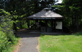 Fort Cascades, built in 1855, is one of several forts built to protect the portage around the Cascade Rapids. The site has a 1.5 mile interpretive trail where visitors may learn about the history of the site which was used by Native American Tribes, the Army in the 1850s, travelers on the Oregon Trail and the early fishing industry. Visitors also enjoy the trail for exercise, wildlife watching, and scenic views. There is little elevation change and most of the trail is shady, lush and green. Help preserve this unique area and also protect yourself, children, and pets from poison oak by staying on the established trail and keeping your pet on a leash. Spectacular views of the Columbia River and Bonneville Dam can be seen from here. Click here for our Fort Cascades trail brochure. Fort Cascades, built in 1855, is one of several forts built to protect the portage around the Cascade Rapids. The site has a 1.5 mile interpretive trail where visitors may learn about the history of the site which was used by Native American Tribes, the Army in the 1850s, travelers on the Oregon Trail and the early fishing industry. Visitors also enjoy the trail for exercise, wildlife watching, and scenic views. There is little elevation change and most of the trail is shady, lush and green. Help preserve this unique area and also protect yourself, children, and pets from poison oak by staying on the established trail and keeping your pet on a leash. Spectacular views of the Columbia River and Bonneville Dam can be seen from here. Click here for our Fort Cascades trail brochure.
Directions: From Portland, Ore.: Take I-84 east to exit 44 for the Bridge of the Gods, cross the river and turn left. Go to the Bonneville Dam entrance on left. From Vancouver, Wash.: Take Hwy. 14 east to Milepost 37. Turn right into the Bonneville Dam entrance. Once on Bonneville property, turn right at the first stop sign, then an immediate left into the Fort Cascades Historical Site parking lot. The Bonneville Dam entrance is approximately a half-mile east of North Bonneville, Wash. and seven miles west of Stevenson, Wash.  Park rangers at Bonneville Lock and Dam maintain eight geocaches. Beginner and advanced geocachers will enjoy the hunt with five traditional caches and three multi-caches. Five caches are on the Oregon side and three are on the Washington side. Our geocaches are "interpretive," which means they are educational. "Green Power" is about hydropower, "Take Me to Lunch" is about sea lions. "BIH" is about Bradford Island history. "Bonneville Landmark Cache" is about Bonneville Dam’s history. "FCRPS: More Power to You" is about the Northwestern hydropower system. "Go with the Flow" is about the Juvenile Fish Bypass System. "Ducks Float" is about water safety. Lastly, "Hamilton or Strawberry Island?" is about Lewis and Clark's travels here. Rangers and volunteers are available to help! Click here for more geocache listings. Park rangers at Bonneville Lock and Dam maintain eight geocaches. Beginner and advanced geocachers will enjoy the hunt with five traditional caches and three multi-caches. Five caches are on the Oregon side and three are on the Washington side. Our geocaches are "interpretive," which means they are educational. "Green Power" is about hydropower, "Take Me to Lunch" is about sea lions. "BIH" is about Bradford Island history. "Bonneville Landmark Cache" is about Bonneville Dam’s history. "FCRPS: More Power to You" is about the Northwestern hydropower system. "Go with the Flow" is about the Juvenile Fish Bypass System. "Ducks Float" is about water safety. Lastly, "Hamilton or Strawberry Island?" is about Lewis and Clark's travels here. Rangers and volunteers are available to help! Click here for more geocache listings.
 There are also several privately-owned caches (http://www.geocaching.com/seek/nearest.aspx?lat=45.642333&lng=-121.946267) at or near Bonneville Dam. While Bonneville Dam doesn't require permits for caches, other Portland District project locations might. In all cases, it's recommended you contact the project or public lands manager before placing any caches. Caches hidden in sensitive areas or pose a security/safety risk will be removed. For more information about hiding or finding geocaches, you can visit www.geocaching.com or www.opencaching.com. There are also several privately-owned caches (http://www.geocaching.com/seek/nearest.aspx?lat=45.642333&lng=-121.946267) at or near Bonneville Dam. While Bonneville Dam doesn't require permits for caches, other Portland District project locations might. In all cases, it's recommended you contact the project or public lands manager before placing any caches. Caches hidden in sensitive areas or pose a security/safety risk will be removed. For more information about hiding or finding geocaches, you can visit www.geocaching.com or www.opencaching.com.
 Open daily 5 a.m. to 10 p.m. Fishing is available below the Fort Cascades historic trail and continuing west to the tip of the island. The access road ends at a gravel parking lot and the trailhead for the Hamilton Island trail. The Hamilton Island boat ramp allows access to the river for motorized and non-motorized vessels. There is no fee to use the boat ramp. Open daily 5 a.m. to 10 p.m. Fishing is available below the Fort Cascades historic trail and continuing west to the tip of the island. The access road ends at a gravel parking lot and the trailhead for the Hamilton Island trail. The Hamilton Island boat ramp allows access to the river for motorized and non-motorized vessels. There is no fee to use the boat ramp.
Directions: Take Hwy. 14 east to Milepost 37. Turn left onto the dam access road, about a half-mile from North Bonneville and seven miles from Stevenson, Wash. At the stop sign, turn right and go about a mile, then turn left toward the river. Go through the parking lot--the boat ramp is at far end.  Open daily, Memorial Day to Labor Day from 1 to 4 p.m. Visitors can watch the navigation lock in operation when commercial or recreational boats are traveling up- or downstream. The visitor center offers exhibits and videos explaining the value to Oregon and Washington economy of river commerce. Open daily, Memorial Day to Labor Day from 1 to 4 p.m. Visitors can watch the navigation lock in operation when commercial or recreational boats are traveling up- or downstream. The visitor center offers exhibits and videos explaining the value to Oregon and Washington economy of river commerce.
Directions: Take I-84 to exit 40, approximately four miles west of Cascade Locks, Ore. At the flag pole intersection, bear right. Follow the signs for the visitor center for about a mile along park roads. Information for vessels on locking through is here.  This site provides spectacular views of the river, surrounding gorge, and wildlife viewing. Open shoreline is available for fishing with access to CXT restrooms and some areas of shade or protections from the elements. This site provides spectacular views of the river, surrounding gorge, and wildlife viewing. Open shoreline is available for fishing with access to CXT restrooms and some areas of shade or protections from the elements.
Directions: From Portland, Ore.: Take I-84 east to exit 44 for the Bridge of the Gods, cross the river and turn left. Travel to Bonneville Dam entrance on left. From Washington: Take Hwy. 14 east to Milepost 37. Once on Bonneville property, follow the signs to the visitor center. Parking for the fishing area is located before the secured entrance station. The Bonneville Dam entrance is approximately a half-mile east of North Bonneville, Wash. and seven miles west of Stevenson, Wash.  Open daily 7 a.m. to 5 p.m. This area's large picnic shelter accommodates up to 100 people, and has horseshoe pits, a playground and open grassy areas for outdoor recreation such as ball and disc games. Visitors enjoy this area's bird-watching and scenic views of the Columbia Gorge. Open daily 7 a.m. to 5 p.m. This area's large picnic shelter accommodates up to 100 people, and has horseshoe pits, a playground and open grassy areas for outdoor recreation such as ball and disc games. Visitors enjoy this area's bird-watching and scenic views of the Columbia Gorge.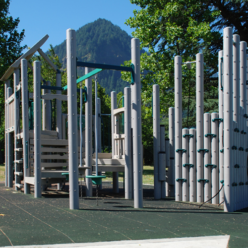
Directions: From Portland, Ore.: Take I-84 east and take exit 40 to Bonneville Dam. From Vancouver, Wash.: Take Hwy. 14 east and cross the river at Bridge of the Gods, then travel west on I-84 and take exit 40 to Bonneville Dam. Once on Bonneville property, travel to the flag pole intersection and bear right. Cross the navigation lock and then turn left at the sign for Robins Island.  In addition to fishing, this site provides great wildlife viewing of salmon spawning in the fall and several species of birds throughout the year. Two trails lead down from the parking lot for access to the fishing area. There are flush toilets available near the parking area. In addition to fishing, this site provides great wildlife viewing of salmon spawning in the fall and several species of birds throughout the year. Two trails lead down from the parking lot for access to the fishing area. There are flush toilets available near the parking area.
Directions: From Portland, Ore.: Take I-84 east to exit 40 for Bonneville Dam. From Vancouver, Wash.: On Hwy. 14, go east and cross the river at Bridge of the Gods, then travel west on I-84 and take exit 40 to Bonneville Dam. Once on Bonneville property, travel to the flag pole intersection and bear left. Continue past the Bonneville Fish Hatchery parking lots to the end of the road, where the Tanner Creek parking lot is located.  Open daily from 9 a.m. to 5 p.m. This complex offers an easily accessible view of the powerhouse. Generators can be viewed from an area 85 feet above the powerhouse floor. Guided tours of Powerhouse 2 are offered at 10 a.m., 1:30 p.m. and 3:30 p.m. daily from June to September. Between October and May please call the visitor center to check on tour availability. The tour schedule is subject to change. Inside the fish-viewing building and adjacent Visitor Orientation building are exhibits on the history of fish in the area and how a modern hydropower plant works. Open daily from 9 a.m. to 5 p.m. This complex offers an easily accessible view of the powerhouse. Generators can be viewed from an area 85 feet above the powerhouse floor. Guided tours of Powerhouse 2 are offered at 10 a.m., 1:30 p.m. and 3:30 p.m. daily from June to September. Between October and May please call the visitor center to check on tour availability. The tour schedule is subject to change. Inside the fish-viewing building and adjacent Visitor Orientation building are exhibits on the history of fish in the area and how a modern hydropower plant works.
Contact information: 509-427-4281
Directions: From the Vancouver, Wash. area, take Hwy. 14 east to Milepost 39 (approximately six miles west of Stevenson, Wash.) Turn south on Dam Access Rd. by the large Bonneville Lock and Dam entrance sign. Turn left at the stop sign and continue along the road one mile to the entrance gate. The Visitor Center Building is the glass building at the end of the powerhouse.
Collapse All Expand All
 Notice: The west portion of Avery Park is temporarily closed to vehicles and limited to day use only. Notice: The west portion of Avery Park is temporarily closed to vehicles and limited to day use only.
No fees; 14-day use limit. First come, first serve availability. No reservations.
Amenities and activities:
- Boat ramp (open to the public except during commercial treaty fishing seasons)
- Camping (primitive)
- Picnic area
- Vault toilets
- Windsurfing
- Kiteboarding
Contact information: 541-506-7857
Directions: Milepost 93 off Hwy. 14. No fees; 14-day use limit. First-come, first-serve availability; no reservations.
Amenities & activities:
- Restrooms
- Boat ramp
- Camping (primitive)
- Historic site
- Picnic area
- Shore access to river
- Windsurfing
- Kiteboarding
Contact information: 541-506-7857
Directions: From I-84, take exit 97. Contact information: 509-767-1159
Directions: Milepost 85 off Washington State Rd. 4. Contact information: 541-739-2322
Directions: 17 miles east from The Dalles off I-84. From I-84, take the Celilo Park exit and continue east on Hwy. 30. No fees; day use only.
Amenities and activities:
- Pond
- Vault toilets
- Wildlife watching
- Fishing
- Picnic area
Contact information: 541-506-7857
Directions: Take Hwy. 197 north, cross the Columbia River Bridge, go one mile and turn right. Sign visible. Contact information: 509-773-5007
Directions: From I-84, take exit 104, turn north on Hwy. 97, cross the bridge and turn right. No fees; day use, overlook and river access only.
Amenities and activities:
- Boat launch with courtesy dock
- Scenic overlook
- Vault toilets
- Fishing
- Geocaching
Contact information: 541-506-7857
Directions: From Hwy. 197 north, cross the Columbia River bridge and turn right. Call to inquire about special event permits for this location.
Amenities and activities:
- Bathrooms
- Gazebo
- Picnic area
- Pond
Contact information: 541-506-7857 or 541-296-9778
Directions: This park is only accessible via special event permit.  No fees; 14-day use limit. First come, first serve availability. No reservations. No fees; 14-day use limit. First come, first serve availability. No reservations.
Amenities and activities:
- Camping (primitive)
- Shore access to the river
- Vault toilets
- Geocaching
- Windsurfing
- Kiteboarding
- Fishing
Contact information: 541-506-7857
Directions: From I-84, take exit 109 at Rufus. Go north towards river and left at intersection. Day-use only; available year-round from dawn to dusk. No bathrooms or water are available if the Visitors Center is closed.
Amenities and activities:
- Covered picnic area
- Historice rose garden
- Scenic views of Mt. Hood
- Access to The Dalles Riverfront Trail
Contact information: 541-506-7857 or 541-296-9778
Directions: On I-84, take exit 87; also at the junction of Hwy. 197 and I-84.  No fees; day-use only. No fees; day-use only.
Amenities and activities:
- Boat ramp (small; provides access to Spearfish Lake only)
- Hiking trail
- Trout fishing
- Vault toilets
- Geocaching
Contact information: 541-506-7857
Directions: From Hwy. 197 north, cross the Columbia River Bridge, go one mile and turn right. Sign visible. The Dalles Dam Visitor Center is open 9 a.m. to 5 p.m., Friday through Sunday, between May 1 and Memorial Day weekend. After Memorial Day, the center begins daily operations, seven days a week through Labor Day weekend. Labor Day through the end of September, weekend only operations resume. No fees are charged at this location. Call to inquire about tour availability.
Amenities and activities:
- Restrooms
- Children's activities
- Exhibits
- Fish viewing
- Picnic shelter
- Drinking fountain
- Rose garden
- Scenic views of Mt. Hood
Contact information: 541-506-7857 or 541-296-9778
Directions: From I-84, take exit 87 and go east on Brett Clodfelter Way, at the junction of Hwy. 197 and I-84. No fees. Amenities and activities:
- Fishing
- Portable bathroom facilities (provided seasonally)
- Shore access to river
- Windsurfing
- Kiteboarding
Contact information: 541-506-7857
Directions: From I-84, take exit 104, turn north on Hwy. 97, cross the bridge and turn right. Continue heading east until paved road becomes gravel.
Collapse All Expand All
Hamilton Island boat ramp
Approximately 1 mile west of Bonneville Lock and Dam and 1 mile east of town of North Bonneville on Washington State Route 14. Turn onto the Dam Access Road towards the river, travel approx ¾ mile to left at boat ramp signed intersection. The loaner board is at the eastern end of the lot. Plymouth Park day-use area and boat ramp
Location: Columbia River Mile 290, North River Bank. In Plymouth, Washington, 1.2 miles west of Umatilla Bridge. Loaner boards are in the day-use area swim beach and at the boat ramp.
LePage Park day-use area swim beach and boat ramp
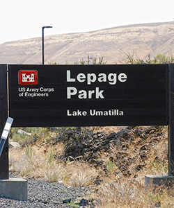
Location: Off Exit 114, Interstate 84, at confluence of John Day and Columbia rivers, on the south river bank, 5 miles from Rufus, Ore. and John Day Dam. Loaner boards located next to the boat ramp and at the swim beach.
|
The Dalles Marina
(managed by Port of The Dalles)
|
Boat ramp
|
From Interstate 84, take exit 86 toward City Center / The Dalles and turn north toward the river. The marina is on the left and the loaner board is at the boat ramp.
|
|
The Dalles Riverfront Park
(managed by North Wasco Co. Parks and Recreation)
|
Day use area swim beach
|
From Interstate 84, take exit 86 toward City Center / The Dalles and turn north toward the river. Park will be on the right and the loaner board is located just east of the Kayak Shack near the swim beach.
|
|
Columbia Hills State Park
(managed by Washington State Parks)
|
Boat ramp
|
From The Dalles, at mile marker 85 (approximately 5 miles northeast and one mile east from the intersection of highways 97 and 14).
|
|
Celilo Park
(managed by USACE)
|
Boat ramp
|
From Interstate 84 take exit 97 and turn North toward the river. Turn left into Celilo Park and the loaner board is at the western end of the park.
|
|
Heritage Landing
(managed by Oregon State Parks)
|
Boat ramp
|
Heritage Landing is approximately 17 miles East from the City of The Dalles. From Interstate 84 take exit 97 and turn South. At the stop sign turn east (left) onto old highway OR-206 E / Celilo-Wasco Hwy. Continue approximately 3 miles and turn North onto Old Moody Road / CO Hwy 143.
|
|
Maryhill State Park
(managed by Oregon State Parks)
|
Day use area swim beach
|
From Interstate 84, take exit 104 and cross the Biggs Bridge at Highway 97. Traveling north into Washington, turn right at the entrance sign just past Maryhill Fruit Stand. From Washington Highway 14, turn south onto Highway 97 and the entrance sign will be on your left just before Maryhill Fruit Stand. The loaner board is at the eastern end of the park, at the boat ramp.
|
Collapse All Expand All
Contact information: 541-454-2868
Directions: From I-84, take exit 137. Contact information: 541-481-7217
Directions: From I-84, take exit 165. No fees. 14-day use limit; first-come, first-served availability, no reservations.
Amenities and activities:
Contact information: 541-506-7819
Directions: From Hwy. 14, turn south on the John Day Dam Road between mileposts 108 and 109, by the old aluminum plant. Follow the paved road until it becomes gravel. Operated by the Port of Benton County since August 1, 2007.
Contact information: 509-948-6069
Directions: Milepost 155 off of Hwy. 14.  No fees, 14-day use limit. First-come, first-serve availability; no reservations.
Amenities and activities:
- Bathrooms
- Boat ramp and dock
- Camping (primitive)
- Trail
Contact information: 541-506-7819
Directions: From I-84, take Rufus exit 109, go north toward the river and turn right. Directions: From I-84, take exit 168.  Open from April 1 to Oct. 31. Availability is first-come, first-serve unless reserved at Recreation.gov or by calling 877-444-6777. Open from April 1 to Oct. 31. Availability is first-come, first-serve unless reserved at Recreation.gov or by calling 877-444-6777.
Fees:
- River campsite: $22 / night
- Back-in campsite: $22 / night
- Gazebo tents (sites T9 & T19): $17.00
- Tent campsite: $15 / night
 (Friday and Saturday nights only) (Friday and Saturday nights only)
- Overflow campsite: $15 / night
- Day use fee: $5 per car
- Extra vehicle: $5 per night
- Boat ramp and tie-up dock fee: $5 / day
- Dump station fee: $5 / dump (free to paid campers)
- Bus or commercial vehicle: $20.00 per vehicle
Amenities and activities:
- Bathrooms
- Beach
- Courtesy docks
- Dump station (free to paid campers)
- Electricity
- Fishing
- Warm showers
Contact information: 541-506-4807 or 541-739-2713
Directions: From I-84, take exit 114 (approximately 3 miles from John Day Dam.) Open May 13 – Sept. 13, 2013. No fees; 7-day use limit. First-come, first-serve availability; no reservations.
Amenities & activities:
- Camping (primitive)
- Vault toilets
Contact information: 541-506-7819
Directions: Take Hwy. 14 to Plymouth, Wash. Paradise Park is 2.9 miles west of Plymouth Rd. on Christie Rd. No fees; 7-day use limit. First-come, first-serve availability; no reservations.
Amenities and activities:
- Boat ramp
- Camping (primitive)
- Vault toilets
Contact information: 541-506-7819
Directions: From I-84, take US-730 east / Columbia River Hwy. and go north on Paterson Ferry Rd. approximately 3.4 miles to the park.
Open from May 27 to September 6.
Amenities and activities:
Contact information: 541-506-7819
Directions: Philippi Park is accessible by boat only and
is located approximately one mile up the John Day River from its confluence with
the Columbia. Parking and boat launch facilities are available at LePage Park.  Dates available: Dates available:
April 1 – Oct. 31. Availability is first-come, first-serve unless reserved at Recreation.gov or 1-877-444-6777.
Fees:
- Full hook-up campsite: $27.00 per night
- Partial hook-up campsite: $24.00 per night
- Tent campsite: $15.00 per night - Friday/Saturday nights only and Sunday night of a holiday weekend. Please go to www.Recreation.gov if you are reserving a campsite on a holiday weekend.
- Day use fee: $5.00 per car
- Boat dock & ramp fee: $5.00 per day
- Dump station fee: $5.00 per dump (free to paid campers)
- Bus or commercial vehicle: $20.00 per vehicle
Amenities and activities:
- Bathrooms
- Beach
- Courtesy docks
- Dump station (free to paid campers)
- Electricity
- Fishing
- Showers
Click here for the Plymouth Park recreation map
Contact information: 541-506-4807 or 509-783-1270
Directions: On Hwy. 14 between exits 179 & 180. No fees. 14-day use limit; first-come, first-served availability, no reservations.
Amenities and activities:
- Boat launch with courtesy dock
- Fishing
- Vault toilet
Contact information: 541-506-7819
Directions: From Hwy. 14, turn south on the John Day Dam Road between mileposts 108 and 109, by the old aluminum plant. Follow the road and the park will be on the left. No fees; 14-day use limit. First-come, first-serve availability; no reservations.
Amenities and activities:
- Boat ramp
- Camping (primitive)
- Portable toilets (April - Sept. only)
Contact information: 541-506-7819
Directions: 35 miles east of The Dalles from Hwy. 14. No fees; 14-day use limit.
Amenities & activities:
- Bathrooms
- Boat ramp
- Camping (primitive)
- Fishing
- Picnic shelters
- Shore access to the river
- Vault toilet
- Windsurfing
Contact information: 541-506-7819
Directions: 50 miles east of The Dalles from Hwy. 14. No fees, 14-day use limit.
Amenities & activities:
- Boat ramp open to the public except during commercial treaty fishing seasons.
- Camping (primitive)
- Picnic area
- Vault toilets
Contact information: 541-506-7819
Directions: Off Hwy. 14, about five miles west of Roosevelt.  No fees, 14-day use limit. First-come, first-serve availability; no reservations.
Amenities and activities:
- Camping (primitive)
- Fishing
- Gravel boat ramp
- Vault toilets
- Windsurfing
Contact information:
541-506-7819
Directions: Take exit 151 for Threemile Canyon from I-84. Contact information: 541-922-3939 or 541-567-6151
Directions: From I-82, take exit 1. For John Day Dam information: 541-676-9009
For park information: 541-676-5576
Go
...
|