The National Map

|
News you can use about USGS Mapping ProductsJune 9, 2014
US Topo Update: Production and release of the USGS's new series of digital topographic maps, the US Topo started in October 2009. In October 2012, the project met its very aggressive long term goal of replacing all quads in the lower 48 states in three years with the new GeoPDF maps. Thus, the second cycle of US Topo map production has started, beginning with Kansas. Also, all previous "Digital Map–Beta" products have been removed from distribution. The National Geospatial Technical Operations Center reports the following US Topo maps are loaded to the Map Locator of the USGS Store (as of 06-09-14):

Discover the Northwest with Revised Montana Maps: Just in time to explore the great outdoors this summer, 2,913 newly designed US Topo maps covering Montana are now available for free download. The new quadrangles have a crisper, cleaner design - enhancing readability of maps for online and printed use. The previous versions of US Topo maps for Montana and scanned images of the entire USGS map library of topographic maps from the period 1884-2006 can be downloaded from the USGS Historical Topographic Map Collection. These scanned images of legacy paper maps, as well as the US Topo maps, are available at no cost from The National Map and the USGS Map Locator & Downloader websites. http://on.doi.gov/1l5i4DS

Want to know how elevation will benefit your state? The USGS National Geospatial Program is advancing the 3D Elevation Program, known as 3DEP, in response to the growing need for high-quality three-dimensional representations of the Nation's natural and constructed features. 3DEP uses modern technologies like lidar and ifsar to collect high-density elevation data over the U.S. These data are essential to a broad range of applications and support a large range of business uses including national security, wildlife and habitat management, water resource management, and geologic hazards mitigation, to name a few. Currently, there are 24 3DEP state-specific fact sheets available on the 3DEP or The National Map websites. http://on.doi.gov/1loqqCZ

Trivia Challenge: The USGS online service called Streamer lets users visualize what? For the answer to this - and other fun science trivia question - go to the Science.gov website. The USGS, as part of 15 Federal science and research agencies who make up the Science.gov alliance, is sponsoring "trivia challenge" questions that are posted on the Science.gov Twitter site. To get the answer to these questions, you will be taken to the Science.gov Trivia Challenge page, where you can get the correct answer, more details and see previous questions from other agencies. So, go ahead, and take the challenge! http://go.usa.gov/b2u5

Antietam Battlefield Area - 130 Years of Maps: The US Topo map and Historical Topographic Map Collection websites have updated the interactive map application to those home pages. The new series features 11 topographic maps of the Keedysville, Maryland area, which features parts of the Antietam Civil War battlefield. The maps range from 1884 to the present and include different scales. These flash thumbnails of original scanned maps display all available versions of the Keedysville/Antietam/Middletown/Harper's Ferry quadrangles in an animated format. The display allows the user to view the maps in chronological order, access larger version of the map and go directly to the free download services. http://1.usa.gov/jtRGVx, http://1.usa.gov/HgbHNw
Latest North Dakota, Delaware and Maryland Quads Available: New US Topo maps for North Dakota (1,402 maps), Delaware (38 maps) and Maryland (213 maps) have been posted to the USGS Map Locator & Downloader and are also accessible through The National Map Viewer. The new maps feature a new design that was launched earlier this year and replace the first edition US Topo maps for those states. The new design presents a crisper and cleaner presentation which enhances the readability of the maps for online and printer use. http://on.doi.gov/1nusTyk

3DEP in the News:

NHD Newsletter: The most recent edition of the NHD Newsletter has been posted. The monthly bulletin highlights some new NHD tool updates, network improvements, GeoConflation Process overview, initial NHD planning for the year and other current hydrography related news. Newsletter readers are encouraged to send in articles on their work to help spread the word of how the NHD and WBD are contributing to water management and science. To view past newsletters go to http://nhd.usgs.gov/newsletter_list.html

Hey, Developers - Changes to USGS National Map elevation point query service: The very popular USGS elevation query service which averages over 8 million hits per month is being replaced with a new updated web query service for finding point elevations. The current service URL at http://gisdata.usgs.gov/xmlwebservices2/elevation_service.asmx is being retired by the end of June 2014. A new service that replaces the previous web query service is now available at http://ned.usgs.gov/epqs/ for your usage. However, be aware that it doesn't exactly replicate the older service's behavior so we recommend that users switch over to the new service prior to the end of June. Please contact <tnm_help@usgs.gov> if you have questions or need additional support.

Nearing 3,000! The National Map Twitter site is just a couple followers shy of 3,000. Thanks to all who have joined us on @USGSTNM. Are you part? If not, sign up today and help us reach 3K!
US Topo Update: Production and release of the USGS's new series of digital topographic maps, the US Topo started in October 2009. In October 2012, the project met its very aggressive long term goal of replacing all quads in the lower 48 states in three years with the new GeoPDF maps. Thus, the second cycle of US Topo map production has started, beginning with Kansas. Also, all previous "Digital Map–Beta" products have been removed from distribution. The National Geospatial Technical Operations Center reports the following US Topo maps are loaded to the Map Locator of the USGS Store (as of 06-09-14):

Latest West Virginia, New Jersey and Georgia Quads Available: New US Topo maps for West Virginia (418 quads), New Jersey (150 quads) and Georgia (952 quads) have been posted to the USGS Map Locator & Downloader and are also accessible through The National Map Viewer. The new maps feature a new design that was launched earlier this year. The new design presents a crisper and cleaner presentation which enhances the readability of the maps for online and printer use. http://on.doi.gov/1ihKlaJ

Floating With Your Computer: With more than 2.9 billion miles of water traced in just eight months of operation, the highly popular "Streamer" just got better. Streamer is an easy to use, on-line mapping program that traces rivers and streams from any starting point all the way downstream to where the stream drains. Streamer also produces a report that includes a map of information about the people and places encountered along the traced stream. To learn about the product improvement and user endorsements, go to the Top Story at the USGS website: http://on.doi.gov/1ij5uQ2
Alaska Mapping on TV: USGS Geospatial Liaison Becci Anderson was featured in a story on the Anchorage regional evening news. The report focused on the new US Topo maps for Alaska as part of the Alaska Mapping Initiative. The broadcast also featured an USGS geologist who explained the benefits of the new elevation data on the maps. http://bit.ly/1iztMkU

TNM Services Webinar: The USGS National Geospatial Technical Operations Center sponsored an interactive webinar titled "Using The National Map services to enable your web and mobile mapping efforts" on April 30. The webinar was well attended and aimed at developers, firms, or organizations that use geospatial data in their mobile or web applications. Event recording, slides and transcripts are available at the webinar website; http://bit.ly/Swryhg

3DEP in the News:

New Hydro Tools: The USGS has released a web-based geospatial services known as the Hydrography Event Management (HEM) Tools that allow users to create, edit, and display geospatial markers, called Events, that are referenced to the National Hydrography Dataset (NHD). Events can be customized by the user to represent nearly any water-related feature. Some examples of Events include streamgages, scenic or impaired stretches of river, fish passage barriers, toxic spills, or put-ins/take-outs for boats. For this initial release, users can customize their own HEM Web edit tool using a sample application and the required web services. http://bit.ly/R7RvCB

LA and NM 3DEP Fact Sheets: Increasing the pace of production, he 3D Elevation Program or 3DEP has added two more states to its rapidly growing selection of state-specific fact sheets that features the applications, benefits, and examples of 3DEP. This data is critical in such fields as agriculture, precision farming, natural resources conservation, flood risk management, infrastructure and construction management, water supply and quality, and other business uses. The Louisiana 3DEP Fact Sheet and New Mexico 3DEP Fact Sheet join the mounting list of 24 state Fact Sheets. All are available for viewing and download from The National Map website.
NHD Newsletter: The most recent edition of the NHD Newsletter has been posted. The monthly bulletin highlights some of the USGS hydrography presentations as part of the 48th annual Alaska Surveying and Mapping Conference, new hydrography tools and other current NHD related news. Newsletter readers are encouraged to send in articles on their work to help spread the word of how the NHD and WBD are contributing to water management and science. To view past newsletters go to http://nhd.usgs.gov/newsletter_list.html

VGI Drives The National Map Corps: Elizabeth McCartney, the USGS lead for The National Map Corps, penned an article titled, "Volunteered Geographic Information Drives USGS National Map Corps", which appears in the recent edition of The Summit magazine (page 2). The article follows the history of the VGI project, current status of the initiative and the award winning recognition program.

You Can Contribute to National Mapping: This April marks the one year anniversary of the USGS's The National Map Corps (TNMCorps) transition from a small regional pilot project in the heart of Denver, Colo., into a very successful nation-wide project. During the past year, civilian volunteers in every state have increasingly provided accurate mapping data to the The National Map. Some numbers: 1,422 volunteers; 33,698 points edited; 18 volunteers who have earned more than 500 points. Earn points, get badges! http://on.doi.gov/1heH7y1

US Topo maps on Google: USGS National Geospatial Program Director Mark DeMulder, in a guest blog on the Google Enterprise website, announced that the Google Maps Gallery is now featuring US Topo maps. The interactive application allows the user to pick a location and select the desired quadrangles. The quads are downloaded directly from the USGS in GeoPDF format and can be manipulated using freely provided commercial mapping tools. The USGS is working with Google to make sure the application points to the most up to date versions of the maps. http://bit.ly/1rKroQo
Latest Utah Quads Available: More than 1,475 newly revised US Topo maps for Utah have been posted to the USGS Map Locator & Downloader and accessible through The National Map viewer. The revised maps feature new road data from Nokia. The new maps also include Public Land Survey System (PLSS) data. The PLSS is a way of subdividing and describing land in the United States. All lands in the public domain are subject to subdivision by this rectangular system of surveys, which is regulated by the U.S. Department of the Interior. Other selected states will begin getting the new transportation and PLSS map data during their next respective revision cycle. http://on.doi.gov/1nX4buM

KY, ME, MO, MT, OR & TN 3DEP Fact Sheets: Increasing the pace of production, he 3D Elevation Program or 3DEP has added six more states to its rapidly growing selection of state-specific fact sheets that features the applications, benefits, and examples of 3DEP. This data is critical in such fields as agriculture, precision farming, natural resources conservation, flood risk management, infrastructure and construction management, water supply and quality, and other business uses. The Kentucky 3DEP Fact Sheet, the Maine 3DEP Fact Sheet, the Missouri 3DEP Fact Sheet, the Montana 3DEP Fact Sheet, the Oregon 3DEP Fact Sheet, and the Tennessee 3DEP Fact Sheet join the mounting list of 21 state Fact Sheets. All are available for viewing and download from The National Map website.
Exploring Moab With New Maps: The US Topo map and Historical Topographic Map Collection websites have updated the interactive map application on those home pages. The new series features 10 topographic maps of the Moab, Utah area. These flash thumbnails of original scanned maps display all available versions of the Moab quadrangles from 1885 to the present in an animated format. The display allows the user to view the maps in chronological order, access larger version of the map and go directly to the download services. http://1.usa.gov/jtRGVx, http://1.usa.gov/HgbHNw

ASPRS Elections: USGS Physical Scientist Jason Stoker has been elected as the Assistant Director of the Lidar Division of the American Society for Photogrammetry and Remote Sensing (ASPRS). Jason is currently at the Earth Resources Observation and Science (EROS) Center and is former Director of the USGS Center for Lidar Information Coordination and Knowledge (CLICK). He has been a conference keynote speaker for ASPRS and guest editor for Photogrammetric Engineering and Remote Sensing (PE&RS), the Journal of the Imaging and Geospatial Information Society. Additionally, USGS Research Physical Scientist Lynn Usery, who was elected as the ARPRS Vice President last year, has been elevated to President-Elect. http://bit.ly/1dNRaj4
NHD Newsletter: The most recent edition of the NHD Newsletter has been posted. The monthly bulletin highlights people and programs involved in the National Hydrography Dataset and Watershed Boundary Dataset. To this point, more than 740 pages of information have been written about these programs. Newsletter readers are encouraged to send in articles on their work to help spread the word of how the NHD and WBD are contributing to water management and science. To view past newsletters go to http://nhd.usgs.gov/newsletter_list.html
The National Map and National Atlas Merge: During this year, National Atlas of the United States and The National Map will transition into a combined single source for geospatial and cartographic information. This transformation is projected to streamline access to maps, data and information from the USGS National Geospatial Program (NGP). This action will prioritize our civilian mapping role and consolidate core investments while maintaining top-quality customer service. http://on.doi.gov/1bS7luv

National Scenic Trails Added to Washington State Maps:
Newly released US Topo maps for Washington State will feature segments of the Pacific Crest National Scenic Trail and Pacific Northwest National Scenic Trail; two of 11 National Scenic Trails in the U.S. The USGS partnered with the National Forest Service, State and citizen alliances to incorporate these trails onto the 1,446 new US Topo quadrangles. The maps can be downloaded for free at: http://nationalmap.gov/ustopo/ News Release: http://on.doi.gov/1okjADg

Border Waters: The U.S. and Canada recently completed a trans-continental project to join digital surface waters along the International Boundary. This linking of water systems data makes it easier to solve cross-border water quality issues and improve environmental coordination. The principle agencies involved in this effort are the USGS and Natural Resources Canada (NRCan), with oversight by the International Joint Commission (IJC). The U.S. Environmental Protection Agency, Agricultural Foods Canada, and Environment Canada also participated throughout the process. http://on.doi.gov/N9WTDp

NHD in the News: USGS Physical Scientist Pater Steeves was interviewed for, and quoted in an article in the Montana Missoulian. The feature titled, "USGS releases watershed maps that cross U.S. - Canada border", highlights the real benefits of the USGS and Canadian border "harmonization" project.

New York and Maryland 3DEP Fact Sheets: The 3D Elevation Program or 3DEP has added the "Empire State" and "The Old Line State" to its growing selection of state-specific fact sheets that features the applications, benefits, and examples of 3DEP. This data is critical in such fields as agriculture, precision farming, natural resources conservation, flood risk management, infrastructure and construction management, water supply and quality, and other business uses. The New York 3DEP Fact Sheet and the Maryland 3DEP Fact Sheet join the growing list of 15 total state Fact Sheets. All are available for viewing and download from The National Map website.

3DEP in the News:

The National Map Corps in the News: Shawana Johnson, the President of Global Marketing Insights cited the USGS "crowdsouring" project during an interview with the most recent edition of Earth Imaging Journal. She noted that the growing project has resulted in improving map data and government/private sector relations even in an era of budgetary restrictions.

New NGAC Appointments: Secretary of the Interior Sally Jewell has appointed 17 new and continuing members to the National Geospatial Advisory Committee (NGAC). The advisory committee provides recommendations on geospatial policy and management issues to the Federal Geographic Data Committee (FGDC), the interagency executive group responsible for providing leadership and direction in federal geospatial programs.

Demand for Elevation Data: National Geospatial Program geographers David Saghy and Allyson Jason were quoted in an article titled, "Demand for Elevation Data is on the Rise" in the January 2014 edition of Point of Beginning (POB) Magazine, p. 14. The report highlighted the benefits 3D Elevation Program (3DEP) to a wide variety of management, hazards and infrastructure matters. It also discusses the interagency cooperation and involvement in the developing program.

Has the Grand Teton Grown?: USGS geographer Steve Reiter was quoted in feature story "It's the same old Grand, only now it's 5 feet grander" that appeared in the Jackson Hole News & Guide. The story looks at a recent release of information indicating that official height of the Grand Teton is now 13,775 feet - up from the previous 13,770 feet. The column further describes the height difference in not a result of mountain growth or new technology, but is due to a more accurate definition of mean sea level, known as the National Geodetic Vertical Datum of 1988 (NAVD88).

Crowd-Sourcing the Nation update: The National Map Corps (TNMCorps) has just passed an exciting milestone. Using crowd-sourcing techniques, the USGS' Volunteered Geographic Information (VGI) project has surpassed 25,000 manmade feature edits since 2011. Structures being updated include schools, hospitals, post offices, police stations and other important public buildings. Tools on TNMCorps web site explain how a volunteer can edit any area, regardless of their familiarity with the selected structures. Becoming a volunteer for TNMCorps is easy; go to The National Map Corps web site to learn more and to sign up as a volunteer. Participants are enrolled in a recognition program that awards "virtual" badges to volunteers as they submit map edits. http://on.doi.gov/1dODMX8

Latest Idaho and New Mexico Quads Available: New US Topo maps for Idaho (1,563 quads) and New Mexico (1,980 quads) have been posted to the USGS Map Locator & Downloader and accessible through The National Map viewer. The new maps also include Public Land Survey System (PLSS) data. The PLSS is a way of subdividing and describing land in the United States. All lands in the public domain are subject to subdivision by this rectangular system of surveys, which is regulated by the U.S. Department of the Interior. Other selected states will begin getting PLSS map data during their next respective revision cycle. http://on.doi.gov/1dOSwcl

South Dakota 3DEP Fact Sheet: The 3D Elevation Program or 3DEP has added the "Mount Rushmore" state to its growing selection of state-specific fact sheets that feature the applications, benefits, and examples of 3DEP. This data is critical in such fields as agriculture, precision farming, natural resources conservation, flood risk management, infrastructure and construction management, water supply and quality, and other business uses. The South Dakota 3DEP Fact Sheet, along with the preceding 12 state Fact Sheets, are available for viewing and download from The National Map website.

America's Oldest Capital - New Maps: The US Topo map and Historical Topographic Map Collection websites have updated the interactive map application to those home pages. The new series features 11 topographic maps of the Santa Fe, New Mexico area, the oldest capital in the US. The maps range from 1889 to the present and include a PLSS layer. These flash thumbnails of original scanned maps display all available versions of the Santa Fe quadrangles in an animated format. The display allows the user to view the maps in chronological order, access larger version of the map and go directly to the download services. http://1.usa.gov/jtRGVx, http://1.usa.gov/HgbHNw

Thirteen Years of Publication: The December edition of the NHD Newsletter marks the start of the thirteenth year of publication. The monthly bulletin has highlighted people and programs involved in the National Hydrography Dataset and Watershed Boundary Dataset. To this point, more than 720 pages of information have been written about these programs. Newsletter readers are encouraged to send in articles on their work to help spread the word of how the NHD and WBD are contributing to water management and science. To view past newsletters go to http://nhd.usgs.gov/newsletter_list.html
Florida 3DEP Fact Sheet: The 3D Elevation Program or 3DEP has added the "Sunshine" state to its growing selection of state-specific fact sheets that feature the applications, benefits, and examples of 3DEP. This data is critical in such fields as agriculture, precision farming, natural resources conservation, flood risk management, infrastructure and construction management, water supply and quality, and other business uses. The Florida 3DEP Fact Sheet, along with the preceding 11 state Fact Sheets, are available for viewing and download from The National Map website.

New Buckeye Maps: The USGS, in cooperation with other Federal agencies, has posted new Ohio US Topo quadrangles (748 maps) which include partial Public Land Survey System (PLSS). Ohio is the first state east of the Mississippi River to have PLSS data added to US Topo maps, joining Wyoming and Colorado in the west. The PLSS is a way of subdividing and describing land in the United States. All lands in the public domain are subject to subdivision by this rectangular system of surveys, which is regulated by the U.S. Department of the Interior. Other selected states will begin getting PLSS map data during the next respective revision cycle. http://on.doi.gov/1drcmXu

Henry Gannett Award: Dr. Cynthia Brewer, an affiliate faculty member who works with the USGS Center of Excellence for Geospatial Information Science, has been awarded the 2013 Henry Gannett Award. The award, presented by the National Geospatial Program, recognizes exceptional contributions to topographic mapping. Dr. Brewer is cited for her involvement in the development of new symbology for the US Topo map project. Additionally, Dr. Brewer directly involves students, both at the graduate and undergraduate level at Penn State University, in her designs and research work, providing a foundation, education and training for the next generation of mapping professionals. http://on.doi.gov/1hIiJvo

Where is Frazeyburg, Ohio? The US Topo map and Historical Topographic Map Collection websites have updated the interactive map application to their home pages. The new series is nine topographic maps of the Dresden, Ohio area maps - ranging from 1910 to the present. The earliest version of the map is centered on Frazeyburg. These flash thumbnails of original scanned maps display all available versions of the featured state quadrangles in an animated format. The display allows the user to view the maps in chronological order, access larger "browse" versions of each map, and go directly to the download services. http://1.usa.gov/jtRGVx, http://1.usa.gov/HgbHNw

More Than 100 Tweets: To support the recognition program for The National Map Corps Volunteer Geographic Information project, The National Map twitter site (@USGSTNM) has posted more than 100 tweets featuring "citizen scientists" who have earned virtual badges. Volunteers that register on TNMCorps VGI website can select and edit structures in a given area and then receive points. As contributors gain more points, they earn increasing significant, mapping related, virtual badges. To recognize the data providers, their "handle" is featured on TNMCorps member website and TNM twitter site. The process is simple and anyone can be an editor. So, join in earns some props!

Alabama 3DEP Fact Sheet: The 3D Elevation Program or 3DEP has added the "Yellowhammer" state to the collection of state-specific fact sheets that feature the applications, benefits, and examples of 3DEP. This data is critical in such areas as agriculture, precision farming, natural resources conservation, flood risk management, infrastructure and construction management, water supply and quality, and other business uses. The Alabama 3DEP Fact Sheet, along with the preceding 10 state Fact Sheets, are available for viewing and download from The National Map website.

Let's Talk Turkey Across the Landscape: For Thanksgiving connections to the names of America's places, check out the Geographic Names Information System (GNIS), the national database for standard geographic names. According to the GNIS database, the word "Turkey" appears in Virginia 83 times, Missouri at 118, and 150 instanes on maps of Oklahoma. Texas is the state with the most "Turkey" placenames at nearly 190. So, what's interesting about Thanksgiving names in your state? Or maybe you'd like to find geographic names that match your family name. You can begin looking through the Geographic Names Information System web portal. Complete story: http://on.doi.gov/1ejT4Ur

Happy GIS Day: Just in time for GIS Day, the latest Top Story added to the USGS main website features updates to exciting mapping and Geographic Information Systems (GIS) initiatives as part of the National Geospatial Program. Those projects include the production and availability of new US Topo maps for Alaska, the increasing growth of the 3-Dimensional Elevation Program (3DEP), the continued improvement of the US Topo map program and a look at the Historical Topographic Map Collection. Also, the article mentions noteworthy participation in other mapping outreach efforts like Geologic Map Day. http://on.doi.gov/1gNvK5w

New US Topo Fact Sheet: A new fact sheet, titled "US Topo - Topographic Maps for the Nation" has been posted and published. US Topo maps are the next generation of maps. As a digital product, they provide modern technical advantages that support faster, wider public distribution and enable basic, on-screen geographic analysis for all users. National coverage (less Alaska) was completed as of Sept 2012. The program is now on it's second revision cycle. The new US Topo quadrangles are available for free download from the USGS Map Locator and Downloader.

Trivia Challenge: Which famous explorer was the second director of the USGS? For the answer to this - and other fun science trivia question - go to: http://www.science.gov/trivia. The USGS, as part of 15 Federal science and research agencies who make up the Science.gov alliance, is sponsoring "trivia challenge" questions that are posted on the Science.gov Twitter site. To get the answer to these questions, you will be taken to the Science.gov Trivia Challenge page, where you can get the correct answer, more details and see previous questions from other agencies. So, go ahead, and take the challenge!

Texas and California 3DEP Fact Sheets: The 3D Elevation Program or 3DEP has added the "Lone Star State" and the "Golden State" to the collection of state-specific fact sheets that feature the applications, benefits, and examples of 3DEP. This data is critical in such areas as agriculture, precision farming, natural resources conservation, flood risk management, infrastructure and construction management, water supply and quality, and other business uses. The TX 3DEP Fact Sheet and CA 3DEP Fact Sheet, along with the preceding eight state Fact Sheets, are available for viewing and download from The National Map website.

VGI and the 4-H: Erin Koris, the technical lead for The National Map Corps Volunteer Geographic Information project and Rob Dollison, the lead for The National Map Viewer recently provided hands-on geospatial training to select 4-H affiliated teachers and students at the 4-H Youth Summit of Geospatial Technologies. Mark DeMulder, Director of the National Geospatial Program, provided the conference keynote. The training was a lead up to the 4-H National Youth Science Day, which was held on the Mall, Oct 9, 2013. The event theme, "4-H Maps & Apps" highlighted the USGS VGI program and was a critical part of the National Science Experiment for 2013.

Mount McKinley Not Shrinking: Alaska Lt. Governor Mead Treadwell, while addressing the International Map Collectors Society, stated that Mt. McKinley was 83 feet shorter that previously thought, and cited USGS data as the source. A resulting article in the Anchorage Daily News, and ensuing articles by Reuters and the Associated Press, caused a media storm. Within two days, more than 500 major media outlets printed or broadcast versions of the story. To clarify the issue, Kari Craun, the Director of the National Geospatial Technical Operations Center, fielded several media interviews to place the issue into perspective and simply explain that the USGS is not disputing the current "spot" Denali elevation of 20,320 feet. A National Geographic article is a good, fairly simple narrative to summarize the matter as a more official response is being drafted for placement on the Alaska Mapping Initiative website.
Bringing Home the Gold: The USGS was awarded the gold medal at the recent International Map and Trade Association "Americas" Conference in Boston. The marketing and communications plan for, and subsequent execution of, The National Map Corps (#TNMCorps) Crowdsourcing or Volunteer Geographic Information project garnered first place in the "Best Marketing or Promotional Program" category. TNMCorps structures program went nation-wide in mid-August and now has nearly 940 volunteers who have contributed more than 16,900 points. The volunteer process is easy, with virtual awards available for participation. Sign up today and give it a try!

Alaska and Minnesota 3DEP Fact Sheets:
The "Frontier State" and the "Land of 10,000 Lakes" have been added to the collection of state-specific Fact Sheets that feature the applications, benefits, and examples of 3D elevation data or 3DEP. This data is critical in such areas as agriculture, precision farming, natural resources conservation, flood risk management, infrastructure and construction management, water supply and quality, and other business uses. The AK 3DEP Fact Sheet and MN 3DEP Fact Sheet, along with the preceding six state Fact Sheets, are available for viewing and downloading from The National Map website.

New maps for Colorado and Minnesota, with CO FS trails:
Updated US Topo quadrangles covering Colorado (1,794 maps) and Minnesota (1,689 maps) are now available and replace the first edition US Topo maps for those states. For the first time, the new Colorado US Topo quads include recreational trails in National Forests, provided by the U.S. Forest Service. The new maps also feature a crisper, cleaner design - enhancing readability of maps for online and printed use. http://on.doi.gov/1d7Uz7H

Redrawing America:
The USGS support of Hurricane Sandy relief and the employment of new technologies were cited in a recent feature titled, "A Huge Laser-Mapping Project Is Redrawing America". The article also discussed increasing use of lidar (light detection and imaging radar) and the emerging 3D Elevation Program.

Where is Mount Massive? The US Topo map and Historical Topographic Map Collection websites have updated the interactive map application to their home pages. The new series is 12 topographic maps of the Mount Massive, Colorado area maps - ranging from 1889 to the present. Earlier versions of the map include Leadville and Mount Elbert. These flash thumbnails of original scanned maps display all available versions of the featured state quadrangles in an animated format. The display allows the user to view the maps in chronological order, access larger versions and the map and go directly to the download services. http://1.usa.gov/82461k, http://1.usa.gov/oSPTDv
 Alaska US Topo Maps Announced: The first 400-plus new US Topo maps for Alaska are now accessible and are the beginning of a multi-year project, ultimately leading to more than 11,000 new maps for the entire state. The goal of the Alaska Mapping Initiative is the production of a complete series of digital topographical maps at a scale of 1:25,000 to replace the 1:63,360-scale maps produced more than 50 years ago. Prior to this effort, topographical maps for much of Alaska were out of date and not produced to current standards, which rely largely on high resolution digital imagery and elevation data. The accurate data of these new maps are essential to the responsible economic and industrial development of Alaska, the preservation of human life and safety, and the advancement of scientific discovery and physical science. Updated Alaska digital map data and US Topo maps over Alaska are available for free download to the general public.

We Will Rock You - Geologic Map Day: The USGS is again partnering with the American Geosciences Institute, the Association for American State Geologists and others to promote the importance of geologic mapping to society by celebrating the 2nd annual Geologic Map Day on October 18, as a part of the Earth Science Week 2013 activities. Geologic maps are vital to education, science, business, and public policy concerns. Geologic Map Day will focus the attention of students, teachers, and the general public on the study, uses, and significance of these tools, by engaging audiences through educational activities, print materials, online resources, and public outreach opportunities. More info: http://www.usgs.gov/newsroom/article.asp?ID=3695
 Post Sandy Mapping: The USGS, the National Oceanic and Atmospheric Administration (NOAA), and the U.S. Army Corps of Engineers (USACE) are using emergency supplemental funds provided by Congress in the aftermath of Hurricane Sandy to survey coastal waters and shorelines in order to update East Coast land maps and nautical charts. The USGS will collect very high-resolution elevation data to support scientific studies related to the hurricane recovery and rebuilding activities, watershed planning and resource management. The elevation data will become part of a new initiative, called the 3D Elevation Program, to systematically acquire improved, high-resolution elevation data across the nation. There were at least 147 direct deaths recorded across the Atlantic basin due to Sandy and damage estimates are near $50 billion, making #HurricaneSandy the second-costliest cyclone to hit the United States since 1900. News Release: http://on.doi.gov/14yeCqd
 Lasers and Post-Sandy Maps: National Geospatial Program (NGP) Director Mark DeMulder and senior NGP advisor Larry Sugarbaker were featured in a recent news brief distributed by the Associated Press. The article, titled "How Lasers Will Give the U.S. East Coast Precise New Post-Sandy Maps", explains the use and benefits of lidar (light detection and ranging) technology for Post-Sandy research and many other earth science applications. The results of the research will eventually be added to the 3D Elevation Program (3DEP). http://bit.ly/1e0q4V3
 New State 3DEP Fact Sheets: Four more states have been added to the collection of state-specific Fact Sheet to feature the applications, benefits, and examples of 3D elevation data or 3DEP. Those states are Washington, Idaho, Virginia and Colorado. This data is critical in such areas as agriculture, precision farming, natural resources conservation, flood risk management, infrastructure and construction management, water supply and quality, and other business uses. The Fact Sheets are available for viewing and downloading from The National Map website.

Crowd-Sourcing the Nation: Now a National Effort. The National Map Corps (#TNMCorps), continues to expand its crowd-sourcing of geographic data and is seeking volunteers nation-wide to contribute structures information. The project encourages citizens to collect structures data by adding new features, removing obsolete points, and correcting existing data for The National Map database. Structures being mapped in the project include schools, hospitals, post offices, police stations and other important public buildings. The project also includes a recognition program that awards "virtual" badges to volunteers and has shown great success. Free to join and participate, no mapping experience necessary! http://on.doi.gov/16Nrsmy

Scenic Trails added to new maps: Hiker and biker alert! The newly released US Topo maps for Wisconsin feature the Ice Age National Scenic Trail. The Trail follows the edge of the most recent continental glacier as it traveled south through the upper Midwest and is world-renowned as one of the best places to see the variety of landforms that resulted from glaciation. Several of the 1,109 new Wisc US Topo quadrangles display parts of the 640 miles of established Ice Age Trail segments. These new maps replace the first edition US Topo maps for the state and are available for free download from The National Map and the USGS Map Locator & Downloader website.

Top TNMCorps Award: Don Kloker, a very active volunteer with The National Map Corps, has reached the program's top recognition badge, the Theodolite Assemblage, after contributing more than 2,000 points!! "I enjoy mapping structures, it's a unique combination of validating structures from aerial photography and web-based sources," says Kloker, "My structures contributions have provided me with an excellent geography lesson and I have learned many things about communities that I most likely would not have been otherwise able to experience." Please join Don in helping us to update The National Map!
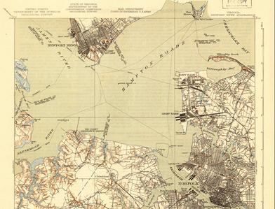
Mapping 111 Years of Norfolk: The US Topo map and Historical Topographic Map Collection websites have added an interactive map application to their home pages. The flash thumbnails of original scanned maps display all available versions of the featured state quadrangles in an animated format. The display allows the user to view the maps in chronological order, access larger versions and the map and go directly to the download services. The new series is 12 topographic maps of Norfolk, Virginia area maps - ranging from 1902 to the present. http://1.usa.gov/82461k, http://1.usa.gov/oSPTDv

New State 3DEP Fact Sheets: Rhode Island is the second state to have a state-specific Fact Sheet to feature the applications, benefits, and examples of 3D elevation data. This data is critical in such areas as agriculture, precision farming, natural resources conservation, flood risk management, infrastructure and construction management, water supply and quality, and other business uses. The Fact Sheets are available for viewing and downloading from The National Map website. http://pubs.usgs.gov/fs/2013/3040/

Nearly 3,900 New Maps Available: To keep pace with a rapid schedule and increasing demand, the USGS has posted new US Topo quadrangles covering Indiana (640 maps), Iowa (1,011 maps), North Carolina (833 maps), Pennsylvania (798 maps) and Virginia (596 maps) which are available for free download. These latest quads feature the new design and replace the first edition US Topo maps for those states. The replaced maps will be added to the USGS Historical Topographic Map Collection and are also available for free download. http://on.doi.gov/17ek42b

On the Radio: USGS Graphics Specialist Kristen Fishburn was interviewed by Jodi Henke, host of "Living the Country Life" for a segment titled, "Reading a Topographic Map". The radio program is the largest rural radio network in the nation and airs twice daily on more than 300 stations in 37 states. The program aired the week of June 3.
http://www.livingthecountrylife.com/country-life/reading-topographic-map/
Mapping On the Radio: Kevin Gallagher, Associate Director of the Core Science Systems (CSS) at the USGS, which encompasses the National Geospatial Program (NGP), was featured on Federal News Radio. Kevin interview included the Alaska Mapping Initiative, the 3D Elevation Program (3DEP), highlighting the geospatial platform and new data management strategies. The title of the program is, "USGS mashing up data to create new views of the country."

Trivia Challenge: What is the largest volcano on Earth? For the answer to this - and other fun science trivia question - go to: http://www.science.gov/trivia .The USGS, as part of 15 Federal science and research agencies who make up the Science.gov alliance, is sponsoring "trivia challenge" questions that are posted on the Science.gov Twitter site. To get the answer to these questions, you will be taken to the Science.gov Trivia Challenge page, where you can get the correct answer, more details and see previous questions from other agencies. So, go ahead, and take the challenge!

VGI "Top Story": The National Map Corps (TNMCorps) volunteer geographic information (VGI) project is a featured "Top Story" on the USGS main website. Titled, "USGS Needs YOU! Help Our National Mapping Efforts By Adding Your Community's Landmarks and Buildings", the story and graphics give greater detail to the soon-to-be national effort. The article provides information on how citizens can volunteer to gather structures data and also highlights the "recognition" program, where volunteers can earn virtual "badges" of increasing importance by earning points for data submission.

"Streamer" Launched: National Atlas of the United States® has released a new on-line service called Streamer. Streamer is a new way to visualize and understand water flow across America. With Streamer you can explore our Nation's major streams by tracing upstream to their source or downstream to where they empty. In addition to making maps, Streamer creates reports about your stream traces and the places they pass through simply by picking a point on a stream. The reports include hydrographic and political features encountered along each trace, as well as USGS streamflow gaging stations. http://go.usa.gov/jjc6
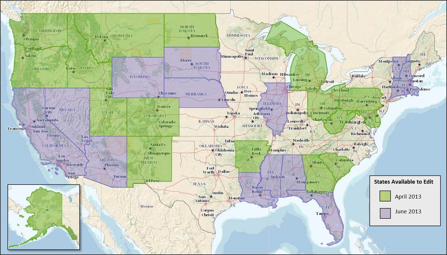
Crowd-Sourcing the Nation - More States Added: The USGS volunteer mapping program known as The National Map Corps (TNMCorps) has added 16 more states to the data collection effort. The program encourages citizens to collect and update structures data such as schools, hospitals, post offices, police stations and other important public buildings to augment The National Map. New states: Alabama, Arizona, California, Connecticut, Florida, Illinois, Louisiana, Massachusetts, Mississippi, Nebraska, Nevada, New Hampshire, Rhode Island, South Dakota, Vermont, and Wyoming, bringing the total number of states available for updating to 35. The tools on TNMCorps website explain how a volunteer can edit any area, regardless of where they live. Rewards are available to participants. News Release.

Mapping Solves Cold Case: Aerial images from the USGS were cited as critical in a story about a 30-year-old St. Louis murder investigation in the June 18 edition of the St. Louis Post-Dispatch. http://bit.ly/10ybrm1

New State 3DEP Fact Sheets: Wisconsin is the first state to have a state-specific Fact Sheet to feature the applications, benefits, and examples of 3D elevation data. This data is critical in such areas as agriculture, precision farming, natural resources conservation, flood risk management, infrastructure and construction management, water supply and quality, and other business uses. The Fact Sheets are available for viewing and downloading from The National Map website. http://pubs.usgs.gov/fs/2013/3032

NED Release: The June update of the National Elevation Dataset (NED) 1-, 1/3- and 1/9-arc-second collections have been posted. This release incorporates 16,439 square miles of new light detection and ranging (lidar) data into the NED 1/9-arc-second layer primarily over CONUS. The NED 1- and 1/3-arc-second layers were updated with 10,338 square miles of migrated high-resolution source data and 3,776 square miles of 5-meter Interferometric Synthetic Aperture Radar (ifsar) source data over Alaska. The update also includes 6,023 square miles of topobathymetric data centering over the San Francisco Bay, California. All NED data are available via The National Map Viewer: http://viewer.nationalmap.gov/viewer/
Find Points, Get Points: To recognize the important work being done by volunteers who are providing mapping data to The National Map, The USGS The National Map Corps is launching a recognition program based on the number of points a volunteer contributes. Levels of recognition are displayed in the form of icons or badges of antique catalog drawings of different and increasingly sophisticated pieces of surveying equipment. As a volunteer attains each level, a congratulations email is sent, and the accomplishments are recognized via The National Map Twitter site (#TNMCorps) and the USGS Facebook page. http://go.usa.gov/bacT

New maps and new design covering Kentucky and Tennessee: US Topo maps now have a crisper, cleaner design - enhancing readability of maps for online and printed use. Map symbols are easier to read over the digital aerial photograph layer, layer order, and annotation fonts, and adjustable transparency are just some of the many additional new features. Coverage of Kentucky and Tennessee highlight this new design. All quadrangles are available for free download at the USGS Map Store website. http://go.usa.gov/TtjB

New Video—US Topo Maps: The US Topo project team has released a new six-minute video explaining the map product basics; what it is, how to access it and how to use it. The short video also demonstrates map layers and content in GeoPDF, the use of the free-for-download TerraGo Tools and how to open Metadata. A link to the video can be found on the US Topo website and The National Map website under "videos".
Chattanooga Maps Featured: The US Topo and Historical Topographic Map Collection websites have added an interactive map application to their home pages. The flash thumbnails of original scanned maps display all available versions of the featured state quadrangles in an animated format. The display allows the user to view the maps in chronological order, access larger versions and the map and go directly to the download services. The new series is 12 topographic maps of the greater Chattanooga, TN area maps - ranging from 1888 to the present. http://1.usa.gov/82461k

"USGS Topo Data on the Go": Got a smart phone and want to use USGS topographic data for navigation? Now you can. The USGS has published information on how to leverage USGS topographic mapping data into mobile devices, and using the power of the device's GPS to find precise locations while hiking, biking, running or other outside activities. The National Map data is available on devices that are using the Android operation system or iOS. http://go.usa.gov/Tmne

Sequestration Impacts: Mark DeMulder, the Director of the USGS National Mapping Program, responded to a query from GIM International asking about the impacts of sequestration on the USGS as well as the greater geomatics/geospatial community. The question was partly due to the postponement of this year's The National Map Users Conference and decreased participation in other geospatial related conferences and meetings because of reduced travel and sponsorship funds. http://bit.ly/ZWpDT5

New elevation data released: The April 2013 update of the National Elevation Dataset (NED) 1-, 1/3- and 1/9-arc-second collections has been posted. The release incorporates 27,895 square miles of new light detection and ranging (LiDAR) data into the NED 1/9-arc-second layer primarily over CONUS. The NED 1- and 1/3-arc-second layers were updated with 54,762 square miles of migrated high resolution source data and 13,700 square miles of 5-meter Interferometric Synthetic Aperture Radar (IFSAR) source data over Alaska. The update also includes topobathymetric data covering the North Carolina Outer Banks. April Release Notes. NED data are available via The National Map Viewer
ASPRS Awards: The American Society for Photogrammetry and Remote Sensing (ASPRS) recently presented the 2013 Outstanding Service Award to USGS scientist: George Y. G. Lee for his service as Technical Editor of the Manual of Photogrammetry and his dedicated efforts to fully endow the Francis H. Moffitt Memorial Scholarship. Also, USGS National Geospatial Technical Operations Center (NGTOC) Director Kari Craun was recognized for her achievements as part of a working group which developed guidelines for procurement of commercial geospatial mapping products. http://bit.ly/10W7SX7
New Database Maps Biodiversity: The UGS Biodiversity Information Serving Our Nation (BISON) system allows users - often land managers, researchers, refuge managers, citizen scientists, agriculture professionals, fisheries managers, water resource managers, educators and others - to search for hundreds of thousands of species records in search fields ranging from the entire country and U.S. territories down to specific towns or parks. BISON displays search results in list or interactive map formats, and each species occurrence point can be clicked on to find more information about who provided or collected the data. http://go.usa.gov/TETj

Mapping Like a Deere: USGS representative Mark Newell was quoted and provided background for an article titled "Free maps, in seconds" for the recent edition of Homestead Magazine, published by Johne Deere (page 29). The short article describes the advances of the US Topo map program and how to download new quadrangles for free. http://bit.ly/18de6SD

USGS Cited in GCN: The USGS-sponsored National Enhanced Elevation Assessment was referenced in the recent edition of Government Computer News. The study found that a national program of light detection and ranging (LiDAR) data collection could result in net benefits ranging from $116 - $620 million per year. Biggest savings would be found in flood risk management, infrastructure and construction management, natural resources conservation, agriculture and water supply management. http://bit.ly/13MZQwu

New Maps for Texas & New York: The release of new maps covering Texas and New York continues the US Topo map revisions, updates and product improvement. The 4,309 quadrangles for Texas and 972 quads for New York replace the existing US Topo maps for those states, and will be added to the USGS Historical Topographic Map Collection. All of these maps are available for free download from The National Map and the USGS Map Store website. http://go.usa.gov/TxGV

Crowd-Sourcing the Nation: The USGS is expanding the involvement of volunteers to enhance data collection about structures for The National Map. This program, known as The National Map Corps, focuses on encouraging citizens to collect data relating to structures such as schools, hospitals, police stations and other important public places. Becoming a volunteer for TNMC is easy; go to the website to learn more and to sign up. First states: Arkansas, Alaska, Colorado, Delaware, Georgia, Idaho, Maryland, Michigan, Montana, North Dakota, New Jersey, New Mexico, Ohio, Oregon, Pennsylvania, South Carolina, Utah, Washington, West Virginia http://go.usa.gov/2tAP

New Users Guide: A new Users Guide for US Topo maps and the Historical Topographic Map Collection has been posted. The Guide, available as a downloadable PDF, features a "Quickstart" page at the beginning as well as detailed instructions for locating, downloading, manipulating and printing US Topo quadrangles and Historical maps - in a step-by-step fashion.

Conference Postponed: Due to the mandatory budget cuts from sequestration, the USGS has postponed The National Map Users Conference and USGS Community for Data Integration Workshop, May 21-24, 2013 in Denver. We regret any inconvenience this postponement has caused, and look forward to continued service with our data users, partners, customers and the public. More information: http://nationalmap.gov/tnmuc_cdiworkshop/

CEGIS Director Elected ASPRS VP: E. Lynn Usery, a Research Physical Scientist and Director of the USGS Center of Excellence for Geospatial Information Science (CEGIS) has been elected as the Vice President of the American Society for Photogrammetry and Remote Sensing (ASPRS) for the coming year. Usery has been very active in national and international geospatial governance and management organizations and is currently the Chair of the U.S. National Committee to the International Cartographic Association. For more on his career and achievements: http://bit.ly/WqxTZW

OK Quads Featured: The US Topo and Historical Topographic Map Collection websites have added an interactive map application to their home pages. The flash thumbnails of original scanned maps display all available versions of the featured state quadrangles in an animated format. The display allows the user to view the maps in chronological order, access larger versions of the map and go directly to the download services. The new series is 12 topographic maps of the Oklahoma City area - ranging from 1893 to the present. http://1.usa.gov/82461k, http://1.usa.gov/oSPTDv

HDDS tutorial: Geospatial data and imagery are critical components of disaster response. The USGS has a web-based application called the Hazard Data Distribution System (HDDS) that provides the capability to download incident related imagery. To learn more about the HDDS, go to this short tutorial video. Note that if you are involved in disaster response you will need to request permissions from the USGS to obtain access to the licensed imagery. More info on HDDS: http://hdds.usgs.gov/hdds2/

New Elevation Report: A recently posted USGS Open-File Report titled, "A Conceptual Prototype for the Next-Generation National Elevation Dataset" is available for download at: http://pubs.usgs.gov/of/2013/1023/ Authors: Jason Stoker, Hans Karl Heidemann, Gayla Evans, and Susan Greenlee (This publication is online only).
Other NGP in the News: Several NGP related article have recently been published to include:

Landsat 8: Launched by NASA, the new Landsat 8 satellite is expected to transmit
images and data about the Earth within 100 days. Landsat data from more than 3 million
current and archived images of Earth - available free of charge the USGS - have spurred
extensive research and innovations, ranging from scientific investigations around the
globe to the development of applications like Google Earth. If you missed the launch, you
can access a replay at: http://1.usa.gov/VRsblN

New lidar data: The February, 2013 update of the National Elevation Dataset (NED)
1-, 1/3- and 1/9-arc-second collections has been released. This marks the 70th update
of the 1-arc-second layer since bi-monthly revisions began in June, 2000. This release
incorporates 22,996 square miles of new light detection and ranging (lidar) data into the
NED 1/9-arc-second layer. The NED 1- and 1/3-arc-second layers were updated with
18,613 square miles of migrated high resolution source data. All NED data are available
via The National Map Viewer: http://viewer.nationalmap.gov/viewer/

New Fact Sheet: A new fact sheet titled "USGS Natural Hazards Response", is now
available. The primary goal of USGS Emergency Operations is to ensure that the disaster
response community has access to timely, accurate, and relevant geospatial products,
imagery, and services during and after an emergency event: http://pubs.usgs.gov/fs/2012/3061/

Round #2: Kansas and Oklahoma usher in the second round of US Topo quadrangle revisions, updates and product improvement. The initial round US Topo map production for the 48 contiguous states was announced last September. The 1,403 quadrangles for Kansas and 1,032 quads covering Oklahoma replace the current US Topo maps, which will be added to the USGS Historical Topographic Map Collection. All of these maps are available for free download from The National Map and the USGS Map Store website.

Call for Abstracts Reminder: Calling for abstracts in support of the joint 2013 The National Map Users Conference and Community for Data Integration Workshop, May 20 – 24, 2013 in Denver, Colorado. Abstracts should address (1) experiences based on use of The National Map data theme or application and (2) data integration issues, planning, and execution in support of science, including products and tools to help users find, get, and use data for conducting interdisciplinary studies. Abstracts must be submitted through this online form not later than February 22, 2013. Authors will be notified of acceptance by April 1, 2013. Questions?

3DEP Reports: "The Benefits of Improved National Elevation Data" by USGS scientist Gregory Snyder is featured in the current issue of Photogrammetric Engineering andRemote Sensing (PE&RS) Magazine along with a forward by USGS scientist Jason Stoker, titled, "Are We Moving Past the Pixel?" (p. 133) .Elevation data are essential for flood hazard mitigation, agricultural productivity, infrastructure and energy development, resource conservation, national security, and many other applications. Under the leadership of the USGS and the National Digital Elevation Program (NDEP), Federal agencies, State agencies, and others work together to acquire high-quality elevation data for the US its territories.

2013 Gannett Award: The USGS is pleased to announce the call for nominations for the 2013 Henry Gannett award. This award commemorates the first USGS Chief Geographer, (1882-1914) Henry Gannett, and his tremendous contributions to topographic mapping in the United States. The Henry Gannett award is designed to recognize and celebrate talented individuals or groups of individuals for outstanding accomplishments to the topographic mapping mission of the USGS. Individuals, both internal and external to the USGS are eligible to make nominations or receive this award.
The call for nominations is made biennially through the USGS National Geospatial Program (NGP). Each nomination package must be submitted no later than February 26. 2013. Details on award criteria and processes are found at http://nationalmap.gov/gannett/. The award will be presented at The National Map Users Conference and Community for Data Integration Workshop and Training during an award ceremony in May 2013.
This is a unique opportunity for the USGS to honor significant contributions in our community. We look forward to receiving a broad range of nominations of individuals that have furthered USGS topographic mapping of the Nation.

US Topo Report: USGS Scientist Larry Moore authored an update to the US Topo map program. The report and accompanying graphics give an overview of the project successes thus far and potential obstacles for 2013. The report was initially published in Direction's Magazine (Jan 14, 2013) and has been referenced or linked by related trade publications, blogs and Twitter. http://www.directionsmag.com/articles/us-topoa-new-national-map-series-2012-update/300690

Geographic Information to the Masses: An article featuring the US Topo, the National Map Viewer and the National Atlas ® titled, "USGS Provides Geographic Information to the Masses" has been published in the most recent edition of the "Esri News for Federal Government" newsletter. http://www.esri.com/Industries/government/federal/~/media/Files/Pdfs/library/newsletters/federal/fall-2012.pdf ( page 8).

Save the Date - Collaborate. Integrate. Innovate: The second biennial The National Map (TNM) Users Conference and the fourth annual Community for Data Integration (CDI) Training and Workshop is planned for May 21-24, 2013 in the Denver, Colorado area. Attendees will have the opportunity to collaborate with other users and scientists at a single venue. The agenda, call for abstracts, registration, hotel information, and other details will be available in the coming weeks. Event highlights include:

Natural Hazards Response Fact Sheet: The USGS strives to ensure that the disaster response community has access to timely, accurate, and relevant geospatial products, imagery, and services during and after an emergency event. To accomplish this goal, products and services provided by the National Geospatial Program (NGP) and Land Remote Sensing (LRS) Program serve as a geospatial framework for mapping activities to assist emergency responders. More information on this system can be found in the new Fact Sheet: http://pubs.usgs.gov/fs/2012/3061/
USGS ASPRS Fellow: Scientist Dr. George Y. Lee, national lead for the USGS orthoimagery program, has been named a 2013 Fellow in the American Society of Photogrammetry and Remote Sensing. The award is in recognition of more than 38 years of professional service and excellence to science, the ASPRS and the USGS. Among his various accomplishments, Lee was instrumental in the development and implementation of a program to complete first time national coverage with Digital Othrophoto Quarter Quadrangles (DOQQ's). More information: http://www.asprs.org/Press-Releases/ASPRS-2013-Fellows-Named.html

"Science.gov: The Power of 10": Science.gov - the Federal government's "one stop" real-time science data website, is now celebrating its 10th anniversary. The USGS is a founding member of Science.gov and, along with 12 other Federal agencies, has created a web portal to provide wide, public access and a unified search of the government's vast stores of scientific and technical information. Moving into its second decade, the website recently launched a Spanish language version and added multimedia content such as videos, images and audio files. Also, to highlight interesting science facts from the Alliance members, the website added "cool stuff" webpage: http://go.usa.gov/gXxF

Aerial Scans of Sandy's Destruction: USGS researchers coordinated and are analyzing before-and-after lidar images of Hurricane Sandy in at Ocean Bay Park on Fire Island National Seashore. The lidar data will check the accuracy of storm predictions, improve future USGS storm modeling and can help scientists and decision-makers identify the areas along the shore that have been made more vulnerable to future coastal hazards in the storm's wake. http://coastal.er.usgs.gov/hurricanes/sandy/lidar/

Website Updated: In keeping with program progress, the US Topo website has undergone several updates to better serve its customers. Links to the US Topo map protype, the "Digital Map - Beta" have removed as the US Topo program is starting its second revision cycle of US Topo maps for the interior U.S. Also, the US Topo video has been added as well as a "US Topo News" page featuring current map status. Page navigation has been improved and Map Locator renovations and underway.

NAS Report: The National Academy of Sciences recently released a report on the USGS titled, "Advancing Strategic Science: A Spatial Data Infrastructure Roadmap for the U.S. Geological Survey". The report examines the USGS Science Strategy and supports the framework of spatial data, metadata, tools, and a user community that is interactively connected to use spatial data in an efficient and flexible way--known as a spatial data infrastructure (SDI) http://www.nap.edu/catalog.php?record_id=13506

Last Frontier Historical Topo Maps: More than 8,000 historical topographic quadrangles, some dating back to 1899, covering all of Alaska have been released for free download. This recent addition to the Historical Topographic Map Collection provides a comprehensive landscape repository of our northernmost State and shows changes through time, providing essential clues critical in the understanding our Nation's development. |
The National Map @USGSTNM
Tweets by @USGSTNM
|

![]() U.S. Department of the Interior |
U.S. Geological Survey
U.S. Department of the Interior |
U.S. Geological Survey
URL: http://nationalmap.gov/index.html
Page Contact Information: The National Map
Page Last Modified: Thursday, 27-Feb-2014 12:30:44 EST


