While the U.S. has committed to upgrading its modeling, it has not kept pace with counterparts in Europe and is not positioned to be a leader in global weather prediction.

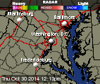
We managed a decent start to the day, especially D.C. and east, before some nuisance showers meandered through. A lengthy cool down starts now.

It will feel like December and the wind chill will be fierce, but snow is not likely.

The breathtaking sunrises keep coming and we're fortunate to have eyes and cameras all around the Washington, D.C. area to capture them.

For more than a week, NOAA's National Ice Center Web site has been down, cutting off access to snow and ice data important for weather forecasters and researchers.

We're much cooler today than yesterday. It's all relative, though, because by Saturday we'll be downright cold and breezy, with a chance of snowflakes.

NASA confirms that all personnel are accounted for, and there were no injuries in the Antares explosion.

A fleeting day of summer weather is behind us. Now it's time for the cool down.

Tropical Cyclone Nilofar is moving north through the Arabian Sea and is expected to make landfall in northwest India or Pakistan later this week.

Between Sunday and Monday, the lava flow advanced over 200 yards, moving at an average rate of 10 to 15 yards per hour.