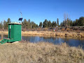
Profile

Cover photo
USGS News: Water
242 followers|84,133 views
AboutPostsPhotosVideos

Stream

USGS News: Water

Shared publicly  - 
 
USGS Uses State-of-the-Art Science to Estimate Nutrient and Suspended-Sediment Loads in the Klamath Basin: A U.S. Geological Survey hydrologist collects a water sample from the Williamson River below Chiloquin, Oregon. The sample was analyzed as part of a water-quality study the USGS conducted in cooperation with the U.S. Bureau of Reclamation and the Klamath Tribes.(Credit: Chauncey Anderson, USGS. Public domain.) PORTLAND, Ore. — The U.S. Geological Survey has employed state-of-the-art science techniques to estimate phosphorus and suspended-sediment loads to Upper Klamath Lake in the Klamath Basin. Large algal blooms are attributed to high phosphorus concentrations in the lake during the summer causing numerous water-quality problems. The blooms are considered a contributor to survival problems for the endangered Lost River and shortnose suckers, which are culturally significant fish for the Klamath Tribes located near the lake. The proof-of-concept effort shows continuous monitoring data can be used as surrogates to successfully estimate loads of phosphorus and sediment on monthly, daily and hourly time scales in this basin. “Understanding nutrient load dynamics that affect algal growth and decay, as well as water quality in Upper Klamath Lake, is crucial for management of the endangered sucker populations,” said Liam Schenk, USGS hydrologist leading the study. The study, conducted in cooperation with the Bureau of Reclamation, Klamath Basin Area Office and the Klamath Tribes, uses continuously measured data related to the scattering of light from particles suspended in the water. These data are then combined with streamflow data and statistical methods to calculate concentrations and loads of sediment and phosphorus for the two main tributaries to Upper Klamath Lake, the Wood and Williamson rivers. Suspended sediment is an important contributing factor to phosphorus loading because it acts as a transport mechanism for phosphorus from the upper watersheds to the lake. Results from this study highlight the usefulness of surrogate techniques to assess loading to the lake and the ability to report loads and model uncertainties in near real-time. The Oregon Real-time Water Quality page shows a graph with estimated suspended sediment concentrations on the Williamson River computed using this technique. A 2002 Clean Water Act “total maximum daily load” standard for Upper Klamath Lake targeted a 40 percent reduction in external total-phosphorus loads to reduce the dense algal blooms that occur during the summer and fall months. Near real-time monitoring of total phosphorus and suspended sediment on the two main tributaries using these techniques will determine whether the targeted reductions are being reached through the combined effect of restoration projects in the upper Klamath Basin. Long-term datasets will be necessary to assess the trends in nutrient and sediment reductions over time. The application of surrogate techniques described in this report provides a cost-effective tool to measure these trends. Results of the study are available in U.S. Geological Survey Scientific Investigations Report 2016-5167. #water
1

USGS News: Water

Shared publicly  - 
 
Groundwater Quality in Eastern U.S.: These combined carbonate-rock aquifers underlie an area with a population of more than 40 million people in ten states and are an important source of public supply, providing about 195 million gallons per day for this use. Scientists tested for a broad range of water-quality characteristics of untreated groundwater in the Valley and Ridge and Piedmont and Blue Ridge aquifers. Results show inorganic constituents present at high concentrations, meaning at levels exceeding human-health benchmarks, in about 15 percent of the study area. Human-made organic constituents (both pesticides and volatile organic compounds) were not detected at high concentrations. The study area includes water at the depth used for public supply. The study evaluated untreated drinking water, but compared results to drinking-water quality standards. The full report is available online. Many inorganic constituents occur naturally in groundwater. The inorganic constituents found at high levels in this study area include radioactive constituents (specifically gross alpha activity), nitrate, strontium, iron and manganese. Concentrations of inorganic constituents can be affected by natural processes as well as by human activities. Results show one or more inorganic constituents present at high concentrations in about 15 percent of the aquifers and at moderate concentrations (between half the human-health benchmark and the benchmark concentration) in about 17 percent. The scientists evaluated groundwater quality in the Valley and Ridge and Piedmont and Blue Ridge aquifers by sampling 60 spatially distributed public-supply wells in these two aquifers. This study area includes parts of New Jersey, Pennsylvania, Maryland, Virginia, West Virginia, Tennessee, Georgia and Alabama. Land use overlying the aquifers is primarily agricultural (35 percent) and urban (17 percent). Water-supply wells in carbonate-rock aquifers such as the Valley and Ridge and Piedmont and Blue Ridge are generally more productive than wells in other rock types, and might be particularly vulnerable to contamination from the land surface. Groundwater provides nearly 50 percent of the nation’s drinking water. To help protect this vital resource, the USGS National Water-Quality Assessment, or NAWQA, Project of the National Water Quality Program assesses groundwater quality in aquifers that are important sources of drinking water. Over the last two decades, USGS scientists have assessed water quality in source (untreated) water from 6,600 wells in extensive regional aquifers that supply most of the groundwater pumped for the nation’s drinking water, irrigation and other uses. This comprehensive sampling, along with detailed information on geology, hydrology, geochemistry and chemical and water use, can be used to explain how and why aquifer vulnerability to contamination varies across the nation. Map showing location and summary of water-quality results for five principal aquifers currently available. For more details, please refer to the linked resources in this story. Between 2013 and 2022, NAWQA will continue to assess the quality of the nation’s groundwater by sampling about 2,300 shallow wells and 1,400 deep public-supply wells for a broad range of water-quality constituents. In the future, USGS-led national- and regional-scale modeling will provide a three-dimensional perspective of the quality of the nation’s groundwater that can be used to inform management decisions. More information on USGS regional aquifer assessments can be found in this recent USGS Top Story. To learn more, visit these websites: USGS National Summary Circular, Quality of the Nation's Groundwater Quality, 1991-2010 Regional reports on principal aquifers of the U.S. National Water-Quality Assessment (NAWQA) Program USGS Groundwater Information WaterSMART #water
These combined carbonate-rock aquifers underlie an area with a population of more than 40 million people in ten states and are an important source of public supply, providing about 195 million gallons per day for this use.
1

USGS News: Water

Shared publicly  - 
 
Groundwater Quality in the West: Examining Basin and Range Basin-Fill Aquifers: The combined Basin and Range basin-fill aquifers rank fourth in the nation as a source of groundwater for public supply, providing about one billion gallons per day for this use. Urban areas within the boundaries of the aquifers include Salt Lake City, Reno, Las Vegas and Phoenix. Scientists tested for a broad range of water-quality characteristics of untreated groundwater in 78 public-supply wells in the Basin and Range basin-fill aquifers. Results show inorganic constituents present at high concentrations, meaning at levels exceeding human health-benchmarks, in about 20 percent of the study area. Human-made organic constituents (both pesticides and volatile organic compounds) were not detected at high concentrations. The study area includes water at the depth used for public supply. The study evaluated untreated drinking water, but compared results to drinking-water quality standards. The full report is available online. Many inorganic constituents occur naturally in groundwater. The inorganic constituents found at high concentrations in this study area include arsenic, fluoride, manganese, molybdenum and uranium. Total dissolved solids, a measure of the amount of salt in groundwater, was also found at high levels in 32 percent of the study area. Concentrations of inorganic constituents can be affected by natural processes as well as by human activities. Results also show one or more inorganic constituents present at moderate concentrations (between half the human-health benchmark and the benchmark concentration) in about 49 percent of the aquifer system. Groundwater provides nearly 50 percent of the nation’s drinking water. To help protect this vital resource, the USGS National Water-Quality Assessment, or NAWQA, Project of the National Water Quality Program assesses groundwater quality in aquifers that are important sources of drinking water. Over the last two decades, USGS scientists have assessed water quality in source (untreated) water from 6,600 wells in extensive regional aquifers that supply most of the groundwater pumped for the nation’s drinking water, irrigation and other uses. This comprehensive sampling, along with detailed information on geology, hydrology, geochemistry and chemical and water use, can be used to explain how and why aquifer vulnerability to contamination varies across the nation. Map showing location and summary of water-quality results for five principal aquifers currently available. For more details, please refer to the linked resources in this story. Between 2013 and 2022, NAWQA will continue to assess the quality of the nation’s groundwater by sampling about 2,300 shallow wells and 1,400 deep public-supply wells for a broad range of water-quality constituents. In the future, USGS-led national- and regional-scale modeling will provide a three-dimensional perspective of the quality of the nation’s groundwater that can be used to inform management decisions. More information on USGS regional aquifer assessments can be found in this recent USGS Featured Story.  To learn more, visit these websites: USGS National Summary Circular, Quality of the Nation's Groundwater Quality, 1991-2010 Regional reports on principal aquifers of the U.S. National Water-Quality Assessment (NAWQA) Project USGS Groundwater Information WaterSMART #water
The combined Basin and Range basin-fill aquifers rank fourth in the nation as a source of groundwater for public supply, providing about one billion gallons per day for this use. Urban areas within the boundaries of the aquifers include Salt Lake City, Reno, Las Vegas and Phoenix.
1

USGS News: Water

Shared publicly  - 
 
Groundwater Quality in the Coastal Lowlands Aquifer System: The Coastal Lowlands aquifer system ranks fourth in the nation as a source of groundwater for public supply and fifth as a source of private domestic supply, providing about one billion gallons per day for this use. The cities of Houston, New Orleans, Baton Rouge and Mobile are included within the boundaries of the aquifer. Scientists tested for a broad range of water-quality characteristics of untreated groundwater in the Coastal Lowlands aquifer. Results show inorganic constituents present at high concentrations, meaning at levels exceeding human-health benchmarks, in about 12 percent of the study area. Human-made organic constituents (both pesticides and volatile organic compounds) were not detected at high levels. The study area includes water at the depth used for public supply. The study evaluated untreated drinking water, but compared results to drinking-water quality standards. The full report is available online. Many inorganic constituents occur naturally in groundwater. The inorganic constituents found at high levels that surpass human-health benchmarks in this study area include arsenic, manganese and the radioactive constituents known as gross alpha activity and radon-222. Total dissolved solids, a measure of the amount of salt in groundwater, was also found at high levels. Concentrations of inorganic constituents can be affected by natural processes as well as by human activities. Results show one or more inorganic constituents present at high concentrations in about 12 percent of the aquifer system and at moderate concentrations (between half the human-health benchmark and the benchmark concentration) in about 18 percent. The scientists evaluated groundwater quality in the Coastal Lowlands aquifer system by sampling 60 public-supply wells distributed across the aquifer. This study area overlying the Coastal Lowlands aquifer system includes 99,000 square miles along the Gulf Coast in Texas, Louisiana, Mississippi, Alabama and Florida. Land use is composed primarily of agricultural (24 percent) and natural (67 percent) land, with a relatively small percentage of urban (9 percent) land. Groundwater provides nearly 50 percent of the nation’s drinking water. To help protect this vital resource, the USGS National Water-Quality Assessment, or NAWQA, Project of the National Water Quality Program assesses groundwater quality in aquifers that are important sources of drinking water. Over the last two decades, USGS scientists have assessed water quality in source (untreated) water from 6,600 wells in extensive regional aquifers that supply most of the groundwater pumped for the nation’s drinking water, irrigation and other uses. This comprehensive sampling, along with detailed information on geology, hydrology, geochemistry and chemical and water use, can be used to explain how and why aquifer vulnerability to contamination varies across the nation. Map showing location and summary of water-quality results for five principal aquifers currently available. For more details, please refer to the linked resources in this story. Between 2013 and 2022, NAWQA will continue to assess the quality of the nation’s groundwater by sampling about 2,300 shallow wells and 1,400 deep public-supply wells for a broad range of water-quality constituents. In the future, USGS-led national- and regional-scale modeling will provide a three-dimensional perspective of the quality of the nation’s groundwater that can be used to inform management decisions. More information on USGS regional aquifer assessments can be found in this recent USGS Top Story. To learn more, visit these websites: USGS National Summary Circular, Quality of the Nation's Groundwater Quality, 1991-2010 Regional reports on principal aquifers of the U.S. National Water-Quality Assessment (NAWQA) Project USGS Groundwater Information WaterSMART #water
The Coastal Lowlands aquifer system ranks fourth in the nation as a source of groundwater for public supply and fifth as a source of private domestic supply, providing about one billion gallons per day for this use. The cities of Houston, New Orleans, Baton Rouge and Mobile are included within the boundaries of the aquifer.
1
1

USGS News: Water

Shared publicly  - 
 
USGS Scientist Wins Governor’s Medal for Science and Technology: USGS scientist Robert Baskin deploys a side scan sonar in the Salton Sea, California. (© Jenny E. Ross) “The medal recipients are true leaders in innovation, serving as educators, mentors and influencers statewide,” Gov. Herbert said. “Innovation drives Utah’s thriving economy and unmatched quality of life. I commend the winners for excellence in their fields and for their important work, which will benefit Utah residents for generations.” Baskin is best known for his innovative research on Great Salt Lake, collaborating with the Scripps Institution of Oceanography and University of Utah to provide information vital for effective lake management. His work has greatly contributed to the understanding of Great Salt Lake and how sediments influence the health of the ecosystem. Baskin has worked extensively with local, state, federal and international entities on subjects ranging from water quality and availability, seismic hazards, thermal imaging and saline ecosystems throughout his 30 year USGS career. His research mainly focuses on Utah, but studies have also lead him to diverse areas around the globe, including the Middle East, the Salton Sea, NASA Stennis Space Center and southern Florida. He holds the world record, as far as he knows, for the deepest dive in Utah Lake (63 feet). Baskin earned his Master of Science and doctorate degrees from the University of Utah. His ongoing research focuses on integrating multiple technologies to identify environmental variables that affect microbial carbonate development and influence the ecology of Great Salt Lake. Baskin has published more than 30 peer-reviewed papers and is working on multiple research projects. Since 1987, the Governor’s Medals for Science and Technology have been awarded to individuals who have provided distinguished service to the state of Utah in science and technology fields. The program is sponsored by the Utah Science and Technology Research Initiative and the Governor’s Office of Economic Development.       USGS scientist Robert Baskin takes a boat out on the Great Salt Lake to conduct research. (Credit: Jennifer LaVista, USGS. Public domain.) USGS scientists Robert Baskin (right) and Danny Brothers (left) deploy a side scan sonar in the Salton Sea, California. (© Jenny E. Ross) #water
1

USGS News: Water

Shared publicly  - 
 
StreamStats Provides New Information for Montana: HELENA, Mont. – The Montana edition of StreamStats, a web-based geographic program developed by the U.S. Geological Survey, is now available providing the public with information for streams and rivers around Montana. This new information will be helpful for anyone designing structures over or near water, managing water distribution, or just wanting to know about the flow of a stream in a particular area. “StreamStats allows users to find information such as peak and average streamflows, stream characteristics such as drainage area and climate data with the click of a button,” said Peter McCarthy, USGS hydrologist leading the effort in Montana. The USGS in Montana has a statewide network of 234 active streamgages that provide real-time streamflow to users via the Web, but those streamgages do not cover the entire state. Over the last several years, USGS hydrologists have been working to fill in the gaps by analyzing data from those active streamgages and an additional 521 historical streamgages in Montana, and inputting that information into StreamStats. In addition to StreamStats, a multi-chapter report detailing the results of the statistical analyses has also been published. McCarthy noted that one of the most important findings that came to light was how important long-term streamgages are in the state. “The peak flows estimates, in particular were very different when we used a 40-year data set compared to the 100-year one.” The report and study were conducted in cooperation with Montana Department of Transportation, Montana Department of Environment Quality, and Montana Department of Natural Resources and Conservation. Copies of the reports describing Montana StreamStats, as well as the studies describing the analyses, are available online at https://pubs.er.usgs.gov/publication/sir20155019. #water
HELENA, Mont. – The Montana edition of StreamStats, a web-based geographic program developed by the U.S. Geological Survey, is now available providing the public with information for streams and rivers around Montana. This new information will be helpful for anyone designing structures over or near water, managing water distribution, or just wanting to know about the flow of a stream in a particular area.
1

USGS News: Water

Shared publicly  - 
 
Uranium in Spring Water North of Grand Canyon Likely Not Related to Nearby Mining Activity: The former Pigeon Mine in northern Arizona is seen here looking towards the northeast. (Credit: Donald Bills, USGS. Public domain.) Pigeon Spring had elevated uranium levels in recent samples from 2012-2014 (73-92 micrograms per liter), compared to other perched springs in the same drainage area (2.7–18 micrograms per liter), and was proportionally elevated in samples collected prior to mining operations at the nearby Pigeon Mine.  The Grand Canyon National Park in Arizona is a United Nations World Heritage Site, an international tourist destination, and is a sacred place to many Native Americans. The Colorado River, which runs through the Grand Canyon, is a primary source of drinking and irrigation water for millions of people in the U.S. and Mexico. The region is also believed to host some of the highest-grade uranium ore in the country. Understanding the potential for uranium mining impacts on water resources in the area is important to manage the intersecting interests of the mining industry, water managers and visitors to the area.  “It’s important to use science to understand the potential for mining impacts on water resources,” said Kimberly Beisner, USGS scientist and lead author of the study. “These results are the first step in understanding if uranium mining in the area may have any impact on water resources; in this case we determined those impacts are not likely at Pigeon Spring. These findings will help inform future studies to understand mining impacts in the region.” USGS scientists conducted a geochemical analysis of water, sediment and rock samples collected from the Snake Gulch area, which includes the former Pigeon Mine. Scientists studied water from nine springs, along with water that had been in contact with uranium mining waste material to better understand the source of elevated uranium at Pigeon Spring. Statistical analyses of trace elements, chemical elements that occur in small amounts, showed Pigeon Spring to be more similar to other nearby springs and distinct from water in contact with uranium mining material. Water in contact with mining material from the Pigeon Mine contained elevated levels of several trace elements in addition to uranium compared to the spring water. Additionally, evidence from available groundwater level measurements in the area indicate that groundwater is probably flowing towards the northwest, whereas Pigeon Spring is due east of Pigeon Mine, making groundwater impacts from the mine on the spring unlikely. “Unbiased scientific studies such as these provide important information that can be used by decision makers tasked with balancing the demands of national energy independence with the need to protect our natural resources, especially water” said Michael Focazio, coordinator for the USGS Toxic Substances Hydrology and Contaminant Biology Programs that supported the study. This study was completed to help answer science questions set forth in the 2012 Record of Decision by then U.S. Secretary of Interior Ken Salazar to withdraw over 1 million acres of federal land in the Grand Canyon region from new uranium mining activities for 20 years.  USGS studies are being conducted to better understand the potential impacts of uranium mining activities on cultural, biological and water resources in the area.   Here, Pigeon Spring emerges in Pigeon Canyon just before it merges with Snake Gulch in northern Arizona. (Credit: Donald Bills, USGS. Public domain.) #water
The former Pigeon Mine in northern Arizona is seen here looking towards the northeast. (Credit: Donald Bills, USGS.
1

USGS News: Water

Shared publicly  - 
 
Groundwater Quality in the Northern Atlantic Coastal Plain Aquifer System: The NACP aquifer system underlies an area with a population of more than 21 million people in six states. The NACP aquifer system ranks seventh in the nation as a source of groundwater for public supply, providing about 800 million gallons per day for this use. The cities of Washington, D.C., New York, Baltimore and Richmond are included within the boundaries of the aquifer. Scientists tested for a broad range of water-quality characteristics of untreated groundwater in the NACP aquifer. Results show inorganic constituents present at high concentrations, meaning at levels exceeding human-health benchmarks, in about 4 percent of the study area. Human-made organic constituents (both pesticides and volatile organic compounds) were not detected at high concentrations. The study area includes water at the depth used for public supply. The study evaluated untreated drinking water, but compared results to drinking-water quality standards. The full report is available online. Many inorganic constituents occur naturally in groundwater. The inorganic constituents that surpass human-health benchmarks in this study area include arsenic, manganese and fluoride (about 4 percent of the study area) and the radioactive constituent gross alpha activity (about 1 percent). Total dissolved solids, a measure of the amount of salt in groundwater, was also found at high levels in 60 percent of the study area. Concentrations of inorganic constituents can be affected by natural processes as well as by human activities. Results also show one or more inorganic constituents present at moderate concentrations (between half the human-health benchmark and the benchmark concentration) in about 21 percent of the study area. The scientists evaluated groundwater quality in the NACP aquifer system by sampling 119 public-supply wells distributed across the system. This study area covers parts of New York, New Jersey, Pennsylvania, Maryland, Virginia and North Carolina. Land use overlying the aquifer system is about 62 percent natural, 24 percent agricultural and 14 percent urban. Groundwater provides nearly 50 percent of the nation’s drinking water. To help protect this vital resource, the USGS National Water-Quality Assessment, or NAWQA, Project of the National Water Quality Program assesses groundwater quality in aquifers that are important sources of drinking water. Over the last two decades, USGS scientists have assessed water quality in source (untreated) water from 6,600 wells in extensive regional aquifers that supply most of the groundwater pumped for the nation’s drinking water, irrigation and other uses. This comprehensive sampling, along with detailed information on geology, hydrology, geochemistry and chemical and water use, can be used to explain how and why aquifer vulnerability to contamination varies across the nation. Map showing location and summary of water-quality results for five principal aquifers currently available. For more details, please refer to the linked resources in this story. Between 2013 and 2022, NAWQA will continue to assess the quality of the nation’s groundwater by sampling about 2,300 shallow wells and 1,400 deep public-supply wells for a broad range of water-quality constituents. In the future, USGS-led national- and regional-scale modeling will provide a three-dimensional perspective of the quality of the nation’s groundwater that can be used to inform management decisions. More information on USGS regional aquifer assessments can be found in this recent USGS Top Story. To learn more, visit these websites: USGS National Summary Circular, Quality of the Nation's Groundwater Quality, 1991-2010 Regional reports on principal aquifers of the U.S. National Water-Quality Assessment (NAWQA) Project USGS Groundwater Information WaterSMART #water
The NACP aquifer system underlies an area with a population of more than 21 million people in six states. The NACP aquifer system ranks seventh in the nation as a source of groundwater for public supply, providing about 800 million gallons per day for this use. The cities of Washington, D.C., New York, Baltimore and Richmond are included within the boundaries of the aquifer.
1

USGS News: Water

Shared publicly  - 
 
The Quality of the Nation’s Groundwater: Progress on a National Survey: About half of the nation’s population relies on groundwater for drinking water. As the nation’s population grows, the need for high-quality drinking-water supplies becomes even more urgent. One hundred fifteen million people rely on groundwater for drinking water. The USGS has identified 68 principal aquifers, or regionally extensive aquifers that can be used as a source of drinking water, across the nation. Groundwater pumped from these aquifers provides nearly 50 percent of the nation’s drinking water. Twenty of these principal aquifers account for about 75 percent of the nation’s groundwater pumped for public supply and 85 percent of the groundwater pumped for domestic supply. These 20 principal aquifers are being intensively evaluated by the USGS National Water-Quality Assessment Project between 2012 and 2023. Summary results for five principal aquifers are recently completed and now available online. A young girl drinks water, which likely originated from groundwater sources. (Credit: Tammy Zimmerman, USGS. Public domain.) “The National Water-Quality Assessment Project is critical in helping resource managers understand how contaminants are introduced into the environment. This knowledge helps them make informed decisions about how to manage the nation’s water resources,” said Don Cline, USGS Associate Director for Water. “Understanding the quality of our water is critical in sustaining this resource for generations to come.” A Deep Look at an Unseen Resource USGS scientists are assessing water quality in source (untreated) water from wells in principal aquifers. Most consumers receive water that has been treated by local utilities to meet federal drinking-water standards. Understanding what constituents are in untreated water can help decision makers manage and treat water resources.  This comprehensive sampling, carried out over principal aquifers across the country, is focused on public-supply wells that tap deeper groundwater. Along with detailed information on geology, hydrology, geochemistry and chemical and water use, this data can be used to explain how and why aquifer vulnerability to contamination varies across the nation. These regional aquifer studies provide water utilities and resource managers with information about: Regulated and unregulated constituents from natural or human sources Pesticides, pharmaceuticals, hormones and other constituents of concern for human health Understanding present groundwater quality, to be compared with future conditions Regional and national statistics on water quality, as context for individual wells A comparison of water quality in the shallow and deep parts of aquifer systems Environmental tracers that can be used to understand sources and sustainability of groundwater supplies Improving understanding of local, regional and national hydrogeology Map showing location and summary of water-quality results for five principal aquifers currently available. For more details, please refer to the linked resources in this story. New Regional Aquifer Studies In-depth, regional-scale assessments conducted or planned for 2012 through 2023 focus on 20 of the most heavily used aquifers in the nation. Groundwater quality results for principal aquifers sampled in 2012 and 2013 are available today and summarized in the fact sheets below. Almost 400 deep public-supply wells were sampled within these aquifers, which were analyzed for a broad range of water-quality constituents. Basin and Range basin-fill aquifers (western U.S.) Valley and Ridge carbonate-rock aquifers and the Piedmont and Blue Ridge carbonate-rock aquifers (eastern U.S.) Northern Atlantic Coastal Plain aquifer system (east coast of U.S.) Southeastern Coastal Plain aquifer system (southeastern U.S.) Coastal Lowlands aquifer system (south central U.S.) Findings One or more inorganic constituents exceeded human-health benchmarks in 4 to 20 percent of samples collected from the five principal aquifers. Organic contaminants were not found at levels of concern. Contaminants from geologic sources – primarily trace elements such as arsenic, fluoride and manganese – were the most common to exceed human-health benchmarks. Radioactive constituents exceeded human-health benchmarks by small percentages – 1 to 3 percent – in all but one (Basin and Range basin-fill aquifers) of the five aquifers studied. The nutrient nitrate was the only constituent from manmade sources that exceeded the human-health benchmark. These findings were in the Valley and Ridge carbonate-rock aquifers and the Piedmont and Blue Ridge carbonate-rock aquifers at a low percentage (2 percent). Understanding how natural features and human activities affect groundwater quality helps to predict how and why aquifer vulnerability to contamination varies across the nation. USGS scientist, Rick Arnold collects groundwater samples to determine water quality. (Credit: Nancy Bauch, USGS. Public domain.) Looking Forward Over the next few years, results will be released for additional principal aquifers that are important sources of drinking water for the nation as the National Water-Quality Assessment Project continues to address three central questions: What is the quality of the nation’s groundwater? Is it getting better or worse? What factors affect the quality of this vital resource? Learn more National Water-Quality Assessment Project USGS Groundwater Information USGS Fact Sheet, NAWQA Groundwater Studies: Principal Aquifer Surveys USGS Data Series, Groundwater quality data from the National Water-Quality Assessment Project, May 2012 through December 2013 USGS WaterSMART Technical announcements for five aquifers studied: Basin and Range basin-fill aquifers (western U.S.) Valley and Ridge carbonate-rock aquifers and the Piedmont and Blue Ridge carbonate-rock aquifers (eastern U.S.) Northern Atlantic Coastal Plain aquifer system (east coast of U.S.) Southeastern Coastal Plain aquifer system (southeastern U.S.) Coastal Lowlands aquifer system (south central U.S.)   USGS scientist tests groundwater samples for water quality. (Credit: Laura Hallberg, USGS. Public domain.) Groundwater samples to be tested for water quality.  (Credit: Laura Hallberg, USGS. Public domain.)   #water
About half of the nation’s population relies on groundwater for drinking water. As the nation’s population grows, the need for high-quality drinking-water supplies becomes even more urgent.
1

USGS News: Water

Shared publicly  - 
 
Groundwater Quality in the Southeastern Coastal Plain Aquifer System: The Southeastern Coastal Plain aquifer system underlies an area of more than 120,000 square miles in Kentucky, Tennessee, Mississippi, Alabama, Georgia, Florida and South Carolina. The aquifer system ranks 15th in the nation as a source of groundwater for public supply, with about 340 million gallons per day pumped for this and other uses in 2000. Scientists tested for a broad range of water-quality characteristics of untreated groundwater in the Southeastern Coastal Plain aquifer system. Results show inorganic constituents present at high concentrations, meaning at levels exceeding human-health benchmarks, in about 6 percent of the study area. Human-made organic constituents (both pesticides and volatile organic compounds) were not detected at high levels. The study area includes water at the depth used for public supply. The study evaluated untreated drinking water, but compared results to drinking-water quality standards. The full report is available online. Many inorganic constituents occur naturally in groundwater. The inorganic constituents found at high levels that surpass human-health benchmarks in this study area include fluoride, lead and manganese (about 4 percent of the study area) and the radioactive constituents gross alpha activity and radium (about 2 percent). Total dissolved solids, a measure of the amount of salt in groundwater, was also found at high levels in 14 percent of the study area. Concentrations of inorganic constituents can be affected by natural processes as well as by human activities. Results show one or more inorganic constituents present at high concentrations in about 6 percent of the aquifer system and at moderate concentrations (between half the human-health benchmark and the benchmark concentration)  in about 13 percent. The scientists evaluated groundwater quality in the Southeastern Coastal Plain aquifer system by sampling 79 public-supply wells distributed across the system. Land use in the area overlying the Southeastern Coastal Plain aquifer system is primarily agricultural (19 percent) and natural land cover (74 percent), with a relatively smaller percentage of urban (7 percent) land. Groundwater provides nearly 50 percent of the nation’s drinking water. To help protect this vital resource, the USGS National Water-Quality Assessment, or NAWQA, Project of the National Water Quality Program assesses groundwater quality in aquifers that are important sources of drinking water. Over the last two decades, USGS scientists have assessed water quality in source (untreated) water from 6,600 wells in extensive regional aquifers that supply most of the groundwater pumped for the nation’s drinking water, irrigation and other uses. This comprehensive sampling, along with detailed information on geology, hydrology, geochemistry and chemical and water use, can be used to explain how and why aquifer vulnerability to contamination varies across the nation. Map showing location and summary of water-quality results for five principal aquifers currently available. For more details, please refer to the linked resources in this story. Between 2013 and 2022, NAWQA will continue to assess the quality of the nation’s groundwater by sampling about 2,300 shallow wells and 1,400 deep public-supply wells for a broad range of water-quality constituents. In the future, USGS-led national- and regional-scale modeling will provide a three-dimensional perspective of the quality of the nation’s groundwater that can be used to inform management decisions. More information on USGS regional aquifer assessments can be found in this recent USGS Top Story. To learn more, visit these websites: USGS National Summary Circular, Quality of the Nation's Groundwater Quality, 1991-2010 Regional reports on principal aquifers of the U.S. National Water-Quality Assessment (NAWQA) Program USGS Groundwater Information WaterSMART #water
The Southeastern Coastal Plain aquifer system underlies an area of more than 120,000 square miles in Kentucky, Tennessee, Mississippi, Alabama, Georgia, Florida and South Carolina. The aquifer system ranks 15th in the nation as a source of groundwater for public supply, with about 340 million gallons per day pumped for this and other uses in 2000.
1

USGS News: Water

Shared publicly  - 
 
New Tool Shows Historic and Simulated Future Water Conditions in the U.S.: Water users around the country can now view the past and simulated future of hydrologic processes. The Hydrology Futures Portal, released today by the U.S. Geological Survey, provides a user-friendly interface summarizing monthly historic (1952 through 2005) and simulated future conditions (2020 through 2099) for various meteorological and hydrological variables at locations across the conterminous United States. The features on this new application include seven searchable meteorological and hydrological variables: actual evapotranspiration, atmospheric temperature, potential evapotranspiration and precipitation, runoff, snow water equivalent (the volume of water stored in the snowpack/depth of water if the snow melted), and streamflow. “The creation of the portal involved the expertise and skills of individuals from all over the U.S. in a number of different sciences and technological fields such hydrological modeling, climate science, geographic information systems, Web development and data science,” said Andrew Bock, lead USGS scientist for the project. “In 2017, the team plans to follow up the platform release with a number of informational products to help users better understand more advanced capabilities this system has to offer.” This collaborative effort is a product of a multi-year partnership between the USGS, the Department of Interior North Central and South Central Climate Science Centers and the Environmental Protection Agency. #water
Water users around the country can now view the past and simulated future of hydrologic processes. The Hydrology Futures Portal, released today by the U.S. Geological Survey, provides a user-friendly interface summarizing monthly historic (1952 through 2005) and simulated future conditions (2020 through 2099) for various meteorological and hydrological variables at locations across the conterminous United States.
1

USGS News: Water

Shared publicly  - 
 
Reporters: Accompany a USGS Field Crew as They Monitor Stream Flow and Flooding: A U.S. Geological Survey field crew uses an Acoustic Doppler Current Profiler to measure water velocity on the Truckee River in Reno, Nevada. (Public domain.) What: The U.S. Geological Survey’s Nevada Water Science Center is hosting a media event Tuesday, January 17 at the USGS streamgage site on the Truckee River near downtown Reno. This streamflow site is significant to the Reno-Sparks metropolitan area and downstream areas. A hydrologic technician will be available for questions and interviews as field crews collect streamflow data at the site, which will be located at the foot bridge near John Champion Park on Kuenzli Street. This streamgage has been in operation since 1906. Topic: You are invited to join USGS scientists and field technician crews as they collect discharge measurements in rainfall-affected areas. The data collected are part of the USGS National Groundwater and Streamflow Information Program, a nationwide program that provides hydrologic information essential to monitoring Nevada’s flood risks. The USGS streamgage network provides real-time stream and river conditions that are used by the National Weather Service to issue flood, flash flood, landslide, and other natural hazard warnings and watches to the public. Where and When:    Location: USGS site 10348000, Truckee River at Reno, at the foot bridge near John Champion Park on Kuenzli Street on Jan. 17 from 11 a.m. to 12 p.m. More Information: USGS field crews will be making streamflow measurements at the above streamgaging location, and closely monitoring current conditions. Data collected by USGS streamgages are used to help safeguard lives, protect property, and inform decision making during emergencies such as floods, and provide vital information needed for human health and safety. The USGS Streamgaging Network is Nevada’s first defense in monitoring potential hazards like flooding, flash flooding and landslides. #water
1
Story
Tagline
News about floods, droughts, water quality, and oceans from the USGS.
Introduction
This Page delivers the latest news from the USGS that are related to water. This includes news releases and another USGS product called Science Features. 

This Page is provided so that you can receive USGS news for this topic through Google+ if you choose to rather than forcing you to go to our site. If you're already using Google+ regularly then we're just making it that much easier for you.

Note: Comments are turned off at this time. 
Contact Information
Contact info
Address
http://usgs.gov/ask