* Information and data here is considered preliminary and subject to revision unless stated otherwise. *

|
 |
Select a site to retrieve streamflow data and station information.

Flood of August 11-16, 2010, in the South Skunk River Basin, Central and Southeast Iowa
This report provides a description of the watershed, the thunderstorms, the flooding, and a profile of high-water marks measured at 20 locations along the South Skunk River.
[10/31/12]

Bayesian WLS/GLS Regression for Regional Skewness Analysis for Regions with Large Crest Stage Gage Networks
This paper summarizes methodological advances in regional log-space skewness analyses that support flood-frequency analysis with the log Pearson Type III (LP3) distribution. A Bayesian Weighted Least Squares/Generalized Least Squares (B-WLS/B-GLS) methodology that relates observed skewness coefficient estimators to basin characteristics in conjunction with diagnostic statistics represents an extension of the previously developed B-GLS methodology. B-WLS/B-GLS has been shown to be effective in two California studies. B-WLS/B-GLS uses B-WLS to generate stable estimators of model parameters and B-GLS to estimate the precision of those B-WLS regression parameters, as well as the precision of the model. The study described here employs this methodology to develop a regional skewness model for the State of Iowa.

Floods of July 23-26, 2010, in the Little Maquoketa River and Maquoketa River Basins, Northeast Iowa
Minor flooding occurred July 23, 2010, in the Little Maquoketa River Basin and major flooding occurred July 23-26, 2010, in the Maquoketa River Basin in northeast Iowa following severe thunderstorm activity over the region during July 22-24. A breach of the Lake Delhi Dam on July 24 aggravated flooding on the Maquoketa River. Rain gages at Manchester and Strawberry Point, Iowa, recorded 72-hour-rainfall amounts of 7.33 and 12.23 inches, respectively, on July 24. The majority of the rainfall occurred during a 48-hour period. Within the Little Maquoketa River Basin, a peak-discharge estimate of 19,000 cubic feet per second (annual flood-probability estimate of 4 to 10 percent) at the discontinued 05414500 Little Maquoketa River near Durango, Iowa streamgage on July 23 is the sixth largest flood on record.

Has the Magnitude of Floods Across the USA Changed With Global CO2 Levels?
An increase in flood magnitudes remains one of the most anticipated impacts of climate change. Land and water resource managers are asking questions about how to estimate future flood risks and develop effective flood mitigation strategies for the future. A new report published by U.S. Geological Survey scientists in the Hydrologic Sciences Journal looks at this potential linkage using historical records looking back 127 years through 2008 at 200 locations across the United States.
Year of The Flood
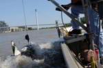
Devastating floods across much of the U.S. were severe and unrelenting during the spring and summer of 2011. When floods happen, USGS crews are among the first-responders. Often working in dangerous conditions, USGS scientists measure streamflow and river levels, repair and install streamgages, measure water quality and changes in sediment flow, and assess river changes. From flood forecasts to difficult decisions about flood management, science is critical for flood preparations and response.
USGS Notes Flood's Quirks
Omaha World-Herald story on the USGS and the Missouri River Flood
Six New Streamflow Gages Available for Flood Forecasting
USGS recently installed six rapid-deployment streamgages to monitor flooding in the Missouri River basin. Four of the streamgages are located in Council Bluffs, two each on Mosquito Creek and Indian Creek. Another is located on Willow Creek near Logan, and the final is located near the intersection of Interstate 29 and State Highway V near Hamburg. Equipment installed at the sites include a non-contact radar sensor and data collection platform that records the height of the water surface at 15-minute intervals. The data are transmitted hourly via satellite and made available to the public via NWISWeb. The streamgages are operated in cooperation with the Omaha District of the U.S. Army Corps of Engineers. For more information, contact the Iowa Water Science Center at (319) 337-4191.
06610502 Indian Creek at Sylvan Drive at Council Bluffs, IA
http://waterdata.usgs.gov/ia/nwis/uv?site_no=06610502
06610504 Indian Creek at US Highway 275 at Council Bluffs, IA
http://waterdata.usgs.gov/ia/nwis/uv?site_no=06610504
06610645 Mosquito Creek at Yellow Pole Road at Council Bluffs, IA
http://waterdata.usgs.gov/ia/nwis/uv?site_no=06610645
06610658 Mosquito Creek upstream of I-29 at Council Bluffs, IA
http://waterdata.usgs.gov/ia/nwis/uv?site_no=06610658
403514095393101 Missouri River Overflow at I-29 near Hamburg, IA
http://waterdata.usgs.gov/ia/nwis/uv/?site_no=403514095393101
Increased Discharge Measurements of Streamgages Located on the Missouri River
In response to flooding on the Missouri River, USGS is currently making weekly discharge measurements at streamgages located at Sioux City, Iowa, and at Decatur, Blair, Omaha, Plattsmouth, Nebraska City, Brownville, and Rulo, Nebraska. Discharge measurements are made three times per week on the Missouri River at Yankton, South Dakota. The data collected in the field are used to verify the current stage-discharge rating for each streamgage, and are also used by the National Weather Service and the U.S. Army Corps of Engineers in support of river forecasting and gate operations. For more information, contact the Iowa Water Science Center at (319) 337-4191.