|
|
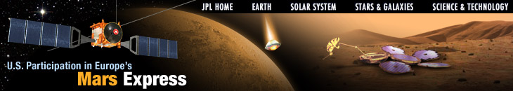
Artists drawing of Mars Express
|
|
 |
|
On June 2, 2003, a small spacecraft backed by a multinational team
left Earth for Mars as part of Earth's search for water and possible
evidence of past or present life on the red planet. Mars Express, which
features an orbiter and a lander, is a European Space Agency mission
designed as a low-cost, fast-track effort. Countries involved include
France, Germany, Great Britain, Ireland, Italy, the Netherlands,
Norway, Russia, Sweden, Spain, Japan, and the United States.
Mars Express launched on a Russian Soyuz/Fregat launch vehicle from
Baikonur, Kazakstan on June 2, 2003. Cruise lasted approximately
seven months, with Mars Orbit Insertion and the Beagle 2 landing scheduled
for December 25, 2003 UT (December 24 in the U.S.).
The seven instruments
on the orbiter are currently making observations at Mars.
U.S. Participation In Mars Express
United States participation includes:
Instruments and Science
- joint development
between NASA's Jet Propulsion Laboratory and the Italian
Space Agency of the radar instrument called MARSIS, which
probes the subsurface of Mars to detect layers of rock, ice and possibly water to a depth of about 5 kilometers
(3 miles)
-
JPL is responsible for the radio frequency system (the integrated
receiver, transmitter and antenna subsystems)
- JPL scientist
Jeffrey Plaut is co-principal investigator
- funding
through NASA's Discovery Program for the
design, construction, and delivery of electron and ion spectrometers
for the ASPERA instrument, which will studies how the solar wind erodes the
martian atmosphere
- NASA funding
for U.S. science participation in Mars Express's science instrument teams
- JPL's Navigation
and Information Facility (NAIF) expertise in the development of software
that supports delivery of Mars Express data (e.g., the spacecraft's position
and other information that aid in the interpretation of scientific data) to
the Planetary Data System, an online repository of mission data available
to scientists worldwide
- JPL's Multimission
Image Processing Laboratory (MIPL) development of software that
converts data from the HRSC camera into a format that is compatible with
existing image processing software, thereby enabling U.S. Co-Investigators
on the science teams to process images further, and into a format
compatible with the Planetary Data System
Navigation and Telecommunications
- NASA/JPL studies
and design tests that allow communications interoperability between
NASA and ESA orbiters and landers at Mars
- NASA provision of
Deep Space Network tracking support
- NASA provision of
navigation support through workshops and technical consultation
|