Climate and Land Use Change
The USGS undertakes scientific research, monitoring, remote sensing, modeling, synthesis, and forecasting to address the effects of climate and land use change on the Nation’s resources. The resulting research and products are provided as the scientific foundation upon which policymakers, natural resource managers, and the public make informed decisions about the management of natural resources on which they and others depend.
Help shape the future of USGS science by weighing in on our Science Strategy planning process.
Climate and Land Use Change Programs

Scientists at the U.S. Geological Survey (USGS) are working to assess both the potential capacities and the potential limitations of the various forms of carbon sequestration and to evaluate their geologic, hydrologic, and ecological consequences. In accordance with the Energy Independence and Security Act of 2007, the USGS has developed scientifically based methods for assessment of biologic and geologic carbon sequestration.
|

The USGS Earth Resources Observation and Science Center (EROS) contributes to the Climate and Land Use Change Mission Area through research and operational activities that enable the understanding of local to global land change. The EROS multidisciplinary staff uses their unique expertise in remote sensing-based science and technologies to carry out basic and applied research, data acquisition, systems engineering, information access and management, and archive preservation to address the Nation’s most critical needs.
|
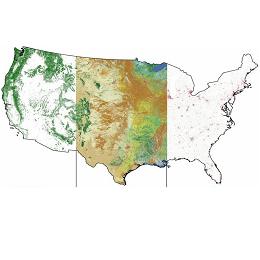
The goal of the USGS Land Change Science (LCS) Program, formerly Geographic Analysis and Monitoring, is to understand the patterns, processes, and consequences of changes in land use, land condition, and land cover at multiple spatial and temporal scales, resulting from the interactions between human activities and natural systems.
|

The Land Remote Sensing Program operates the Landsat satellites and provides the Nation's portal to the largest archive of remotely sensed land data in the world, supplying access to current and historical images. These images serve many purposes from assessing the impact of natural disasters to monitoring global agricultural production.
|
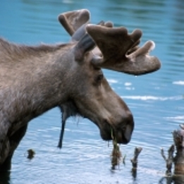
The National Climate Change and Wildlife Science Center responds to the research and management needs of partners and provides science and technical support regarding the impacts of climate change on fish, wildlife and ecological process. The Center is taking the lead on establishing the Department of the Interior regional Climate Science Centers.
|

The USGS Climate and Land Use Change Research and Development Program supports fundamental scientific research to: 1) understand processes controlling Earth system responses to global change over broad temporal and spatial scales; and 2) understand and model impacts of climate and land-cover change on ecosystems and other natural resources.
|
|

