
Water Resources of Pennsylvania
The Pennsylvania Baseline Streamflow Estimator (BaSE)
- Estimate baseline streamflow (minimally altered by regulation, diversion, or mining, and other anthropogenic activities) for ungaged streams in Pennsylvania
- Generate text file of daily mean streamflow for the ungaged site for the period 1960 to 2008
- Create a report that includes streamflow data, exceedance probabilities, basin characteristics, and hydrographs for the ungaged site
 StreamStats for Pennsylvania
StreamStats for Pennsylvania can be used to estimate low-flow, peak-flow, and mean-flow statistics for ungaged and unregulated streams. These streamflow statistics are based on regression equations published in USGS reports. Users should familiarize themselves with the reports before using StreamStats to obtain estimates of streamflow statistics for ungaged sites.
-
StreamStats
Delineate watersheds and estimate streamflow - NWIS Mapper
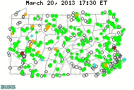
View the locations of sites with USGS water data - WaterWatch
Compare current streamflow to historical record - WaterQualityWatch
View stream-temperature and water-quality monitoring data - Groundwater Watch
Compare current groundwater levels to historical record - Groundwater Recharge
Compare aquifer recharge for 197 watersheds - WaterAlert
Get condition updates by text message or email

The USGS Pennsylvania Water Science Center is your direct link to all kinds of water-resource information. Data collection and interpretive studies are done in cooperation with various local, State, and Federal agencies.
 Surface Water
Streamflow, lake, reservoir, and precipitation data
 Groundwater
Water levels in wells and other aquifer data
 Water Quality
Chemical and biological quality data for surface water and groundwater
 On-demand, current conditions for water data directly to your mobile phone or email. 2 ways to get started:
- Send a text message to WaterNow@usgs.gov containing the USGS Site Number of the gage you want to query
- Send an email message to WaterNow@usgs.gov where either the Subject or the first line of the message contains the USGS Site Number of the gage you want to query
Just What Is a 100-Year Flood Anyway?

Almost everyone has heard the term "100-year flood", but not everyone knows what it really means. A common question is, "we just had a 100-year flood a few years ago, why are we having another one so soon?" The USGS Office of Surface Water has released a poster that explains the concept, probabilistic nature, and inherent uncertainties of a 100-year flood. The poster, entitled "100-Year Flood—It's All About Chance," can be found at http://pubs.usgs.gov/gip/106/.
