NWS Springfield, Missouri Fire Weather
Fire Weather Spot Forecast Requests Via the Internet:
Spot Forecasts are issued for prescribed burns, wildfires, spray projects, or any number of land management activities within our forecast area. Government agencies anywhere within our fire weather forecast area can request a spot forecast.
Click Here For A Spot Forecast
|
|
|
|
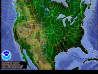
Current Weather Map With Satellite Imagery (from HPC) |
Current Weather Map With Radar Mosaic (from HPC) |
Short Range Forecast Maps (from HPC)
|
Forecast Days 3 to 7 (HPC) |
|
|
|
|
|
|
|
|
National Forecast Overview |
National Weather Hazards |
Radar |
NWS Fire Weather Page |
|
|
Alternative: NWS Ridge 2 Radar Display |
|
Local Fire Weather Text Forecast. Click on one of the shaded counties below to retrieve the fire weather forecast
for that county.
|
Fire Weather Forecast Area: |
|
|
|
|
|
|
|
|
|
|
|
|
|
|
Area Observations (note observation platforms are not operated by the NWS)
|
Regional Observations Map
|
MesoWest (Univ. of Utah) |
Map of Missouri Airport and RAWS Weather Observation Sites |
Meteorological Assimilation Data Ingest System (MADIS) |
Hourly Regional Weather Roundup (NWS Springfield) |
Community Collaborative Rain, Hail and Snow Network (CoCoRaHS) |
NWS GIS Data |
|
Ava/Tidwell Site(NFDRS-SGF) |
Macks Creek (NFDRS-SGF) |
Mt. Vernon (NFDRS-SGF) |
Roby (NFDRS-SGF) |
Ashland |
Carr Creek |
Clinton |
Council Bluffs |
Doniphan |
Farmington |
Sinkin |
State Line, KS |
Sullivan |
TT107, OK (5NNW Seneca, MO) |
|
|
Area Airport Observations (ASOS/AWOS)
|
Missouri |
Branson AWOS |
Camdenton AWOS |
Clinton AWOS |
Farmington ASOS |
Ft. Leonard Wood ASOS |
Joplin ASOS |
Lebanon AWOS |
Monett AWOS |
Neosho AWOS |
Nevada AWOS |
Osage Beach AWOS |
Piedmont AWOS |
Rolla/Vichy ASOS |
Sedalia ASOS |
Springfield ASOS |
Sullivan AWOS |
Warrensburg AWOS |
Warsaw AWOS |
West Plains ASOS |
Whiteman AFB ASOS |
|
|
|
MODOT AWOS Page |
Kansas and Oklahoma
|
Chanute KS ASOS |
Fort Scott KS AWOS |
Grove, OK AWOS |
Parsons, KS ASOS |
Pittsburg, KS AWOS |
|
|
|
Arkansas
|
Bentonville, AR AWOS |
Flippin, AR AWOS |
Harrison, AR ASOS |
Mountain Home, AR ASOS
|
Rogers, AR AWOS |
|
|
|
|
Cook Station Crawford County |
Green Ridge |
Lamar (includes 10hr fuel) |
Mountain Grove (includes 10 hr fuel) |
Versailles |
|
|
|
|
Near Arma, KS |
10 WSW Salem, MO |
|
|
Highway Weather Observations (I-44 corridor) |
MO010 Joplin |
MO11 Fidelity |
MO012 Mt. Vernon |
MO013 Halltown |
MO014 Springfield |
MO015 Marshfield |
MO016 Lebanon |
MO004 Gasconade |
MO005 Waynesville |
MO006 Rolla |
MO007 Sullivan |
|
Nearby Oklahoma Mesonet Stations (far northeast Oklahoma) |
Miami |
Jay |
Westville |
OK-FIRE |
|
|
|
|
|
|
Other Links
|
Fire Weather Annual Operating Plan (.pdf file requires Adobe Acrobat or Adobe Acrobat Reader)
Fire Weather Annual Operating Plan (MS Word Version)
|
Fire Incidents Status (Nationwide)
|
Fire Incidents Mark Twain National Forest |
National Fire and Aviation Management Page (includes Weather Information Management System (WIMS)) |
Wildfire Assessment System (Maps of Various Weather, Fuel Moisture, Drought, Burning Parameters, etc)
|
National Interagency Fire Center |
National Wildland Significant Fire Potential Outlook |
National Interagency Coordination Center |
Eastern Area Coordination Center |
Eastern Area Seven Day Fire Potential Outlook |
Rocky Mountain Area Coordination Center |
Eastern Area Modeling Constortium / Rocky Mountain Center Research Center / Southern High Resolution Modeling Consortium |
Rocky Mountain Center/Research Center USFS |
Mark Twain National Forest - Current Conditions |
U.S. Forest Service Fire and Aviation Page |
Missouri Department of Conservation Forestry / Wildfire In Missouri / Missouri Wildfire Statistics |
Healthy Forests and Rangelands - National Fire Plan
|
Joint Fire Science Program |
AIRNow.gov (Air Quality Monitoring Page)
|
Firewise Communities |
Neighboring National Weather Service Office's Fire Weather Pages
|
WFO Paducah, KY |
WFO Pleasant Hill, MO |
WFO Little Rock, AR |
WFO St. Louis, MO |
WFO Tulsa, OK |
WFO Wichita, KS |
|
|