NWS Jacksonville » Tropical Weather   weather.gov/jax/tropical   National Hurricane Center   Hurricane Preparedness   Ready.gov: Hurricanes 

New Expermental Products:

Coastal NWS Weather Offices now produce a suite of graphics that serves to complement the corresponding Hurricane Local Statement (HLS) text product. They are hosted on an experimental NWS web site and provide an internet-based decision-support service consisting of at least four graphics: high wind impacts, coastal flooding impacts, inland flooding impacts, and tornado impacts. For the Atlantic/Gulf 2012 Hurricane Season, the graphics will be generated and posted by the 23 coastal NWS Offices whenever Tropical Cyclone Watches and/or Warnings are in effect for their area.

The NWS Jacksonville - Interactive Hurricane Local Statement - Text Reader - GHLS: page is an interactive Text Reader for the segmented Hurricane Local Statement (HLS) text product. By segmenting the HLS product into corresponding geographic areas of concern, it is designed to make it easier to extract the desired local information. This page has a suite of BLANK graphic backgrounds in 5 tabs that depict Wind, Coastal Flood, Inland Flood Tornadoes and Marine areas overlaid with the segmented HLS Text product. These tabs are active whenever tropical cyclone watches/warnings are in effect locally, and refreshed with each issuance of the HLS by your local forecast office.

The Tropical Cyclone Impact Graphics The purpose of Tropical Cyclone Impacts (TCI) Graphics is to facilitate the proportionate implementation of your emergency action plan based on descriptions of potential impact unique to your area. The intent is to invoke a measured response that is reasonable and responsible by considering the composite of plausible outcomes in context of the event at hand. These TCIG images are designed to complement the Interactive HLS - GHLS and provide a graphical .png image, KML or google map overview of the potential impacts for threat assessment. The assessment scheme takes into account the forecast magnitude of the hazard, along with the associated uncertainty of the forecast. They provide an "at-a-glance" summary of potential impacts that have the reasonable chance to occur.
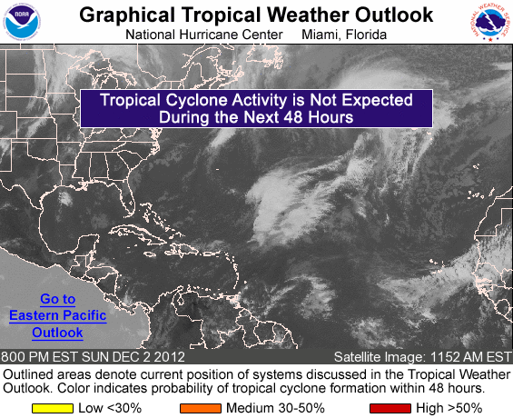
Atlantic Tropical Overview - Click for National Hurricane Center

 National Hurricane Center Graphics 
No advisories found
 Tropical Products  
Local Area Products Tropical Statements
Local Tropical Statement: TextRSS
Post-Storm Report: TextRSS
Local Storm Reports: TextRSS
Local Tide Information
Local:
Elsewhere:
NHC Forecast Tracks, Public & Marine Advisories, Discussions, & Wind Speed Probabilities
Tropical Depression #:
By Product Number:
1 2 3 4 5
Named Storms:  
 Additional National Hurricane Center Products
Tropical Weather Outlook: TextAudioGraphicalRSS
TAFB Tropical Weather Discussion
Mariners' 1-2-3 Rule Graphic
Reconnaissance Plan of the Day: TodayTomorrow (Decode Key)
Vortex Messages (Decode Key)
Monthly Tropical Weather Summary
Other Media: Audio Podcasts*Live Video*GIS DataRSS Feeds
NHC Email Lists
* available on the hour when watch/warning issued for US coastline
 
 Saffir-Simpson Scale More
Category Winds
(mph)
TD < 39
TS 39-73
1 74-95
2 96-110
3 111-130
4 131-155
5 155 >
 NHC Forecast Error
Forecast
Hour
Average Error
NM Miles
12 36 41
24 59 68
36 79 91
48 98 113
72 144 166
96 190 219
120 239 275
 Tropical Satellite Loop Sectors MORE 
Region Source Infra-red Visible Water Vapor
 Wide View NASA
 NW Africa EUMETSAT
 E North Atlantic EUMETSAT
 S North Atlantic NASA
 Middle North Atlantic NASA
 W North Atlantic NASA
 Gulf of Mexico NASA
 E Caribbean NASA
 W Caribbean NASA
 Tropical Radar Imagery TOP 
N Caribbean
San Juan, PRBahamas
Pico San Juan, CubaKey West, FL
US Atlantic Coast
Miami, FLMelbourne, FLJacksonville, FL
Charleston, SCWilmington, NC
Newport/Morehead, NCWakefield, VA
US Gulf of Mexico Coast
Tampa, FLTallahassee, FLMobile, AL
New Orleans/Baton Rouge, LALake Charles, LA
Houston/Galveston, TXBrownsville, TX
 Hurricane Related Links TOP 
General Information Scientific & Historical Info
Florida Evacuation & Shelter Info
Preparedness/Safety Tips
Atlantic Storm NamesPronunciation
General Information (FAQ)
Official NOAA Hurricane Outlook
Storm Shutter FAQ
Hurricane Hunters
NHC Track Forecast Cone
Georgia Evacuation & Shelter Info
National Hurricane Center
Saffir-Simpson Scale
Tracking Chart: NHC pdfRegional
Interactive Breakpoint Map
Glossary of Terms
NHC Text Product Descriptions
User's Guide to NHC Products (pdf)
Historical Storm Tracks
Univ. of Wisconsin Tropical Page
Local Research
Satellite Position/Intensity
Max. Potential Hurricane Intensity
Area History
Hurricane Potential:  GOMEX/CaribbeanAtlantic
 Monthly Tropical Cyclone Probability Maps INFO 
 Type   Jun   Jul   Aug   Sep   Oct   Nov   Annual 
 Named storms
 Hurricanes
 Major Hurricanes NA NA NA
 Storm Distance Calculator INFO TOP 
  City   Storm   Distance
 Lat:   Lat:  Mi
 Lon:   Lon:  Km

 Questions or comments about the Jacksonville tropical program?  Email Steve Letro & Al Sandrik

 Want to schedule a hurricane talk for your group?  Email Steve Letro, Meteorologist-in-Charge

 Want information about Pacific storms?  Visit the National Hurricane Center webpage

 
 Tropical ActivityINFO 
Hurricane season runs from June 1st-November 30th.  Be sure to check our site for the latest tropical info.
 
 2013 Storm NamesINFO 
Andrea
Barry
Chantal
Dorian
Erin
Fernand
Gabrielle
Humberto
Ingrid
Jerry
Karen
Lorenzo
Melissa
Nestor
Olga
Pablo
Rebekah
Sebastien
Tanya
Van
Wendy
Other years
 
 Past StormsMORE INFO 
2012
2011
2010
2009
2008
2007
 Storms of Local Interest
   f  NHC@Facebook
   f  NWSJax@Facebook
Learn More...J E T S T R E A M
Online Weather School

USA.gov is the U.S. government's official web portal to all federal, state and local government web resources and services.