
Geography
You are here: Census.gov › Geography › Maps & Data › Census Data Mapper - Beta
Census Data Mapper - Beta
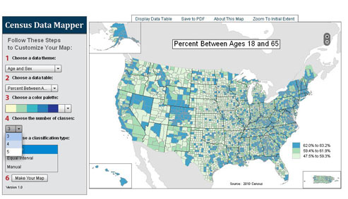
The Census Data Mapper is a web mapping application intended to provide users with a simple interface to view, save and print county-based demographic maps of the United States. The data are from the 2010 Census.
Please click on the image or link below to launch the application.
Application Requirements:
- To view this application, you will need the Adobe Flash Player
 available for free from Adobe.
 - To save and print a map, you will need the Adobe® Reader® available for free from Adobe.
- To save tabular data, you will need Microsoft Excel or the Microsoft® Excel® Viewer available for free from Microsoft®.
[PDF] or  denotes a file in Adobe’s Portable Document Format. To view the file, you will need the Adobe® Reader® available free from Adobe.
[Excel] or the letters [xls] indicate a document is in the Microsoft® Excel® Spreadsheet Format (XLS). To view the file, you will need the Microsoft® Excel® Viewer available for free from Microsoft®.
This symbol indicates a link to a non-government web site. Our linking to these sites does not constitute an endorsement of any products, services or the information found on them. Once you link to another site you are subject to the policies of the new site.
denotes a file in Adobe’s Portable Document Format. To view the file, you will need the Adobe® Reader® available free from Adobe.
[Excel] or the letters [xls] indicate a document is in the Microsoft® Excel® Spreadsheet Format (XLS). To view the file, you will need the Microsoft® Excel® Viewer available for free from Microsoft®.
This symbol indicates a link to a non-government web site. Our linking to these sites does not constitute an endorsement of any products, services or the information found on them. Once you link to another site you are subject to the policies of the new site.
 Facebook
 Twitter
 Flickr
 YouTube