Hazardous Weather Outlook
|
Hazard Specific Graphics |
|||
|
Thunderstorms |
Flooding |
Winter Weather |
|
|
Wind and Fog |
Excessive Temperatures |
Fire Danger |
|
|
2-3 Day Hazards Outlook |
4-7 Day Hazards Outlook |
||
View only the product text for printing.
000
FLUS43 KFSD 051034
HWOFSD

HAZARDOUS WEATHER OUTLOOK
NATIONAL WEATHER SERVICE SIOUX FALLS SD
0427 AM CST TUE MAR 05 2013

SDZ038>040-050-052>071-MNZ071-072-080-081-089-090-097-098-
IAZ001>003-012>014-020>022-031-032-NEZ013-014-061200-
AURORA-BEADLE-BON HOMME-BROOKINGS-BRULE-BUENA VISTA IA-
CHARLES MIX-CHEROKEE IA-CLAY-CLAY IA-COTTONWOOD MN-DAKOTA NE-
DAVISON-DICKINSON IA-DIXON NE-DOUGLAS-GREGORY-HANSON-HUTCHINSON-
IDA IA-JACKSON MN-JERAULD-KINGSBURY-LAKE-LINCOLN-LINCOLN MN-
LYON IA-LYON MN-MCCOOK-MINER-MINNEHAHA-MOODY-MURRAY MN-NOBLES MN-
OBRIEN IA-OSCEOLA IA-PIPESTONE MN-PLYMOUTH IA-ROCK MN-SANBORN-
SIOUX IA-TURNER-UNION-WOODBURY IA-YANKTON-
0427 AM CST TUE MAR 05 2013

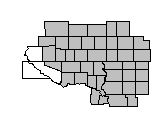
THIS HAZARDOUS WEATHER OUTLOOK IS FOR SOUTHEAST SOUTH DAKOTA...
SOUTHWEST MINNESOTA...NORTHWEST IOWA...AND NORTHEAST NEBRASKA.

.DAY ONE...TODAY AND TONIGHT

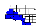
WINTER WEATHER...
LIGHT SNOW WILL SPREAD ACROSS THE AREA THROUGH THE MORNING...THEN
DIMINISH FROM WEST TO EAST DURING THE LATE MORNING AND AFTERNOON.
ANY ADDITIONAL ACCUMULATION WILL BE GENERALLY LESS THAN HALF AN
INCH.

WIND AND FOG...
NORTHWESTERLY WINDS WILL CONTINUE TO INCREASE ACROSS THE AREA
THROUGH THE MORNING.  THE STRONGEST WINDS WILL BE LOCATED THROUGH
THE MISSOURI RIVER CORRIDOR...BECOMING SUSTAINED AT 25 TO 35 MPH
WITH GUSTS TO 45 MPH. WINDS WILL THEN BEGIN TO TAPER DOWN DURING
THE LATE AFTERNOON.

.DAYS TWO THROUGH SEVEN...WEDNESDAY THROUGH MONDAY

NO HAZARDOUS WEATHER IS EXPECTED AT THIS TIME.

.SPOTTER INFORMATION STATEMENT...

SPOTTER ACTIVATION WILL NOT BE NEEDED TODAY AND TONIGHT.

&&

FOR MORE INFORMATION PLEASE VISIT OUR WEBSITE AT
WWW.WEATHER.GOV/SIOUXFALLS. THIS INCLUDES THE GRAPHICAL HAZARDOUS
WEATHER OUTLOOK.

$$
Check our Local Products page for any Watches, Warnings or Advisories which may be in effect.
Additional Severe Weather Products
From the Storm Prediction Center:
 Mesoscale Discussions |
 Convective Watches |
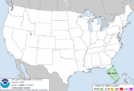 Day 1 Convective Outlook |
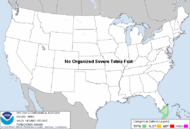 Day 2 Convective Outlook |
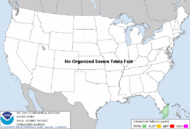 Day 3 Convective Outlook |
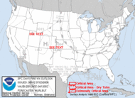 Day 1 Fire Weather Outlook |
 Day 2 Fire Weather Outlook |
From the Climate Prediction Center:
- Web Site Owner:
- National Weather Service
- Sioux Falls, SD Weather Forecast Office
- 26 Weather Lane
- Sioux Falls, SD 57104-0198
- 605-330-4247
- Page Author: FSD Webmaster
- Web Master's E-mail: w-fsd.webmaster@noaa.gov
- Page last modified: August 1st 2012 12:45 AM


