USGS - science for a changing world

Michigan Water Science Center

Home Data/Information Projects Publications Droughtwatch Contact USGS

DATA CENTER

Click for real-time water data for Michigan.

ABOUT THE Michigan
WSC

USGS in Your State

USGS Water Science Centers are located in each state.

 [Map: There is a USGS Water Science Center office in each State.] Washington Oregon California Idaho Nevada Montana Wyoming Utah Colorado Arizona New Mexico North Dakota South Dakota Nebraska Kansas Oklahoma Texas Minnesota Iowa Missouri Arkansas Louisiana Wisconsin Illinois Mississippi Michigan Indiana Ohio Kentucky Tennessee Alabama Pennsylvania West Virginia Georgia Florida Caribbean Alaska Hawaii New York Vermont New Hampshire Maine Massachusettes South Carolina North Carolina Rhode Island Virginia Connecticut New Jersey Maryland-Delaware-D.C.

USGS: Your Source For Water Science You Can Use

Welcome to the U.S. Geological Survey (USGS) Web page for the water resources of Michigan; this is your direct link to all kinds of water information. Here you'll find information on Michigan's streams, ground water, water quality, and many other topics. more...

Newsworthy

Current: Watches, Warnings or Advisories for Michigan from the National Weather Service


January 31, 2013: Cottage owners warned by National Weather Service as White River floods its banks By Stephen Kloosterman at "Michigan Live"


What we're doing...


Groundwater
Groundwater picture
    Microbiology
Microbiology picture
    Surface Water
Surface Water picture
    Water Quality
Water Quality picture
    NAWQA
NAWQA picture
    GLRI
GLRI picture

Of Interest...

Michigan Bacteriological Research Laboratory (MI-BaRL)

Awesome Aquifers! Hydrologists Judge State Science Olympiad TournamentThe USGS Michigan Water Science Center Bacteriological Research Laboratory (MI-BaRL) in Lansing, MI provides a variety of modern analytical approaches to understand bacteriological contamination and microbial ecology in diverse aquatic environments. The MI-BaRL laboratory has examined beach microbiology, the occurrence of antibiotic-resistant bacteria in surface water, and the occurrence of microbial pathogens in surface water, ground water, and in drinking water supplies. In addition, several studies conducted in the MI-BaRL have examined the ecology of microbial communities in different settings, including sulfur rich springs, arsenic and hydrocarbon contaminated groundwater, and wastewater-contaminated surface and groundwater.

Featured Publication:

Pathogenic Bacteria and Microbial-Source Tracking Markers in Brandywine Creek Basin, Pennsylvania and Delaware, 2009–10Publication cover - SIR2011-5164

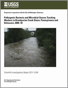
The City of Wilmington, Delaware, is in the downstream part of the Brandywine Creek Basin, on the main stem of Brandywine Creek. Wilmington uses this stream, which drains a mixed-land-use area upstream, for its main drinking-water supply. Because the stream is used for drinking water, Wilmington is in need of information about the occurrence and distribution of specific fecally derived pathogenic bacteria (disease-causing bacteria) and their relations to commonly measured fecal-indicator bacteria (FIB), as well as information regarding the potential sources of the fecal pollution and pathogens in the basin.

This study focused on five routinely sampled sites within the basin, one each on the West Branch and the East Branch of Brandywine Creek and at three on the main stem below the confluence of the West and East Branches. These sites were sampled monthly for 1 year. Targeted event samples were collected on two occasions during high flow and two occasions during normal flow.

Silver Lake Nutrient Loading Study (Oceana County, MI)

Silver Lake, MI photo

The Silver Lake Nutrient Loading Study began in August 2012 between the Silver Lake Improvement Board and project partners, which include the U.S. Geological Survey (USGS), the Annis Water Resources Institute (AWRI) , and Progressive AE. Recent persistent algal blooms, high phosphorus concentrations during summer months, as well as a decrease in water clarity underscore a need to characterize water and nutrient sources to Silver Lake (located in Oceana County, MI). The objective of the Silver Lake Nutrient study is to characterize the nutrient conditions and hydrologic inputs and outputs to Silver Lake in order to develop a water budget and nutrient budget for the lake. Once identified, information on nutrient sources can be used by the Silver Lake Improvement Board to implement management practices that best protect Silver Lake from potential negative effects associated with elevated nutrient concentrations.

In addition to the website (http://mi.water.usgs.gov/projects/silverlake/index.html), you can also follow project progress on Twitter at @USGS_Silverlake

Predicting Water Clarity Overview

Lake Water-Clarity Assessment for Michigan Inland Lakes

The U.S. Geological Survey (USGS), in cooperation with the Michigan Department of Environmental Quality (MDEQ), has been monitoring the quality of inland lakes in Michigan through the Lake Water Quality Assessment monitoring program. This program is funded through the Michigan Clean Michigan Initiative, and the USGS Cooperative Program. However, only a portion of Michigan's inland lakes can be conventionally sampled each year. A technique was developed by USGS, modeled after Olmanson and others (2001), to predict water clarity and corresponding trophic state index (TSI) values based on the Carlson's Trophic State Index (TSI) in inland lakes greater than 20 acres using satellite remote sensing data.


Cover of Scientific Investigations Map 3135

Publication on Predicting Water Clarity

Predicting Lake Trophic State by Relating Secchi–Disk Transparency Measurements to Landsat–Satellite Imagery for Michigan Inland Lakes, 2003–05 and 2007–08
Scientific Investigations Report 2011–5007
By L.M. Fuller, R.S. Jodoin, and R.J. Minnerick

For the full report click here.

Michigan Lake Water Clarity Interactive Map Viewer

Michigan Lake Water Clarity Interactive Map Viewer


Publication cover of USGS Data Series 723

Chemicals of emerging concern in water and bottom sediment in Great Lakes areas of concern, 2010 to 2011-Collection methods, analyses methods, quality assurance, and data

2012, Lee, Kathy E.; Langer, Susan K.; Menheer, Michael A.; Foreman, William T.; Furlong, Edward T.; Smith, Steven G. USGS Data Series: 723


Older News

Follow Us on Twitter

Note: These are third-party services. DOI and USGS link policies apply.

Recent Publications


Featured Projects in Michigan

Current Drought Conditions

Waterwatch Drought (USGS) - United States and Michigan

U.S. Drought Monitor (NOAA) - United States and Michigan

Questions?


Ask-A-Geologist have a question?

USGS Home Water Climate Change Core Science Ecosystems Energy & Environmental Health Hazards

Accessibility FOIA Privacy Policies and Notices

Take Pride in America logo USA.gov logo U.S. Department of the Interior | U.S. Geological Survey
URL: http://mi.water.usgs.gov/index.html
Page Contact Information: gs-w-milns_webmaster@usgs.gov
Page Last Modified: Friday, 01-Mar-2013 13:48:48 EST

04060993: Flow=1080cfs,Stage=5.28ft,2013-03-20 13:30,High,BRULE RIVER AT US HIGHWAY 2 NEAR FLORENCE, WI 04105700: Flow=34cfs,Stage=1.19ft,2013-03-20 14:00,Low,AUGUSTA CREEK NEAR AUGUSTA, MI 04060500: Flow=35cfs,Stage=3.81ft,Floodstage=11ft,2013-03-20 14:30,Low,IRON RIVER AT CASPIAN, MI 04064500: Flow=741cfs,Stage=3.62ft,Floodstage=7ft,2013-03-20 14:00,>90,PINE RIVER BELOW PINE R POWERPLANT NR FLORENCE, WI 04101800: Flow=269cfs,Stage=5.82ft,Floodstage=8ft,2013-03-20 15:00,<10,DOWAGIAC RIVER AT SUMNERVILLE, MI 04062000: Flow=117cfs,Stage=3.56ft,2013-03-20 13:30,76-90,PAINT RIVER NEAR ALPHA, MI 04176000: Flow=421cfs,Stage=6.84ft,Floodstage=18ft,2013-03-20 14:15,10-24,RIVER RAISIN NEAR ADRIAN, MI 04173500: Flow=85cfs,Stage=6.64ft,Floodstage=12ft,2013-03-20 14:45,10-24,MILL CREEK NEAR DEXTER, MI 04167000: Flow=70cfs,Stage=2.93ft,Floodstage=10ft,2013-03-20 14:15,10-24,MIDDLE RIVER ROUGE NEAR GARDEN CITY, MI 04166500: Flow=105cfs,Stage=5.85ft,Floodstage=15ft,2013-03-20 14:45,10-24,RIVER ROUGE AT DETROIT, MI 04166100: Flow=45cfs,Stage=4.60ft,2013-03-20 14:45,10-24,RIVER ROUGE AT SOUTHFIELD, MI 04166000: Flow=21cfs,Stage=1.97ft,2013-03-20 14:00,10-24,RIVER ROUGE AT BIRMINGHAM, MI 04165500: Flow=565cfs,Stage=5.48ft,Floodstage=16ft,2013-03-20 14:48,10-24,CLINTON RIVER AT MORAVIAN DRIVE AT MT. CLEMENS, MI 04164100: Flow=17cfs,Stage=1.39ft,2013-03-20 15:00,10-24,EAST POND CREEK AT ROMEO, MI 04164000: Flow=378cfs,Stage=7.26ft,Floodstage=16ft,2013-03-20 13:30,10-24,CLINTON RIVER NEAR FRASER, MI 04161580: Flow=16cfs,Stage=2.04ft,2013-03-20 13:30,10-24,STONY CREEK NEAR ROMEO, MI 04160600: Flow=66cfs,Stage=2.02ft,2013-03-20 14:15,10-24,BELLE RIVER AT MEMPHIS, MI 04159492: Flow=224cfs,Stage=4.67ft,2013-03-20 14:15,10-24,BLACK RIVER NEAR JEDDO, MI 04146063: Flow=191cfs,Stage=2.32ft,2013-03-20 13:15,10-24,SOUTH BRANCH FLINT RIVER NEAR COLUMBIAVILLE,MI 04118500: Flow=259cfs,Stage=4.49ft,Floodstage=8ft,2013-03-20 13:30,10-24,ROGUE RIVER NEAR ROCKFORD, MI 04117000: Flow=6.4cfs,Stage=2.03ft,2013-03-20 15:00,10-24,QUAKER BROOK NEAR NASHVILLE, MI 04108600: Flow=62cfs,Stage=3.82ft,2013-03-20 14:00,10-24,RABBIT RIVER NEAR HOPKINS, MI 04063500: Flow=981cfs,Stage=6.71ft,Floodstage=12ft,2013-03-20 14:30,10-24,MENOMINEE RIVER AT TWIN FALLS NEAR IRON MT, MI 04063000: Flow=838cfs,Stage=3.26ft,Floodstage=9ft,2013-03-20 15:00,10-24,MENOMINEE RIVER NEAR FLORENCE, WI 04057800: Flow=15cfs,Stage=1.88ft,Floodstage=6.5ft,2013-03-20 14:15,10-24,MIDDLE BRANCH ESCANABA RIVER AT HUMBOLDT, MI 04041500: Flow=175cfs,Stage=3.82ft,2013-03-20 14:15,10-24,STURGEON RIVER NEAR ALSTON, MI 04036000: Flow=88cfs,Stage=2.00ft,Floodstage=8ft,2013-03-20 15:00,10-24,WEST BRANCH ONTONAGON RIVER NEAR BERGLAND, MI 04033500: Flow=20cfs,Stage=3.49ft,2013-03-20 14:15,10-24,BOND FALLS CANAL NEAR PAULDING, MI 04184500: Flow=207cfs,Stage=9.65ft,Floodstage=15ft,2013-03-20 16:00,25-75,Bean Creek at Powers OH 04176500: Flow=849cfs,Stage=3.63ft,Floodstage=9ft,2013-03-20 14:45,25-75,RIVER RAISIN NEAR MONROE, MI 04175600: Flow=150cfs,Stage=3.70ft,2013-03-20 13:30,25-75,RIVER RAISIN NEAR MANCHESTER, MI 04174500: Flow=695cfs,Stage=13.04ft,Floodstage=16ft,2013-03-20 14:15,25-75,HURON RIVER AT ANN ARBOR, MI 04172000: Flow=295cfs,Stage=4.56ft,Floodstage=6.5ft,2013-03-20 14:15,25-75,HURON RIVER NEAR HAMBURG, MI 04170500: Flow=142cfs,Stage=1.75ft,2013-03-20 15:00,25-75,HURON RIVER NEAR NEW HUDSON, MI 04168000: Flow=74cfs,Stage=3.91ft,Floodstage=10ft,2013-03-20 13:30,25-75,LOWER RIVER ROUGE AT INKSTER, MI 04164500: Flow=146cfs,Stage=5.86ft,Floodstage=15ft,2013-03-20 15:00,25-75,NORTH BRANCH CLINTON RIVER NEAR MT. CLEMENS, MI 04161800: Flow=56cfs,Stage=2.75ft,2013-03-20 15:00,25-75,STONY CREEK NEAR WASHINGTON, MI 04161540: Flow=67cfs,Stage=2.17ft,2013-03-20 15:00,25-75,PAINT CREEK AT ROCHESTER, MI 04161000: Flow=175cfs,Stage=1.90ft,2013-03-20 15:00,25-75,CLINTON RIVER AT AUBURN HILLS, MI 04156000: Flow=2940cfs,Stage=12.88ft,Floodstage=24ft,2013-03-20 13:30,25-75,TITTABAWASSEE RIVER AT MIDLAND, MI 04155500: Flow=475cfs,Stage=3.60ft,Floodstage=12ft,2013-03-20 14:45,25-75,PINE RIVER NEAR MIDLAND, MI 04154000: Flow=383cfs,Stage=3.67ft,Floodstage=8ft,2013-03-20 14:15,25-75,CHIPPEWA RIVER NEAR MOUNT PLEASANT, MI 04151500: Flow=838cfs,Stage=6.57ft,Floodstage=17ft,2013-03-20 14:45,25-75,CASS RIVER AT FRANKENMUTH, MI 04148500: Flow=1300cfs,Stage=5.48ft,Floodstage=13ft,2013-03-20 14:00,25-75,FLINT RIVER NEAR FLINT, MI 04148140: Flow=97cfs,Stage=4.72ft,Floodstage=10ft,2013-03-20 14:00,25-75,KEARSLEY CREEK NEAR DAVISON, MI 04147500: Flow=741cfs,Stage=6.14ft,2013-03-20 13:15,25-75,FLINT RIVER NEAR OTISVILLE, MI 04146000: Flow=63cfs,Stage=15.99ft,2013-03-20 14:00,25-75,FARMERS CREEK NEAR LAPEER, MI 04144500: Flow=586cfs,Stage=3.56ft,Floodstage=7ft,2013-03-20 14:15,25-75,SHIAWASSEE RIVER AT OWOSSO, MI 04142000: Flow=349cfs,Stage=2.21ft,Floodstage=6ft,2013-03-20 14:30,25-75,RIFLE RIVER NEAR STERLING, MI 04136500: Flow=1050cfs,Stage=3.07ft,2013-03-20 14:00,25-75,AU SABLE RIVER AT MIO, MI 04135700: Flow=236cfs,Stage=4.91ft,2013-03-20 14:30,25-75,SOUTH BRANCH AU SABLE RIVER NEAR LUZERNE, MI 04133501: Flow=546cfs,Stage=12.05ft,2013-03-20 14:30,25-75,THUNDER BAY RIVER AT HERRON ROAD NEAR BOLTON, MI 04128990: Flow=71cfs,Stage=2.35ft,2013-03-20 13:45,25-75,PIGEON RIVER NEAR VANDERBILT, MI 04127997: Flow=214cfs,Stage=2.82ft,2013-03-20 14:30,25-75,STURGEON RIVER AT WOLVERINE, MI 04127800: Flow=183cfs,Stage=3.04ft,2013-03-20 14:30,25-75,JORDAN RIVER NEAR EAST JORDAN, MI 04125460: Flow=301cfs,Stage=4.23ft,2013-03-20 14:15,25-75,PINE RIVER AT HIGH SCHOOL BRIDGE NR HOXEYVILLE, MI 04124500: Flow=30cfs,Stage=2.17ft,2013-03-20 14:15,25-75,EAST BRANCH PINE RIVER NEAR TUSTIN, MI 04124000: Flow=1230cfs,Stage=12.49ft,Floodstage=15ft,2013-03-20 13:45,25-75,MANISTEE RIVER NEAR SHERMAN, MI 04122500: Flow=1020cfs,Stage=2.82ft,Floodstage=5.5ft,2013-03-20 15:00,25-75,PERE MARQUETTE RIVER AT SCOTTVILLE, MI 04122200: Flow=569cfs,Stage=2.82ft,Floodstage=6ft,2013-03-20 13:45,25-75,WHITE RIVER NEAR WHITEHALL, MI 04122100: Flow=22cfs,Stage=11.37ft,2013-03-20 14:30,25-75,BEAR CREEK NEAR MUSKEGON, MI 04121500: Flow=1540cfs,Stage=8.40ft,Floodstage=12ft,2013-03-20 13:30,25-75,MUSKEGON RIVER AT EVART, MI 04121300: Flow=155cfs,Stage=3.21ft,2013-03-20 14:15,25-75,CLAM RIVER AT VOGEL CENTER, MI 04119000: Flow=6910cfs,Stage=6.88ft,Floodstage=18ft,2013-03-20 14:00,25-75,GRAND RIVER AT GRAND RAPIDS, MI 04117500: Flow=470cfs,Stage=4.04ft,Floodstage=7ft,2013-03-20 14:15,25-75,THORNAPPLE RIVER NEAR HASTINGS, MI 04116000: Flow=3420cfs,Stage=12.18ft,Floodstage=21ft,2013-03-20 14:45,25-75,GRAND RIVER AT IONIA, MI 04115000: Flow=721cfs,Stage=7.24ft,Floodstage=9ft,2013-03-20 14:15,25-75,MAPLE RIVER AT MAPLE RAPIDS, MI 04114498: Flow=291cfs,Stage=3.84ft,Floodstage=7ft,2013-03-20 14:45,25-75,LOOKING GLASS RIVER NEAR EAGLE, MI 04114000: Flow=1230cfs,Stage=6.63ft,Floodstage=12ft,2013-03-20 13:30,25-75,GRAND RIVER AT PORTLAND, MI 04113000: Flow=1260cfs,Stage=4.41ft,Floodstage=11ft,2013-03-20 14:45,25-75,GRAND RIVER AT LANSING, MI 04112500: Flow=254cfs,Stage=3.97ft,Floodstage=7ft,2013-03-20 13:30,25-75,RED CEDAR RIVER AT EAST LANSING, MI 04112000: Flow=6.4cfs,Stage=2.28ft,2013-03-20 14:45,25-75,SLOAN CREEK NEAR WILLIAMSTON, MI 04111000: Flow=710cfs,Stage=3.11ft,2013-03-20 15:00,25-75,GRAND RIVER NEAR EATON RAPIDS, MI 04109000: Flow=238cfs,Stage=10.80ft,Floodstage=14ft,2013-03-20 13:30,25-75,GRAND RIVER AT JACKSON, MI 04108800: Flow=66cfs,Stage=2.91ft,2013-03-20 15:00,25-75,MACATAWA RIVER AT STATE ROAD NEAR ZEELAND, MI 04106400: Flow=8.5cfs,Stage=2.42ft,2013-03-20 13:30,25-75,WEST FORK PORTAGE CREEK AT KALAMAZOO, MI 04106000: Flow=1280cfs,Stage=4.84ft,Floodstage=9ft,2013-03-20 14:15,25-75,KALAMAZOO RIVER AT COMSTOCK, MI 04105500: Flow=891cfs,Stage=3.72ft,Floodstage=9ft,2013-03-20 14:45,25-75,KALAMAZOO RIVER NEAR BATTLE CREEK, MI 04105000: Flow=332cfs,Stage=1.27ft,Floodstage=4ft,2013-03-20 14:15,25-75,BATTLE CREEK AT BATTLE CREEK, MI 04103500: Flow=381cfs,Stage=4.53ft,Floodstage=8ft,2013-03-20 13:15,25-75,KALAMAZOO RIVER AT MARSHALL, MI 04102700: Flow=138cfs,Stage=4.22ft,2013-03-20 15:00,25-75,SOUTH BRANCH BLACK RIVER NEAR BANGOR, MI 04102500: Flow=549cfs,Stage=7.24ft,Floodstage=11ft,2013-03-20 15:00,25-75,PAW PAW RIVER AT RIVERSIDE, MI 04101000: Flow=4200cfs,Stage=20.20ft,Floodstage=24ft,2013-03-20 14:30,25-75,ST. JOSEPH RIVER AT ELKHART, IN 04099750: Flow=455cfs,Stage=4.35ft,Floodstage=6ft,2013-03-20 14:15,25-75,PIGEON RIVER NEAR SCOTT, IN 04099000: Flow=2510cfs,Stage=4.43ft,Floodstage=8ft,2013-03-20 14:15,25-75,ST. JOSEPH RIVER AT MOTTVILLE, MI 04097500: Flow=1940cfs,Stage=4.99ft,Floodstage=7ft,2013-03-20 14:45,25-75,ST. JOSEPH RIVER AT THREE RIVERS, MI 04096405: Flow=295cfs,Stage=4.57ft,Floodstage=6.5ft,2013-03-20 14:00,25-75,ST. JOSEPH RIVER AT BURLINGTON, MI 04062500: Flow=432cfs,Stage=3.30ft,Floodstage=8ft,2013-03-20 13:15,25-75,MICHIGAMME RIVER NEAR CRYSTAL FALLS, MI 04057814: Flow=25cfs,Stage=2.27ft,2013-03-20 14:30,25-75,GREENWOOD RELEASE NEAR GREENWOOD, MI 04057813: Flow=13cfs,Stage=1.22ft,2013-03-20 15:00,25-75,GREENWOOD DIVERSION NEAR GREENWOOD, MI 04037500: Flow=34cfs,Stage=4.58ft,2013-03-20 15:00,25-75,CISCO BRANCH ONTONAGON R AT CISCO LAKE OUTLET, MI 450415085153501: Stage=7.34ft,2013-03-20 13:45,Not ranked,INTERMEDIATE LAKE AT CENTRAL LAKE, MI 442805084411001: Stage=4.96ft,2013-03-20 13:30,Not ranked,HIGGINS LAKE NEAR ROSCOMMON, MI 442409084274001: Stage=6.22ft,2013-03-20 14:00,Not ranked,LAKE ST HELEN AT ST HELEN, MI 442400084472801: Stage=8.47ft,2013-03-20 13:30,Not ranked,HOUGHTON LAKE NR HOUGHTON LAKE HEIGHTS, MI 425443083472501: Stage=0.237ft,2013-03-20 15:00,Not ranked,GENESEE CO. FARM TILE SITE 01 NR SWARTZ CREEK, MI 425440083472401: Stage=0.003ft,2013-03-20 15:00,Not ranked,GENESEE COUNTY MONITOR SITE 01 NR SWARTZ CREEK, MI 0412220999: Stage=6.40ft,2013-03-20 14:55,Not ranked,HUNTER CREEK AT NORTH SHORE DRIVE NEAR MEARS, MI 041482663: Stage=2.90ft,2013-03-20 15:00,Not ranked,ALGER CREEK AT HILL ROAD NEAR SWARTZ CREEK, MI 05390100: Stage=79.91ft,Floodstage=82ft,2013-03-20 14:00,Not ranked,LAC VIEUX DESERT NEAR LAND O\'LAKES, WI 04174518: Flow=4.4cfs,Stage=3.12ft,2013-03-20 14:30,Not ranked,MALLETTS CREEK AT ANN ARBOR, MI 04174514: Flow=5.6cfs,Stage=2.02ft,2013-03-20 14:15,Not ranked,MALLETTS CREEK AT DOYLE PARK AT ANN ARBOR, MI 04174490: Flow=1.3cfs,Stage=1.75ft,2013-03-20 14:55,Not ranked,ALLEN CREEK AT MOUTH AT ANN ARBOR, MI 04170490: Stage=12.75ft,2013-03-20 13:00,Not ranked,KENT LAKE NEAR NEW HUDSON, MI 04168580: Flow=3.7cfs,Stage=2.42ft,2013-03-20 13:30,Not ranked,ECORSE RIVER AT DEARBORN HEIGHTS, MI 04167150: Not ranked,Site discontinued,MIDDLE RIVER ROUGE AT DEARBORN HEIGHTS, MI 04166750: Not ranked,Site discontinued,MIDDLE RIVER ROUGE AT PLYMOUTH, MI 04165710: Flow=180000cfs,2013-03-20 14:54,Stage=571.84ft,2013-03-20 15:06:00,Not ranked,DETROIT RIVER AT FORT WAYNE AT DETROIT, MI 04164300: Stage=1.88ft,2013-03-20 15:00,Not ranked,EAST BRANCH COON CREEK AT ARMADA, MI 04161820: Flow=295cfs,Stage=8.70ft,2013-03-20 15:00,Not ranked,CLINTON RIVER AT STERLING HEIGHTS, MI 04159900: Stage=2.15ft,2013-03-20 14:00,Not ranked,MILL CREEK NEAR AVOCA, MI 04159130: Flow=175000cfs,Stage=575.84ft,2013-03-20 14:24,Not ranked,ST. CLAIR RIVER AT PORT HURON, MI 04157060: Stage=576.04ft,2013-03-20 14:06,Not ranked,SAGINAW RIVER AT MIDLAND STREET AT BAY CITY, MI 04157000: 2013-03-20 13:15,Stage=11.19ft,2013-03-20 13:30:00,Floodstage=17ft,Not ranked,Very low value,SAGINAW RIVER AT SAGINAW, MI 04152238: Flow=117cfs,Stage=4.77ft,2013-03-20 14:15,Not ranked,SOUTH BRANCH TOBACCO RIVER NEAR BEAVERTON, MI 04150800: Stage=4.62ft,2013-03-20 13:15,Not ranked,CASS RIVER AT WAHJAMEGA, MI 04148440: Stage=4.18ft,2013-03-20 13:15,Not ranked,THREAD CREEK NEAR FLINT, MI 04148300: Stage=3.36ft,Floodstage=10ft,2013-03-20 13:30,Not ranked,SWARTZ CREEK AT FLINT, MI 04137500: Flow=1230cfs,Stage=8.91ft,2013-03-20 14:15,Not ranked,AU SABLE RIVER NEAR AU SABLE, MI 04137005: Flow=1200cfs,Stage=8.43ft,2013-03-20 14:00,Not ranked,AU SABLE RIVER NEAR CURTISVILLE, MI 04136900: Flow=1220cfs,Stage=7.78ft,2013-03-20 14:00,Not ranked,AU SABLE RIVER NEAR MC KINLEY, MI 04136000: Flow=840cfs,Stage=3.11ft,Floodstage=7ft,2013-03-20 14:00,Not ranked,AU SABLE RIVER NEAR RED OAK, MI 04127918: Floodstage=17ft,Not ranked,Equipment malfunction,PINE RIVER AT MACKINAC TRAIL NEAR RUDYARD, MI 04127885: Stage=577.52ft,2013-03-20 15:00,Not ranked,ST. MARYS RIVER AT SAULT STE. MARIE, ONTARIO 04126970: Flow=130cfs,Stage=3.49ft,Floodstage=7ft,2013-03-20 13:30,Not ranked,BOARDMAN R ABOVE BROWN BRIDGE ROAD NR MAYFIELD, MI 04126740: Flow=131cfs,Stage=1.20ft,2013-03-20 13:30,Not ranked,PLATTE RIVER AT HONOR, MI 04125550: Flow=1960cfs,Stage=8.87ft,2013-03-20 13:45,Not ranked,MANISTEE RIVER NEAR WELLSTON, MI 04124200: Flow=1270cfs,Stage=4.13ft,2013-03-20 13:45,Not ranked,MANISTEE RIVER NEAR MESICK, MI 04122211: Stage=6.23ft,2013-03-20 14:55,Not ranked,SILVER CREEK AT SILVER LAKE DAM NEAR MEARS, MI 04121970: Flow=3140cfs,Stage=6.59ft,Floodstage=9ft,2013-03-20 13:45,Not ranked,MUSKEGON RIVER NEAR CROTON, MI 04121944: Flow=387cfs,Stage=3.85ft,2013-03-20 13:45,Not ranked,LITTLE MUSKEGON RIVER NEAR OAK GROVE, MI 04119400: Stage=11.68ft,2013-03-20 14:48,Not ranked,GRAND RIVER NEAR EASTMANVILLE, MI 04118105: Stage=10.45ft,2013-03-20 13:30,Not ranked,GRAND RIVER AT ADA, MI 04118000: Stage=4.76ft,Floodstage=10ft,2013-03-20 13:30,Not ranked,THORNAPPLE RIVER NEAR CALEDONIA, MI 04116500: Stage=4.27ft,Floodstage=8.5ft,2013-03-20 15:00,Not ranked,FLAT RIVER AT SMYRNA, MI 04111379: Flow=108cfs,Stage=4.47ft,Floodstage=9ft,2013-03-20 14:15,Not ranked,RED CEDAR RIVER NEAR WILLIAMSTON, MI 04108660: Flow=2460cfs,Stage=12.29ft,Floodstage=17ft,2013-03-20 14:00,Not ranked,KALAMAZOO RIVER AT NEW RICHMOND, MI 04104945: Flow=39cfs,Stage=4.27ft,2013-03-20 14:00,Not ranked,WANADOGA CREEK NEAR BATTLE CREEK, MI 04101535: Stage=3.18ft,2013-03-20 14:15,Not ranked,DOWAGIAC RIVER AT STATE HWY 51 NEAR DOWAGIAC, MI 04101500: Flow=4250cfs,Stage=6.75ft,Floodstage=11ft,2013-03-19 16:00,Not ranked,ST. JOSEPH RIVER AT NILES, MI 04101370: Flow=24cfs,Stage=2.38ft,2013-03-20 14:30,Not ranked,JUDY CREEK NEAR SOUTH BEND, IN 04098980: Stage=4.39ft,2013-03-20 14:15,Not ranked,MILL CREEK AT QUAKER STREET NEAR MOTTVILLE, MI 04097188: Stage=6.10ft,2013-03-20 13:00,Not ranked,AUSTIN LAKE NEAR KALAMAZOO, MI 04095380: Flow=101cfs,Stage=3.28ft,2013-03-20 14:35,Not ranked,TRAIL CREEK AT MICHIGAN CITY HARBOR, IN 04095300: Flow=65cfs,Stage=2.67ft,2013-03-20 14:30,Not ranked,TRAIL CREEK AT MICHIGAN CITY, IN 04069416: Stage=9.42ft,2013-03-20 12:45:00,Floodstage=12ft,Not ranked,Ice affected,PESHTIGO RIVER AT PORTERFIELD, WI 04067500: Stage=10.26ft,2013-03-20 14:00:00,Floodstage=15ft,Not ranked,Ice affected,MENOMINEE RIVER NEAR MC ALLISTER, WI 04066800: Not ranked,Ice affected,MENOMINEE RIVER AT KOSS, MI 04066030: Flow=1330cfs,Stage=6.49ft,Floodstage=14ft,2013-03-20 14:30,Not ranked,MENOMINEE RIVER AT WHITE RAPIDS DAM NEAR BANAT, MI 04066003: Flow=2090cfs,Stage=7.79ft,Floodstage=14ft,2013-03-20 14:00,Not ranked,MENOMINEE RIVER BELOW PEMENE CREEK NR PEMBINE, WI 04065722: Flow=1240cfs,Stage=5.16ft,Floodstage=15ft,2013-03-20 15:00,Not ranked,MENOMINEE RIVER NEAR VULCAN, MI 04065650: Stage=2.06ft,2013-03-20 15:00:00,Not ranked,Ice affected,STURGEON RIVER AT US HWY-2 AT LORETTO, MI 04065106: Flow=1200cfs,Stage=5.41ft,Floodstage=13ft,2013-03-20 14:15,Not ranked,MENOMINEE RIVER AT NIAGARA, WI 04062011: Flow=285cfs,Stage=6.38ft,Floodstage=12ft,2013-03-20 14:15,Not ranked,BRULE RIVER NEAR COMMONWEALTH, WI 04059500: Stage=3.54ft,2013-03-20 15:00:00,Floodstage=8ft,Not ranked,Ice affected,FORD RIVER NEAR HYDE, MI 04059000: Stage=3.08ft,2013-03-20 14:45:00,Floodstage=10ft,Not ranked,Ice affected,ESCANABA RIVER AT CORNELL, MI 04058940: Stage=2.00ft,2013-03-20 13:45,Not ranked,ESCANABA RIVER NEAR ST. NICHOLAS, MI 04058200: Stage=2.79ft,2013-03-20 15:00:00,Floodstage=6.5ft,Not ranked,Ice affected,SCHWEITZER CREEK NEAR PALMER, MI 04058190: Stage=34.70ft,2013-03-20 14:15,Not ranked,SCHWEITZER RESERVOIR NEAR PALMER, MI 04058100: Stage=1.48ft,2013-03-20 14:15:00,Not ranked,Ice affected,MIDDLE BRANCH ESCANABA RIVER NR PRINCETON, MI 04057812: Stage=80.44ft,2013-03-20 14:00,Not ranked,GREENWOOD AFTERBAY NEAR GREENWOOD, MI 04057811: Stage=106.23ft,2013-03-20 14:00,Not ranked,GREENWOOD RESERVOIR NEAR GREENWOOD, MI 04057510: Stage=4.96ft,2013-03-20 14:00:00,Floodstage=10ft,Not ranked,Ice affected,STURGEON RIVER NEAR NAHMA JUNCTION, MI 04056500: Stage=6.38ft,2013-03-20 14:45:00,Not ranked,Ice affected,MANISTIQUE RIVER NEAR MANISTIQUE, MI 04046000: Stage=2.82ft,2013-03-20 14:30:00,Not ranked,Ice affected,BLACK RIVER NEAR GARNET, MI 04045500: Stage=4.63ft,2013-03-20 14:00:00,Floodstage=10ft,Not ranked,Ice affected,TAHQUAMENON RIVER NEAR PARADISE, MI 04044724: Flow=71cfs,Stage=2.93ft,2013-03-20 14:15,Not ranked,AU TRAIN RIVER AT FOREST LAKE, MI 04043275: Stage=4.59ft,2013-03-20 14:00:00,Not ranked,Ice affected,YELLOW DOG RIVER NEAR BIG BAY, MI 04043244: Stage=1.67ft,2013-03-20 14:00:00,Not ranked,Ice affected,EAST BRANCH SALMON TROUT RIVER NEAR DODGE CITY, MI 04043238: Stage=0.39ft,2013-03-20 14:00:00,Not ranked,Ice affected,SALMON TROUT RIVER NEAR BIG BAY, MI 04043150: Stage=7.46ft,2013-03-20 14:15:00,Floodstage=14ft,Not ranked,Ice affected,SILVER RIVER NEAR L\'ANSE, MI 04043140: Stage=2.58ft,2013-03-20 14:00:00,Not ranked,Ice affected,GOMANCHE CREEK AT INDIAN ROAD NEAR L\'ANSE, MI 04043126: Stage=5.02ft,2013-03-20 14:00:00,Not ranked,Ice affected,SILVER RIVER UPSTREAM OF EAST BRANCH NR L\'ANSE, MI 04043050: Stage=3.02ft,2013-03-20 14:15:00,Floodstage=9.5ft,Not ranked,Ice affected,TRAP ROCK RIVER NEAR LAKE LINDEN, MI 04040500: Stage=4.13ft,2013-03-20 14:00:00,Floodstage=12ft,Not ranked,Ice affected,STURGEON RIVER NEAR SIDNAW, MI 04040000: Stage=8.39ft,2013-03-20 14:15:00,Floodstage=25ft,Not ranked,Ice affected,ONTONAGON RIVER NEAR ROCKLAND, MI 04039500: Stage=15.96ft,2013-03-20 14:30:00,Not ranked,Ice affected,SOUTH BRANCH ONTONAGON RIVER AT EWEN, MI 04037400: Stage=3.92ft,2013-03-20 14:45,Not ranked,CISCO LAKE NEAR WATERSMEET, MI 04035995: Stage=1.30ft,2013-03-20 14:45,Not ranked,LAKE GOGEBIC NEAR BERGLAND, MI 04033000: Stage=4.90ft,2013-03-20 14:00:00,Floodstage=12ft,Not ranked,Ice affected,MIDDLE BRANCH ONTONAGON RIVER NEAR PAULDING, MI 04032000: Not ranked,Site discontinued,PRESQUE ISLE RIVER NEAR TULA, MI 04031000: Stage=1.59ft,2013-03-20 15:00:00,Floodstage=10ft,Not ranked,Ice affected,BLACK RIVER NEAR BESSEMER, MI 04001000: Not ranked,Seasonal site,WASHINGTON CREEK AT WINDIGO, MI Go to WaterWatch (offsite) for a larger map with additional options