Map
Gettysburg and vicinity, showing the lines of battle, July, 1863, and the land purchased and dedicated to the public by General S. Wylie Crawford and the Gettysburg Battlefield Memorial Association

| Format |
Map |
|---|---|
| Contributors |
Long, James T. |
| Dates |
1863 |
| Location |
Gettysburg Region Pennsylvania United States |
| Language |
English |
| Subjects |
Battle Of Gettysburg Gettysburg (Pa.), Battle Of Gettysburg Region Pa Pennsylvania United States |
- Title
- Gettysburg and vicinity, showing the lines of battle, July, 1863, and the land purchased and dedicated to the public by General S. Wylie Crawford and the Gettysburg Battlefield Memorial Association
- Description
-
Scale 1:15,840.
-
LC Civil War Maps (2nd ed.), 342
-
From his Gettysburg: How the battle was fought. c1891.
-
Inset: Site of Gen. Gregg's calvary [sic] operations. Three miles east of Gettysburg. Uncolored. Scale 1:63,360. 13 x 7 cm.
-
Shows Union positions in blue and Confederate positions in red, roads, houses and names of residents, fences, railroad, vegetation, and drainage.
-
Description derived from published bibliography.
-
"34746" printed in lower left hand margin.
-
Available also through the Library of Congress web site as raster image.
-
1 map, col., 41 x 32 cm.
- Creator
- Long, James T.
- Created Published
-
[S.l., c1891]
- Subject Headings
-
-
Gettysburg, Battle of, Gettysburg, Pa., 1863
-
-
United States--Pennsylvania--Gettysburg Region.
-
-
Gettysburg (Pa.), Battle of.
- Notes
-
-
Scale 1:15,840.
-
-
LC Civil War Maps (2nd ed.), 342
-
-
From his Gettysburg: How the battle was fought. c1891.
-
-
Inset: Site of Gen. Gregg's calvary [sic] operations. Three miles east of Gettysburg. Uncolored. Scale 1:63,360. 13 x 7 cm.
-
-
Shows Union positions in blue and Confederate positions in red, roads, houses and names of residents, fences, railroad, vegetation, and drainage.
-
-
Description derived from published bibliography.
-
-
"34746" printed in lower left hand margin.
-
-
Available also through the Library of Congress web site as raster image.
- Medium
-
1 map, col., 41 x 32 cm.
- Call Number
-
G3824.G3S5 1863 .L6
- Repository
-
Library of Congress Geography and Map Division Washington, D.C. 20540-4650 dcu
- Digital Id
-
g3824g cw0342000 http://hdl.loc.gov/loc.gmd/g3824g.cw0342000
- Library of Congress Catalog Number
- 99439133
Rights & Access
The maps in the Map Collections materials were either published prior to 1922, produced by the United States government, or both (see catalogue records that accompany each map for information regarding date of publication and source). The Library of Congress is providing access to these materials for educational and research purposes and is not aware of any U.S. copyright protection (see Title 17 of the United States Code) or any other restrictions in the Map Collection materials.
Note that the written permission of the copyright owners and/or other rights holders (such as publicity and/or privacy rights) is required for distribution, reproduction, or other use of protected items beyond that allowed by fair use or other statutory exemptions. Responsibility for making an independent legal assessment of an item and securing any necessary permissions ultimately rests with persons desiring to use the item.
More about Copyright and other Restrictions
For guidance about compiling full citations consult Citing Primary Sources.
Part of...
-
Civil War Maps
[2281]
-
Military Battles And Campaigns Cartographic Items
[3867]
-
Geography And Maps Division
[60803]
-
American Memory
[1121009]
More maps like this
-
 Gettysburg and vicinity : showing the lines of battle, July, 1863, and the land purchased and dedicated to the public by General S. Wylie Crawford ...
Contributor:
Long, James T.
Site:
American Memory-cultural, Main Catalog
Original Format:
Map
Date:
1863
View catalog record
Gettysburg and vicinity : showing the lines of battle, July, 1863, and the land purchased and dedicated to the public by General S. Wylie Crawford ...
Contributor:
Long, James T.
Site:
American Memory-cultural, Main Catalog
Original Format:
Map
Date:
1863
View catalog record
-
 Position of Union and Confederate armies on the morning of July 1, 1863.
Site:
American Memory-cultural, Main Catalog
Original Format:
Map
Date:
1863-07-01
View catalog record
Position of Union and Confederate armies on the morning of July 1, 1863.
Site:
American Memory-cultural, Main Catalog
Original Format:
Map
Date:
1863-07-01
View catalog record
-
 Gettysburg battlefield
Contributor:
Cope, Emmor B.
Site:
American Memory-cultural, Main Catalog
Original Format:
Map
Date:
1863
View catalog record
Gettysburg battlefield
Contributor:
Cope, Emmor B.
Site:
American Memory-cultural, Main Catalog
Original Format:
Map
Date:
1863
View catalog record
-
 Plan of Gettysburg with the battlefield of July 2nd & 3rd, 1863 and the National Cemetery.
Contributor:
Meisel, Augustus
Site:
American Memory-cultural, Main Catalog
Original Format:
Map
View catalog record
Plan of Gettysburg with the battlefield of July 2nd & 3rd, 1863 and the National Cemetery.
Contributor:
Meisel, Augustus
Site:
American Memory-cultural, Main Catalog
Original Format:
Map
View catalog record
-
 Plan of the Gettysburg battle ground.
Contributor:
Reed, Charles Wellington
Site:
American Memory-cultural, Main Catalog
Original Format:
Map
Date:
1863
View catalog record
Plan of the Gettysburg battle ground.
Contributor:
Reed, Charles Wellington
Site:
American Memory-cultural, Main Catalog
Original Format:
Map
Date:
1863
View catalog record
-
 The battlefield of Gettysburg, July 1st, 2d, 3d, 1863, showing the movements of the 12th Army Corps.
Contributor:
Goodhue, W. F.
Site:
American Memory-cultural, Main Catalog
Original Format:
Map
Date:
1863
View catalog record
The battlefield of Gettysburg, July 1st, 2d, 3d, 1863, showing the movements of the 12th Army Corps.
Contributor:
Goodhue, W. F.
Site:
American Memory-cultural, Main Catalog
Original Format:
Map
Date:
1863
View catalog record
-
 The battlefield of Gettysburg, July 1st, 2nd and 3rd, 1863
Contributor:
Minnigh, Luther W.
Site:
American Memory-cultural, Main Catalog
Original Format:
Map
Date:
1905
View catalog record
The battlefield of Gettysburg, July 1st, 2nd and 3rd, 1863
Contributor:
Minnigh, Luther W.
Site:
American Memory-cultural, Main Catalog
Original Format:
Map
Date:
1905
View catalog record
-
 Map of the battle field of Gettysburg. [July 1st, 2nd, and 3rd 1863].
Contributor:
J.B. Lippincott Company
Site:
American Memory-cultural, Main Catalog
Original Format:
Map
Date:
1863
View catalog record
Map of the battle field of Gettysburg. [July 1st, 2nd, and 3rd 1863].
Contributor:
J.B. Lippincott Company
Site:
American Memory-cultural, Main Catalog
Original Format:
Map
Date:
1863
View catalog record
-
 Gettysburg and vicinity, showing the lines of battle, July, 1863
Contributor:
Gilbert, J. Warren
Site:
American Memory-cultural, Main Catalog
Original Format:
Map
Date:
1863
View catalog record
Gettysburg and vicinity, showing the lines of battle, July, 1863
Contributor:
Gilbert, J. Warren
Site:
American Memory-cultural, Main Catalog
Original Format:
Map
Date:
1863
View catalog record
-
 Map of the battle field of Gettysburg. [July 1st, 2nd, and 3rd 1863]
Contributor:
J.B. Lippincott Company
Site:
American Memory-cultural, Main Catalog
Original Format:
Map
Date:
1864
View catalog record
Map of the battle field of Gettysburg. [July 1st, 2nd, and 3rd 1863]
Contributor:
J.B. Lippincott Company
Site:
American Memory-cultural, Main Catalog
Original Format:
Map
Date:
1864
View catalog record
-
 Map showing the positions occupied by the Third Pennsylvania Cavalry in the engagements on the right flank at Gettysburg, Pa., between the Union cavalry under ...
Contributor:
United States. Army. Pennsylvania Cavalry Regiment, 3rd
Site:
American Memory-cultural, Main Catalog
Original Format:
Map
Date:
1863
View catalog record
Map showing the positions occupied by the Third Pennsylvania Cavalry in the engagements on the right flank at Gettysburg, Pa., between the Union cavalry under ...
Contributor:
United States. Army. Pennsylvania Cavalry Regiment, 3rd
Site:
American Memory-cultural, Main Catalog
Original Format:
Map
Date:
1863
View catalog record
-
 Map of the battlefield of Gettysburg. July 1st, 2nd, 3rd, 1863
Contributor:
Bachelder, John B.
Site:
American Memory-cultural, Main Catalog
Original Format:
Map
Date:
1863
View catalog record
Map of the battlefield of Gettysburg. July 1st, 2nd, 3rd, 1863
Contributor:
Bachelder, John B.
Site:
American Memory-cultural, Main Catalog
Original Format:
Map
Date:
1863
View catalog record
-
 Map of the field of operations of Gregg's (Union) & Stuart's (Confederate) cavalry at the battle of Gettysburg, July 3, 1863
Contributor:
Bachelder, John B.
Site:
American Memory-cultural, Main Catalog
Original Format:
Map
Date:
1863-07-03
View catalog record
Map of the field of operations of Gregg's (Union) & Stuart's (Confederate) cavalry at the battle of Gettysburg, July 3, 1863
Contributor:
Bachelder, John B.
Site:
American Memory-cultural, Main Catalog
Original Format:
Map
Date:
1863-07-03
View catalog record
-
 Map of the battle field of Gettysburg. July 1st, 2nd, 3rd, 1863
Contributor:
Bachelder, John B.
Site:
American Memory-cultural, Main Catalog
Original Format:
Map
Date:
1879
View catalog record
Map of the battle field of Gettysburg. July 1st, 2nd, 3rd, 1863
Contributor:
Bachelder, John B.
Site:
American Memory-cultural, Main Catalog
Original Format:
Map
Date:
1879
View catalog record
-
 Battle of Gettysburg, July 1, 1863. First day. General position of troops, 2 to 3.30 p.m.
Site:
American Memory-cultural, Main Catalog
Original Format:
Map
Date:
1863-07-01
View catalog record
Battle of Gettysburg, July 1, 1863. First day. General position of troops, 2 to 3.30 p.m.
Site:
American Memory-cultural, Main Catalog
Original Format:
Map
Date:
1863-07-01
View catalog record
-
 Gettysburg Battlefield. Battle fought at Gettysburg, Pa. July 1st, 2d & 3d 1863 by the Federal and Confederate armies commanded respectively by Genl. G. G. ...
Contributor:
Bachelder, John B.
Site:
American Memory-cultural, Main Catalog
Original Format:
Map
Date:
1863
View catalog record
Gettysburg Battlefield. Battle fought at Gettysburg, Pa. July 1st, 2d & 3d 1863 by the Federal and Confederate armies commanded respectively by Genl. G. G. ...
Contributor:
Bachelder, John B.
Site:
American Memory-cultural, Main Catalog
Original Format:
Map
Date:
1863
View catalog record
You might also like
-
 Home of a Rebel sharpshooter
Contributor:
Gardner, Alexander
Site:
Prints & Photographs
Original Format:
Photo, Print, Drawing
Date:
1863
Home of a Rebel sharpshooter
Contributor:
Gardner, Alexander
Site:
Prints & Photographs
Original Format:
Photo, Print, Drawing
Date:
1863
-
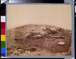 Battlefield of Gettysburg. Body of a soldier in "the wheat field," evidently killed by the explosion of a shell
Contributor:
Gibson, James F.
Site:
Prints & Photographs, Main Catalog
Original Format:
Photo, Print, Drawing
Date:
1863
View catalog record
Battlefield of Gettysburg. Body of a soldier in "the wheat field," evidently killed by the explosion of a shell
Contributor:
Gibson, James F.
Site:
Prints & Photographs, Main Catalog
Original Format:
Photo, Print, Drawing
Date:
1863
View catalog record
-
 Federal soldier disembowelled by a shell
Contributor:
Gardner, Alexander
Site:
Prints & Photographs, Main Catalog
Original Format:
Photo, Print, Drawing
Date:
1863
View catalog record
Federal soldier disembowelled by a shell
Contributor:
Gardner, Alexander
Site:
Prints & Photographs, Main Catalog
Original Format:
Photo, Print, Drawing
Date:
1863
View catalog record
-

 The battlefield of Gettysburg. Federal and Confederate dead on Sickle's Line
Contributor:
O'Sullivan, Timothy H.
Site:
Main Catalog
Original Format:
Photo, Print, Drawing
Date:
1861
The battlefield of Gettysburg. Federal and Confederate dead on Sickle's Line
Contributor:
O'Sullivan, Timothy H.
Site:
Main Catalog
Original Format:
Photo, Print, Drawing
Date:
1861
-
 GETTYSBURG REUNION
Contributor:
Harris & Ewing
Site:
Prints & Photographs
Original Format:
Photo, Print, Drawing
Date:
1913
GETTYSBURG REUNION
Contributor:
Harris & Ewing
Site:
Prints & Photographs
Original Format:
Photo, Print, Drawing
Date:
1913
-
 GETTYSBURG REUNION
Contributor:
Harris & Ewing
Site:
Prints & Photographs
Original Format:
Photo, Print, Drawing
Date:
1913
GETTYSBURG REUNION
Contributor:
Harris & Ewing
Site:
Prints & Photographs
Original Format:
Photo, Print, Drawing
Date:
1913