| Category |
Ceiling |
Visibility |
Icon |
| LIFR |
below 500 feet and/or |
less than 1 mile |
 |
| IFR |
500 to below 1,000 feet and/or |
1 to less than 3 miles |
|
| MVFR |
1,000 to 3,000 feet and/or |
3 to 5 miles |
 |
| VFR |
greater than 3,000 feet and |
greater than 5 miles |
 |
| MISSING |
MISSING |
MISSING |
 |
.AVIATION /12Z FRIDAY THROUGH TUESDAY/...
IFR CEILINGS/VISIBILITIES JUST TO THE NORTHWEST OF THE ARE THIS
MORNING IN LHQ/VTA/CMH WITH MVFR HOLDING AT PKB AT THIS HOUR. IFR
EXPECTED AT PKB AND HTS OVER THE NEXT 3 TO 6 HOURS...EVENTUALLY
SPREADING EASTWARD TO CKB AND CRW LATE MORNING...AND EKN AND BKW
FRIDAY AFTERNOON. TIMING OF THIS IS DIFFICULT...AND MAY VARY AN
HOUR OR TWO EITHER WAY AT EACH SITE. THIS WILL ACCOUNT FOR THE
MEDIUM FORECAST CONFIDENCE. FEEL IFR IS A GOOD BET TODAY IN
RAIN...BUT THE TIMING IS THE ISSUE.

RAIN PERSISTS TONIGHT...ESPECIALLY NORTH/WEST OF THE OHIO
RIVER...BUT NOT RELEGATED TO THIS AREA. IFR CEILINGS MAY HAVE A
BRIEF REPRIEVE...BUT IFR EXPECTED TO GENERALLY LINGER INTO
TONIGHT.

FORECAST CONFIDENCE AND ALTERNATE SCENARIOS THROUGH 12Z SATURDAY...

FORECAST CONFIDENCE: MEDIUM.


ALTERNATE SCENARIOS: TIMING OF THE IFR CEILINGS/VISIBILITIES WILL BE
AN ISSUE IN THE SCOPE OF THIS FORECAST ISSUANCE.


EXPERIMENTAL TABLE OF FLIGHT CATEGORY OBJECTIVELY SHOWS CONSISTENCY
OF WFO FORECAST TO AVAILABLE MODEL INFORMATION:
H = HIGH:   TAF CONSISTENT WITH ALL MODELS OR ALL BUT ONE MODEL.
M = MEDIUM: TAF HAS VARYING LEVEL OF CONSISTENCY WITH MODELS.
L = LOW:    TAF INCONSISTENT WITH ALL MODELS OR ALL BUT ONE MODEL
| Updated: 544 AM EST FRI DEC 7 2012 |
| UTC |
11 |
12 |
13 |
14 |
15 |
16 |
17 |
18 |
19 |
20 |
21 |
22 |
| EST |
06 |
07 |
08 |
09 |
10 |
11 |
12 |
13 |
14 |
15 |
16 |
17 |
| CRW |
H |
H |
H |
M |
M |
M |
M |
M |
M |
M |
M |
H |
| HTS |
H |
H |
M |
M |
M |
M |
M |
H |
M |
M |
M |
M |
| BKW |
H |
H |
H |
H |
H |
M |
M |
M |
M |
M |
M |
M |
| EKN |
M |
M |
M |
H |
H |
H |
H |
H |
M |
M |
M |
H |
| PKB |
M |
L |
L |
L |
H |
H |
H |
H |
H |
H |
L |
M |
| CKB |
H |
M |
M |
H |
M |
M |
H |
H |
H |
H |
H |
M |
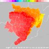
Forecast Graphics for Ceiling and Visibility | 04Z-Cig  | 05Z-Cig  | 06Z-Cig  | 07Z-Cig  | 04Z-Vsby  | 05Z-Vsby  | 06Z-Vsby  | 07Z-Vsby  | |
Aviation Guidance Products
GFS LAMP Aviation Guidance
Surface observations (METAR)
Information on METAR reports
List of current METAR observations across the area - raw
format, decoded
Past 24 hours of METAR reports for NWS Charleston TAF sites:
Charleston (CRW) - raw
format, decoded
Huntington (HTS) - raw
format, decoded
Parkersburg (PKB) - raw
format, decoded
Clarksburg (CKB) - raw
format, decoded
Elkins (EKN) - raw
format, decoded
Beckley (BKW) - raw
format, decoded
Other obsevation locations:
Point Pleasant (3I2) - raw
format, decoded
Buckhannon (W22) - raw
format, decoded
Pineville (I16) - raw
format, decoded
Sutton (48I) - raw
format, decoded
Interactive METAR
map (must have Java enabled)
Terminal Aerodrome Forecasts (TAFs) issued by NWS Charleston
How
to read a TAF
NOTE - The Tatical Decision Aid presents an auto-refreshing page with the TAF broken down into forecast parameters, color-coded by severity. Courtesy of the Center Weather Service Unit in Houston, TX.
Nearby TAFs issued by other NWS offices
KHLG
- Wheeling, WV
KMGW
- Morgantown, WV
KMRB
- Martinsburg, WV
KLWB
- Lewisburg, WV
KBLF
- Bluefield, WV
KLEX
- Lexington, KY
KCMH
- Columbus, OH
KPIT
- Pittsburgh, PA
KDCA
- Washington, DC (Reagan)
KIAD - Washington, DC (Dulles)
KROA - Roanoke, VA
All other TAFs
Interactive
TAF Map (must have Java enabled)
Center Weather Service Unit (CWSU) Products
Click for Center Weather Advisories(CWA) and Meteorological Impact Statements(MIS) from each center.
Cleveland (ZOB)
Indianapolis (ZID)
Washington (ZDC)
AIRMETs/SIGMETs
(what is an AIRMET
and a SIGMET?)
Current AIRMETs and
SIGMETs
Convective SIGMETs
(what
is this?)
Area Forecasts (FA)
(what is an Area
Forecast?)
Boston
area
Chicago
area
Miami
area
Fort Worth
area
Other Links
NWS Aviation Weather Center
Federal Aviation Administration
Air Traffic
Publications Library
|